Folding Pacific is ongoing! The evidence is here.
The Folding Pacific, a [3] part of the 7 of 10, is ongoing. Nancy has been presenting/giving us the evidence in her weekly newsletter or weekly chats.
http://www.zetatalk.com/newsletr/archives.htm
http://www.zetatalk.com/index/ningarch.htm
I picked out the items related to Folding Pacific from the newsletter in 2011 and 2012 to show a part of the quotation, then 18 items obtained.
---------------------------------------------------------------------
List of the Folding Pacific items;
1) Cocos Plate Crunch; Apr 1, 2012; http://www.zetatalk.com/newsletr/issue287.htm
2) Pacific Compression; Mar 25, 2012; http://www.zetatalk.com/newsletr/issue286.htm
3) Domino Quakes; Mar 18, 2012; ; http://www.zetatalk.com/newsletr/issue285.htm
4) Americas Buoys; Mar 11, 2012; ; http://www.zetatalk.com/newsletr/issue284.htm
5) Sakurajima Erupts; Mar 4, 2012; http://www.zetatalk.com/newsletr/issue283.htm
6) Mariana Trench Collapse; Jan 8, 2012; http://www.zetatalk.com/newsletr/issue275.htm
7) 7 of 10 Year in Review; Jan 8, 2012; http://www.zetatalk.com/newsletr/issue275.htm
8) IRIS 7 of 10 Revelation; Dec 25, 2011; http://www.zetatalk.com/newsletr/issue273.htm
9) Plate Movements; Nov 20, 2011; http://www.zetatalk.com/newsletr/issue268.htm
10) Rena Stranded; Oct 23, 2011; http://www.zetatalk.com/newsletr/issue264.htm
11) 7 of 10 Creep; Jul 17, 2011; http://www.zetatalk.com/newsletr/issue250.htm
12) Pacific Compression; Jul 3, 2011; http://www.zetatalk.com/newsletr/issue248.htm
13) Pacific Heap; May 8, 2011; http://www.zetatalk.com/newsletr/issue240.htm
14) Pacific Pingpong; Apr 17, 2011; http://www.zetatalk.com/newsletr/issue237.htm
15) Japan Disaster; Mar 20, 2011; http://www.zetatalk.com/newsletr/issue233.htm
16) Folding Pacific Confirmed; Feb 20, 2011; http://www.zetatalk.com/newsletr/issue229.htm
17) Plate Undulation Explained; Feb 6, 2011; http://www.zetatalk.com/newsletr/issue227.htm
18) Japan Precursor; Jan 16, 2011; http://www.zetatalk.com/newsletr/issue223.htm
---------------------------------------------------------------------
1) Cocos Plate Crunch
Why should a large quake near Acapulco cause buoy 21401 off Japan to go on alert, as well as buoy 46419 off coast of Oregon to go on alert? One would expect buoy 43413 near Acapulco to be on alert, which it was. All of this of course is being caused by plate movements, per the Zetas 7 of 10 scenarios.
This quake is precisely on the 3-way point where the Cocos, N American, and Caribbean plates meet. As S America rolls its top to the west, the Caribbean Plate is pushed over the Cocos Plate and the tip of the N American Plate at Mexico is pulled to the west. As the Caribbean Plate is pushed down, Central America crumbles. The northern edge of the Caribbean Plate cuts through the Dominican Republic, and sure enough, right on the border in Mabrigida Community farmers report that their land is sinking and tearing apart.
And as the great continent of S America is pulled to the west, it too is stretched. If S America is an ice cream cone, the ice cream piled at the top pulls more readily to the west, as the Cocos and Caribbean plates are small and thus easily pushed around. The cone, whose tip points to Antarctica, butts up against the larger Nazca Plate, which resists and forces the spine of the Andes up and over the edge of the Nazca Plate. As the ice cream top lobs over toward the west, S America is pulled into a stretch, which can be seen in the large crevasses that have opened up across the continent, a point well made in this Pole Shift ning blog.
2) Pacific Compression
Just as the weather wobbles are getting worse, the compression of the Pacific is picking up speed. Notice the sudden drop in water, 25 meters (75 feet) in the Pacific accompanying this recent series of quakes off the coast of Honshu, Japan as noted by buoy 21401. The Pacific Plate subducted under Japan, creating a temporary void in the ocean. Almost simultaneously, the Juan de Fuca off the coast of Oregon also had an adjustment, and in the days following, a dramatic response in buoy 46419. A sudden rise or heap of 33 meters (99 feet) was recorded, followed by a drop of over 20 meters (60 feet) before the water returned to its level. Since this occurred a full two days after the Japan and Oregon quake, buoy 46419 was no reflecting a tsunami, but was showing us activity in the Pacific, where the great Pacific Plate is in fact four segments, as the Zetas have explained. Clearly, the Pacific is compressing.
3) Domino Quakes
The Zetas predicted in 1999 that domino quakes would start, where a quake on one side of a plate would bump the other side of the plate, or result in plates pushing one another so ricocheting to a neighboring plate. This demonstrably showed up at that time, by August of 1999, where quakes would have a ricochet effect, moving notably from west to east around the globe.
The domino effect that earthquakes have during the time of expedited plate movements, the 7 of 10 scenarios and the pressure applied due to this, is apparent when the whole world lights up like a Christmas tree with quakes, all on the same day. Compared to earlier IRIS diagrams, this is quite apparent.
4) Americas Buoys
Why would a buoy off the Washington coast and another off Colombia suddenly go on alert at the same time? On February 27, 2012 buoy 46419 showed a water depth drop and rise of over 60 meters - rising to 2,804 and then plunging to 2,744. That equates to 180 feet! The buoy is located along the Juan de Fuca Plate border, and the N America Plate, per the Zetas, is being pulled into a bow, the West Coast of the US the center of that bow.
As noted in this Pole Shift ning blog, this is not the only buoy that reacted to plate movement. Buoy 32411 just off the Colombia coastline and on the Cocos and Nazca plate borders also went on alert, simultaneously. As S America rolls its top to the west, rolling over the Cocos and Nazca plates and pushing the Caribbean Plate down, it pulls Mexico to the west, increasing the bowing pressure on the N American continent.
This is yet more proof of the 7 of 10 plate movements predicted by the Zetas. What else would cause these two buoys to go on alert at the same time!
5) Sakurajima Erupts
This Japanese volcano is on a southern island, very much affected by the 7 of 10 plate movements ongoing. As noted in this Pole Shift ning blog, Sakurajima's eruption history took a sharp increase since 2010.
Note the location. As the Philippine Plate tilts and folds, it subducts sharply under the south islands of Japan. At Sakurajima's precise location there is also a fracturing of the great Eurasian Plate. Sakurajima's eruption comes just after a period where heaping water east of the Mariana Trench was evident, as shown by buoy 52402 in Issue 282 of this newsletter just last week. The Mariana and Philippine plates are tilting and folding, and this likewise affects Sakurajima's location. Per the Zetas the Philippine Plate normally applies less pressure to Japan than the Pacific Plate to the north, so this is clearly due to movement in the Philippine Plate.
6) Mariana Trench Collapse
Is the trench collapsing? Certainly buoys 52402 and 52403 are are signaling that. The Philippine Plate lies to the east of the Philippine Islands, and the Mariana Plate lies to the east of the Mariana Islands, and the Mariana Trench lies to the east of the Mariana Plate.
The Zetas predicted that the folding of the Mariana Trench would be sudden. The Zetas also stated that the folding of the Philippine and Mariana plates in 7 of 10 Scenario 3 is key to acceleration of the 7 of 10 scenarios.
Buoy 52402 shows that something dramatic occurred on December 13, 2011. Buoy 52402 is at Latitude 11.74N Longitude 154E out in the Pacific, just east of the trench and approximately 1/3 of the way to Hawaii from the Philippine Islands. What would cause this buoy to show a sudden drop of 15 meters (45 feet) on December 13!
A clue lies in the heaping waters shown by Buoy 52403, which lies along the trench to the SW of 52402. Water squirting out of a collapsing trench would end up in this vicinity, and it did! The waters on the Carolina Platelet are also not as deep as the deep Pacific, and would take more time to disburse a heap, thus. Per the Zetas, the trench did indeed collapse on December 13.
The Mariana Islands, on the lifting eastern edge of the Philippine Plate just to the west of the Mariana Plate, have been beset with quakes since, even during lulls affecting the rest of the world.
Have the heaping waters been noted by those nearby, on the Philippine Islands? Certainly the Mindanao tsunami on December 17 was caused by the disbursing waters. And just a quick end of the year snapshot for incidents in the Philippine Islands show continuing references to capsizing boats, "swelling seawater", and a "storm surge" without an accompanying storm.
7) 7 of 10 Year in Review
7 of 10 Scenario 3, the folding of the Philippine and Mariana plates, is likewise still completing. The pace of this scenario could be detected by reports of sinking from the north Philippine island of Luzon, which lies partially on the Philippine Plate. When typhoon Falcon passed through in July, 2011 northern Luzon was entirely spared the flooding that the portion lying on the Sunda Plate experienced. But by August 28, 2011 when typhoon Mina passed through, the northern coast of Luzon was affected with flooding. The Mindanao tsunami on December 17, 2011 striking the Philippines was likewise, per the Zetas, caused by a clash with waters from the folding Philippine Plate. Now, with the obvious collapse of the Mariana Trench, the folding is clearly and undeniably in process.
8) IRIS 7 of 10 Revelation
The USGS Incorporated Research Institutions Seismology site, known as IRIS, shows at a glance where earthquakes have occurred as well as the most recent quakes over magnitude 4. This newsletter frequently makes use of IRIS charts to show where plate movement has been occurring. But more has been revealed. The IRIS charts also show quakes over the past 5 years with little purple dots, which cluster along plate borders and fault lines. A ZetaTalk fan has noted that the frequency of quakes has dramatically increased! This increase in quake frequency was noted and mentioned on August 14, 2011 in Issue 254 of this newsletter and a year earlier in August 15, 2010 in Issue 198 of this newsletter.
Compare the historical 5-year chart showing all quakes from January 20, 2004 to January 20, 2009 to a chart showing the two years since. Clearly the pace has picked up. In particular, the plate edges involved in the early 7 of 10 scenarios show this dramatic increase. If one could peer beneath the outline of the Sunda Plate and the eastern border of the Indo-Australian Plate, they are fat with purple quake dots as is the region above India in the Himalayas. The Philippine Plate is heavily outlined. The Andes are fat with dots. And the eastern border of the Caribbean Plate is likewise thick with dots. Compared to the West Coast of the US, the borders of the African Plate, and the Atlantic Ridge borders, it is obvious the increased quakes are due to the 7 of 10 plate movements.
9) Plate Movements
… On November 8, 2011 a large quake along the border of the Philippine Plate shows movement in that plate, which the Zetas predicted will tilt and fold as sequence #3 of the 7 of 10 scenarios progresses. This has been in process, but has not yet completed. The quake was exactly along the Philippine Plate border, and by the following day there was another, smaller quake on the opposite side of the plate. This plate is moving too. …
10) Rena Stranded
Plate movements result in land rising and falling, and the Earth wobble puts the GPS satellites out of synch with the Earth beneath. Has any of this started to create mischief with mankind's guidance systems? The recent beaching of the cargo ship Rena in New Zealand points to the problems facing ships captains when their maps prove to be outdated.
Per the Zetas, such confusion will be on the increase, involving planes as well as ships. The GPS system has been malfunctioning during the Earth wobble for some time now and this will only get worse.
Meanwhile, the eastern edge of the Indo-Australian Plate continues to rise, as shown by this recent IRIS map where earthquakes are along this plate border as well as the spine of the S American Andes. A buoy in the Coral Sea is also on alert.
11) 7 of 10 Creep
Where the 7 of 10 scenarios appear to be unfolding slowly, per the Zetas there are reasons for the delay. But this does not mean the overall schedule will be delayed. Where the scenarios started on time, the [1] tilting of India for a 10 foot drop in elevation in Pakistan in the latter half of 2010 and the [2] sinking of the Sunda Plate by December 23, 2010, plate undulation set in to cause a delay. Heaping water throughout the Pacific was evidence that [3] the folding of the Philippine and Mariana plates had started, and certainly [4] the S American roll had begun. But recently there was evidence that Luzon Island in the Philippines had not sunk, though being on that part of the Philippine Plate that was to plunge during the fold, it should be going under. What is going on? The Zetas explain why the 7 of 10 scenarios have been delayed, temporarily.
12) Pacific Compression
The Pacific will compress by 250 miles at the Equator during the 7 of 10 S American roll. This 250 mile compression is the sum total of 47 miles due to the tilting of the Philippine Plate, and 78 miles due to the folding of the Mariana Plate and Mariana Trench. An additional 125 miles of compression comes from the overlapping of the Pacific Plate parts in the center of the Pacific.
The Pacific, per the Zetas, is not one plate but four.
When compression along this border occurs the Aleutian Islands would be pulled into a bow, snap with quakes, and the ocean buoys would show heaving of the floor due to temporary compressed magma in the area. This occurred on June 24, 2011 when the Aleutian Islands suffered a 7.2 quake and buoys in the area showed a heaving or undulating floor in the days before the quake. Clearly, something happened on the ocean floor!
This was reflected all the way to the plate under Australia on that same day, June 24, 2011, as noted by a sharp eye'd Pole Shift ning member. The curve under Sumatra and Java lifted, while the Coral Sea experienced more water.
13) Pacific Heap
The Zetas have stated that the Pacific Plate is not one plate but four, and these plates are overlapping in the middle of the Pacific to allow compression.
Where does the water go during such a compression of the Pacific plates? Increased water volume from the Aleutian Islands down through Asia was noted on February 20, 2011, as detailed in Issue 229 of this newsletter. The Zetas stated at the time that this heap of water was due to the folding of the Mariana and Philippine Plates.
Now another heap has occurred but this one is involving the entire Pacific, from the Aleutian Island down through Asia and across the Pacific to S America! The buoys are showing an increased depth in the water across this vast area. This is a huge amount of water to be disbursed elsewhere! Only a folding of the Pacific plates could create such a volume. Since the overlapping borders of the parts of the Pacific Plate are deep under the ocean, quakes along these borders are silent.
The Zetas have stated that the Pacific will compress during the 7 of 10 plate movements, to the extent that the top part of S America will end up 250 miles further west. What will be the affect of this compression of the Pacific on the S American roll and other 7 of 10 scenarios? As the Pacific compression S America is literally pulled to the west. But what will this do to Mexico? Will there be a great tear between Mexico and Central America as the Caribbean Plate is pushed to the west by the great S American Plate? Per the Zetas, Mexico will be pulled westward too by the compression of the Pacific plates, temporarily increasing the bow stress on the N American continent.
14) Pacific Pingpong
There is a relationship in plate movement, particularly between easing of pressure in Asia and the pending S America roll. During four days in April this could be seen in activity in Asia and in the region of Central America. A pingpong, or back and forth effect, was obvious. On April 3, 2011 the little Fiji platelet sustained a magnitude 6.5 quake. Per the Zetas, this platelet will be a loser in the crunch as the Pacific compresses.
On April 5, 2011 the plates on the move in Asia were outlined with quakes on IRIS. The plate tongue holding Indonesia was outlined. The Indo-Australian Plate rising at New Zealand was outlined. Kepulauan Talaud, Indonesia had a series of quakes upwards to magnitude 6, right on the Philippine Plate border. The Philippine Plate is folding, sinking under the Philippine Islands while tilting.
On April 4, 2011 buoy 56001 just under the plate curve beneath Sumatra and Java went on alert. Following this, a magnitude 5.9 quake occurred off the sinking edge of Sumatra. The buoy is letting us know that a sinking of the plate tongue holding Indonesia occurred prior to the quake. Sinking is an otherwise silent process.
As the Zetas predicted, plate movement in S America and the Caribbean will be right behind the changes in Asia, as there is a domino reaction. On April 7, 2011 a second buoy went off - 56001 under the curve of Sumatra was joined by buoy 42407 south of Puerto Rico. Once again, the buoy is alerting us to plate movement, in this case the lifting of the northern side of the Caribbean Plate while the plate tilts down, is pushed down, at the southern edge.
This was accompanied by quakes along the Caribbean Plate border and at Chiapas, Mexico where the Cocos Plate pushes under southern Mexico during the westward push of the Americas.
And the coastline along Ecuador shows the effect of land on the pushing edge being pushed over the Nazca Plate. Anconcito is right on the coast, at the point where the S American Plate is pushing over the Nazca Plate, and at the point where the N Andes fault line emerges to touch the coastline. Yet more evidence that plate movement in the region has occurred during the April 4-8, 2011 period.
Now back to Asia, where on April 7, 2011 the Japan region had more quakes, a 7.4 in Sendai, where earthquake lights produced a flash. LISS showed a global quake at this time, registering on all seismographs worldwide.
And showing unmistakably the absolute relationship between the plate movements in Asia and the plate movements in the Caribbean, both buoys 56001 and 42407 were on alert at the same time during this period. As the Zetas said, the S American roll follows right on the heels of the changes in Asia, and this relationship can be seen even prior to the roll.
15) Japan Disaster
At the point of pressure for the compressing Pacific, the earthquake ridden Japan was given a devastating blow on March 11, 2011 with a quake just offshore its North Island (near Tokyo), now estimated even by the conservative USGS to be a 9.0 magnitude quake. The quake was followed by countless aftershocks. Considered the strongest earthquake Japan has even experienced, at least since record keeping began.
The quake occurred on the finger of the North American Plate that drops down to hold the North Island of Japan. The Zetas have stated that this finger will not break off, despite the intense pressure coming from the compression of the Pacific. Subduction under this finger by the Pacific Plate occurs, instead. As powerful as this quake was, it is, per the Zetas, only an incidental quake in the scheme of things, and not the series of great quakes they have predicted for Japan during the 7 of 10 scenarios.
The quake generated a tsunami warning for the entire Pacific Rim. Waves reached the West Coast of the US and the coastline of Chile. Ocean buoys went off all over the Pacific, accordingly. But the devastation was to Japan itself, which suffered a tsunami 10 meters high roaring inland, scouring the coastline and, it is feared, washing away over 10,000 inhabitants of one coastal town. The Zeta warnings to be away from the coastlines when the pole shift hits, so clearly relevant.
The Zeta warnings to anticipate travel restrictions, an inability to travel during the last weeks, was also brought home by photos of the condition of roads in Japan after this large quake. Is there any doubt that roadways, rail lines, and air port runways could be inoperable during the last weeks?
The danger from living in cities and not leaving for rural safe areas was also depicted graphically in photos from the Japan quake. Fires break out, even when surrounded by seawater. Industrial storage tanks rupture and tip over. When there is no water pressure, fires cannot be put out in the traditional way, and rage unabated after earthquakes.
Even in earthquake resistant Japan, which has made a science of building resistant buildings and houses, total collapse can be seen. How does one live in a city when there is no fresh water, no standing structures, the stores shelves empty of food, and no way to grow food?
16) Folding Pacific Confirmed
The Zetas predicted that the Mariana and Philippine Plates would tilt and fold against each other during the 7 of 10 sequence, a step in the process in between the sinking of Indonesia and the S American roll. All these steps in the sequence were anticipated to show their trends well ahead of time. The tipping of the Indo-Australian Plate occurred during the latter half of 2010, as the July, 2010 flood waters in Pakistan have never drained. This was finally admitted by NASA and detailed in Issue 217 of this newsletter. The sinking of the plate tongue holding Indonesia started on December 23, 2010, as noted in Issue 218 of this newsletter, and is not yet completed. But there is overlap in the steps, as the S America roll has already expressed in sinking in Panama and the Caribbean Plate north of Colombia and mountain building along the N Andeas Fault.
Due to recent buoy data, it appears the folding of the Mariana and Philippine Plates has started! There is no other explanation for an increase in the water volume in the entire area from the Aleutian Islands down to Tasmania, and throughout Asia.
Note that all the buoys are showing an increased water volume. The could happen if the sea floor dropped, as had been occurring during plate undulation, as noted in Issue 227 of this newsletter. Or alternatively, there could just be an increase in the water volume. It is the latter, and the Zetas explain.
17) Plate Undulation Explained
Undulating plates have been noted since the 7 of 10 scenarios started at the end of December, 2010. Issue 219 detailed buoy charts at the end of December, 2010 when the Coral Seafloor was dropping and the seafloor curve under Sumatra and Java was rising. Both these regions are housed on the Indo-Australian Plate. Two weeks later by January 16, 2011 the Coral Seafloor was heaving again, the Fiji Plate dropping, as detailed in Buoy charts in Issue 223 of this newsletter. The Zetas explained at that time that such undulation is causing a delay in the sinking of Indonesia, which is facilitated by the curve under Sumatra and Java on the Indo-Australian Plate being lifted. By the end of January the Caroline Plate north of New Guinea was rising, as was the seafloor out in the Pacific near there, as shown by the buoy charts in Issue 226 of this newsletter. What causes this undulation?
This was recently explained, by the Zetas, because it was noted at one point that Pacific buoys, all the way up to the Aleutians Islands, were simultaneously showing a seafloor rise!
18) Japan Precursor
Few parts of the globe have more earthquakes than Japan, which seem bombarded almost daily. The Japanese have learned to use earthquake clouds as a predictor, and a recent example shows how accurate such observations can be. On January 11, 2011 at 4:21 pm earthquake clouds above Chiba City were observed.
This is the spot where three plates meet - the Pacific, the Eurasian, and the N American Plate. The observation lwas looking out over the water, down toward the Bonin Islands, one of the spots hammered during the Christmas Hammer on December 22, 2010. Did the quake clouds indicate another hammer was going to descend on the Bonin Islands region? Yes!
---------------------------------------------------------------------
See also;
* S American Roll is on going! The evidence is here.
* Sunda Plate sinking is almost complete! The evidence is here.
Views: 1755
Comment
-
Comment by Recall 15 on June 22, 2012 at 7:49pm
-
After TPTB handled the Buoys there were silent... But in the las few days there were missing events in the following buoys, around the world:
June 21, 22 Buoy 55013, TASMAN SEA 3 - 1160km ESE of Hobart
http://www.ndbc.noaa.gov/station_page.php?station=55013
June 22, Buoy 51425, 370 NM NW of Apia
http://www.ndbc.noaa.gov/station_page.php?station=51425
June 22, Buoy 51407, 140 NM Southeast of Honolulu, HI
http://www.ndbc.noaa.gov/station_page.php?station=51407
June 22, Buoy 21413, 690 NM Southeast of Tokyo, Japan
http://www.ndbc.noaa.gov/station_page.php?station=21413
June 22, Buoy 52405, 740 NM West of Agana, Guam
http://www.ndbc.noaa.gov/station_page.php?station=52405
June 21, June 22 Buoy 46413, East of ADAK, AK
http://www.ndbc.noaa.gov/station_page.php?station=46413
June 19, june 21, Buoy 46403, 230 NM Southeast of Shumagin Island, AK
http://www.ndbc.noaa.gov/station_page.php?station=46403
June 18, in 2 event mode june 20, june 21, Buoy 46409, 240 NM Southeast of Kodiak, AK
http://www.ndbc.noaa.gov/station_page.php?station=46409
June 22, Buoy 46419, 300 NM West-Northwest of Seattle, WA
http://www.ndbc.noaa.gov/station_page.php?station=46419
June 19, Buoy 46411, 260 NM Northwest of San Francisco, CA
http://www.ndbc.noaa.gov/station_page.php?station=46411
June 21, june 22, Buoy 43413, 360 NM South-Southwest of Acapulco, Mexico
http://www.ndbc.noaa.gov/station_page.php?station=43413
June 21, Buoy 32413, 1000 NM WestNorthwest of Lima, Peru
http://www.ndbc.noaa.gov/station_page.php?station=32413
June 19 Buoy 23228, Arabian Sea
http://www.ndbc.noaa.gov/station_page.php?station=23228
June 18, 20 Buoy 23227, Bay of Bengal
http://www.ndbc.noaa.gov/station_page.php?station=23227
June 21, Buoy 42407, 230 NM South of San Juan, PR
http://www.ndbc.noaa.gov/station_page.php?station=42407
June 21, Buoy 44401, 790 NM NE of Bermuda
-
Comment by bill on June 17, 2012 at 10:44am
-
6.1 quake rocks Philippines

A general view from Tagaytay City, south of Manila, of the volcanic crater of the Taal volcano island. A 6.1-magnitude earthquake struck off the west coast of the main Philippine island of Luzon on Sunday, US seismologists said, but there were no reports of casualties and no tsunami alert was issued.
A 6.1-magnitude earthquake struck off the west coast of the main Philippine island of Luzon on Sunday, US seismologists said, but there were no reports of casualties and no tsunami alert was issued.
The US Geological Survey said the quake hit at a depth of 35 kilometres (22 miles) at 6:18 am (2218 GMT Saturday), 182 km northwest of the capital Manila.
The Philippine Institute of Volcanology and Seismology measured the quake at 6.0 magnitude.
The quake was felt in some areas, including Manila, but there were no immediate reports of damage or casualties, said civil defence chief Benito Ramos.
The Philippines sits on the Pacific Ring of Fire -- a belt around the Pacific Ocean dotted by active volcanoes and unstable ocean trenches.
One fault line runs directly under Manila, a metropolis of more than 12 million people, and government seismologists have warned the city is unprepared for a major quake.
In February, a 6.7-magnitude earthquake in the central Philippines triggered landslides that left more than 100 people dead or missing.
-
-
Four die in Taiwan mudslides
At least four people have died and one was injured when mudslides triggered by torrential rains hit two areas in central Taiwan.
Schools were suspended in several large cities, as Taiwan faced the most serious flooding since Typhoon Morakot lashed the island in 2009, triggering massive mudslides that killed more than 600 people.
Two were killed and one was wounded when a makeshift shelter in a mountainous area of Nantou county was buried by mudslides, said the national fire agency, adding downpours also damaged roads and disrupted electricity.
Two men who worked for the forestry bureau in Taichung city were rushed to a clinic on Monday with severe injuries caused when a mudslide crushed their office, but despite efforts to save them they died later in the day, emergency services said on Tuesday.
In northern Taoyuan county, 20,000 chickens were drowned when a farm was submerged by a flash flood, officials said.
Massive flooding was reported across the island since late Monday, with more than 700mm of rain in some areas while Taiwan's central weather bureau warned of more heavy rains this week.
As of mid-morning Tuesday, Taipei and three other large cities had suspended classes and work in government offices.
-
-
Earthquake jolts Philippine island of Luzon
AN earthquake with a 6.1-magnitude has jolted the sea area off the Philippine island of Luzon, US seismologists said.
The US Geological Survey said the quake had a depth of 35 kilometres and hit at 6.19 am local time some 143 kilometres southwest of the city of Baguio and 181 kilometres northwest of the capital Manila.
The Philippines sits on the Pacific Ring of Fire -- a belt around the Pacific Ocean dotted by active volcanoes and unstable ocean trenches.
In February, a 6.7-magnitude earthquake in the central Philippines triggered landslides that left over a hundred people dead or missing.
One fault line runs directly under Manila, a metropolis of more than 12 million people, and government seismologists have warned the city is unprepared for a major quake.
-
-
Hualien reports 59 earthquakes
More moderate to strong aftershocks can be expected in eastern Taiwan over the next two weeks in the wake of a magnitude 5.4 earthquake in that area early yesterday, the Central Weather Bureau warned.
As of 11am yesterday, a total of 58 aftershocks had been recorded in Hualien County after the main earthquake that occurred at 0:15am, the bureau said.
The quake’s center was located at sea 31.5km south of Hualien County Hall, at a depth of 10km, the bureau said. The tremor was felt at an intensity of 6 in the coastal area of Jici (磯崎).
The quake was followed by 58 others as of 11am yesterday, including one of magnitude 4.9 that struck at 3:30am and was centered in Shoufeng Township (壽豐).
The Hualien Fire Department said it had not received any -reports of major damage except for some blockage of mountain roads caused by falling rocks, which were all cleared before daybreak.
As the earthquake was strong and at a shallow depth, it is likely that aftershocks of magnitude 4 to 5 will continue over the next two weeks, the bureau’s seismology center director Kuo Kai-wen (郭鎧紋) said.
Kuo urged the public not to panic over the frequency of the aftershocks, saying they are just a normal release of energy.
Taiwan has been hit by a number of earthquakes this month, the strongest of which measured 6.5 on the Richter scale and was centered under the seabed off the east coast on Sunday. None of the quakes have caused casualties or major damage.
Eastern Taiwan’s location at the boundary of two tectonic plates — the Philippine Sea Plate and the Pacific Plate — makes it especially prone to earthquakes, Kuo said.
When a magnitude 7.3 earthquake struck central Taiwan on Sept. 21, 1999, about 1,000 aftershocks occurred the same day, he said.
-
-
Train swept off track, none hurt
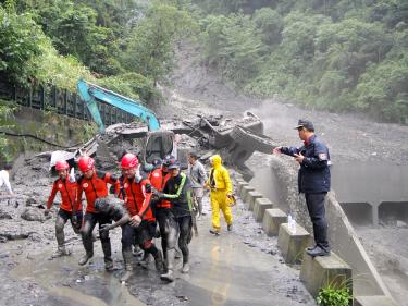
The driver of an earthmover working for the Nantou Forest District Office is rescued in Nantou County yesterday after the equipment overturned in a landslide.
Photo: Chen Fong-li, Taipei Times
A Tzuchiang-class train operating along the South Link Line (南迴鐵路) derailed yesterday after running into a mudslide on the mountain slopes north of the Dawu Tunnel (大武隧道). Fortunately the about 250 passengers on board were not injured.
The train, which left New Zuo-ying (新左營) at 12:25pm yesterday, was traveling toward Hualien. After exiting the Dawu Tunnel in Taitung County at 2:27pm, the driver saw a mound of rubble lying on the tracks and immediately hit the breaks, but the train was unable to stop in time, as it was going at 90kph.
The impact derailed the first car of the train, but damage was not severe because the train had already slowed to 40kph when it hit the rubble, Taiwan Railway Administration (TRA) officials said.
After TRA personnel arrived on the scene, they decoupled the first two cars and sent passengers back to Dawu station on the four remaining cars, TRA officials said.
Buses were also dispatched to transfer passengers to Lungsi Station, where they were able to continue on their northbound journey.
The Central Emergency Operations Center yesterday said that days of heavy rain around the nation created by a frontal system converging with the southwest monsoon have so far claimed six lives, injured 11 and left two people missing.
Casualties caused by landslides or flooding were recorded in Nantou County and Greater Taichung, as well as in New Taipei City (新北市) and Taoyuan County, the center said in a press release.
About 7,120 people were evacuated from disaster zones or areas at risk of mudslides around the country, it added.
Although the rain has abated, heavy downpours were still forecast for some areas in central and southern Taiwan, with generally unstable weather expected to continue nationwide, the Central Weather Bureau said.
The public still needs to pay attention to the potential danger from rain-triggered disasters, such as road collapses and falling rocks, it said.
Meanwhile, 285 riverside locations in Greater Kaohsiung, Greater Tainan and Greater Taichung, as well as in the counties of Nantou, Chiayi and Pingtung remained on red alert for mudslides, while yellow alerts were issued by the Council of Agriculture earlier in the day for 398 mudslide-prone spots nationwide.
Agricultural losses throughout the country have reached NT$317.1 million (US$10.57 million) since the rain began on June 9, the council said.
Damage to agricultural produce topped the list of losses, totaling NT$181.6 million, with rice, leafy vegetables and seasonal fruit among the worst-hit.
Among the worst-affected areas were Chiayi County in the south, which suffered estimated losses of NT$93.9 million, Taoyuan County in the north, Nantou County in the center, and Pingtung County and Greater Kaohsiung in the south.
-
Comment by KM on April 1, 2012 at 4:58am
-
Thank you Kojima, your overview of the 7 of 10 events is as always in great detail and well presented.
SEARCH PS Ning or Zetatalk
https://poleshift.ning.com/forum/topics/last-trimester-event-timeline
NEW POLE SHIFT UPDATE!
Awakening to the Alien Presence ZetaTalk
The truth will likely never to be known to the public but be washed away in the Nibiru panic soon to engulf the world.
The Worst of the Cover-Up
https://poleshift.ning.com/profiles/blogs/the-worst-of-the-cover-up
Main Establishment Lies
https://poleshift.ning.com/profiles/blogs/main-establishment-lies
Donate
© 2026 Created by Juan F Martinez.
Powered by
![]()
You need to be a member of Earth Changes and the Pole Shift to add comments!
Join Earth Changes and the Pole Shift