EARTHQUAKES Worldwide! (Frequently Updated)
 Global Earthquake Maps
Regionally Specific Earthquake Maps
|
Related Informations:
Earthquakes during the poleshift Magnetic twist and the effects
|
Additional Information from the F.A.Q: Q: What is the "Earth Wobble"?
Q: How can I understand the Magnetosphere? - About the Magnetosphere
Q: Is there a relationship between disturbances in the magnetosphere and seismic activity? |
Altering Earthquakes:
As of late, I have observed that USGS and EMSC are a bit lax on their reports of earthquakes. Sometimes not seeing anything reported for hours from the last update, or seeing periods of 90-200 minutes with no earthquakes in between. My question is, are they leaving swarms of earthquakes out of their reports, or there are actually periods of no earthquakes?
SOZT: Greater than 90% of the earthquake activity is being altered by the USGS at present, which is under orders to prevent any clue being given to the public about the Earth changes caused by the presence of Planet X. Over a decade ago, the approach was to de-sensitize the live seismographs periodically, so the displays do not turn black worldwide, and to ignore the twice-a-day patterns showing up on these seismographs. Then any quakes that could be dropped were dropped. This was obvious to some who were watching the database manipulation. Quakes in the list would suddenly disappear. This was particularly the case where a quake happened in a remote location, or out in the ocean. Dumbing down the magnitude quickly followed, but in order to ensure the public did not notice, the USGS took control of all websites reporting quake statistics. At times, this control breaks, and discrepancies are reported to the public. Some countries rebel. Quake swarms are another source of control, as they pepper the databases with many quakes and skew the statistics, and thus are pulled from the database. Else the question is raised, why so many? EOZT
Will the USGS internet system be a reliable warning system for the European tsunami by registering on the net the New Madrid earthquake on the exact time it occurs?
SOZT: It will not be a lack of information from the USGS that will be the point of confusion during the earthquakes leading up to the New Madrid adjustment, it will be knowing which quake is the big one vs the many minor quakes preceding it. The USGS downgrades almost all earthquakes, to prevent meaningful statistics from being generated from their databases. They also exclude quakes whenever they can, but this is unlikely to happen in the New Madrid area as it is in the center of a populated land mass. Thus you will have magnitude 6 quakes that will be called a 5.2, magnitude 7 quakes called a 6.1, and when a magnitude 8 or greater quake occurs, it will be called a 6.9.
We would advise that rather than watching the USGS quake statistics, that you watch the Earth changes. The adjustment that will incite the European tsunami will involve bridges on the Mississippi breaking, and being impassable. The land to the west of the Mississippi will drop so that the Mississippi will become 50 miles wide in the state of Mississippi. Watch for this. The New Madrid adjustment will be several large quakes of magnitude 8-9, though will be listed as a lesser magnitude. As the N American continent continues to unzip up to and along the Seaway, the quakes will be less than a magnitude 8 but very destructive to Cleveland and Toledo and Buffalo and the inland locks along the Seaway. Thus it is not what the USGS says that should be watched, but the condition of the bridges on the Mississippi, the impact on the cities along the Seaway, and whether the inland locks are reported as inoperable. EOZT
Please collect earthquake-reports here. Significant Quakes or Magnitude 7+ can be posted separately.
[Edited by the Moderation]
Views: 569020
Comment
-
Comment by Tracie Crespo 19 hours ago
-
Already downgraded to a 5.2...
https://www.volcanodiscovery.com/earthquakes/quake-info/21673165/ma...
 www.volcanodiscovery.com www. M30°W Nogales 0 Map width 30'N SONORA 500km center 2075, km 1500mi'" width="574" height="526"/>
-
Comment by jorge namour on Sunday
-
Magnitude 6.1
Region TAJIKISTAN
Date time 2025-04-13 04:24:03.1 UTC
Location 38.976 ; 70.797
Depth 16 km
Distance 173 km S of Qo‘qon, Uzbekistan / pop: 254,000 / local time: 09:24:03.1 2025-04-13
37 km E of Rasht, Tajikistan /https://www.emsc-csem.org/Earthquake_information/earthquake.php?id=...
-
-
M 5.5 - 34 km NNE of Meiktila, Burma (Myanmar)
2025-04-13 02:24:57 (UTC)21.154°N 96.006°E7.7 km depth
https://earthquake.usgs.gov/earthquakes/eventpage/us6000q5ps/executive
..................................................5.5
46 km E of Lae, Papua New Guinea
2025-04-13 00:48:23 (UTC-03:00)
65.9 km2.6
10 km N of Tonasket, Washington
2025-04-13 00:11:55 (UTC-03:00)
10.0 km
4.0
100 km SSW of Nikolski, Alaska
2025-04-13 00:05:39 (UTC-03:00)
10.0 km4.4
143 km SE of Hasaki, Japan
2025-04-12 21:43:05 (UTC-03:00)
10.0 km
4.8
197 km ESE of Kimbe, Papua New Guinea
2025-04-12 21:33:16 (UTC-03:00)
10.0 km
3.1
19 km NW of Midland, Texas
2025-04-12 21:12:13 (UTC-03:00)
6.3 km
2.5
11 km NE of Pāhala, Hawaii4.6
southern Mid-Atlantic Ridge
2025-04-12 15:57:55 (UTC-03:00)
10.0 km4.6
168 km ESE of Kimbe, Papua New Guinea
2025-04-12 09:52:25 (UTC-03:00)
10.0 km
5.0
South Sandwich Islands region
2025-04-12 09:37:51 (UTC-03:00)
100.7 km5.0
12 km ENE of Sanjwal, Pakistan
2025-04-12 04:30:56 (UTC-03:00)
39.2 kmagnitud 6.1
A 105 km de Kokopo, Papúa Nueva Guinea · 12 abr, 12:47 a.m.
-
-
M 6.9 - 194 km ESE of Kimbe, Papua New Guinea
2025-04-04 20:04:38 (UTC)6.205°S 151.764°E10.0 km depth
https://earthquake.usgs.gov/earthquakes/eventpage/us6000q41n/executive5.1
164 km ESE of Kimbe, Papua New Guinea
2025-04-04 18:14:42 (UTC-03:00)
10.0 km
5.3
183 km ESE of Kimbe, Papua New Guinea
2025-04-04 17:39:34 (UTC-03:00)
10.0 km
.................................................................4.6
24 km WNW of Imabetsu, Japan
2025-04-04 16:15:42 (UTC-03:00)
10.0 km
4.1
south of the Fiji Islands
2025-04-04 13:17:21 (UTC-03:00)
511.8 km
4.4
northern Mid-Atlantic Ridge
2025-04-04 12:49:14 (UTC-03:00)
10.0 km
2.9
13 km NNE of Pittsburg, CA
2025-04-04 12:37:40 (UTC-03:00)
27.2 km
4.7
7 km W of Kyaukse, Burma (Myanmar)
2025-04-04 12:25:24 (UTC-03:00)
10.0 km4.9
32 km ENE of Dailekh, Nepal
2025-04-04 11:22:50 (UTC-03:00)
10.0 km5.2
53 km S of Madang, Papua New Guinea
2025-04-04 07:51:48 (UTC-03:00)
115.1 k4.8
south of Panama
2025-04-04 05:31:10 (UTC-03:00)
10.0 km5.7
93 km WNW of Hihifo, Tonga
2025-04-04 05:01:06 (UTC-03:00)
192.0 km
4.5
99 km WNW of Hihifo, Tonga
2025-04-04 05:00:48 (UTC-03:00)
175.4 km4.4
21 km NNE of Akbarābād, Iran
2025-04-04 00:44:20 (UTC-03:00)
10.0 km4.9
Reykjanes Ridge
2025-04-03 21:28:26 (UTC-03:00)
10.0 km3.4
32 km WNW of Whites City, New Mexico
2025-04-03 19:10:30 (UTC-03:00)
5.0 kmMagnitude 5.5
Region NEAR ISLANDS, ALEUTIAN ISLANDS
Date time 2025-04-02 16:26:34.9 UTC
Location 53.331 ; 172.826
Depth 7 km
Distance 945 km E of Petropavlovsk-Kamchatsky, Russia
-
-
Magnitude 6.2 Region KYUSHU, JAPAN Date time 2025-04-02 14:03:57.4 UTC Location 31.002 ; 131.473 Depth 26 km Distance 90 km SE of Miyakonojō, Japan / pop: 130,000 / local time: 23:03:57.4 2025-04-02
58 km SSE of Kushima, Japan / pop: 22,100 / local time: 23:03:57.4 2025-04-02Source parameters provided by:
National Earthquake Information Center, U.S. Geological Survey -- Golden, United States (NEIC)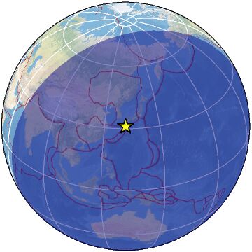
-
Comment by A. Hall on April 2, 2025 at 7:03am
-
5.3-Magnitude Earthquake Strikes Reykjanestá
A series of earthquakes started this morning due to the …
A series of earthquakes started this morning due to the magma run. This afternoon two earthquakes were felt widely in the south of Iceland. mbl.is/Eggert Jóhannesson
Two significant earthquakes were recorded near Reykjanestá shortly before 5 p.m. today
-
-
https://www.emsc-csem.org/Earthquake_information/earthquake.php?id=...
Another huge one...
Magnitude 7.1 Region TONGA Date time 2025-03-30 12:18:47.8 UTC Location -20.448 ; -174.082 Depth 10 km Distance 139 km NE of Nuku‘alofa, Tonga / pop: 22,400 / local time: 01:18:47.8 2025-03-31
76 km SSE of Pangai, Tonga / pop: 1,700 / local time: 01:18:47.8 2025-03-31Source parameters reviewed by a seismologist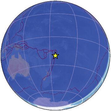
-
-
M 7.7 - 2025 Mandalay, Burma Earthquake
2025-03-28 06:20:54 (UTC)22.013°N 95.922°E10.0 km depthhttps://earthquake.usgs.gov/earthquakes/eventpage/us7000pn9s/executive
6.4
Burma
2025-03-28 03:32:04 (UTC-03:00)
10.0 km4.5
Burma
2025-03-28 04:57:00 (UTC-03:00)
10.0 km
4.6
Burma
2025-03-28 04:36:58 (UTC-03:00)
10.0 km
4.6
Burma
2025-03-28 04:27:47 (UTC-03:00)
10.0 km
......................................................6.1
central Mid-Atlantic Ridge
2025-03-27 21:34:21 (UTC-03:00)
10.0 km4.5
13 km NE of Coyuquilla Norte, Mexico
2025-03-27 19:42:43 (UTC-03:00)
63.0 km
5.2
22 km SW of Merke, Kazakhstan
2025-03-27 19:42:41 (UTC-03:00)
10.0 km
5.0
Easter Island region
2025-03-27 18:33:13 (UTC-03:00)
10.0 km5.2
44 km ESE of Kandrian, Papua New Guinea
2025-03-27 16:42:55 (UTC-03:00)
13.7 km
4.6
5 km ENE of Ōtaki, Japan
2025-03-27 15:50:40 (UTC-03:00)
52.3 km
4.1
170 km N of Kuril’sk, Russia
2025-03-27 15:12:38 (UTC-03:00)
325.6 km
4.5
20 km NE of Oía, Greece4.6
9 km NNE of Unidad, Philippines
2025-03-27 11:10:52 (UTC-03:00)
76.2 km
4.5
51 km ESE of Bobon, Philippines
2025-03-27 11:08:24 (UTC-03:00)
42.2 km
4.6
east of the Kuril Islands
2025-03-27 11:05:10 (UTC-03:00)
34.0 k
-
-
M 6.7 - 164 km WSW of Riverton, New Zealand
2025-03-25 01:43:12 (UTC)46.708°S 165.933°E21.0 km depthhttps://earthquake.usgs.gov/earthquakes/eventpage/us7000pmem/executive
M 5.4 - 169 km WSW of Riverton, New Zealand
........................................................5.0
14 km NNE of Le Lorrain, Martinique
2025-03-25 01:53:54 (UTC-03:00)
114.9 kmmagnitud 5.6
A 714 km de Unalaska, Alaska, EE. UU. · 22 mar, 6:49 a.m.magnitud 5.5
A 925 km de Nasinu, Fiyi · 21 mar, 10:15 p.m.
-
-
M 6.2 - 123 km SSE of Burica, Panama
2025-03-21 14:50:51 (UTC)7.036°N 82.372°W10.0 km depth
https://earthquake.usgs.gov/earthquakes/eventpage/us7000pllt/executive
.........................................................................Magnitude 6.2
Region ANDREANOF ISLANDS, ALEUTIAN IS.
Date time 2025-03-21 14:53:44.3 UTC
Location 51.290 ; -176.192
Depth 30 km
Distance 1719 km E of Petropavlovsk-Kamchatskhttps://www.emsc-csem.org/Earthquake_information/earthquake.php?id=...
M 5.7 - 93 km SSE of Adak, Alaska
2025-03-21 14:58:26 (UTC)51.121°N 176.024°W18.5 km depth4.6
87 km SSE of Adak, Alaska
2025-03-21 12:46:32 (UTC-03:00)
32.2 km
3.6
95 km SSE of Adak, Alaska
2025-03-21 12:24:27 (UTC-03:00)
16.9 km
4.6
75 km SSE of Adak, Alaska
2025-03-21 12:12:39 (UTC-03:00)
37.5 km
2.8
91 km SSE of Adak, Alaska
2025-03-21 12:08:57 (UTC-03:00)
25.6 km
5.0
104 km SSE of Adak, Alaska
2025-03-21 12:03:21 (UTC-03:00)
11.5 kmhttps://www.facebook.com/photo/?fbid=2810716635798819&set=gm.38...
an LP event just occurred at Spurr volcano in Alaska. Not very intense or high magnitude, but it could signal a potential change leading up to an eruption, along with all the other changes that have been observed at the AVO.
Also unrelated, but there is a swarm of quakes occurring on the Denali fault line, which can produce big ones.
.......................................................4.8
59 km E of La Tirana, Chile
2025-03-21 10:59:03 (UTC-03:00)
101.7 km
3.1
90 km ENE of Chalkyitsik, Alaska
2025-03-21 10:56:02 (UTC-03:00)
0.1 km
2.5
31 km S of Scenic, Arizona
2025-03-21 09:15:04 (UTC-03:00)
10.0 km
2.7
25 km WNW of Akhiok, Alaska
2025-03-21 08:54:35 (UTC-03:00)
21.3 km
2.5
2 km SE of Meno, Oklahoma
2025-03-21 08:16:58 (UTC-03:00)
8.0 k5.1
37 km WSW of Dalandzadgad, Mongolia
2025-03-21 06:33:46 (UTC-03:00)
10.0 km
4.8
30 km WNW of Ardestān, Iran
2025-03-21 03:53:49 (UTC-03:00)
10.0 km4.3
25 km SW of Amorgós, Greece
2025-03-21 00:47:32 (UTC-03:00)
10.0 km4.9
southeast Indian Ridge
2025-03-20 20:13:16 (UTC-03:00)
10.0 km
4.5
Mid-Indian Ridge
2025-03-20 19:59:47 (UTC-03:00)
10.0 km
© 2025 Created by 0nin2migqvl32.
Powered by
![]()
You need to be a member of Earth Changes and the Pole Shift to add comments!
Join Earth Changes and the Pole Shift