Wild Weather, the Wobble Effect
TOTAL DESTRUCTION IN PARTS OF CEBU CITY, PHILIPPINES, 05.11.25
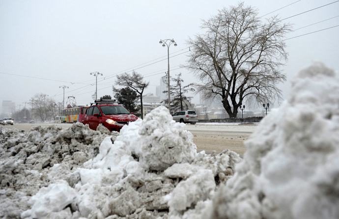
Massive flooding in Da Nang, Vietnam. 30.10.2025.
Giant waves crash over seawalls during a storm
in the suburbs of Taipei, Taiwan. 21.10.2025
"We warned at the start of ZetaTalk, in 1995, that unpredictable weather extremes, switching about from drought to deluge, would occur and increase on a lineal basis up until the pole shift. Where this occurred steadily, it has only recently become undeniable. ZetaTalk, and only ZetaTalk, warned of these weather changes, at that early date. Our early warnings spoke to the issue of global heating from the core outward, hardly Global Warming, a surface or atmospheric issue, but caused by consternation in the core. Affected by the approach of Planet X, which was by then starting to zoom rapidly toward the inner solar system for its periodic passage, the core was churning, melting the permafrost and glaciers and riling up volcanoes. When the passage did not occur as expected in 2003 because Planet X had stalled in the inner solar system, we explained the increasing weather irregularities in the context of the global wobble that had ensued - weather wobbles where the Earth is suddenly forced under air masses, churning them. This evolved by 2005 into a looping jet stream, loops breaking away and turning like a tornado to affect the air masses underneath. Meanwhile, on Planet Earth, droughts had become more intractable and deluges positively frightening, temperature swings bringing snow in summer in the tropics and searing heat in Arctic regions, with the violence of storms increasing in number and ferocity."
ZETATALK
Wild Weather, the Wobble Effect - Earth Changes and the Pole Shift
Views: 637985
Comment
-
Comment by Howard on May 17, 2014 at 3:28am
-
Georgia Hit by Rare Anticyclonic Tornado (May 15)
Ever heard of a tornado that spins in the opposite direction?
Tornadoes usually spin in a counterclockwise direction. A storm survey of an EF-0 tornado that hit Eastman, Georgia Wednesday night showed that the tornado was actually spinning in a "clockwise" motion. That is called an "anticyclonic tornado."
"Our survey team confirmed an EF0 tornado with maximum winds of 80 mph touched down in the south part of Eastman at 1150 pm EDT on May 14th and traveled north approximately 1.75 miles through town. As illustrated below, the storm exhibited anticyclonic (clockwise) rotation, a very rare phenomenon since the vast majority of tornadoes rotate cyclonically (counter-clockwise)," said National Weather Service forecasters in a post on their Facebook page.
11Alive Meteorologist Chris Holcomb also says this is a rare event.
"This might happen one out of every 1,000 tornadoes," he said. "This type of rotation is usually away from stronger rotation within a storm in the rear flank of the rotating system. These anticyclonic rotations are usually weak and don't last long."
Source
http://www.11alive.com/story/news/local/2014/05/16/dodge-county-hit...
-
-
Rare Cloud Formation Over the Philippines (May 15)
Pink and bulgy clouds across a darkening sky stunned residents of San Carlos city, Pangasinan shortly before nightfall on Friday.
Resident Holden Kirby Valdez said he has not seen such a cloud formation before.
According to the American Meteorological Society study, the rare cloud formation is called “mammatus clouds,” defined in the study as clouds that appear like “hanging protuberances, like pouches, on the undersurface of a cloud.”
The cloud formation is formed when the sinking air is cooler than the air around it, according to the Earth Observatory of NASA, adding that the sinking air must have a high water or ice content.
Source
http://newsinfo.inquirer.net/602725/rare-cloud-formation-spotted-in...
-
-
Rare Snowstorm Blankets Northern China During Chinese Summer (May 11)
A rare snow has hit Shandan County in north China's Gansu province over the weekend with temperature dropping to 8.1 degrees Celsius and snow depth reaching 100mm. It's the first snowfall the county has ever seen in May, when Lixia - the 7th solar term according to the traditional Chinese calendar marking the beginning of summer - falls.
Source
-
Comment by KM on May 10, 2014 at 3:38am
-
http://english.ahram.org.eg/NewsContent/1/64/100801/Egypt/Politics-...
Severe sandstorm sinks boat, damages museum in AswanThe unusually harsh weather sunk a tourist boat, leaving one South African passenger missingAhram Online , Thursday 8 May 2014 A massive sandstorm cloud rolls over Aswan governorate, Egypt, Wednesday, May 7, 2014 (Photo: Mohammed Rawy)
A severe sandstorm in Aswan in southern Egypt led to a boat accident and damage to a local museum on Wednesday.
A touristic Nile boat sank amid the unusually severe storm, leaving one South African passenger missing. Six other tourists, including one other South African, three Australians, and one Pole, as well as three Egyptians, were rescued from the boat
The Crocodile Museum in the southern city of Kom Ombo also suffered damage when its roof collapsed after the fierce sandstorm hit the governorate.
The Crocodile Museum, inaugurated in 2012, exhibits a collection of mummified crocodiles found in Ancient Egypt, alongside tablets and statutes of ancient Egyptian crocodile deity Sobek.
Officials from the antiquities ministry said that none of the artifacts had been damaged but that the museum would be closed to visitors until a technical committee could inspect the site.
Egypt is currently witnessing unstable weather conditions, including rainstorms and floods in Sinai and along the Red Sea coast.
According to Egypt's Meteorological Authority, the unstable weather conditions will continue for another two days.
-
Comment by jorge namour on May 2, 2014 at 5:53pm
-
U.S., record rainfall in New York ever so much since 1882 [PHOTOS and VIDEO]
Friday, May 2, 2014,
New York City has set a new record weather: April 30th marked the record rain fall after the floods of 23 September 1882. Wednesday you are in fact recorded 126.2 mm of rain in Central Park (September 23, 1882 were recorded 210.3 mm, according to data from the National Weather Service), while the total figure reported in April 2014 to 199.3 mm.
The April 30 millimeters fell were more numerous than those who fell during Hurricane Irene or Sandy.http://www.meteoweb.eu/2014/05/usa-pioggia-record-a-new-york-mai-co...
http://translate.google.com/translate?hl=en&sl=auto&tl=en&a...
-
Comment by Sevan Makaracı on April 27, 2014 at 9:06pm
-
Heatwave higher than usual for this time of year making life miserable accross Bangladesh
A heatwave that has been blazing across Bangladesh, making life miserable all around, will continue at least for two more days, the Met office says.
On Sunday, the mercury shot to 40 degrees Celsius in Rangamati, the highest temperature of the season - six notches higher than the normal reading of 34 degrees for this time of the year.
Capital Dhaka recorded a temperature of 38.5 degrees in the day.
The weather office declares heatwave conditions when the maximum temperature rises five degrees above normal to either touch or cross 40.
Senior Met officer Sanaul Haq Mandal said the high levels of humidity made the heat unbearable. On Sunday, Dhaka recorded 77 percent humidity. .....
-
Comment by lonne rey on April 27, 2014 at 10:52am
-
Winter comes again suddenly for Russia’s Urals
Russia’s Urals region has been hit with freak winter weather, with severe snowstorms causing massive traffic jams, flight delays, power blackouts and school closures.
Just when everybody in the cities of Ekaterinburg and Chelyabinsk thought they had waved winter good-bye and was anticipating greener spring weather, blizzards dragging the region back to winter.
Winter struck the region hard, with precipitation twice the monthly average coming as a shock to already burgeoning grass and trees.
Urals meteorologists have said the last time the region was struck by a snowfall of such severity in springtime was 123 years ago. They’ve found an April 26, 1891 issue of “Ekaterinburg Week” magazine that reported how the region witnessed “even more snow fallen than throughout the whole winter”.
-
-
Just days before Easter, in Romania it snowed like it was Christmas. Snow cover 10 cm in Predeal

Just days before Easter , on April 14, it snowed like at Christmas. – road workers were out working just like in a regular month of winter !Romania was under code yellow alert for snow and rain in 12 districts in the country !
Everyone hoped the snow would pass quickly, but on Friday it began snowing again, dumping 10 cm of snow on Predeal .
Tourist : “I got winter in the mountains, we came to leave for the summer so I am not prepared for winter, I had to change the tires.
Tourist: "I've got two days of rain and sunny spring and summer and then two days yesterday and today two authentic winter days.
Worried for trees already in bloom and cultures that have sprung up in the garden
In Step Tihuta , which links Transylvania and Moldavia , snow removal machinery worked almost as hard as in full winter . Snow measured 10 inches , and the wind blew hard. Temperatures dropped to 0 degrees on Friday, and people made fires in their stoves . I am worried for the animals, but also for trees already in bloom and cultures that have sprung up in the garden.
The landscape looked like the middle of December.
http://translate.google.com/translate?hl=en&sl=auto&tl=en&a...
-
Comment by Kojima on April 26, 2014 at 4:21am
-
Flash floods kill more than 100 in north Afghanistan [Relief Web: 25 April, 2014]
Afghanistan Flash Floods Situation Report No. 1 as of 2300h (local time) on 25 April 2014
Situation Overview
Heavy rainfall, which started on 24 April, has sparked flash floods in 23 districts, across six provinces, of the Northern Region of Afghanistan. Provincial authorities report that 123 people have been killed and more are still missing.
As assessments are underway to determine the full extent of the damage caused, as well as the humanitarian needs of the affected population, it is still too early to get a full picture of the scale of the flooding. Initial reports indicate that Jawzjan province is the worst affected in the region, where 80 people have reportedly been killed and some 6,000 people have been displaced. The provinces of Faryab, Sar-e-Pul, Balkh, Samangan and Takhar have also been affected to a lesser degree.
The Afghan Government’s Provincial Disaster Management Committees (PDMC) are leading the coordination of the response within their affected provinces, with support from humanitarian agencies. Limited access to some of the more heavily affected areas remains a key challenge.
Priority needs at present include clean drinking water, medical supplies, food, non-food items and shelter.
-
-
China’s Great Wall of Dust [Earth Observatory: 23 April, 2014]
A wall of dust was barreling across northern China on April 23, 2014, when the Moderate Resolution Imaging Spectroradiometer (MODIS) acquired these images from NASA’s Aqua and Terra satellites. The top image was taken at 12:35 p.m. local time, and the lower image is from 2:20 p.m. Turn on the image comparison tool to see how far the dust advanced in the two hours between images.
Dust storms are common in the deserts of northern China, but they peak during the spring when large storms and weather fronts move in from Siberia. In this case, a very large front appears to be pushing east across Asia, kicking up dust ahead of it. On the ground, the dust brought visibility down to less than 50 meters (160 feet), veiling parts of northwest China in yellow haze.
The winds and resulting dust are widespread, since a dense airborne dust plume is visible under the clouds throughout the scene. The large storm also extended to the Taklimakan Desert (immediately southwest of the area shown here) on April 23 and April 24.
See also;
"Day or night? Massive sandstorm plunges China into red mist" of lonne's comment in Red Dust effects
© 2025 Created by 0nin2migqvl32.
Powered by
![]()
You need to be a member of Earth Changes and the Pole Shift to add comments!
Join Earth Changes and the Pole Shift