EARTHQUAKES Worldwide! (Frequently Updated)
Earthquakes Today, November 7, 2025
Altering Earthquakes:
As of late, I have observed that USGS and EMSC are a bit lax on their reports of earthquakes. Sometimes not seeing anything reported for hours from the last update, or seeing periods of 90-200 minutes with no earthquakes in between. My question is, are they leaving swarms of earthquakes out of their reports, or there are actually periods of no earthquakes?
SOZT: Greater than 90% of the earthquake activity is being altered by the USGS at present, which is under orders to prevent any clue being given to the public about the Earth changes caused by the presence of Planet X. Over a decade ago, the approach was to de-sensitize the live seismographs periodically, so the displays do not turn black worldwide, and to ignore the twice-a-day patterns showing up on these seismographs. Then any quakes that could be dropped were dropped. This was obvious to some who were watching the database manipulation. Quakes in the list would suddenly disappear. This was particularly the case where a quake happened in a remote location, or out in the ocean. Dumbing down the magnitude quickly followed, but in order to ensure the public did not notice, the USGS took control of all websites reporting quake statistics. At times, this control breaks, and discrepancies are reported to the public. Some countries rebel. Quake swarms are another source of control, as they pepper the databases with many quakes and skew the statistics, and thus are pulled from the database. Else the question is raised, why so many? EOZT
Will the USGS internet system be a reliable warning system for the European tsunami by registering on the net the New Madrid earthquake on the exact time it occurs?
SOZT: It will not be a lack of information from the USGS that will be the point of confusion during the earthquakes leading up to the New Madrid adjustment, it will be knowing which quake is the big one vs the many minor quakes preceding it. The USGS downgrades almost all earthquakes, to prevent meaningful statistics from being generated from their databases. They also exclude quakes whenever they can, but this is unlikely to happen in the New Madrid area as it is in the center of a populated land mass. Thus you will have magnitude 6 quakes that will be called a 5.2, magnitude 7 quakes called a 6.1, and when a magnitude 8 or greater quake occurs, it will be called a 6.9.
We would advise that rather than watching the USGS quake statistics, that you watch the Earth changes. The adjustment that will incite the European tsunami will involve bridges on the Mississippi breaking, and being impassable. The land to the west of the Mississippi will drop so that the Mississippi will become 50 miles wide in the state of Mississippi. Watch for this. The New Madrid adjustment will be several large quakes of magnitude 8-9, though will be listed as a lesser magnitude. As the N American continent continues to unzip up to and along the Seaway, the quakes will be less than a magnitude 8 but very destructive to Cleveland and Toledo and Buffalo and the inland locks along the Seaway. Thus it is not what the USGS says that should be watched, but the condition of the bridges on the Mississippi, the impact on the cities along the Seaway, and whether the inland locks are reported as inoperable. EOZT
Views: 581938
Comment
-
Comment by Tracie Crespo on January 12, 2025 at 3:04pm
-
Magnitude 6.2 Region MICHOACAN, MEXICO Date time 2025-01-12 08:32:50.1 UTC Location 18.525 ; -103.316 Depth 34 km Distance 92 km SE of Colima, Mexico / pop: 137,000 / local time: 02:32:50.1 2025-01-12
22 km ESE of Aquila, Mexico / pop: 1,700 / local time: 02:32:50.1 2025-01-12Source parameters provided by:
National Earthquake Information Center, U.S. Geological Survey -- Golden, United States (NEIC)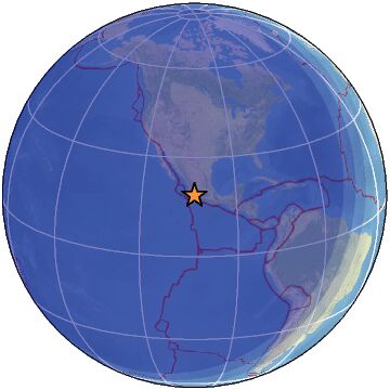
-
-
Magnitude 5.6 Region NEAR WEST COAST OF COLOMBIA Date time 2025-01-10 08:14:31.4 UTC Location 5.938 ; -77.424 Depth 10 km Distance 204 km WSW of Itagüí, Colombia / pop: 281,000 / local time: 03:14:31.4 2025-01-10
32 km S of Bahía Solano, Colombia / pop: 3,000 / local time: 03:14:31.4 2025-01-10Source parameters reviewed by a seismologist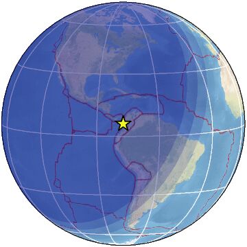
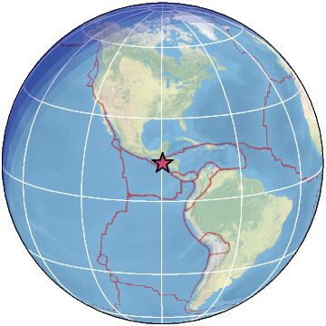
Magnitude 5.8 Region EL SALVADOR Date time 2025-01-09 16:31:44.8 UTC Location 13.734 ; -89.618 Depth 95 km Distance 30 km S of Santa Ana, El Salvador / pop: 176,000 / local time: 10:31:44.8 2025-01-09
12 km ENE of Sonsonate, El Salvador / pop: 59,400 / local time: 10:31:44.8 2025-01-09Source parameters reviewed by a seismologist
-
Comment by jorge namour on January 7, 2025 at 2:27am
-
M 7.1 - 93 km NE of Lobuche, Nepal
2025-01-07 01:05:16 (UTC)28.639°N 87.361°E10.0 km depthhttps://earthquake.usgs.gov/earthquakes/eventpage/us6000pi9w/executive
-
-
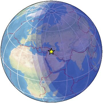
Magnitude 5.3 Region SOUTHERN IRAN Date time 2025-01-06 16:59:54.6 UTC Location 28.388 ; 52.249 Depth 19 km Distance 139 km S of Shiraz, Iran / pop: 1,249,000 / local time: 20:29:54.6 2025-01-06
60 km SSW of Fīrūzābād, Iran / pop: 66,500 / local time: 20:29:54.6 2025-01-06Source parameters not yet reviewed by a seismologist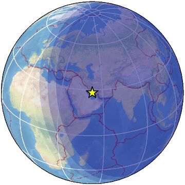
Magnitude 5.0 Region NEAR EAST COAST OF HONSHU, JAPAN Date time 2025-01-06 16:44:42.3 UTC Location 35.865 ; 141.991 Depth 23 km Distance 143 km ESE of Katsuta, Japan / pop: 155,000 / local time: 01:44:42.3 2025-01-07
105 km ENE of Hasaki, Japan / pop: 39,200 / local time: 01:44:42.3 2025-01-07Source parameters provided by:
National Earthquake Information Center, U.S. Geological Survey -- Golden, United States (NEIC)
Magnitude 3.3 Region IRAQ Date time 2025-01-06 16:37:58.1 UTC Location 36.307 ; 42.477 Depth 27 km Distance 374 km NW of Baghdad, Iraq / pop: 7,216,000 / local time: 19:37:58.1 2025-01-06
56 km WSW of Al Mawşil al Jadīdah, Iraq / pop: 2,065,000 / local time: 19:37:58.1 2025-01-06Source parameters provided by:
Kandilli Observatory and Earthquake Research Institute -- Istanbul, Turkey (KOERI)
-
-
Magnitude 6.2 Region OFFSHORE EL SALVADOR Date time 2025-01-05 17:18:47.6 UTC Location 13.053 ; -89.172 Depth 49 km Distance 70 km SSE of Santa Tecla, El Salvador / pop: 124,000 / local time: 11:18:47.6 2025-01-05
60 km SSW of Zacatecoluca, El Salvador / pop: 39,600 / local time: 11:18:47.6 2025-01-05Source parameters provided by:
National Earthquake Information Center, U.S. Geological Survey -- Golden, United States (NEIC)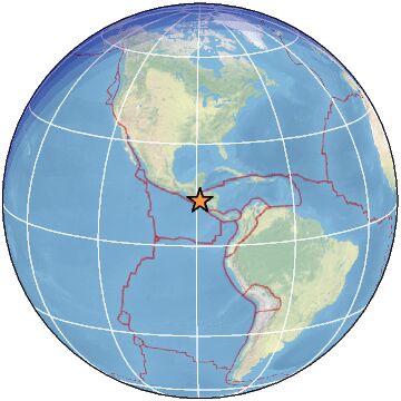
-
-
M 5.5 - 44 km NE of Āwash, Ethiopia
2025-01-03 17:01:45 (UTC)9.299°N 40.425°E10.0 km depthhttps://earthquake.usgs.gov/earthquakes/eventpage/us6000phnz/executive
5.2
32 km N of Metahāra, Ethiopia
2025-01-03 11:27:18 (UTC-03:00)
10.0 km4.5
30 km NE of Āwash, Ethiopia
2025-01-02 23:10:37 (UTC-03:00)
10.0 km4.7
13 km SSW of Āwash, Ethiopia
2025-01-02 22:34:21 (UTC-03:00)
10.0 k
4.5
54 km SSE of Metahāra, Ethiopia
2025-01-02 22:19:59 (UTC-03:00)
10.0 km
4.7
16 km N of Āwash, Ethiopia
2025-01-02 19:22:48 (UTC-03:00)
10.0 km
5.0
63 km NNE of Āwash, Ethiopia
2025-01-02 18:18:26 (UTC-03:00)
10.0 km
.................................................................
M 6.1 - 84 km NNW of Calama, Chile
2025-01-02 20:43:35 (UTC)21.715°S 69.125°W99.0 km depth4.7
Kermadec Islands, New Zealand
2025-01-03 12:56:42 (UTC-03:00)
38.5 km
4.8
94 km SSW of Pagar Alam, Indonesia
2025-01-03 11:44:43 (UTC-03:00)
64.5 km4.5
10 km SW of Alanya, Turkey
2025-01-03 10:51:05 (UTC-03:00)
31.5 km5.0
128 km SE of Phek, India
2025-01-03 01:32:38 (UTC-03:00)
159.0 km
4.7
258 km SE of Katsuura, Japan
2025-01-03 01:20:43 (UTC-03:00)
10.0 km4.5
52 km SSE of Debre Sīna, Ethiopia
2025-01-02 23:52:35 (UTC-03:00)
10.0 km
5.5
South Sandwich Islands region
2025-01-02 23:33:20 (UTC-03:00)
117.1 km5.4
62 km NW of Rabaul, Papua New Guinea
2025-01-02 22:47:28 (UTC-03:00)
10.0 km4.5
Izu Islands, Japan region
2025-01-02 16:34:37 (UTC-03:00)
10.0 km
-
-
Magnitude 6.2 Region SOUTH SANDWICH ISLANDS REGION Date time 2025-01-01 13:48:26.5 UTC Location -56.392 ; -26.693 Depth 78 km Distance 2809 km ENE of Punta Arenas, Chile / pop: 117,000 / local time: 10:48:26.5 2025-01-01
2081 km E of Stanley, Falkland Islands / pop: 2,200 / local time: 10:48:26.5 2025-01-01Source parameters provided by:
National Earthquake Information Center, U.S. Geological Survey -- Golden, United States (NEIC)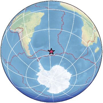
-
-
M 5.1 - 52 km SSE of Debre Sīna, Ethiopia
2024-12-29 22:20:43 (UTC)9.437°N 39.999°E10.0 km depth
https://earthquake.usgs.gov/earthquakes/eventpage/us6000pgct/executive4.9
14 km N of Āwash, Ethiopia
2024-12-29 14:10:44 (UTC-03:00)4.4
9 km NNE of Āwash, Ethiopia
2024-12-29 13:21:35 (UTC-03:00)
10.0 km4.4
27 km NNW of Āwash, Ethiopia
2024-12-29 04:19:13 (UTC-03:00)
10.0 km
Magnitude 4.6
Region ETHIOPIA
Date time 2024-12-28 05:12:12.8 UTC
Location 9.270 ; 40.059
Depth 10 km.9
29 km N of Metahāra, Ethiopia
2024-12-26 23:00:50 (UTC-03:00)
10.0 kmM 4.5 - 19 km NNE of Metahāra, Ethiopia
https://earthquake.usgs.gov/earthquakes/eventpage/us6000pfqt/executive4.9
13 km NNE of Metahāra, Ethiopia
2024-12-23 16:41:25 (UTC-03:00)
10.0 km4.4
61 km ENE of Massawa, Eritrea
2024-12-22 23:52:54 (UTC-03:00)
10.0 km4.6
Carlsberg Ridge
2024-12-22 22:36:09 (UTC-03:00)
10.0 km4.6
5 km WSW of Āwash, Ethiopia
2024-12-22 22:13:53 (UTC-03:00)
10.2 km10.0 k SWARM
https://www.facebook.com/photo/?fbid=122183660942152408&set=a.1...
4 hours ago 5.1 earthquake in the Magma Intrusion of Ethiopia 🇪🇹
The earthquakes are still intense and are still felt in Addis AbabaThe VolcanoDiscovery Team spent a few nights near the volcano and the volcanologists managed to feel more than 7 earthquakes during the night
https://www.facebook.com/photo/?fbid=1153520040107604&set=gm.24...
https://www.facebook.com/photo/?fbid=122183230766152408&set=a.1...
Satellite View of the Lava Flows of the Nabro Volcano During its Effusive Eruption in 2011
The Nabro is an Active Caldera Volcano Located in Eritrea 🇪🇷 Near the Border with Ethiopia 🇪🇹
These Lava Flows Reached a Length of 20 km Being One of the Widest on the African Continent
Later this Eruption Became Explosive Reaching IEV 4, which made it the largest eruption on the continent that we have been able to record
Unfortunately, the expelled ash caused a huge problem in Eritrea, both economically, naturally and health-wise, leaving this country worse off than it was
.....................................................++5.5
11 km SE of Bangui, Philippines
2024-12-29 23:56:16 (UTC-03:00)
34.0 km
4.1
20 km ESE of Elmalı, Turkey
2024-12-29 23:25:17 (UTC-03:00)
9.3 km
3.2
21 km W of Petrolia, CA
2024-12-29 23:09:20 (UTC-03:00)
20.1 km4.8
62 km SW of Santiago Tepextla, Mexico
2024-12-29 17:34:33 (UTC-03:00)
10.0 km4.4
51 km NNE of Bilajer, Azerbaijan
2024-12-29 17:14:17 (UTC-03:00)
10.0 km
4.7
21 km ENE of Pizitou, Taiwan
2024-12-29 16:51:35 (UTC-03:00)
20.1 km4.4
81 km SE of Kuqa, China
2024-12-29 05:58:47 (UTC-03:00)
10.0 km
3.1
80 km NNW of Charlotte Amalie, U.S. Virgin Islands
2024-12-29 05:12:42 (UTC-03:00)
28.4 km
4.5
9 km ESE of Palekastro, Greece
2024-12-29 05:02:09 (UTC-03:00)
48.5 km
4.5
104 km SE of Adak, Alaska
2024-12-29 04:47:37 (UTC-03:00)
39.6 kmmagnitud 5.3
southern Mid-Atlantic Ridge · 28 dic, 5:34 a.m.5.7
A 351 km de Hachijō, Tokio, Japón · 26 dic, 6:02 p.m.
-
-
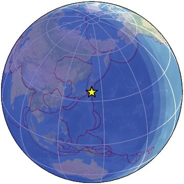
Magnitude 6.7 Region KURIL ISLANDS Date time 2024-12-27 12:47:37.1 UTC Location 47.237 ; 151.360 Depth 152 km Distance 653 km E of Yuzhno-Sakhalinsk, Russia / pop: 176,000 / local time: 23:47:37.1 2024-12-27
349 km NE of Kuril’sk, Russia / pop: 1,600 / local time: 21:47:37.1 2024-12-27Source parameters reviewed by a seismologist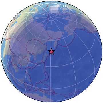
-
-
Magnitude 5.9 Region CUBA REGION Date time 2024-12-23 06:00:59.0 UTC Location 19.916 ; -76.515 Depth 22 km Distance 53 km SSE of Bayamo, Cuba / pop: 192,000 / local time: 01:00:59.0 2024-12-23
38 km SSE of Guisa, Cuba / pop: 18,400 / local time: 01:00:59.0 2024-12-23Source parameters provided by:
National Earthquake Information Center, U.S. Geological Survey -- Golden, United States (NEIC)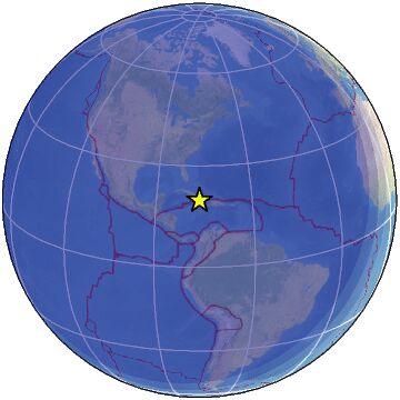
SEARCH PS Ning or Zetatalk
Nancy Lieder, Emissary of the Zetas.
https://poleshift.ning.com/xn/detail/3863141:Comment:1168188
Awakening to the Alien Presence ZetaTalk
The truth will likely never to be known to the public but be washed away in the Nibiru panic soon to engulf the world.
The Worst of the Cover-Up
https://poleshift.ning.com/profiles/blogs/the-worst-of-the-cover-up
Main Establishment Lies
https://poleshift.ning.com/profiles/blogs/main-establishment-lies
Donate
© 2025 Created by 0nin2migqvl32.
Powered by
![]()
You need to be a member of Earth Changes and the Pole Shift to add comments!
Join Earth Changes and the Pole Shift