EARTHQUAKES Worldwide! (Frequently Updated)
Earthquakes Today, November 7, 2025
Altering Earthquakes:
As of late, I have observed that USGS and EMSC are a bit lax on their reports of earthquakes. Sometimes not seeing anything reported for hours from the last update, or seeing periods of 90-200 minutes with no earthquakes in between. My question is, are they leaving swarms of earthquakes out of their reports, or there are actually periods of no earthquakes?
SOZT: Greater than 90% of the earthquake activity is being altered by the USGS at present, which is under orders to prevent any clue being given to the public about the Earth changes caused by the presence of Planet X. Over a decade ago, the approach was to de-sensitize the live seismographs periodically, so the displays do not turn black worldwide, and to ignore the twice-a-day patterns showing up on these seismographs. Then any quakes that could be dropped were dropped. This was obvious to some who were watching the database manipulation. Quakes in the list would suddenly disappear. This was particularly the case where a quake happened in a remote location, or out in the ocean. Dumbing down the magnitude quickly followed, but in order to ensure the public did not notice, the USGS took control of all websites reporting quake statistics. At times, this control breaks, and discrepancies are reported to the public. Some countries rebel. Quake swarms are another source of control, as they pepper the databases with many quakes and skew the statistics, and thus are pulled from the database. Else the question is raised, why so many? EOZT
Will the USGS internet system be a reliable warning system for the European tsunami by registering on the net the New Madrid earthquake on the exact time it occurs?
SOZT: It will not be a lack of information from the USGS that will be the point of confusion during the earthquakes leading up to the New Madrid adjustment, it will be knowing which quake is the big one vs the many minor quakes preceding it. The USGS downgrades almost all earthquakes, to prevent meaningful statistics from being generated from their databases. They also exclude quakes whenever they can, but this is unlikely to happen in the New Madrid area as it is in the center of a populated land mass. Thus you will have magnitude 6 quakes that will be called a 5.2, magnitude 7 quakes called a 6.1, and when a magnitude 8 or greater quake occurs, it will be called a 6.9.
We would advise that rather than watching the USGS quake statistics, that you watch the Earth changes. The adjustment that will incite the European tsunami will involve bridges on the Mississippi breaking, and being impassable. The land to the west of the Mississippi will drop so that the Mississippi will become 50 miles wide in the state of Mississippi. Watch for this. The New Madrid adjustment will be several large quakes of magnitude 8-9, though will be listed as a lesser magnitude. As the N American continent continues to unzip up to and along the Seaway, the quakes will be less than a magnitude 8 but very destructive to Cleveland and Toledo and Buffalo and the inland locks along the Seaway. Thus it is not what the USGS says that should be watched, but the condition of the bridges on the Mississippi, the impact on the cities along the Seaway, and whether the inland locks are reported as inoperable. EOZT
Views: 580891
Comment
-
Comment by jorge namour on February 15, 2025 at 12:12am
-
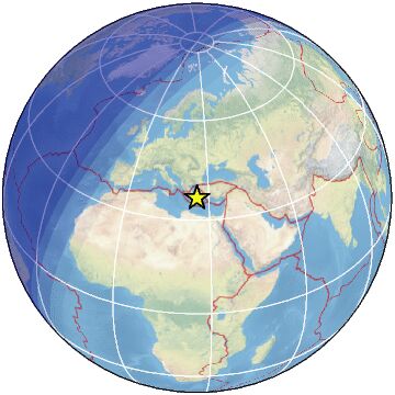
M 6.0 - 6 km NNE of Metahāra, Ethiopia
2025-02-14 20:28:23 (UTC)8.956°N 39.934°E10.0 km depth
https://earthquake.usgs.gov/earthquakes/eventpage/us7000pdu6/executive
.........................................................magnitud 5.8
A 286 km de Kodiak, Alaska, EE. UU. · 13 feb, 8:59 p.m.magnitud 3.7
Países afectados: Estados Unidos y Canadá
A 17 km de Victoria, Columbia Británica, Canadá · 2:59 a.m.magnitud 3.6
A 4 km de Fairview, California, EE. UU. · 13 feb, 6:59 p.m.magnitud 5.1
A 2 km de Souk L'Qolla, MOROCCO 10 feb, 7:48 p.m.magnitud 3.6
Países afectados: Estados Unidos y México
A 7 km de San Bernardino, California, EE. UU. · 10 feb, 2:44 p.m.magnitud 5.9
A 66 km de Port Vila, Vanuatu · 9 feb, 9:09 p.m.4.8
43 km SW of Montecillos, Mexico
2025-02-14 12:26:55 (UTC-03:00)
10.0 km5.1
South Sandwich Islands region
2025-02-14 06:46:33 (UTC-03:00)
10.0 km
4.8
29 km NNE of Goroka, Papua New Guinea
2025-02-14 06:27:41 (UTC-03:00)
108.0 km
4.8
51 km SW of Angoram, Papua New Guinea
2025-02-14 05:09:58 (UTC-03:00)
116.4 km
4.7
211 km NNE of Barra Patuca, Honduras
2025-02-14 04:26:23 (UTC-03:00)
10.0 km
5.2
off the coast of Ecuador
2025-02-14 03:39:50 (UTC-03:00)
10.0 k2025-02-14 23:02:53
8 min ago
36.675 25.764 5 3.0 DODECANESE ISLANDS, GREECE
2025-02-14 22:45:18
25 min ago
36.647 25.786 12 4.0 DODECANESE ISLANDS, GREEC2025-02-14 20:18:55
2 hr 52 min ago
36.656 25.739 8 4.1 DODECANESE ISLANDS, GREECE
1 2025-02-14 20:17:45
2 hr 53 min ago
36.600 25.600 5 4.3 DODECANESE ISLANDS, GREECE
2025-02-14 20:15:40
2 hr 55 min ago
36.627 25.769 12 3.5 DODECANESE ISLANDS, GREECE
-
-
BREAKING NEWS: A powerful 7.6 magnitude earthquake occurred just over half an hour ago 200 kilometres southwest of the Cayman Islands, in the heart of the Caribbean Sea. According to current data, the quake occurred at a depth of only 10 km, therefore NOAA immediately issued a tsunami warning that is currently in effect for all countries facing the Caribbean Sea and the Gulf of Mexico.
01:40 AM UPDATE: The tsunami warning has returned to nearly every country, it remains in effect in Cayman Islands, Cuba and Jamaica.
https://www.facebook.com/photo/?fbid=1072627788210972&set=a.473...
-
-
M 7.6 - 209 km SSW of George Town, Cayman Islands
2025-02-08 23:23:14 (UTC)17.702°N 82.456°W10.0 km depthhttps://earthquake.usgs.gov/earthquakes/eventpage/us7000pcdl/executive
........................................................................
4.2
18 km E of Mesariá, Greece
2025-02-08 06:15:48 (UTC-03:00)
10.0 km
4.4
17 km NE of Firá, Greece
2025-02-08 06:10:06 (UTC-03:00)
10.0 km
5.1
13 km NE of Mesariá, Greece
2025-02-08 06:00:40 (UTC-03:00)
10.0 km
4.9
18 km NE of Firá, Greece
2025-02-08 05:36:04 (UTC-03:00)
10.0 km
-
Comment by Tracie Crespo on February 7, 2025 at 1:34pm
-
Magnitude 6.0 Region SOUTH OF FIJI ISLANDS Date time 2025-02-07 10:26:58.8 UTC Location -23.924 ; -176.086 Depth 36 km Distance 323 km S of Nuku‘alofa, Tonga / pop: 22,400 / local time: 23:26:58.8 2025-02-07
320 km S of Tatakamotonga, Tonga / pop: 3,000 / local time: 23:26:58.8 2025-02-07Source parameters reviewed by a seismologist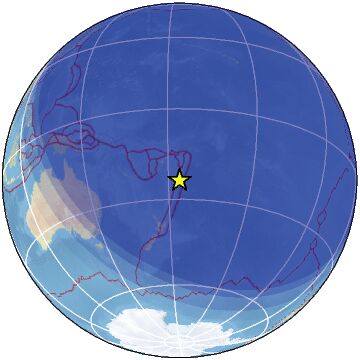
Magnitude 5.1 Region DODECANESE ISLANDS, GREECE Date time 2025-02-07 07:16:15.0 UTC Location 36.564 ; 25.631 Depth 7 km Distance 144 km N of Irákleion, Greece / pop: 137,000 / local time: 09:16:15.0 2025-02-07
25 km NE of Oía, Greece / pop: 3,300 / local time: 09:16:15.0 2025-02-07Source parameters reviewed by a seismologist
-
-
SantorinI GREECE
https://www.facebook.com/meteohellas/videos/584398624432249
the earth beneath the feet of the inhabitants does not stop shaking.
Newer amateur video shows the prevailing situation on the island of Santorini, at the time the seismic sequence is in full swing, and during yesterday's 5.1 R earthquake.
For the latest in our group Meteo Hellas🔴 VOLCANIC ERUPTION RECORDED IN GREECE, POPULATION BEGINS TO MIGRATE
https://www.facebook.com/carlos.aguela.9/videos/907753251240520
-
Comment by Kris H on February 4, 2025 at 11:33pm
-
Hundreds of people fleeing Santorini as earthquake activity increases/swarms.
https://www.reuters.com/world/europe/hundreds-flee-santorini-quakes...
-
-
M 3.8 - 10 km SE of York Harbor, Maine
2025-01-27 15:22:56 (UTC)43.062°N 70.566°W13.2 km depth
https://earthquake.usgs.gov/earthquakes/eventpage/us6000pmk3/executiveMagnitude 2.2
Region NEW YORK
Date time 2025-02-02 07:56:43.4 UTC
Location 44.686 ; -74.651
Depth 8 km https://www.emsc-csem.org/Earthquake_information/earthquake.php?id=...Magnitude 2.0
Region MAINE
Date time 2025-02-02 12:57:59.3 UTC
Location 43.067 ; -70.509
Depth 12 kmM 4.2 - 26 km WNW of Clayton, Idaho
magnitud 4.5
Países afectados: Estados Unidos y México
A 22 km de Karnes City, Texas, EE. UU. · 30 ene, 12:26 a.m.
................................................................Magnitude 4.5
Region DODECANESE ISLANDS, GREECE
Date time 2025-02-02 23:54:41.8 UTC
Location 36.594 ; 25.717
Depth 11 km https://www.emsc-csem.org/Earthquake_information/earthquake.php?id=...2025-02-03 00:29:22
41 min ago
36.619 25.656 16 3.7 DODECANESE ISLANDS, GREECE
2025-02-03 00:26:54
43 min ago
36.600 25.620 6 2.6 DODECANESE ISLANDS, GREE
2025-02-02 23:22:101 hr 49 min ago
36.620 25.620 5 2.6 DODECANESE ISLANDS, GREECE
2025-02-02 23:19:33
1 hr 52 min ago
36.540 25.660 5 2.6 DODECANESE ISLANDS, GREECE
2025-02-02 23:16:34
1 hr 55 min ago
36.600 25.630 5 2.6 DODECANESE ISLANDS, GREECE
2025-02-02 23:10:57
2 hr 00 min ago
36.596 25.684 14 3.2 DODECANESE ISLANDS, GREECE
2025-02-02 23:09:59
2 hr 01 min ago
13.890 120.500 95 3.0 MINDORO, PHILIPPINES
2025-02-02 23:09:10
2 hr 02 min ago
36.536 25.639 17 2.7 DODECANESE ISLANDS, GREECE
2025-02-02 23:04:35
2 hr 07 min ago
Greece on high alert as multiple earthquakes shake island of Santorinihttps://www.cbsnews.com/news/greece-earthquakes-santorini-island/?f...
https://www.facebook.com/photo/?fbid=1067851635355254&set=a.473...
Il Mondo dei Terremoti
onedtprSso
1
h
389ti2c5u00a273g2iaulamc0htfilmt5h59hhia23
1
aa117
·
⚠️ Intense swarm going on in Santorini: tectonic or volcanic?
An intense seismic swarm has occurred since Tuesday off the coast of Santorini, Greece, a few kilometers from one of the best-known and visited volcanic islands in the world. The ongoing sequence since Tuesday has so far recorded over 300 earthquakes, 9 of which have had a magnitude of or more than 4. The strongest earthquakes of the swarm occurred all this morning and had magnitude between 4.1 and 4.7, all well warned on the island of Santorini. The activity is so intense that the tremors occur every couple of minutes, so the data is constantly being updated.Most of the epicenters are concentrated near the northeastern side of the underwater volcano Kolumbo, one of the most important volcanic systems in the whole Aegean Sea whose last eruption dates back to 1650. We’re talking about one of the most significant historical eruptions in the Mediterranean Sea, with so many extensive pyroclastic flows, submarine landslides and a tsunami with waves over 20 meters high. But then are these earthquakes related to the volcano or just the tectonic of the Hellenic Arc? The answer is that we don’t know, we don’t have enough data to rule out both assumptions. According to the statements by the director of the National Seismic Observatory in Athens, it appears that the earthquakes are mainly tectonic in nature, as volcanic monitoring networks do not appear to have detect any variation in the monitored parameters.
The attention remains high anyway, already on Tuesday a first emergency meeting was held between the Civil Protection, some members of the Greek government and the volcanologists from the Santorini Monitoring Institute in order to check and update the emergency protocols in case things turn for the worst. Also, after the earthquakes of the last few hours, the decision was made to keep the schools closed in Santorini for tomorrow.
The last unrest (agitation) of the Santorini-Kolumbo volcanic system dates back to 2011-2012 when a sequence of earthquakes affected the island for as many as 14 months. In that case, however, important changes were detected throughout the volcanic apparatus, including an increase in gas emissions and a deformation of the boiler of 12 cm, which was a sign of the fact that a magmatic intrusion was underway, which fortunately did not culminate in an eruption.
For more updates, stay tuned! 👀
----------------------------------------------------------
magnitud 5.5
A 42 km de Tena, Ecuador · 31 ene, 8:02 p.m.magnitud 5.4
A 153 km de Kirakira, Islas Salomón · 31 ene, 9:04 a.m.magnitud 5.4
A 153 km de Kirakira, Islas Salomón · 31 ene, 9:04 a.m.magnitud 5.8
A 19 km de Kabupaten Aceh Selatan, Aceh, Indonesia · 31 ene, 8:03 a.m.magnitud 5.3
A 1317 km de Natal - Río Grande del Norte, Brasil · 31 ene, 6:04 a.magnitud 5.6
A 431 km de Anchorage, Alaska, EE. UU. · 30 ene, 1:40 a.m.magnitud 5.6
A 1744 km de Ushuaia, Tierra del Fuego · 28 ene, 10:32 p.m.M 4.4 - 277 km WNW of Port McNeill, Canada
2025-02-03 00:25:37 (UTC)51.577°N 130.720°W10.0 km depthM 4.6 - 10 km NNW of Āwash, Ethiopia
-
-
Magnitude 5.8 Region NORTHERN SUMATRA, INDONESIA Date time 2025-01-31 11:03:41.7 UTC Location 3.261 ; 97.002 Depth 49 km Distance 169 km WSW of Binjai, Indonesia / pop: 228,000 / local time: 18:03:41.7 2025-01-31
111 km NNE of Sinabang, Indonesia / pop: 15,000 / local time: 18:03:41.7 2025-01-31Source parameters provided by:
GeoForschungsZentrum (GFZ) -- Potsdam, Germany (GFZ)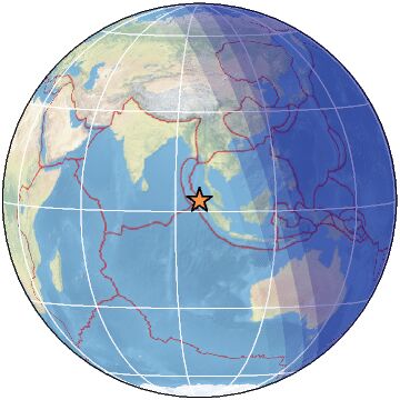
-
-
M 6.0 - 12 km N of Yujing, Taiwan
2025-01-20 16:17:26 (UTC)23.234°N 120.475°E10.0 km depth
https://earthquake.usgs.gov/earthquakes/eventpage/us6000pl8h/executive4.5
23 km WSW of Ōfunato, Japan
2025-01-20 15:14:38 (UTC-03:00)
88.1 km
4.8
6 km SSE of Yujing, Taiwan
2025-01-20 14:42:30 (UTC-03:00)
10.0 km
2.7
43 km WNW of Hebgen Lake Estates, Montana
2025-01-20 13:47:20 (UTC-03:00)
13.7 km
5.1
3 km WSW of Yujing, Taiwan
2025-01-20 13:26:24 (UTC-03:00)
10.0 km
.................................................................4.9
121 km SSW of Lata, Solomon Islands
2025-01-20 05:49:04 (UTC-03:00)
35.0 km
3.3
53 km NW of San Antonio, Puerto Rico
2025-01-20 05:48:29 (UTC-03:00)
16.1 km
5.6
67 km S of Lata, Solomon Islands
2025-01-20 05:38:43 (UTC-03:00)
35.0 km4.8
73 km NE of Lobuche, Nepal
2025-01-20 21:14:23 (UTC-03:00)
54.8 km
5.0
160 km N of Saipan, Northern Mariana Islands
2025-01-20 20:25:59 (UTC-03:00)
10.7 km
,,,,,,,,,,,,,,,,,,,,,,,,,,,,,,,,,,,,,,,,,,,,,,,,5.5
17 km WNW of Agat Village, Guam
2025-01-21 02:47:51 (UTC-03:00)
133.4 km
,,,,,,,,,,,,,,,,,,,,,,,,,,,,,,,,,,,,,,,,,,,,,,,,,,,,,,,,5.1
southern Mid-Atlantic Ridge
2025-01-21 02:36:11 (UTC-03:00)
10.0 km
4.9
southern Mid-Atlantic Ridge
2025-01-21 02:29:32 (UTC-03:00)
10.0 km
5.2
southern Mid-Atlantic Ridge
2025-01-21 02:13:36 (UTC-03:00)
10.0 km
4.8
southern Mid-Atlantic Ridge
2025-01-21 01:01:34 (UTC-03:00)
10.0
-
-
Magnitude 6.8 Region KYUSHU, JAPAN Date time 2025-01-13 12:19:34.0 UTC Location 31.860 ; 131.519 Depth 49 km Distance 97 km ENE of Kagoshima, Japan / pop: 555,000 / local time: 21:19:34.0 2025-01-13
12 km ESE of Miyazaki, Japan / pop: 311,000 / local time: 21:19:34.0 2025-01-13Source parameters reviewed by a seismologist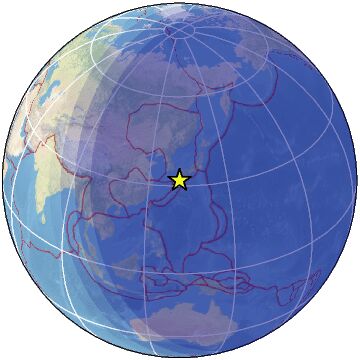
SEARCH PS Ning or Zetatalk
Nancy Lieder, Emissary of the Zetas.
https://poleshift.ning.com/xn/detail/3863141:Comment:1168188
Awakening to the Alien Presence ZetaTalk
The truth will likely never to be known to the public but be washed away in the Nibiru panic soon to engulf the world.
The Worst of the Cover-Up
https://poleshift.ning.com/profiles/blogs/the-worst-of-the-cover-up
Main Establishment Lies
https://poleshift.ning.com/profiles/blogs/main-establishment-lies
Donate
© 2025 Created by 0nin2migqvl32.
Powered by
![]()
You need to be a member of Earth Changes and the Pole Shift to add comments!
Join Earth Changes and the Pole Shift