EARTHQUAKES Worldwide! (Frequently Updated)
 Global Earthquake Maps
Regionally Specific Earthquake Maps
|
Related Informations:
Earthquakes during the poleshift Magnetic twist and the effects
|
Additional Information from the F.A.Q: Q: What is the "Earth Wobble"?
Q: How can I understand the Magnetosphere? - About the Magnetosphere
Q: Is there a relationship between disturbances in the magnetosphere and seismic activity? |
Altering Earthquakes:
As of late, I have observed that USGS and EMSC are a bit lax on their reports of earthquakes. Sometimes not seeing anything reported for hours from the last update, or seeing periods of 90-200 minutes with no earthquakes in between. My question is, are they leaving swarms of earthquakes out of their reports, or there are actually periods of no earthquakes?
SOZT: Greater than 90% of the earthquake activity is being altered by the USGS at present, which is under orders to prevent any clue being given to the public about the Earth changes caused by the presence of Planet X. Over a decade ago, the approach was to de-sensitize the live seismographs periodically, so the displays do not turn black worldwide, and to ignore the twice-a-day patterns showing up on these seismographs. Then any quakes that could be dropped were dropped. This was obvious to some who were watching the database manipulation. Quakes in the list would suddenly disappear. This was particularly the case where a quake happened in a remote location, or out in the ocean. Dumbing down the magnitude quickly followed, but in order to ensure the public did not notice, the USGS took control of all websites reporting quake statistics. At times, this control breaks, and discrepancies are reported to the public. Some countries rebel. Quake swarms are another source of control, as they pepper the databases with many quakes and skew the statistics, and thus are pulled from the database. Else the question is raised, why so many? EOZT
Will the USGS internet system be a reliable warning system for the European tsunami by registering on the net the New Madrid earthquake on the exact time it occurs?
SOZT: It will not be a lack of information from the USGS that will be the point of confusion during the earthquakes leading up to the New Madrid adjustment, it will be knowing which quake is the big one vs the many minor quakes preceding it. The USGS downgrades almost all earthquakes, to prevent meaningful statistics from being generated from their databases. They also exclude quakes whenever they can, but this is unlikely to happen in the New Madrid area as it is in the center of a populated land mass. Thus you will have magnitude 6 quakes that will be called a 5.2, magnitude 7 quakes called a 6.1, and when a magnitude 8 or greater quake occurs, it will be called a 6.9.
We would advise that rather than watching the USGS quake statistics, that you watch the Earth changes. The adjustment that will incite the European tsunami will involve bridges on the Mississippi breaking, and being impassable. The land to the west of the Mississippi will drop so that the Mississippi will become 50 miles wide in the state of Mississippi. Watch for this. The New Madrid adjustment will be several large quakes of magnitude 8-9, though will be listed as a lesser magnitude. As the N American continent continues to unzip up to and along the Seaway, the quakes will be less than a magnitude 8 but very destructive to Cleveland and Toledo and Buffalo and the inland locks along the Seaway. Thus it is not what the USGS says that should be watched, but the condition of the bridges on the Mississippi, the impact on the cities along the Seaway, and whether the inland locks are reported as inoperable. EOZT
Please collect earthquake-reports here. Significant Quakes or Magnitude 7+ can be posted separately.
[Edited by the Moderation]
Views: 573104
Comment
-
Comment by jorge namour on August 8, 2024 at 12:01pm
-
M 7.1 - 20 km NE of Nichinan, Japan
2024-08-08 07:42:55 (UTC)31.719°N 131.527°E25.0 km depth
https://earthquake.usgs.gov/earthquakes/eventpage/us6000nith/executive4.6
20 km ESE of Nichinan, Japan
2024-08-08 06:00:02 (UTC-03:00)
42.9 km
4.8
31 km SE of Miyazaki, Japan
2024-08-08 05:35:48 (UTC-03:00)
38.4 km
-
-
M 6.8 - 18 km ENE of Barcelona, Philippines
2024-08-02 22:23:01 (UTC)8.193°N 126.600°E25.8 km depth
https://earthquake.usgs.gov/earthquakes/eventpage/us6000nhqc/executive4.9
28 km NE of Kinablangan, Philippines
2024-08-02 19:46:02 (UTC-03:00)
77.7 km
5.3
32 km E of Barcelona, Philippines
2024-08-02 19:31:14 (UTC-03:00)
81.6 km
-------------------------------------------------------
magnitud 4.9
A 22 km de Barstow, California, · 29 jul, 5:00 p.mmagnitud 5.6
A 447 km de Unalaska, Alaska, 1 ago, 7:03 a.m.magnitud 5.7
A 185 km de Fiyi · 29 jul, 9:11 a.m.magnitud 6.0
Países afectados: Niue y Tonga
A 154 km de Nukualofa, Tonga · 29 jul, 10:07 a.m.magnitud 4.5
A 29 km de Cedar City, Utah,· 29 jul, 2:29 a.m.
-
-
6.0
167 km WSW of Nikolski, Alaska
2024-07-19 00:13:48 (UTC-03:00)
41.5 km https://earthquake.usgs.gov/earthquakes/eventpage/us7000n068/executive4.7
65 km SE of San Pedro de Atacama, Chile
2024-07-19 00:11:24 (UTC-03:00)
145.4 km
-
-
M 7.4 - 45 km ESE of San Pedro de Atacama, Chile
2024-07-19 01:50:47 (UTC)23.047°S 67.782°W117.4 km depth
https://earthquake.usgs.gov/earthquakes/eventpage/us7000n05d/executive5.0
39 km SE of San Pedro de Atacama, Chile
2024-07-18 23:15:51 (UTC-03:00)
138.2 km
-
-
M 6.4 - 209 km WSW of Tofino, Canada
2024-07-11 15:08:47 (UTC)48.813°N 128.725°W10.0 km depth
https://earthquake.usgs.gov/earthquakes/eventpage/us7000mykj/executive
M 5.4 - 187 km W of Tofino, Canada
....................................................................5.4
120 km SSW of Merizo Village, Guam
2024-07-11 06:27:34 (UTC-03:00)
10.0 km4.9
10 km NW of Nyūzen, Japan
2024-07-11 00:01:18 (UTC-03:00)
10.0 km
4.8
9 km ENE of Honoria, Peru
2024-07-10 23:55:19 (UTC-03:00)
132.9 km4.3
42 km WSW of Kuqa, China
2024-07-10 21:49:16 (UTC-03:00)
10.0 km
4.5
Izu Islands, Japan region
2024-07-10 21:59:45 (UTC-03:00)
20.0 km5.0
South Sandwich Islands region
2024-07-10 20:52:00 (UTC-03:00)
10.0 km
-
-
M 7.1 - 106 km WSW of Sangay, Philippines
2024-07-11 02:13:17 (UTC)6.065°N 123.161°E620.1 km depthhttps://earthquake.usgs.gov/earthquakes/eventpage/us7000myfa/executive
-
Comment by Tracie Crespo on July 10, 2024 at 1:08pm
-
Magnitude 6.7 Region SOUTH OF AFRICA Date time 2024-07-10 04:55:45.1 UTC Location -53.301 ; 25.451 Depth 10 km Distance 2151 km S of Port Elizabeth, South Africa / pop: 967,000 / local time: 06:55:45.1 2024-07-10
2112 km SSE of Arniston, South Africa / pop: 1,200 / local time: 06:55:45.1 2024-07-10Source parameters reviewed by a seismologist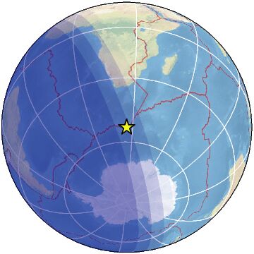
-
-
M 6.2 - Bonin Islands, Japan region
2024-07-07 20:01:14 (UTC)26.888°N 138.828°E571.2 km depth
https://earthquake.usgs.gov/earthquakes/eventpage/us7000mxmu/executive
---------------------------------------------------------M 5.5 - 77 km SSW of Ust’-Kamchatsk Staryy, Russia
2024-07-07 20:15:49 (UTC)55.567°N 162.102°E73.4 km depth
https://earthquake.usgs.gov/earthquakes/eventpage/us7000mxmx/executiveM 5.5 - 76 km SSW of Ust’-Kamchatsk Staryy, Russia
---------------------------------------------------------
4.7
7 km WSW of Savália, Greece
2024-07-07 11:41:04 (UTC-03:00)
23.5 km
4.4
101 km NNW of Vallenar, Chile
2024-07-07 11:28:07 (UTC-03:00)
26.5 km
-
-
Magnitude 7.2 Region NEAR COAST OF SOUTHERN PERU Date time 2024-06-28 05:36:38.3 UTC Location -15.819 ; -74.364 Depth 30 km Distance 244 km SE of Ica, Peru / pop: 246,000 / local time: 00:36:38.3 2024-06-28
51 km SE of Acarí, Peru / pop: 4,400 / local time: 00:36:38.3 2024-06-28Source parameters reviewed by a seismologist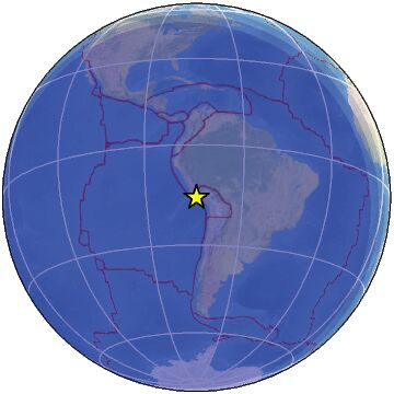
-
-
4.8
central East Pacific Rise
2024-06-09 09:03:28 (UTC-03:00)
10.0 km
5.0
Pacific-Antarctic Ridge
2024-06-09 08:27:42 (UTC-03:00)
10.0 km
5.0
Pacific-Antarctic Ridge
2024-06-09 07:34:27 (UTC-03:00)
10.0 km
5.1
Pacific-Antarctic Ridge
2024-06-09 07:17:55 (UTC-03:00)
10.0 km
6.2
Pacific-Antarctic Ridge
2024-06-09 06:55:49 (UTC-03:00)
10.0 km https://earthquake.usgs.gov/earthquakes/eventpage/us7000mrbr/executive
5.3
Pacific-Antarctic Ridge
2024-06-09 06:48:04 (UTC-03:00)
10.0 km
--------------------------------------------------------------------------5.7
181 km WNW of Panguna, Papua New Guinea
2024-06-09 13:28:38 (UTC-03:00)
125.0 km4.4
western Xizang
2024-06-09 13:01:23 (UTC-03:00)
12.9 kMagnitude 5.9
Region SEA OF OKHOTSK
Date time 2024-06-06 11:07:53.6 UTC
Location 50.146 ; 147.685
Depth 620 km https://www.emsc-csem.org/Earthquake_information/earthquake.php?id=...magnitud 5.5
País afectado: Islas Georgias del Sur y Sandwich del Sur
A 1962 km de Puerto Argentino, Islas Malvinas (Falkland Islands) · 5 jun, 7:39 a.m.
© 2025 Created by 0nin2migqvl32.
Powered by
![]()
You need to be a member of Earth Changes and the Pole Shift to add comments!
Join Earth Changes and the Pole Shift