EARTHQUAKES Worldwide! (Frequently Updated)
Earthquakes December 10, 2025
Altering Earthquakes:
As of late, I have observed that USGS and EMSC are a bit lax on their reports of earthquakes. Sometimes not seeing anything reported for hours from the last update, or seeing periods of 90-200 minutes with no earthquakes in between. My question is, are they leaving swarms of earthquakes out of their reports, or there are actually periods of no earthquakes?
SOZT: Greater than 90% of the earthquake activity is being altered by the USGS at present, which is under orders to prevent any clue being given to the public about the Earth changes caused by the presence of Planet X. Over a decade ago, the approach was to de-sensitize the live seismographs periodically, so the displays do not turn black worldwide, and to ignore the twice-a-day patterns showing up on these seismographs. Then any quakes that could be dropped were dropped. This was obvious to some who were watching the database manipulation. Quakes in the list would suddenly disappear. This was particularly the case where a quake happened in a remote location, or out in the ocean. Dumbing down the magnitude quickly followed, but in order to ensure the public did not notice, the USGS took control of all websites reporting quake statistics. At times, this control breaks, and discrepancies are reported to the public. Some countries rebel. Quake swarms are another source of control, as they pepper the databases with many quakes and skew the statistics, and thus are pulled from the database. Else the question is raised, why so many? EOZT
Will the USGS internet system be a reliable warning system for the European tsunami by registering on the net the New Madrid earthquake on the exact time it occurs?
SOZT: It will not be a lack of information from the USGS that will be the point of confusion during the earthquakes leading up to the New Madrid adjustment, it will be knowing which quake is the big one vs the many minor quakes preceding it. The USGS downgrades almost all earthquakes, to prevent meaningful statistics from being generated from their databases. They also exclude quakes whenever they can, but this is unlikely to happen in the New Madrid area as it is in the center of a populated land mass. Thus you will have magnitude 6 quakes that will be called a 5.2, magnitude 7 quakes called a 6.1, and when a magnitude 8 or greater quake occurs, it will be called a 6.9.
We would advise that rather than watching the USGS quake statistics, that you watch the Earth changes. The adjustment that will incite the European tsunami will involve bridges on the Mississippi breaking, and being impassable. The land to the west of the Mississippi will drop so that the Mississippi will become 50 miles wide in the state of Mississippi. Watch for this. The New Madrid adjustment will be several large quakes of magnitude 8-9, though will be listed as a lesser magnitude. As the N American continent continues to unzip up to and along the Seaway, the quakes will be less than a magnitude 8 but very destructive to Cleveland and Toledo and Buffalo and the inland locks along the Seaway. Thus it is not what the USGS says that should be watched, but the condition of the bridges on the Mississippi, the impact on the cities along the Seaway, and whether the inland locks are reported as inoperable. EOZT
Views: 583330
Comment
-
Comment by jorge namour on September 22, 2024 at 4:01am
-
SOUTH AMERICA WAGGLE
M 6.0 - 88 km NNW of Villa General Roca, Argentina
2024-09-21 21:24:27 (UTC)31.921°S 66.794°W130.4 km depth
https://earthquake.usgs.gov/earthquakes/eventpage/us6000ntjh/executiveIt shook in the extreme northwest of the province of San Luis
It was of medium intensity, according to the assessment made by Inpres. It was felt in all the provinces of Cuyo and Córdoba.ANOTHER EARTHQUAKE
https://www.inpres.gob.ar/desktop/epicentro1.php?s=20240922013223
Tiempo local: 21/09/2024 a las 22:32:23
Tiempo GMT: 22/09/2024 a las 01:32:23
Epicentro: 154 km al N de San Luis; 164 km al E de San Juan; 74 km al SE de Marayes -31.990 (lat) -66.870 (long)
Magnitud: 4.3
Profundidad: 150 kmEARTHQUAKE SAN JUAN- ARGENTINA
https://www.inpres.gob.ar/desktop/epicentro1.php?s=20240920231144
Tiempo local: 20/09/2024 a las 20:11:44
Tiempo GMT: 20/09/2024 a las 23:11:43
Epicentro: 69 km al E de Calingasta -31.297 (lat) -68.692 (long)
Magnitud: 4.3
Profundidad: 107 km
...........................................................4.6
16 km N of Bojnūrd, Iran
2024-09-21 20:58:45 (UTC-03:00)
10.0 km
4.3
15 km N of Bojnūrd, Iran
2024-09-21 20:51:49 (UTC-03:00)
10.0 km4.7
22 km SW of Placeres del Oro, Mexico
2024-09-21 16:54:45 (UTC-03:00)
71.3 km5.4
149 km WSW of Adak, Alaska
2024-09-21 14:21:18 (UTC-03:00)
43.4 km4.9
168 km SW of Port Blair, India
2024-09-21 13:41:39 (UTC-03:00)
26.8 km4.5
79 km N of Pārūn, Afghanistan
2024-09-21 11:42:44 (UTC-03:00)
115.6 km
4.5
Volcano Islands, Japan region
2024-09-21 10:14:00 (UTC-03:00)
116.6 km
4.8
28 km NNE of Hualien City, Taiwan
2024-09-21 07:51:08 (UTC-03:00)
28.6 km5.6
Kermadec Islands region
2024-09-20 23:32:17 (UTC-03:00)
10.0 kmmagnitud 5.1
A 46 km de Midland, Texas, EE. UU. · 16 sept, 9:49 p.m.magnitud 5.6
A 889 km de Nukualofa, Tonga · 20 sept, 11:32 p.m.magnitud 5.6
A 96 km de Kabwum, Papúa Nueva Guinea · 19 sept, 5:41 a.mmagnitud 5.2
Países afectados: Bulgaria, Moldavia, Rumanía y Ucrania
A 14 km de Nehoiu, Rumanía · 16 sept, 11:40 a.m.
-
Comment by Tracie Crespo on September 16, 2024 at 1:51pm
-
Magnitude 6.3 Region MARIANA ISLANDS REGION Date time 2024-09-16 11:36:35.7 UTC Location 17.066 ; 147.195 Depth 51 km Distance 2159 km SSE of Yokosuka, Japan / pop: 428,000 / local time: 20:36:35.7 2024-09-16
257 km NNE of Saipan, Northern Mariana Islands / pop: 48,200 / local time: 21:36:35.7 2024-09-16Source parameters not yet reviewed by a seismologist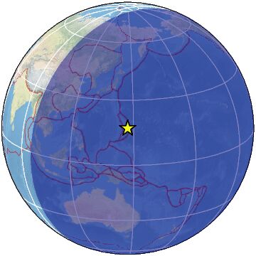
-
-
M 6.5 - 272 km WNW of Port McNeill, Canada
2024-09-15 22:22:48 (UTC)51.604°N 130.621°W10.0 km depth
https://earthquake.usgs.gov/earthquakes/eventpage/us7000ne51/executive
---------------------------------------------------------------
magnitud 4.7
A 14 km de Thousand Oaks, California, · 12 sept, 11:28 a.m.FROM LINK
Intense blazes, including the Line fire in Southern California, created “fire clouds” that matured into thunderstorms.
but this particular fire happens to be burning right at the San Andreas Fault
............................................................https://www.facebook.com/photo?fbid=913467157481399&set=a.53993...
The Next California Earthquake
·
A M3.4 quake was felt in parts of the Bay Area at 3:15pm.
It was centered northeast of San Jose near the Calaveras Fault.
People reported feeling the quake in San Jose, Milpitas, Fremont, Dublin, San Ramon, Hayward, Pleasanton, Palo Alto, Mountain View, Half Moon Bay, and parts of San Francisco, among other locations.
-----------------------------------------------------
FRANCE REGIONWESTERN MEDITERRANEAN SEA ORID : 5066609
14/09/24 49 Arrivees RMS : 0.79 Type :uk
Heure orig: 18h 47m 45.60 ± 0.52
Latitude : 42.90 ± -1.0 1/2 Grand Axe : 7.1 km
Longitude : 7.19 ± -1.0 1/2 Petit Axe : 4.3 km
Profondeur: 4. (Imposee) Azimut gd Axe : 143.0 deg
ML : 4.80±0.54 sur 11 stationshttps://www-dase.cea.fr/evenement/evenements.php?type=seisme&id...
https://www.laprovence.com/article/ecoplanete/4453367811897914/seis...Earthquake off the Côte d'Azur, tremors felt as far as Marseille: "We felt the sofa shake"
On the evening of Saturday, September 14, at around 8:47 p.m., an earthquake measuring 4.3* on the Richter scale occurred off the coast of Var. An event automatically detected by the tools of the Bureau Central Seismologique Français (BCSF) which has yet to be confirmed by one of its analysts.
The earth shook, and tremors were felt as far away as Marseille
---------------------------------------------------------------------EL SALVADOR REGION
https://www.facebook.com/photo/?fbid=122154440192252366&set=a.1...
EARTHQUAKES recorded from 2 a.m. to 10 a.m. from 10 a.m. to 10 a.m. in the middle of the night, sensitive algae in Guatemala.
--------------------------------------------------------
3.2
23 km N of Pāhala, Hawaii
2024-09-15 20:15:40 (UTC-03:00)
5.2 km
2.8
7 km SSW of Volcano, Hawaii
2024-09-15 20:14:44 (UTC-03:00)
1.7 km
2.7
10 km SE of Volcano, Hawaii SWARM
2024-09-15 19:54:43 (UTC-03:00)
2.8 kmM 4.6 - 238 km ESE of Castlepoint, New Zealand
4.5
47 km E of Estique, Peru
2024-09-15 10:17:31 (UTC-03:00)
155.1 km
5.5
171 km NE of Bontang, Indonesia
2024-09-15 10:08:09 (UTC-03:00)
10.6 km
5.0
219 km W of Adak, Alaska
2024-09-15 09:41:02 (UTC-03:00)
171.5 km
-
-
5.0
South Sandwich Islands region
2024-09-10 20:57:22 (UTC-03:00)
10.0 km
5.7
South Sandwich Islands region
2024-09-10 20:50:39 (UTC-03:00)
10.0 km
5.0
South Sandwich Islands region
2024-09-10 19:01:20 (UTC-03:00)
10.0 km
4.9
South Sandwich Islands region
2024-09-10 18:48:45 (UTC-03:00)
10.0 km
5.0
South Sandwich Islands region
2024-09-10 18:39:12 (UTC-03:00)
10.0 km
5.0
South Sandwich Islands region
2024-09-10 18:18:56 (UTC-03:00)
10.0 km
4.7
South Sandwich Islands region
2024-09-10 15:02:13 (UTC-03:00)
10.0 km
-------------------------------------------------------------------AFRICA ROLL
EGYPT REGION
FROM LINK
FOUR EARTHYQUAKES ASWAN REGION EGYPT ,, ASWAN DAM
https://www.facebook.com/photo/?fbid=1491189501650024&set=a.115...
M2.5 M1.5 M1 AND M3.6
...................................AFRICA ROLL
CANARY ISLANDS . SPAIN REGION
https://www.facebook.com/photo/?fbid=122141132750288750&set=pcb...
GEVolcan-OfficialEARTHQUAKE SENSE OF 3.8 TO THE NORTH OF GRAN CANARIA
Earthquake FELT throughout Gran Canaria and located by the IGN with a magnitude of 3.8 mblg at 18 km depth with epicenter in the sea NE of Santa María de Guia in Gran Canaria today September 10, 2024 at 7:20 p.m. local time Canaria, registered in all Canari stations
-
-
M 4.5 - 8 km NE of Denman, Australia
2024-09-06 19:58:33 (UTC)32.324°S 150.745°E8.1 km depth
https://earthquake.usgs.gov/earthquakes/eventpage/us6000nq6h/executivehttps://www.abc.net.au/news/2024-09-07/earthquake-hits-nsw-hunter-r...
Earthquake hits NSW Hunter Region weeks after two similar events
4.7 magnitude earthquake rattles Sydney and NSW Upper Hunter region in latest ground shake
A 5.0 magnitude earthquake was felt in the same area of NSW a fortnight ago.
In short:
A magnitude-4.5 earthquake hit the New South Wales Hunter Region shortly before 6am on Saturday.Geoscience Australia reported it happened at a depth of 5 kilometres.
It comes two weeks after similar events in the region.
n earthquake has hit New South Wales' Hunter Region two weeks after similar events in the area.
The Seismology Research Centre recorded a magnitude-4.5 earthquake near Muswellbrook shortly before 6am on Saturday.
"Another large earthquake has occurred near Muswellbrook NSW," it said.
"This magnitude-4.5 earthquake occurred at 5:58am local time."
Around 2,500 customers were left without power but Ausgrid said all were restored before 11am. Water outages also occurred but have now been fixed.
Geoscience Australia reported the earthquake happened at a depth of 5 kilometres.
Senior seismologist Trevor Allen said the quake was felt outside the Hunter region.
Worker injured at mine site
A coal miner was treated for minor injuries following the earthquake.BHP said a person received first aid at the Mt Arthur Coal mine.
Operations at the open-cut mine, which is 5km south of Muswellbrook, have been paused while a site inspection is carried out.
The whole house shook 'from side to side'
"So it wasn't just a little one like a lot of the others.
Difficult to predict how long 'swarm of earthquakes' will last
---------------------------------------------------------4.8
10 km NNE of Ubud, Indonesia
2024-09-06 22:51:44 (UTC-03:00)
35.8 km
4.5
173 km ESE of Nabire, Indonesia
2024-09-06 22:14:06 (UTC-03:00)
136.7 km
4.6
165 km N of Tobelo, IndonesiaMagnitude 5.0
Region EAST OF NORTH ISLAND, N.Z.
Date time 2024-09-06 17:30:41.1 UTC
Location -35.369 ; -179.499
Depth 23 kmMagnitude 4.8
Region BALI REGION, INDONESIA
Date time 2024-09-07 01:51:44.0 UTC
Location -8.431 ; 115.313
Depth 36 kmMagnitude 5.0
Region EAST OF NORTH ISLAND, N.Z.
Date time 2024-09-06 17:30:41.1 UTC
Location -35.369 ; -179.499
Depth 23 kmMagnitude 5.7
Region SAN JUAN, ARGENTINA
Date time 2024-09-06 10:12:57.4 UTC
Location -28.656 ; -69.443
Depth 113 kmMagnitude 4.2
Region WESTERN XIZANG
Date time 2024-09-06 10:21:18.3 UTC
Location 34.670 ; 83.789
Depth 10 kmMagnitude 4.5
Region BHUTAN
Date time 2024-09-06 14:28:32.0 UTC
Location 27.020 ; 89.270
Depth 5 km
-
-
magnitud 6.4
Países afectados: Islas Salomón y Papúa Nueva Guinea
A 52 km de Papúa Nueva Guinea · 1 sept, 5:13 p.m.magnitud 5.3
A 298 km de Puerto Aysen, Aysén, Chile · 2 sept, 10:21 p.m.magnitud 5.3
A 1311 km de Isla de Pascua, Chile · 2 sept, 12:16 a.m.magnitud 4.6
A 1 km de Homer, Alaska, EE. UU. · 1 sept, 10:20 a.m.magnitud 3.8
Países afectados: Estados Unidos y Canadá
A 5 km de Pierreville, Quebec, Canadá · 1 sept, 6:43 a.mde magnitud 5.6
País afectado: Islas Georgias del Sur y Sandwich del Sur
South Sandwich Islands region · 31 ago, 9:53 p.m.de magnitud 5.6
A 1438 km de Reikiavik, Islandia · 30 ago, 6:32 a.m.magnitud 6.0
A 1422 km de Yuzhno-Sajalinsk, Rusia · 30 ago, 1:24 a.m.magnitud 5.4
Países afectados: Pakistán, Tayikistán y Afganistán
A 37 km de Eshkashem, Tayikistán · 29 ago, 2:56 a.m.4.6
Izu Islands, Japan region
2024-09-03 11:30:35 (UTC-03:00)
21.3 km
4.8
99 km E of Sarangani, Philippines
2024-09-03 10:36:41 (UTC-03:00)
9.8 k4.7
115 km ESE of Petropavlovsk-Kamchatsky, Russia
2024-09-03 06:18:26 (UTC-03:00)
35.0 km
-
-
Magnitude 6.1 Region OFFSHORE EL SALVADOR Date time 2024-08-28 21:57:56.8 UTC Location 12.998 ; -89.562 Depth 34 km Distance 81 km SSW of Santa Tecla, El Salvador / pop: 124,000 / local time: 15:57:56.8 2024-08-28
60 km SSW of La Libertad, El Salvador / pop: 16,800 / local time: 15:57:56.8 2024-08-28Source parameters provided by:
National Earthquake Information Center, U.S. Geological Survey -- Golden, United States (NEIC)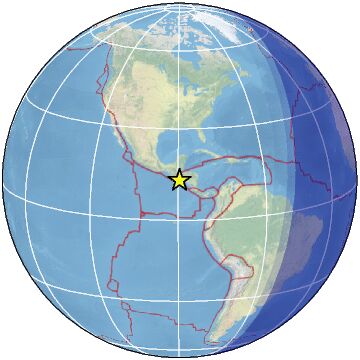
-
-
M 6.9 - 72 km W of Pangai, Tonga
2024-08-25 23:29:08 (UTC)19.755°S 175.041°W106.7 km depth
https://earthquake.usgs.gov/earthquakes/eventpage/us7000n9dt/executive5.3
91 km W of Pangai, Tonga
2024-08-25 20:37:58 (UTC-03:00)
99.0 km
6.1
59 km W of Pangai, Tonga
2024-08-25 20:30:52 (UTC-03:00)
106.5 k
-
Comment by Juan F Martinez on August 17, 2024 at 9:28pm
-
BREAKING!
Major Magnitude 7.4 Earthquake - 107 km ESE of Petropavlovsk-Kamchatsky, Russia, on Saturday, Aug 17, 2024, at 07:10 pm (Universal Time Time)
volcanodiscovery.com
https://x.com/ZT_Followers/status/1824889905912410584
-
-
https://www.emsc-csem.org/Earthquake_information/earthquake.php?id=...
Magnitude 6.1 Region TAIWAN Date time 2024-08-15 23:35:54.9 UTC Location 23.784 ; 121.760 Depth 15 km Distance 117 km E of Taichung, Taiwan / pop: 1,040,000 / local time: 07:35:54.9 2024-08-16
27 km SE of Hualien City, Taiwan / pop: 350,000 / local time: 07:35:54.9 2024-08-16Source parameters provided by:
National Earthquake Information Center, U.S. Geological Survey -- Golden, United States (NEIC)
SEARCH PS Ning or Zetatalk
Nancy Lieder, Emissary of the Zetas.
https://poleshift.ning.com/xn/detail/3863141:Comment:1168188
Awakening to the Alien Presence ZetaTalk
The truth will likely never to be known to the public but be washed away in the Nibiru panic soon to engulf the world.
The Worst of the Cover-Up
https://poleshift.ning.com/profiles/blogs/the-worst-of-the-cover-up
Main Establishment Lies
https://poleshift.ning.com/profiles/blogs/main-establishment-lies
Donate
© 2025 Created by 0nin2migqvl32.
Powered by
![]()
You need to be a member of Earth Changes and the Pole Shift to add comments!
Join Earth Changes and the Pole Shift