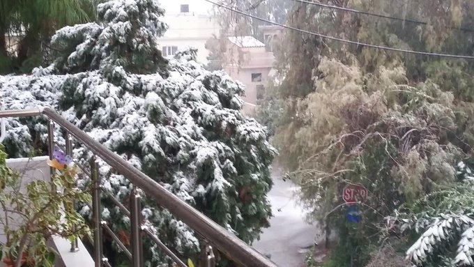
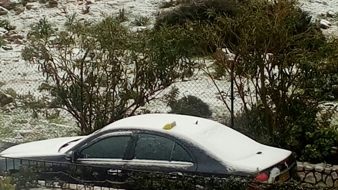
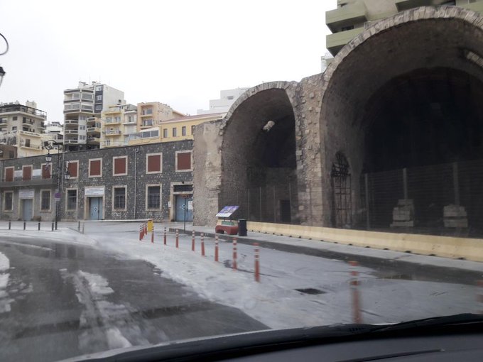
"We warned at the start of ZetaTalk, in 1995, thatunpredictable weather extremes, switching about from drought to deluge,would occur and increase on a lineal basis up until the pole shift. Where this occurred steadily, it has only recently become undeniable. ZetaTalk, and only ZetaTalk, warned of these weather changes, at that early date. Our early warnings spoke to the issue of global heating from the core outward, hardly Global Warming, a surface or atmospheric issue, but caused by consternation in the core. Affected by the approach of Planet X, which was by then starting to zoom rapidly toward the inner solar system for its periodic passage, the core was churning, melting the permafrost and glaciers and riling up volcanoes. When the passage did not occur as expected in 2003 because Planet X had stalled in the inner solar system, we explained the increasing weather irregularities in the context of the global wobble that had ensued - weather wobbles where the Earth is suddenly forced under air masses, churning them. This evolved by 2005 into a looping jet stream, loops breaking away and turning like a tornado to affect the air masses underneath. Meanwhile, on Planet Earth, droughts had become more intractable and deluges positively frightening, temperature swings bringing snow in summer in the tropics and searing heat in Artic regions, with the violence of storms increasing in number and ferocity."
The wobble seems to have changed, as the temperature in Europe suddenly plunged after being like an early Spring, Alaska has its coldest temps ever while the US and much of Canada is having an extremely mild winter. India went from fatal cold spell to balmy again. Has the Earth changed position vs a vs Planet X to cause this?[and from another]Bitter cold records broken in Alaska - all time coldest record nearly broken, but Murphy's Law intervenes[Jan 30]http://wattsupwiththat.com/2012/01/30/bitter-cold-records-broken-in-alaskaJim River, AK closed in on the all time record coldest temperature of -80°F set in 1971, which is not only the Alaska all-time record, but the record for the entire United States. Unfortunately, it seems the battery died in the weather station just at the critical moment. While the continental USA has a mild winter and has set a number of high temperature records in the last week and pundits ponder whether they will be blaming the dreaded "global warming" for those temperatures, Alaska and Canada have been suffering through some of the coldest temperatures on record during the last week.
There has been no change in the wobble pattern, the wobble has merely become more severe. Nancy noted a Figure 8 format when the Earth wobble first became noticeable, in early 2005, after Planet X moved into the inner solar system at the end of 2003. The Figure 8 shifted along to the east a bit on the globe between 2005 and 2009, (the last time Nancy took its measure) as Planet X came closer to the Earth, encountering the magnetic N Pole with a violent push earlier in the day. But the pattern of the Figure 8 remained essentially the same. So what changed recently that the weather patterns became noticeably different in late January, 2012?
The N Pole is pushed away when it comes over the horizon, when the noon Sun is centered over the Pacific. This regularly puts Alaska under colder air, with less sunlight, and thus the historically low temps there this January, 2012 as the wobble has gotten stronger. But by the time the Sun is positioned over India, the N Pole has swung during the Figure 8 so the globe tilts, and this tilt is visible in the weather maps from Asia. The tilt has forced the globe under the hot air closer to the Equator, warming the land along a discernable tilt demarcation line.
The next loop of the Figure 8 swings the globe so that the N Pole moves in the other direction, putting the globe again at a tilt but this time in the other direction. This tilt is discernable in weather maps of Europe, again along a diagonal line. Depending upon air pressure and temperature differences, the weather on either side of this diagonal line may be suddenly warm or suddenly cold. The tilt and diagonal line lingers to affect much of the US and Canada, but the Figure 8 changes at this point to be an up and down motion, pulling the geographic N Pole south so the US is experiencing a warmer than expected winter under a stronger Sun. Then the cycle repeats, with the magnetic N Pole of Earth pushed violently away again as the Sun is positioned over the Pacific.
Would the Zetas be able to let us know what is causing the early break-up of the Arctic Ice, the ice seems to have taken on a swirling pattern at the same time, would this be wobble related?[and from another]http://www.vancouversun.com/news/national/Canada+Arctic+cracks+spec... The ice in Canada’s western Arctic ripped open in a massive “fracturing event” this spring that spread like a wave across 1,000 kilometres of the Beaufort Sea. Huge leads of water – some more than 500 kilometres long and as much as 70 kilometres across – opened up from Alaska to Canada’s Arctic islands as the massive ice sheet cracked as it was pushed around by strong winds and currents. It took just seven days for the fractures to progress across the entire area from west to east.[and from another]http://earthobservatory.nasa.gov/IOTD/view.php?id=80752&src=iot... A high-pressure weather system was parked over the region, producing warmer temperatures and winds that flowed in a southwesterly direction. That fueled the Beaufort Gyre, a wind-driven ocean current that flows clockwise. The gyre was the key force pulling pieces of ice west past Point Barrow, the northern nub of Alaska that protrudes into the Beaufort Sea.
The Figure 8 formed by the N Pole during the daily Earth wobble has shifted somewhat to the East, due to Planet X positioned more to the right of the Earth during its approach. This was anticipated, and well described in ZetaTalk, the Earth crowding to the left in the cup to escape the approach of Planet X, so the angle between these two planets would change slightly. This shift of the Figure 8 to the East is due to the push against the Earth’s magnetic N Pole occurring sooner each day than prior. Thus instead of occurring when the Sun is high over the Pacific, over New Zealand, it is now occurring when the Sun is high over Alaska. All the wobble points have shifted eastward accordingly.
This has brought a lingering Winter to the western US, and a changed sloshing pattern to the Arctic waters. Instead of Pacific waters being pushed through the Bering Straits into the Arctic when the polar push occurs, the wobble is swinging the Arctic to the right, and then later to the left, creating a circular motion in the waters trapped in the Arctic. Since the Earth rotates counterclockwise, the motion also takes this path. This is yet another piece of evidence that the establishment is hard pressed to explain. They are attempting to ascribe this to high pressure and wind, all of which are not new to the Arctic, but this circular early breakup of ice in the Arctic is new.
Indonesia – Floods in Bandung, West Java, Leave 1 Dead
Disaster management officials in Indonesia report that one person has died and thousands of homes were damaged after flash floods in the city of Bandung, West Java, on 24 October, 2016.
Sutopo Purwo Nugroho, spokesperson for the National Disaster Management Authority (BNPB), said that 77 mm of rain fell in the city in just 1.5 hours around midday on 24 October. Areas of the city were inundated with flood water between 120 cm and 200 cm deep in parts.
BNPD say that Pasteur, Pagarsih, Solokan Jeruk and Sukajadi were among the worst affected districts.
The heavy rain caused the Citepus River to overflow. Drainage canals blocked by trash were blamed for much of the flooding.
Streets were turned to rivers for several hours. Vehicles were swept away on the flow of the flood water. One person drowned in the flood water while attempting to rescue others.
Full damage assessments are yet to be carried out. However, earlier today a BNPD spokesperson said via Social Media that thousands of homes have been damaged. Some residents have been evacuated. Schools in the area have also been reported as damaged in the floods.
Floods in Bandung, West Java, 24 October 2016. Floods in Bandung, West Java, 24 October 2016.
Typhoon Haima: Death toll rises as ferocious gales and landslides destroy tens of thousands of homes in the Philippines
A resident runs past a collapsed roof of a petrol station after Typhoon Haima struck San Nicolas, Ilocos Norte in northern Philippines
One of the most powerful typhoons to ever hit the Philippines killed at least eight people on Thursday as ferocious gales and landslides destroyed tens of thousands of homes.
Super Typhoon Haima struck late on Wednesday night with winds similar to those of catastrophic Haiyan in 2013, which was then the strongest storm to strike the disaster-prone Southeast Asian archipelago and claimed more than 7,350 lives.
Typhoon Haima bears down on China after ravaging the Philippines
Haima then roared across mountain and farming communities of the northern regions of the main island of Luzon overnight, causing widespread destruction and killing at least eight people, authorities said.
"We were frightened because of the strong winds. There was no power, no help coming," Jovy Dalupan, 20, told AFP as she sheltered at nightfall on the side of a highway in San Pablo, a badly damaged town of 20,000 people in Isabela province.
Dalupan, her two young daughters and husband, were forced to flee to the highway along with their neighbours during the height of the storm when their shanty homes, made of plywood, were ripped apart.
Biblical floods kill at least 11 and destroy throusands of homes in Vietnam
At least 11 people have died and several more are missing in heavy flooding in central Vietnam.
Tens of thousands of homes have been completely submerged by water. Local authorities mobilise army and police to rescue trapped residents in central Vietnam following torrential rain.
The communist government has ordered local authorities to mobilise the army and police to rescue trapped residents following heavy downpours.
Officials say at least 11 had died in the flooding with some 27,000 homes under water in the region.
The death toll was seven in Quang Binh province. Conditions are however improving. Now safety troops can reach areas which were isolated by flooding.
Though rainfall is expected to ease, officials warned the region could be hammered again if typhoon Sarika in the South China Sea reaches Vietnam.
Rare tornado hits Oregon as storms bear down on Pacific Northwest
A small coastal town in Oregon was clobbered on Friday by a rare tornado that ripped roofs from buildings, toppled trees and tore down power lines as the first of two storm systems forecast this weekend unleashed high winds and heavy rain across the Pacific Northwest.
The twister left most of Manzanita, a community of some 600 permanent residents in the northwest corner of Oregon, without electricity and more than two dozen homes uninhabitable, though no injuries were reported, City Manager Jerry Taylor said.
The tornado was spawned by a major Pacific storm sweeping coastal portions of Oregon and Washington state even as the region braced for harsher weather forecast by the National Weather Service from remnants of a typhoon expected to arrive on Saturday.
High winds, gusting to gale-force speeds, were reported by the weather service across the Puget Sound area of Washington with more than 100 lightning strikes recorded over coastal waters in a single hour at one point.
The weather service said about 20,000 Seattle-area homes and businesses were without electricity on Friday morning.
Beginning as a waterspout first spotted just offshore, the Manzanita tornado raked a half-mile long path of destruction through commercial and residential sections of town just after 8 a.m. local time, much of it along the community's main street.
About half the roof of a building housing an ice cream parlor and two other shops was torn off and hurled into an adjacent parking lot, while a nearby stationery store sustained similar damage, Taylor said.
Numerous houses were damaged, including 28 left red-tagged as unsafe for occupation, according to Taylor. The community was littered with fallen trees, strewn debris and tangles of downed wires and utility poles.
Mayor Garry Bullard declared a state of emergency seeking disaster recovery assistance.
Taylor said damage from the twister could leave the town especially vulnerable to more severe weather forecast for the entire region on Saturday as the remnants of Typhoon Songda, a tropical cyclone that formed in the western Pacific, move ashore.
The National Weather Service said that the Seattle area could see wind gusts of up to 70 miles per hour on Saturday, warning on Twitter: "It's not the 'storm of the century.' But it has [the] potential to be significant for Seattle."
Mayor Ed Murray said Seattle's homeless shelters were expanding their capacity in anticipation of the storm.
Flooding, damage as Matthew-fueled storm lashes Maritimes
Tuesday, October 11, 2016, 7:31 AM - Tropical moisture from former Hurricane Matthew has fueled record-breaking rainfall, damaging winds, and widespread flooding through parts of Atlantic Canada.
Though the storm itself did not directly impact Atlantic Canada, a low-pressure system fueled by Matthew's moisture brought severe weather conditions to areas in Nova Scotia and Newfoundland.
Tens of thousands of residents and business-owners in Atlantic Canada were left without power early Tuesday after wind gusts of more than 100 km/h lashed the region on Monday.
Emergency management efforts continue in Sydney, N.S. and St. Albans, N.L., with a state of emergency declared in both municipalities, including Harbour Breton, and Lewis Port, N.L.
Sydney, N.S., and Gander, N.L. saw record-breaking rainfall totals of up to 225 mm for the former and 124 mm for the latter.
Sydney's previous official one-day total rainfall record was 128 mm, set in 1981.
Rain began to taper off overnight Monday from south to north across the Nova Scotia as the system moves away. Newfoundland will see precipitation dwindle through the day Tuesday, lingering longest over the east and southeast parts of the province.
Though rainfall warnings dropped, wind warnings were in place for northeast Nova Scotia and Newfoundland's Avalon and Bonavista Peninsulas early Tuesday, with gusts near 100 km/h expected to persist through the day.
"Damage to buildings, such as to roof shingles and windows, may occur," Environment Canada said in a statement. "Loose objects may be tossed by the wind and cause injury or damage."
tropical moisture threatens Atlantic Canada
"[W]e're closely watching the track of Nicole," says Weather Network meteorologist Dr. Doug Gillham.
"[It's] forecast to stay offshore, but potentially close enough to have some impact, especially to Southern Newfoundland," he adds. "Matthew is a sobering reminder to not let your guard down even when all the models are offshore."
A cold front that will slowly cross Atlantic Canada Thursday night through Saturday, bringing below-seasonal temperatures for the weekend.
Cleanup continues in Saskatoon and area following record snowfall
A massive snow storm in Saskatchewan has closed schools, shut down highways and resulted in a devastating halt to harvest. A century old snowfall record has been surpassed and up to half a metre of snow has fallen in some areas with more on the way. Peter Quinlan has more details.
A snowfall warning has ended in Saskatoon but remains in place in other parts of Saskatchewan as crews continue to cleanup from a record Oct. 5 snowfall.
Early snowfall leaves Saskatoon residents feeling winter’s chill
According to Environment Canada, 30 centimetres of snow had fallen in Saskatoon as of Thursday afternoon.
At least 17 centimetres fell on Wednesday, unofficially breaking a century old record for that day, when 5.6 centimetres was recorded on Oct. 5, 2016.
Environment Canada stopped measuring snowfall in Saskatoon in 2007, meaning the record cannot officially be broken.
The major low pressure system that brought an early snowfall to many parts of the province is now weakening, with another two to four centimetres expected to fall before tapering off to a few flurries Thursday evening.
The agency said much of the northern grainbelt received five to 10 centimetres of snow overnight Wednesday.
Total snowfall amounts from the storm are expected to range in the 20 to 30 centimetre range.
In Saskatoon, police said the overnight snowfall has left city streets very slippery and they are asking drivers to give themselves more time to get to their destination.
City officials said sanders and plows are focused on priority 1 streets and contractors to help with sidewalk snow clearing and for grader assistance.
“We did see more snow than we anticipated (Wednesday night), but throughout the mid morning the temperature came up which softened the ruts,” said City of Saskatoon director of roadways and operations, Brandon Harris.
They also said temperatures into the weekend will pose challenges as it could lead to more ice formation.
Saskatoon Light & Power dealt with power outages in three neighbourhoods. Power was knocked out in Nutana, Buena Vista and Exhibition at around 7 a.m. and restored by 9:30 a.m.
Thailand – Floods Reported in 14 Provinces, 3 Dead in Nakornsawan
In a report issued late yesterday, Thailand’s Department of Disaster Prevention and Mitigation (DDPM) said that 3 people have been killed by floods in Nakornsawan province. Wide areas of farmland have been submerged and 27,000 houses inundated.
Flooding is affecting a total of 14 provinces across the country as the rainy season comes to a peak. Many areas have reported persistent heavy rain over the last 2 weeks.
River levels are high and the Royal Irrigation Department (RID) has said it will need to make controlled releases of water from several dams.
Ayutthaya province in particular is seeing some severe flooding, with around 22,000 homes inundated as well as a number of important historical buildings and temples.
Floods in Fourteen Provinces
Yesterday, DDPM Director General Chatchai Promlert said that excessive rainwater had been reported in the 14 provinces including 61 districts, 358 communities and 2,087 villages. Officials report that 68,000 houses have been damaged by floodwater.
According to the National News Bureau of Thailand (NNT), those provinces included eight in the Central Region, namely Nakhorn Sawan, Chainat, Singburi, Angtong, Ayuthaya, Supanburi, Lopburi and Kanchanaburi, three in the North, namely Pichit, Pitsanulok and Petchabun, and three in the Northeast, namely Chaiyapum, Ubon Ratchathani and Khon Kaen.
The DDPM Director says his department is cooperating with military units in efforts to urgently provide assistance to flood victims.
He added that DDPM is also working with local units of the Irrigation Department to install water pumps drain off the excessive water from communities and economic areas in those provinces, he said. Relief items will be handed out the villagers affected by flooding and damaged roads will be promptly repaired.
Bangkok Under Threat
The Bangkok Metropolitan Council (BMC) is closely monitoring the situation in the flood-prone district of Don Mueang as run-off from the upper provinces heads towards the capital.
NNT reports that “the BMC is particularly concerned about Khlong Prem Prachakorn, where the canal is seeing surging water levels and passes through different districts in Bangkok and other provinces. Heavy rains could cause the canal to overflow and flood nearby communities.”
Dam Releases Could Cause Flooding Along Chao Phraya and Pa Sak Rivers
The long term heavy rain in catchment areas prompted the country’s Royal Irrigation Department (RID) to increase the volume of water released from Pasak Chollasit dam from 06 October onwards, in order to increase the dam’s capacity to accommodate for the high water flow.
People and businesses near the Chao Phraya river, Noi river, Bang Luang canal, Bang Ban canal and Pasak river are advised to move their belongings to high grounds to brace for inundation.
By late yesterday, local media had already reported 100s of villages had been flooded, with some under as much as 1.5 metres of water.
Communities along the Pa Sak River in Ayutthaya, as well as Lop Buri and Sara Buri provinces, have also been warned of possible overflows in the coming days due to an increase in water discharge from dams upstream.
RID officials reported that the water level at Pasak Jolasid Dam on the Pa Sak River has already reached 90 percent of its capacity and, if nothing is done, the dam is expected to be completely full by October 11. RID therefore need to increase the discharge rate.
Police condemn man for ‘act of stupidity’ after ignoring warnings not to enter Victorian floodwaters
Frustrated rescuers have saved a paddleboarder in his 60s who became trapped in floodwaters for a second time at Yarrawonga.
Police say a man who was forced to take refuge in a tree with his dog after ignoring warnings not to return to his home engaged in an “act of stupidity”.
Paul Debar, 61, was paddleboarding in rising floodwaters near the Yarrawonga holiday park with his dog when he got into trouble about 9am.
He had to wait almost three hours before water police from Melbourne were able to rescue him.
The man and his dog were eventually rescued from a tree near the Yarrawonga Holiday Park. (9NEWS)
“He had been warned yesterday not to return to his caravan. Sometime during the night, he returned,” Sergeant Bruce Rigoni said.
“This morning he was using his paddleboard to get back to the caravan park when he came off the paddleboard.
“It’s quite fast water so it was very dangerous for him and for rescuers… It’s very frustrating, our resources are tied up with people doing this sort of thing.”
State Emergency Service volunteers rescued two other people yesterday at Tarrawingee and Charlton.
The man and his dog were paddle boarding when they became trapped. (9NEWS)
Wangaratta was spared further damage today despite the Ovens River peaking at 12.8 metres overnight, with conditions remaining dry, however the floodwaters will take days to subside.
Focus has shifted to Bundalong near the New South Wales border, where the Murray River joins the Ovens River.
"We're beginning to focus our attention on the Murray and the impacts on communities along the Murray as the water moves down," SES spokesman Brian Wright said.
The Murray River is expected to peak later this week.
Community meetings were held at Bundalong and Cobram today to discuss sandbagging properties and preparing for more damage.
The Murray River is expected to reach 8.1 metres at Yarrawonga on Friday, and near 7.4 metres at Tocumwal.
It will peak in other towns at some stage on Saturday.
Major and moderate flooding is occurring at parts of the Loddon River, the Avoca River, the Seven and Castle Creeks, Broken River, Ovens and King Rivers, the Kiewa River and the Mitchell River.
Typhoon Chaba in South Korea Leaves Three Dead, Three Missing
Typhoon Chaba hit the southern parts of South Korea Wednesday, leading to casualties among local population. At least three people were killed and three others went missing after the typhoon swept over South Korean island of Jeju and the cities of Busan and Ulsan, according to national KBS broadcaster.
The rainfall due to typhoon Chaba reached over 120 millimeters (4 inches) in some areas of the country, according to the Korean Meteorological Administration. About 58,000 houses are left without power in Busan and Jeju Island. The typhoon has reportedly disrupted transport services and air traffic. Typhoon Chaba hammered parts of Japan's Okinawa prefecture on Monday, bringing more than 200 millimeters of rainfall. Over 590,000 residents of the Japanese Okinawa Prefecture were prepared for evacuation.
You need to be a member of Earth Changes and the Pole Shift to add comments!
Join Earth Changes and the Pole Shift