![Emergency workers pump water at Aabenraa Harbour. Photo: Søren Gylling/Scanpix Emergency workers pump water at Aabenraa Harbour. Photo: Søren Gylling/Scanpix](http://www.thelocal.dk/userdata/images/1483605187_20170105-073038-L-640x426we.jpg)
Emergency workers pump water at Aabenraa Harbour.
![Emergency preparations in Faaborg on the island of Funen. Photo: Ólafur Steinar Gestsson/Scanpix Emergency preparations in Faaborg on the island of Funen. Photo: Ólafur Steinar Gestsson/Scanpix](http://www.thelocal.dk/userdata/images/1483605522_20170105-025356-L-640x426we.jpg)
![Boating docks on the Jutland side of Sønderborg were underwater on Thursday morning. Photto: Lene Esthave/Scanpix Boating docks on the Jutland side of Sønderborg were underwater on Thursday morning. Photto: Lene Esthave/Scanpix](http://www.thelocal.dk/userdata/images/1483605279_20170105-072633-L-640x426we.jpg)
Boating docks at Sønderborg were underwater on Thursday morning.
|
Weather: |
Tides and Whirlpools:
|
"We warned at the start of ZetaTalk, in 1995, that unpredictable weather extremes, switching about from drought to deluge, would occur and increase on a lineal basis up until the pole shift. Where this occurred steadily, it has only recently become undeniable. ZetaTalk, and only ZetaTalk, warned of these weather changes, at that early date. Our early warnings spoke to the issue of global heating from the core outward, hardly Global Warming, a surface or atmospheric issue, but caused by consternation in the core. Affected by the approach of Planet X, which was by then starting to zoom rapidly toward the inner solar system for its periodic passage, the core was churning, melting the permafrost and glaciers and riling up volcanoes. When the passage did not occur as expected in 2003 because Planet X had stalled in the inner solar system, we explained the increasing weather irregularities in the context of the global wobble that had ensued - weather wobbles where the Earth is suddenly forced under air masses, churning them. This evolved by 2005 into a looping jet stream, loops breaking away and turning like a tornado to affect the air masses underneath. Meanwhile, on Planet Earth, droughts had become more intractable and deluges positively frightening, temperature swings bringing snow in summer in the tropics and searing heat in Artic regions, with the violence of storms increasing in number and ferocity."
From the ZetaTalk Chat Q&A for February 4, 2012:
The wobble seems to have changed, as the temperature in Europe suddenly plunged after being like an early Spring, Alaska has its coldest temps ever while the US and much of Canada is having an extremely mild winter. India went from fatal cold spell to balmy again. Has the Earth changed position vs a vs Planet X to cause this? [and from another] Bitter cold records broken in Alaska - all time coldest record nearly broken, but Murphy's Law intervenes [Jan 30] http://wattsupwiththat.com/2012/01/30/bitter-cold-records-broken-in-alaska Jim River, AK closed in on the all time record coldest temperature of -80°F set in 1971, which is not only the Alaska all-time record, but the record for the entire United States. Unfortunately, it seems the battery died in the weather station just at the critical moment. While the continental USA has a mild winter and has set a number of high temperature records in the last week and pundits ponder whether they will be blaming the dreaded "global warming" for those temperatures, Alaska and Canada have been suffering through some of the coldest temperatures on record during the last week.
There has been no change in the wobble pattern, the wobble has merely become more severe. Nancy noted a Figure 8 format when the Earth wobble first became noticeable, in early 2005, after Planet X moved into the inner solar system at the end of 2003. The Figure 8 shifted along to the east a bit on the globe between 2005 and 2009, (the last time Nancy took its measure) as Planet X came closer to the Earth, encountering the magnetic N Pole with a violent push earlier in the day. But the pattern of the Figure 8 remained essentially the same. So what changed recently that the weather patterns became noticeably different in late January, 2012?
The N Pole is pushed away when it comes over the horizon, when the noon Sun is centered over the Pacific. This regularly puts Alaska under colder air, with less sunlight, and thus the historically low temps there this January, 2012 as the wobble has gotten stronger. But by the time the Sun is positioned over India, the N Pole has swung during the Figure 8 so the globe tilts, and this tilt is visible in the weather maps from Asia. The tilt has forced the globe under the hot air closer to the Equator, warming the land along a discernable tilt demarcation line.
The next loop of the Figure 8 swings the globe so that the N Pole moves in the other direction, putting the globe again at a tilt but this time in the other direction. This tilt is discernable in weather maps of Europe, again along a diagonal line. Depending upon air pressure and temperature differences, the weather on either side of this diagonal line may be suddenly warm or suddenly cold. The tilt and diagonal line lingers to affect much of the US and Canada, but the Figure 8 changes at this point to be an up and down motion, pulling the geographic N Pole south so the US is experiencing a warmer than expected winter under a stronger Sun. Then the cycle repeats, with the magnetic N Pole of Earth pushed violently away again as the Sun is positioned over the Pacific.
From the ZetaTalk Chat Q&A for April 6, 2013:
Would the Zetas be able to let us know what is causing the early break-up of the Arctic Ice, the ice seems to have taken on a swirling pattern at the same time, would this be wobble related? [and from another] http://www.vancouversun.com/news/national/Canada+Arctic+cracks+spec... The ice in Canada’s western Arctic ripped open in a massive “fracturing event” this spring that spread like a wave across 1,000 kilometres of the Beaufort Sea. Huge leads of water – some more than 500 kilometres long and as much as 70 kilometres across – opened up from Alaska to Canada’s Arctic islands as the massive ice sheet cracked as it was pushed around by strong winds and currents. It took just seven days for the fractures to progress across the entire area from west to east. [and from another] http://earthobservatory.nasa.gov/IOTD/view.php?id=80752&src=iot... A high-pressure weather system was parked over the region, producing warmer temperatures and winds that flowed in a southwesterly direction. That fueled the Beaufort Gyre, a wind-driven ocean current that flows clockwise. The gyre was the key force pulling pieces of ice west past Point Barrow, the northern nub of Alaska that protrudes into the Beaufort Sea.
The Figure 8 formed by the N Pole during the daily Earth wobble has shifted somewhat to the East, due to Planet X positioned more to the right of the Earth during its approach. This was anticipated, and well described in ZetaTalk, the Earth crowding to the left in the cup to escape the approach of Planet X, so the angle between these two planets would change slightly. This shift of the Figure 8 to the East is due to the push against the Earth’s magnetic N Pole occurring sooner each day than prior. Thus instead of occurring when the Sun is high over the Pacific, over New Zealand, it is now occurring when the Sun is high over Alaska. All the wobble points have shifted eastward accordingly.
This has brought a lingering Winter to the western US, and a changed sloshing pattern to the Arctic waters. Instead of Pacific waters being pushed through the Bering Straits into the Arctic when the polar push occurs, the wobble is swinging the Arctic to the right, and then later to the left, creating a circular motion in the waters trapped in the Arctic. Since the Earth rotates counterclockwise, the motion also takes this path. This is yet another piece of evidence that the establishment is hard pressed to explain. They are attempting to ascribe this to high pressure and wind, all of which are not new to the Arctic, but this circular early breakup of ice in the Arctic is new.
Comment
Christmas night in Moscow was the coldest in the XXI century
7 January, 2017. Christmas Night in Moscow was very frosty since the beginning of winter, the air in the capital has cooled to minus 29.8 degrees, was reported in the Russian Hydrometeorological Center.
"It's so cold in this century in the night of 6 January 7 was not. In the XXI century, 20 degrees of frost on Christmas night marked three times (2002, 2003 and 2015). Last Christmas frosty (minus 20.4 degrees) was observed . in 2015, the most frosty in this century was Christmas 2003, then amplified by the frost to minus 26 degrees, "- said the representative of the weather service.
Even cooler was that night in the suburbs. In Klin air is cooled to minus 32.7 degrees, Volokolamsk - up to 32.2 degrees Celsius.
However, the temperature record for December 7 is not broken. The coldest in the history of meteorological observations Christmas night in Moscow was in 1891, when the air is cooled down to minus 34.8 degrees, the warmest day of January 7 states in 2007, when the maximum temperature reached 3.5 degrees Celsius. Source: tass.ru
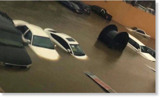
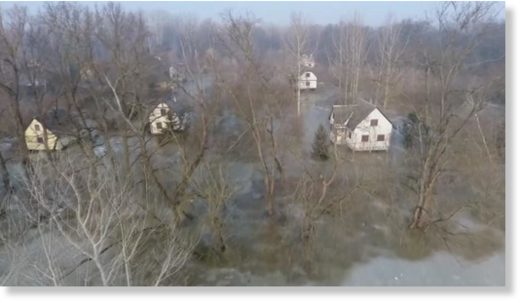
http://www.thelocal.dk/20170105/photos-100-year-flood-hits-denmark
https://weather.com/storms/winter/news/winter-storm-helena-impacts
The rush was on as millions in the Deep South began preparations Thursday for Helena, a dangerous, deadly winter storm that could cause serious problems across the region over the weekend.
Alabama Gov. Robert Bentley announced Thursday afternoon that a state of emergency will take effect Friday morning at 7 a.m. CST. The declaration affects all counties in the state, and among the impacts of the state of emergency is the activation of 300 soldiers from the Alabama National Guard to assist mission support teams and command staff.
Georgia Gov. Nathan Deal also declared a state of emergency, which was set to begin at noon on Friday.
On Thursday, the Georgia Emergency Management Agency warned North Georgia residents to prepare for the winter storm and urged people to have enough food and other supplies on hand to stay in their homes for t.... Several school districts in metro Atlanta will dismiss students early on Friday.
The Georgia Department of Transportation began working days ahead of the storm to make sure they are ready when wintry weather moves into central and north Georgia, including metro Atlanta, Friday night into Saturday, reports WALB.com.
"In the metro area, we have 10 5,000-gallon tanker trucks to treat the interstate," GDOT Maintenance Engineer Dale Bradley said.
Pre-treating roads with brine is a new tactic for GDOT since Winter Storm Leon crippled the city and left drivers stranded on area roads in January 2014.
"We are trying to pre-treat before the storm, but at the same time close enough to the storm that if it does come in as heavy rain, we don't get a lot of it washed off," Bradley said.
Into the Carolinas, residents began to stock up on food and other supplies with even bigger snow totals in the forecast.
Record drought in Bolivia drains lakes, threatens capital
A dried farmland is seen during the worst drought in 25 years in El Choro, Bolivia, on December 1, 2016. (David Mercado/Reuters)
4 January, 2017. Lake Poopo, Bolivia's second-largest, has dried up entirely
Last year, the flowering quinoa plants painted Florencio Tola's farmlands in vibrant sepia and ochre tones.
But this season, all that could be seen was the straw colour of dried-out stalks that never germinated amid Bolivia's worst drought in 30 years. Nearby a collection of scrawny cows, with their ribs protruding and flaccid udders, grazed on what little vegetation could be found on the sere ground.
"It's as if I had never sown anything," said Tola, 60, who like thousands of other farmers planted his quinoa in October ahead of the rainy season that usually runs through March.
He and thousands of other farmers in the Bolivian high plains believe they have been hit by a particularly strong weather phenomenon known as El Nino, caused by warming waters in the eastern Pacific Ocean. Crops and livestock were decimated, and reservoirs that supply the capital of La Paz and other cities have dropped to alarming levels. Lake Poopo, Bolivia's second-largest, has dried up entirely.
"The 2015-2016 (El Nino) is one of the strongest in 30 years, although scientists' verdict on its role in the current drought has not been concluded yet," said Dirk Hoffmann, a glacial and climate specialist who directs the Bolivian Mountain Institute, a research and advisory foundation.
Bolivian President Evo Morales has warned that if the rainy season is delayed further, it could deplete food supply next year. In October he approved a $250 million emergency plan to support those affected by the drought by drilling wells to stave off potential water shortages.
Rain, but not enough
Cows graze on arid fields during a severe and prolonged drought on the outskirts of Burguillos in Bolivia's Altiplano. Bolivia's worst drought in 30 years has decimated crops and livestock and evaporated the country's second largest lake. (Juan Karita/The Associated Press)
While there have been isolated heavy rains in recent weeks, they haven't yet been enough to compensate for months of drier than usual weather.
Authorities say reservoir levels are at their lowest level ever. According to Humberto Claure, manager of the Social Public Enterprise for Water and Sanitation, even generous rains will not fill up the five dams that serve La Paz, so the emergency is expected to last through the end of 2017.
The city relies on rain for 80 per cent of its water, and this season has seen just 10 per cent of normal rainfall, according to hydrological scientist Edson Ramirez of the Higher University of San Andres.
In some parts of the capital, water no longer flows through the pipes and people are forced to rely on trucked deliveries. Several weeks ago, La Paz's largest hospital limited surgeries to only the most urgent cases because of low water pressure. Public schools ended the academic cycle early. The popular professional soccer club The Strongest even asked its players to shower at home.
Crop losses
But the drought has hit hardest in the countryside, including the eastern region that is often punished by deluges and flash floods. The Agricultural Chamber of the East reported the loss of nearly 50 per cent of production over the South American winter in that part of the country, equivalent to 448,000 tons of soy, corn and wheat.
Although the South American summer has already begun, fields in the Andean region retain the yellowish hue of autumn. In the eastern lowlands, rice paddies dried out before germination due to the drought, which aggravated pest infestations, according to growers. In the central valleys, you can see skeletons of animals that died looking for watering holes.
Farmers' groups say 30 per cent of the quinoa crop has been lost to the delayed rains.
Often referred to as the "golden grain of the Andes," quinoa cultivation has helped thousands of farmers climb out of poverty after it became widely popular overseas among organic-oriented consumers during the last decade.
Many in Bolivia turned to the crop as prices rose from $11 for roughly 50 kilograms in the early 2000s to as high as $259 at the end of 2014.
That fell last year to $100 per 50 kilograms, but the drought remains the worst enemy of farmers like Tola.
This season, nothing has sprouted on his lands in Caracollo, about 110 miles (180 kilometres) east of La Paz.
"As a teen I went to the city of Oruro to make a living because the countryside didn't allow you to live," Tola said. "But I returned to my family when quinoa got better and had a good price. I improved my little home and built more rooms for my children."
Migration
In many rural villages, farmers' desperation is so great that Roman Catholic saints have been brought out in processions and offerings have been made to the Pachamama, or Mother Earth of indigenous tradition, beseeching her for the rains to arrive.
"Families are beginning to migrate," said Mayor Jaime Mendieta of Pasorapa, a village in the high valleys of central Bolivia. "You see it in the schools. Children are enrolled in neighbouring municipalities where there is water because parents know there will be production there."
Tola said that if it weren't for his cattle, he would have already joined his eldest son, who left for eastern Bolivia to find work as a day labourer. But he hopes to never again have to abandon his home like he did in his youth.
"I wouldn't want to leave my town again," Tola said. Source: cbc.ca
Scientists Say 2016 Is Hottest Year Ever Recorded
Source: mercurynews.com
3 January, 2017. Climate scientists are all but assured that 2016 was the hottest year ever recorded. If that sounds familiar, 2014 and 2015 were also the hottest years since record-keeping began in 1880.
"2016 will break the global temperature record that was set in 2015, which broke the record that was set in 2014," climate change scientist Noah S. Diffenbaugh, professor of the Department of Earth System Science at Stanford University, told The Mercury News.
A number of experts and government organizations had already predicted that 2016 was Earth's hottest year in recorded history.
Last month, the National Oceanic and Atmospheric Administration (NOAA) announced that El Nino drove much of the record warmth during the first two-thirds of 2016, while a weak La Nina cooled the globe down during the past few months. However, the period between January to November of 2016 was the warmest such period on record.
"The average global temperature was 1.69 degrees F above the average of 57.2 degrees, surpassing the record set in 2015 by 0.13 degrees F," the agency stated.
Recent headlines from publications around the world—from Houston, Texas to Singapore—have declared extreme heat. Meanwhile, the Arctic in particular saw "a meteoric rise" in October heat that contributed to the region's record low sea ice extent for the month, which clocked in at 28.5 percent below the 1981-2010 average. Source: ecowatch.com
https://www.rt.com/news/372532-wildfire-valparaiso-chile-evacuation/
Valparaiso residents put on masks in an attempt to protect themselves from plumes of black smoke, AP reported.
The authorities have issued a maximum red alert.
“It was hopeless. The smoke was suffocating. It stung my eyes. So, we had to evacuate,” Pablo Luna Flores, a local resident who lost his home, told AFP.
“The fire was coming from the other side of the hill, down below. We never thought it would spread so far,” added Rosa Gallardo, who also lost her home to the fire.
The flames, boosted by gusty winds and high temperatures, destroyed at least 50 hectares (123 acres) of woodland, the National Emergencies Office said.
Electricity providers were forced to cut power to nearly 47,000 customers as a precaution, Deputy Interior Minister Mahmud Aleuy said in televised remarks, adding that it had later been restored to all but 350 homes, Reuters reported.
Located 120 kilometers (75 miles) northwest of the capital, Santiago, the colonial city of Valparaiso is a UNESCO World Heritage Site, touted as an “excellent example of late 19th-century urban and architectural development in Latin America.”
“This is a high-risk zone and the sector has undergone an evacuation,” Aleuy said of the affected areas.
“It [evacuation] has been successful, and fortunately we don’t have any tragedies to grieve,” he added, according to Reuters.
Hundreds of firefighters have been deployed to battle the blaze, with helicopters dumping water onto the fire.
“Emergency protocols have been activated,” President Michelle Bachelet said on Twitter, expressing her “solidarity with the people affected.”
One of the South Pacific’s most important seaports. the city is home to 285,000 people.
Forest fires are common in Chile around March, when many of the city’s wooden structures are susceptible to fire, especially in poor neighborhoods higher in the hills.
https://www.rt.com/news/372135-greece-athens-rare-snow/
Greeks are in awe following a rare snowfall in their country that blanketed the streets, trees, and houses of the capital.
http://www.dailymail.co.uk/news/article-4066264/Uluru-National-Park...
Flash flooding closed Uluru and forced a town to evacuate after a record 232 millimetres of rain fell in a single day.
The freak desert storm damaged at least 40 per cent of homes in Kintore, about 520 kilometres west of the red centre, forcing 100 of its 400 residents to flee.
Uluru National Park was shut down at 9am on Monday but visitors revelled in the rare sight of water cascading down the sides of the massive rock the day before.
Scroll down for videos
Flash flooding closed Uluru and forced a town to evacuate after a record 232 millimetres of rain fell in a single day with a thick low-lying white cloud obscured the top of the rock
Uluru National Park was shut down at 9am on Monday but visitors revelled in the rare sight of water cascading down the sides of the massive rock the day before
Dozens of waterfalls completely changed its complexion and put on a show for tourists who stayed out in the rain to watch the spectacle.
Photos and video from the base of Uluru showed huge pools forming below the waterfalls that lapped around raised walkways.
A thick low-lying white cloud obscured the top of the rock.
Dozens of waterfalls completely changed its complexion and put on a show for tourists who stayed out in the rain to watch the spectacle
Water begins to trickle down the side of the massive rock
Photos and video from the base of Uluru showed huge pools forming below the waterfalls that lapped around raised walkways
Park manager Mike Misso said the park was closed due to the risk of flooded roads and the potential for car accidents.
'There's a lot of water coming off the rock and what that does is just channels across the ring road around Uluru, some of those roads there were flooded by about 300 to 400 millimeteres of rain,' he told the ABC.
'[It is] quite spectacular but very hazardous road conditions.'
https://www.rt.com/usa/371886-blizzard-northern-plains-christmas/
In North Dakota, weather conditions and near-zero visibility compelled a no-travel warning, as the National Weather Service said a blizzard warning would remain in effect for much of the state through Monday afternoon.
"It will take many days to get this snow cleared out,"said Jeff Heintz, North Dakota's director of public works.
Power outages have been reported across the region, especially in North and South Dakota, as well as Nebraska, where high winds have reached 70 miles per hour. Nearly 20,000 customers of the South Dakota Rural Electric Association were without power as of Monday afternoon, according to AP.
The North Dakota Transportation Department closed 240 miles of Interstate 94 on Sunday evening while no-travel advisories were issued across the state. In South Dakota, authorities shut down 260 miles of Interstate 90.
Flight delays and cancellations have occurred at Minneapolis-St. Paul International Airport in Minnesota and Minot International Airport in North Dakota, as well as airports in Fargo, Hector, and Bismarck, North Dakota.
The National Weather Service in Grand Forks, North Dakota, reported near-zero visibility and wind gusts of up to 45 miles per hour in the eastern region of the state.
As of early Monday morning, Bismarck has received more than 12 inches of snow, according to the National Weather Service, while Underwood, North Dakota, got 18 inches of snow, the Weather Channel reported.
http://www.thelocal.se/20161227/hurricane-force-winds-as-storm-urd-...
The Öresund Bridge between Malmö in Sweden and Copenhagen in Denmark reopened to traffic at 2.40am on Tuesday after closing at around 10pm the previous evening. Drivers were however warned to drive carefully and stay below 50 kilometres an hour on the 7.8-kilometre road bridge.
The water level in the strait separating the two countries rose to around 120-150 centimetres above average overnight, but national weather agency SMHI reported it was slowly subsiding in the morning.
SMHI downgraded its class-two weather warnings for southern Sweden to class-one in the far south and said gale-force winds were no longer expected for the rest of the Götaland region.
“The risk of strong gusts was over by around 4am or 5am,” SMHI meteorologist Johan Lundgren told news agency TT.
Several trains were still expected to be cancelled until 3pm on Tuesday on the following routes: Lund-Ystad/Simrishamn, Helsingborg-Simrishamn via Eslöv, Helsingborg-Hässleholm via Åstorp and Kristianstad-Karlskrona. Replacement buses will be in place, said operator Skånetrafiken.
Authorities in all three Scandinavian countries – Sweden, Norway and Denmark – had advised residents ahead of the storm to take precautions, including staying at home during the evening of the 26th and securing loose objects outside. However, the overall damages were not as bad as anticipated.
Fire and rescue services built sandbag barriers around the harbour and football arena in Halmstad, where the sea level was 175 centimetres above normal and residents in the region reported that the river Nissan had burst its banks.
Emergency services in Gothenburg were called out to a number of flooded basements and fallen trees and cars getting stuck on flooded roads were also reported across southern Sweden. 7
One Scandinavian Airlines flight from Reykjavik had to land at Bornholm island after twice being diverted – once from Copenhagen and once after being struck by lightning near Malmö Airport.
This free script provided by
JavaScript Kit
© 2025 Created by 0nin2migqvl32.
Powered by
You need to be a member of Earth Changes and the Pole Shift to add comments!
Join Earth Changes and the Pole Shift