
The final weekend of September looked a lot more like mid-winter across southern Alberta and Saskatchewan, and the snow isn't over yet. Some spots are already buried in drifts a metre deep, and with the storm set to linger into Monday, more is on the way. Gusty winds have also made travel dangerous in blizzard-like conditions across much of the region. We look at what's fallen so far, and what's still to come, below.
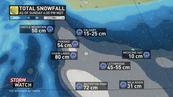
The calendar may say September, but you wouldn't be able to tell across much of southern Alberta and Saskatchewan this weekend. 80 cm of snowfall was reported in some of Alberta's high mountain communities by Sunday morning, and that was only the start of a day filled with another round of heavy snow.
Other parts of southern Alberta and Saskatchewan had already picked up hefty amounts by Sunday morning, as well.
Sunday was another long, snowy day, not just in extreme southern Alberta, but as far north as Red Deer, and as far east as Regina by late Sunday afternoon, as a Colorado low south of the border funnelled additional moisture into the region.
While Environment Canada has yet to release further official snowfall totals, by early Sunday evening amounts in excess of 20 cm were being reported by Calgary residents, with around 25 cm in Lethbridge.

Heavy, wet snow started to bring down tree branches across parts of southern Saskatchewan by Sunday afternoon. SaskPower has reported outages in the Assiniboia area due to downed power poles, while area residents took to Twitter to report power outages in Moose Jaw.
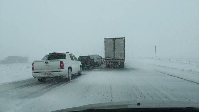
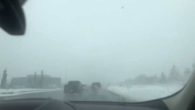
Travel in southern Alberta was treacherous on Sunday, and officials urged drivers to keep off the roads if at all possible. "Poor winter driving conditions have been reported across southern Alberta," 511 Alberta said in a statement. "Travel is not advised south of Highway 1 due to poor visibility and heavy snowfall within this region. An Environment Canada winter storm warning remains in effect. Postpone all non-essential travel. If you must travel, ensure your headlights are on, reduce speed, and share your travel plans with others."
Snowfall will begin to ease overnight into Monday for southern Alberta, though Monday morning commutes will still be a challenge. Some school boards were already starting to report closures by Sunday evening.
Snow will lift north across southern Saskatchewan into early Monday, with some mixing of rain and snow possible through the overnight before precipitation turns back to snow for Monday afternoon. Snow will taper off there through Monday evening.
You need to be a member of Earth Changes and the Pole Shift to add comments!
Join Earth Changes and the Pole Shift