Weather:

Weather Wobble

Jet Stream tornados

Siberian Freeze Weather Wobble

Wild weather , [2]

Wobble Clouds

Hurricane development

Violent Push

Weather & ocean currents

Europe Weather

Tides and Whirlpools:

Storm Clash whirlpools

Lurch of earth

Tides , [2]

Whirlpools

Wobble Sloshing


"We warned at the start of ZetaTalk, in 1995, that unpredictable weather extremes, switching about from drought to deluge, would occur and increase on a lineal basis up until the pole shift. Where this occurred steadily, it has only recently become undeniable. ZetaTalk, and only ZetaTalk, warned of these weather changes, at that early date. Our early warnings spoke to the issue of global heating from the core outward, hardly Global Warming, a surface or atmospheric issue, but caused by consternation in the core. Affected by the approach of Planet X, which was by then starting to zoom rapidly toward the inner solar system for its periodic passage, the core was churning, melting the permafrost and glaciers and riling up volcanoes. When the passage did not occur as expected in 2003 because Planet X had stalled in the inner solar system, we explained the increasing weather irregularities in the context of the global wobble that had ensued - weather wobbles where the Earth is suddenly forced under air masses, churning them. This evolved by 2005 into a looping jet stream, loops breaking away and turning like a tornado to affect the air masses underneath. Meanwhile, on Planet Earth, droughts had become more intractable and deluges positively frightening, temperature swings bringing snow in summer in the tropics and searing heat in Artic regions, with the violence of storms increasing in number and ferocity."

ZETATALK


From the ZetaTalk Chat Q&A for February 4, 2012:


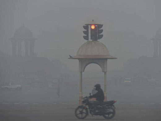
The wobble seems to have changed, as the temperature in Europe suddenly plunged after being like an early Spring, Alaska has its coldest temps ever while the US and much of Canada is having an extremely mild winter. India went from fatal cold spell to balmy again. Has the Earth changed position vs a vs Planet X to cause this? [and from another] Bitter cold records broken in Alaska - all time coldest record nearly broken, but Murphy's Law intervenes [Jan 30] http://wattsupwiththat.com/2012/01/30/bitter-cold-records-broken-in-alaska Jim River, AK closed in on the all time record coldest temperature of -80°F set in 1971, which is not only the Alaska all-time record, but the record for the entire United States. Unfortunately, it seems the battery died in the weather station just at the critical moment. While the continental USA has a mild winter and has set a number of high temperature records in the last week and pundits ponder whether they will be blaming the dreaded "global warming" for those temperatures, Alaska and Canada have been suffering through some of the coldest temperatures on record during the last week.

There has been no change in the wobble pattern, the wobble has merely become more severe. Nancy noted a Figure 8 format when the Earth wobble first became noticeable, in early 2005, after Planet X moved into the inner solar system at the end of 2003. The Figure 8 shifted along to the east a bit on the globe between 2005 and 2009, (the last time Nancy took its measure) as Planet X came closer to the Earth, encountering the magnetic N Pole with a violent push earlier in the day. But the pattern of the Figure 8 remained essentially the same. So what changed recently that the weather patterns became noticeably different in late January, 2012?

The N Pole is pushed away when it comes over the horizon, when the noon Sun is centered over the Pacific. This regularly puts Alaska under colder air, with less sunlight, and thus the historically low temps there this January, 2012 as the wobble has gotten stronger. But by the time the Sun is positioned over India, the N Pole has swung during the Figure 8 so the globe tilts, and this tilt is visible in the weather maps from Asia. The tilt has forced the globe under the hot air closer to the Equator, warming the land along a discernable tilt demarcation line.

The next loop of the Figure 8 swings the globe so that the N Pole moves in the other direction, putting the globe again at a tilt but this time in the other direction. This tilt is discernable in weather maps of Europe, again along a diagonal line. Depending upon air pressure and temperature differences, the weather on either side of this diagonal line may be suddenly warm or suddenly cold. The tilt and diagonal line lingers to affect much of the US and Canada, but the Figure 8 changes at this point to be an up and down motion, pulling the geographic N Pole south so the US is experiencing a warmer than expected winter under a stronger Sun. Then the cycle repeats, with the magnetic N Pole of Earth pushed violently away again as the Sun is positioned over the Pacific.


From the ZetaTalk Chat Q&A for April 6, 2013:


Would the Zetas be able to let us know what is causing the early break-up of the Arctic Ice, the ice seems to have taken on a swirling pattern at the same time, would this be wobble related? [and from another] http://www.vancouversun.com/news/national/Canada+Arctic+cracks+spec... The ice in Canada’s western Arctic ripped open in a massive “fracturing event” this spring that spread like a wave across 1,000 kilometres of the Beaufort Sea. Huge leads of water – some more than 500 kilometres long and as much as 70 kilometres across – opened up from Alaska to Canada’s Arctic islands as the massive ice sheet cracked as it was pushed around by strong winds and currents. It took just seven days for the fractures to progress across the entire area from west to east. [and from another] http://earthobservatory.nasa.gov/IOTD/view.php?id=80752&src=iot... A high-pressure weather system was parked over the region, producing warmer temperatures and winds that flowed in a southwesterly direction. That fueled the Beaufort Gyre, a wind-driven ocean current that flows clockwise. The gyre was the key force pulling pieces of ice west past Point Barrow, the northern nub of Alaska that protrudes into the Beaufort Sea.


The Figure 8 formed by the N Pole during the daily Earth wobble has shifted somewhat to the East, due to Planet X positioned more to the right of the Earth during its approach. This was anticipated, and well described in ZetaTalk, the Earth crowding to the left in the cup to escape the approach of Planet X, so the angle between these two planets would change slightly. This shift of the Figure 8 to the East is due to the push against the Earth’s magnetic N Pole occurring sooner each day than prior. Thus instead of occurring when the Sun is high over the Pacific, over New Zealand, it is now occurring when the Sun is high over Alaska. All the wobble points have shifted eastward accordingly.

This has brought a lingering Winter to the western US, and a changed sloshing pattern to the Arctic waters. Instead of Pacific waters being pushed through the Bering Straits into the Arctic when the polar push occurs, the wobble is swinging the Arctic to the right, and then later to the left, creating a circular motion in the waters trapped in the Arctic. Since the Earth rotates counterclockwise, the motion also takes this path. This is yet another piece of evidence that the establishment is hard pressed to explain. They are attempting to ascribe this to high pressure and wind, all of which are not new to the Arctic, but this circular early breakup of ice in the Arctic is new.

Views: 629700

Comment

You need to be a member of Earth Changes and the Pole Shift to add comments!
Join Earth Changes and the Pole Shift

Comment by Starr DiGiacomo on August 29, 2019 at 5:49am

http://www.asianews.it/news-en/Torrential-rains,-landslides-force-t...

Torrential rains, landslides force the evacuation of 900,000 people in Japan

08/28/2019, 17.27

Highest alert level raised in the southern island of Kyushu. Since early July, floods have killed 155 people. Weather agency official urges people “to protect your lives" and “don't wait".

Tokyo (AsiaNews/Agencies) – At least two people lost their life today because of torrential rains that have killed more than 150 people over the past two months.

The torrential rains that have been pouring since early July triggering floods and landslides, forcing the authorities to order more than 900,000 people to leave their homes in south-west Japan. This is the worst flooding to hit Japan in the last 30 years with at least 155 fatalities.

More than twice the usual rainfall for the whole of August has fallen over parts of the southern island of Kyushu over the past 48 hours, washing away roads, causing rivers to burst their banks and forcing the suspension of train services.

Today, the country's weather agency raised the alert to its highest level. The latter is issued "if there is a significant likelihood of catastrophes".

Japan's Fire and Disaster Management Agency said that another million people were advised to leave their homes. "It is a situation where you should do your best to protect your lives," said Weather agency official Yasushi Kajiwara. "Please don't wait," he added

Comment by Starr DiGiacomo on August 25, 2019 at 1:03am

https://weather.com/news/news/2019-08-24-tropical-storm-bailu-taiwa...

Tropical Storm Bailu Drenches Taiwan, Injuring 6 and Trapping Tourists

Tropical Storm Bailu swept through Taiwan Friday with flooding rain and mudslides, and the storm is now on its way to China's southeastern coast.

At least six people were injured, including a 79-year-old man who was knocked off his motorcycle and another man of the same age injured by glass that sprayed into his home, the government's disaster response center said.

A landslide triggered by a tropical storm stranded 18 people, including 14 tourists, in Taiwan on Saturday. Most of the tourists were in Hualien county, which saw as much as 23 inches of rain since Thursday.

About 450 people were evacuated around the island and 12,000 households were without power late Saturday afternoon.

A mudslide swept away a warehouse in Taitung county in Taiwan's southeast.

"Wind speeds weren't that high, but what made it stand out was rainfall," Central Weather Bureau forecaster Yen Tseng-hsi said.

There were gusts up to 65 mph reported across the island.

Tropical storms and typhoons, which gather strength from the warm waters of the Pacific Ocean and the South China Sea, hit Taiwan, China, Japan, the Philippines and Vietnam from June through November each year.

Taiwan is especially prone to mudslides following tropical storms and typhoons due to its steep terrain.

Comment by Juan F Martinez on August 23, 2019 at 7:39pm

Poland, Slovakia Lightning Kills at Least 5, Injures 150  

Three people remained missing Friday morning and rescuers were still combing the area looking for other victims, according to the Associated Press.

"A large group of random people has been hit," Jan Krzysztof, chief of the mountain rescue service, said. "Many people, including children. Burnt, with broken legs, wounds all over their bodies."

Four of the dead were struck on a popular hiking trail to the summit of Giewont, a peak in southern Poland's Tatra mountains, the BBC reported. Officials think a lightning bolt may have struck a nearly 50-foot-tall metal cross and then traveled along a metal railing.

"We heard that after (the) lightning struck, people fell," Krzysztof said. "The current then continued along the chains securing the ascent, striking everyone along the way. It looked bad."

The fifth person killed was struck in neighboring Slovakia. The victim was a Czech tourist who fell hundreds of yards down a mountainside after being hit.

https://weather.com/news/news/2019-08-23-deadly-poland-slovakia-lig...

Comment by KM on August 22, 2019 at 5:09pm

https://www.theweathernetwork.com/ca/news/article/intense-low-press...

Eyes on an extreme ice smasher headed for the ArcticWednesday, August 21st 2019, 3:45 pm - This storm is about two months early for the Arctic.

Later this week a rare system will make its way into the Arctic Ocean. This system's pressure centre is expected to dip to an unusually low value for the month of August.

Just how low?

GFS has a sub-970 low over the Canadian Archipelago by Friday afternoon, which would be in record territory.

View image on Twitter

When you look at other climatology tools, the outlier even becomes more apparent, hinting at the extreme anomaly:

biglow

The blue and pink blob over northern Canada represents the forecast position of the low pressure centre. The blue indicates atmospheric pressure values at some of the lowest values on record. The pinks show where the pressure is expected to fall out of the range of climatology and near the extreme minimum benchmarks for the August 12th to September 2nd time period. Quite the summer storm; this low would be more typical in late-September or early October.

Strong winds associated with such a robust area of low pressure will spur larger waves -- waves that will be highly effective at breaking up the fragile sea ice during the summer months.

Currently, the arctic sea ice annual minimum is projected to be the second-lowest on record, only behind the 2012 minimum, shown below with the yellow dot marker.

biglow2

For reference, the current sea ice extent is similar to the 2010-2018 minimum mean, with approximately another three to four weeks of sea ice decline expected before ice starts to rebuild, according to historical trends.

Comment by jorge namour on August 21, 2019 at 6:50pm

*World Weather* Day turns to night in Sao Paulo, Brazil due to thick smoke coming from fires in the Amazon region, hundreds of kilometers away.
Report: @GlobalNews77

https://www.facebook.com/severeweatherEU/videos/1325416517607590/Uz...

Comment by Juan F Martinez on August 21, 2019 at 4:54am
Rehoboth Beach, Delaware. Aug 20, 2019.  Gary A. Flynn posted on FB

Comment by KM on August 20, 2019 at 5:10pm

Source


Regina and Saskatoon see record-breaking low temperatures

A blast of cold air from the Arctic brought record-breaking low summer temperatures to central Saskatchewan on Sunday.


A large low-pressure system caused record-breaking low temperatures in Saskatchewan — and in northern British Columbia (pictured), where it snowed on the weekend. 


A blast of cold air from the Arctic brought record-breaking low summer temperatures to central Saskatchewan on Sunday.

In Regina, the temperature reached a low of 2 C, breaking the record of 2.8 C set in 1901. In Saskatoon, the mercury dropped to 0.7 C, breaking the record low of 2.2 C set in 1940.

North Battleford broke the longest-standing record. Temperatures dropped to 0.5 C, breaking the record low of 1.7 C set all the way back in 1895.

According to Environment and Climate Change Canada (ECC), the cause for the drop was a large low-pressure system that was sitting over northern Saskatchewan that sucked cold air down from the Arctic. The plummeting temperatures even brought snow to areas of northern British Columbia and Alberta.

Clear skies helped drag the temperatures down over central regions of the province.

Terri Lang, a meteorologist with ECC, explained that cloud cover usually acts like a blanket, trapping heat. Without that blanket, Lang said it allowed temperatures in those areas to sink.

Temperature drops like this are rare, but not unprecedented. Especially for Saskatchewan. Lang said this drop isn’t the sign of a trend.

“It’s the nature of where we are. We’re one of the places in North America that’s really far away from water,” said Lang.

Water helps moderate temperature, and since Saskatchewan is not near any major lakes or oceans, Lang said temperatures are at the mercy of weather systems.

“So we can get the really hot stuff from the south, we can get the really humid stuff from the southeast, and we can get the real cold stuff from the north,” said Lang.

The nights are also getting longer, which allows the cold air to get deeper. This, as Lang explained, is unfortunately a sign that summer won’t be around much longer.

“We’re turning that corner, I think, into the end of summer and coming into fall, which is a tough realization,” said Lang.

The likelihood of crops being damaged by the brief temperature drop is low. Cory Jacob, a crops extension specialist with the province’s Ministry of Agriculture, said lighter frosts at these temperatures are not as severe as the heavier ones, which happen in the -4 to -5 C range.

“This would be minor damage, in our opinion, if any,” said Jacob.

Comment by jorge namour on August 19, 2019 at 5:12pm

FIRES CANARY ISLANDS - SPAIN REGION

AUGUST 19 2019

https://www.facebook.com/efemeteo/photos/a.1546908055589084/2438561...

Canary Meteorological Ephemeris
·
 
FIRE OUT OF HUMAN CAPACITY OF ACTION.

Federico Grillo, emergency chief of the Cabildo de Gran Canaria, said: "The human being is not able to face firestorms like the ones we are having."
These statements reflect in a very graphic way the virulence of this fire: Ravenous and infernal.

That was last night. A hell. Various nuclei of the Tejeda caldera, hamlets of the Agaete Valley, El Risco de Agaete and the municipal capital of Valleseco were evicted.

The data until 08:00 were the following:

-6,000 hectares that could reach 8,000 today.
-70 perimeter kiometers
-60 population centers evacuated.
-8-000 people evacuated.
-8 municipalities affected.
-20 roads cut

What has hurt the Grancanarians the most has been the arrival of the Tamadaba front, a very well preserved pine grove, one of the most beautiful and most important natural landscapes in the Canary Islands.

We are facing a type of fire that technicians call "hungry" or "convective", hence those large columns of smoke called pyro-clusters whose origin is similar to storm clouds and that we have seen from anywhere on the island. The flames reach 50 meters. It is the type of fire most feared by the emergency teams.

-Pirocumulus from Sardina above the Pinar de Tamadaba. Magnificent shot of Ysse.

Comment by KM on August 14, 2019 at 2:04pm

Source

A total of 56 wildfires burning out of control in parts of Greece as smoke from the Evia fire covers Athens and strong winds fan the flames

More than a thousand firefighters battled wildfires Tuesday in Greece, with the largest burning out of control through a nature reserve on the island of Evia north of Athens causing four villages and a monastery to be evacuated. The country's civil protection authority declared a state of emergency in the area of Evia affected by the fire, where about 280 firefighters, volunteers, soldiers, six water-dropping planes and six helicopters were deployed, along with one more helicopter coordinating the air support. Greece called on the European civil protection organization for assistance, and four firefighting planes were being sent from Croatia and Italy, said Prime Minister Kyriakos Mitsotakis, who cut short his summer vacation and returned to the Greek capital to visit the fire department's main coordination centre.

"The conditions today are exceptionally difficult," Mitsotakis said. He thanked firefighters for their efforts and said the government's main concern was protecting human life. Strong winds fanned the fire in the thickly forested Evia reserve, as well as several more wildfires burning Tuesday in Greece.

A total of 56 forest fires broke out around the country in a 24-hour period spanning Monday night and Tuesday. More than 1,000 firefighters in all were assigned to the blazes. A volunteer firefighter reportedly burned on the island was transported to a hospital in Athens. "The most important thing is to not have any human casualties," Interior Minister Takis Theodorikakos said in a telephone interview aired on state television.

Smoke from the Evia fire blanketed Athens in the morning. Authorities warned people in affected areas, particularly the elderly, young children and those suffering from breathing or heart conditions, to remain indoors and set air conditioning units to recycle indoor air. The blaze broke out shortly after 3 a.m. local time, the civil protection authority said, and strong winds helped spread it through the dense pine forest. More than 300 people from four villages were gradually evacuated during the day, many riding on buses and others going out in their own vehicles.

"The fire trapped us at Makrimalli, and we had to leave quickly," said Nikos Petrou, referring to one of the villages that were ordered evacuated. "As I was leaving, the fire was coming behind us. " A separate blaze broke out on the north part of Evia, and 15 firefighters, a helicopter and a small plane worked to keep it from spreading.

Dozens of more firefighters, two planes and a helicopter tackled a separate forest fire on the northern island of Thassos. Another wildfire was burning through brush and dried weeds near Thebes, northwest of Athens. More than 30 firefighters tackled yet another in southern Greece; the fire department said it was brought under partial control after about an hour. On Tuesday afternoon, an additional blaze broke out in southern Greece.

Forest fires are common in Greece during the hot, dry summer months. Authorities have repeatedly warned the public not to engage in outdoor activities that could cause fires, such as welding work, burning dried weeds or lighting campfires and barbecues. Parks and forest areas are closed to the public at times of high fire risk. Last year, more than 100 people died when a fast-moving forest fire broke out in a seaside area northeast of Athens and raged through a nearby settlement of mainly holiday homes. The fire trapped people in their cars as they attempted to flee, while many other victims drowned as they tried to swim away from beaches overcome by heat and choking smoke.
Comment by KM on August 14, 2019 at 1:59pm

Source

Hat-trick! Krosa will be the third storm to hit Japan in only 10 days after super typhoon Lekima hit late last week and typhoon Francisco made landfall on Aug 6

Map weather.com meteorologists
  • Tropical Storm Krosa will be the third storm to hit eastern Asia in 10 days. 
  • Lekima first hit Japan's southern Ryukyu Islands as a super typhoon late last week.
  • Francisco made landfall in southern Japan as typhoon Tuesday, Aug. 6, local time, with maximum sustained winds of 85 mph
A severe tropical storm may make landfall in western Japan on Thursday, bringing torrential rains, violent winds, and rough seas. The Meteorological Agency estimates that Krosa was situated 220 kilometres southeast of Tanegashima Island in Kagoshima Prefecture at 3 p.m. on Wednesday. The agency says the storm is moving north-northwest, producing sustained winds of 108 kilometres per hour and gusts of 144 kilometres per hour. The agency says Krosa may approach the western regions of Kyushu and Shikoku. It adds that the storm may sweep through western Japan on Thursday.

Rainfall for the 24 hours through noon on Thursday is expected to reach 900 millimetres in Shikoku, 600 in Tokai, and 500 in Kinki, and northern and southern Kyushu. For the 24 hours through Friday noon the numbers are 600 to 800 millimetres in Tokai, 400 to 600 in Shikoku and Kinki, and 200 to 300 in northern Kyushu and Chugoku. The overall precipitation may exceed 1,200 millimetres in some areas. Krosa is also expected to bring strong winds to the Pacific side of western Japan through Thursday, with speeds of 108 kilometres per hour for Shikoku and 97 kilometres per hour for northern and southern Kyushu. Gusts are expected to reach 144 to 162 kilometres per hour. The seas are already rough. Expected wave heights through Thursday are 10 meters along with the coastal areas of Shikoku and 9 meters along the shores of northern and southern Kyushu, Kinki and Tokai. People are advised to stay on the alert for violent winds, high waves, and storm surges, as well as mudslides, floods, and swollen rivers.

SEARCH PS Ning or Zetatalk

 
Search:

This free script provided by
JavaScript Kit

Donate

Donate to support Pole Shift ning costs. Thank you!

© 2025   Created by 0nin2migqvl32.   Powered by

Badges  |  Report an Issue  |  Terms of Service