
Eastern Turkey is under the grip of freezing weather, with some areas seeing snowstorms and piercing temperatures including a record-breaking -40 °C (-40 °F) in the town of Gole, Ardahan, on Sunday, February 9, 2020. Heavy snow and blizzard also caused disruptions in the search operations for 13 missing migrants in Caldiran district on Monday, February 10, feared to have died in the cold.
Residents of Gole town in Ardahan province shivered through a cold Sunday night at -40 °C (-40 °F), a new record for the province which broke the previous one set at -39.8 °C (-39.6 °F) on January 21, 1972, according to the Turkish State Meteorological Service.
Aside from numbing temperatures, snowfall and blizzards cut off access to critical areas, including an area in the Caldiran district, Van province, where 13 migrants were feared to be missing.
Rescuers were sent but snow blocked passages, including in Bachcesaray where 41 people died and two others remain missing due to avalanches.
Van province governor Mehmet Emin Bilmez said crews may only return to work once the condition improves, adding that a road connecting the province to the Catak district was temporarily closed due to threats of more avalanches.
On Monday, February 10, Bilmez reported that 13 migrants are feared frozen to death in Caldiran, near the border with Iran.
"We had phone calls [from relatives of migrants] from Iran, Germany, and Diyarbakir, and these people are believed to have been frozen to death while crossing the border. Even if crews can reach the area, they cannot recover anyone because of storms and blizzards," he said. "The visibility is zero now."
Bilmez also noted that the only way to clear the roads and have access to cut off areas was for the blizzards to stop.
"Unfortunately, such cases of migrant deaths happen in the region. Last year, we found about 100 bodies and only after the snow thawed."
In addition, the governor warned of the risk of avalanche, particularly in Catak district. He also advised the public in rural areas not to leave for towns or Van's central area.
On Monday, the coldest temperatures were 0 °C (32 °F) in Igdir, -4 °C (24.8 °F) in Tunceli, and -10 °C (14 °F) in Adahan.
Other cities in the eastern region also saw heavy snow, with 34 cm (13.4 inches) in Agri and 84 cm (33 inches) in Palandoken of Erzurum.
The meteorological agency said seasonal temperatures are expected to return to normal from Monday night.
Müzeyyen Çiftçi Yolaçan@avmuzeyyen75Ardahan’a ilk kar gecikmeli yağdı


Evren Keser@keser_evren


ANADOLU AGENCY (ENG) ✔@anadoluagencyIn Photos | #Cold weather leaves cars covered in #ice
Ice-covered car is seen due to freezing cold in Sivas, #Turkey on February 10, 2020.https://www.aa.com.tr/en/pg/foto-galeri/cold-weather-leaves-cars-covered-in-ice …


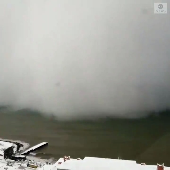
ABC News ✔@ABCMesmerizing timelapse footage captures snowstorm slamming the Turkish coast. https://abcn.ws/2HbfjSH

Featured image credit: Demiroren Haber Ajansi


You need to be a member of Earth Changes and the Pole Shift to add comments!
Join Earth Changes and the Pole Shift