Do you have your AC on?
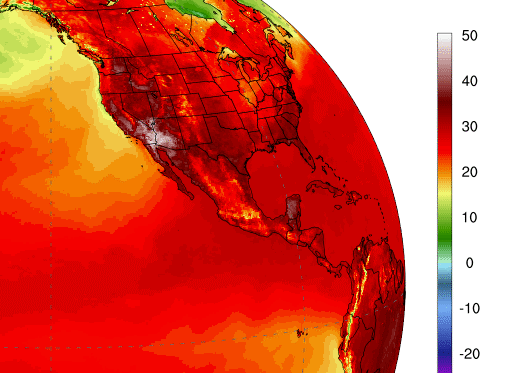
Because extreme deadly heatwaves have engulfed parts of the Desert Southwest United States, the Middle East and Europe.
In the U.S., California and Arizona are experiencing 115-120°F (46-49°C), Death Valley’s temperature reaches up to 127°F (53°C). Meanwhile, parts of Iraq, Iran, and Kuwait come close to all-time records at 127°F (53°C)!
Unusually hot temperatures in USA
The temperatures were unusually hot in July 2020 across Arizona, New Mexico, and West Texas.
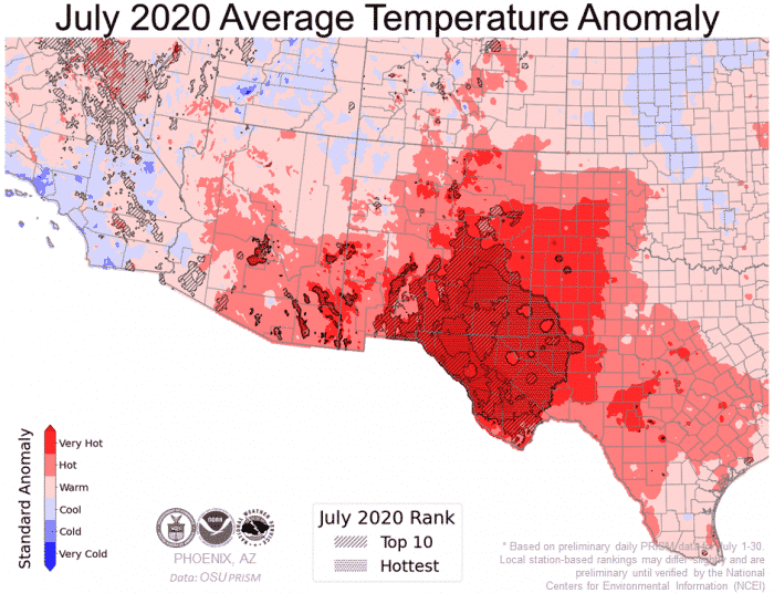
The temperatures were unusually hot in July 2020 across Arizona, New Mexico, and West Texas. Map: Oregon State University
The southwest US is suffering all-time record temperatures. July 2020 was the hottest on record for Phoenix, Arizona, with temperatures up to 118°F (48°C) this week.
 Extreme temperatures usa in July 2020.
As shown in the gray spot on the map above, a killer heatwave has developed across a large part of the southwest United States, including Arizona, inland California (Death Valley), Nevada, and New Mexico in July 2020.

Deadly heatwave will scorches Arizona beginning of August 2020. NWS Phoenix
July 2020 was the hottest month on record for Phoenix, Arizona with a new average temperature of 99°F (37.2°C) compared to 98.3°F (36.8°C) in July 2009:
Insane temperatures in Death Valley
Again, the Death Valley is making the headlines with this year’s highest temperatures recorded in mid-July at 128°F (53°C).
There is even a picture of Death Valley park rangers near the temperature display in front of the Visitors Centre in Furnace Creek on July 13th showing an amazing 129°F (54°C).
Furnace Creek has set the record for the highest temperature ever measured on Earth at 134°F (56.7°C)… This best mark was measured on July 10, 1913 and has never been broken since… I bet it will be soon.
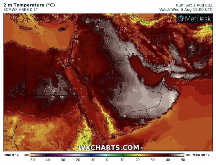
127°F (53°C) across Iraq, Iran and Kuwait
The Middle East has also recorded excessive heat in the last weeks or so, with temperatures reaching 122°F (50°C) in Iran, Iraq, Kuwait, and Saudi Arabia.
The highest temperature in the last few days was 127°F (53°C) and was recorded in Iraq and Kuwait.

Extreme temperatures recorded in Middle East end of July 2020: 53°C or 127°F in Irak and Kuwait. Ogimet
Weather forecast show that this apocalyptic heatwave will last until August 5, 2020. The highest temperature ever recorded in Kuwait is 129°F (53.9°C).


You need to be a member of Earth Changes and the Pole Shift to add comments!
Join Earth Changes and the Pole Shift