Wild Weather, the Wobble Effect
TOTAL DESTRUCTION IN PARTS OF CEBU CITY, PHILIPPINES, 05.11.25
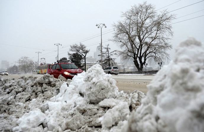
Massive flooding in Da Nang, Vietnam. 30.10.2025.
Giant waves crash over seawalls during a storm
in the suburbs of Taipei, Taiwan. 21.10.2025
"We warned at the start of ZetaTalk, in 1995, that unpredictable weather extremes, switching about from drought to deluge, would occur and increase on a lineal basis up until the pole shift. Where this occurred steadily, it has only recently become undeniable. ZetaTalk, and only ZetaTalk, warned of these weather changes, at that early date. Our early warnings spoke to the issue of global heating from the core outward, hardly Global Warming, a surface or atmospheric issue, but caused by consternation in the core. Affected by the approach of Planet X, which was by then starting to zoom rapidly toward the inner solar system for its periodic passage, the core was churning, melting the permafrost and glaciers and riling up volcanoes. When the passage did not occur as expected in 2003 because Planet X had stalled in the inner solar system, we explained the increasing weather irregularities in the context of the global wobble that had ensued - weather wobbles where the Earth is suddenly forced under air masses, churning them. This evolved by 2005 into a looping jet stream, loops breaking away and turning like a tornado to affect the air masses underneath. Meanwhile, on Planet Earth, droughts had become more intractable and deluges positively frightening, temperature swings bringing snow in summer in the tropics and searing heat in Arctic regions, with the violence of storms increasing in number and ferocity."
ZETATALK
Wild Weather, the Wobble Effect - Earth Changes and the Pole Shift
Views: 640044
Comment
-
Comment by jorge namour on May 22, 2014 at 4:03pm
-
Record heat in Russia: fear of an agricultural disaster
http://translate.google.com/translate?hl=en&sl=auto&tl=en&a...
http://actualite.lachainemeteo.com/actualite-meteo/2014-05-22-10h51...
News - Published Thursday, May 22, 2014 by The Weather Channel
Depression that caused the severe weather in the Balkans has traced the soft air to Russia. The beginning of this heat wave fears an agricultural disaster.
28 ° C in Moscow yesterday, today 29 ° C and 32 ° C in anticipation of the end of the week. Moscow is affected by a heat wave that could have serious consequences for the Russian economy, but also globally. Temperatures 10 ° C above the seasonal average, which had not been higher since August 2013. Besides the heat, drought is present in the south-east of Russia with a rainfall deficit of 20% over a geographical area known for its cultivation of cereals. Fear mainly the oat market, widely used for livestock feed. Some financiers are already worried about a likely increase in world prices if the weather situation persists, as was the case during the summer of 2012.
Weather forecast: heat and lack of rain
These next ten days ahead of cyclone Moscow region: sun and heat will remain set, with temperatures will not fall below 25 ° C and an almost total lack of precipitation, except for some thunderstorms heat.Heat wave "red-hot" Russia and the Baltics: tips +33 ° C in Estonia, altered historical records
Monday, May 19, 2014http://translate.google.com/translate?hl=en&sl=auto&tl=en&a...
http://www.meteoweb.eu/2014/05/eccezionale-ondata-calore-arroventa-...
As we announced in recent days, while the countries of Central Europe and Italy were hit by descent of air masses rather fresh from the North Atlantic and the British Isles, the countries of Eastern Europe and European Russia, the persistence of a massive block of anticyclonic headland, now spintosi with its northernmost elements above 60 ° north latitude, has given rise to an intense
heat wave that is affecting the western sector of European Russia, Belarus, Lithuania, Latvia, Estonia and southern Finland.
The ascent of air masses sub-tropical continental decidedly hot and dry from the arid steppes of Uzbekistan and Kazakhstan, has catapulted the thermometers on values from the height of summer. So much so that the wall of +30 ° C +32 ° C was broken in several places in Russia, the Volga region to Karelia, where the heat is really intense in the central hours of the day. But temperatures above +30 ° C, at this time, are being recorded in the inland areas of the Baltic countries and Finland, where it begins to flow much of the air very hot and dry in these days has just deposited over the vast Sarmatian plains. Note that in many cities, including the western part of European Russia, eastern Finland and Estonia, the threshold of +30 ° C, thanks to the advent of a moderate and "red-hot" ventilation from the south-eastern quadrant , has been largely overcome. On all stands the figure of St. Petersburg that today recorded a maximum temperature of more than +31 ° C, above the already record hot month of +30.9 ° C, established in May 1958.
The charming Russian city improved its record monthly hot, attestandolo over the threshold of +31 ° C. But the new record heat in St. Petersburg is nothing compared to +33 ° C in the shade achieved in Estonia Continue...
-
-
Weather alert, alarm in France and England for "the strongest storms in 50 years." But even in Italy ...
Tuesday, May 20, 2014,
http://translate.google.com/translate?hl=en&sl=auto&tl=en&a...
A new plunge of cold air from the Arctic Circle is affecting Europe at this time, this time further west than what happened last week when the cold weather and are sealed on Italy and the Balkans causing the disastrous flood that put knee in Bosnia, Serbia and Croatia with unprecedented rains over the past 120 years, disastrous floods and, unfortunately, dozens of victims (at least 70 seconds the latest updates, still not final).
This time the bad weather, just as severe, will concentrate in the areas most Western Europe, including the UK, France, Spain and Portugal where since yesterday evening I started heavy rain and spectacular thunderstorms that made fans go crazy British unleashed to publish on social networks photographs of lightning storms out of season. In recent days, the United Kingdom has experienced an intense heat wave that had guaranteed sunny days and warm with highs of over 30 ° C: its the heat has fueled the energy that is now giving rise to extreme events, caused by thermal contrasts due to the clash between the cold air coming in the persistent heat at lower layers.
After the storms of the past few hours in Liverpool and Wirral, especially where there was no damage to the arrows that hit the towns causing collapses and blackouts, now more storms are expected for the next 48 hours. The Met Office has issued a warning especially for Wednesday and Thursday, "models let you imagine scenarios of particular concern, with the strongest storms of the past 50 years, at least since 1960," wrote the British experts. Even in France, Spain and Portugal will have violent storms that can cause storms, floods, and even numerous tornadoes. And 'high risk of another flood, because the most affected areas will fall up to 150mm of rain in a few hours. And this, again one step from Italy but this time not in the east to the west.
Rtavn19218 Be warned, however, that also in Italy from Friday onwards will return to the bad weather, and as we can see from the maps of the rainy forecast for the next few days, will once again end with heavy rainfall especially in the center / north, after a few hours hot ephemeral between Wednesday and Thursday.
To monitor the situation live you can browse our real-time news and the pages of nowcasting: satellites , situation , lightning , radar and webcam . On our facebook page you can find more updates and interact with the editors sending pictures, messages or any kind of reflection. If you want, write us and send us the photos also e-mail address, redazione@meteoweb.it .
Here are some satellite maps and some of the most beautiful photographs of lightning strikes of the past few hours in England:http://www.meteoweb.eu/2014/05/allerta-meteo-allarme-in-francia-e-i...
-
Comment by Howard on May 20, 2014 at 5:48am
-
Surreal Time Lapse Video of Supercell Forming in Eastern Wyoming (May 19)
During peak tornado seasons, supercell videos are a dime a dozen, but this one out of Wyoming is as if it were straight from a sci-fi movie or another planet.
What you're seeing is a rotating updraft of a supercell. This particular supercell is known as a low precipitation or LP supercell. It's called that because it simply does not produce much precipitation to the ground. In fact, the most frequent precipitation you'll ever see out of these is large hail stones. This is why they are a little dangerous to chase, as you want to make sure you don't get pelted by the hail.
Source
http://www.theweathernetwork.com/news/articles/must-see-surreal-tim...
-
-
Georgia Hit by Rare Anticyclonic Tornado (May 15)
Ever heard of a tornado that spins in the opposite direction?
Tornadoes usually spin in a counterclockwise direction. A storm survey of an EF-0 tornado that hit Eastman, Georgia Wednesday night showed that the tornado was actually spinning in a "clockwise" motion. That is called an "anticyclonic tornado."
"Our survey team confirmed an EF0 tornado with maximum winds of 80 mph touched down in the south part of Eastman at 1150 pm EDT on May 14th and traveled north approximately 1.75 miles through town. As illustrated below, the storm exhibited anticyclonic (clockwise) rotation, a very rare phenomenon since the vast majority of tornadoes rotate cyclonically (counter-clockwise)," said National Weather Service forecasters in a post on their Facebook page.
11Alive Meteorologist Chris Holcomb also says this is a rare event.
"This might happen one out of every 1,000 tornadoes," he said. "This type of rotation is usually away from stronger rotation within a storm in the rear flank of the rotating system. These anticyclonic rotations are usually weak and don't last long."
Source
http://www.11alive.com/story/news/local/2014/05/16/dodge-county-hit...
-
-
Rare Cloud Formation Over the Philippines (May 15)
Pink and bulgy clouds across a darkening sky stunned residents of San Carlos city, Pangasinan shortly before nightfall on Friday.
Resident Holden Kirby Valdez said he has not seen such a cloud formation before.
According to the American Meteorological Society study, the rare cloud formation is called “mammatus clouds,” defined in the study as clouds that appear like “hanging protuberances, like pouches, on the undersurface of a cloud.”
The cloud formation is formed when the sinking air is cooler than the air around it, according to the Earth Observatory of NASA, adding that the sinking air must have a high water or ice content.
Source
http://newsinfo.inquirer.net/602725/rare-cloud-formation-spotted-in...
-
-
Rare Snowstorm Blankets Northern China During Chinese Summer (May 11)
A rare snow has hit Shandan County in north China's Gansu province over the weekend with temperature dropping to 8.1 degrees Celsius and snow depth reaching 100mm. It's the first snowfall the county has ever seen in May, when Lixia - the 7th solar term according to the traditional Chinese calendar marking the beginning of summer - falls.
Source
-
Comment by KM on May 10, 2014 at 3:38am
-
http://english.ahram.org.eg/NewsContent/1/64/100801/Egypt/Politics-...
Severe sandstorm sinks boat, damages museum in AswanThe unusually harsh weather sunk a tourist boat, leaving one South African passenger missingAhram Online , Thursday 8 May 2014 A massive sandstorm cloud rolls over Aswan governorate, Egypt, Wednesday, May 7, 2014 (Photo: Mohammed Rawy)
A severe sandstorm in Aswan in southern Egypt led to a boat accident and damage to a local museum on Wednesday.
A touristic Nile boat sank amid the unusually severe storm, leaving one South African passenger missing. Six other tourists, including one other South African, three Australians, and one Pole, as well as three Egyptians, were rescued from the boat
The Crocodile Museum in the southern city of Kom Ombo also suffered damage when its roof collapsed after the fierce sandstorm hit the governorate.
The Crocodile Museum, inaugurated in 2012, exhibits a collection of mummified crocodiles found in Ancient Egypt, alongside tablets and statutes of ancient Egyptian crocodile deity Sobek.
Officials from the antiquities ministry said that none of the artifacts had been damaged but that the museum would be closed to visitors until a technical committee could inspect the site.
Egypt is currently witnessing unstable weather conditions, including rainstorms and floods in Sinai and along the Red Sea coast.
According to Egypt's Meteorological Authority, the unstable weather conditions will continue for another two days.
-
-
U.S., record rainfall in New York ever so much since 1882 [PHOTOS and VIDEO]
Friday, May 2, 2014,
New York City has set a new record weather: April 30th marked the record rain fall after the floods of 23 September 1882. Wednesday you are in fact recorded 126.2 mm of rain in Central Park (September 23, 1882 were recorded 210.3 mm, according to data from the National Weather Service), while the total figure reported in April 2014 to 199.3 mm.
The April 30 millimeters fell were more numerous than those who fell during Hurricane Irene or Sandy.http://www.meteoweb.eu/2014/05/usa-pioggia-record-a-new-york-mai-co...
http://translate.google.com/translate?hl=en&sl=auto&tl=en&a...
-
Comment by Sevan Makaracı on April 27, 2014 at 9:06pm
-
Heatwave higher than usual for this time of year making life miserable accross Bangladesh
A heatwave that has been blazing across Bangladesh, making life miserable all around, will continue at least for two more days, the Met office says.
On Sunday, the mercury shot to 40 degrees Celsius in Rangamati, the highest temperature of the season - six notches higher than the normal reading of 34 degrees for this time of the year.
Capital Dhaka recorded a temperature of 38.5 degrees in the day.
The weather office declares heatwave conditions when the maximum temperature rises five degrees above normal to either touch or cross 40.
Senior Met officer Sanaul Haq Mandal said the high levels of humidity made the heat unbearable. On Sunday, Dhaka recorded 77 percent humidity. .....
-
Comment by lonne rey on April 27, 2014 at 10:52am
-
Winter comes again suddenly for Russia’s Urals
Russia’s Urals region has been hit with freak winter weather, with severe snowstorms causing massive traffic jams, flight delays, power blackouts and school closures.
Just when everybody in the cities of Ekaterinburg and Chelyabinsk thought they had waved winter good-bye and was anticipating greener spring weather, blizzards dragging the region back to winter.
Winter struck the region hard, with precipitation twice the monthly average coming as a shock to already burgeoning grass and trees.
Urals meteorologists have said the last time the region was struck by a snowfall of such severity in springtime was 123 years ago. They’ve found an April 26, 1891 issue of “Ekaterinburg Week” magazine that reported how the region witnessed “even more snow fallen than throughout the whole winter”.
SEARCH PS Ning or Zetatalk
Nancy Lieder, Emissary of the Zetas.
https://poleshift.ning.com/xn/detail/3863141:Comment:1168188
Awakening to the Alien Presence ZetaTalk
The truth will likely never to be known to the public but be washed away in the Nibiru panic soon to engulf the world.
The Worst of the Cover-Up
https://poleshift.ning.com/profiles/blogs/the-worst-of-the-cover-up
Main Establishment Lies
https://poleshift.ning.com/profiles/blogs/main-establishment-lies
Donate
© 2025 Created by 0nin2migqvl32.
Powered by
![]()
You need to be a member of Earth Changes and the Pole Shift to add comments!
Join Earth Changes and the Pole Shift