
Let’s just say the Easter bunny may have a heck of a time navigating Fort McMurray next week, thanks to a hefty amount of snow they got overnight Saturday into Sunday, April 10.
The northern Alberta city can expect a further five centimetres of the white stuff to fall today according to Environment Canada, on top of the already large amount they’ve already received.
It’s set to be cold too thanks to strong winds tonight pushing the temperature to feel like -19°C overnight. Not very spring like at all!
“Yeah only called for roughly 5cm overnight and easily 20-30 cm came down,” claimed one Fort McMurray resident on how much snow had fallen in the city in a tweet. You just gotta love that sneaky Alberta spring snow!
“The Weather Gods got this forecast WWWAAAAYYYYY off…. cleaned a foot of snow off my truck TWICE since midnight last night,” one person jokingly tweeted.


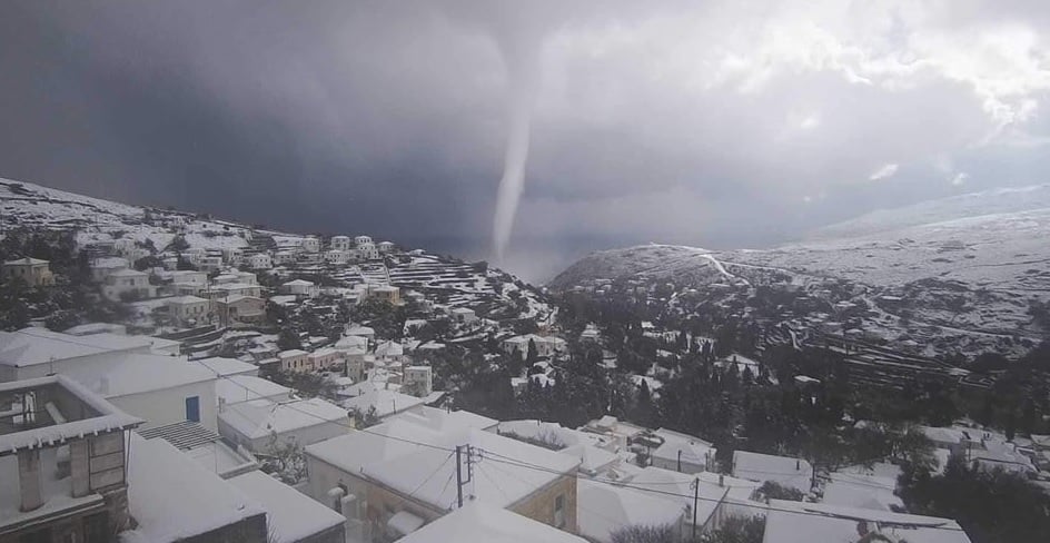 A tornado is seen hitting the Greek island of Andros on Monday.
You need to be a member of Earth Changes and the Pole Shift to add comments!
Join Earth Changes and the Pole Shift