Wild Weather, the Wobble Effect
Massive flooding in Da Nang, Vietnam. 30.10.2025.
Giant waves crash over seawalls during a storm
in the suburbs of Taipei, Taiwan. 21.10.2025
"We warned at the start of ZetaTalk, in 1995, that unpredictable weather extremes, switching about from drought to deluge, would occur and increase on a lineal basis up until the pole shift. Where this occurred steadily, it has only recently become undeniable. ZetaTalk, and only ZetaTalk, warned of these weather changes, at that early date. Our early warnings spoke to the issue of global heating from the core outward, hardly Global Warming, a surface or atmospheric issue, but caused by consternation in the core. Affected by the approach of Planet X, which was by then starting to zoom rapidly toward the inner solar system for its periodic passage, the core was churning, melting the permafrost and glaciers and riling up volcanoes. When the passage did not occur as expected in 2003 because Planet X had stalled in the inner solar system, we explained the increasing weather irregularities in the context of the global wobble that had ensued - weather wobbles where the Earth is suddenly forced under air masses, churning them. This evolved by 2005 into a looping jet stream, loops breaking away and turning like a tornado to affect the air masses underneath. Meanwhile, on Planet Earth, droughts had become more intractable and deluges positively frightening, temperature swings bringing snow in summer in the tropics and searing heat in Arctic regions, with the violence of storms increasing in number and ferocity."
ZETATALK
Wild Weather, the Wobble Effect - Earth Changes and the Pole Shift
Views: 637674
Comment
-
Comment by Moderating Staff on June 25, 2015 at 7:01am
-
Comment by SongStar101 19 hours ago
Arctic Sea Ice Area Drops 340,000 Square Kilometers in Just One Day
On Tuesday evening, the Cryosphere Today site showed Arctic sea ice at about 8,986,000 square kilometers. The next day the measure stood at about 8,646,000 square kilometers. That’s a huge loss of 340,000 square kilometers in just one day!
https://robertscribbler.wordpress.com/2015/06/18/arctic-sea-ice-are...
(Cryosphere Today sea ice graph shows that losses basically went vertical on Tuesday, June 16. Image source: Cryosphere Today.)
340,000 square kilometers gone in a single 24 hour period. That’s an area of sea ice the size of the state of New Mexico gone in a single day. In the above graph, you can see the drop as the vertical turn in the yellow line denoting 2015.
The massive single day drop temporarily brought sea ice area in the Cryosphere Today sea ice area chart into the range of second lowest on record for the date. Area losses of around 70,000 square kilometers for Wednesday resulted in a retreat to around 4th lowest on record. But any period in which drops of this size become frequent would easily transport the measure into new record low territory.
-
Comment by lonne rey on June 24, 2015 at 11:24am
-
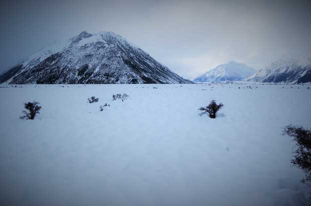
South Island wakes to record freeze (new zealand)
http://www.radionz.co.nz/news/regional/276919/south-island-wakes-to...
In a rare event, almost the entire South Island has woken up to temperatures below zero degrees today.
MetService meteorologist Stephen Glassy said the coldest place in the South Island overnight was Pukaki aerodrome near Twizel which reached a bone chilling - 19.8°C.
The all time record low is - 25.6°C recorded in Ranfurly in 1903.
Power still out for many
Some people in the Canterbury region have been without power since heavy snow brought down lines last week.
Line workers have been working to restore power, using helicopters to get to isolated places.
-
-
Pakistan Heat Wave Kills Hundreds: Victims 'Dying On the Streets'
http://www.nbcnews.com/news/world/pakistan-heat-wave-kills-hundreds...
ISLAMABAD, Pakistan — A heat wave raging through southern Pakistan has claimed more than 700 lives, officials said, with witnesses describing victims "dropping dead" on the streets.
Temperatures have exceeded 110 degrees in recent days, and thousands of people have been left to face the heat without electricity amid widespread power outages.

-
Comment by jorge namour on June 23, 2015 at 1:32am
-
Rare double rainbow frames Sydney skyline
June 18, 2015
http://edition.cnn.com/2015/06/18/asia/sydney-double-rainbow-stunne...
double rainbow at sunset in Sydney.
Sydney's sunset was twice as spectacular Wednesday when its beaches, harbor and city skyline were framed by a rare double rainbow.
Social media was awash with breathtaking pictures, with the sight literally stopping traffic on the city's streets.
-
Comment by KM on June 21, 2015 at 3:05pm
-
http://pulse.ng/local/in-lagos-floods-overwhelm-major-streets-photo...
Floods overwhelm major streets [PHOTOS]
Motorists are finding it hard to navigate their way due to the water level and pedestrians are unable to pass unaided.
 Flooding in Lagos Twitter
 Flooding in Lagos Twitter

 Flooding in Lagos Twitter
Motorists are finding it hard to navigate their way due to the water level and pedestrians are unable to pass unaided.
The affected areas include Lekki, Ajah, Oshodi, Iju, Opebi, Agege and Ikorodu among others.
Floods are a constant problem in Lagos leading the state government to provide a free phone line, 08099183777, for residents to report flooding incidents in their respective areas.
-
-
http://www.stuff.co.nz/national/69567269/hundreds-flee-rising-flood...
Hundreds flee rising floodwaters in North Island

 CHARLOTTE CURD/Stuff.co.nz
People in Waitotara return to the Taranaki town to assess the damage from the weekend's flooding.
A hundred people have been evacuated from Waitotara - likely the south Taranaki village's entire population - after flooding engulfed the remote town.
Waitotara is located about 30 kilometres north of Whanganui. It has sixty houses and sits on the Waitotara River, which flooded in the heavy rain over the weekend.
Residents were not able to return to their homes on Sunday, as flood waters were still high, Civil Defence said. Some residents were asked to evacuate, while others self-evacuated. Many went to the nearby town of Waverley.
A state of emergency remains in place for Taranaki, Whanganui and Rangitikei.
More than 200 people were evacuated from areas near the Whanganui River, which reached record levels of 9.1 metres at Town Bridge at 3am on Sunday. Many more people had self-evacuated.
About 100 flood affected homes on the city's Anzac Parade could be inaccessible until Tuesday because of the high waters, the Ministry of Civil Defence said.

The Whangaehu River in flood.
Assessments of properties along the Whanganui River had been delayed because water levels were not expected to start receding until early afternoon, despite improvements in the weather, CD director Sarah Stuart-Black said.
Slips had also come down on the aveneue and needed to be assessed before the road could reopen.
-
-
18 dead, 4 missing as dangerous storms sweep through China
http://www.foxnews.com/world/2015/06/20/18-dead-4-missing-as-danger...
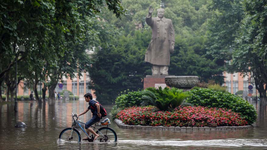
Heavy storms that swept through several southern Chinese provinces this past week have killed 18 people and left four more missing, according to the Ministry of Civil Affairs.
The storms have dumped more than nearly 8 inches of rainfall in 48 hours on some towns, toppled thousands of homes, and dislocated tens of thousands of residents, the ministry said Friday.
The deaths were caused by house collapses, landslides, drowning or lightning.
-
-
June on track to be coldest summer for 40 years
http://www.heraldscotland.com/news/home-news/june-on-track-to-be-co...
JUNE is on track to be the coldest summer month for more than 40 years as the persistent rainfall and low temperatures blight hopes of a turn to warmer weather.
Scotland's average temperature up until June 15 was 9.3C, two degrees below normal and the coldest June, July or August since June 1972, Met Office records show.

Forecasters are predicting another 10 days of downpours from next week. But first, another cold front will bring cloud and scattered heavy showers tomorrow, followed by a wet Sunday with hail. Highs of 18C tomorrow will drop to 15C on Sunday.
-
-
Thunderstorms in France: more than 500,000 lightning in 15 days!
News - Updated Friday, 19 June 2015 by The Weather Channel - LA CHAINE METEO
After a remarkably stable spring, the beginning of June was particularly hot in France, but also very stormy, with several peaks of activity during the first 15 days.
http://actualite.lachainemeteo.com/actualite-meteo/2015-06-19-06h25...
https://translate.google.com.ar/translate?sl=fr&tl=en&js=y&...
If the first three days of June 2015 have not been particularly stormy, it is quite another result. Indeed, according Blitzortung network, the number of readings lightning was above 20000 for 10 consecutive days, from June 5 to 14, with two peaks of activity on June 6 and June 11 (over 80000 flashes these days there). Of all the first 15 days of the month, more than 500,000 lightning were recorded.
However, in the image of the distribution of total rainfall, thunderstorm activity was very heterogeneous across the country. It is above the edge of the reliefs and the south, mainly the southeast as storms erupted and where the electrical activity was intense. In the north, however, the electric activity was much lower (0 days in Paris), and mainly concerns the Normandy and Picardy.
-
-
Coldest June in 92 years (Norway)
You have every reason to complain about the weather. Trøndelag has not experienced such a cold first half of June since 1923.
Since the daily measurements (average temperature through the day) began in Trondheim in 1870, it has been measured an even colder first half of June only once, 92 years ago.
There has not been a single day of summer meteorological in Trondheim in the first half of June.
Switch to the Mobile Optimized View
© 2025 Created by 0nin2migqvl32.
Powered by
![]()
You need to be a member of Earth Changes and the Pole Shift to add comments!
Join Earth Changes and the Pole Shift