Giant waves crash over seawalls during a storm

in the suburbs of Taipei, Taiwan. 21.10.2025

"We warned at the start of ZetaTalk, in 1995, that unpredictable weather extremes, switching about from drought to deluge, would occur and increase on a lineal basis up until the pole shift. Where this occurred steadily, it has only recently become undeniable. ZetaTalk, and only ZetaTalk, warned of these weather changes, at that early date. Our early warnings spoke to the issue of global heating from the core outward, hardly Global Warming, a surface or atmospheric issue, but caused by consternation in the core. Affected by the approach of Planet X, which was by then starting to zoom rapidly toward the inner solar system for its periodic passage, the core was churning, melting the permafrost and glaciers and riling up volcanoes. When the passage did not occur as expected in 2003 because Planet X had stalled in the inner solar system, we explained the increasing weather irregularities in the context of the global wobble that had ensued - weather wobbles where the Earth is suddenly forced under air masses, churning them. This evolved by 2005 into a looping jet stream, loops breaking away and turning like a tornado to affect the air masses underneath. Meanwhile, on Planet Earth, droughts had become more intractable and deluges positively frightening, temperature swings bringing snow in summer in the tropics and searing heat in Arctic regions, with the violence of storms increasing in number and ferocity."

ZETATALK

Wild Weather, the Wobble Effect - Earth Changes and the Pole Shift

Views: 637006

Comment

You need to be a member of Earth Changes and the Pole Shift to add comments!

Join Earth Changes and the Pole Shift

Comment by Scott on December 1, 2015 at 8:51am

IBM is supplementing its weather prediction supercomputing with magma flow modeling.

IBM wants to predict earthquakes and volcanoes with Watson (11/23/15)
http://qz.com/556172/ibm-wants-to-predict-earthquakes-and-volcanoes...
Quote: "A team of computer scientists at IBM, in partnership with researchers from the University of Texas at Austin, New York University and the California Institute for Technology, created a model that simulated the entire flow of mantle under the Earth’s surface. ... IBM is working with the US Department of Energy on this model, as well as its work on attempting to predict the weather. The company also recently bought most of the assets of Weather Company—the owners of the Weather Channel—including its myriad weather sensors around the world."

See ZetaTalk: Heralding
http://www.zetatalk.com/poleshft/p24.htm
All attempts to explain the changes based on Global Warming from the Greenhouse effect will run into snags as the weather will refuse to be predictable. Areas of the world which have been deserts throughout mankind's memory will become swamps under constant and repeated rains. Temperate climates used to periodic gentle rainfall will suffer intractable droughts. Then this will switch about, for no apparent reason. The reason lies deep within the Earth's core, an area the meteorologists refuse to consider, and thus their predictions on the atmosphere will never be based on the right parameters.

Also:
Weather Predictions
http://www.zetatalk.com/index/blog1005.htm

Weather Channel Depicts Planet X/Passage (NEW ZetaTalk)
http://poleshift.ning.com/profiles/blogs/weather-channel-depicts-pl...

Comment by KM on December 1, 2015 at 2:23am

http://strangesounds.org/2015/11/terrifying-green-storm-clouds-engu...

Terrifying green storm clouds engulf Brisbane, Australia in apocalyptical scenery

Look at these terrifying green storm clouds engulfing Brisbane, Queensland on November 29, 2015.

And I am pretty surprised that no tornadoes have been reported.

Green clouds are often associated with extreme weather phenomena such as tornadoes – in the Great Plains region of the U.S. – or apocalyptic... in large thunderstorms – in Queensland.

Well, yesterday on November 29, 2015, terrifying greens storm clouds engulfed the sky of Brisbane and surrounding areas in southeast Queensland, Australia. Pictures are just insane. Enjoy…

terrifying clouds brisbane storm november 2015, brisbane storm november 29 2015, green clouds brisbane storm november 29 2015, apocalyptic storm brisbane november 2015, terrifying clouds engulf brisbane november 2015, brisbane storm pictures, insane storm destroys brisbane november 2015 picture, insane cloud brisbane storm 2015, green cloud storm brisbane november 29 2015 pictures

Comment by KM on December 1, 2015 at 2:10am

http://m.thejakartapost.com/news/2015/11/30/floods-landslides-hit-w...

Floods, landslides hit West, North Sumatra, cut off access

Torrential rain has caused landslides in parts of West and North Sumatra, cutting off access and disrupting economic activity. 

A 150-meter stretch of the highway connecting West Sumatra and Riau in Jorong Sopang, Pangkalan Koto Baru, Limapuluh Kota regency, was engulfed by up to a meter of floodwater on Sunday at 5 a.m. local time.

Limapuluh Kota Disaster Mitigation Agency (BPBD) head Nasriyanto said the flooding was triggered by the overflowing Batang Manggilang River.

“Only large trucks were able to pass, resulting in other vehicles from Pekanbaru and Payakumbuh backing up 2 kilometers for eight hours,” Nasriyanto told The Jakarta Post on Sunday. 

He said the heavy rain that had drenched the region in the past three days had triggered floods and landslides in a number of locations in the regency. At least 500 homes were engulfed by over 50 centimeters of floodwater and eight homes were reportedly damaged by a landslide on Sunday morning.

“We, together with residents, are currently moving residents and livestock to safer areas. Reports are coming in, but no casualties have been reported so far,” said Nasriyanto.

Floods have taken place in Taram and Sarilamak villages in Harau district, Payakumbuh, Guguk, Lareh Sago Halaban and Kapur Sembilan districts. 


Comment by KM on November 29, 2015 at 1:16am

http://www.dailymail.co.uk/news/article-3337673/The-Latest-Freezing...

Nine dead as ICE STORMS batter Texas, Oklahoma and Kansas and cause travel chaos for millions heading home after the Thanksgiving weekend

  • Forecasters said a band of storms will leave Texas but will likely dump more freezing rain on parts of Oklahoma and Kansas
  • The National Weather Service says the storms causing icy conditions in Oklahoma and Kansas are expected to last through Saturday night 
  • Temperatures are expected to be above-freezing in the region on Sunday 
  • Thousands of people are without power as accumulated ice downed power lines 
  • The storm will make conditions difficult for millions of people heading home on Sunday after the long Thanksgiving weekend 

At least five people have died in accidents related to a ice storm in Kansas and Oklahoma and another three people were killed in North Texas flash floods.

The band of storms moving slowly through the nation's midsection is set to leave Texas but will likely dump more freezing rain on parts of Oklahoma and Kansas.

The National Weather Service says the storms causing icy conditions in Oklahoma and Kansas are expected to last through Saturday night. 

Temperatures are expected to be above-freezing in the region on Sunday. 

Saturday's forecast shows rain in many areas - and there is still a severe threat of freezing rain tonight

Saturday's forecast shows rain in many areas - and there is still a severe threat of freezing rain tonight

One person is still missing. Thousands of people are without power as accumulated ice downed power lines.

Meanwhile, with up to four inches of rain expected in northeast Texas and central Arkansas, a flash flood threat continues in North Texas and most of Arkansas. 

More rain is forecast on Sunday from Texas to the Mid-Atlantic states. Freezing rain is expected in southern Nebraska and central Kansas.  

Authorities in Kansas are blaming four more traffic deaths in the Wichita area on the icy conditions gripping the state and other parts of the nation's midsection.

Harvey County Sheriff T. Walton says icy roads caused a Friday afternoon crash about 10 miles southeast of Newton that killed two people. 

The Kansas Turnpike Authority says two other people were killed hours later when a tractor trailer jackknifed on an icy stretch of Interstate 35 near Andover and struck an SUV.

Comment by KM on November 28, 2015 at 3:54am

https://www.rt.com/news/323666-vladivostok-tempest-epic-photos/

Freeze frames: Russia’s Far East hit by icy tempest (PHOTOS)

© libra.anna
Russia’s Far Eastern port city of Vladivostok has been hit hard by gusts of freezing wind reaching speeds of 25 meters per second causing sea water to freeze over anything the giant waves touched.

This Thursday Vladivostok’s port turned into a giant slushy machine as sea water mixed with sand started freezing under gusts of cold wind in subzero temperatures. 

Although locals took it as a photo opportunity and flooded social media with impressive shots, the tempest had its consequences: trucks were banned from crossing the city’s Russky Bridge, some power cables came down and electricity supplies weren’t restored in certain areas even by Friday, some parked cars got damaged, not to mention car accidents on slippery roads, the wind tore down roofing, a bus stop and overturned some kiosks. 

No casualties have been reported so far although a video posted on-line shows a girl who apparently fell, thrown by the strong wind. She is lying on her side on the pavement, holding her head. The video was filmed at the Far Eastern Federal University, on Russky Island.  

Comment by KM on November 27, 2015 at 1:50am

http://maldivesindependent.com/environment/addu-city-suffers-worst-...

Addu City suffers worst floods in 40 years

Addu City suffers worst floods in 40 years

Southern Addu City has suffered the worst storm damage in 40 years after 12 continuous hours of torrential rain left streets inundated and flooded some 200 households.

“This is the worst flooding I’ve seen in decades. The water is knee-deep in most areas, and a majority of houses are under a foot of water,” saud Abdulla Thoyyib, the deputy mayor.

The Feydhoo and Maradhoo-Feydhoo wards suffered the most damage. According to the Maldives Red Crescent, some 32 houses in Feydhoo and 11 houses in Maradhoo-Feydhoo suffered major damage. A majority of household appliances were destroyed, a spokesperson said.

Residents are now worried of water contamination as sewers are full and overflowing. The city, home to some 20,000 people, and the second most populous region, is out of chlorine, according to Thoyyib.

The Maldives National Defence Forces have set up water pumps in the three worst affected wards. Sand bags have been piled up to stop water entering into 17 houses in the Feydhoo ward.

The rain, which started at 3pm on Tuesday, continued for 12 hours. The department of meteorology recorded 228mm of rain, the worst in 40 years in the Maldives.

“This kind of rain is not common and it has damaged houses that are normally safe,” Thoyyib said.

Photos shared by the MRC show a foot of water inside some households.

Addu City floods

Comment by KM on November 26, 2015 at 12:26am

http://floodlist.com/asia/floods-riyadh-saudi-arabia-qatar-november...

1 Dead after Floods in Saudi Arabia, Qatar sees 1 Year of Rain in 1 Day

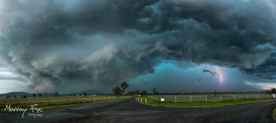
Seasonal storms brought heavy rain to Qatar and central and eastern parts of Saudi Arabia on 25 November 2015.

Doha, Qatar, recorded more than a year’s worth of rain in one day. One person has been reported as killed in the floods in Riyadh Region, Saudi Arabia in what is the third deadly flood event to hit the country in the last 4 weeks.

Saudi Arabia

The state-run Saudi Press Agency reported earlier today that seasonal storms brought heavy rainfall in central and eastern areas of the country, causing severe flooding in Riyadh and Al-Qassim Regions.

Saudi Arabia civil defence report that 1 person has died in the floods in the province of Rimah, Riyadh Region, which is located about 120 kilometres north-east of the capital Riyadh.

Schools have been closed, roads blocked and in some cases flooding has forced drivers to abandon their vehicles. Saudi Arabia civil defence say they have responded to dozens of emergency calls. The city of Buraidah, Al-Qassim Region, is reported as one of the worst hit.

Saudi Arabia Civil Defence teams carrying out flood rescues in Buraydah. Photo: Saudi Arabia Civil DefenceSaudi Arabia Civil Defence teams carrying out flood rescues in Buraidah, Al-Qassim Region. Photo: Saudi Arabia Civil Defence

This is the third deadly flood to strike in Saudi Arabia in the last few weeks. Floods struck in Jeddah, Makkah and other western parts of the country on 17 November 2015, leaving as many as 12 dead. Six people died in floods that struck in late October.

Qatar

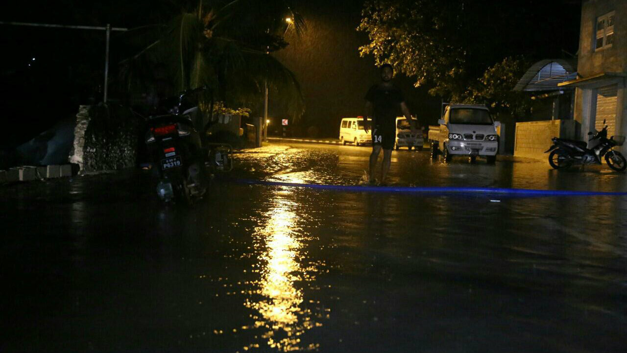
Parts of Qatar, including Doha, also saw heavy rainfall and floods. Qatar Meteorology Department say at least 80.8 mm of rain fell at Hamad International Airport in Doha, the highest ever recorded at that location and more than Doha would typically see in a whole year.

According to WMO figures, 3.3 mm is the typical monthly average for November and the total yearly average is around 75 mm.

The floods caused major problems for drivers. Qatar’s Interior Ministry warned drivers of the dangers of driving in floods and severe weather. No deaths or injuries have been reported in Qatar.

Some flooding was reported at Doha’s new $17 billion Hamad international airport. Social media photos and videos showed water pouring in from a leaking roof. However, flights were operating normally despite the weather conditions.

Comment by Stanislav on November 23, 2015 at 8:42pm

UN: Weather disasters occur almost daily

Full report Relief Web

Weather-related disasters such as floods and heat waves have occurred almost daily in the past decade — nearly twice as often as two decades ago — and Asia is the hardest-hit region, the United Nations said in a report released Monday.

While the report’s authors didn’t pin the increase wholly on climate change, they said extreme weather events were likely to increase.

Weather disasters have killed 606,000 people and left 4.1 billion injured, homeless or in need of aid, and have accounted for 90 percent of all disasters since 1995, the report said.

A recent peak year was 2002, when drought in India affected 200 million people and a sandstorm in China affected 100 million. But the standout mega-disaster in the report was Cyclone Nargis, which killed 138,000 in Myanmar in 2008.

While geophysical events like earthquakes, volcanoes and tsunamis often grab headlines, they only make up one in 10 of the disasters trawled from a database of events defined by their impact.

The report, titled “The Human Cost of Weather Related Disasters,” found an average of 335 weather-related disasters annually between 2005 and August 2015 — up 14 percent from 1995 to 2004, and almost twice as many as in the years from 1985 to 1994.

“While scientists cannot calculate what percentage of this rise is due to climate change, predictions of more extreme weather in future almost certainly mean that we will witness a continued upward trend in weather-related disasters in the decades ahead,” the report said.

The release of the report comes a week before world leaders were set to gather in Paris to discuss plans to curb greenhouse gas emissions and mitigate a global rise in temperatures.

The U.N. has said atmospheric levels of carbon dioxide, the main greenhouse gas blamed for global warming, have risen to a new record every year for the past 30 years.

“All we can say is that certain disaster types are increasing. Floods are definitely increasing,” said Debarati Guha-Sapir, professor at the Centre for Research on the Epidemiology of Disasters at UCL University in Louvain, Belgium, which co-authored the report.

“Whether it's increasing due to global warming, I think it's safe to say the jury's out on that. But rather than focus on the ifs, whys and wherefores, I think we should focus on how to manage floods.”

Margareta Wahlstrom, head of the U.N. Office for Disaster Risk Reduction (UNISDR), said floods were not just caused by heavy rains but also by poorly planned construction.

The UNISDR estimates natural disasters of all types cause losses of $250 billion-$300 billion globally each year.

The report drew on a database of weather events that defines an event as a disaster if 10 or more people are killed, if 100 or more are affected, if a state of emergency is declared or if there is a call for international assistance.

The countries hit by the highest number of weather-related disasters over the past decade were the United States with 472, China with 441, India with 288, the Philippines with 274 and Indonesia with 163. Source: america.aljazeera.com

Comment by jorge namour on November 22, 2015 at 3:41pm

Three simultaneous polar vortex in America, Europe and Asia

News - Published Sunday, November 22, 2015 by The Weather Channel - la chaine meteo

This weekend marks several simultaneous winter offensives in North America, Europe and China.

http://actualite.lachainemeteo.com/actualite-meteo/2015-11-22-10h54...

https://translate.google.com/translate?sl=fr&tl=en&js=y&...

The jet stream, high altitude wind, experienced this weekend three major waves: one in North America, the Western Europe and Asia.

These oscillations of the jet stream, called "polar vortex", causing cold air raids south. Thus, a major snowstorm affected the Great Lakes in North America: Chicago has undergone in the night from Saturday to Sunday the biggest snowstorm in 100 years for the month of November with 41 cm of snow. More than 500 flights were canceled.

In Western Europe, the cold air raid caused a winter time in France and a violent storm in the Mediterranean. The temperature dropped to -32 ° on Mont Blanc (4750 m in altitude). In Denmark, the snow falls since last night with accumulations of 25-40 cm on the East Coast.

In China, the temperature plunged to -15 ° in Beijing and did not thaw at least before December 5, or 10 degrees below average (however indicate that Beijing has a continental climate with harsh winters).

These offensives cold do not allow however to consider a harsh winter, especially since a rapid thaw is expected this week in the United States and Europe.

The polar vortex plunges to France

News - Updated Saturday, November 21, 2015 by The Weather Channel - LA CHAINE METEO

The polar vortex, the term was widely publicized during cold waves that affected the United States in recent winters, will experience a stall from the Arctic and plunges towards France.

This is actually a "stall" the jet stream, the wind blowing at high altitudes and contains polar air at high latitudes. Sometimes the jet stream is diverted from its usual trajectory (from west to east) and dips to the south: this is what happened during cold spells occurred in North America in recent years .

A chill of short duration

Thereafter, the cold air mass will cut its Arctic power on Tuesday, the Jet Stream resuming his usual traces (from the west).

--------------------------

COLD winter across Europe, blizzards in many countries: accumulations of 60cm in the plain in Denmark!
November 22, 2015

http://www.meteoweb.eu/video-gallery/eccezionali-nevicate-in-danima...

https://translate.google.com/translate?sl=it&tl=en&js=y&...

VIDEO: http://www.meteoweb.eu/video-gallery/eccezionali-nevicate-in-danima...

COLD and snow arrived over Europe: heavy snowfalls in many countries with freezing temperatures. At the time, in broad daylight, we -3 ° C in Oslo and Tromso, -2 ° C in Trondheim and Bergen, -1 ° C

Stockholm, 0 ° C in Moscow and Helsinki, + 2 ° C in Berlin, Prague, Warsaw, St. Petersburg, Belgrade and Copenhagen, + 3 ° C in London and Sarajevo, + 4 ° C in Vienna, Budapest and Brussels, + 5 ° C in Paris

The abnormal heat goes back to the Black Sea in the areas south / east of the continent, from the Balkans as well as in Greece and Turkey with the current + 21 ° C in Istanbul and Athens and + 17 ° C in Bucharest. Last night occurred authentic blizzards in many countries, especially in Denmark with accumulations up to 60cm in the plain. Here are the images:

Comment by KM on November 22, 2015 at 1:19pm

http://www.chicagotribune.com/news/local/breaking/ct-chicago-winter...

Season's first snow is Chicago's largest November snowfall in 120 years

Photo gallery: Winter weather
Chicago gets its largest November snowfall in 120 years

The season's first snowfall dropped as much as 17 inches across Chicago's northern suburbs, and the total of 11.2 inches at O'Hare International Airport made it the largest November snowfall in 120 years.

The steady stream of snow began Friday evening and carried into Saturday, bringing cold winds and slushy puddles to Michigan Avenue. But it also fashioned a wintry backdrop to the annual Magnificent Mile Lights Festival, transporting Chicagoans into a life-sized holiday snow globe.

The chill didn't bother the Kendalls, who traveled from Northwest Indiana for the festivities. They stood in Pioneer Court bundled in snow gear, relishing bites of candy-cane-garnished cheesecake as heavy snowflakes plopped onto their noses.

"It rings in the beginning of Christmas season," said Jessica Kendall. "The roads are warm, the snow's melting and we had a nice, wintry drive."


Data: Looking at the winter ahead

The storm hit hardest in the northern suburbs.

Lake County was walloped. By about 2 p.m. Saturday, there were reports of 17 inches in Grayslake, 16.5 in Hawthorn Woods, and 15.5 inches in Mundelein, said National Weather Servicemeteorologist Jamie Enderlen.

McHenry County also was socked, with 13.6 inches in Bull Valley, 12.5 inches in Woodstock and 9.5 inches in Hebron by about 7 a.m. Saturday, according to the weather service.

Communities further south saw less precipitation. Naperville had 6.4 inches of snow as of midafternoon, and Romeoville had 4.7 inches as of early evening, according to the weather service. Batavia had 7.5 inches by late afternoon.

As of about 6 p.m. Saturday, 11.2 inches of snow was measured at O'Hare International Airport, where some airlines reported delays of up to 20 minutes and more than 260 flights were canceled. Midway Airport reported 5.8 inches.

According to the weather service, this was the second-largest November snowstorm, behind only a 12-inch snowfall Nov. 25-26, 1895.

SEARCH PS Ning or Zetatalk

 
Search:

This free script provided by
JavaScript Kit

Donate

Donate to support Pole Shift ning costs. Thank you!