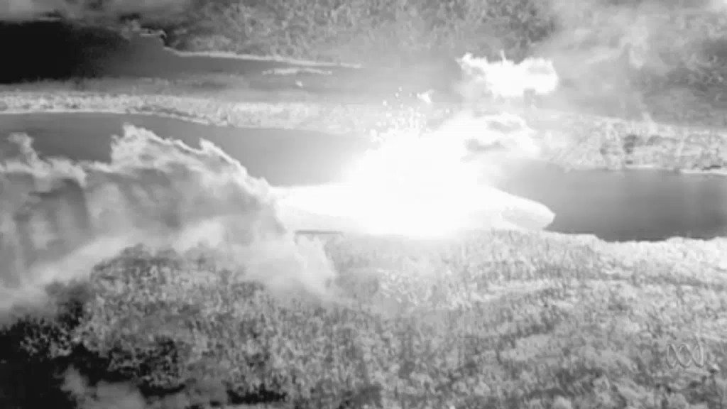
Japan: A new island appears in the Ogasawara Islands - November 2013

Active volcanoes (Sep 28, 2012)

Source

Source

"Of course all volcanoes will explode, as this is going to be a very severe pole shift. What about the months and years preceding the pole shift? It is no secret that Mammoth Lake and the caldera of Yellowstone are warming up, and the populace has been prepared for these occurrences by the movie Volcano where there, in the middle of LA, lava is bubbling up. In fact, there is a fault line running from the approximate San Diego/LA area, up into the Sierras, and this is liable to rupture rather violently during one of the quakes that precedes the pole shift by some months. Volcanic eruptions from that area in the Sierras can be expected. Will Mount St. Helen erupt? All volcanoes that have been active within the memory of man will begin spewing and burping and oozing, and many that were not expected to become active will reactive. "   ZetaTalk - Feb 15, 2000

Views: 218973

Comment

You need to be a member of Earth Changes and the Pole Shift to add comments!

Join Earth Changes and the Pole Shift

Comment by KM on May 16, 2017 at 8:05pm

http://strangesounds.org/2017/05/volcanic-island-nihinoshima-grows-...

Volcanic island NISHINOSHIMA continues to grow in Japan – 180 meters in 2 weeks

 The volcanic island Nishinoshima continues to grow due to an intense eruption and strong lava flow.

Within 2 weeks it gained more than 170 meters of new lava ground or 70,000 square meters.

nishinoshima grows, nishinoshima grows japan, Eruption and lava flow at Nishinoshima volcanoEruption and lava flow at Nishinoshima volcano. via Earth Observer

Last month, Nishinoshima started erupting again after a rest of more than a year and a half.

nishinoshima grows, nishinoshima grows japan, Eruption and lava flow at Nishinoshima volcanoExpansion of Nishinoshima volcanic island in 2017. 

The island has now expanded more than 180 meters on the southwest side and about 170 meters on the west.

nishinoshima grows, nishinoshima grows japan, Eruption and lava flow at Nishinoshima volcanoThe surface of the island grew 180 meters on the southwest side and about 170 meters on the west.

This is equivalent to an increase of 70,000 square meters and a total of 2.75 square kilometers for the island.

nishinoshima grows, nishinoshima grows japan, Eruption and lava flow at Nishinoshima volcanoNishinoshima eruption and lava flow in 2017. 

Scientists believe the island could still continue growing in the future.

Imagine, expertes thought Nishinoshima wouldn’t grow that large after the first eruption. There is no exact SCIENCE, especially in volcanology.

Comment by Starr DiGiacomo on May 8, 2017 at 6:34pm

Sunday, 7 May 2017

http://www.thebigwobble.org/2017/05/state-of-emergency-declared-aft...

State of emergency declared after colossus The Volcán de Fuego spews ash and steam 3763 meter high in Guatemala; hundreds evacuated

In Guatemala, the state of emergency declared in the vicinity of the Fire Volcano.
The Volcán de Fuego came this week for the fourth time this year to burst and thrust a two kilometer high ash cloud from.
From the 3763 meter high volcano are two lava flows threaten down the nearby villages.
330 people had to be evacuated and had to be closed ten schools.
There are believed to be no casualties.
The inhabitants of the villages can attend not yet returned to their homes.
Due to heavy rains the danger of avalanches and landslides,
Insisvumeh reports, the organization that monitors earthquakes and volcanic eruptions.
The Fire Volcano, fifty kilometers southwest of the capital Guatemala City is located, is known as the most active in the Americas.

https://www.youtube.com/watch?time_continue=3&v=Ebr_J_Yaj0Y

Comment by jorge namour on May 5, 2017 at 3:13pm

CARIBBEAN: Warnings issued as volcano near Grenada becomes restless

Volcano Kick ’em Jenny

April 30, 2017

https://www.stlucianewsonline.com/caribbean-warnings-issued-as-volc...

CMC – The National Disaster Management Agency is monitoring an increase in activities taking place at Kick ’em Jenny, the region’s only submarine volcano located between Grenada and the Grenadine island of Carriacou.
In a release early Sunday, the disaster agency said it has been advised of the increase in activity by the Seismic Research Centre (SRC) of the University of the West Indies (UWI).
“The UWI/SRC recorded a high amplitude signal, lasting about 25 seconds, on one of the Grenada stations. The signal was also recorded on a station in Montserrat. This signal follows an increase in the number of background events associated with the Kick-’em-Jenny volcano,” said the release which confirmed that persons in the St Patrick’s area have reported feeling tremors.”
As a result, the alert level is now on yellow and sea users and ships have been warned to stay away from vicinity of the submarine volcano.

“In light of the ongoing we are advising all sea users that the 5km (3.1 miles) exclusion zone of Kick ’em Jenny be strictly observed. The SRC has advised that heightened alert is necessary for the exclusion zone,” the release added.
A yellow alert means the volcano is restless; seismicity and/or fumarolic activity are above the historical level or other unusual activity has been observed or can be expected without warning.

SOUFRIÈRE , SAINT LUCIA , WEST INDIES :

New vent at Soufriere volcano no cause for alarm.

http://lechaudrondevulcain.com/blog/2017/05/04/may-04-2017-en-ubina...

3 MAY 2017 . he National Emergency Management Organisation (NEMO) has said that the discovery of a new vent at the Soufriere volcano here is no cause for alarm. The new vent was discovered about two weeks ago

persons were concerned that the new vent was a sign of activity within the Soufriere volcano because ashes were emitted. CONTINUE...
--------------------------------
GERMANY

https://www.facebook.com/VolcanoPlanet/ APRIL 2017

Volcano Planet

Yesterday, mountaineers climbed Mount Walzmann outside Schonau-am-Konigsee and noticed an odour of sulphur. When they got to the summit they had discovered that a lava dome had been growing in the summit area. Police has closed access to the mountain pending further investigation from scientists. Mount Walzmann, previously thought to be a mountain is located in Germany's deep south in the Bavaria region.

MAP: https://en.wikipedia.org/wiki/Watzmann

Comment by Howard on May 3, 2017 at 2:55am

Japan's Mt Sakurajima Erupts 5 Times Covering Nearby Cities with Ash (May 2)

Mount Sakurajima blew its top again at 3:20 a.m. on May 2 in spectacular fashion, spewing a massive column of smoke rising 4,000 meters from the crater.

Locals have spoken of having difficulty breathing after bright flashes and billowing smoke blasted from the volcano in at least five separate eruptions.

Residents in the town of Kagoshima, found on the southern island of Kyushu and around 4km away from the volcano, awoke to find their homes littered with ash.

One person living nearby posted a picture of his car covered in ash, with the caption: “Everything in my town is being covered with volcanic ash from Sakurajima. I can't breathe!!”

It is thought there are no injuries or casualties resulting from the violent eruptions but authorities have recommended that people in Kagoshima wear face masks until the ash stops falling on the region.

Sources

http://www.express.co.uk/news/science/799120/Mount-Sakurajima-volca...

http://www.asahi.com/ajw/articles/photo/AS20170502003075.html

Comment by M. Difato on April 29, 2017 at 11:04pm

Japan volcano erupts, shoots ash 3 kms high (Apr 28)

http://conceptnewscentral.com/index.php/2017/04/28/japan-volcano-er...


TOKYO — Mt. Sakurajima, a volcano in Kagoshima Prefecture in southwestern Japan, erupted on Friday, the weather agency said.

According to Japan’s Meteorological Agency, the eruption occurred at 11:01 a.m. local time.

Ash and smoke was recorded as billowing as high as 3 kilometers into the sky, the weather agency said.

The agency warned that similar eruptions could occur, although there have been no immediate reports of injury or damage as a result of the latest eruption.

The last major eruption occurred at the mountain on July 26 last year and the volcano is under Level 3 (orange alert) by the Japan Meteorological Agency, signifying the volcano is active and should not be approached.

In September 2016, a team of experts from Bristol University and the Sakurajima Volcano Research Center in Japan concluded after studies that the volcano could have a major eruption within 30 years. Xinhua

Comment by Howard on April 23, 2017 at 7:17pm

Continuous Activity at Costa Rica's Poás Volcano Culminates with Powerful Explosion (Apr 22)

Video 1

Video 2

48 hours of continuous eruptive activity at Poás Volcano were marked on Saturday at 10:12 p.m. with a massive explosion that launched glowing bombs over the entire sector of the active crater.

In what appear to be the strongest eruption in the current ongoing crisis thus far, the presence of large amounts of incandescent material suggests that magma continues to rise towards the surface.

People in nearby towns such as Alajuela reported strong sulfur smells and ash falls that caused headaches, burning eyes, and respiration irritation.

Earlier on the same day, at 4:03 p.m. local time, another explosion occurred at Poás, but the height of the eruption column was not observed due to bad visibility.

The peak of activity began on April 20 at 10 p.m. with an increase in the evaporation and emission of gases in the area where the volcanic dome used to be.

The emission of solid material and the eruptions increased on April 21 and during the night hours the volcano expelled ash aside from the vapors as well as rocks at high temperature. 

The incandescent material has temperatures of more than 800 degrees Celsius (1472 Fahrenheit), when they fall again they form a cone that has been changing its shape. The volcano also emits a loud sound similar to that of a plane turbine.

Experts estimate that the temperature of the Laguna Caliente lake could be near the 80 degrees Celsius at this point.

Residents of San José, Alajuela, Heredia and Cartago are breathing high levels of sulfur, carbon dioxide and occasionally ash particles, that can have a negative effect on health.

The air quality monitoring station located in Hatillo, registered in average a concentration of carbon dioxide of 81 parts per billion (ppb), with a maximum peak of 99.1 ppb, which exceeds the WHO limits of 75 ppb.

According to Jorge Herrera, coordinator of the environmental laboratory of the National University, the emissions of gas by the Poás Volcano is affecting the quality of the air in the metropolitan area which was already compromised with the eruptions of the Turrialba Volcano.

The high levels of sulfur dioxide and carbon dioxide measured near the crater of the volcano are interpreted by scientists as a sign of fresh magma near the surface.

The combination of these gases in the air and heavy rains like the ones experienced in the last few days create what is known as acid rain, which causes damage in crops, vegetation, and even metallic structures.

Sources

https://www.volcanodiscovery.com/poas/news/62693/Poas-volcano-Costa...

http://news.co.cr/48-hours-of-activity-at-poas-volcano-costa-rica-b...

Comment by Howard on April 16, 2017 at 3:26am

Costa Rica's Poás Volcano Erupting (Apr 14)

Just two days after suddenly erupting with enough force to leave a crack in the dome of its crater, Costa Rica's Poás volcano on Friday spewed a plume of smoke and ash more than three kilometers into the air.

The strong explosion was preceded by several smaller and moderately sized explosions from around 6 am; the most significant one occurred at 6:59, 7:18, 7:39 and 7:57 local time.

The plume, visible from different points in the country, went higher than three kilometers.

Poás is located just 40 kilometers north of the capital San Jose, in Alajuela province.

The country's Turrialba Volcano, located in the east, is usually the one making headlines for sending plumes of ash and smoke as high as 4,000 meters into the sky.

Sources

http://news.xinhuanet.com/english/2017-04/15/c_136209927.htm

http://qcostarica.com/the-poas-volcano-eruption-from-above/

http://qcostarica.com/poas-volcano-spewed-out-gas-and-ash-3-km-high...

https://www.volcanodiscovery.com/poas/news/62585/Poas-volcano-Costa...

Comment by M. Difato on April 12, 2017 at 10:04pm

Volcano Sinabung in western Indonesia has begun to erupt on April 12, creating a 3,000-metre pillar of dust and smoke.

The volcano, nearly 2,500 metres tall, has erupted in recent days, according to local disaster prevention agency.

Local authorities have banned people from travelling to area of seven kilometres from the crater’s radius.

Sinabung is one of 130 active volcanoes in Indonesia, which has continuously erupted since 2013.

At least 23 people were killed by the volcano’s eruption in 2014 and 2015. The following eruptions forced thousands of people to evacuate, causing huge losses to the local economy.-VNA

~

"..Villagers also continue their precarious existences despite the eruptions, putting on masks to go shopping as ash falls from the sky, and tending to their crops.

Over 2,000 families have been evacuated from around the rumbling volcano in recent years, and many will soon be relocated to new villages after lengthy stays in temporary shelters.

Sinabung roared back to life in 2010 for the first time in 400 years. After another period of inactivity it began erupting again three years later..."

Sources: 

https://www.yahoo.com/news/indonesian-volcano-fresh-eruptions-06571...

http://en.vietnamplus.vn/volcano-erupts-in-indonesia/110140.vnp

Comment by M. Difato on April 4, 2017 at 3:43pm

Twitter Photos of Mount Asama eruption under red skies.

http://heavy.com/…/mount-asama-volcano-volcanic-eruption-j…/

On April 2 Mount Asama, a volcano on the border of Japan’s Gunma and Nagano prefectures, erupted. People in the

vicinityimmediately took to Twitter to share photos of the impressive event..."

https://twitter.com/aosannekosan/status/848460926613245952/photo/1

https://twitter.com/lazy_toddler/status/848462439494569984/photo/1

https://twitter.com/akisetu/status/848461177449361408/photo/1?ref_s...

Comment by jorge namour on March 28, 2017 at 4:11pm

Euro-Med Seismological Centre (EMSC) shared My Etna Map's live video.

MARCH 28 2017

https://www.facebook.com/myetnamap/videos/1818045098446110/?pnref=s...

-------------------------------------------
Strong earthquake swarm 80 km north of Kolbeinsey Island - ICELAND
March 26, 2017

http://www.jonfr.com/volcano/?p=6745

Largest earthquakes in this swarm had the following magnitudes. Magnitude 4,6 (EMSC Information here), magnitude 5,0 (EMSC information here), magnitude 4,8 (EMSC information here).

http://www.emsc-csem.org/Earthquake/earthquake.php?id=579440

During the night of 26-March-2017 there was an strong earthquake swarm about 80 km north of Kolbeinsey Island. This is around 250 km from the coast in north Iceland. It is not clear what is happening in this location, since this area has been seeing higher than usual earthquake activity in recent months. This is the largest earthquake swarm so far to take place.

ICELAND REGION UPDATE LINK:

http://www.jonfr.com/volcano/

SEARCH PS Ning or Zetatalk

 
Search:

This free script provided by
JavaScript Kit

Donate

Donate to support Pole Shift ning costs. Thank you!

© 2024   Created by 0nin2migqvl32.   Powered by

Badges  |  Report an Issue  |  Terms of Service