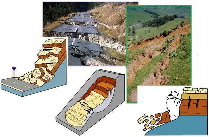
"The causes of landslides are not a mystery to mankind. Layers of rock and soil such that rain running along a clay or rock layer can create a slippery surface for the weight of the layers above it is a common cause. A rock jumble from previous mountain building, broken or fractured rock easily dislodged. We have stated that the earthquakes man experiences between the periodic passages of Planet X can be considered aftershocks from the last passage, and this is true of landslides also. Mountain building rumples the landscape, so the land is not flat but has steep ravines and hill sides. Older mountain ranges are recognized for their rounded or smoothed appearance, because of frequent landslides distributing the rubble.

"As we approach another passage, another Pole Shift, the pace of landslides has picked up. Why would this be? Plates under pressure will put pressure on regions that contain rumpled hillsides and deep ravines, as these give more readily than strictly flat land, thus act as a weak link. In addition, due to the wobble, the weather has gotten more extreme, with drought and deluge increasing in extremes. Dry ground, suddenly flooded with rainwater needing to seek its level as runoff, will create internal water slides between the rock and soil layers that constitute the rumpled hillsides. Is there an early warning system that mankind could use? The trembles that soil about to slide emits could be detected, yes. These are not earthquakes, and have their own frequency. "

ZetaTalk Chat Q&A: March 22, 2014
Views: 122500

Comment

You need to be a member of Earth Changes and the Pole Shift to add comments!

Join Earth Changes and the Pole Shift

Comment by Derrick Johnson on August 10, 2015 at 6:41am

Huge cliff landslide on road in China

Watch the moment a cliff collapses as huge chunks of rock fall onto a road in China

Dramatic footage has emerged from China of a huge landslide onto a provincial road - triggered by heavy rainfall.

The video, captured on a main road in Qinghai Province, shows a small amount of earth crashing down onto the road before the entire slope collapses, showering rocks and dust.

The road is covered in rocks as the landslide crashes down (Newsflare / China-Live)

According to local reports the road had already been closed after some loose pieces of rock fell onto it - with the main landslide injuring nobody.

The clearance and repairs to the roadway took twenty hours.

Huge chunks of rock fall onto the road (Newsflare / China-Live)

Watch the moment it was caught on camera as the landslide crashes onto the road.

Source: http://www.telegraph.co.uk/news/worldnews/asia/china/11783070/Huge-... 

Comment by Howard on July 30, 2015 at 5:26am

Japanese Mountainside Collapses in Epic Landslide (Jul 28)

The unbelievable moment an entire side of a mountain came crashing down in an epic landslide has been recorded by Japanese broadcaster NTV.

Cameras were rolling Tuesday in Kagoshima Prefecture as the third landslide in a month forced residents of the small, nearby town of Tarumizu to run for their lives.

Footage also showed a river of mud surge its way through town but no injuries or fatalities were reported.

Source

http://globalnews.ca/news/2137543/cameras-rolling-as-japanese-mount...

Comment by Mark on July 28, 2015 at 6:28am

2 die in Cox's Bazar landslip

http://www.thefinancialexpress-bd.com/2015/07/27/101741

A landslide, caused by heavy rains, in Cox’s Bazar early on Monday has left at least two people dead. Two others were rescued but three others were still missing after the landslide hit the South Baharchhara area of Cox's Bazar around 2am, officials said. The fire service and army are conducting rescue operation at South Baharchhara. Cox’s Bazar Fire Service Operation Officer Abdul Majid said that the huge chunks of earth buried four houses at the bottom of the hill. Two bodies were recovered while two were rescued alive until now, he said, according to bdnews24.com.

Comment by Mark on July 25, 2015 at 6:25am

From earthquakes to landslides and potential floods in Nepal

http://news.usc.edu/84235/from-earthquakes-to-landslides-and-potent...

For Nepal, the hits just keep coming.

It started with a magnitude 7.8 earthquake in April, which led to aftershocks that are ongoing even now. All of the shaking triggered what are estimated to be more than 5,000 landslides, frequently with devastating consequences, and now material from these landslides is filling up riverbeds with sediment.

With the advent of the monsoon season — during which more than 40 inches of rain can be expected to drench Nepal from June through September — these rivers are at risk of becoming choked with landslide-derived sediment, potentially flooding low-lying areas and washing away pieces of the nation’s already hard-hit infrastructure.

“A lot of people live in the mountains in a country like Nepal, and much of their economy depends on mountain tourism. If persistent flooding makes it hard to rebuild key infrastructure, that could really challenge the country,” said Joshua West, assistant professor of earth sciences at the USC Dornsife College of Letters, Arts and Sciences, who traveled to Nepal in June to conduct an assessment of the condition of the rivers and landslides before the rains began.

He already happened to be in the region studying the effects of the 2008 Wenchuan quake, a 7.9 temblor that wracked China’s Sichuan Province and left nearly 70,000 dead. The subsequent landslides killed dozens, and their effects continue to plague the region.

Comment by KM on July 24, 2015 at 4:20pm

http://www.vancouversun.com/business/fp/yourmoney/lake+falling+clif...

This lake is about to fall off a cliff in the Northwest Territories as permafrost melts

This lake is about to fall off a cliff in the Northwest Territories as permafrost melts
 

This small unnamed lake, shown in this undated University of Alberta handout photo, in the Northwest Territories is expected to burst through the rapidly shrinking land holding it in over the next few months and plunge 200 metres into the Mackenzie Valley.

Some time in the next few months, a small northern lake will burst through the shrinking earthen rampart holding it back and fall off a cliff.

"It's got a ways to travel," says Steve Kokelj of the Northwest Territories Geological Survey. "This lake happens to be perched about 600 feet above the Mackenzie Valley."

It will be spectacular, but it won't be unique. Melting permafrost caused by climate change is causing changes in the northern landscape on a scale not seen since the end of the last ice age, says Kokelj.

"It's changing the form of the landscape in ways that have not impacted this environment in the last several hundreds of thousands of years."

The doomed lake, which has no name and sits in the northern corner of the territory near the community of Fort McPherson, is a victim of the region's geology and changing climate.

Permafrost in this part of the N.W.T. contains a high percentage of ice in headwalls, which can be up to 30 metres thick. That ice has been there since the retreat of the Laurentide Ice Sheet 20,000 years ago.

Comment by Mark on July 20, 2015 at 8:00pm

Two killed in landslide on Mumbai-Pune Expressway

http://www.thehindu.com/news/cities/mumbai/landslip-on-mumbaipune-e...

Two persons were killed and two others seriously injured when the cars they were travelling in were hit by a landslide on the Mumbai-Pune Expressway at noon on Sunday, the expressway control room said.

The incident took place near the Adoshi tunnel at Khopoli in Raigad district. The two injured women were rushed to the Lokmanya Hospital in Pune.

Comment by Mark on July 19, 2015 at 6:19pm

Red alert as Varunavat Mountain splits, landslides feared

http://zeenews.india.com/news/uttarakhand/red-alert-as-varunavat-mo...

Uttarkashi: Indira Colony and Jansu residents in India`s Uttarkashi region are expecting a landslide in the wake of the Varunavat Mountain developing a 25-meter-long and 4-5 -inch wide crack.

Houses situated at the foot of the mountain are specially under high risk.

District Magistrate Indudhar Bodai said he is aware of the situation and has issued orders to block the road in front of the Tamba Khani tunnel.A few cracks have also reportedly occurred on stairs constructed for treatment of the mountain.

A report for the same has been sent to the administration, following which two teams of geo-scientists have been deployed for surveying the damage at the spot, and to recommend appropriate solutions.

Comment by Derrick Johnson on July 16, 2015 at 7:41am

UPDATE: WV 82 remains closed for emergency cleanup of landslide

Posted: Wednesday, July 15, 2015 3:24 pm

WV 82 remains closed 2.6 miles East of Birch River due to a rock slide that occurred Monday, July 13. The West Virginia Division of Highways has been working diligently to remove rock and debris from the roadway. Additional storms on Monday, July 13 and Tuesday, July 14 hindered cleanup efforts and crews were forced to stop work due to safety concerns.

The WVDOH has removed approximately 2,500 tons of rock from the roadway, and workers estimate an additional 2,500 tons is left to haul away. 

WV 82 at the site of the slide is expected to reopen during the evening hours of Friday. Traffic is advised to follow WV 20 to Craigsville and WV 55 to US 19 at Muddlety.

This section of WV 82 was closed on Monday by a large landslide caused by heavy rain. State forces are working to remove the rocks and debris. The road is scheduled to re-open to one-lane traffic on this evening at 6:00 p.m.

Traffic is advised to follow WV 20 to Craigsville and WV 55 to US 19 at Muddlety. WVDOH expresses their apologies for the inconvenience this may cause the citizens and guests to the area. The detour is necessary until the rocks and debris are removed from the roadway for the public’s safety.

Motorists are asked to observe all traffic control signs and devices and use caution while traveling through the work zone once it is re-opened to one-lane traffic. Delays are expected; therefore, motorists should allow additional time for their commute or seek alternate routes.

Source: http://www.register-herald.com/news/update-wv-remains-closed-for-em... 

Comment by Howard on July 5, 2015 at 10:03pm

Nepal Quakes Trigger 5,600 Landslides (Jun 19)

Approximately 5,600 landslides have resulted from the 25 April Gorkha and 12 May Dolakha earthquakes, as well as reactivations of landslides present before these earthquakes occurred.

Landsliding is limited to a zone that runs east-west, approximately parallel to the transition between the Lesser and High Himalaya. This zone includes parts of the districts of Gorkha, Dhading, Nuwakot, Rasuwa, Sindhupalchok, Dolakha, Ramechhap, and Khavre.

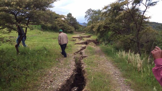
There have also been numerous reports of cracked ground in the affected areas.

Source

http://ewf.nerc.ac.uk/2015/06/30/updated-30-june-landslide-inventor...

Comment by jorge namour on July 5, 2015 at 2:38pm

ISERE / HIGH-ALPS: the mountain began to collapse in the lake Chambon
FRANCE

with our correspondent in Isère Serge Pueyo | 04 Jul 2015

http://www.leparisien.fr/faits-divers/isere-la-sirene-annonce-la-ch...

https://translate.google.com.ar/translate?sl=fr&tl=en&js=y&...

Saturday the regular departures of several hundred m3 were recorded in early evening

Mizoën (Isère) yesterday. A section of this mountain will collapse into the lake, which could cause a wave of 20 m on the water.

That's it, the mountain began to crumble Saturday night around 8:45 p.m. in the lake Chambon. According to witnesses on site, a slope is currently fracture.

n the afternoon, at 16:25, the siren sounded to announce that hundreds of thousands of cubic meters of rock must soon fall into the lake.

A fall that could trigger a wave of 20 meters high.

On 10 April, the authorities find disturbing cracks on the roof of the tunnel Chambon in Mizoën (Isère) in the Massif de l'Oisans. This is the result of a landslide over on a slope of the mountain. The tunnel and the 1091 county road, which connects Grenoble to Briançon, are closed. Tourism professionals from the Grave Valley saw their sales collapse. Residents must walk almost an hour on a trail or take boats in place of the lake to be able to work on the other side of the tunnel. On June 23, the experts note that the landslide accelerates dangerously. The work is then stopped in the tunnel.

hursday new alert. Geologists announce that the collapse of an area 280 m long, 100 m wide and 25 m thick, on a slope of 50 degrees, is Friday, Saturday or Sunday. These are 100 000 to 800 000 m 3 which will slide into the lake Chambon. No harm to the population because the banks are not urbanized.

The wave should not damage the dam

In the village of Freney-d'Oisans, under the dam, residents are worried, "he The dam will withstand this wave. If he gives in, we're all dead " , assures Isabelle. Officials of EDF want to be reassuring: "The sliding axis opposed to the dam. The wave will head to the opposite shore. At the dam, it is expected a wave of only 3 to 4 m, which will not damage the book. 35 m currently separate the current level of the water and the dam crest, "explains Stéphane Toletti, director of the hydraulic group Ecrins-Vercors.

Since Friday, police patrols crisscross the area to prohibit hikers, fishermen and curious, access to banks. CONTINUE...

UPDATDE

https://translate.google.com.ar/translate?sl=fr&tl=en&js=y&...

ISERE / HIGH-ALPS Chambon lake: part of the land broke away from the mountain JULY 5 2015

The massive collapse of the mountain has not yet occurred but regular departures of several hundred m3 have already occurred since Saturday ...

MAP: https://en.wikipedia.org/wiki/Lac_du_Chambon

Lac du Chambon is a lake in Isère, Rhône-Alpes, France. At an elevation of 1040 m, its surface area is 1.4 km².

SEARCH PS Ning or Zetatalk

 
Search:

This free script provided by
JavaScript Kit

Donate

Donate to support Pole Shift ning costs. Thank you!

© 2025   Created by 0nin2migqvl32.   Powered by

Badges  |  Report an Issue  |  Terms of Service