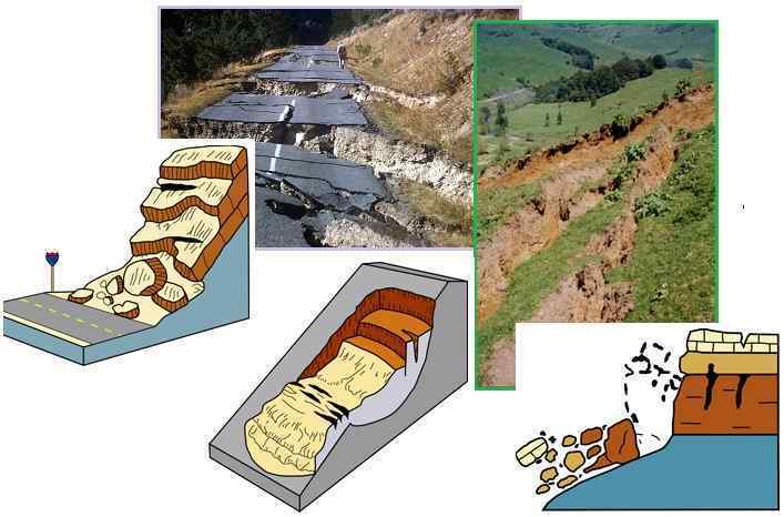
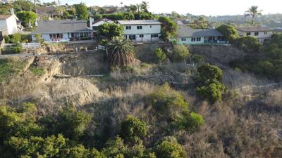
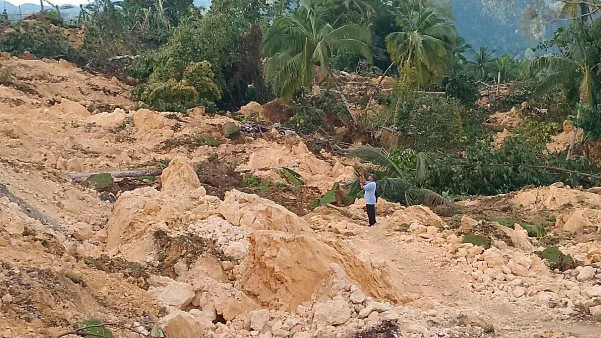
"The causes of landslides are not a mystery to mankind. Layers of rock and soil such that rain running along a clay or rock layer can create a slippery surface for the weight of the layers above it is a common cause. A rock jumble from previous mountain building, broken or fractured rock easily dislodged. We have stated that the earthquakes man experiences between the periodic passages of Planet X can be considered aftershocks from the last passage, and this is true of landslides also. Mountain building rumples the landscape, so the land is not flat but has steep ravines and hill sides. Older mountain ranges are recognized for their rounded or smoothed appearance, because of frequent landslides distributing the rubble.

"As we approach another passage, another Pole Shift, the pace of landslides has picked up. Why would this be? Plates under pressure will put pressure on regions that contain rumpled hillsides and deep ravines, as these give more readily than strictly flat land, thus act as a weak link. In addition, due to the wobble, the weather has gotten more extreme, with drought and deluge increasing in extremes. Dry ground, suddenly flooded with rainwater needing to seek its level as runoff, will create internal water slides between the rock and soil layers that constitute the rumpled hillsides. Is there an early warning system that mankind could use? The trembles that soil about to slide emits could be detected, yes. These are not earthquakes, and have their own frequency. "

ZetaTalk Chat Q&A: March 22, 2014

Views: 122496

Comment

You need to be a member of Earth Changes and the Pole Shift to add comments!

Join Earth Changes and the Pole Shift

Comment by Yvonne Lawson on May 1, 2024 at 7:02am

Floods/Landslides: 66 deaths reported in last 24 hours pushing death toll to 169- Kenya

Heavy rains pounding several parts of the country and devastating flash floods have left 169 people dead.

The government which gave an update on the situation Tuesday said in the last 24 hours 66 more people had died, 46 from the Mai Mahiu mudslide which has turned out to be one of the worst tragedies since the onset of the rains in March.

Nairobi, Tana River, West Pokot, and Homa Bay are adversely affected. Additionally, landslides and mudslides have impacted residents of Muranga and Nakuru Counties.

“Approximately 190,942 individuals have been affected by these natural disasters. We are actively carrying out search, rescue, and retrieval operations particularly in Nakuru due to the recent mudslide and have rescued 23 people in Garissa” said the Ministry.

The Kenya Meteorological Department has said the heavy rains will continue.

“Heavy rainfall events are likely to occur in some parts of the Highlands East and West of the Rift Valley, the Lake Victoria Basin, the Rift Valley, the South-eastern lowlands, North-western and North-eastern Kenya,” says the statement released by the Director of Meteorological Services, Dr. David Gikungu.

The Weatherman is further warning of landslides in areas with steep slopes where soils become saturated, he says that, visibility is likely to be reduced during heavy rainfall events and is advising road-users, aviators and boat operators to exercise caution as large waves and strong winds may affect marine activities.

Source: https://www.kbc.co.ke/govt-says-102-injured-while-91-are-missing/

Comment by Yvonne Lawson on April 14, 2024 at 6:43am

'We didn't hear a thing - the next thing we knew, the gardens were gone': Owners are too heartbroken to visit scene where deadly landslip turned their £1.4 million mansions to rubble. UK

The freak mudslide has left the pensioner homeowners feeling heartbroken after it caused their 'forever' homes to become perched precariously above a 50ft deep railway line

The neighbours of two mansions worth £1.4 million said they 'didn't hear a thing' while a deadly landslip turned two dream homes into rubble.

The freak mudslide has left the pensioner homeowners feeling heartbroken after it caused their 'forever' homes to become perched precariously above a 50ft deep railway line.

Now both properties have been officially condemned, leaving the owners homeless and their Millionaires' Row neighbours waiting for news about the future of their own properties.

The two houses  pictured before the demolition. They were both perched directly above the Ilkley to Bradford line, which serves four local schools

The two houses  pictured before the demolition. They were both perched directly above the Ilkley to Bradford line, which serves four local schools

An aerial view of the houses (at the top of the image) and the railway line below prior to the demolition

No heard the gardens collapse. Mick Spencer, who lives on the property on the other side of the two condemned houses, said: 'There was just a slight tremor. We are not affected – or so we understand. But it is devastating for the people who had been here 30 odd years.

Stephen and Lynne Coverdale have lived in their property on the exclusive Woodlands Estate in Baildon, West Yorkshire, since it was built in 1986, while David and Fiona Lerner moved in next door in 2009 after buying their home for £385,000.

Both homes had more than doubled in value since then but neither couple had any plans to sell - until the dramatic turn of events in February. 

Read more: https://www.dailymail.co.uk/news/article-13304023/Owners-heartbroke...

Comment by Tracie Crespo on April 2, 2024 at 3:52pm

2 people rescued from Humber River following landslide in Corner Brook

Truck swept into the water after hill gives way on Riverside Drive

A picture of a landslide from across a river.
A photo from across the Humber River shows a section of the hill above Riverside Drive has collapsed. (Submitted by Terri-Lynn Suley)

Four people in western Newfoundland narrowly escaped disaster in the early hours of Tuesday morning, when a landslide struck their vehicles on Riverside Drive in Corner Brook. 

A truck carrying two people was swept into the Humber River, while another car carrying two people was struck by falling rocks and dirt.

Members of the Royal Newfoundland Constabulary were first on scene, and went into the water to rescue the passengers of the truck.

"Everyone is OK," said Todd Flynn, director of protective services for the City of Corner Brook. 

"Obviously the people pushed into the water inside the truck were brought to the hospital for treatment for minor injuries, but they are OK."

A car with damage to the front end and a pile of earth in front of it.
This sedan was struck by dirt and debris from a landslide on Riverside Drive in Corner Brook on Tuesday morning. (Submitted by Dawn Aylward)

The west coast of Newfoundland was hammered by heavy rainfall and melting snow over the long weekend. Corner Brook received 121 mm of rain in a 96-hour period.

There were washouts in other western communities, including Cape St. George on the Port au Port Peninsula, where flooding washed culverts away and destroyed roads in the small community.

The landslide happened just after midnight. Pictures from the area show the hillside across the road from the river gave way, leading to a mess of earth falling down across the road. One car appears to have sustained damage to its front. Flynn said the truck is underwater and out of sight.

It's believed only two vehicles and four people were struck by the landslide, but Flynn said divers from the RCMP will scour the area to ensure there were no other victims.

The slide happened between the Atlantic Concrete and Stan Dawe properties. The road closure is more broad, however, encompassing all of Riverside Road from Route 440 to Humber Road.

A sign that says "no through traffic" standing on a road.
Riverside Drive in Corner Brook was closed in the early hours of Tuesday morning, due to a landslide. (Bernice Hillier/CBC)

Flynn said the closure could last a long time.

"Our big concern right now is what else is going to come down," he said. "So we are bringing in an engineering crew to take a look and see if we can figure out what's going on here. And the thing is the road is going to be closed until we resolve that, and make sure it's safe. So we're working on it, but it will take time to figure this one out."

Another section of Riverside Drive was closed on Friday for a different landslide. Flynn said they felt comfortable opening the road after checking out the scene, and couldn't have predicted that another area a few hundred metres away would cave in days later.

"We had no idea, or even suspected that the hill was compromised in any way," he said. "It's never happened there before, as far as we know."

https://www.cbc.ca/news/canada/newfoundland-labrador/corner-brook-r...

Comment by Yvonne Lawson on March 16, 2024 at 9:48am

Homeowners left living on 'cliff edge' fear their homes will disappear in landslide gradually destroying their gardens - with one saying 'I've seen trees and two sheds disappear and it keeps getting worse'

Residents of the town Cradley Heath in the West Midlands (UK) say they might as well be living by the coast as they watch their gardens slowly crumbly into a huge chasm behind their garden fences. 

So far, the landslip next to High Haden Crescent has claimed two garden sheds and destroyed multiple trees as it continues to get bigger every time it rains.

Now, the concerned homeowners are worried about the safety of their families as recent bad weather has caused even more land to crumble. 

Residents of High Haden Crescent in Cradley Heath in the West Midlands say they might as well be living by the coast as they watch their gardens slowly crumbly into a huge landslip which has been growing for the last 30 years

Residents of High Haden Crescent in Cradley Heath in the West Midlands say they might as well be living by the coast as they watch their gardens slowly crumbly into a huge landslip which has been growing for the last 30 years

Gardens on High Haden Crescent  now back onto a sheer drop due to a landslip. The concerned homeowners are worried about the safety of their families as recent bad weather has caused even more land to crumble

Another homeowner Henry Robinson, 55, said: 'It feels like you're living by the coast and one of those people worried about their house falling into the sea.

'There you sort of know what you're getting into but we couldn't be further away from the sea in the West Midlands, so it's been a real shock and a concern.

'I don't let my grandkids play out near the bottom of the garden, it's just too dangerous.

Read more:  https://www.dailymail.co.uk/news/article-13201315/Homeowners-left-l...    

Comment by Yvonne Lawson on February 29, 2024 at 4:02am

How Britain's homes are slipping into the sea: Residents in Norfolk, Kent, East Sussex and Essex fear their clifftop houses could topple into the water or over cliffs at any moment amid fears recent storms are speeding up perilous coastal erosion

Homes across Britain are sliding into the sea as the cliffs beneath them rapidly erode away - amid fears recent storms are speeding up perilous coastal erosion.  

Families in Norfolk, East Sussex, Essex and East Yorkshire are terrified that their houses could plunge hundreds of feet into the water at any moment as the nation's weather becomes increasingly unpredictable due to climate change

More than 2,200 houses are predicted to be lost by the year 2100, with coastal communities in Cornwall, Cumbria, Dorset, East Yorkshire, Essex, the Isle of Wight, Kent, Northumberland, Norfolk and Sussex most at risk, according to Rightmove. 

A house pictured today in Folkestone, Kent, which has been left perilously close to a cliff edge following a major landslide

A drone photo taken today that shows what remains of the garden of Dr Ralitsa Hiteva in St Leonards, East Sussex

SKIPSEA: On the Holderness Coast, dozens of second and holiday homes on the Skipsea Sands caravan park are now within 20ft of the 60ft drop down to the rocks

COASTAL EROSION: THE AREAS MOST AT RISK BY 2040
COASTAL AREA:  LAND ERODED AFTER 20 YEARS: 
1. Happisburgh, Norfolk 318 feet (97m)
2. Kessingland, Suffolk  230 feet (70m) 
3. Hornsea, East Riding of Yorkshire  223 feet (68m) 
4. Withernsea, East Riding of Yorkshire  200 feet (61m) 
5. Sunderland, Tyne & Wear  131 feet (40m) 
6. Filey, North Yorkshire  131 feet (40m) 
7. Camber, East Sussex  131 feet (40m) 

Source: https://www.dailymail.co.uk/news/article-13136037/homes-slipping-se...

Comment by Yvonne Lawson on December 12, 2023 at 6:11am

Huge landslide on Isle of Wight, UK sees around 20 homes evacuated just two weeks before Christmas - as police tell locals to stay away

  • Images show the devastation caused by the unexpected landslip at Bonchurch 

Some homes have been left perilously close to the edge of the ridge after part of the area collapsed

Council officers are still assessing the risk of further landslips after the incident on Sunday night on the south coast of the Isle of Wight

A huge landslide on the Isle of Wight has left dozens of people homeless in the weeks before Christmas - with some houses inches from total destruction.

Aerial photographs show the devastation at Bonchurch, near Ventnor on the island's southern edge.

Huge chunks of the cliff have collapsed, with some homes perilously close to following them down the ridge towards the sea - prompting the mass evacuation by council officers and police.

The collapse, which happened at 9.20pm on Sunday December 10, saw a cafe, car park and toilet destroyed.

Roads have been closed and locals have been told to avoid the area while council officers assess the risk of further landslips.

Read more: https://www.dailymail.co.uk/news/article-12852129/huge-landslide-Is...

Comment by Derrick Johnson on July 10, 2023 at 6:48am

Massive landslide forces 12 families to evacuate from their 'visibly leaning' homes next to a canyon in LA as SoCal Edison shuts off power and gas company rushes to the scene

  • A dozen homes in the LA suburb of Rolling Hills were evacuated as they appeared to be on the verge of collapsing into a nearby canyon
  • Police, fire and utility company officials were on scene Sunday morning to assist with the evacuation of 16 residents who had 20 minutes to grab belongings
  • Residents in the area say they noticed cracking and popping sounds starting Thursday and by Sunday night the homes were essentially destroyed

A dozen homes in a Los Angeles suburb were evacuated on Saturday night after the houses appeared to be on the verge of collapse and about to tumble into the canyon behind them.

The foundations of homes situated along Peartree Lane in Rolling Hills Estates in LA County suddenly shifted following a major landslide.  

Police, fire and utility company officials were on the scene Sunday morning to assist with the evacuation, which saw a total of 16 residents being forced to flee their homes. 

SoCal Edison shut off power in the area, and Southern California Gas Company crews were called in to make sure no gas lines had ruptured.

Residents in the area reported they started hearing cracking and popping noises as early as Thursday. The neighborhood was first built in 1978 and had been solid until this weekend.

'We thought something was amidst because all through the day and night we heard cracks in the house,' said one evacuated, Weber Yen. 'And then, you know, the frequency became more and more frequent.' 

By Sunday afternoon, LA County Supervisor Janice Hahn said the homes on Peartree Lane were 'completely destroyed.'

'This is just devastating for these residents,' she said.

The ordeal began when cracks were discovered in one of the homes, which then saw crews investigating other nearby structures. 

Unfortunately, the damage appeared to spread from one home to the next leading all 12 to be evacuated.

'They discovered cracks along the structure of one building, and upon further investigation they realized that there were some cracks running through one home specifically, and it was progressing to the next home,' LA fire Captain Chiyoshi Hasegawa told KTLA

'We got additional specialists to assess the situation, and after assessing the situation we realized there were 12 homes that had received damage either inside of their home or outside of the structure.'

'I was up actually, most of the night, worrying about what's going to happen,' said Mimi Borg to ABC 7. 'They told us that they would knock on our door if we had to be evacuated.' 

One woman who lives on the street but whose home was not affected because it sits on the side opposite the canyon explained how she was woken up by the commotion.

'I was sleeping…[I woke up to] a lot of noises and fire trucks, I was very concerned,' she said. 'Then I was up most of the night worrying about what's going to happen.

'My home is fine; we are on the ocean side…it's the canyon side that's having the problems. They told us they were not going to [evacuate us] if they didn't need to,' she added.

No injuries were reported. Geologists are now conducting an investigation into what caused the landslide. 

https://www.dailymail.co.uk/news/article-12281131/Massive-landslide... 

Comment by KM on June 29, 2023 at 3:13pm

https://abcnews.go.com/International/wireStory/4-dead-900-evacuated...

4 dead, 900 evacuated after landslides triggered by flash floods in southwest China

Four people have died and three others are missing after landslides hit a county in China’s southwestern Sichuan province, leading authorities to evacuate more than 900 people

China Landslide
In this photo released by China's Xinhua News Agency, rescuers work at a landslide site in Miansi Township of Wenchuan County in southwestern China's Sichuan Province, Tuesday, June 27, 2023. Several people were found dead..


TAIPEI, Taiwan -- Four people died and three others were missing after landslides hit a county in China’s southwestern Sichuan province on Tuesday, leading authorities to evacuate more than 900 people.

The landslides, triggered by flash floods, occurred in Miansi and Weizhou townships in Wenchuan county, according to the county’s emergency management bureau.

More than 400 rescuers searched for missing people after the landslides hit early Tuesday, state media said. Four people, including a couple from Miansi township, were found dead later on Tuesday, while three others remained missing, according to official broadcaster CCTV.

More than 900 people in the area were evacuated, Xinhua news agency reported.

Wenchuan county was the site of a devastating earthquake in 2008 that claimed at least 69,000 lives, according to the Chinese government.

China is experiencing extreme weather patterns, with heavy rainfall in southern regions and record-breaking temperatures in the north including in the capital, Beijing.

Comment by KM on June 12, 2023 at 3:02pm

Source

Videos: Massive Austrian Alp summit crumbles to the ground during giant ridge collapse – Fluchthorn/Galtür lost 100 meters (328 feet) elevation within seconds!

On Sunday afternoon, at around 3:20 p.m., huge masses of rock broke off from the north-western flank of the southern Flüchthorn massif. Impressive amounts of rubble collapsed in a loud roar. According to first estimates, the summit is now around 100 meters lower after the landslide.

Boulders also thundered in the direction of Jamtalhütte. However, the refuge itself was not damaged. According to first indications, there are neither injuries nor damage. The police and the mountain rescue service assume that at the time of the collapse there were no people on or directly below the Flughorn.

The first (left) video in the Tweet is the same as that above. The second video (right) shows you the extent of the collapse. The mountain lost an amazing 100 meters or 328 feet in elevation!

Nothing is known about the cause of the landslide. The snowmelt has picked up speed in recent weeks: This in combination with the frequent thunderstorms, may have destabilized the mountain flank. A lot of meltwater and rainwater is perfectly normal at this time of year. There is no indication that climate change is behing the giant rockslide.

This is the result of the amjor ridge collapse a bit below:

100 meters (328 feet) elevation lost in seconds

The Flüchthorn is located in the border area between Austria and Switzerland and belongs to the Silvretta, a well-known alpine region with many mountains over 3000 meters. At 3,398 meters, the southern summit of the Flughorn was the second highest peak in the Silvretta after the Piz Linard (3,410 meters).

According to first estimates, the summit is now around 100 meters lower after the landslide. A new summit cross can probably not be attached for the time being, as further collapses are imminent.

A nearby mountain, the Kleiner Piz Buin (3255 meters), is also at risk of a giant landslide. The mountain is therefore under close observation and there are discussions about relocating the normal ascending route. A nearby Alpine Club hut was closed in winter due to the high risk.

Comment by Yvonne Lawson on May 16, 2023 at 8:00am

'It is a question of a few days or a couple of weeks before the side of the mountain will fall': Rocks and debris come crashing down and threaten to completely collapse and DESTROY Swiss village

Pictured: An overview of the village of Brienz and its church in front of the zone of rockslide, eastern canton of Graubunden, Switzerland, May 11, 2023. The village has been evacuated as officials anticipate disaster

This is the dramatic moment rocks and debris hurtle at speed down a mountain threatening to engulf an entire Swiss village below.

Several boulders broke free from the top and came crashing down in a stomach-churning crescendo of noise that echoed across the picturesque valley.

Plumes of dust were thrown into the air as the rocks - cartwheeling as if in a cartoon - rolled down the slope and headed to the now evacuated village of Brienz.

Swiss authorities are preparing for an 'imminent' danger for a village that lies at the foot of a mountain where two million cubic tons of rock threaten to engulf it.

Residents and livestock were ordered out of Brienz in central Switz... because of the impending danger and a total exclusion zone is now in force.

Swiss authorities have ordered residents to abandon a tiny mountain village in the eastern canton of Graubunden because of fears it could soon be buried beneath the collapsing mountainside, seen looming over the village

Officials have said the area is now moving from the 'red' phase into the 'blue' phase of the emergency where an 'event that may endanger the village is imminent'.

A stark warning on the local regional council website read:' The blue phase means ' Stay away from the entire Brienz slide area. An event is imminent.'

Today civil protection chiefs and police manned roadblocks at all access points to the picturesque village which has breathtaking views over a nearby valley.

MailOnline watched as just before 2pm local time several boulders slipped down the side of the Lenzerhorn mountain and came crashing down, sending dust into the sky.

A deafening roar could be heard as the huge rocks bounced downwards at a frightening speed towards the centre of Brienz which was obscured by trees.

Christian Gartmann, a spokesman for the local Albula-Alvara council told MailOnline:' Since the total evacuation of the village on Friday we have detected a movement of around 15 cm a day, of the mountain towards Brienz.

'The situation is very dangerous and although we have no idea when the side of the mountain will fall it is imminent and a question of a few days or a couple of weeks at the most.

'That's why the village has been completely excavated - there are no people left there and there is no livestock, the place is deserted, and it has to be because of the situation. At the moment we are in the red phase but we are preparing for a possible move into the more dangerous blue phase.'

Brienz lies at 3,800ft above sea level and is just 40 minutes from the town of Davos which holds the yearly World Economic Forum - a power meeting of world leaders and business chiefs.

Officials say that a 'handful' of houses in Brienz have already been damaged by subsidence and that the most likely outcome is the rockfall will be in small chunks.

However Mr Gartmann said there was a '10% chance' the entire mountainside - two million cubic tons - could come down on to Brienz pulverising everything in its path.

Read more and video :  https://www.dailymail.co.uk/news/article-12085957/Rocks-debris-come...

SEARCH PS Ning or Zetatalk

 
Search:

This free script provided by
JavaScript Kit

Donate

Donate to support Pole Shift ning costs. Thank you!

© 2025   Created by 0nin2migqvl32.   Powered by

Badges  |  Report an Issue  |  Terms of Service