Weather:

Weather Wobble

Jet Stream tornados

Siberian Freeze Weather Wobble

Wild weather , [2]

Wobble Clouds

Hurricane development

Violent Push

Weather & ocean currents

Europe Weather

Tides and Whirlpools:

Storm Clash whirlpools

Lurch of earth

Tides , [2]

Whirlpools

Wobble Sloshing


"We warned at the start of ZetaTalk, in 1995, that unpredictable weather extremes, switching about from drought to deluge, would occur and increase on a lineal basis up until the pole shift. Where this occurred steadily, it has only recently become undeniable. ZetaTalk, and only ZetaTalk, warned of these weather changes, at that early date. Our early warnings spoke to the issue of global heating from the core outward, hardly Global Warming, a surface or atmospheric issue, but caused by consternation in the core. Affected by the approach of Planet X, which was by then starting to zoom rapidly toward the inner solar system for its periodic passage, the core was churning, melting the permafrost and glaciers and riling up volcanoes. When the passage did not occur as expected in 2003 because Planet X had stalled in the inner solar system, we explained the increasing weather irregularities in the context of the global wobble that had ensued - weather wobbles where the Earth is suddenly forced under air masses, churning them. This evolved by 2005 into a looping jet stream, loops breaking away and turning like a tornado to affect the air masses underneath. Meanwhile, on Planet Earth, droughts had become more intractable and deluges positively frightening, temperature swings bringing snow in summer in the tropics and searing heat in Artic regions, with the violence of storms increasing in number and ferocity."

ZETATALK


From the ZetaTalk Chat Q&A for February 4, 2012:


The wobble seems to have changed, as the temperature in Europe suddenly plunged after being like an early Spring, Alaska has its coldest temps ever while the US and much of Canada is having an extremely mild winter. India went from fatal cold spell to balmy again. Has the Earth changed position vs a vs Planet X to cause this? [and from another] Bitter cold records broken in Alaska - all time coldest record nearly broken, but Murphy's Law intervenes [Jan 30] http://wattsupwiththat.com/2012/01/30/bitter-cold-records-broken-in-alaska Jim River, AK closed in on the all time record coldest temperature of -80°F set in 1971, which is not only the Alaska all-time record, but the record for the entire United States. Unfortunately, it seems the battery died in the weather station just at the critical moment. While the continental USA has a mild winter and has set a number of high temperature records in the last week and pundits ponder whether they will be blaming the dreaded "global warming" for those temperatures, Alaska and Canada have been suffering through some of the coldest temperatures on record during the last week.

There has been no change in the wobble pattern, the wobble has merely become more severe. Nancy noted a Figure 8 format when the Earth wobble first became noticeable, in early 2005, after Planet X moved into the inner solar system at the end of 2003. The Figure 8 shifted along to the east a bit on the globe between 2005 and 2009, (the last time Nancy took its measure) as Planet X came closer to the Earth, encountering the magnetic N Pole with a violent push earlier in the day. But the pattern of the Figure 8 remained essentially the same. So what changed recently that the weather patterns became noticeably different in late January, 2012?

The N Pole is pushed away when it comes over the horizon, when the noon Sun is centered over the Pacific. This regularly puts Alaska under colder air, with less sunlight, and thus the historically low temps there this January, 2012 as the wobble has gotten stronger. But by the time the Sun is positioned over India, the N Pole has swung during the Figure 8 so the globe tilts, and this tilt is visible in the weather maps from Asia. The tilt has forced the globe under the hot air closer to the Equator, warming the land along a discernable tilt demarcation line.

The next loop of the Figure 8 swings the globe so that the N Pole moves in the other direction, putting the globe again at a tilt but this time in the other direction. This tilt is discernable in weather maps of Europe, again along a diagonal line. Depending upon air pressure and temperature differences, the weather on either side of this diagonal line may be suddenly warm or suddenly cold. The tilt and diagonal line lingers to affect much of the US and Canada, but the Figure 8 changes at this point to be an up and down motion, pulling the geographic N Pole south so the US is experiencing a warmer than expected winter under a stronger Sun. Then the cycle repeats, with the magnetic N Pole of Earth pushed violently away again as the Sun is positioned over the Pacific.


From the ZetaTalk Chat Q&A for April 6, 2013:


Would the Zetas be able to let us know what is causing the early break-up of the Arctic Ice, the ice seems to have taken on a swirling pattern at the same time, would this be wobble related? [and from another] http://www.vancouversun.com/news/national/Canada+Arctic+cracks+spec... The ice in Canada’s western Arctic ripped open in a massive “fracturing event” this spring that spread like a wave across 1,000 kilometres of the Beaufort Sea. Huge leads of water – some more than 500 kilometres long and as much as 70 kilometres across – opened up from Alaska to Canada’s Arctic islands as the massive ice sheet cracked as it was pushed around by strong winds and currents. It took just seven days for the fractures to progress across the entire area from west to east. [and from another] http://earthobservatory.nasa.gov/IOTD/view.php?id=80752&src=iot... A high-pressure weather system was parked over the region, producing warmer temperatures and winds that flowed in a southwesterly direction. That fueled the Beaufort Gyre, a wind-driven ocean current that flows clockwise. The gyre was the key force pulling pieces of ice west past Point Barrow, the northern nub of Alaska that protrudes into the Beaufort Sea.


The Figure 8 formed by the N Pole during the daily Earth wobble has shifted somewhat to the East, due to Planet X positioned more to the right of the Earth during its approach. This was anticipated, and well described in ZetaTalk, the Earth crowding to the left in the cup to escape the approach of Planet X, so the angle between these two planets would change slightly. This shift of the Figure 8 to the East is due to the push against the Earth’s magnetic N Pole occurring sooner each day than prior. Thus instead of occurring when the Sun is high over the Pacific, over New Zealand, it is now occurring when the Sun is high over Alaska. All the wobble points have shifted eastward accordingly.

This has brought a lingering Winter to the western US, and a changed sloshing pattern to the Arctic waters. Instead of Pacific waters being pushed through the Bering Straits into the Arctic when the polar push occurs, the wobble is swinging the Arctic to the right, and then later to the left, creating a circular motion in the waters trapped in the Arctic. Since the Earth rotates counterclockwise, the motion also takes this path. This is yet another piece of evidence that the establishment is hard pressed to explain. They are attempting to ascribe this to high pressure and wind, all of which are not new to the Arctic, but this circular early breakup of ice in the Arctic is new.

Views: 629468

Comment

You need to be a member of Earth Changes and the Pole Shift to add comments!

Join Earth Changes and the Pole Shift

Comment by SongStar101 on October 25, 2017 at 10:29am

Fire loss total surges to 8,400 structures in Northern California

http://www.latimes.com/local/lanow/la-me-wildfires-devastation-2017...

The wine country wildfires destroyed at least 8,400 homes and other buildings, authorities said Monday, a significant increase in the already staggering property loss.

Efforts continued by firefighters to gain control of the fires and by searchers looking for more victims. The death toll as of Monday remained at 42, making the fire series the deadliest in California history. The estimate of structure losses jumped from 7,700 reported over the weekend.

Officials said 5,000 firefighters remain on the lines, battling 10 different fires across Northern California.

About 100,000 people were displaced by the fires, and some evacuees are wondering whether they can stay in the region for the long term.

---------------------------------------------------------------------------------

At evacuation centers, many ask whether their future is in Santa Rosa

http://www.latimes.com/local/lanow/la-me-santa-rosa-wildfire-future...

Sitting on a bed inside an evacuation center, Imelda Flores had nothing to do but think. Her Santa Rosa home had been spared by a massive wildfire, but her son’s caretaker wasn’t so lucky.

“I don’t know if I’ll be able to find another nurse now,” she said. “I don’t have anyone who can understand his situation.”

Her 12-year-old son, James Lopez, was born with one bad lung, a weak immune system and requires a machine to pump food into his stomach; if done improperly, it could lead to an infection. Because of his health problems, her son needs a nurse by his side at school.

Flores looked at James on the bed next to her. A blue face mask lay between them.

“I may need to go to school to personally feed him,” she said. “I may become his nurse.”

As firefighters anticipate full containment of the Sonoma County wildfires this week, residents like Flores are anxious about how they will find affordable housing while others find themselves overwhelmed at having to start over.

“We have an opportunity to move forward,” Flores said. “We didn’t lose our home, and I’m compelled to help others.”

The mother and son have been staying at the Grace Pavilion on the Sonoma County Fairgrounds for two weeks now. She said the first three days at the evacuation shelter were difficult.

“People were waking up screaming, some were crying, and some people would storm in here, desperately looking for relatives,” she said. “It was just difficult and sad.”

But amid the chaos, she said, Red Cross volunteers at the shelter helped ease her worries by providing them clothing and other essentials. She said Lopez’s doctor and nurses from UC San Francisco Medical Center came by to check on the young boy.

Though the shelter is now mostly empty, Flores said she has decided to stay longer because lingering smoke from the massive fires could endanger her son’s health.

“He is prone to getting sick,” she said. “A cold can turn into pneumonia.”

Even when things clear up, she feels she can’t let her guard down.

“He’ll still have to wear a mask a few more days,” she said.

There have been 18 large wildfires in Northern California, displacing about 100,000 people and destroying about 7,700 homes and other buildings since the blazes began Oct. 8, according to the California Department of Forestry and Fire Protection.

Some fires merged as more than 10,000 firefighters struggled to establish containment lines and prevent the spread of the flames.

On Thursday, light rain helped firefighters battle the flames, which have scorched more than 240,000 acres, killed 42 people and caused more than $1 billion worth of insured losses.

In Sonoma County, the Nuns fire was reported to be 90% contained Sunday evening after burning 56,556 acres; the Tubbs fire, which is the most destructive wildfire in California history, was 94% contained after burning 36,807 acres; and the 17,357-acre Pocket fire was 87% contained.

In Napa County, the Atlas fire was 93% contained Sunday evening after burning 51,624 acres and killing at least six people.

And in Mendocino and Lake counties, the 36,523-acre Redwood fire was 97% contained and the Sulphur fire 97% after burning 2,207 acres.

Across from the pavilion at the Sonoma County Fairgrounds, Terry Andrew, 63, sat with his girlfriend, Marjorie Roush, 59, and her mother, Marjorie Sparaco, 92, at a special Red Cross shelter set up for pet owners.

The couple said their mobile homes were spared, but they couldn’t return to the Journey’s End Mobile Home Park because there is no power, gas or water. Almost all of the park’s 160 homes were destroyed.

“It was sad going in there to see the mobile home park,” Roush said.

The couple said a neighbor had alerted them about the fast-moving fire encroaching from the Napa area. They didn’t think the fire would reach deep into town until Andrew woke up and saw the flames had gotten closer.

“I didn’t think we were going to get out,” Andrew said, adding that he had to help Roush move her mother, who uses a wheelchair, from the mobile trailer into a vehicle.

At the shelter, the couple said it’s been difficult having to lift her mother to use the restroom. Sometimes, her mother yells out to them whenever they’re away.

“She doesn’t know where she’s at and when we tell her, she forgets,” Roush said.

The couple have managed to find a two-bedroom home, which they say they will move into Monday; but they had to dip into their savings, taking out $5,000 to make first and last months’ rent. They said rent will be about $2,000 a month, leaving them with only $1,000 to work with from social security benefits.

They still have to buy furniture for their home and a T.V. for Roush.

“I love T.V.,” she said.

Lying on the ground, Andrew’s dog, Homer, slept, ignoring the loud parrot from across the room.

Nearby, Forrest Smith, 53, a paratransit bus driver for the city of Santa Rosa, lay on a cot while his dog, Jazz, licked his cheek.

“She doesn’t think I’m clean enough,” he said, smiling.

Smith was living in a hotel, trying to find a new place to live when the wildfire swept through the storage unit where he kept all his belongings.

“Whatever I have is in my truck,” he said.

On the day of the fire, Smith said he and other bus drivers help evacuate people from retirement homes. Smith, alone, helped evacuate six people. Since then, he hasn’t been working much. He’s volunteered at the shelter, cleaning cots, throwing out trash and doing anything else to keep his mind from thinking about his situation.

“How am I going to find a place for me and my dog,” he said.

Outside, sitting on a folded chair, Steve Champ, 61, who has been homeless for more than 10 years, could only feel sad. Unlike other residents, he lost his bicycle and an orange tent where he slept. He had a few photos of his family in a zip-lock bag that the fire destroyed.

“I have them up here though,” he said, tapping his head with his index finger.

Champ said he doesn’t know where to even begin. Having to start over is even harder when you’re homeless.

He said he had found a new sleeping place at Coffey Park when the wildfire swept through the neighborhood. The community was left in ruins. Also gone was Champ’s tent, which he considered home.

“I didn’t have a chance to grab anything,” he said.

Unlike other residents, Champ said he will have to seek help at homeless shelters and other religious organizations.

Until then, he said: “I’ll let God guide me — all of us.”

-------------------------------------------------------------------------

New Fire Danger Threatens to Worsen Most Disastrous Wildfire Season in California History

https://www.wunderground.com/cat6/new-fire-danger-threatens-worsen-...

A record-breaking heat wave will build over Southern California over the weekend and peak on Tuesday, bringing triple-digit temperatures that could set marks for the hottest temperatures ever recorded so late in the year in the Los Angeles area. Accompanying the heat will be the notorious Santa Ana winds, which will bring a multi-day period of critical fire danger, Saturday through Tuesday.

According to NOAA, the hottest temperatures ever recorded after October 23 in Southern California (along with the Weather Underground forecast for Tuesday) were:

105°F Riverside, 10/28/1915 (WU forecast for Tuesday: 100°F)
101°F LAX Airport, 11/1/1966 (WU forecast for Tuesday: 96°F)
101°F Longbeach, 11/1/1966 (WU forecast for Tuesday: 100°F)
100°F Downtown Los Angeles, 11/1/1966 (WU forecast for Tuesday: 101°F)
100°F Burbank/Glendale/Pasadena, 10/26/2003 (WU forecast for Tuesday: 99°F)
100°F San Diego, 11/4/2010 (WU forecast for Tuesday: 91°F)
99°F Bakersfield, 10/27/1906 (WU forecast for Tuesday: 90°F)

The heat wave and Santa Ana winds will be caused by a large near-record-strength dome of high pressure expected to settle in over the Great Basin, a few hundred miles northeast of Los Angeles. The difference in pressure between this high-pressure system and lower pressure over Southern California will drive gusty northeast winds over Southern California. Since these winds will originate over desert areas, they will be hot and dry. As the air descends from the mountains to the coast, the air will get hotter and drier, due to adiabatic compression—the process whereby the pressure on a parcel of air increases as it descends, decreasing its volume, and thus increasing its temperature as work is done on it.

Comment by Starr DiGiacomo on October 24, 2017 at 6:13pm

Historic flooding in the mountain town of Boone, NC

https://biggeekdad.com/2017/10/flooding-in-boone/


Flooding In Boone


A look at the flooding that occurred in Boone, NC on Monday, October 23, 2017, after a day of heavy rains. Filmed by Nelson Aerial Productions this aerial view of the flooding in Boone shows how quickly a few inches of rain can cause flooding when the rivers and creeks overflow. The flooding was more widespread than the Boone Mall parking lot which floods on a regular basis. A beautiful rainbow appeared over the mountains after the storm.

https://www.youtube.com/watch?v=W7giqSUqPqc

Comment by Derrick Johnson on October 24, 2017 at 6:20am

Rare red sprites in action: Dazzling footage shows mysterious electric tendrils lighting up the sky over Oklahoma

  • Red sprites are electrical bursts of light above highly active thunderstorms
  • They appear as red at higher altitudes and fade to blue at lower heights
  • One lucky videographer captured the phenomenon six times on October 6 
This month, people in Oklahoma have been treated to a stunning and extremely rare display - a red sprite lightning storm

This month, people in Oklahoma have been treated to a stunning and extremely rare display - a red sprite lightning storm.

The extraordinary weather occurrence is caused by electrical bursts of light above highly active thunderstorms, and appears as jellyfish-shaped clusters of red light.

Red sprites are rarely seen, yet one lucky videographer managed to catch the display six times during a storm earlier this month over Edmond, Oklahoma. 

On October 6, videographer Paul Smith headed outdoors with his camera to capture some of the lightening forks on film, but instead he managed to capture something far more remarkable.

Sprawled out in the sky intermittently appears a spectacular series of bright red, jellyfish-shaped clusters of light, an extraordinary weather occurrence known as a 'red sprite'.

The mysterious electrical bursts occur over highly active thunderstorms around 37 to 56 miles (50 to 60 kilometres) above Earth, and are rarely observed from land or space, due to their high altitudes and millisecond durations.

The stunning sight is captured not only once, but a staggering six times by Mr Smith, who was left 'stunned' by the magnificent encounter.

Mr Smith said: 'I've always been interested in unusual weather and uncommon natural phenomenon.

The extraordinary weather occurrence appears as jellyfish-shaped clusters of bright red light, and is caused by electrical bursts of light above highly active thunderstorms

The extraordinary weather occurrence appears as jellyfish-shaped clusters of bright red light, and is caused by electrical bursts of light above highly active thunderstorms

Sprawled out in the sky intermittently appears a spectacular series of bright red, jellyfish-shaped clusters of light, an extraordinary weather occurrence known as a 'red sprite'
The mysterious electrical bursts occur over highly active thunderstorms around 80 kilometres above Earth, and are rarely observed from land or space, due to their high altitudes and millisecond durations

Red sprites are rarely seen, yet one lucky videographer managed to catch the display six times during a storm earlier this month over Edmond, Oklahom

Source: http://www.dailymail.co.uk/sciencetech/article-5008797/Red-sprite-l... 

Comment by KM on October 23, 2017 at 2:41pm

https://weather.com/news/news/2017-10-22-typhoon-lan-tokyo-japan-ra...

Typhoon Lan Makes Landfall, Lashes Japan With 100+ MPH Winds

By Ada Carr

17 hours ago

weather.com


buffering
Lan Bringing High Winds and Rain to Japan
Typhoon Lan creating stormy conditions for much of Japan into the first part of the new week.

At a Glance

  • The storm made landfall on the country's main island of Honshu early Monday local time.
  • More than 381,000 were forced to evacuate their homes ahead of the storm's arrival.
  • At least five injuries from the effects of the storm have been reported.

Powerful Typhoon Lan made landfall in Japan early Monday local time, lashing the country's main island of Honshu with winds moving up to 105 mph. 

Injuries were reported and evacuations were ordered as torrential rain arrived in western Japan ahead of the storm.

At least five people sustained slight injuries from the effects of the storm, the Associated Press reports.

Evacuation orders were issued by officials of five local governments Sunday for roughly 5,600 homes, NHK reports. Another roughly 376,000 home were placed under evacuation orders by 70 local governments.

"I live alone and at night it's scary, so I came here as early as I could," a woman at an evacuation center told NHK in a statement obtained by Reuters.

(FORECAST: The Latest of Typhoon Lan)

Reports of damage have also already begun rolling in. 

A train driver in Osaka Prefecture was forced to apply the emergency brake when he came across a stretch of railroad that had been caved in, NHK reports. At least one passenger was injured by the abrupt stop. 

The storm has disrupted air and road travel. Airlines canceled more than 300 flights and rail services were interrupted throughout the country, according to Reuters. A power outage caused the failure of one train.

Wind gusts could be as high as 120 mph as Lan approaches Tokyo, with higher gusts in higher elevations.  


Comment by KM on October 22, 2017 at 2:01pm

http://newsday.co.tt/2017/10/19/flood-alert-stays-in-effect-tobago-...

SWAMPED

Residents of Rochard Road, Barrackpore, woke up to their entire road covered in water on Thursday morning.

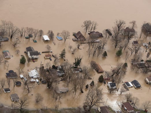
Large sections of Trinidad were swamped yesterday by flood waters which continued to rise in certain areas following over 24 hours of non-stop rainfall which began on Wednesday.

As a result, the Meteorological Service yesterday maintained its riverine flood alert for Trinidad especially as the Caroni River burst its banks shortly after midday. In its 9.12 am bulletin, the Met Office advised that as opposed to street and flash flooding, riverine flooding is more prolonged and widespread.

WATER EVERYWHERE: This photo, posted on social media yesterday, shows brown water covering all of Rochard Road in Barrackpore as large sections of Trinidad saw widespread flooding following heavy showers which started on Wednesday.

It also reported that water levels in some major rivers as well as their tributaries reached threshold levels overnight and the flood situation would be exacerbated by rainfall yesterday accompanied by gusty winds. “(With) the occurrence of high tide at 3.50 pm, the flooding situation is expected to continue for the next 12 to 24 hours in areas already affected,” the bulletin said.

SEABRIDGE AFFECTED

People living in the Caroni River Basin were asked to be on alert for high river levels and overspill. Heavy rain left many areas in Central and South Trinidad under water Wednesday night with several families marooned in their homes. In a statement yesterday, the Inter-island Transportation Company Limited (TTIT) advised that due to prevailing sea conditions with waves three metres high, the sailing of the T&T Express has been affected.

Yesterday’s 4 pm sail from Port of Spain to Tobago was cancelled and so too today’s 6.30 am sail from Tobago to Port of Spain. While sea conditions are expected to continue today, the TTIT said additional updates will be provided. The dedicated cargo vessel, MV Cabo Star will maintain its daily schedule.

The Cabo Star was still on schedule to sail from Port of Spain to Tobago at 2 pm yesterday and was expected to depart Tobago to Port of Spain at 11 o’clock last night. This decision is necessary, the release state, to ensure the safety of passengers, crew and vehicles on the sailing to/from Tobago.

RONDON VEX

Chairman of the Sangre Grande Regional Corporation Martin Terry Rondon was an angry man yesterday as he and councillors toured several flood areas in East Trinidad. “We as the authorities have to get together and follow the law and we have to be strict because at the end of the day it falls right back to sometimes one person who really cares to try to get the job done,” Rondon said.

Comment by Howard on October 20, 2017 at 4:20pm

Ophelia Created Biggest Waves Ever Recorded off Irish Coast (Oct 19) 

The M5 buoy off the southeast coast of Ireland recorded a startling wave height of 17.81 m (58.4 feet) on Monday, October 16, 2017, the Irish Weather Buoy Network (IWBN) confirms. This is now the biggest individual wave ever recorded off the Irish coast. The same buoy also measured a record significant wave height (Hs) of 12.97 m (42.55 feet).

Record wave heights were captured by the Irish Weather Buoy Network during Ex-hurricane "Ophelia" on Monday, October 16, causing one of the five weather buoys to break its moorings.

The highest wave was recorded off the Irish coastline at 16.00 on Monday when the M5 weather buoy off the South East coast, measured a record individual wave (Hmax) of 17.81m (58.43 feet) and a record significant wave height (Hs) of 12.97 m (42.55 feet).

The M5 weather buoy subsequently broke away from its mooring and the Marine Institute coordinated the retrieval process as a matter of urgency. The M5 was recovered October 17 by the MV Puffin of Fastnet Shipping (Waterford) and brought ashore, IWBN said.

As Ophelia moved northwards, the M2 buoy to the east of Dublin also experienced a record significant wave height of 6.64 m (21.78 feet) measured at 18.00 on Monday, October 16.

Earlier in the day, at 12.00 local time, the M3 buoy, off the South West coast measured an individual wave height of 13.59 m (44.58 feet), although this was not a record wave for this buoy.

The world record for significant wave height is 19 m (62.33), confirmed December 2016 by the WMO.

The wave was recorded by an automated buoy at 06:00 UTC on February 4, 2013 in the North Atlantic ocean between Iceland and the United Kingdom (approximately 59° N, 11° W). It followed the passage of a very strong cold front, which produced winds of up to 43.8 knots (81.1 km/h / 50.4 mph) over the area.

The previous record of 18.275 meters (59.96 feet) was measured on December 8, 2007, also in the North Atlantic.

Source

https://watchers.news/2017/10/20/ophelia-created-biggest-waves-ever...

Comment by KM on October 19, 2017 at 1:55pm

http://www.cbc.ca/news/canada/calgary/wildfires-southern-alberta-ev...

Wildfires force multiple evacuations across southern Alberta

From the B.C. border to the Saskatchewan border, residents of towns, hamlets and cities were forced to flee

A building burns in Crowsnest Pass just east of the Devon gas plant. The wildfire near Coleman was one of many in Alberta on Tuesday.

A building burns in Crowsnest Pass just east of the Devon gas plant. The wildfire near Coleman was one of many in Alberta on Tuesday. (Name withheld by request)

Eight wildfires burning across a swath of southern Alberta have forced evacuations from multiple communities on Tuesday.

High winds helped fan the flames from the foothills in the west to the Saskatchewan border in the east. 

Here is a rundown of evacuations and information at this time. Watch here for updates. 

Acadia Valley

East of Calgary, near the Saskatchewan border, the municipal district of Acadia declared a state of emergency Tuesday evening, telling residents of the hamlet of Acadia Valley to leave immediately "if it is safe to do so."

That evacuation order has now been lifted and residents are permitted to return home. 

Highway 41, south of Acadia Valley, remains closed and a local state of emergency remains in effect.

Airdrie

The Sharp Hill neighbourhood southeast of Airdrie was placed under a sudden evacuation order Tuesday afternoon as a grass fire whipped up by strong winds raced toward homes.

Rocky View County said one home was destroyed by the fire. 

Sharp Hill residents are allowed to return home, but those who live in the Stagecoach Trail area are asked to meet with the Rocky View Fire Department at Stagecoach Trail and Township 264. Residents will be allowed in one by one with fire escort to assess their residences.

Coleman

Residents on the western edge of Coleman in southwestern Alberta are being told to evacuate as a fast-moving wildfire, fueled by strong winds, burns out of control. 

The Alberta Emergency Management Agency said the fire is burning in the area between the Sentinel Industrial Park and Coleman, but it's moving quickly.

A reception centre is open at the Vertical Church in Pincher Creek, located at 1200 Ken Thorton Blvd.

Empress

A "serious fire" was threatening the Village of Empress, east of Calgary and north of Medicine Hat, on Tuesday. The evacuation order was lifted around 9:30 p.m. MT.

Gleichen/Strathmore

Residents living in and around Gleichen and Carseland in southeast Alberta are being evacuated as wildfires close in.

A local state of emergency has been declared and an Alberta Emergency Alert warns those living in areas surrounding Carseland and Gleichen to go to reception centres in Strathmore — at the Strathmore Civic Centre — or in Standard — at the Standard Community Hall. 

​A second fire, ignited by a train that caught fire near the Agrium Plant, was burning near Highway 910 and Range Road 264.

​Hilda

Residents of the village of Hilda, which is about 375 kilometres southeast of Calgary, have been advised to evacuate to Medicine Hat.

Lethbridge

Lethbridge police are warning residents of Scenic Heights that a mandatory evacuation may be required and people may be forced to leave on short notice.

That's due to a fire burning in the coulees on the west of the city.

Comment by Starr DiGiacomo on October 19, 2017 at 1:02am

https://chicago.suntimes.com/chicago-politics/riverwalk-remains-clo...

Riverwalk remains closed after being flooded by record rainfall

Comment by jorge namour on October 16, 2017 at 6:14pm

Severe Weather Europe OCTOBER 16 2017

Nearly 600 fires ongoing in north Spain and Portugal right now! Apocalyptic scenes from the zone ..

https://www.facebook.com/severeweatherEU/posts/2099649150258175?pnr...

http://www.severe-weather.eu/news/wildfires-in-spain-and-portugal/

Comment by Howard on October 14, 2017 at 10:29pm

Hurricane Ophelia Defies North Atlantic Hurricane Tracking (Oct 14) 

Plot of all tropical systems that tracked over/near Ireland. All but 1 had transitioned to post/extra-tropical: Hurricane Debbie in 1961.

Traditionally, Atlantic hurricanes move westward off the coast of Africa and across thousands of miles of open ocean before swinging back eastward. 

Not Hurricane Ophelia.

Hurricane Ophelia has set the record for the most easterly Category 3 hurricane in the Atlantic.

Western England, Northern Ireland and parts of Scotland will be most affected by hurricane force winds up to 130 kph by Monday, October 16.

Also, parts of England could see temperatures reach 25C on Sunday rather than the 15C average for mid-October.

Usually, by the time a former hurricane makes it across the North Atlantic, it is no longer getting it's energy from warm water and more resembles a winter storm. 

From 1851 to 2010, only 10 extratropical storms, typically the tail ends of tropical cyclones, have hit within 200 miles of Ireland.

Sources

http://www.bbc.com/news/uk-41620071

https://www.livescience.com/16016-hurricane-katia-hits-britain.html

https://media1.britannica.com/eb-media/45/76745-004-A1546E88.jpg

http://image.al.com/home/bama-media/width600/img/news_impact/photo/...

https://upload.wikimedia.org/wikipedia/commons/thumb/3/31/Atlantic_...

SEARCH PS Ning or Zetatalk

 
Search:

This free script provided by
JavaScript Kit

Donate

Donate to support Pole Shift ning costs. Thank you!

© 2024   Created by 0nin2migqvl32.   Powered by

Badges  |  Report an Issue  |  Terms of Service