


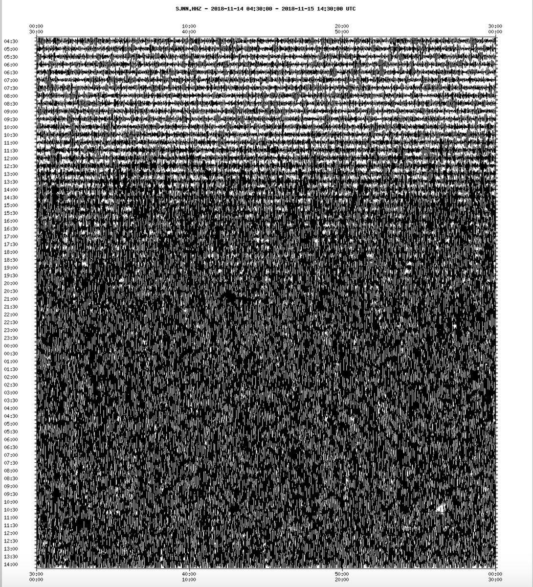
The effects of the incredibly strong low pressure system moving through Atlantic Canada caused more than ripples across the Atlantic Ocean this week, causing giant waves to track towards Europe and Africa. The LARGEST waves on the planet crashed onto the Grand Banks of Newfoundland with significant wave height over 15 metres (50 feet) and theoretical maximum wave height over 30 metres (100 feet) on November 14-15, 2018. Large swells and surf reached Ireland, Portugal, and parts of Africa this weekend. As the world’s largest waves, and wind gusts of more than 100 km/h hit Newfoundland, the island started shaking like during an earthquake. Just look at this image from a seismograph in St. John below… It was going crazy:
As the world’s largest waves, and wind gusts of more than 100 km/h hit Newfoundland, the island is shaking like during an earthquake! Insane!
According to John Cassidy, a seismologist at the Department of Natural Resources of Canada, similar seismic activity is recorded at this time of the year when giant waves combined to high winds engulf the eastern and western coastal regions of Canada.

This video recorded around 7:30 AM on the morning of November 15, 2018 in Bonavista, Newfoundland and Labrador shows the dramatic of the situation when such storms hit:
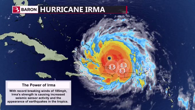
This is not the only place on Earth where seismographs record seismic activity during violent storms. For example, increased seismic activity was observed after Hurricane Irma passed Puerto Rico and the Dominican Republic giving the appearance of earthquakes:
The Weather Network – Largest waves on the planet target Newfoundland, see it here


You need to be a member of Earth Changes and the Pole Shift to add comments!
Join Earth Changes and the Pole Shift