"We warned at the start of ZetaTalk, in 1995, thatunpredictable weather extremes, switching about from drought to deluge,would occur and increase on a lineal basis up until the pole shift. Where this occurred steadily, it has only recently become undeniable. ZetaTalk, and only ZetaTalk, warned of these weather changes, at that early date. Our early warnings spoke to the issue of global heating from the core outward, hardly Global Warming, a surface or atmospheric issue, but caused by consternation in the core. Affected by the approach of Planet X, which was by then starting to zoom rapidly toward the inner solar system for its periodic passage, the core was churning, melting the permafrost and glaciers and riling up volcanoes. When the passage did not occur as expected in 2003 because Planet X had stalled in the inner solar system, we explained the increasing weather irregularities in the context of the global wobble that had ensued - weather wobbles where the Earth is suddenly forced under air masses, churning them. This evolved by 2005 into a looping jet stream, loops breaking away and turning like a tornado to affect the air masses underneath. Meanwhile, on Planet Earth, droughts had become more intractable and deluges positively frightening, temperature swings bringing snow in summer in the tropics and searing heat in Artic regions, with the violence of storms increasing in number and ferocity."
The wobble seems to have changed, as the temperature in Europe suddenly plunged after being like an early Spring, Alaska has its coldest temps ever while the US and much of Canada is having an extremely mild winter. India went from fatal cold spell to balmy again. Has the Earth changed position vs a vs Planet X to cause this?[and from another]Bitter cold records broken in Alaska - all time coldest record nearly broken, but Murphy's Law intervenes[Jan 30]http://wattsupwiththat.com/2012/01/30/bitter-cold-records-broken-in-alaskaJim River, AK closed in on the all time record coldest temperature of -80°F set in 1971, which is not only the Alaska all-time record, but the record for the entire United States. Unfortunately, it seems the battery died in the weather station just at the critical moment. While the continental USA has a mild winter and has set a number of high temperature records in the last week and pundits ponder whether they will be blaming the dreaded "global warming" for those temperatures, Alaska and Canada have been suffering through some of the coldest temperatures on record during the last week.
There has been no change in the wobble pattern, the wobble has merely become more severe. Nancy noted a Figure 8 format when the Earth wobble first became noticeable, in early 2005, after Planet X moved into the inner solar system at the end of 2003. The Figure 8 shifted along to the east a bit on the globe between 2005 and 2009, (the last time Nancy took its measure) as Planet X came closer to the Earth, encountering the magnetic N Pole with a violent push earlier in the day. But the pattern of the Figure 8 remained essentially the same. So what changed recently that the weather patterns became noticeably different in late January, 2012?
The N Pole is pushed away when it comes over the horizon, when the noon Sun is centered over the Pacific. This regularly puts Alaska under colder air, with less sunlight, and thus the historically low temps there this January, 2012 as the wobble has gotten stronger. But by the time the Sun is positioned over India, the N Pole has swung during the Figure 8 so the globe tilts, and this tilt is visible in the weather maps from Asia. The tilt has forced the globe under the hot air closer to the Equator, warming the land along a discernable tilt demarcation line.
The next loop of the Figure 8 swings the globe so that the N Pole moves in the other direction, putting the globe again at a tilt but this time in the other direction. This tilt is discernable in weather maps of Europe, again along a diagonal line. Depending upon air pressure and temperature differences, the weather on either side of this diagonal line may be suddenly warm or suddenly cold. The tilt and diagonal line lingers to affect much of the US and Canada, but the Figure 8 changes at this point to be an up and down motion, pulling the geographic N Pole south so the US is experiencing a warmer than expected winter under a stronger Sun. Then the cycle repeats, with the magnetic N Pole of Earth pushed violently away again as the Sun is positioned over the Pacific.
Would the Zetas be able to let us know what is causing the early break-up of the Arctic Ice, the ice seems to have taken on a swirling pattern at the same time, would this be wobble related?[and from another]http://www.vancouversun.com/news/national/Canada+Arctic+cracks+spec... The ice in Canada’s western Arctic ripped open in a massive “fracturing event” this spring that spread like a wave across 1,000 kilometres of the Beaufort Sea. Huge leads of water – some more than 500 kilometres long and as much as 70 kilometres across – opened up from Alaska to Canada’s Arctic islands as the massive ice sheet cracked as it was pushed around by strong winds and currents. It took just seven days for the fractures to progress across the entire area from west to east.[and from another]http://earthobservatory.nasa.gov/IOTD/view.php?id=80752&src=iot... A high-pressure weather system was parked over the region, producing warmer temperatures and winds that flowed in a southwesterly direction. That fueled the Beaufort Gyre, a wind-driven ocean current that flows clockwise. The gyre was the key force pulling pieces of ice west past Point Barrow, the northern nub of Alaska that protrudes into the Beaufort Sea.
The Figure 8 formed by the N Pole during the daily Earth wobble has shifted somewhat to the East, due to Planet X positioned more to the right of the Earth during its approach. This was anticipated, and well described in ZetaTalk, the Earth crowding to the left in the cup to escape the approach of Planet X, so the angle between these two planets would change slightly. This shift of the Figure 8 to the East is due to the push against the Earth’s magnetic N Pole occurring sooner each day than prior. Thus instead of occurring when the Sun is high over the Pacific, over New Zealand, it is now occurring when the Sun is high over Alaska. All the wobble points have shifted eastward accordingly.
This has brought a lingering Winter to the western US, and a changed sloshing pattern to the Arctic waters. Instead of Pacific waters being pushed through the Bering Straits into the Arctic when the polar push occurs, the wobble is swinging the Arctic to the right, and then later to the left, creating a circular motion in the waters trapped in the Arctic. Since the Earth rotates counterclockwise, the motion also takes this path. This is yet another piece of evidence that the establishment is hard pressed to explain. They are attempting to ascribe this to high pressure and wind, all of which are not new to the Arctic, but this circular early breakup of ice in the Arctic is new.
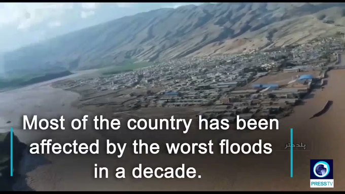
Kerala's floods and landslides have left ruin so terrible that around 200,000 people will be unable return home for at least six months, Christian Aid estimates.
A further 75,000 people in the south Indian State will never be able to return to properties that have disappeared in the floodwaters or mud or are irreparably damaged, the charity fears.
Even among houses that were not destroyed, many are now filled with stinking mud, vegetation and rubbish, roofs and walls have collapsed, furniture and household goods ruined and wells contaminated.
"The floodwaters have receded but left such severe damage that we estimate around 200,000 people will be unable to go home, for at least six months to come," said Madara Hettiarachchi, Head of Humanitarian Programmes at Christian Aid.
"They will have to live in temporary shelters or other temporary accommodation until their homes are safe enough for return.
"The hardest hit of all may be people who earned their living as farm labourers. With crops ruined and livestock lost, they will be unable to work for the next two or three months."
Christian Aid staff working in Kerala have heard many people's stories of losing everything they had, including important legal documents, livestock, household goods and sometimes their houses too.
Kurrmati, a woman from Nattra colony, Thirunaly panchayat, Wayanad district, has lost her home to a landslide. She told us she valued the emergency aid kit that Christian Aid and its partners are distributing but also the chance to tell her story and share her grief. Christian Aid and its local partners IGSSS and CASA are working in two of the hardest hit of Kerala's 14 districts, Wayanad and Idukki, targeting areas where many people are considered to be Dalits and 'Tribals' - among the most deprived and excluded in society.
By Sunday 26th August, we had reached 10,000 people with emergency kits that include water purification tablets, tarpaulins, mosquito nets, soap, rope and blankets. Thanks to the work of our local partner PHIA, a further 2,000 people have safe drinking water. We will reach a further 7,500 people in the week commencing Monday 27th August.
Globally, floods force more people to flee their homes than any other type of 'natural' disaster, according to experts at the Internal Displacement Monitoring Centre in Geneva.
Well over one million people are thought to have been displaced by the Kerala floods, while more than 400 have died.
Even today, official figures suggest that some 725,000 people are still sheltering in emergency camps set up by the government.
Ms Hettiarachchi added: "People in Kerala are due to get financial help from the government, depending on what they have lost, but it's not yet clear how this will work and it's likely to be a long process.
"Aid agencies should try to involve farm labourers in the clean-up - for instance clearing debris, repairing roads and repairing water sources - and pay them. This will help, until their normal work becomes possible again."
Comment by SongStar101 on August 28, 2018 at 11:56am
Unusual Weather the last few days: very cold snow and sizzling hot within the same day accross two parts of Canada, Snow in European Alps...in August.
Canada, eh? Snow in the west as easterners brace for heat wave
In some parts of Canada, the end of summer vacation is bringing some of the hottest temperatures of the year.
In other areas, it’s bringing weather more typically experienced in December than during the last week of August.
Some B.C. communities saw temperatures dip near or below the freezing mark Monday morning. A temperature of -1.5 C was recorded at Burns Lake at 5 a.m. One hour later, the temperature in Prince George dipped to 0 C.
The cold snap marked Prince George’s second unusual weather phenomenon in eight days, following the ash-filled skies that had shrouded the city from the sun as smoke from some of the province’s hundreds of active wildfires drifted over the region.
Temperatures in the low single digits were also reported Monday in some areas around the B.C.-Alberta border. Traffic cameras captured snow falling on Alberta’s Highway 1 near the community of Canmore.
It was a very different story in Eastern Canada, where heat warnings were in place for most of southern Ontario and parts of southern Quebec.
Environment Canada warned that cities including Toronto, Montreal and Hamilton would see daily highs at or above 30 C through Wednesday, with humidex values around 40.
Tuesday was expected to be especially hot and humid in the Montreal area. Cooler temperatures were expected later in the week, with a slight warmup in the forecast for the Labour Day weekend.
Authorities warned that parents should ensure to keep their children hydrated and away from prolonged exposure to heat to help prevent medical emergencies.
Also considered particularly at risk for heat-related illnesses are seniors, pregnant women and people with chronic illnesses, although Environment Canada was warning all people in areas under heat warnings to drink water and try to avoid outdoor activities during the hottest periods of the heat wave.
No, you’re eyes aren’t decieving you in these photos. That’s fresh snow that has accumulated in the mountain parks of Alberta near Banff, Canmore and Lake Louise since Sunday afternoon. ❄️☃️ #ABStormpic.twitter.com/HTrSpw1qOR
Stunning pictures baffle the world as Austrian mountains covered in up to 40cm of snow
We’re in August and people across the EU should be enjoying summer’s sweltering temperatures.
But baffling images show Germany and Austria covered in SNOW as temperatures dropped up to 15 degrees from one day to another.
The pictures shows different mountainous areas in the two bordering countries turning into a very early winter wonderland.
Of the two, Austria was most hit with up a downfall over the weekend that left it with up to 40cm of snow.
The city of Salzburg, according to WetterOnline , saw the heaviest downfall. But areas at less than 1000 metres of altitude were also covered in snow.
The ski town of Bad Gastein, for example, which is south of Salzburg and at 900 metres of altitude, awoke to a dreamy white landscape as it was covered in up to five centimetres of snow.
Residents of Obertauern, Rauris, Sankt Jakob in Defereggental and Hintertux on Sunday morning were welcomed with snowflakes amid zero-degree temperatures.
And according to the Central Institute for Meteorology and Geodynamics (CIMG) announced, higher mountain roads from Tyrol to Styria were inaccessible because of the sudden and equally bizarre weather. It also snowed down on the 1,200 metre-high Alps valley of Pustertal.
The Alpine Sölkpass road (L704) had to be closed between Stein an der Enns (Liezen district) and Baierdorf in the Murau district in the early hours of Sunday morning.
There has been heavy snowfall on higher slopes in the Alps this weekend, with Austrian glaciers appearing to get the biggest accumulations so far.
The forecast snowfall has resulted from a cold front moving across central Europe, bringing snow above 1500 metres in places.
About half a dozen glacier ski areas are currently open in Austria, Italy and Switzerland with today the last day of the summer ski season at Les 2 Alpes, the only area currently open in France.
Up to 35cm of snow was forecast to fall by Monday morning at Hintertux, which reports 30cm of fresh snow so far this morning. So it looks like a summer powder day there when the weather clears.
The unusual weather is not all good news in the Alps though, the leading resort of Saalbach Hinterglemm had an emergency evacuation a few days ago as flash floods hit.
This was the resort of Obertauern in Salzburgerland, which opens in November with one of the longest seasons for a non-glacier resort in Austria:
Weather conditions are expected to return to normal for the time of year over the next week.
Comment by SongStar101 on August 28, 2018 at 11:26am
Extreme weather shifts unexpectedly. First very Cold, then very sizzling Warm again!
SNOW falls on UK as Brits SHIVER in freezing -2C start to Bank Holiday
BRITS woke up to a bone-chilling start to the Bank Holiday this morning – with even snow falling on some parts.
Fresh flurries of the white stuff were recorded in the Scottish mountains in the early hours of this morning as temperatures plummeted.
The snowfall was the first of the summer – coming just days after Brits sizzled in the high 20s and weeks after a relentless 35C heatwave.
Temperatures nosedived to single figures across the UK overnight as freezing Arctic air sweapt in from Iceland.
The bitterly cold air saw rain fall as snow in some parts of northern Scotland at around 5am, including the Cairngorms National Park near Inverness where -2C was felt.
Weather maps by NetWeather also showed the white stuff falling over mountains to the west of Inverness in central Scotland.
Elsewhere, the teeth-chattering cold air saw temperatures drop across England and Wales to around 6C, according to the Met Office.
London “felt like” 5C, say NetWeather, while Brighton shivered in 3C, Cardiff 4C and Edinburgh 2C.
Although temperatures are set to rise into the mid-to-late teens this afternoon, the cold air will strike again tonight.
Single figure temperatures will return to deliver another chiller in another “dramatic dip” and it won’t be until next week when the Arctic air disappears.
Meteorologist Becky Mitchell told Express.co.uk: “We are going to see quite a dramatic dip in temperatures.”
Drenched Brits suffered a torrid “soaking Sunday” yesterday, as a massive band of rain was dumped all over the UK.
Gale force winds of up to 50mph also battered the country – after weeks of relentless 35C heat came a shuddering end.
Friday night saw the UK blasted by Arctic air from Iceland as temperatures plummeted to freezing as a low pressure system moved in.
The teeth-chattering conditions even saw bands of rain turn to snow in parts of Scotland in a massive contrast in weather.
But after two days of misery, there is finally light at the end of the tunnel on the last day of the three-day Bank Holiday weekend.
The huge band of rain has now made way for a warm spell that will see temperatures leap to 23C across southern parts of the UK.
The sun will finally make a reappearance for many parts this morning, with the warmest part of the day set to be this afternoon.
Although the BBC forecasts 20C for London, NetWeather say it will “feel like” 23C when brisk winds ease later on.
And Met Office forecaster Greg Dewhurst said: “The (low pressure) system is all cleared by Sunday night, with sunny spells and improved temperatures for the Bank Holiday.
“22C (is) possible in the South-East.”
The Met Office forecast reads: “Monday will be drier and brighter than Sunday, although some showers are still likely, mainly affecting north Wales, northwest England and western Scotland.
“Where the sun does come out, it will feel warmer, particularly when the breeze dies down later.”
Also warning of another wet day up north, where temperatures will manage to reach the mid-teens, BBC Weather’s forecast reads: “A fairly cloudy day for most with a scattering of showers around, especially in the north and west.
“Showers will gradually ease in the afternoon with perhaps some sunny breaks in places.”
The warm weather today will set the trend for the rest of the week too, with forecast maps hinting a return of the 30C roastings the UK has enjoyed all summer.
Comment by SongStar101 on August 25, 2018 at 10:26pm
Mendocino Complex Fire is now 400,000 acres—more than half the size of Rhode Island
Twin fires burning on both sides of Clear Lake in Mendocino, Lake and Colusa counties have devoured more than 400,000 acres, scorching an area more than half the size of Rhode Island.
The Ranch Fire near Ukiah has chewed up 351,557 acres, making it the largest wildfire in modern California history, and the River Fire north of Hopland has burned through 48,920 acres. Many are referring to the pair of infernos as the Mendocino Complex Fire.
The out-of-control wildfires both started on July 27 by unknown causes and rapidly caught up to the state's previous record holder--the Thomas Fire--that consumed an area the size of New York City in December 2017.
Five of the 10 largest wildfires in California history have occurred in the the past five years, and many experts believe the more extreme nature of today's wildfires is a result of environmental conditions.
At the current pace, the two fire seasons since California's five-year drought ended will be the worst on record.
In recent weeks, residents have been forced to flee their homes as firefighters battled flames up and down the state and temperatures in inland valleys and mountain regions repeatedly soared into the triple digits.
The deadly Ferguson Fire that has been burning for more than a month and caused closures at Yosemite National Park is now fully contained.
Firefighters over the weekend gained full control of the wildfire that began July 13 and has burned nearly 156 square miles (404 square kilometers).
But officials say firefighters continue to work in the area and that some islands of unburned vegetation will continue to ignite but they are not a threat to containment lines.
Two Firefighters were killed while battling the blaze, which overtook parts of Yosemite, the Stanislaus and Sierra National Forests.
As the Mendocino Complex Fire continues to spread, officials ordered new mandatory evacuations for some areas in Glenn County. The blaze has already displaced people in neighboring Lake, Mendocino and Colusa counties. Nearly 3,500 firefighters are battling the blaze that's burning in steep, difficult-to-access terrain covered in deep timber and dry brush.
While the state saw heavy precipitation two years ago, with reservoirs filling up and California Governor Jerry Brown declaring an end to the drought, the landscape is parched and groundwater depleted from multiple years marked by low rainfall and a paltry snowpack.
"Folks believe the rains came and took care of the problem," says Scott McLean, a Cal Fire deputy chief. "They exacerbated the problem by promoting growth. Our grass growth has been very significant in recent years and that has added fuel to these fires. It just takes a spark. We need several years of significant winters to get us back to the place we were before."
Adding yet another dimension to the problem, the forests suffered through years of drought leading up to 2017, and the state estimates that since Dec. 2016 some 129 million trees have died due to drought and insect infestation.That's a staggering 2 million trees a month.
"The fact is millions of trees die every year, and there are millions of little seedlings that don't make it," says Keith Gilles, a professor of forest economics at UC Berkeley. "But when you have this many big trees dead, it's pretty different. The fuel load is very high."
For more information on blazes burning around California, check out SFGATE's wildfire page.
As Hurricane Lane barrels towards Hawaii as a Category 4 storm packing sustained winds of 155 mph, officials in the Aloha state are warning residents they don't have enough shelter space to meet the "estimated demands" of the population.
The National Weather Service's Central Pacific Hurricane Center said in its 11 a.m. ET advisory that Lane, which is likely to cause catastrophic damage with winds 155 mph or above, is located about 460 miles south-southeast of Honolulu and moving west-northwest at 9 mph. The storm strengthened to a Category 5 storm with 160 mph winds before slightly weakening, but hurricane warnings are in effect for Hawaii's Big Island and the island of Maui.
"Some weakening is forecast during the next 48 hours, but Lane is forecast to remain a dangerous hurricane as it draws closer to the Hawaiian Islands," the CPHC said.
On Tuesday, emergency management officials across the state urged residents to prepare to evacuate if needed or shelter in place if its safe. Hawaii State Emergency Management Administrator Tom Travis said during a news conference that the priorities for state officials are to manage shelters because "we do not have enough shelters for everyone."
"The sheltering policy should be – if you’re not in a flood zone, most citizens should remain in their homes," Travis said. "If in a flood zone, actively seek shelter elsewhere with someone not in a flood zone or public shelter."
Earlier this year, a state report on hazards facing Hawaii warned there are only 277,376 available shelter spaces for the islands' estimated 1.4 million people.
"Hurricane evacuation shelters are a last resort option for residents and visitors who do not have a safer place to stay," the report noted. "There are insufficient hurricane evacuation shelters to meet the estimated demand of the population and these shelters have no supplies."
State officials said residents instead should harden their homes, and stock up on two weeks-worth of food and water to weather the storm and its after-effects.
"It's obvious there aren't enough shelters," Brig. Gen. Moses Kaoiwi, director of joint staff of the Hawaii National Guard told Hawaii News Now after the report was issued. "If you have a home you can shelter in, it's probably better to stay at home."
Max sustained winds in #HurricaneLane have increased to 160 MPH, making this a very dangerous Category 5 hurricane. Storm motion has begun to take more of a northerly component as it continues to approach #Hawaii. #HIwx (@NOAA GOES-West imagery) pic.twitter.com/Prh8s3yUfu
Public schools on the Big Island and in Maui County are closed Wednesday until further notice, and Hawaii Gov. David Ige is allowing non-essential state employees on the Big Island and Maui to go on administrative leave from Wednesday to Friday as Hurricane Lane approaches. Employees on Hawaii and Maui islands who work in disaster response as well as in hospitals and prisons are required to report to their jobs, the governor said.
Brianna Sugimura unloads supplies for riding out the storm while her children, Radon-Kai and Kanaloa watch in the parking lot of a Walmart store Tuesday, Aug. 21, 2018, in Lihue, on the island of Kauai in Hawaii. (Dennis Fujimoto/The Garden Island via AP)
A statement from the U.S. Navy also revealed Wednesday that Hawaii-based ships and submarines have started to "sortie," or are being moved from their locations, ahead of the storm in order to avoid potential damage.
"Based on the current track of the storm, we made the decision to begin to sortie the Pearl Harbor-based ships," Rear Adm. Brian Fort, commander, Naval Surface Group Middle Pacific, said. "This allows the ships enough time to transit safely out of the path of the storm."
The ships will stay at sea until Lane's potential dangers pass and "will be positioned to help respond after the storm, if needed," the statement said. Because of "maintenance availabilities," certain ships will not depart but they'll take "extra precautions to avoid potential damage."
President Trump said on Twitter in the path of Lane needs to prepare for the storm.
"Everyone in the path of #HurricaneLane please prepare yourselves, heed the advice of State and local officials, and follow @NWSHonolulu for updates," he wrote. "Be safe!"
Ige said the state will start to see impacts beginning late Wednesday into Thursday, and that Federal Emergency Management Agency has been "very proactive" with placing food, water and emergency equipment throughout the state.
"We do anticipate that we would activate the National Guard depending on what the impact would be," he told reporters.
The center of Lane is forecast to pass just west of the Big Island on Thursday, likely weakening to a category 2 or 3 storm by then, according to Fox News Senior Meteorologist Janice Dean. Hurricane-force winds extend 40 miles from Lane’s eye, while tropical storm-force winds extend 140 miles from the center of the storm.
The forecast for rain through Saturday across Hawaii from Hurricane Lane. (Fox News)
"Not only are hurricane-force winds possible on the Big Island, but torrential rain, flooding, and mudslides are likely given the steep terrain," Dean said.
The forecast track is still uncertain, and if the storm slows down "catastrophic flooding" will be a danger, as the towering mountains on the islands of Maui and the Big Island could lead to deadly flash flooding and landslides. Besides heavy rain, tropical-storm force winds of up to 73 mph are possible for all of the islands, in addition to coastal flooding and possible storm-surge flooding if the center of Lane moves close to land.
The high elevation on Hawaii may cause additional flooding problems. (Fox News)
Lane is the strongest storm to come this close to Hawaii in recorded history, and only six category 5 storms have been located in this part of the Pacific Ocean.
The Aloha State, while located in a vast ocean, has not had many brushes with large tropical systems. According to the National Oceanic and Atmospheric Administration's database, there is no record of a hurricane track within 65 nautical miles of either Maui or Honolulu since statehood.
Up late and looking for some fun #hurricane facts? The https://t.co/KRJdeZOp7t site in an interactive map that lets you see historical hurricane tracks within a given point and gives you information on each storm. Really gives you an idea of how rare a storm like #Lane is! #hiwxpic.twitter.com/rnCRebyJfQ
For Hawaii, the "big one" came in in 1992 when Hurricane Iniki struck the island of Kauai as a Category-4 storm, causing $3.2 billion in damage and killing six people, according to Dean.
Iniki is still the costliest and deadliest storm to hit the islands in recorded history, and only two other hurricanes -- an unnamed storm in 1871 and Dot in 1959 -- have hit a Hawaiian island in that time period.
Rescuers walk past damaged bicycles in a flooded camping area on August 9 in Saint-Julien-de-Peyrolas in southern France
Paris (CNN)A German man in his 70s is missing and 1,600 people have been evacuated because of flash floods in France, according to authorities.
The man is thought to have fallen into the fast-flowing River Aube at the village of Rouvres-sur-Aube in eastern France on Thursday afternoon, Françoise Souliman, prefect of the Haute-Marne district, told the German Press Agency on Friday. Divers and a helicopter have been deployed to search for the missing man, Souliman said. In southeastern France, 1,600 people were evacuated because of a "violent" storm, according to a government statement Thursday.
Rescuers walk past a damaged tent in Saint-Julien-de-Peyrolas.
Supported by four helicopters, more than 400 firefighters and paramilitary officers were mobilized for the rescue operation.
French Interior Minister Gérard Colomb advised citizens to exercise "utmost caution" in a tweet Thursday. Heavy rainfall has swept across central Europe in the past few days following weeks of extreme heat and drought. Storms in Germany caused hundreds of people to be evacuated and dozens of flights were canceled.
Comment by jorge namour on August 2, 2018 at 7:51pm
Record-breaking temperatures could hit Spain, Portugal and create drought conditions, forecasters warn
London (CNN)Forecasters have warned of potentially record-breaking temperatures in Spain and Portugal this week as much of Europe swelters in a heat wave that has left some farmers suffering drought conditions.
The UK Met Office said parts of the Iberian peninsula could beat the all-time continental European record of 48 degrees Celsius (118.4 degrees Fahrenheit) this week, with inland areas likely to be hotter than the coast.
The Portuguese capital, Lisbon, could see a high of 41 Celsius on Saturday, according to CNN forecasters. Its average temperature is 28 Celsius for this time of year
A heat wave warning was in place across much of southern and eastern France on Thursday.
Vulnerable people such as children and the elderly could be at risk of heat stroke, which occurs when a person's core body temperature rises above 40 Celsius and can lead to permanent brain, heart and kidney damage and, in more severe instances, death.
The United Kingdom is also experiencing a prolonged spell of hot, dry weather
The National Farmers' Union hosted an emergency summit Wednesday with representatives of the UK government, at which it called for its members to be given help to cope with the conditions. Farmers are struggling with irrigation, heat stress on livestock, the loss of crops and a shortage of forage for animals, the union said.
Meanwhile, German Agriculture Minister Julia Klöckner wrote to the European Commission on Wednesday urging it to take steps to help farmers affected by drought. Food for livestock could become scarce in the coming weeks, she warned. The past four months in Germany have been very hot and dry, particularly in the north and east of the country.
The partly dried-out bed of the River Danube is pictured in Mariaposching, southern Germany, on Wednesday.
Comment by SongStar101 on July 29, 2018 at 11:08pm
Trump declares emergency declaration for California fires
REDDING, Calif. (BCN) - President Donald Trump signed an emergency declaration making federal emergency aid available to supplement state, local and tribal efforts in battling California wildfires, the Department of Homeland Security said today.
The state is battling raging fires in several counties. The declaration authorizes the Federal Emergency Management Agency to coordinate disaster relief efforts.
California governor Jerry Brown sent a letter to the president on Friday, requesting an emergency declaration that would help Shasta County communities suffering the impacts of the Carr Fire.
"I am requesting direct federal assistance, including Department of Defense assets to immediately mitigate the impacts of this fire," Brown wrote.
The governor also requested "shelter supplies and water for 30,000 evacuated residents in Shasta County; U.S. Department of Agriculture's assistance in evacuating large animals; mass care; evacuation assistance for individuals with access and functional needs; and ambulatory assistance."
Cal Fire and crews from around the state are battling fires on several different fronts, including major wildfire blazes in Shasta, Mendocino and Mariposa counties.
You need to be a member of Earth Changes and the Pole Shift to add comments!
Join Earth Changes and the Pole Shift