There are currently 21 wildfires burning in Alberta. Seven of them are burning “out of control.”
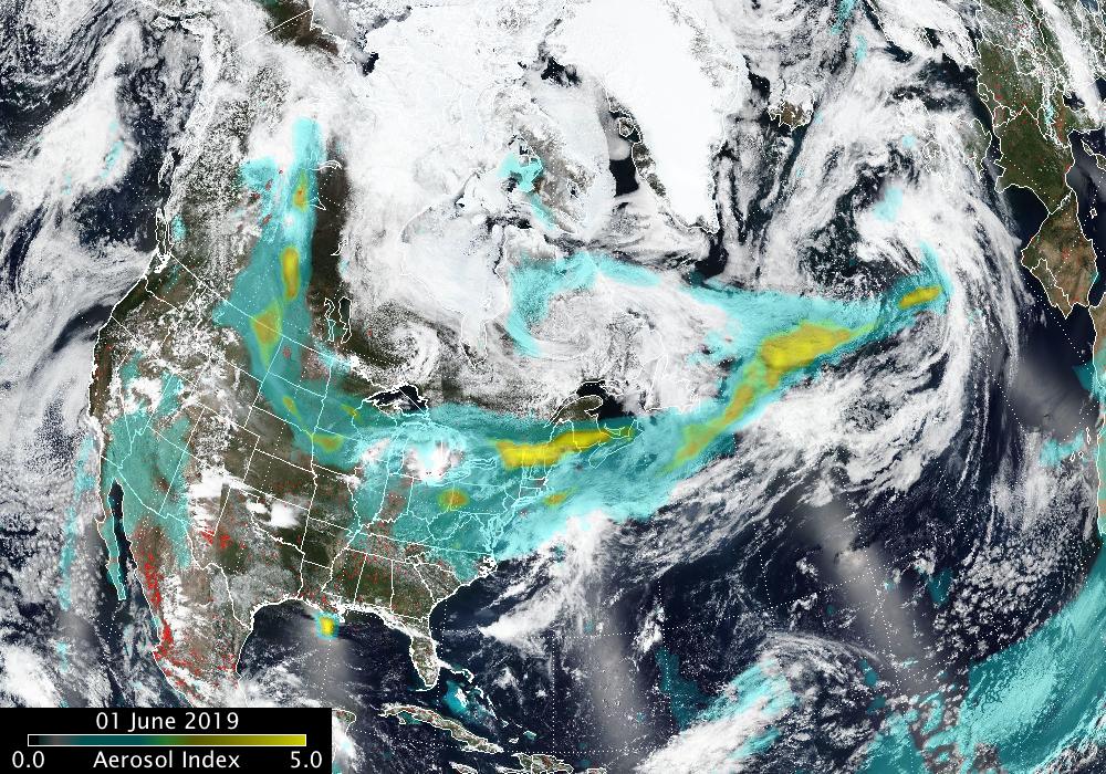
Smoke billowing from the destructive fires – Chuckegg Creek Wildfire (692,000 acres) and Jackpot Creek Wildfire (61,000 acres) – has spread far beyond Alberta, reaching the US East Coast and Europe within a few days.
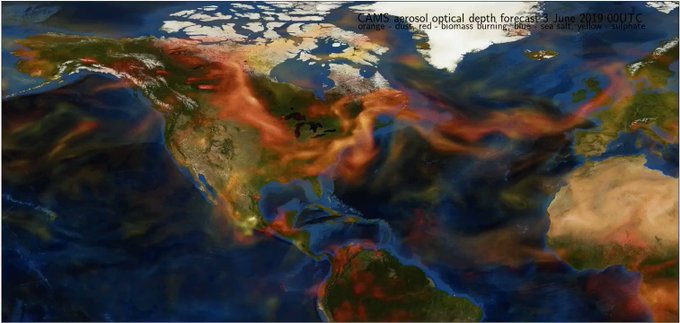
After dangerously engulfing Edmonton and Calgary during the weekend, smoke of these monster wildfires reached the eastern US on June 3, 2019:


But how exactly does smoke travel this far?
Small particles of smoke that come from the fires can stay in the air and move through the Earth’s atmosphere — all the way around the globe. The smoke sits more than a mile above the Earth’s surface, but can move down through strong winds called jet streams and have an impact on air quality.
The smoke of the Alberta wildfires has reached Europe on June 4, 2019. Image: Suomi NPP OMPS aerosol index
That’s an amazing speed… And new way to rapidly propagate a range of health issues, including respiratory problems, and aggravate lung and heart issues.


 De stormschade tot nu toe in


You need to be a member of Earth Changes and the Pole Shift to add comments!
Join Earth Changes and the Pole Shift