Weather:

Weather Wobble

Jet Stream tornados

Siberian Freeze Weather Wobble

Wild weather , [2]

Wobble Clouds

Hurricane development

Violent Push

Weather & ocean currents

Europe Weather

Tides and Whirlpools:

Storm Clash whirlpools

Lurch of earth

Tides , [2]

Whirlpools

Wobble Sloshing


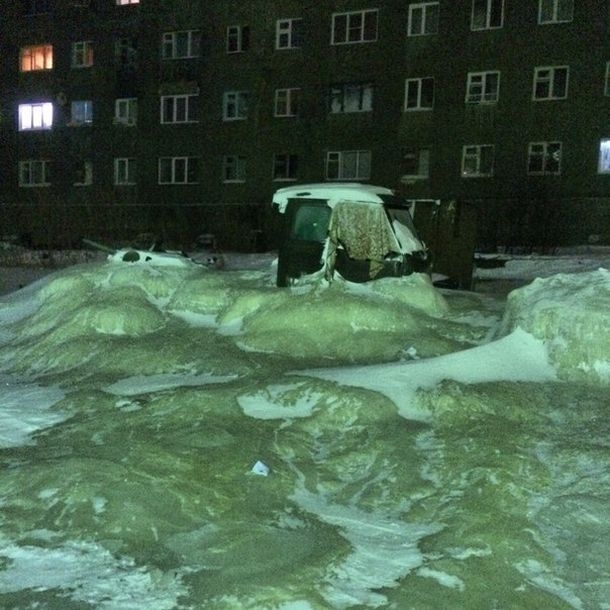
"We warned at the start of ZetaTalk, in 1995, that unpredictable weather extremes, switching about from drought to deluge, would occur and increase on a lineal basis up until the pole shift. Where this occurred steadily, it has only recently become undeniable. ZetaTalk, and only ZetaTalk, warned of these weather changes, at that early date. Our early warnings spoke to the issue of global heating from the core outward, hardly Global Warming, a surface or atmospheric issue, but caused by consternation in the core. Affected by the approach of Planet X, which was by then starting to zoom rapidly toward the inner solar system for its periodic passage, the core was churning, melting the permafrost and glaciers and riling up volcanoes. When the passage did not occur as expected in 2003 because Planet X had stalled in the inner solar system, we explained the increasing weather irregularities in the context of the global wobble that had ensued - weather wobbles where the Earth is suddenly forced under air masses, churning them. This evolved by 2005 into a looping jet stream, loops breaking away and turning like a tornado to affect the air masses underneath. Meanwhile, on Planet Earth, droughts had become more intractable and deluges positively frightening, temperature swings bringing snow in summer in the tropics and searing heat in Artic regions, with the violence of storms increasing in number and ferocity."

ZETATALK


From the ZetaTalk Chat Q&A for February 4, 2012:


The wobble seems to have changed, as the temperature in Europe suddenly plunged after being like an early Spring, Alaska has its coldest temps ever while the US and much of Canada is having an extremely mild winter. India went from fatal cold spell to balmy again. Has the Earth changed position vs a vs Planet X to cause this? [and from another] Bitter cold records broken in Alaska - all time coldest record nearly broken, but Murphy's Law intervenes [Jan 30] http://wattsupwiththat.com/2012/01/30/bitter-cold-records-broken-in-alaska Jim River, AK closed in on the all time record coldest temperature of -80°F set in 1971, which is not only the Alaska all-time record, but the record for the entire United States. Unfortunately, it seems the battery died in the weather station just at the critical moment. While the continental USA has a mild winter and has set a number of high temperature records in the last week and pundits ponder whether they will be blaming the dreaded "global warming" for those temperatures, Alaska and Canada have been suffering through some of the coldest temperatures on record during the last week.

There has been no change in the wobble pattern, the wobble has merely become more severe. Nancy noted a Figure 8 format when the Earth wobble first became noticeable, in early 2005, after Planet X moved into the inner solar system at the end of 2003. The Figure 8 shifted along to the east a bit on the globe between 2005 and 2009, (the last time Nancy took its measure) as Planet X came closer to the Earth, encountering the magnetic N Pole with a violent push earlier in the day. But the pattern of the Figure 8 remained essentially the same. So what changed recently that the weather patterns became noticeably different in late January, 2012?

The N Pole is pushed away when it comes over the horizon, when the noon Sun is centered over the Pacific. This regularly puts Alaska under colder air, with less sunlight, and thus the historically low temps there this January, 2012 as the wobble has gotten stronger. But by the time the Sun is positioned over India, the N Pole has swung during the Figure 8 so the globe tilts, and this tilt is visible in the weather maps from Asia. The tilt has forced the globe under the hot air closer to the Equator, warming the land along a discernable tilt demarcation line.

The next loop of the Figure 8 swings the globe so that the N Pole moves in the other direction, putting the globe again at a tilt but this time in the other direction. This tilt is discernable in weather maps of Europe, again along a diagonal line. Depending upon air pressure and temperature differences, the weather on either side of this diagonal line may be suddenly warm or suddenly cold. The tilt and diagonal line lingers to affect much of the US and Canada, but the Figure 8 changes at this point to be an up and down motion, pulling the geographic N Pole south so the US is experiencing a warmer than expected winter under a stronger Sun. Then the cycle repeats, with the magnetic N Pole of Earth pushed violently away again as the Sun is positioned over the Pacific.


From the ZetaTalk Chat Q&A for April 6, 2013:


Would the Zetas be able to let us know what is causing the early break-up of the Arctic Ice, the ice seems to have taken on a swirling pattern at the same time, would this be wobble related? [and from another] http://www.vancouversun.com/news/national/Canada+Arctic+cracks+spec... The ice in Canada’s western Arctic ripped open in a massive “fracturing event” this spring that spread like a wave across 1,000 kilometres of the Beaufort Sea. Huge leads of water – some more than 500 kilometres long and as much as 70 kilometres across – opened up from Alaska to Canada’s Arctic islands as the massive ice sheet cracked as it was pushed around by strong winds and currents. It took just seven days for the fractures to progress across the entire area from west to east. [and from another] http://earthobservatory.nasa.gov/IOTD/view.php?id=80752&src=iot... A high-pressure weather system was parked over the region, producing warmer temperatures and winds that flowed in a southwesterly direction. That fueled the Beaufort Gyre, a wind-driven ocean current that flows clockwise. The gyre was the key force pulling pieces of ice west past Point Barrow, the northern nub of Alaska that protrudes into the Beaufort Sea.


The Figure 8 formed by the N Pole during the daily Earth wobble has shifted somewhat to the East, due to Planet X positioned more to the right of the Earth during its approach. This was anticipated, and well described in ZetaTalk, the Earth crowding to the left in the cup to escape the approach of Planet X, so the angle between these two planets would change slightly. This shift of the Figure 8 to the East is due to the push against the Earth’s magnetic N Pole occurring sooner each day than prior. Thus instead of occurring when the Sun is high over the Pacific, over New Zealand, it is now occurring when the Sun is high over Alaska. All the wobble points have shifted eastward accordingly.

This has brought a lingering Winter to the western US, and a changed sloshing pattern to the Arctic waters. Instead of Pacific waters being pushed through the Bering Straits into the Arctic when the polar push occurs, the wobble is swinging the Arctic to the right, and then later to the left, creating a circular motion in the waters trapped in the Arctic. Since the Earth rotates counterclockwise, the motion also takes this path. This is yet another piece of evidence that the establishment is hard pressed to explain. They are attempting to ascribe this to high pressure and wind, all of which are not new to the Arctic, but this circular early breakup of ice in the Arctic is new.

Views: 629706

Comment

You need to be a member of Earth Changes and the Pole Shift to add comments!

Join Earth Changes and the Pole Shift

Comment by SongStar101 on October 25, 2014 at 9:45am

China's largest freshwater lake shrinks by one third in 3 days

http://english.peopledaily.com.cn/n/2014/1022/c90882-8798502.html

NANCHANG, Oct. 22 -- China's largest freshwater lake, Poyang, has shrunk by one third in the past three days due to reduced water supply from the Yangtze River and little rainfall.

At 8 a.m. Wednesday, the lake's surface area was 1,490 sq km, a reduction of 679 sq km compared with 2,169 sq km on Monday, said the Jiangxi Provincial Hydrological Bureau.

The water level at Xingzi hydrological station was 11.99 meters at 4 p.m. Wednesday, 2.13 meters lower than the levels in normal years. The water level is falling by 30 cm per day.

Reduced water supply from the upper Yangtze River due to dams and little rainfall in the past month in Jiangxi were two major causes for the shrinking, said the bureau.

The average precipitation was less than 5 mm since Sept. 20 in Jiangxi Province.

The lake's flood season began on April 30 and lasted until Oct. 18. The flood period was 33 days longer than that of last year.

The sharp fall of water levels in the lake will affect shipping and fishing as well as the water supply for nearby residents.

Comment by jorge namour on October 24, 2014 at 3:23pm
Comment by SongStar101 on October 23, 2014 at 9:42am

Significant temperature drop in northern areas in China

http://english.jschina.com.cn/20728/201410/t1729675.shtml

A cold front has brought dramatic temperature drops to the northern regions of China.

North China’s Inner Mongolia Autonomous Region, and northeastern provinces of Heilongjiang and Jilin are seeing falls of up to 20 degrees Celsius. In Harbin, the highest temperature is just 5 degrees Celsius. And the lowest in many cities is below zero. Heilongjiang’s Mohe has seen some heavy snowfall this season already.

The cold front is however a bringer of good news as it’s driving away the smog that’s been lingering in the north for several days. Air pollution has been easing gradually since Monday afternoon.

The cold will also creep down into the southern and eastern regions, with temperature falls of up to 10 degrees Celsius, along with bouts of rain.

Comment by KM on October 22, 2014 at 1:40am

http://floodlist.com/europe/deadly-flash-floods-tenerife

Deadly Flash Floods in Tenerife

At least one person has died in flash flooding that struck on the tourist island of Tenerife. Some local media reports claim that at as many as 5 people have died in flooding in the Canary Islands between 19 and 20 October 2014.

Streets were turned to rivers as the eye of a storm passed over Tenerife and La Gomera islands, dumping 140 mm of rain on the Santa Cruz area of Tenerife in just 24 hours. Cars were submerged and tarmac ripped up from roads as raging flood water swept through the streets. Over 4,000 homes were left without power during the peak of the storm.

floods tenerife car 2014Flood damage in Tenerife, Canary Islands, October 2014. Photo: Canarias Emergencias / Twitter

A 56 year old woman died from a heart attack after being dragged away by flood water while crossing a flooded street in Santa Cruz.

The islands are hugely popular with tourists, especially those from northern Europe. A state of emergency has been declared in 4 of the islands – Tenerife, La Gomera, La Palma and El Hierro.

Comment by Mark on October 18, 2014 at 6:08pm

Summer Returns to the UK:

Britain to be hotter than Greece tomorrow - but Hurricane Gonzalo will bring 50mph winds and heavy rains when it hits on Monday

http://www.dailymail.co.uk/news/article-2797050/come-rain-shine-bri...

Britain is expected to be hotter than Greece tomorrow, with temperatures soaring to 22C - but the aftermath of a ferocious hurricane will bring weather misery just two days later.

Forecasters say Hurricane Gonzalo - the strongest Atlantic storm in three years - is heading for the UK and will unleash heavy rain and 50mph gales when it hits on Monday night.

Gonzalo has already battered islands across the West Indies, with images revealing destroyed boats, down trees and debris strewn across beaches in Guadeloupe, Saint Barthelemy and Saint-Martin. It is also expected to hit Bermuda tonight, leaving devastation in its wake.

Comment by KM on October 16, 2014 at 4:56pm

http://www.dailymail.co.uk/news/article-2794053/blizzard-conditions...

Blizzard conditions kill 27 in Nepal with another 70 missing as officials warn it will take days to dig out bodies from deep snow

  • 27 have died in Nepal in the country's mountainous north
  • Avalanche buried four Canadians and one Indian trekker in Phu, Manang
  • Three villagers killed in the same district, 100 miles from Kathmandu
  • In neighbouring Mustang district, four trekkers died on Tuesday
  • The blizzard was caused by cyclone Hudhud, which hit neighboring India

Dozens of stranded foreign trekkers have been rescued and more bodies have been found following a blizzard and avalanches in northern Nepal, taking the death toll to 27.

About 70 people are still missing along or near the popular Annapurna trail, according to the Trekking Agencies Association of Nepal, and the death toll is expected to rise.

The route, 100 miles north-west of the capital, Kathmandu, was filled with international hikers during the peak October trekking season, when the air is generally clear and cool.

Members of the army pulling dead bodies of trekkers from the Thorung La mountain pass on the Annapurna Circuit, near Muktinath, in Mustang district

Members of the army pulling dead bodies of trekkers from the Thorung La mountain pass on the Annapurna Circuit, near Muktinath, in Mustang district

Dozens of stranded foreign trekkers have been rescued and more bodies have been found (pictured) following a blizzard and avalanches in northern Nepal, taking the death toll to 27

Dozens of stranded foreign trekkers have been rescued and more bodies have been found (pictured) following a blizzard and avalanches in northern Nepal, taking the death toll to 27

HOW DID CYCLONE HUDHUD BECOME SUCH A DEVASTATING FORCE?

Pictured is Cyclone Hudhud on October 9th in the Bay of Bengal. The storms that form in this region have a reputation for being unusually destructive

Pictured is Cyclone Hudhud on October 9th in the Bay of Bengal. The storms that form in this region have a reputation for being unusually destructive

India's east coast has been in the path of a powerful cyclone, Hudhud, that has engulfed the area in winds of up to 135mph (217 km per hour).

Weather experts claim it is the strongest tropical cyclone of this year within the North Indian Ocean.

The cyclone, named after the Arabic Hoopoe, formed in the Northern Indian Ocean with satellite pictures now showing it moving away from Nepal towards China.

While tropical cyclones are less likely to form in this region than in the Atlantic or Pacific Ocean basins, the storms that do form have a reputation for being unusually destructive.

Eight of the ten deadliest tropical cyclones in history are believed to be Bay of Bengal storms, with all of these storms causing well over 100,000 deaths.

A number of factors contribute to the destructiveness of Indian Ocean storms, including simple geography.

For instance, the Bay of Bengal is semi-enclosed, which means storms that form there are quite likely to strike land where much of the coastline is densely populated and low-lying.

The storm went through a period of rapid intensification as it approached the India coast, with Nasa suggesting this may be due to increasing sea surface temperatures.

Hudhud intensified into a cyclonic storm on October 8 and as a Severe Cyclonic Storm on October 9. It then gathered pace and was classified as a Very Severe Cyclonic Storm.

Shortly before landfall near Visakhapatnam, Hudhud reached its peak strength with three minute wind speeds of 109mph (175 km/h) and a minimum central pressure of 960 mbar (28.35 inHg).

The bad weather hit a resting place 4,500m (14,800ft) above sea level, not far below popular Annapurna trek's highest point, the Thong La pass.

After bringing damaging winds and flooding to parts of eastern and northern India, the tail end of Tropical Cyclone Hudhud hit the Himalayas resulting in an intense blizzard. 

Pictured is the rainfall analysis of Cyclone Hudhud from October 7-14 showed heavy rainfall in many areas. Up to 550 mm (~22 inches, dark red) over ocean and over land, the highest totals are 200 to 250 mm (~8 to 12 inches, green) and 50 to 100 mm (~2 to 4 inches, blue)

Pictured is the rainfall analysis of Cyclone Hudhud from October 7-14 showed heavy rainfall in many areas. Up to 550 mm (~22 inches, dark red) over ocean and over land, the highest totals are 200 to 250 mm (~8 to 12 inches, green) and 50 to 100 mm (~2 to 4 inches, blue)


Comment by jorge namour on October 12, 2014 at 2:25pm

Bad weather, ghostly clouds "mammatus" on the sky at sunset Parma [PHOTOS] - ITALY

Saturday, October 11th 2014,

http://www.meteoweb.eu/2014/10/maltempo-spettrali-nubi-mammatus-sul...

https://translate.google.com.co/translate?sl=it&tl=en&js=y&...

------------------------------------------------------------------------------------------
FRANCE

http://actualite.lachainemeteo.com/actualite-meteo/2014-08-25-16h22...

https://translate.google.com.co/translate?sl=fr&tl=en&js=y&...

It has not rained in a particularly intense way to Parma this afternoon, as opposed to other places in Emilia Romagna, but at sunset they were formed in the sky spectacular mammatus clouds that gave glimpses at times dark, but still extraordinarily fascinating and suggestive.

Comment by lonne rey on October 11, 2014 at 3:05pm

Torrential rain causes deadly flash flooding in Genoa, Italy

http://www.washingtonpost.com/blogs/capital-weather-gang/wp/2014/10...

Over 17 inches of rain in 24 hours fell near Genoa, Italy on Thursday and Friday, causing the Bisagno river to swell past its banks, leaving at least one person dead according to Reuters.

CNN International meteorologist Brandon Miller reports that this amount of rain is two and a half times the monthly average for the area.

View image on Twitter

View image on Twitter

Comment by KM on October 11, 2014 at 3:57am

http://floodlist.com/america/378-mm-rain-floods-nicaragua

Floods in Nicaragua After 378 mm of Rain in 24 Hours

A slow moving low pressure system moving from the Caribbean dumped record amounts of heavy rain on north and south-western Nicaragua on 9 October 2014, causing floods and landslides in the departments of Rivas, Granada, Chinandega and Rio San Juan.

As many as 6,000 people (800 families) have been affected. More than 500 people had to be evacuated and are now being houses in temporary accommodation. SINAPRED (Sistema Nacional para la Prevención, Mitigación y Atención de Desastres) reports that 24 houses have been completely destroyed in the floods, with a further 890 damaged. There are unconfirmed reports that over 20 families have been completey cut off by flooding near the Ochomogo River.

A young girl, aged 5 years old, died when she was swept away in flood waters in the village of Santa Teresa, Ometepe Island.

Record Rainfall

According to a report by SINAPRED, the accumulated rainfall figures over 24 hours were above 60 mm in Masatepe, Masaya, Granada, and over 100 mm in Nandaime, Rivas Tola.

In Altagracia, Rivas Departmenr, 378 mm of rain fell in 24 hours between 08 and 09 October, breaking previous records.

Yesterday Nicaragua’s Meteorology departmert, INETER, said that the heavy rain is expected to cintinue for 36 hours.

Heavy rain in Nicaragua

Heavy rain in Nicaragua / SINAPRED

Heavy rain was also falling elsewhere in the region over the last 24 hours according to WMO. Over 77 mm fell in Belize, 101.6 mm in Puerto Lempra, Honduras, and 73 mm in Pereira, north Colombia..

Comment by KM on October 9, 2014 at 11:59pm

http://floodlist.com/africa/10-killed-south-sudan-floods-october-2014

At Least 10 Killed in South Sudan Floods

Local media in Sudan are reporting that at least 10 people have been killed in 2 separate incidents of flooding in South Sudan over the last 7 days.

The Sudan Tribune reports that heavy rain in Eastern Equatoria state between 04 and 05 October 2014 caused severe floods in the county of Magwi. Roads and bridges have been damaged as a result of the flooding. The heavy rain has also caused landslides in the area.

At least 6 people died in the flooding in the village of Owinykibul. The heavy rain caused the Atebi River to overflow and one person died after being swept away while he attempted to cross.

Floods Sudan

File photo – floods in South Sudan

In Unity state at least 3 people drowned in floods after heavy rain in Mankien, Mayom county on 05 October. The flooding has also caused damage to homes and property in several areas of the county.

Local media are also reporting that heavy rains and floods have been seen in Maban County, Upper Nile state. No damage to property has been reported, although the flooding caused disruption to transport after major roads were blocked or made impassable.

File photo: Floods in Upper Nile state, 2011. Photo: UN Photo / Flickr

File photo: Floods in Upper Nile state, 2011. Photo: UN Photo / Flickr

Over 60,000 people were displaced by flooding in Sudan and South Sudan in August this year.

One of the worst affected areas has been Bentiu, Unity state, South Sudan, the location of the refugee camp housing around 50,000 people. The camp has suffered badly from flooding since July this year. A recent report by IRIN said that flooding had wiped out much of the camp’s infrastructure and the property of camp residents, including beds.

The camp is located in a low lying area prone to flooding. The recent heavy rainfall in Unity state is likley to affect camp conditions once again.

Bentiu camp, South Sudan. Photo: UN Photo / Flickr

Bentiu camp, South Sudan. Photo: UN Photo / Flickr

Floods in refugee camp at Bentiu, August 2014. Photo: UN Photo / Flickr

Floods in refugee camp at Bentiu, August 2014. Photo: UN Photo / Flickr

SEARCH PS Ning or Zetatalk

 
Search:

This free script provided by
JavaScript Kit

Donate

Donate to support Pole Shift ning costs. Thank you!

© 2025   Created by 0nin2migqvl32.   Powered by

Badges  |  Report an Issue  |  Terms of Service