Wild Weather, the Wobble Effect
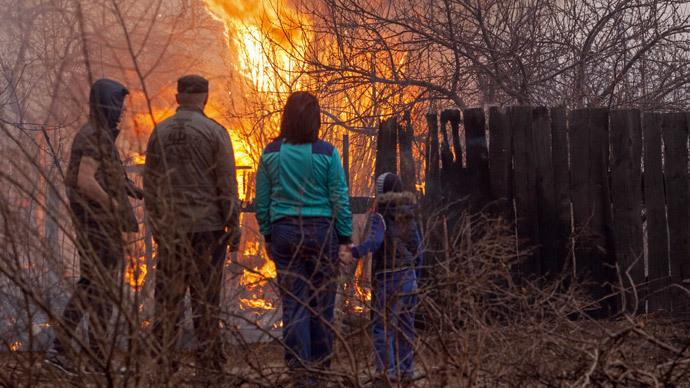
TOTAL DESTRUCTION IN PARTS OF CEBU CITY, PHILIPPINES, 05.11.25
Massive flooding in Da Nang, Vietnam. 30.10.2025.
Giant waves crash over seawalls during a storm
in the suburbs of Taipei, Taiwan. 21.10.2025
"We warned at the start of ZetaTalk, in 1995, that unpredictable weather extremes, switching about from drought to deluge, would occur and increase on a lineal basis up until the pole shift. Where this occurred steadily, it has only recently become undeniable. ZetaTalk, and only ZetaTalk, warned of these weather changes, at that early date. Our early warnings spoke to the issue of global heating from the core outward, hardly Global Warming, a surface or atmospheric issue, but caused by consternation in the core. Affected by the approach of Planet X, which was by then starting to zoom rapidly toward the inner solar system for its periodic passage, the core was churning, melting the permafrost and glaciers and riling up volcanoes. When the passage did not occur as expected in 2003 because Planet X had stalled in the inner solar system, we explained the increasing weather irregularities in the context of the global wobble that had ensued - weather wobbles where the Earth is suddenly forced under air masses, churning them. This evolved by 2005 into a looping jet stream, loops breaking away and turning like a tornado to affect the air masses underneath. Meanwhile, on Planet Earth, droughts had become more intractable and deluges positively frightening, temperature swings bringing snow in summer in the tropics and searing heat in Arctic regions, with the violence of storms increasing in number and ferocity."
ZETATALK
Wild Weather, the Wobble Effect - Earth Changes and the Pole Shift
Views: 639310
Comment
-
Comment by Howard on April 17, 2015 at 5:29am
-
Massive Sandstorm Causes Panic In China (Apr 15)
A massive sandstorm swept over Beijing on Wednesday, darkening the skies and causing panic among residents.
The storm, which some outlets are calling the worst in more than a decade, reached speeds of 45 miles an hour and brought traffic in the city to a halt. Visibility plummeted and authorities urged people to stay indoors after the national observatory, China's environmental monitoring center, issued a heightened "yellow" alert before the storm hit.
Some residents wrote they felt like it was "the end of the world" and questioned how they could "survive such bad weather."
Source
http://www.huffingtonpost.com/2015/04/16/beijing-sandstorm_n_708171...
-
Comment by SongStar101 on April 15, 2015 at 11:00pm
-
This is unprecedented, nearly 60 villages! Uncharacteristically strong and rough winds!
23 dead, more than 900 injured in Siberian grassland fire
http://rt.com/news/249393-siberia-grass-blaze-russia/
The massive fires that swept through nearly 60 villages and towns in the Siberian republic of Khakassia have left 23 people dead, and more than 900 injured, according to an official committee investigating the tragedy.
“Currently the committee can confirm 23 deaths,” head of the investigative committee Vladimir Markin was quoted as saying by TASS.
More than 1,400 homes were destroyed in the fire, leaving some 6,000 people homeless, according to regional governor Viktor Zimin. Those who suffered severe injuries from the fire were delivered to Krasnoyarsk for treatment.
Russian President Vladimir Putin had personally coordinated emergency services operations in Khakassia, according to his spokesperson.
Some 5,000 firefighters as well as thousands of volunteers worked to contain the blazes through the night, extinguishing the fires by Monday morning. Temporary camps have been set up in the Beisky and Shirinksy districts nearby for those displaced by the fire.
The fires started after mass grass burning by residents in the region. Grass burning is a springtime tradition among farmers in some parts of Russia, meant to clear the fields of dry grass and prepare them for planting.
Officials blamed the extreme severity of this year’s fire on “uncontrolled burning, dry weather and uncharacteristically strong and rough winds.”
“As soon as snow melts, while rivers are still covered by ice, dry grass burns like gunpowder,” said emergency Situations Minister Vladimir Puchkov, “People begin to burn grass on their plots and fire spreads to agricultural land and pastures are burnt.”
-
Comment by jorge namour on April 13, 2015 at 11:44pm
-
Incredible dust storms between Ukraine and Belarus, unprecedented phenomenon in the history [PHOTOS and VIDEO]
April 13, 2015
An impressive dust storm invests western Ukraine and Belarus southern causing huge inconvenience and a lot of fear among the population. Event quite unique to this corner of Europe
http://www.meteoweb.eu/2015/04/incredibili-tempeste-di-polvere-tra-...
https://translate.google.com/translate?sl=it&tl=en&js=y&...
https://www.youtube.com/watch?v=n8wuBcnLE5c
The wall of dust observed in Ukraine
The month of April continues to amaze us, churning weather events truly amazing on the old continent.
Just yesterday afternoon as impressive as a rare dust storm hit several areas of Ukraine northwestern and southern Belarus, characterized by rather mature and intense storms that were preceded by powerful "downbursts".
The advance of these storms was accompanied by the formation of impressive clouds of dust as high as 900-1000 meters, moving in parallel with the various "storm cells" that generated have temporarily obscured the sky in different villages and cities Ukraine's north-western and southern Belarus.
The strong "downbursts" raising the air, quite turbulent, a ingentissima amount of land and fine powder which has created a real wall of sediment along the part of the advancing storm front.
This process has led to the formation of this incredible dust storm, unusual for these areas of Europe.
Around 17:00 PM a massive wall of red dust, which was accompanied by the "gust front" of storms, has invested in the full Oblast 'Ukrainian Khmelnytsky, causing a drastic reduction in horizontal visibility, as well as a temporary darkening of heavenly blanket for the presence of a very heavy amount of fine dust in the air coming from the fields and from rural northern Ukraine.
But the worst dust storms were observed on its southern Belarus, where there was a real "Haboob", such as those that usually are realized on the Sahara or the sandy deserts of the Middle East.
The dust cloud has hit the Belarusian city of Soligorsk, where shortly after 17:00 PM the arrival of '' Haboob 'has virtually overshadowed everything, so much so that within seconds it has gone from daylight to night To the astonishment and fear of the local population, not accustomed to living with similar weather phenomena .
During the arrival of the cloud of dust the city of Soligorsk remained totally paralyzed in the dark, with people who have crowded stores for shelter from all that dust that made the air unbreathable. What most surprises most is that a similar phenomenon has occurred in the month of April and not in the middle of summer
more to the west, between Ukraine and Belarus, similar events are most unique and rare, given the very considerable distance from sandy deserts or steppes dusty semi-arid regions (such as those of Central and Eastern Kazakhstan). CONTINUE...
-
Comment by Mark on April 13, 2015 at 8:38am
-
Tale of two countries: Snow in the North, but glorious sunshine in the South
http://www.dailymail.co.uk/news/article-3036143/Tale-two-countries-...
As thick snow settled in Cumbria and rain lashed other parts of the North, winter is clinging on in half of the country.
But with this week set to be sunny and the mercury predicted to hit 24C (75F), the rest of Britain is heading for a heatwave.
Forecasters say temperatures will be up to 10C above average for the time of year, making parts of the UK hotter than holiday destinations in southern Europe.And bookmakers have slashed odds on this being the warmest spring on record after the Met Office confirmed temperatures from now to June are more than twice as likely to be above average than below average.
Last Friday was the hottest day of 2015 so far, reaching 21.9C (71.4F) in St James’s Park, central London. But despite balmy weather in much of the South, blizzards hit Scotland and northern England, covering areas including the Lake District’s Kirkstone Pass with a layer of snow. Rain battered Manchester and the Pennines.
The South enjoyed sunshine, with punters flocking to the Cam in Cambridge – 250 miles from the Lake District – but temperatures stalled at 13-14C (55-57F).
The mercury fell below zero in Berkshire early yesterday, while winds in Wales reached speeds of up to 75mph.
-
-
Holy Saturday of rain in Jerusalem, the cyclonic circulation on Turkey provoke intense thunderstorms in the Middle East
April 11, 2015
The cyclonic circulation Anatolian plateau moves eastward causing rains, scattered showers and thunderstorms between Asia Minor and the Middle East
http://www.meteoweb.eu/2015/04/sabato-santo-di-pioggia-a-gerusalemm...
https://translate.google.com/translate?sl=it&tl=en&js=y&...
A Holy Saturday, the eve of the Orthodox Easter, penalized by the rain and the rain on the city of Jerusalem.
Since yesterday throughout Asia Minor, and even along the coast of Egypt and the Sinai Peninsula, the weather continues to be markedly unstable, with rain, scattered showers and thunderstorms, locally also give rise to short bursts of hail. All because of continental polar air that has moved away from the Aegean to the Western Turkey.
This cyclonic circulation has evolved into a minimum depressionario derivative that you went to place the Sea of Levante, off the southern coast of Turkey and Syria where he is leading a phase of marked instability, with frequent rains and thunderstorms between Turkey, Syria, Lebanon, Israel and northern Egypt.
Strong wave of bad weather in Israel: snowfall in the Galilee and the Golan
Heavy rains have fallen on the Mediterranean coast and also in the area of Jerusalem
April 12, 2015http://www.meteoweb.eu/2015/04/forte-ondata-di-maltempo-in-israele-...
https://translate.google.com/translate?sl=it&tl=en&js=y&...
A wave of bad weather yesterday invests different regions of Israel, particularly the Upper Galilee and the Golan Heights. In some localities' are reported blizzards as we have not seen for a decade.
Heavy rains have fallen on the Mediterranean coast and also in the area of Jerusalem. Consequently they are now in full in the Judean Desert several rivers that lead from the hills of Jerusalem to the Dead Sea depression. Some roads were closed to traffic for prudential reasons. Persistent rains and strong winds are also recorded in the Negev desert.
------------------------------------------------------------------------------------------
Wave of bad weather in the Gaza Strip: flooding to hail and rain [PHOTOS and VIDEO]
A stretch of the main artery, the Sallah-a-din, was closed to traffic
April 12, 2015http://www.meteoweb.eu/2015/04/ondata-di-maltempo-nella-striscia-di...
https://translate.google.com/translate?sl=it&tl=en&js=y&...
VIDEO: http://www.meteoweb.eu/video-gallery/?id=734
A wave of bad weather and in the last hours in the Gaza Strip, making it even more' difficult living conditions of thousands of Palestinians displaced after the conflict with Israel last summer. Local sources of heavy rains (which have caused flooding in several districts, including Khuzaa, Sajaya and Beit Hanun) and even hail in the northern Gaza Strip. A stretch of the main thoroughfare, the Sallah-a-din, and 'was closed to traffic. In some localities' panel houses made available to displaced persons are flooded. Only a consolation for the population and 'an increased supply of electric current, past now three to eight hours daily.
-
Comment by lonne rey on April 12, 2015 at 3:44pm
-
Snowfall on the Cairo-Alexandria desert road
http://www.3ajlnews.com/egypt/78250.html translated with google
http://translate.google.com/translate?hl=en&sl=auto&tl=en&a...

Alexandria saw this afternoon, the increase in the severity of a wave of bad weather that hit the province, since the dawn of the day, with snow-white balls fell west of Alexandria and on the road to Alexandria - Cairo Desert.
Also different parts of Alexandria, had heavy rain, which led to traffic problems on the Corniche and the main street.
-
-
Tornadoes Wreak Destruction Across the Midwest (Apr 9)
Multiple tornadoes ripped through parts of Iowa, Illinois and Ohio on Thursday, leaving widespread destruction and injuries in their wake, including a 50-mile path of damage across north central Illinois.
"Preliminary indications based on radar data would suggest a path of 50 mies of intermittent tornado damage, potentially a single track or a couple of tracks, and there have been reports of more significant damage," National Weather Service Meteorologist Gino Izzi said.
In Rochelle, Illinois, there were "multiple reports of injuries and damage," the Ogle County Sheriff's dispatchers said.
The Rochelle Community Hospital was in "disaster mode," spokeswoman Kelly Smith said, with patients in the emergency room and urgent care because of the tornado.
Storm chaser Dan Gottschalk told CNN he observed "massive damage" north of Rochelle, spotting some homes with only their foundations remaining.
"You can hear the hissing everywhere from where the structures used to be," he said.
As reports of tornadoes in Illinois, Ohio and Iowa grew, ominous storm images quickly surfaced on social media.
More tornadoes were later reported near the Illinois community of Ashton, which also saw tennis ball-sized hail, and around Rockford, which is Illinois' third largest city, about 85 miles northwest of Chicago.
Lee County, Illinois, which is about 50 miles south of Rockford, also had a tornado go through, county Emergency Management Agency Director Kevin Lalley said.
"We do have damage at this time," Lalley said. "I'm trying to confirm the area of the image and the extent."
Emergency officials reached in parts of McHenry County said they were swamped with calls for help. There were reports of damage in the incorporated community of Fairdale. A dispatcher with the McHenry County Sheriff's Department said they have received several reports of tornadoes in the area of Woodstock.
The small town of Kirkland has sent its public works employees with backhoes, generators and other equipment to the town of Fairdale to help in anyway they can, Village President Les Bellah said.
"Fairdale is pretty well destroyed, from what I understand," Bellah said. "They're taking our backhoes and whatever generators and whatever equipment we got over there to assist them. Our fire department is there now on scene as well."
More than 700 flights have been canceled at Chicago's airports, and more than 1,400 were experiencing delays.
The twisters are part of a broader severe weather pattern that was expected to affect about 95 million people Thursday, including those in major cities such as Chicago and St. Louis.
Eight tornadoes were reported Wednesday in Oklahoma, Kansas and Missouri, the Storm Prediction Center said.
The National Weather Service indicated a tornado may have touched down in the small town of Potosi, Missouri, about 70 miles from St. Louis.
Another tornado was reported south of Toledo, Ohio.
More storms are expected in the Midwest, Mississippi River Valley, Tennessee River Valley and near the southern Great Lakes, the Weather Service said.
Sources
http://www.cnn.com/2015/04/09/us/severe-weather/
http://www.chicagotribune.com/news/local/breaking/chi-chicago-weath...
http://www.chicagotribune.com/news/local/breaking/chi-live-blog-sto...
http://www.kttc.com/story/28766363/nws-tornado-touched-down-in-east...
http://www.accuweather.com/en/weather-news/photos-tornadoes-hail-fl...
http://www.chicagotribune.com/news/local/breaking/chi-geraldine-sch...
-
-
A deep extratropical cyclone on the Black Sea ravaging the south of Ukraine, strong winds and torrential rains flooded the city of Odessa
Wednesday, April 8, 2015,
http://www.meteoweb.eu/2015/04/profondo-ciclone-extratropicale-mar-...
https://translate.google.com/translate?sl=it&tl=en&js=y&...
A severe wave of bad weather yesterday lashed several southern areas of Ukraine and the Crimean peninsula, with heavy rain, torrential character, accompanied by strong winds, NE, N-NE and North, who are over 70 -80 km / h gusts. The mix of heavy rain and strong winds has reaped considerable damage and many hardships in many cities in southern Ukraine. The strong wave of bad weather was produced by the passage of a young and deep extratropical cyclone of 995 hPa on the Black Sea, and in the 24-36 hours before it was developed on the western sector of the Black Sea, taking a remarkable development, with an intense frontogenesis in the lower layers.
The interaction between an extended advection of warm air source sub-tropical continental un'avvezione of very cold air flowed towards the Carpathian region and the western area of the Black Sea, has woven the ideal conditions for the development of a deep cyclogenesis on the Black Sea Basin
But strong winds, exceeding the threshold of the storm, they also swept the remaining Oblast 'southern Ukraine, from Dnipropetrovsk to the coastal city of Mariupol', Sea of Azov, gusting to N-NE and NE until beyond 70 km / h
-
-
Easter Monday as San Silvestro, polar temperatures: -15 ° C to Predazzo, -13 ° C in Livigno [DATA] - ITALY
Monday, April 6, 2015
Temperatures of nearly 10 ° C lower than the average of April, very cold especially in the center / north but in the next two days the mercury will drop further
http://www.meteoweb.eu/2015/04/temperature-minime-oggi-in-italia-pa...
https://translate.google.com/translate?sl=it&tl=en&js=y&...
Very cold this morning throughout Italy, especially in the center / north where the weather is sunny but cold and windy as if we were in the middle of winter
Frosts early in the Po Valley with -1 ° C to Malpensa and other locations subzero between Piedmont, Lombardy and Veneto. Freezing cold on the reliefs with -15.4 ° C in Predazzo, -15.3 ° C to Pale di San Martino, -14.0 ° C in Ortisei, -13.7 ° C in Peio, -12.6 ° C Livigno, -12.3 ° C to Grigna, -12.2 ° C in Cortina d'Ampezzo, -12.1 ° C in Pinzolo, -11.4 ° C to Passo del Tonale, -10.3 ° C La Thuile, -9.5 ° C to Monte Cimon, -9.2 ° C at the Refuge Hut, -8.8 ° C to Croce Arcana, -8.7 ° C at Mount Elbow.
Instead these minimum temperatures in the main: 0 ° C to Bologna and Verona, + 1 ° C in Padua, Vicenza, Cuneo, Belluno, Cremona, Varese, Modena, Mantua, Bolzano and Campobasso, + 2 ° C in Parma,
Temperatures will fall again tomorrow and Wednesday, which will be the two coldest days, with extensive frost in the center / north from the plains.
-
-
Interesting read on Alaska's record warmth that coincides with the Zeta's explanation of the polar wobble (global warming disinfo removed).
Baked Alaska (Mar 11)
Earlier this winter, Monica Zappa packed up her crew of Alaskan sled dogs and headed SOUTH, in search of snow. "We haven't been able to train where we live for two months," she told me.
Alaska's Kenai Peninsula, which Zappa calls home, was practically tropical this winter. Rick Thoman, a meteorologist with the National Weather Service in Alaska, has been dumbfounded. "Homer, Alaska, keeps setting record after record, and I keep looking at the data like, Has the temperature sensor gone out or something?"
Something does seem to be going on in Alaska. Last fall, a skipjack tuna, which is more likely to be found in the Galápagos than near a glacier, was caught about 150 miles southeast of Anchorage, not far from the Kenai. A few weeks ago, race organizers had to truck in snow to the ceremonial Iditarod start line in Anchorage.
This February was the most extreme on record in the Lower 48, and it marked the first time that two large sections of territory (each more than 30 percent of the country) experienced both exceptional cold and exceptional warmth in the same month, according to data from the National Oceanic and Atmospheric Administration. All-time records were set for the coldest month in dozens of Eastern cities, with Boston racking up more snow than the peaks of California's Sierra Nevada. A single January storm in Boston produced more snow than Anchorage saw all winter.
This year's Iditarod was rerouted — twice — because of the warm weather. The race traditionally starts in Anchorage, which had near-record-low snowfall this winter. The city was without a single significant snowstorm between October and late January, so race organizers decided to move the start from the Anchorage area 360 miles north to Fairbanks. But when the Chena River, which was supposed to be part of the new route's first few miles, failed to sufficiently freeze, the starting point had to move again, to another location in Fairbanks.
On March 9, Zappa set out with her dogs on the 1,000-mile race across Alaska as one of 78 mushers in this year's Iditarod. For most of the winter, the weather across the interior of the state had been abnormally warm. To train, many teams of dogs and their owners had to travel, often "outside" — away from Alaska. Zappa ended up going to the mountains of Wyoming.
A recent study said that Alaska's rivers and melting glaciers are now outputting more water than the Mississippi River. Last year was Alaska's warmest on record, and the warm weather has continued right on into 2015. This winter, Anchorage essentially transformed into a less sunny version of Seattle. As of March 9, the city had received less than one-third of its normal amount of snow. In its place? Rain. Lots of rain. In fact, schools in the Anchorage area are now more likely to cancel school because of rain and street flooding than because of cold and snow.
The Pacific Ocean near Alaska has been record-warm for months now. This year is off to a record-wet start in Juneau. Kodiak experienced its warmest winter on record. A sudden burst of ocean warmth has affected statewide weather before, but this time feels different, residents say. In late February, National Weather Service employees spotted thundersnow in Nome — a city just 100 miles south of the Arctic Circle. "As far as I know, that's unprecedented," Thoman told me. Thunderstorms of any kind require a level of atmospheric energy that's rarely present in cold climates. To get that outside of the summer is incredibly rare everywhere, let alone in Alaska.
For the past few winters, shifts in the jet stream have brought surges of tropical moisture toward southern Alaska via potent atmospheric rivers. This weather pattern has endured so long, it's even earned its own name: the Ridiculously Resilient Ridge. The persistent area of high pressure stretching from Alaska to California has shunted wintertime warmth and moisture northward into the Arctic while the eastern half of the continent is plunged into a deep freeze, polar-vortex style.
The warm water is making its way north into the Arctic Ocean, too, where as of early March, sea ice levels were at their record lowest for the date.
The city of Anchorage has saved an estimated $1 million on snow removal this year and is instead pouring the money into fixing potholes and other backlogged maintenance issues. But getting around the rest of the state hasn't been so easy.
There are few roads in rural Alaska, so winter travel is often done by snowmobiles over frozen rivers. Not this year. Warm temperatures in February led to thin ice and open water in the southwest part of the state near Galena and Bethel. David Hulen, managing editor for the Alaska Dispatch News in Anchorage, has spent nearly 30 years in the state. He says the freeze-thaw cycle is out of whack, "changing the nature of the place." Usually, things freeze in the fall and unfreeze in the spring; this winter, they've seen a nearly constant back and forth between freezing and thawing.
Those are city problems. Along the state's west coast, some native coastal villages are facing an existential threat as sea levels rise. Earlier this winter, Washington Post climate reporter Chris Mooney visited Kivalina, one of the six villages considering plans to relocate.
For now, the most visible change is still in the shifting habitats of the fish, birds, trees, and animals. Permafrost still covers 85 percent of the state, but "almost everywhere, the depth of the active layer is increasing over the last few decades," said Thoman. Since the active layer — the zone of soil above the permafrost that thaws out each summer — now penetrates deeper down, that means landforms are shifting, lakes are draining, and new forests are springing up.
Sources
http://theweek.com/articles/546496/baked-alaska
http://www.slate.com/articles/technology/future_tense/2015/03/clima...
"This is a result of the Polar Push, where the magnetic N Pole of Earth is shoved away daily when it comes up over the horizon to face the Sun and the approaching Planet X, aka Nibiru. The magnetic N Pole of Earth is now positioned over eastern Siberia, which is bitterly cold while Norway and Sweden, just as far north, are warm. The magnetic N Pole of Earth receives less sunlight, and as the globe then leans to the right the northeastern part of N America likewise is cold. The lean to the left, next in the Figure 8 wobble, gives Europe more sunlight while the magnetic N Pole is on the far side of the globe, as does the bounce back from the Polar Push which gives Alaska its warm temps."
SEARCH PS Ning or Zetatalk
Nancy Lieder, Emissary of the Zetas.
https://poleshift.ning.com/xn/detail/3863141:Comment:1168188
Awakening to the Alien Presence ZetaTalk
The truth will likely never to be known to the public but be washed away in the Nibiru panic soon to engulf the world.
The Worst of the Cover-Up
https://poleshift.ning.com/profiles/blogs/the-worst-of-the-cover-up
Main Establishment Lies
https://poleshift.ning.com/profiles/blogs/main-establishment-lies
Donate
© 2025 Created by 0nin2migqvl32.
Powered by
![]()
You need to be a member of Earth Changes and the Pole Shift to add comments!
Join Earth Changes and the Pole Shift