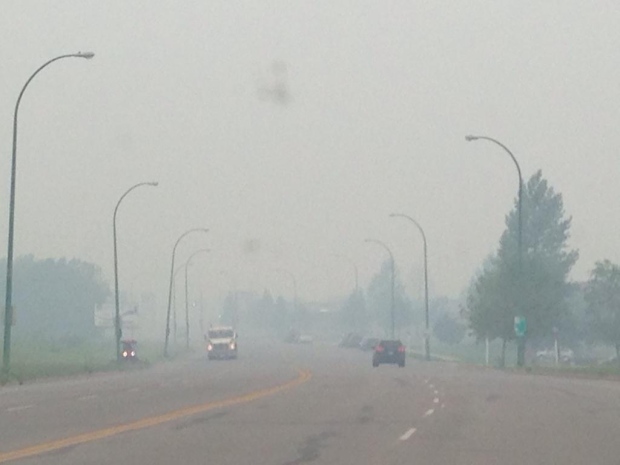
Smoke from wildfires in northern Saskatchewan has left a thick haze in the air across much of the Prairies, prompting Environment Canada to warn that the poor air quality could be dangerous to some.
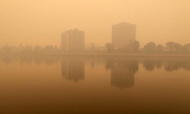
"A large area of smoke from forest fires is blanketing much of Saskatchewan," said an air quality statement from the Weather Office that applies to almost the whole province.
"Smoke near the ground may cause potentially high health risk conditions. The smoke is expected to persist over the next couple of days."
Seniors, children and those with breathing conditions such as asthma are considered at highest risk.
The smoke in Saskatchewan is coming from forest fires raging in the north of the province and in the Northwest Territories.
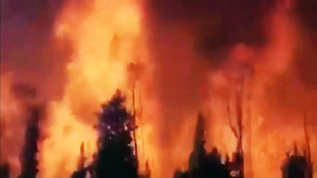
There are now 116 fires burning in Saskatchewan, fuelled by high heat and little humidity. The nights are bringing little relief from the heat, so many of the fires are continuing to spread through the nights.
Fires raging near La Ronge and La Loche, Sask. have forced many people to leave their homes.
Toddi Steelman, executive director of the University of Saskatchewan's school of environment and sustainability, said that conditions will likely stay prime for wildfires.
"The current trends with wildfire activity will be contingent on the continued drought that we're experiencing, the dry lightning, the low humidities and the dry vegetation that we've got out there," Steelman told CTV Saskatoon.
"So, unless we get a lot of rain, it's probably unlikely things are going to change in the near future," she added.
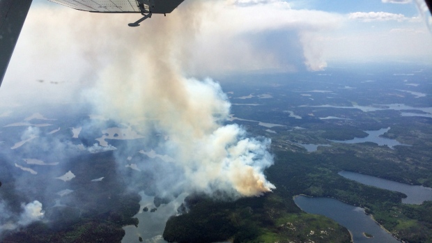
The largest of the fires is burning in central Saskatchewan, close to Prince Albert National Park.
The blaze has already burned the equivalent of 9,000 football fields. Crews from across the country have been summoned for help.
"We have a group of amphibious tankers from Quebec here now, another will be arriving from Newfoundland that has been order and we just briefed and started to deploy personnel that have arrived from Ontario to back up our ground crews," said Steve Roberts, executive director of the province's wildfire management branch.
Another 55 air tankers and helicopters are already fighting the blaze from above.
Fires raging near La Ronge and La Loche, Sask. Have also forced many people to leave their homes.
And roughly 1,700 people were evacuated from the Montreal Lake area on Monday, about 100 kilometres north of Prince Albert. Many were taken on buses to Saskatoon, North Battleford, Regina and Prince Albert.
In some places, the wildfires are burning so fiercely that they've jumped highways, causing crews to take special precautions and closures across the province.
"Highway transportation into those smoked areas we're looking at convoy-style pilot of vehicles through there to ensure that people aren't unnecessarily put and risk … so, we are controlling some of the access," said provincial fire commissioner Duane McKay.
In Manitoba, more than 200 people were evacuated from Red Sucker Lake First Nation Saturday, when a fire spread too close to the community. The residents are now staying at a hotel in Winnipeg and it's not clear when they'll be able to return to their homes.
The forest fire situation is no better in northwestern Alberta, where almost two dozen new wildfires were reported over the weekend.
Meanwhile in British Columbia, the province has already burned through nearly all its wildfire-fighting budget, with 43 wildfires currently active across the province, most in the northeast.
Environment Canada says much of Western Canada can expect another warm week, with daily highs reaching into the high-20s Celsius and into the mid-30s in some areas. The Weather Office also notes there's not a lot of rain in the forecast.


You need to be a member of Earth Changes and the Pole Shift to add comments!
Join Earth Changes and the Pole Shift