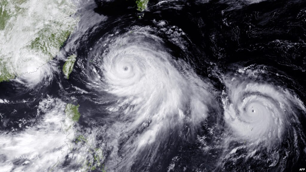
SHANGHAI (Reuters) - One of the most powerful typhoons to strike eastern China in decades disrupted air, rail and sea transport on Saturday after forcing the evacuation of more than a million people from the provinces of Zhejiang and Jiangsu, state media reported.


Two areas of Vancouver Island have introduced the highest water restriction levels as B.C.'s dry summer rages on.
The Regional District of Nanaimo and the city of Parksville announced Thursday that a Level 4 water ban was officially in place.
That means no outdoor sprinklers, no filling up swimming pools, and no washing cars, driveways, sidewalks, or buildings. Strict rules for watering gardens are also in effect.
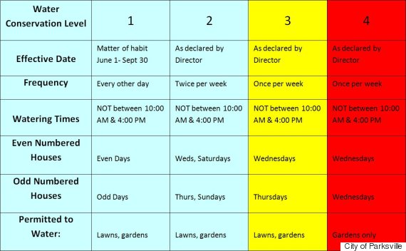
A breakdown of the different levels of water restrictions, from levels 1 to 4.
The City of Vancouver is currently under a level 2 water restriction, which means lawn-watering is allowed, but only on certain days of the week.
Some Vancouverites have reportedly been calling out wasteful neighbours for breaking the rules, leading to over 750 warnings and five $250 tickets being issued to residents, city spokeswoman Patricia MacNeil told CBC News.
Across the province, 197 fires are burning, prompting nine evacuation orders and eight states of local emergency. The B.C. government has spent nearly $97 million fighting the flames, far exceeding its $63-million budget already.
Environment Canada is predicting that the higher-than-normal temperatures and dry conditions will continue well into the fall.


You need to be a member of Earth Changes and the Pole Shift to add comments!
Join Earth Changes and the Pole Shift