"We warned at the start of ZetaTalk, in 1995, thatunpredictable weather extremes, switching about from drought to deluge,would occur and increase on a lineal basis up until the pole shift. Where this occurred steadily, it has only recently become undeniable. ZetaTalk, and only ZetaTalk, warned of these weather changes, at that early date. Our early warnings spoke to the issue of global heating from the core outward, hardly Global Warming, a surface or atmospheric issue, but caused by consternation in the core. Affected by the approach of Planet X, which was by then starting to zoom rapidly toward the inner solar system for its periodic passage, the core was churning, melting the permafrost and glaciers and riling up volcanoes. When the passage did not occur as expected in 2003 because Planet X had stalled in the inner solar system, we explained the increasing weather irregularities in the context of the global wobble that had ensued - weather wobbles where the Earth is suddenly forced under air masses, churning them. This evolved by 2005 into a looping jet stream, loops breaking away and turning like a tornado to affect the air masses underneath. Meanwhile, on Planet Earth, droughts had become more intractable and deluges positively frightening, temperature swings bringing snow in summer in the tropics and searing heat in Artic regions, with the violence of storms increasing in number and ferocity."
The wobble seems to have changed, as the temperature in Europe suddenly plunged after being like an early Spring, Alaska has its coldest temps ever while the US and much of Canada is having an extremely mild winter. India went from fatal cold spell to balmy again. Has the Earth changed position vs a vs Planet X to cause this?[and from another]Bitter cold records broken in Alaska - all time coldest record nearly broken, but Murphy's Law intervenes[Jan 30]http://wattsupwiththat.com/2012/01/30/bitter-cold-records-broken-in-alaskaJim River, AK closed in on the all time record coldest temperature of -80°F set in 1971, which is not only the Alaska all-time record, but the record for the entire United States. Unfortunately, it seems the battery died in the weather station just at the critical moment. While the continental USA has a mild winter and has set a number of high temperature records in the last week and pundits ponder whether they will be blaming the dreaded "global warming" for those temperatures, Alaska and Canada have been suffering through some of the coldest temperatures on record during the last week.
There has been no change in the wobble pattern, the wobble has merely become more severe. Nancy noted a Figure 8 format when the Earth wobble first became noticeable, in early 2005, after Planet X moved into the inner solar system at the end of 2003. The Figure 8 shifted along to the east a bit on the globe between 2005 and 2009, (the last time Nancy took its measure) as Planet X came closer to the Earth, encountering the magnetic N Pole with a violent push earlier in the day. But the pattern of the Figure 8 remained essentially the same. So what changed recently that the weather patterns became noticeably different in late January, 2012?
The N Pole is pushed away when it comes over the horizon, when the noon Sun is centered over the Pacific. This regularly puts Alaska under colder air, with less sunlight, and thus the historically low temps there this January, 2012 as the wobble has gotten stronger. But by the time the Sun is positioned over India, the N Pole has swung during the Figure 8 so the globe tilts, and this tilt is visible in the weather maps from Asia. The tilt has forced the globe under the hot air closer to the Equator, warming the land along a discernable tilt demarcation line.
The next loop of the Figure 8 swings the globe so that the N Pole moves in the other direction, putting the globe again at a tilt but this time in the other direction. This tilt is discernable in weather maps of Europe, again along a diagonal line. Depending upon air pressure and temperature differences, the weather on either side of this diagonal line may be suddenly warm or suddenly cold. The tilt and diagonal line lingers to affect much of the US and Canada, but the Figure 8 changes at this point to be an up and down motion, pulling the geographic N Pole south so the US is experiencing a warmer than expected winter under a stronger Sun. Then the cycle repeats, with the magnetic N Pole of Earth pushed violently away again as the Sun is positioned over the Pacific.
Would the Zetas be able to let us know what is causing the early break-up of the Arctic Ice, the ice seems to have taken on a swirling pattern at the same time, would this be wobble related?[and from another]http://www.vancouversun.com/news/national/Canada+Arctic+cracks+spec... The ice in Canada’s western Arctic ripped open in a massive “fracturing event” this spring that spread like a wave across 1,000 kilometres of the Beaufort Sea. Huge leads of water – some more than 500 kilometres long and as much as 70 kilometres across – opened up from Alaska to Canada’s Arctic islands as the massive ice sheet cracked as it was pushed around by strong winds and currents. It took just seven days for the fractures to progress across the entire area from west to east.[and from another]http://earthobservatory.nasa.gov/IOTD/view.php?id=80752&src=iot... A high-pressure weather system was parked over the region, producing warmer temperatures and winds that flowed in a southwesterly direction. That fueled the Beaufort Gyre, a wind-driven ocean current that flows clockwise. The gyre was the key force pulling pieces of ice west past Point Barrow, the northern nub of Alaska that protrudes into the Beaufort Sea.
The Figure 8 formed by the N Pole during the daily Earth wobble has shifted somewhat to the East, due to Planet X positioned more to the right of the Earth during its approach. This was anticipated, and well described in ZetaTalk, the Earth crowding to the left in the cup to escape the approach of Planet X, so the angle between these two planets would change slightly. This shift of the Figure 8 to the East is due to the push against the Earth’s magnetic N Pole occurring sooner each day than prior. Thus instead of occurring when the Sun is high over the Pacific, over New Zealand, it is now occurring when the Sun is high over Alaska. All the wobble points have shifted eastward accordingly.
This has brought a lingering Winter to the western US, and a changed sloshing pattern to the Arctic waters. Instead of Pacific waters being pushed through the Bering Straits into the Arctic when the polar push occurs, the wobble is swinging the Arctic to the right, and then later to the left, creating a circular motion in the waters trapped in the Arctic. Since the Earth rotates counterclockwise, the motion also takes this path. This is yet another piece of evidence that the establishment is hard pressed to explain. They are attempting to ascribe this to high pressure and wind, all of which are not new to the Arctic, but this circular early breakup of ice in the Arctic is new.
Nebraska Declares State of Emergency after Flood and Storm Damage
Parts of Nebraska saw over 8 inches (200 mm) of rain in 24 hours yesterday, 07 May 2015. Storm and flood damage has been so severe that Nebraska Governor Pete Ricketts declared a State of Emergency for the affected areas.
The Governor surveyed storm damage and flooding in Hebron, Deshler, Roseland, and near Lincoln via helicopter. Following the flight he said, “I have authorized an emergency declaration. At this time the Nebraska Emergency Management Agency is in contact with other state agencies and they are actively monitoring the situation and will provide assistance as needed.”
“The good news is nobody was hurt and everybody is safe. Utility crews are out there working. We did have a power outage last night in about a third of the town. As we flew over the state, we saw more utility crews continuing to work to restore power to folks in Roseland.”
Other affected areas include the town of DeWitt and the city of Fairbury, where 100s of people have been evacuated. The town of Crete saw 8.10 inches of rain fall in 24 hours. Salt Creek and Little Blue River are reported to be at flood stage at several points in the area.
Heavy rainfall cause severe flooding in the city of Lincoln, Nebraska. As much as 6.65 inches of rain fell in 24 hours at Lincoln Airport between 06 and 07 May 2015.
The mayor’s office of Lincoln issued a statement last night encouraging residents to evacuate flood-hit areas of the city. The statement said:
“Public safety officials are advising residents in the North and South Bottoms neighborhoods to voluntarily evacuate as soon as possible. The affected area is bordered by Folsom, 8th, Van Dorn and Cornhusker. Salt Creek is getting close to topping the levee as other creeks drain into it”.
The American Red Cross set up two shelters in Lincoln to house those evacuated. The mayor’s office warned that mandatory evacuations may follow, depending on the flood situation.
“The Salt Creek levee has not been topped. The next 24 hours will be critical. If the creek tops the levee, a mandatory evacuation may be necessary.”
Several people had to be rescued from flood waters. There were also reports of cars floating along roads and highways. No deaths have been reported.
Nebraska Rainfall
Below is a map showing official rainfall figures from NOAA / NWS for the area.
Image: NOAA
Rainfall figures from CoCoRaHS (Community Collaborative Rain, Hail and Snow Network) for a 24 hour period to 07 May 2015 show further extreme levels of rainfall. These figures are considered supplemental and are not official NWS figures.
While Italy is going through the heat wave more intense and premature in the history of Europe with peaks of more than + 40 ° C in Sardinia and, tomorrow, probably also in other regions of the South, northern Germany was hit in the last hours by violent storms that have spawned numerous tornadoes. The most serious has literally devastated Bützow Rostock and causing dozens of injuries. Fortunately at the moment there is no news of casualties. Several cars were overturned, many roofless houses with streets flooded by the tiles.
News - Updated Monday, May 4, 2015 by The Weather Channel- LA CHAINE METEO
The Jura and Savoies are hit by severe weather since last Thursday. Switzerland is no exception, with a historical flood Arve in Geneva and some flooding.
This severe weather is linked to a series of disturbances that sweep France and Central Europe. The torrential rains in Switzerland. Since last Tuesday, the average cumulative amount to 100mm (across the country), or the equivalent of one month of rain fell in 72 hours.
Historic flood Arve in Geneva
In the canton of Berne and Fribourg, firefighters intervened almost 300 times for the flooded houses. In Geneva, the Arve, which crosses the city, had a rate of twelve times higher than normal, making it the largest ever observed since 1935. This is a hundred-year flood. The trend is the decline since Sunday despite the resumption of the rains, lower than those experienced Thursday and Friday.
Colossal waves in California blamed on New Zealand storm
Reuters / Mike Blake
A recent storm near New Zealand is being blamed for major waves thousands of miles away off the coast of California this week.
The National Weather Service says Californians can expect to encounter massive waves through Tuesday this week as a result of the storm that erupted on Thursday and Friday in the southern hemisphere, the Los Angeles Times reported. According to the paper, a high-surf advisory has been issued for the west coast upon concerns that waves as tall as 15 feet could crash onto Newport Beach in Orange County. “Once those waves are created, they keep traveling until they reach land,” David Sweet, a weather service meteorologist, told the Times. “So we can thank our friends Down Under.”
The Orange County Register reported on Monday morning that waves taller than 18 feet have already been spotted at the Wedge, a popular surf spot by Newport Beach.
“It’s a washing machine,” 48-year-old surfer Christopher Scott told the Register on Sunday. “It can knock the wind out of you, break people’s bones. Some people don’t realize the power of The Wedge.”
“Right now, if a surfer came down here, I’d be like, ‘Dude, what are you doing?’” lifeguard Jonathan Richards told the paper eight miles up the beach in Huntington on Sunday.
According to the Associated Press, authorities had to rescue at least 16 people in Newport Beach on Sunday due to high waves. Additionally, the Carnival Imagination cruise ship was prompted to change course and dock in San Diego due to the extreme conditions.
"Therefore, in the interest of caution, the cruise ship ... deviated to San Diego," Carnival said in a statement.
The LA Daily News reported that current swells have been racing across the Pacific from New Zealand at a rate of around 30 miles per hour, according to NASA oceanographer Bill Patzert, covering upwards of 750 miles each day.
“This will carve a new coastline in some areas,” Patzert predicted.
California Drought Killed 12 Million Forest Trees Since Last Year
U.S. FOREST SERVICE
This aerial view shows Jeffrey pine and oak mortality in the Cleveland National Forest in San Diego County, April 2015.
In San Diego County, 82,528 trees, mostly Jeffrey pines across Mt. Laguna, have succumbed to a lack of rainfall, with many more struggling to survive.
An estimated 12 million trees across California’s forestlands have died over the past year because of extreme drought conditions, according to an aerial survey conducted April 8-17 by the U.S. Forest Service.
In San Diego County, 82,528 trees, mostly Jeffrey pines across Mt. Laguna, have succumbed to a lack of rainfall, with many more struggling to survive, said Jeffrey Moore, interim aerial survey program manager for the U.S. Forest Service.
DOCUMENT
Tree Mortality In Southern California Forests
The extent and severity of tree mortality, which occurred after the 2014 aerial surveys in Southern California Forests.
Recently dead or injured trees were mapped visually by a surveyor using a digital aerial sketch-mapping system flying in a light fixed-wing aircraft approximately 1,000 feet above ground level.
There is “very heavy mortality, a lot of discoloration in the pine trees that probably will expire sometime during this growing season, as well as oak trees that are suffering,” Moore said.
Moore was part of a team that surveyed the trees visually, using a digital mapping system while flying in a fixed-wing aircraft 1,000 feet above ground.
A tree’s survival often depends on its proximity to other trees, he said.
“A lot of trees are competing for whatever available moisture there is in a drought situation,” Moore said. “When you have too many trees in an area, it makes it hard on all of the trees.”
In Southern California, the researchers tracked more than 4.2 million acres in Cleveland, San Bernardino, Angeles and Los Padres National Forests, where they found an estimated 2 million perished trees. They combed another 4.1 million acres in the Southern Sierra Nevada, where they documented approximately 10 million dead trees. Their findings were compared to similar surveys taken in July 2014, Moore said.
In San Diego County, Moore said they found substantial pine mortality near Descanso Road in the Cleveland National Forest, and throughout Mt. Laguna.
The team did not attempt to map gold-spotted oak borer beetle-related mortality in this survey, he said. Nor did they track black oak trees, since it's unclear whether those without leaves are dead or just “leafing out”—bare but in the process of growing their new leaves for the spring.
The county’s forests are already reeling from the2003 Cedar Fire that devoured 280,000 acres, including in the Cuyamaca Mountains. The region was formerly blanketed by a coniferous forest, but recovery has been poor, Moore said.
“Most of those areas aren’t even coming back into trees at all,” Moore said. “They’re kind of being switched over now into Chaparral plants because they burned so hot the seed source is gone.”
Large trees, such as the Jeffrey pine, are important for storing carbon from the air. They also provide food and habitat for various species, including squirrels, deer and birds, such as the Pygmy Nuthatch that probes into clusters of pine needles for small insects.
U.S. DROUGHT MONITOR
This color-coded map shows drought conditions across the U.S., on April 30, 2015. Much of San Diego County, shown in red, is in an "extreme" drought. At this level, major crop and pasture losses are common, fire risk is extreme, and widespread water shortages can be expected, requiring restrictions.
“When you start thinking about what it takes for a tree, which is usually a fairly hearty type of plant to die off, it’s telling you a pretty clear signal of just how intense the drought has been,” said Brian Fuchs, climatologist with the National Drought Mitigation Center.
“These dead forests are going to be more primed for any type of fire,” Fuchs said. “Also, it’s going to impact water quality as there’s going to be more particulate that will go running off these hillsides into the rivers and streams.”
Fuchs said 67 percent of California remains in an “extreme” or “exceptional” drought, and conditions are expected to worsen as the dry season sets in.
“The heat of the summer really amplifies some of that development,” Fuchs said.
Cuba – 2 Killed in Havana Floods after 188mm of Rain
A storm dumped over 188mm (7.4 inches) of rain on Havana, Cuba, during 30 April 2015, leaving 2 dead and causing several buildings to collapse.
Local media say that one of the victims, an elderly man, drowned in the flood water in the Old Havana District of the city. The other victim was electrocuted after power cables were knocked down by the storm.
Water and power supplies were interrupted during the storm. At least three buildings collapsed and over 20 others were damaged. Building collapses are not uncommon in the older areas of the city, where housing stock is densely inhabited and generally in poor condition. In late November 2013, 2 people died in Havana after a building collapsed as a result of f....
The heavy rain flooded many of the city’s streets. The municipalities of Centro Habana, Old Havana and Cerro were the worst affected, according to local media. Flood water was over 50cm deep in some areas, causing problems for drivers and pedestrians.
More heavy rain is expected in the country over the next 24 to 48 hours, particularly in western regions. The torrential rains have been caused by thunderstorms that formed rapidly in the Florida Straits, ahead of a cold front, according to Cuba’s National Institute of Meteorology (INSMET).
Rainfall Figures
According to WMO figures, between 29 and 30 April 2015, Havana received 188.3mm of rain in 24 hours. Between 30 April and 01 May, Caibarién, Villa Clara saw 80.7 mm and Playa Girón, Matanzas 99.0 mm
Nearby Florida also saw some heavy rainfall. In 24 hours between 29 and 30 April 2015, Key West received 134.1 mm and Miami 53 mm.
Floods in Havana, Cuba, 30 April 2015. Photo credit: Juvenal Balán / Granma
PHOTOS:Power restored following record Saskatoon spring snowfall
Residents experience power outages, dig out from 30 centimeters of snow
Power has been restored for most of Saskatoon and city crews were out in force clearing streets following this weekend's record-breaking snowfall.
Saskatoon received 30 centimeters (12 inches) of snow, the most of any region between Outlook and Melfort that saw snow over the weekend. The previous records for April 25 and 26 were 9.4 centimeters in 1954 and 7.6 centimeters in 1945 respectively.
Power Outages
Heavy wet snow caused homes, businesses and traffic lights in 20 neighbourhoods across the city to lose power over the weekend.
On Saturday, the City of Saskatoon twitter account said there was an issue with the power supply for seven sub-stations, which affected west side neighbourhoods within Circle Drive. The substations were brought back online at 6:35 p.m. restoring power to many neighbourhoods.
By 4:20 a.m. Sunday morning, snow-covered branches and power lines caused more power outages throughout the city.
The outage also knocked out the city’s website, phone lines and service alert system (SAS) — a system that notifies residents via text and email of emergencies, power outages, and other situations across the city. The city website came back online at 9 p.m. but during that time Saskatoon Light and Power was unable to issue service alerts.
Communications manager Carla Blumers said the city will work to install more backups for when the SAS goes down.
Brendan Lemke with Saskatoon Light and Power said the final major outage was repaired around noon Sunday. He said crews were moving to secondary locations to service individual homes with power issues and should be done before the end of the day.
Anyone with issues of tree branches on power lines or outages can contact the city at 306-975-2621
Lemke said crews are unsure why the city's main transmission station and seven sub-stations went down Saturday, but he said they did see the lines galloping.
"(Galloping) means there's enough build up of ice and snow on a line where it acts like the airfoil or a wing of an airplane and it actually will start to lift as the wind blows across it. So the lines start to move and they can get too close together and then cause an outage that was," Lemke said, adding crews also saw an insulating material covered in ice and snow that showed signs of arching electricity.
The city did not know the exact number of houses affected by the outage.
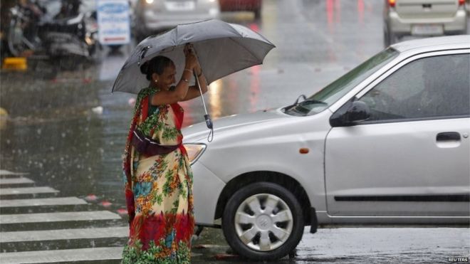
The storm, described by the meteorological department as a “mini- cyclone”, lashed Peshawar, Charsadda and Nowshera in the northwestern province of Khyber-Pakhtunkhwa.
Fallen trees and mobile phone towers and rubble from buildings blocked several key roads. In Peshawar, the roofs of several houses collapsed during the storm. The torrential rainfall resulted in the accumulation of three feet of water in some areas.
BEACHSIDE suburbs have been made over as winter wonderlands after a destructive hailstorm blanketed much of Sydney and the Blue Mountains with ice.
FIREFIGHTERS were expected to spend much of the night mopping up at Huntingwood, in Sydney's southwest, where five large factory buildings were brought down by the weight of up to half a metre of hailstones.
PHOTOS: Massive Hailstorm Buries Sydney, Australia
A strong thunderstorm crossed Sydney, Australia, on Saturday, covering the ground with hail.
The thunderstorm crossed the city during the late-afternoon hours on Saturday. In excess of 50 mm (2 inches) of rain and hail flooded roadways and covered yards. While individual hailstones were not large in size, the amount of hail was enough to bring significant problems
Lake Mead On Track For Record Low Water Level Amid Drought
By Victoria Cavaliere
April 24 (Reuters) - Nevada's Lake Mead, the largest capacity reservoir in the United States, is on track to drop to its lowest water level in recorded history on Sunday as its source, the Colorado River, suffers from 14 years of severe drought, experts said on Friday.
The 79-year-old reservoir, formed by the building of the Hoover Dam outside Las Vegas, was expected to dip below 1,080 feet on Sunday, lower than a previous record of 1,080.19 feet last August, according to the U.S. Bureau of Reclamation.
Predictions show that on May 31, the reservoir will have dipped again to 1,075 feet, well below its record high levels of around 1,206 feet in the 1980s, according to Bureau of Reclamation data.
Lake Mead supplies water to agriculture and about 40 million people in Nevada, Arizona, Southern California, and northern Mexico.
The water source and several other man-made reservoirs springing from the 1,450-mile (2,230-km) Colorado River, have dropped to as low as 45 percent of their capacity as the river suffers a 14th straight year of crippling drought.
About 96 percent of the water in Lake Mead is from melted snow that falls in "upper basin" states of Colorado, Utah, New Mexico, and Wyoming, officials said.
Over the past 14 years, snowfall has dropped in the Rocky Mountains, leading to a drop in snow pack runoff that feeds the river, according to Bureau of Reclamation statistics. In 2013, runoff was at 47 percent of normal.
The lake's levels are nearing a critical trigger where federal officials will have to start rationing water deliveries to Nevada, Arizona and parts of California. States in the region have enacted action plans to lessen greenhouse gas emissions linked to climate change.
A study carried out by the Bureau of Reclamation and the seven states in the Colorado river basin concluded that the drought was not likely to end soon, and that large metropolitan cities like Las Vegas and Phoenix grew rapidly during a rare wetter period for the river.
On average, the Colorado River Basin temperature is projected to increase by five to six F degrees during the 21st century, the report said. Mean annual runoff is projected to decrease by 8.5 percent by 2050. (Reporting by Victoria Cavaliere; Editing by Sandra Maler)
Incredible footage of a Sydney train station flooding during the storm of a decade on Wednesday has been captured on CCTV. A time lapse video, filmed from the platform over a 45 minute period at 11am, shows the water creeping along the tracks at Bardwell Park in Sydney's south forcing the partial closure of the T2 Airport line. At one point a worker in a high-vis jacket appears to look at the rising water to take a photo. The murky flood water eventually submerges the train line and begins moving like a river past the platform. Sydney's two-day total rainfall totalled about 225mm by 9am Wednesday – the most fall for almost 17 years.
You need to be a member of Earth Changes and the Pole Shift to add comments!
Join Earth Changes and the Pole Shift