Track the latest weather story and share your comments with CNN Weather on Facebookand Twitter.
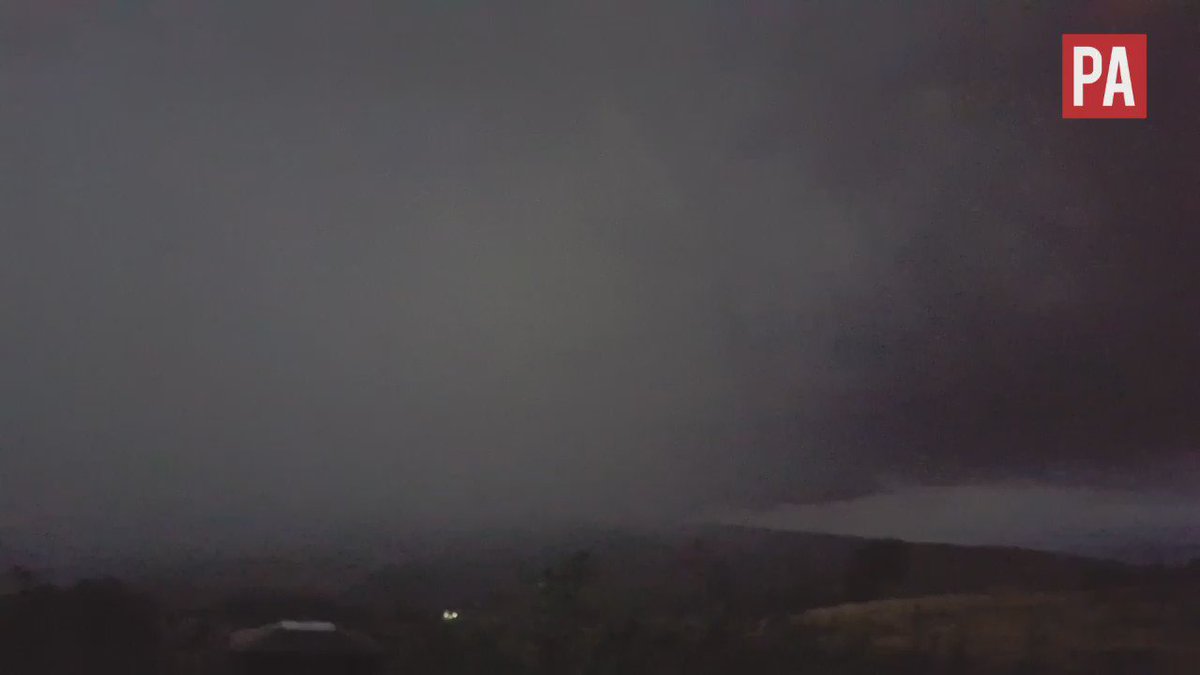
Residents reported a “tornado” touching down in Sheffield last night amid a night of extreme weather across the UK.
Conditions varied hugely across the country, with a high of 34.4C in Gravesend making Tuesday the hottest the day of 2016, and hottest September day since 1911.
During the evening, a number of Sheffield’s residents filmed what appeared to be a tornado unfurling on the outskirts of the city.
Extreme weather was experienced across the country. Manchester City's Champions League tie with Borussia Monchengladbach was cancelled due to the heavy downpour.
In addition to the Etihad Stadium, an Asda supermarket in Greater Manchester had to be closed after torrential rain caused a flash flood in the shopping aisles.
People were also forced to wade through knee-deep water in the centre of Mancherster. Residents awoke to sink holes in Mancheser's streets.
In Lancashire, 20,000 homes were left without power throughout Tuesday night.
The Met Office recorded “quite intense thunder activity” in the Sheffield area, but has no record of tornado activity. “It’s quite possible there was a tornado and they are not that unusual,” Grahame Madge, senior press officer for The Met Office, told The Independent.
“It’s very difficult to record a tornado unless people have seen them first-hand,” he said.
“They often don’t leave a trace. Tornados can be so fleeting and transient.”
Mr Madge maintained, however, the perfect conditions needed for a tornado to take place were not present in Sheffield last night.
While it was warm and humid, “the conditions in the upper atmosphere were not perfect.”
Sheffield continued to face torrential rainfall in the evening, which disrupted the pre-match build-up to Sheffield Wednesday’s football match against Bristol City.


You need to be a member of Earth Changes and the Pole Shift to add comments!
Join Earth Changes and the Pole Shift