


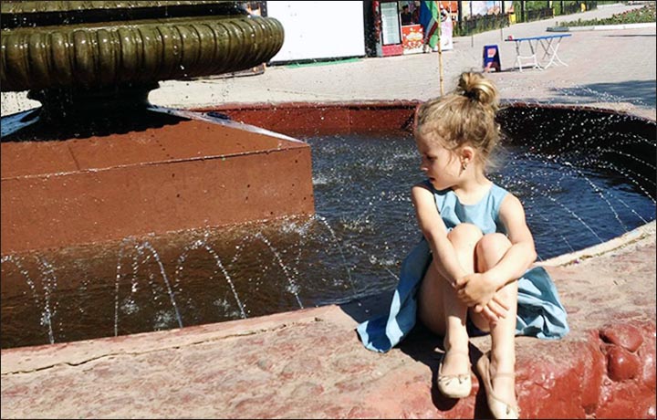
Homes in Arborfield, Sask., are being evacuated after a structure holding water back south of town broke apart.
The province said a "hold back road" has given way and water is flowing towards the west side of the town, located about 260 kilometres northeast of Saskatoon.
The breach is about 30 metres wide and it usually holds back about a kilometre-and-a-half of water. The province said water flowing into town from the breach is expected to hit as early as this evening.

People leaving Arborfield, Sask., after mandatory evacuation ordered for approximately 400 residents. (Devin Heroux/CBC)
The town issued the evacuation order and door-to-door notification has begun.
Approximately 400 people who live in Arborfield are being told to head to the town office where officials can tell them where they can stay. Town officials said there is room for people to stay in nearby communities like Zenon Park.
Coun. Joanne Rusk told CBC News there's still full access in and out of Arborfield, and officials plan to stay at the town office until they are told they have to leave.
State of emergency declared
The towns of Arborfield and Carrot River, Sask., and the rural municipality of Arborfield have declared states of emergency after heavy rainfall caused flooding in both communities.
In two hours, 10 centimetres — or four inches — of rain fell in Carrot River.
As the declarations were made, it was still raining in both northeastern communities, and the situation is getting worse, according to Carrot River Mayor Bob Gagne.
Fifty basements have flooded so far and that number is expected to rise as rain continues to fall and drainage systems struggle to keep up.

Water rises in Arborfield as residents leave town. (Devin Heroux/CBC)
A state of emergency was declared in Estevan, Sask., on Sunday evening after the southeastern city received 130 millimetres of rain. There are more heavy rainfall warnings again today, ranging from the southwest to the northeast.
- 'A disgusting mess': State of emergency declared in Estevan, Sask.,...
- Who got the most rain? Environment Canada releases latest totals

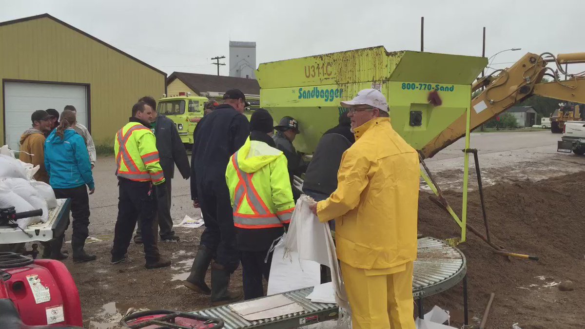
Sandbags and a berm attempt to hold back water from rushing towards Arborfield, Sask. (Devin Heroux/CBC)
Sandbagging and heavy machinery are currently being used to repair breaches in berms near Arborfield.
The town has evacuated its Special Care Lodge and sent residents to be with family or stay at other facilities in the Kelsey Trail Health Region.
There were 36 seniors removed from the long-term facility on Monday as a precaution. Sandbags placed around the lodge meant that water never entered the facility.
The water near the facility is receding, according to the province, and if rain subsides, residents could be back by the end of the week.
Highway 23 at Arborfield is closed due to flooding.
Arborfield is approximately 260 kilometres northeast of Saskatoon. Carrot River is about 25 kilometres north of Arborfield.


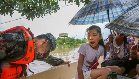
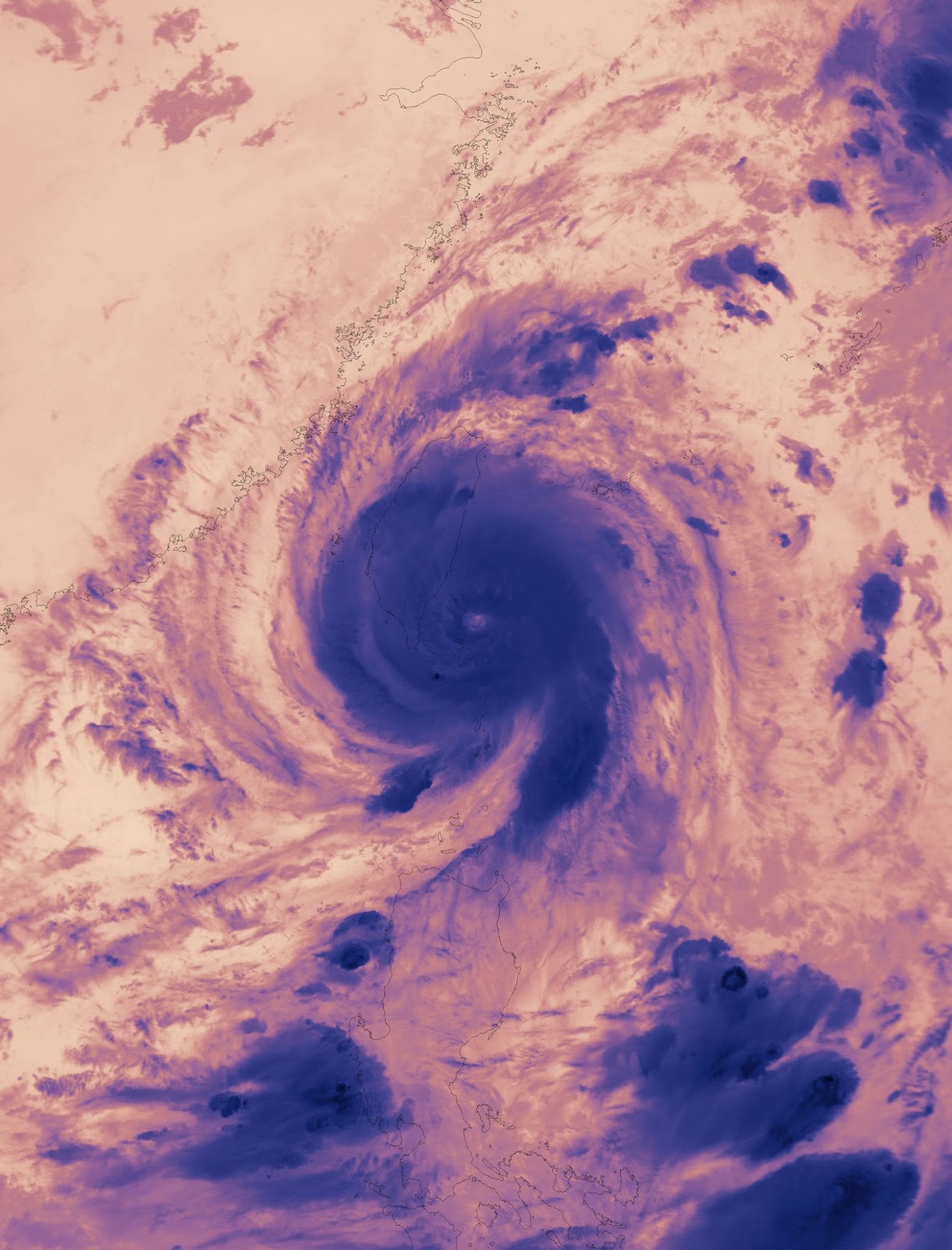


![Residents are moved to safety on Sunday in Tongling, Anhui province, as flooding continued to affect the city and other regions in central and eastern China. [Photo by Zhan Jun/For China Daily]](http://images.china.cn/attachement/jpg/site1007/20160704/b8aeed99045618e3e7ae0b.jpg "Residents are moved to safety on Sunday in Tongling, Anhui province, as flooding continued to affect the city and other regions in central and eastern China. [Photo by Zhan Jun/For China Daily]")
You need to be a member of Earth Changes and the Pole Shift to add comments!
Join Earth Changes and the Pole Shift