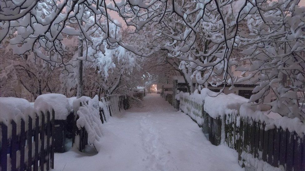
Wild Weather, the Wobble Effect
TOTAL DESTRUCTION IN PARTS OF CEBU CITY, PHILIPPINES, 05.11.25
Massive flooding in Da Nang, Vietnam. 30.10.2025.
Giant waves crash over seawalls during a storm
in the suburbs of Taipei, Taiwan. 21.10.2025
"We warned at the start of ZetaTalk, in 1995, that unpredictable weather extremes, switching about from drought to deluge, would occur and increase on a lineal basis up until the pole shift. Where this occurred steadily, it has only recently become undeniable. ZetaTalk, and only ZetaTalk, warned of these weather changes, at that early date. Our early warnings spoke to the issue of global heating from the core outward, hardly Global Warming, a surface or atmospheric issue, but caused by consternation in the core. Affected by the approach of Planet X, which was by then starting to zoom rapidly toward the inner solar system for its periodic passage, the core was churning, melting the permafrost and glaciers and riling up volcanoes. When the passage did not occur as expected in 2003 because Planet X had stalled in the inner solar system, we explained the increasing weather irregularities in the context of the global wobble that had ensued - weather wobbles where the Earth is suddenly forced under air masses, churning them. This evolved by 2005 into a looping jet stream, loops breaking away and turning like a tornado to affect the air masses underneath. Meanwhile, on Planet Earth, droughts had become more intractable and deluges positively frightening, temperature swings bringing snow in summer in the tropics and searing heat in Arctic regions, with the violence of storms increasing in number and ferocity."
ZETATALK
Wild Weather, the Wobble Effect - Earth Changes and the Pole Shift
Views: 637998
Comment
-
Comment by Juan F Martinez on March 4, 2017 at 11:25pm
-
Zimbabwe – Floods Leave 246 Dead after an absolutely astonishing shift from a drought condition to an excessive saturation mirroring events in California
In a country where millions have been affected by a crippling drought in the last couple of years brought on by the super El-Niño event, an absolutely astonishing shift has taken place from a drought condition to an excessively wet situation” and there have been heavy (rain) falls that have surpassed all previous years. The situation was exacerbated by Tropical Cyclone Dineo in mid-February.The government of Zimbabwe has appealed to international donors to help those affected by floods in the country during the 2016 to 2017 rainy season.246 people have died, 128 people injured and approximately 1,985 made homeless by flooding in the country since October 2016.The country’s Civil Protection agency reported a few days ago that another 859 people remained displaced after flooding in Tsholotsho District in Matabeleland North, where the Gwayi River and its tributaries burst their banks in the latest deluge.Across the country as a whole, the minister, Mr. Kasukuwere said that over 2,500 homes have been damaged since October and some communities are still cut off by the floods. Roads, schools and health facilities have also suffered damage. The districts of Mberebgwa, Insiza and Lupane have suffered major road damage. Full damage assessments are yet to be carried out in some areas that remain inaccessible due to flooding.And as is happening this month in California, Mr. Kasukuwere added that “85% of dams in the country are full and spilling, thus even low amounts of rainfall will cause flooding.” Around 70 small and medium sized dams have already been breached.Just last November it was reported that Zimbabwe's dam levels had fallen to below 40 percent following the devastating drought that has left millions in need of food aid and local councils rationing water, Vice President Emmerson Mnangagwa said on Friday.An El Nino weather pattern, which ended in May, triggered drought conditions across the southern African region that hit the staple, maize, and other crops and dented economic growth.
Mnangagwa said the last time Zimbabwe experienced such a severe drought was in 1992, adding that the biggest dam in the south of the country was only 9 percent full.http://www.thebigwobble.org/2017/03/zimbabwe-floods-leave-246-dead-...
-
Comment by jorge namour on March 4, 2017 at 4:33pm
-
Wave clouds spotted 'breaking' again, this time over Christchurch Airport
NEW ZEALANDSaturday Mar 4, 2017
Waves looked like they were breaking in the sky above Christchurch Airport last night in the second "wave cloud" formation spotted in as many weeks around the country.
http://www.nzherald.co.nz/nz/news/article.cfm?c_id=1&objectid=1...
Wave clouds, were spotted over Christchurch Airport on Friday night. Photo/ Facebook
Just under two weeks ago similar wave clouds were spotted in Palmerston North,
The "breaking wave" cloud formed over the eastern side of Palmerston North nearly two weeks ago. Photo / Carl Gadsby
-
Comment by KM on March 4, 2017 at 12:31pm
-
http://www.usatoday.com/story/news/nation-now/2017/03/02/western-sn...
Out West, the snow is so deep that scientists don't have any tools to measure it
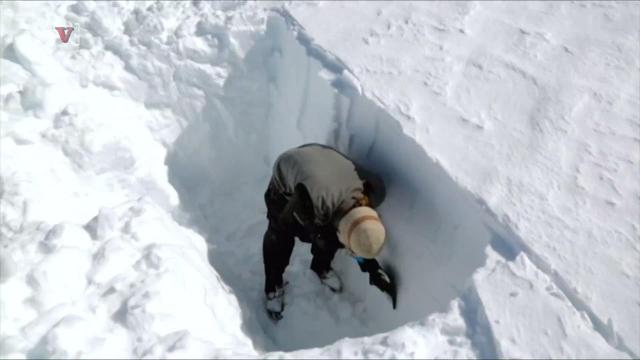
California’s wild winter of incredible snowfall has scientists struggling to even measure it. Nathan Rousseau Smith
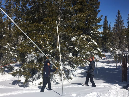
One sure sign the Sierra Nevada is experiencing a historic winter is the snowpack is getting too deep for devices scientists use to measure it.
It’s a problem that cropped up Wednesday when researchers sought to confirm snow depth at a data site on Slide Mountain at Mount Rose Ski Tahoe near Reno.
“We’re not even close,” hydrologist Jeff Anderson said after jamming an aluminum tube more than 16 feet into the snowpack hoping to reach the ground below.
The snow-measuring snafu provided real life confirmation of what scientific instruments on the site already showed.
The Sierra Nevada is wrapping up a historic winter and that’s huge news for Nevada and California, states that have spent the past several years parched in drought.
“Who would have thought this two years ago when we were measuring the worst snowpack on record,” Anderson said.
The snowpack is 212 inches deep at the Slide Mountain SNOTEL site. Water content at the site was 74.6 inches, meaning there’s more than six feet of water in the 17-foot snowpack. It’s a record for March 1 at the site.
The previous record for March 1 snow water equivalent at the site was a little more than five feet in 1997. The overall site record was more than seven feet of snow water equivalent in May 1995.
Since Oct. 1, the first day of what’s referred to as the “water year,” there’s been nearly eight feet of precipitation at the Slide Mountain site. Much of it has been rain but there’s plenty of snow.
Mount Rose Ski Tahoe has measured a total of about 54 feet since the beginning of ski season.
The total precipitation so far makes it the second-wettest year at that SNOTEL site, with seven months remaining in the water year.
An average year at the site sees a little more than four-and-a-half feet of precipitation.
The big numbers aren’t limited to one SNOTEL site.
The overall snowpack in the Truckee River Basin is 207% of normal for the date. The Lake Tahoe Basin snowpack is at 220%. The Carson River Basin is at 210%. The Upper Humboldt Basin, which is an important basin for rural northern Nevada, is at 156%.
California’s March 1 snowpack totals are equally impressive.
At the Phillips snow course site south of Lake Tahoe the water content jumped from 28 inches at the beginning of February to more than 43 inches March 1. Snow depth was more than nine feet.
Statewide, the California snowpack is at an estimated 185% of normal for the date.
In fact, there’s more snow now than there usually is on April 1, when the snowpack tends to peak.
“We busted through April 1 values pretty much at all snow courses throughout the state,” said Frank Gehrke, chief of the California Cooperative Snow Surveys Program.
Although the impressive snowpack has delivered much-needed drought relief the region still faces long term environmental challenges due in large part to global climate change.
Nighttime lows in the Sierra Nevada are trending warmer and the mean freeze level is getting higher. Both trends threaten to make large snowpack winters less frequent in the future.
A greater percentage of precipitation coming in the form of rain instead of snow and irregular snow-melt cycles makes it more difficult for communities to capture water for public use.
“Instead of making its way into our faucets, the snow we have now could be washed away into the ocean,” said Juliet Christian-Smith, senior climate scientist and water expert at the Union of Concerned Scientists, wrote in a statement about the California snowpack. “Even in heavy snow years like this one, global warming is the wild card in our water security.”
-
-
http://www.13newsnow.com/news/hawaii-picks-up-8-inches-of-snow-over...
Hawaii picks up 8 inches of snow overnight after blizzard
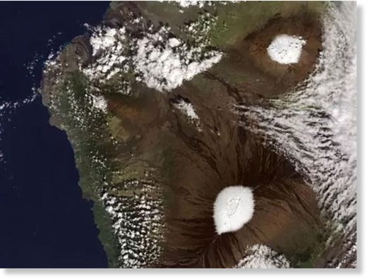
Do you want to build a snowman in paradise? Hawaii's mountainous peaks picked up 8 inches of snow overnight this week after a blizzard hit the summit of Mauna Kea on the Big Island of Hawaii.
Most of the snow fell late Tuesday into early Wednesday, and a blizzard warning for Mauna Kea and its sister peak Mauna Loa was canceled Thursday. A few additional snow showers were forecast, with no accumulation expected.
While the summits received snow, the rest of the Big Island dealt with heavy rain and thunderstorms that pelted the lower elevations. Both Oahu and Kauai were under flash flood warnings. Temperatures were mild, with highs in the 70s and 80s.
Snow on Hawaii's peaks is not uncommon in the colder months because they are nearly 14,000 feet high. Mauna Kea has a sub-Arctic climate, the weather service said.
“As long as we have deep enough clouds to support ice crystals, and when you have cold enough temperatures at the summit level, you can get snowfall,” said Matthew Foster, a staff meteorologist with the weather service in Honolulu.
Snow fell on both mountains on at least two occasions in December. Mauna Loa and its sister peak of Mauna Kea are both volcanoes. Mauna Kea is the highest point in the state.
The only other area of Hawaii that gets snow with any regularity is the Haleakalā volcano on Maui, which at about 10,000 feet gets snow once every five years or so.
The coldest temperature ever recorded in Hawaii was 12 degrees on Mauna Kea on May 17, 1979, the weather service said.
-
Comment by Mark on March 2, 2017 at 1:11pm
-
Antarctic temperatures hit unprecedented high of 17.5C as continent's warming accelerates
Researchers record hottest ever reading on Earth's coldest continent where temperatures usually range between -10C and -60C
http://www.independent.co.uk/news/science/antarctica-temperature-hi...
Temperatures in Antarctica have reached a record high, hitting an unprecedented 17.5C, the United Nations weather agency has announced.
An Argentine research base near the northern tip of the Antarctic recorded the temperature in March 2015, new analysis has revealed.
The World Meteorological Organisation (WMO) announced the finding after analysing data from a number of recording stations.
The temperature, more common in the Mediterranean than near the South Pole, is a significant departure from Antarctic averages, which range from -10C on the continent’s coast to -60C in the interior.
The region is made up of ice 4.8 kilometres thick, which contains 90 per cent of the world’s fresh water. If it were all to melt, experts say sea levels would rise by 60 metres.
-
-
http://www.thelocal.ch/20170224/switzerland-breaks-records-with-bri...
Switzerland breaks records with brief spring in February
Thursday was exceptionally warm in Switzerland with many places across the country seeing temperatures of around 20 degrees, breaking previous records for the month of February.
The unseasonal weather, due to a mass of dry, hot air moving up from Spain, meant it felt more like the end of April than February, with temperatures on the Swiss lowlands some 12 degrees warmer than usual for this time of year, said MeteoNews.
The cities of Nyon, Sion, Aigle and Neuchâtel all broke their previous February records. In Sion, the mercury rose to 21.2 degrees, smashing its previous record of 19.8 set in 1998. Nyon reached 18.4 degrees and Aigle 19.5.
Cities in German-speaking Switzerland were also affected, with Thun, Interlaken and Basel-Binningen all surpassing 20 degrees. Lucerne wasn't far behind with 19.9 degrees, Zurich reached 19.5 and Bern set a new city record for February with 18.5 degrees.
The temperatures were helped by a strong foehn wind which brought gusts of up to 90km/hr in some places, said MeteoNews. However the brief spring has already disappeared as quickly as it arrived. The arrival of a cold front in the night of Thursday to Friday saw temperatures fall rapidly back to the norm for this time of year.
-
Comment by lonne rey on March 1, 2017 at 11:07am
-
Chicago records no snow on ground in January, February for 1st time in 146 years
http://www.chicagotribune.com/news/local/breaking/ct-no-snow-januar...
"This is occurring against a backdrop of a changing climate," Skilling said. "I think the door is open to additional unusual weather events as we go forward."
Typically, January and February are the snowiest months of the year, said Jim Angel, state climatologist at the University of Illinois' Illinois State Water Survey.
"It's pretty impressive for any place in the northern part of the state to go both January and February with no snow on the ground," he said.
-
-
Iceland gets record breaking snowfall
http://www.bbc.co.uk/newsbeat/article/39104230/iceland-gets-record-...
The snow in the capital peaked at 51 cm.
Only once in history has this been topped, when snowfall in the city reached 55 cm in January 1937.
-
Comment by Stanislav on February 25, 2017 at 10:08pm
-
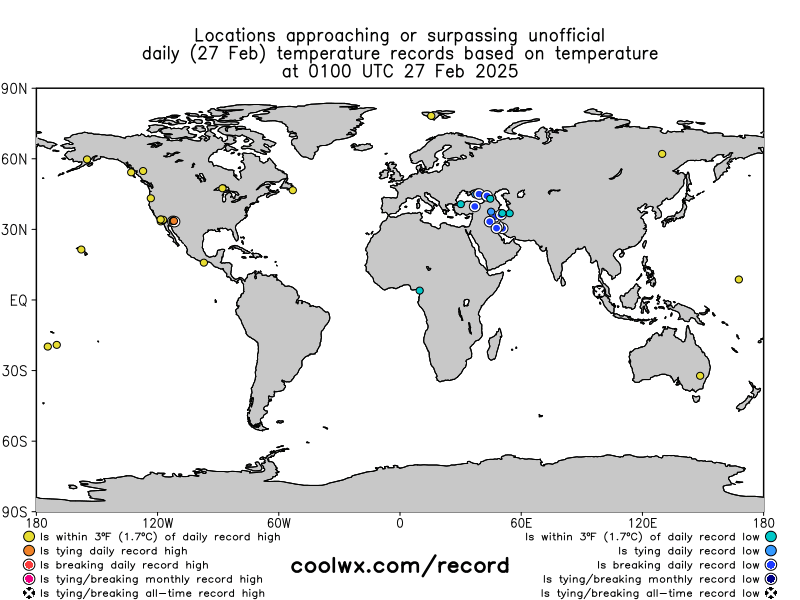
Record-breaking temperature across the Globe. Source: coolwx.com
Source: coolwx.com
It Just Hit 73 Degrees In Boston. That's The Warmest Ever For February

Robyn Wessman, 12, of Belmont, scooped up melting ice water at the Boston Common’s Frog Pond on Friday. By Maddie Kilgannon GLOBE CORRESPONDENT FEBRUARY 24, 2017. Source: bostonglobe.com
24 February, 2017. Some see it as a welcome winter respite. Some might also see it as an unnerving sign of a warming planet.
It hit 71 degrees in Boston just after noon on Friday - the city's warmest temperature ever recorded for the month of February. The temperature ticked all the way up to 73 after 3 p.m.
That surpasses the 70 degrees reached on Feb. 24, 1985. Boston temperature records go back to 1872, according to the National Weather Service.
Worcester on Friday also set an all-time record for February, at 68 degrees. That city's temperature then edged up to 69.
Additionally, the weather service said records were close to breaking in Providence, Rhode Island, and Hartford, Connecticut. The day before, Thursday, reached 68 degrees in Boston - a record for Feb. 23, and now a tie for the third-highest temperature ever recorded in February.
Boston was among many places in the Eastern United States to set a single-day temperature record for Feb. 23. Farther south, a different record was set: the earliest calendar-year occurrence for a 100-degree day in McAllen, Texas. In Massachusetts, the unseasonably warm temperatures continue Saturday, WBUR meteorologist David Epstein forecasts, before more normal readings in the 40s return Sunday. Source: wbur.org
Milwaukee reaches warmest winter temperature ever (US)
22 February, 2017. The 71-degree temperature recorded at Mitchell International Airport shortly before 3 p.m. Wednesday is the warmest temperature ever recorded in Milwaukee during meteorological winter — or December through February — the National Weather Service in Sullivan said. Source: jsonline.com
All-time high temperature for February recorded at Westover (US)
24 February, 2017. If you don’t remember the weather in February being this warm, you are right!
As of 2:00 P.M., the temperature at Westover Air Reserve Base in Chicopee reached 72 degrees. That beats the previous high for this date of 71 degrees, which was set back in 1985.
More than that though, Friday’s record-breaking temperature is actually the highest temperature ever recorded at Westover in the month of February. Source: wwlp.com
Britain enjoys one of the hottest winter days ever as balmy Caribbean air sends temperatures rising to 65F (but snow, gales and rain are on the way)

Daffodils in full bloom at Tenby, West Wales, where visitors arrived in the area as unseasonably warm weather takes hold
20 February, 2017. A balmy Caribbean blast saw temperatures hit an astonishingly mild 65F (18.3C) in Britain today, making some parts of the country hotter than Spain and Greece.
The UK had already recorded its warmest day of the year by 9am, with London being the country's mildest spot this afternoon, and the surprisingly mild weather comes just one week after snowfall on the south coast.
<...>
By this afternoon Kew Gardens in South West London and Northolt in West London had hit 65F (18.3C), making it the hottest February 20 on record. This also made it the seventh warmest winter day on record, based on annual records from December 1 to February 28 going back 160 years. Britons abroad might be wishing they stayed at home, as Alicante reached 59F (14.8C), Menorca 63F (17.1C) and Ibiza 59F (15.1C), MeteoGroup said.
Elsewhere temperatures were 61F (16C) in Athens and Barcelona today, while it was 59F (15C) in Corfu and 57F (14C) in Malta, Rome and Marrakesh.
But the warm UK temperatures were mainly found in London - Edinburgh reached 57F (13.7C), Exeter 56F (13.6C), and Blackpool 50F (10C).
Today's high in London edged towards the highest February temperature since records began - 67F (19.7C) at Greenwich Observatory in South East London, on February 13, 1998. <...> Source: dailymail.co.uk
-
-
https://www.washingtonpost.com/news/capital-weather-gang/wp/2017/02...
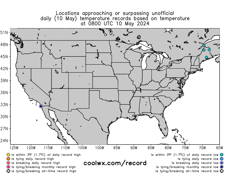
500 inches and counting: Snow has clobbered California ski resorts this winter

Scene at Squaw Valley Alpine Meadows ski resort: The snow is so high that it's burying chairlifts, forcing ski resorts to close.
The snow amounts in California's Sierra Nevada mountain range this winter are difficult to wrap your head around. In many cases topping 500 inches, they are some of the highest totals in memory.
At the Squaw Valley Alpine Meadows resort, seven feet fell in just the past week. The snow is so high that it buried chairlifts and ski patrol shacks.
Snow blankets the Squaw Valley Alpine Meadows resort, which has been hit with 565 inches (47 feet) of the white stuff this season.
The resort has received 565 inches (47 feet) this season, including a 45-year record of 282 inches in January. On Thursday, it announced that its ski area would remain open through July 4. Since 1962, it will mark just the fourth instance of Independence Day skiing (the other years were 1998, 1999, and 2011), according to a resort spokesperson.
Other ski areas in the Sierra Nevada also have seen mind-boggling amounts of snow (totals via SnowBrains.com):- 636 inches at the Mount Rose ski area in Nevada.
- 584 inches at Boreal Mountain.
- 556 inches at Kirkwood, including 80 inches this week.
- 544 inches at Heavenly, including 81 inches this week.
- 534 inches at Northstar, including 84 inches this week (61 inches in 48 hours).
- 510 inches at Mammoth.
The prolific snowfall has resulted from phenomena known as atmospheric rivers, which are essentially rivers in the sky that carry vast amounts of moisture. Like a fire hose, they have bombarded central and northern California, repeatedly.
"We usually see three or four atmospheric rivers in a season," Scott McGuire, a meteorologist with the National Weather Service office in Reno, told the San Francisco Chronicle. "We've already had 10. We've had so much snow to the point where it's getting hard to measure."
California's Natural Resources Agency said Wednesday that the water contained in the state's snowpack is 188 percent of normal.
The mountain snow and low-elevation rain have ended the multiyear drought over large parts of the state. Only 17 percent of California remains in drought, according to the latest U.S. Drought Monitor data.
California's record drought is officially over thanks to record precipitation
More snow and rain are on the way Sunday and Monday as the next Pacific storm system rolls ashore.


© 2025 Created by 0nin2migqvl32.
Powered by
![]()
You need to be a member of Earth Changes and the Pole Shift to add comments!
Join Earth Changes and the Pole Shift