
At least 2 400 preliminary daily cold temperature records, including cold maximums and minimums, were broken or tied at longer-term sites (75+ years of data) in the United States from February 12 to 16, 2021. The cold snap peaked from February 14 to 16. Another winter storm will affect a large area from Friday, February 19 -- from the Lower Mississippi Valley into the Mid-Atlantic and Northeast.
Over just the past week, much of the Lower 48 has been punished with record-breaking cold and unusually heavy snow and ice, NWS Weather Prediction Center said.
From the Pacific Northwest across the Rockies and into the Southern Plains and Midwest, the snowfall has been measured in feet. Ice and snow continue to plague Texas and the Northeast.
In the NCEI database, approximately 30% of available U.S. sites set cold maximum records, and about 20% set minimum records.
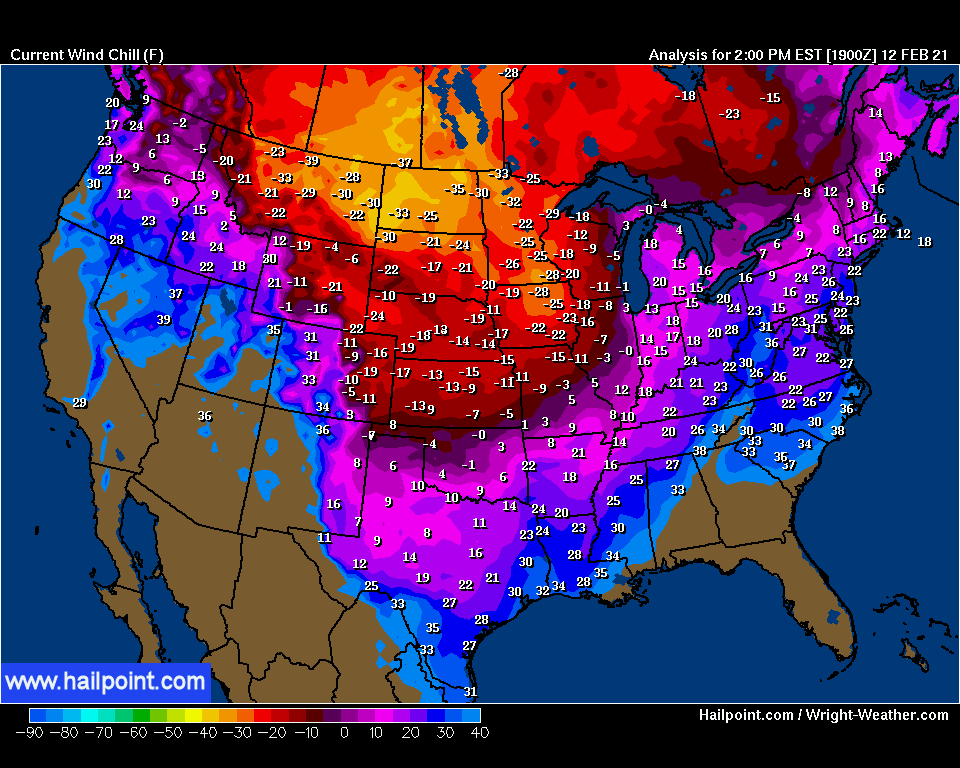
Analyzed temperatures were 22 to 28 °C (40 - 50 °F) below average over a large portion of the central and southern Plains.
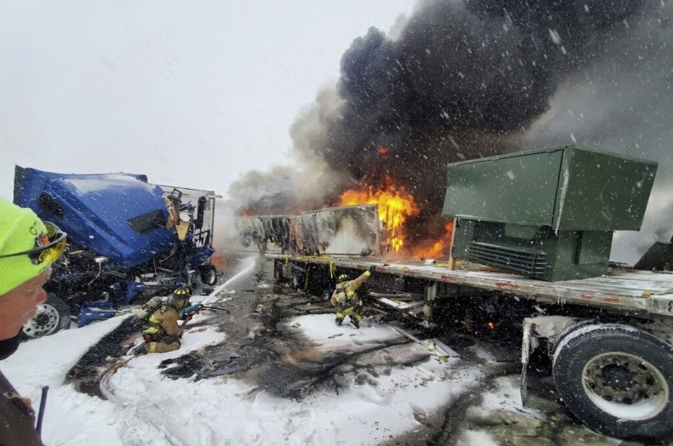
At the peak of the cold, more than 5 million homes were without power, most of them in Texas (4.3+ million). More than 30 people have lost their lives.

Credit: NOAA
Some of the records on February 15 and 16 include:
-38.8 °C (-38 °F) at Hibbing/Chisholm, MN on February 15. The previous record was -35.5 °C (-28 °F) set on February 15, 1939.
-36.1 °C (-33 °F) at Valentine, NE on February 15. The previous record was -33.3 °C (-28 °F) set in 2007.
-33.8 °C (-29 °F) at North Platte, NE on February 15. The previous record was -30.5 °C (-23 °F) set in 1881.
-35 °C (-31 °F) at Lincoln, NE on February 16. The previous record was -27.7 °C (-18 °F) set in 1978.
-34.4 °C (-30 °F) at Hastings, NE on February 16. The previous record was -25 °C (-13 °F) set in 1979.
-33.3 °C (-28 °F) at Sioux City, IA on February 16. The previous record was -31.6 °C (-25 °F) set in 1936.


73% of CONUS was covered in snow as of midnight CST, February 16, making it the greatest extent on record in the database which dates back to 2003.


Here are some snowfall totals over the past two days for the winter storm that entered Texas and Oklahoma Tuesday morning, February 16.
"Some very impressive numbers for what has been an extraordinarily active pattern over the past week," NWS WPC said.

On February 14, U.S. saw the largest area covered by issued Winter Storm Warnings in the Lower 48 states since at least 2005.
~1.6 million km2 (994 193 mi2) beats the previous number 1 day over the past 15+ years of 1.2 million km2 (745 645 mi2) on February 1, 2011.

A major winter storm will continue to bring significant impacts from the Mid-Atlantic to Northeast U.S. today, February 18, with significant ice accumulations and heavy snowfall expected.
Well below normal temperatures will exist throughout the central third of the country into the weekend.
Featured image: Temperature anomaly U.S. on February 15, 2021. Credit: NWS
Source: https://watchers.news/2021/02/18/2400-cold-temperature-records-brok...

 Multiple storms can be seen across the United States on this satellite image taken on Friday, Feb. 12, 2021. One storm lingered over the Southeast states as a storm pushed from the Rockies to the central Plains. A third storm can be seen along the Pacific coast in the Northwest. (CIRA at Colorado State/GOES-East)
 The snow in this 1,500-mile-long swath will be light and fluffy due to the Arctic air in place. This type of snow can be highly subject to blowing and drifting in a mere breeze amid the frigid conditions.
 Milder air will cause a wintry mix that includes some ice to develop from portions of middle Tennessee to southern Ohio and southwestern West Virginia as well as from northwestern North Carolina to much of Virginia. The icy mix will expand over the Interstate-95 corridor and coastal areas of the East from central Maryland to southeastern New England.
 A change to plain rain is most likely along much of the I-95 corridor, but precipitation is likely to start out as a period of ice at the onset in the mid-Atlantic and across southern New England, according to Rayno.
 Should the layer of cold air be deeper as the secondary storm develops along the coast, then snow may fall farther to the south in the Northeast states. Precipitation could change from ice or rain to snow along part of I-95 on Tuesday in that case.
 In a case of atmospheric deja vu, yet another storm may dip southward over the Central states with snow and ice during the middle of next week, grab Gulf of Mexico moisture and head northeastward later next week.


You need to be a member of Earth Changes and the Pole Shift to add comments!
Join Earth Changes and the Pole Shift