Earth Changes and the Pole Shift
New Madrid Adjustment under microscope

As per Nancy and zetas, we are in progress of the sequence of 7 / 10.
The Zeta sequence for 7 / 10 is as follows:
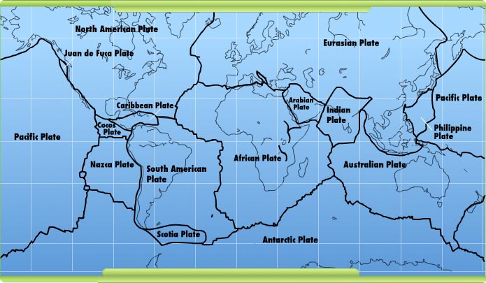
(1) a tipping Indo-Australia Plate with (2) Indonesia sinking,
(3) a folding Pacific allowing (4) S America to roll,
(5) a tearing of the south Atlantic Rift allowing (6) Africa to roll and (7) the floor of the Mediterranean to drop,
(8) great quakes in Japan followed by (9) the New Madrid adjustment,
(10) which is followed almost instantly by the tearing of the north Atlantic Rift with consequent European tsunami.
However, none of the steps have been 100% completed.
The indo-australian plate has been rising and tilting indicated by for example, the brisbane flood in January 2011 and Earthquake of 7.1 in Christchurch on 4th of September 2010 plus another quake of 6.3 on 22nd of February 2011 .
Indonesia has been sinking with lots of earthquakes, sinkholes, earth cracking, volcano eruptions, landsliding and off course flooding all around the coast line of Indonesia.
A folding pacific has created a lot of pressure tectonically in the pacific ocean and consequently a big earthquake magnitude of 9.0 happened on March the 11th 2011 in the ocean near the northern Japan with a 10 meter Tsunami and finally nuclear disasters. Please note that this is not the great quakes mentioned in the 7 / 10 sequence. Not yet!
Severe earth wobble has caused wild weather around the world. Drought, rain, bush fires, hailstorms, sandstorms, thunderstorms, cyclones, tornadoes, etc, have hit various part of the world. In US alone, we have seen close to 300 tornadoes in April 2011 alone and around 400 died in total.
South America is now showing signs of rolling west as per Nancy's blog in "7 of 10 Status as of April 28, 2011".
These are all precursors for the bigger events such as new madrid adjustment and off course the european tsunami in the 7 / 10 sequence. It took almost four months to get to step 4. It is time to prepare and please take it seriously!
The intention of this blog is to take a closer look at the new madrid adjustment in details and see if we can connect all the dots together. I thought that this could be beneficial especially for all new members who have only joined this ning recently but also a good reminder to all existing members.
Information has been compiled from Zetatalk, blogs from various members plus all other new madrid related information and articles on the world wide web .
Written June 19, 2010
We have described the plate movements to be anticipated during the hour of the pole shift as a scripted drama, and stated that the plate movement ahead of the pole shift can be anticipated to fall along those lines. Thus, our statements that the New Madrid zone will adjust at the hour of the pole shift was well as before that hour are consistent. The Atlantic is tearing now, thus the Iceland volcanoes, and will tear further well before the pole shift to cause the European tsunami, as we have described. But this in no way compares to the major tearing of the Atlantic that occurs during the hour of the pole shift. The Seaway is pulling apart now, thus the humongous sinkhole just NE of Montreal, but this is no way compares to the pulling apart that will occur during the hour of the pole shift. When we speak of a New Madrid adjustment as potentially part of a 7 of 10 or an 8 of 10 stage, we are not speaking of the pole shift adjustments. Those are regularly referred to as the hour of the pole shift, to differentiate any Earth changes that come before. Prior to the pole shift, the New Madrid will adjust. Canada remains firmly attached at her border with the Eurasian Plate, and thus the Seaway will participate in this pre-shift New Madrid adjustment. But the primary reaction will be along the Mississippi, with bridges failing and land just to the west of the Mississippi dropping slightly. Certainly this adjustment, which may be a series of large quakes, will shatter cities throughout the region and affect cities all the way to the Great Lakes and down into Mexico.
The New Madrid adjustment
Where the N American continent is under great stress, it has not slipped because it is held in place on both sides. The Pacific side holds due to subduction friction along the San Andreas, and the Atlantic side holds due to the Atlantic Rift's reluctance to rip open. What changes this dynamic? When S America rolls, almost in step with the folding Pacific, it tears the Atlantic Rift on the southern side. This allows Africa freedom to move and it rolls too, dropping the Mediterranean floor above Algeria. What is holding the N American continent together has thus eased, so that when the Japan adjustments are made, there is less holding the N American continent in place than before, and the New Madrid gives way


The New Madrid adjustment will affect so much area, in a domino manner, that it will not be a single large quake, but a series, separated by weeks and months. The primary adjustment will be within days, after shocks for weeks, but months later still, adjustments. The New Madrid is associated with fault lines that run up toward the Great Lakes, Chicago will adjust and rupture, Ohio will be pulled in places, and as we have explained, the land to the West of the Mississippi will sink in places. There is a known fault line that runs from the center of the Gulf up along the East Coast, thus the effect in 1811-12 in the Carolinas and DC on up to Boston. Then, as we have explained, there will be a bow from San Diego out to Arizona, which will rupture the great dam on the Colorado. When this bow, which forces Mexico too far to the West for the comfort of the West Coast, adjustes, it will be a slip-slide adjustment of the San Andreas and related fault lines up the coast.


In September, FEMA's associate administrator for Response and Recovery, William Carwile, told a Senate panel that FEMA has five regional groups planning for possible earthquake responses, but a major quake along the New Madrid fault line could displace 7.2 million people and knock out 15 bridges. The response would require 42,000 first responders from local firefighters to the Pentagon."
"Although Memphis is likely to be the focus of major damage in the region, St. Louis, Mo., Little Rock, Ark., and many small and medium sized cities would also sustain damage, " the U.S.. Geological Survey found.
South Carolina is home to an active fault line, which could also produce a catastrophic earthquake.
A quake in Charleston in 1886 was a magnitude 7.6. That city in 2008 had a population in excess of 348,000. Much of that state's coastal area is at risk."
This year marks the bi-centennial of the New Madrid Quake. Mr. Nations is not the only one concerned many communities are making preparations and there aregeologists warning of the dangers. A new report out recently also stresses Americans are not prepared. FEMA is also asking that groups take part in the Great Earthquake ShakeOut Drill. A Map that shows the locations of the nuclear plants along the New Madrid Fault zone can be viewed here.

The Zeta mention that the Phoenix, AZ area will not be safe due in part to the breaching of dams along the Colorado River. I found 5 dams but there may be more.
The Zetas stressed in February that the Phoenix Lights redux UFOs were a warning about future changes in the southwest, a bowing in the
land from Mexico to northern California which would ultimately cause the Hoover Dam to break.
ZetaTalk Explanation 2/10/2007: And why the anniversary blitz of Phoenix lights? Is not the flat
dry desert of Arizona expected to remain relatively undisturbed, during the coming pole shift?
When the New Madrid Fault adjusts, Mexico will be too far to the West for the current comfort
of the West Coast, which will bow in the Southern California and Arizona region. The fault line
that runs along Mexico's west coast runs just under the Arizona border, then on up along the
west coast of California. Before the west coast of the US starts adjusting to the new position of
Mexico, with slip-slide adjustments, there will be a bending of the Arizona desert area that will
fracture the dry soil, create a breach in the great Colorado River dam, and allow magma to rise
in the calderas in the US - Mammoth Lake in California and Yellowstone. If the Hoover Dam
breaks, whither the city of Phoenix, which lies on flat land and near farm land irrigated by the
waters of the Colorado?
Davis Dam is a dam on the Colorado River about 45 miles (72 km)) downstream from Hoover Dam. It stretches across the border between Arizona and Nevada. Originally called Bullhead Dam, Davis dam was renamed after Arthur Powell Davis, who was the director of the U.S. Bureau of Reclamation from 1914 to 1932. The United States Bureau of Reclamation owns and operates the dam, which was completed in 1951.
The Flaming Gorge Dam is a concrete thin-arch dam in the Flaming Gorge of the Green River, a major tributary of theColorado River, in the U.S. state of Utah. One of the largest dams in the American West. Situated in Flaming Gorge, a canyon of the Green River named by John Wesley Powell, the dam was built and is operated by the U.S. Bureau of Reclamation. Groundbreaking for the structure began in 1958 and was completed in 1964.
The Glen Canyon Dam is the second largest dam on the Colorado River [1] at Page, Arizona, USA. Construction of the dam began in 1956 by the industrial conglomerate, Merritt-Chapman & Scott. Although the dam was not dedicated until 1966, it was able to begin blocking the flow of the river in 1963.
Hoover Dam, once known as Boulder Dam, is a concrete arch-gravity dam in the Black Canyon of the Colorado River, on the border between the US states of Arizona and Nevada. It was constructed between 1931 and 1936, and was dedicated on September 30, 1935 by President Franklin Roosevelt. Its construction was the result of a massive effort involving thousands of workers, and cost over a hundred lives.
Parker Dam spans the Colorado River between Arizona and California, 155 miles downstream from HooverDam
. Built between 1934 and 1938 by the Bureau of Reclamation.
The Morelos Dam (the last dam on the Colorado River) will not be able to hold back the upcoming deluge of the Colorado River as the dams above breach.
The Morelos Diversion Dam, located on the Mexico–Arizona border, is the southernmost dam on the Colorado River. It sends nearly all of the remaining water to irrigation canals in the Mexicali Valley and to the Mexican towns of Mexicali and Tijuana. As a result, the river rarely reaches the Gulf of California, normally the river's mouth. Consequently, the vast wetlands at the mouth of the Colorado River have been reduced to just a fraction of their former size, affecting vegetation and wildlife. Before the construction of a number of dams along its reach, the Colorado flowed 129 kilometers (80 miles) through Mexico to the Gulf of California.
http://www.waterencyclopedia.com/Ce-Cr/Colorado-River-Basin.html
The bowing stress on N. America is the result of the daily Torque Effect caused by Planet X gripping the highly magnetized Atlantic Rift. This causes the N American continent to be pulled into a bow, the Aleutian Islands pulled toward the tip of Mexico, with the center of the bow at San Diego.
ZetaTalk: N American Rip written Feb 10, 2006
We have discussed what we call the stretch zone, where a land mass is pulled apart so that the rock flakes pull across each other, silently, creating sinkholes and rifts and manifesting as broken gas and water mains and derailing trains. These stretch zones have dramatically expressed themselves in the African Rift area and in the SE United States and in the UK during the past couple years. When Planet X arrived in the inner solar system in 2003 and began seriously tugging at the highly magnetized Atlantic Rift, it accentuated this stretch on either side of the Atlantic. What went unstated during these discussions is why a stretch zone occurs. Look at S America, on the large S American plate. As the Atlantic is pulled apart, the Pacific compressed, it is required to have the upper part migrate to the West more than the tip, which is anchored at Antarctica. It moves as a whole, in the main, crunching the small plates in the Caribbean and Central America as it does so and popping the plate holding the Galapagos Islands which lies just to the west of S America. It can move, in short. But what of the African and N American plates?
The African Rift is caused because Africa is not free to move. It is bulbous at the north end, and comes to a tip at the south end. It is anchored at the south end, at South Africa, so when the Atlantic pulls apart, the bulbous northern part of the African plate moves directly eastward, yawing open the African Rift, along with the Red Sea, which is also widening. This inability of plates to move during the ripping apart of the Atlantic and compression of the Pacific is what will create a new rift up through Pakistan and above the Himalayas into Russia during the pole shift, equivalent to the St. Lawrence Seaway in N America. The Indio-Australia plate moves in the direction of the Himalayas, diving under them. Hawaii rises up during compression of the Pacific, so can move, if only up. Japan likewise is forced up, violently so, during Pacific compression. The Antarctica plate, as we have mentioned, is pressed down in the Pacific so will pop up on the Atlantic side, creating new land there ultimately during the pole shift.
The giant plates of N America and Eurasia are locked against each other, unable to rotate against each other due to their shape. Slip-slide along the West Coast, measured as a creep by geologists, is due only to slight adjustments along that edge of the plate, primarily due to adjustments within the small plates to the west of the N American plate, which move to accommodate pressure. The N American plate does not move, pre se, but other dramas occur. We explained, months before it expressed enough to show up on IRIS charts, the Earth torque caused as the N Pole continuing to rotate to the East while the S Pole was held back by Planet X, tending to open the globe like a jar of pickles. This creates a diagonal stress on the N American continent where New England is pulled to the east while Mexico is pulled to the West, so the New Madrid is put under slip-slide stress where one half, east of the Mississippi, will move toward the NE while the other, west of the Mississippi, moves toward the SW. The virtual hook of land in the N American continent near the Kamchatka peninsula is solid rock and will not snap off to become a separate land plate, nor would this ease the deadlock along the N American and Eurasian plates even it if did. These massive plates cannot move.
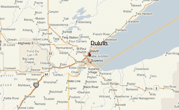
The stress on the N American plate will resolve by ripping. Ripping the St. Lawrence Seaway open. Pulling the SE down into the crumbling Caribbean and into the widening Atlantic, as neither of these sinking fronts will be able to support the edge of the weighty N American plate. There is pressure along the West Coast, of course, and as the N American plate confronts the compressing Pacific, this will only result in the predictable volcanic increases and West Coast earthquakes. But the primary drama preceding the pole shift will be the ripping action that a plate unable to move must endure. The notable area of catastrophe during this is the eastern half of the continental US. From Houston to Chicago to New England, the diagonal pull will tear the underpinning of cities and create a catastrophe for the US that will make the New Orleans disaster appear trivial. A widening Seaway also does not affect just those land masses bordering the Seaway, as buckling occurs inland and afar. What does man assume caused the Black Hills to be so rumpled, with the appearance of a recent bucking and heaving? This is the center of a land plate! The tearing of the Seaway does not end at Duluth, MN, it travels underground to S Dakota!


Indeed, tearing of the St. Lawrence Seaway will occur during the New Madrid adjustment. We have warned that quakes on the West Coast, or the Seaway, or in the New Madrid region will occur before the major quake in the New Madrid region we have referred to as the adjustment on a 7 of 10 level. There will be quakes in these areas, magnitude 4-7, which should not be considered the New Madrid adjustment of which we speak. Please do not ask, at every quake, what this "means". It means the New Madrid adjustment is still pending. When the tension in the N American continent starts to force major tearing of rock strata, so that the changes we have described can take place, this will not be all at once, simultaneously. We have described a series of large quakes, with one major one stemming from the New Madrid area that will be called a magnitude 9 but in truth will be larger. It is this quake that will set in motion adjustments elsewhere.

Mexico will lurch to the west as this major quake occurs, with a settling of land to the west of the Mississippi almost instantly afterwards. The Mississippi will seem to have widened, and those to the west will see a new view as they look east, as their land will have shifted to the southwest as well as dropped. Because the lurch of Mexico to the west actually intensifies the bowing of the N American continent, the Seaway tears open. This is actually various adjustments at weak points along the Seaway rather than the tearing apart into a larger inland bay that occurs during the pole shift itself. Niagara Falls will remain, but some of the inland locks will break. When the upper Mississippi region finds the land to its west slipping down and to the southwest, those parts north which were formerly firmly attached find they can spring northward, as the pressure from the bow had been inclining them to do. This allows the edge of the rip, at Duluth, MN, to tear further inland, with consequent rumpling in S Dakota and minor shifting of ground in all parts in between.

Due to the rise in sea level to 675 feet within two years after the pole shift, the N American continent will appear to be two separate land masses in the future. The 7 of 10 will not effect this change, but will tear most bridges on the Mississippi River when the New Madrid adjusts. This will of course affect travel and distribution of goods, but in that the Mississippi employs barges, a workaround will be arranged quickly enough. But after the pole shift the eastern half of the continent will certainly be more isolated. Travel across the widened seaway by boat, across the flooded Mississippi Valley by barge, and by foot through the swampy land of what is now northern Illinois will certainly be possible. After the New Madrid adjusts, those living in the US should be considering their proximity to loved ones, in this light, the travel restrictions being considered a wake-up call re what is coming if nothing else.
The Bridges And Structures
Of The Mississippi River
Second Edition — August 2007

In describing the 7 of 10 scenarios, we do not detail every minor quake or every point where a minor tsunami might be generated. The 7 of 10 scenarios did not even include the major quakes in Japan, which are predicted to be in the range of magnitude 9's. Nor did they include the tsunami that large quakes in Japan always involve, which we have recently stated could be considered to be as high as 150 feet for the South Island quakes. After the New Madrid adjusts the West Coast adjusts, as we have stated. We have not detailed this, as compared to the New Madrid this is minor. All the fault lines closely watched on the West Coast will adjust, the volcanoes nervously watched will erupt, and certainly the waters off the coast will be choppy if not generating some minor tsunami during the plate adjustments. The West Coast of the US is alert and guarded in this regard, as is Japan. They anticipate this type of activity, and will be alert to signs that a quake or eruption or tsunami is pending. Thus, we focus on the larger changes, and in warning those areas that will not receive such services from their governments.

There is general confusion about our predicted Earth changes. This is most often envisioned as happening all at once, suddenly, without warning. Where earthquakes and stretch zone accidents do seem to happen almost without warning, their approach is never that silent. The N American continent has been getting these warnings for some time, with increasing intensity. Quake swams in the New Madrid region and west of this spot have been occurring, and are on the increase. Sinkholes and shifting roadways are occurring from Pennsylvania through Tennessee and elsewhere. The center of the bow being formed by the N American continent, the San Diego area, has an epidemic of water main breaks, and the snapping rock inland from this point has affected a mine in Utah. None of this is officially ascribed to the New Madrid adjustment that is pending, though FEMA gives evidence of their nervous preparations for the disaster they know is pending.
Will the New Madrid just suddenly rip with our predicted magnitude 9 quake? Hardly. There will be a progression of quakes in the magnitude 4-5 range all along the New Madrid fault line, which runs up to the Great Lakes and thence along the seaway. The bow will become more stressed, cracking rock inland from San Diego all the way to the Mississippi, and forcing adjustments north and south of this point too, from the Aleutian Islands to the tip of Mexico. Sinkholes and crevasses will proliferate throughout the US in her stretch zones, in a swath that ranges from the New England states south to the tip of Florida and all points west. This is a large bow. Then quakes will increase to the point of being considered magnitude 6-7 along the long New Madrid fault line and its attendant splinters. The New Madrid adjustment will thus NOT sneak up on you, but will be well announced.
Source: ZetaTalk Chat Q&A for March 12, 2011
Potential Nuclear disaster risk in the new madrid zone


Bob Nations, Jr., the Director of Shelby County Office of Preparedness, says that since the lack of preparation exposed by Hurricane Katrina, he is "preparing for the catastrophic event" in his six-county jurisdiction.
Nations admitted that after a major quake, Tennessee's infrastructure and response capabilities "would get overwhelmed fairly quickly."
There are 15 nuclear power plants in the New Madrid fault zone -- three reactors in Alabama -- that are of the same or similar design as the site in Japan experiencing problems.
The USGS report predicts that a major quake would create horrific scenes like something out of a science fiction movie, potentially cutting the Eastern part of the country off from the West in terms of vehicular traffic and road commerce.
"The older highways and railroad bridges that cross the Mississippi River, as well as older overpasses, would likely be damaged or collapse in the event of a major New Madrid earthquake," according to USGS.
In September, FEMA's associate administrator for Response and Recovery, William Carwile, told a Senate panel that FEMA has five regional groups planning for possible earthquake responses, but a major quake along the New Madrid fault line could displace 7.2 million people and knock out 15 bridges. The response would require 42,000 first responders from local firefighters to the Pentagon.
Another study by the Mid-America Earthquake Center last year estimates that nearly 750,000 buildings would be damaged, 3,000 bridges would potentially collapse, 400,000 breaks and leaks to local pipelines and $300 billion in direct damage and $600 billion in indirect losses would occur. Source
Other potential nuclear risk: Three Mile Island
The Three Mile Island accident was a core meltdown in Unit 2 (a pressurized water reactor manufactured by Babcock & Wilcox) of the Three Mile Island Nuclear Generating Station in Dauphin County, Pennsylvania near Harrisburg,United States in 1979.
![]()
Viewed from the west, Three Mile Island currently uses only one nuclear generating station, TMI-1, which is on the left. TMI-2, to the right, has not been used since the accident. Note that this is a pre-accident photo taken when TMI-2 was in operation.

Current status
Unit 1 had its license temporarily suspended following the incident at Unit 2. Although the citizens of the three counties surrounding the site voted by a margin of 3:1 to permanently retire Unit 1, it was permitted to resume operations in 1985. General Public Utilities Corporation, the plant's owner, formed General Public Utilities Nuclear Corporation (GPUN) as a new subsidiary to own and operate the company's nuclear facilities, including Three Mile Island. The plant had previously been operated by Metropolitan Edison Company (Met-Ed), one of GPU's regional utility operating companies. In 1996, General Public Utilities shortened its name to GPU Inc. Three Mile Island Unit 1 was sold to AmerGenEnergy Corporation, a joint venture between Philadelphia Electric Company (PECO), and British Energy, in 1998. In 2000, PECO merged with Unicom Corporation to form Exelon Corporation, which acquired British Energy's share of AmerGen in 2003. Today, AmerGen LLC is a fully owned subsidiary of Exelon Generation and owns TMI Unit 1, Oyster Creek Nuclear Generating Station, and Clinton Power Station. These three units, in addition to Exelon's other nuclear units, are operated by Exelon Nuclear Inc., an Exelon subsidiary.
General Public Utilities was legally obliged to continue to maintain and monitor the site, and therefore retained ownership of Unit 2 when Unit 1 was sold to AmerGen in 1998. GPU Inc. was acquired by FirstEnergy Corporation in 2001, and subsequently dissolved. FirstEnergy then contracted out the maintenance and administration of Unit 2 to AmerGen. Unit 2 has been administered by Exelon Nuclear since 2003, when Exelon Nuclear's parent company, Exelon, bought out the remaining shares of AmerGen, inheriting FirstEnergy's maintenance contract. Unit 2 continues to be licensed and regulated by the Nuclear Regulatory Commission in a condition known as Post Defueling Monitored Storage (PDMS).[83]
Today, the TMI-2 reactor is permanently shut down with the reactor coolant system drained, the radioactive water decontaminated and evaporated, radioactive waste shipped off-site, reactor fuel and core debris shipped off-site to a Department of Energy facility, and the remainder of the site being monitored. The owner says it will keep the facility in long-term, monitored storage until the operating license for the TMI-1 plant expires at which time both plants will be decommissioned.[10] In 2009, the NRC granted a license extension which means the TMI-1 reactor may operate until April 19, 2034.[84][85]
NEW MADRID FAULT, WHEN WILL IT SNAP?
New Madrid Fault
What is the New Madrid fault line, and why is it so much on the tips of tongues these days?
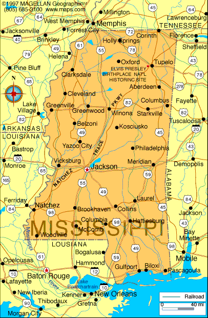
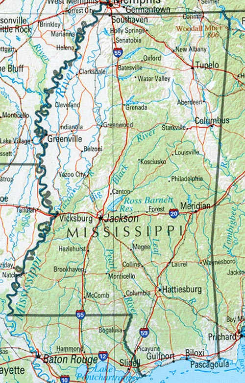
The New Madrid fault line essentially follows the Mississippi River from Illinois to Arkansas.
- http://www.ceri.memphis.edu/public/facts_long.shtml
- The New Madrid fault system, or the New Madrid seismic zone, is a series of faults beneath the continental crust in a weak spot known as the Reelfoot Rift. It cannot be seen on the surface. The fault system extends 150 miles southward from Cairo, Illinois through New Madrid and Caruthersville, Missouri, down through Blytheville, Arkansas to Marked Tree, Arkansas. It dips into Kentucky near Fulton and into Tennessee near Reelfoot Lake, and extends southeast to Dyersburg, Tennessee. It crosses five state lines, and crosses the Mississippi River in at least three places.
Seems like a local affair, but this is deceptive.
Where quakes along the West Coast of the US cause a jolt in the underlying rock, the area surrounding the New Madrid is essentially mud, soil, wet from the mighty Mississippi and Missouri and Tennessee and Ohio rivers which join near the New Madrid fault line, and liquifaction thus affects a huge area.
- Liquifaction
http://en.wikipedia.org/wiki/Soil_liquefaction - The shock or repeated shock of earthquake waves can cause water-saturated soil to rearrange itself in such a way that it essentially becomes a suspension of solids in the liquid. Heavy structures on such areas can suddenly sink or shift. Buried objects can shift and relatively low density objects can float to the surface.
The last great quakes on the New Madrid fault line occurred in the Winter of 1811-1812.
- http://quake.wr.usgs.gov/prepare/factsheets/NewMadrid/
- The 400 terrified residents in the town of New Madrid (Missouri) were abruptly awakened by violent shaking and a tremendous roar. It was December 16, 1811, and a powerful earthquake had just struck. This was the first of three magnitude-8 earthquakes and thousands of aftershocks to rock the region that winter. Survivors reported that the earthquakes caused cracks to open in the earth's surface, the ground to roll in visible waves, and large areas of land to sink or rise. By winter's end, few houses within 250 miles of the Mississippi River town of New Madrid (Missouri) remained undamaged. The crew of the New Orleans (the first steamboat on the Mississippi, which was on her maiden voyage) reported mooring to an island only to awake in the morning and find that the island had disappeared below the waters of the Mississippi River. Damage was reported as far away as Charleston, South Carolina, and Washington, D.C.
Just how far ranging was the effect, compared to a quake of similar Richter on the West Coast?
- http://quake.wr.usgs.gov/prepare/factsheets/NewMadrid/
- Earthquakes in the central or eastern United States affect much larger areas than earthquakes of similar magnitude in the western United States. For example, the San Francisco, California, earthquake of 1906 (magnitude 7.8) was felt 350 miles away in the middle of Nevada, whereas the New Madrid earthquake of December 1811 (magnitude 8.0) rang church bells in Boston, Massachusetts, 1,000 miles away. Differences in geology east and west of the Rocky Mountains cause this strong contrast. [And more recently] earthquakes of similar magnitude-the 1895 Charleston, Missouri, earthquake in the New Madrid seismic zone and the 1994 Northridge, California, earthquake, [showed similar effects].
- http://edition.cnn.com/2005/TECH/science/06/22/new.madrid.quake/
- The [quake] in 1968, centered in southeastern Illinois near the confluence of the Tennessee and Ohio rivers, caused moderate damage, but it was felt across 23 states -- as far as the Carolinas -- and into Canada.
A map on the USGS website shows the relative extent of influence, which is far more dramatic than might be imagined.
In 1994 the 6.7 Richter Northridge quake was felt throughout southern California, barely reaching over the border into Nevada and Arizona and Mexico.
The comparable 1895 Charleston, MO quake covered the eastern half of the US, primarily affected, of course, were the states central to the New Madrid fault line - Ohio, Kentucky, Tennessee, Arkansas, Missouri, Illinois, and Indiana.
But the effect covered at least half of the states of Wisconsin, Michigan, Pennsylvania, Virginia, North and South Carolina, Georgia, Alabama, Mississippi, Louisiana, Oklahoma, Kansas, and Iowa, and crossed the border into the states of New York and Florida.
But the seriousness of the situation is not described by the effects of quakes in 1811 and 1895, as going into the pole shift, during the quakes preceding the pole shift, there is another aspect to the fault line adjustments.
There is an Earth torque, cause by the twisting of the globe that Planet X causes when it tugs on the S Pole of Earth and the highly magnetized Atlantic Rift, daily.
- ZetaTalk: Torque Effect, written May 1, 2004
- By gripping the Atlantic Rift, the cause of the Global Quakes that have racked the Earth [since 2003], Planet X is creating a slow continental drift. The Atlantic Rift is held back when it faces or is in opposition to Planet X, creating not only a pile up in the plates following the rift, but also tearing apart the rift by the momentum to the East. What is the effect on the plates on either side of the rift when a void is created? There is a slide into the void, on the side experiencing a pileup, and thus the N American Plate is dropping into the void, relieving the stress of compression along its northern border in the Arctic by a torque to the side as it does so. The overall effect of this drift, which will increase in speed and force, will be a torque. Hold the globe with the left hand on the N Pole, the right hand on the S Pole. The N Pole going in the direction of rotation with the S Pole held back, the torque forces the N American Plate down and into the Caribbean.
Complicating the torque is the fact that the N American continent is held rigid at the top, where the plate boundary crosses through the Arctic from the Kamchaka Peninsula just above Japan in almost a straight line to Iceland in the Altantic, East of Greenland.
The N American plate, thus, CANNOT roll round to adjust to the stress of having the Atlantic widen and the Pacific shorten during the tugging Planet X does upon the Earth.
Mexico wants to move westward faster than Alaska, but cannot without pulling the N American continent in a diagonal, a stress the Zetas call the N American Rip.
This ZetaTalk was written during a time when S Dakota, at the Black Hills, was showing an odd stress wobble once daily, a clear sign this was a wobble induced by the tugging of Planet X.
- ZetaTalk: N American Rip, written Feb 10, 2006
- When Planet X arrived in the inner solar system in 2003 and began seriously tugging at the highly magnetized Atlantic Rift, it accentuated this stretch on either side of the Atlantic. What went unstated during these discussions is why a stretch zone occurs. Look at S America, on the large S American plate. As the Atlantic is pulled apart, the Pacific compressed, it is required to have the upper part migrate to the West more than the tip, which is anchored at Antarctica. It moves as a whole, in the main, crunching the small plates in the Caribbean and Central America as it does so and popping the plate holding the Galapagos Islands which lies just to the west of S America. It can move, in short. But what of the N American plate? The giant plates of N America and Eurasia are locked against each other, unable to rotate against each other due to their shape. Slip-slide along the West Coast, measured as a creep by geologists, is due only to slight adjustments along that edge of the plate, primarily due to adjustments within the small plates to the west of the N American plate, which move to accommodate pressure.
The N American plate does not move, pre se, but other dramas occur. We explained [in May 2004], months before it expressed enough to show up on IRIS charts, the Earth torque caused as the N Pole continuing to rotate to the East while the S Pole was held back by Planet X, tending to open the globe like a jar of pickles. This creates a diagonal stress on the N American continent where New England is pulled to the east while Mexico is pulled to the West, so the New Madrid is put under slip-slide stress where one half, east of the Mississippi, will move toward the NE while the other, west of the Mississippi, moves toward the SW. The virtual hook of land in the N American continent near the Kamchatka peninsula is solid rock and will not snap off to become a separate land plate, nor would this ease the deadlock along the N American and Eurasian plates even it if did. These massive plates cannot move.
The stress on the N American plate will resolve by ripping. Ripping the St. Lawrence Seaway open. Pulling the SE down into the crumbling Caribbean and into the widening Atlantic, as neither of these sinking fronts will be able to support the edge of the weighty N American plate. There is pressure along the West Coast, of course, and as the N American plate confronts the compressing Pacific, this will only result in the predictable volcanic increases and West Coast earthquakes. But the primary drama preceding the pole shift will be the ripping action that a plate unable to move must endure. The notable area of catastrophe during this is the eastern half of the continental US. From Houston to Chicago to New England, the diagonal pull will tear the underpinning of cities and create a catastrophe for the US that will make the New Orleans disaster appear trivial. A widening Seaway also does not affect just those land masses bordering the Seaway, as buckling occurs inland and afar. What does man assume caused the Black Hills to be so rumpled, with the appearance of a recent bucking and heaving? This is the center of a land plate! The tearing of the Seaway does not end at Duluth, MN, it travels underground to S Dakota!
2003-2004
The first evidence of this torque on the N American continent occurred in August of 2003, when a massive power outage struck New York City, causing a complete blackout with a million commuters walking home to suburbia silently across the bridges.
The cause? A substation at Niagara, on the stretching seaway.
- Reuters, Aug 14, 2003
- A New York State official said the Niagara Mohawk power grid overloaded on Thursday, causing a massive power outage, and New York Major Michael Bloomberg said it was likely a natural occurrence. A massive power outage swept across swaths of the eastern United States and Canada on Thursday, leaving sections of New York , Detroit, Cleveland and Toronto without electricity. It was not immediately clear whether the Niagara Mohawk problem caused the wider outage.
- AP, Aug 14, 2003
- Canadian officials insisted a massive blackout Thursday across the Northeast and parts of Canada originated in the United States, though U.S. power workers denied that and American officials blamed Canada.
This was followed by trail derailments and bursting gas and water mains and sinkholes and yawing crevasses that were suddenly and dramatically in the news.
Sinking, or lack of support in stretch zone, results in sinkholes.
The incidence of sinkholes, in the US alone, during the 6 months period from April to October 2004, was certainly astonishing.
These hit Florida hard, not surprising as it is at a point, literally, where the pull down is the most extreme.
Detroit and Milwaukee, at the end of the St. Lawrence Seaway yawing.
up the East Cost through Virginia and into Pennsylvania, a point where sinking and rising land create a break, a snapping of the Earth, as land south of Pennsylvania is pulled down while land North tends to bounce up as the Seaway yaws.
And into land at the edge of the stretch zone, such as Missouri and central Canada.
- Missouri Sinkhole, June 9, 2004
- To folks around Wildwood MO, it is nothing but freaky: an entire 23-acre lake vanished in a matter of days, as if someone pulled the plug on a bathtub. Lake Chesterfield went down a sinkhole this week, leaving homeowners in this affluent St. Louis suburb wondering if their property values disappeared along with their lakeside views.
- Milwaukee Sinkhole, June 11, 2004
- A Milwaukee street was closed Friday because of a huge sinkhole. The hole, at 35th and Juneau streets, measures around 40 feet long, 40 feet wide and about 15 feet deep.
- Florida Sinkhole, June 25, 2004
- US 27 was closed Tuesday when the Department of Transportation discovered a giant sinkhole below the surface. The sinkhole was about 20 to 30 feet in diameter.
- Florida Sinkhole, July 1, 2004
- The discovery of a sinkhole near Highway 100 east of Franklin forced work to stop last week on the city's sewer extension project.
- Detroit Sinkhole, Aug 23, 2004
- A giant sinkhole in Sterling Heights grew even bigger late Monday morning as repair crews worked to stabilize the ground surrounding it. The hole measured approximately 160 feet long and 60 feet wide. The cavity was estimated to be as deep as 30 feet. Crews could not say what caused the sinkhole.
- Scranton PA Sinkhole, Sep 19, 2004
- As the Pittston Avenue sinkhole continues to expand, so does the number of damaged properties in Lackawanna County. Across town on Pittston Avenue, city and state officials met Monday morning to examine the subsidence that swallowed a portion of the road near Brook Street, rupturing a gas line and forcing the evacuation of at least 50 residents. The sink hole has expanded by about five feet and now consumed three-fourths of the two-lane road.
- Virginia Sinkhole, Oct 5, 2004
- A collector lane of Interstate 81 in Montgomery County was closed Monday because of a sinkhole. Crews will repair the sinkhole by excavating it, filling it with rock, capping it with concrete and paving over it.
- Florida Sinkhole, Oct 14, 2004
- 50-Foot Wide Sinkhole Opens In Couple's Backyard. The Fishers were in disbelief when they noticed two 30 foot trees, a shed and two other citrus trees had been swallowed up by the ground.
If trains were derailing due to twisting track, and sinkholes appearing suddenly under highways, this was not the only horror aflicting transportation.
Road heaved, bridges dropped, and land slid on top of traffic.
Particularly in July, 2004, oddly, in 3 different US states.
This shows a relationship to a diagonal pull across the US, happening at that time.
- Kansas Road Pop, July 13, 2004
- Sweltering Heat Causes Street to Rise 5 Inches, Crack, and Blow Up. Experts say the crack is unusual, because the heat-related breaks typically occur in concrete, as opposed to asphalt.
- Illinois Heaving Road, July 29, 2004
- A block of road was in normal condition last week, but since then it has risen three or four inches out of the ground. Now, traffic is blocked off in that area. The City Engineer's office say they still don't know what's causing the road to rise up.
- Pennsylvania Quarry, July 29, 2004
- A huge chunk of earth surrounding a quarry collapsed overnight. Deep crevices can be seen right on the shoulder of the roadway. The cause of the collapse is under investigation.
- Denver I70 Overpass, May 15, 2004
- I-70 is closed in both directions at C-470 after a steel girder collapsed onto the eastbound lanes of I-70 and landed on a SUV. The girder weighed several tons. The girder was put up as part of a project to widen a ramp that leads to I-70.
This twisting of the North American continent involves New England pulled to the East along with the rotation of the Earth, Mexico and the southwest pulled to the West, as the South Pole was being tugged in that direction.
This opened crevasses in the southwest.
This was not due to compression, subduction of plates, but due to the stretch, the land in these areas being pulled apart.
These sudden crevasses were not associated with any particular earthquake, but they WERE associated with road pops from Kansas to Illinois to Pennsyvania!
Again, in July 2004.
- Mexico Crevasse, June 29, 2004
Huge Mile-Long Crevasse Opens along Fault in Western Mexico - A gaping, mile-long crevasse opened early Tuesday along what officials described as a geological fault line in western Mexico. The crevasse reportedly opened without warning early Wednesday. It stretches about one mile across farm fields in a sparsely populated area in Zapopan, a suburb of the western city of Guadalajara. It is as much as 15 feet wide in some places.
- Arizona Crevasse, July 14, 2004
Quarter-Mile-Long Fissure opens North of Willcox - Authorities today are investigating the cause of a fissure north of Willcox that spans a quarter mile and is up to five feet wide at some points. The fissure was discovered Wednesday morning by a resident who told Cochise County Sheriff's deputies that he awoke to loud rumbling and crackling overnight. He found a fissure near his home, that officials say appears to be expanding. Authorities do not know how deep the fissure is, but a spokeswoman for the Sheriff's Department said it's too deep to see the bottom. Willcox is about 80 miles east of Tucson.
Sinking land in the stretch zone very much affects gas and water mains running under streets, and a rash of reports emerged as Planet X tightened its grip on the Earth.
During the 6 months reporting period from April to October 2004, pipes were snapping all across the stretch zone like never before.
- Atlanta Explosion, Aug 23, 2004
- Georgia Power crews continued working Monday afternoon to repair underground power lines in downtown Atlanta that exploded overnight, sending manhole covers flying into the air. An official with Georgia Power said such explosions are not common. The force of the blast sent three, 50-pound manhole covers into the air.
- Boston Tunnel Leak, Sep 15, 2004
- Gridlock ensued when water began leaking into the northbound lanes of the tunnel, at one of its deepest points. The tunnel carries Interstate 93 through the city. The leak occured in a portion of the wall which has been in place for 10 years.
- Buffalo Water Main, Sep 20, 2004
- A water main break in Buffalo early this morning has shut down part of Chippewa Street. Water bubbling up from the break flooded the area and caused parts of Chippewa to buckle. As the area began to resemble a lake, police blocked off intersections and water crews were summoned to the scene.
- Virginia Main Break, Oct 22, 2004
- The crack extended about three-quarters across on the bottom, which indicated that it was a stress crack caused by the earth's movement. The earth shifted, and deep below the surface a water line bent and cracked.
- Boston Main Break, Oct 29, 2004
- City officials said a 36-inch water main gave way, shooting a high-pressure jet of water underground and clearing away the dirt and sand under the road. The hole stretched nearly across Perkins Avenue and was at least 15 feet deep. The DPW Commissioner said he was unsure what caused the 36-inch pipe to let go.
2005
By June, 2005 scientists were openly admitting they were concerned about the New Madrid fault.
- AP, Jun 22, 2005
- US scientists, reporting in the British science journal Nature on Thursday, say the New Madrid Seismic Zone is deforming rapidly, experiencing rates of strain that are similar to those in notoriously active plate boundaries.
- New Data Confirms Strong Earthquake Risk to Central US, Jun 22, 2005
- Strain is building on a fault near Memphis, Tennessee that was the site of a magnitude 8.1 earthquake in 1812. Such a strong earthquake would rock the entire eastern half of the country and prove devastating to the local region. In a three-month period in 1811-12, three major earthquakes rattled a broad expanse of the United States, causing damage as far away as Charleston, South Carolina and even rattling nerves in Boston. The quakes triggered landslides into the Mississippi River and, according to some boaters who were not drowned, sent part of the river running the other direction for a time. The earthquakes were centered around New Madrid, Missouri. They measured 8.1, 8.0 and 7.8 and represent three of the four strongest earthquakes ever recorded in the lower 48 states. Sandy soil in some areas became liquefied in past events. This tendency for soil east of the Rockies to liquefy, along with other differences in geology, means earthquakes there pack more potential for damage and are felt over a much wider region than western temblors.
A few months later, in September of 2005, a mysterious smell like rotting cabbage or the cat's litter box wafted across the US.
- Bellaire, Ohio Strange Smell
Sep 20, 2005 - A mysterious smell has been lingering around numerous neighborhoods in one local community, and now residents want to know where that odor is coming from and if it's dangerous.
Central Texas: Strange Odor Prompts School Evacuation
Sep 22, 2005
Washington Post: Mysterious Stench Nauseates Northeast
Sep 30, 2005
- LA Times: Mysterious Stench Swirls Around City
Sep 22, 2005 - And so it went across the Southland, as some detected strong odors from the coast to the Valley. Workplaces and weblogs were buzzing, with descriptions comparing the smell to old socks, rotting cabbage soup, moldy wet wallboard and the cat´s litter box.
- Thunder Bay Canada: Strange Smell in Lonlac
Sep 27, 2005 - Municipal officials are urging Longlac residents to exercise caution as they investigate reports of gasoline-type odours in the towns sewer system.
- Washington DC Affiliate: Mystery Odors Reported Around District
Sep 28, 2005 - Students returned to class Wednesday afternoon at two adjacent schools in Northeast Washington, but the mystery continues over what caused the odor that led to evacuations.
- Greenville, South Carolina: Workers Sickened at Downtown Greenville Building
Sep 29, 2005 - A foul smell at a downtown Greenville building sickened several workers and forced an evacuation. Four people were sent to Greenville Memorial Hospital for treatment of nausea.
- Lake Erie burps and nearby residents smell it
Sep 30, 2005
http://www.post-gazette.com/pg/05273/580563.stm - State and federal environmental officials are trying to determine the cause of a big stink reported along Lake Erie. Hundreds of residents called authorities or the National Weather Service yesterday to report the smell, which has been variously described as like gasoline, natural gas or even decaying garbage and rotten eggs.
The cause, per the Zetas, was methane gas released when rock fingers were pulled apart, releasing gasses from rotting material trapped between rock layers.
- ZetaTalk: Stretch Stench, written Oct 1, 2005
- We have gone into great detail on what occurs in the stretch zones along the Atlantic, which includes the southeast United States and the St Lawrence Seaway, and warned recently that the stretch would accelerate and be exacerbated by the torque effect which is twisting the North American continent at a diagonal, pulling New England to the East and Mexico to the West. The overall effect of these forces is to drag the southeastern US down, along a line from Pennsylvania to Texas; to pull the continent diagonally; and to ease stress on the West Coast, as can be shown by IRIS charts indicating reduced earthquake incidence along the West Coast compared to the rest of the Ring of Fire. What happens to rock layers under a diagonal pull, or being pulled apart? As can be seen during recent years, this has resulted in derailing trains, sinkholes suddenly appearing, gas and water main breaks, torn roadways and separating bridges. Despite the effect on man, crawling about on the surface of what they assume to be terra firma, these changes are superficial. When the pulling starts, weak points break and thereafter the plumbing and roadways hold, giving the impression that the pulling has stopped, but this is misleading.
The North American continent is giving evidence that its rock layers are separating from each other, and sliding sideways in a diagonal, thus exposing portions of these layers to vent into the air above. If rock is being stressed, then where are the earthquake predictors giving evidence of this, the frantic animals, the static on the radio, the earthquake swarms? Rock in the stretch zone, pulling apart rather than compressing, does not emit the particles flows that animals and radios sense, nor register on instruments are tension and release quakes. What lies beneath mankind's civilization, waiting to be exposed? More than rock and trapped oil and coal deposits, those these may vent during stretching. More than trapped volcanic gasses, perhaps trapped for eons since the rock was hardened or breached during previous upheavals. There is also, surprisingly, rotting material, trapped when extreme stress on the surface created yawing that swallowed surface material or when rock layers rolled over each other to sandwich such material between rock layers. Exposed, to the degree that venting upward into the air can occur, these smells are solid evidence that the rock layers below are adjusting. Since the concept of the stretch zone behavior as precursor to a pole shift was introduced by ourselves, the Zetas, and the detailed description of the torque on the North American continent was made by ourselves months before it expressed on the IRIS charts, we can only say, as Nancy is fond of saying, Zetas right again!
In early 2006 there was additional evidence that the N American continent was being put under stress, pulled in a diagonal.
Within a 4 week period, mining accidents from Canada to Mexico occurred, in a line parallel to one that could be drawn from Maine to Mexico, the stress line that the Zetas have described.
The first was in the Sago mines in West Virginia, then another in Ontario, Canada, followed by a rare disaster in Mexico.
- Workers Try to Reach Trapped Mexico Miners
Feb 20, 2006 - Rescue workers were burrowing through debris clogging a Mexican coal mine early Monday in a desperate effort to reach some 65 miners who were trapped for more than a day by a gas explosion. A federal labor official told reporters during a news conference at the site that officials found nothing unusual during a routine evaluation on Feb. 7. Last month, 14 miners died in two separate accidents at mines in West Virginia, in the United States. Two men died in a fire Jan. 21 at a mine in Melville, nearly three weeks after 12 men died after an explosion near Tallmansville. In Canada last month, 72 potash miners walked away from an underground fire and toxic smoke after being locked down overnight in airtight chambers packed with enough oxygen, food and water for several days.
Methane gas was suspected.
Although a constant source of worry, why the sudden rash of explosions across the continent, and along a diagonal line parallel to what the Zetas have described?
Coincidence?
If so, coincidentally, Maine was reporting odd methane bubbles off their coast.
University of Maine geologists reported in December, in the Portland Press Herald, 12-26-05, that dozens of methane fields off the coast of Maine were releasing large amounts of gas, disrupting the ocean floor and creating massive bubbles.
2006
By July, 2006, Cleveland, Ohio was reports quake swarms.
Accompanying this was another blackout caused by problems in what is called the Lake Erie Loop.
The stretching Seaway, at it again!
- An Earthquake Every Two Weeks? It's Happening Near Cleveland
Jul 13, 2006 - Without damage or injury and sometimes unnoticed, a corner of suburban Cleveland has become the earthquake capital of Ohio, shaking on average every two weeks since New Year's Day and making people wonder: What's next? Earthquake experts don't know why the repetitive quakes have come at this time. Eye-catching series of earthquakes -- measuring from magnitude 2.0 to 3.8
- Power returns to most areas hit by blackout
Jul 21, 2003
http://www.cnn.com/2006/US/07/21/ny.blackouts.ap/index.html - New York state was facing the largest blackout in the history of America and had lost more than 85 percent of power in New York state. the exact cause remains unknown, but indications so far point to a downed 345,000 volt power line east of Cleveland, Ohio, on the "Lake Erie loop" - a series of transmission lines around the lake.
Then on Sep 10, 2006, a rare quake in the Gulf of Mexico, on a fault line the USGS was unaware existed.
- Gulf Quake Felt From La. to Fla.
Sep 10, 2006 - The largest earthquake to strike the eastern Gulf of Mexico in the last 30 years sent shock waves from Louisiana to southwest Florida Sunday, but did little more than rattle residents. The magnitude 6.0 earthquake, centered about 260 miles southwest of Tampa, was too small to trigger a tsunami or dangerous waves. The USGS received more than 2,800 reports from people who felt the 10:56 a.m. quake. Scientists said it was the largest and most widely felt of more than a dozen earthquakes recorded in the region in three decades. The most prevalent vibration, which lasted for about 20 seconds, was felt on the gulf coast of Florida and in southern Georgia. But residents in Alabama, Mississippi and Louisiana also called in reports. The epicenter is an unusual location for earthquake activity, but scientists recorded a magnitude 5.2 temblor in the same location on Feb. 10. The temblor was unusual because it was not centered on a known fault line.
The Zetas related this to the stress on the N American continent, and the pending New Madrid diagonal rip.
- ZetaTalk: GodlikeProduction Live, written Sep 16, 2006
- We have stated that the New Madrid fault line will give way soon, in a diagonal pull not predicted by the experts as they discount the torque the N American plate is currently subject to. New England goes East, along with the Earth's rotation, but Mexico is tugged back toward the West when the S Pole is tugged by Planet X. This Earth Torque was predicted by ourselves 9 months prior to the Dec 26, 2004 tsunami quake in Sumatra, and has shown up on IRIS charts ever since. The diagonal pull on the New Madrid will cause the land East of the Mississippi to slide NE, land West of the Mississippi to slip SW, tearing many of the bridges across the Mississippi. As the fault lines known by man are those that have recently adjusted, during the quiet times between pole shifts, it comes as a shock to find new fault lines in the center of the plate, and even more shocking, that large quakes are occurring there! This is only the start of New Madrid activity, which has also cause quake swarms in the SE US and torn the land in the SW and Mexico into crevasses. Just when it will hit, we will not say, as by the rules we are placed under by the Council of Worlds, we are not allowed to warn the public.
This was followed by more adjustments in New England, which is scheduled to rise some 450 feet above sea level during the coming pole shift.
The tiny New England states are grouped at the end of what will become increasingly a peninsula of land, due to the widening of the St. Lawrence Seaway and the melting poles. The land is rocky, and will rise some 450 feet by our estimate above the current level due to the land being freed from its current connections during this continental rip.
Quake swarms continued in Maine, and a dramatic drop in the water level in wells at the USGS site.
- Maine Quake Causes Dramatic Drop in Well Water Level
Oct 3, 2006 - A minor earthquake that shook parts of Maine at 8:07 p.m. local time Monday caused water to drop 2.5 feet at a
U.S. Geological Survey monitoring well. Nearly 17 hours later, the water level was still dropping. Hydrologists call the change in the well dramatic. The preliminary magnitude 3.9 earthquake was the third such event to shake the state in the past few weeks. A magnitude 2.5 earthquake on Sep 28 and a magnitude 3.4 on Sep 22 were centered in the same location.
Per the Zetas, all these are clues that the New Madrid does not have long to go before it gives way, allowing the diagonal slip along the Mississippi that the Zetas have predicted.
- ZetaTalk: GodlikeProduction Live, written Oct 7, 2006.
- Periodically, during the N American plate rip taking place steadily, there is evidence that rock fingers are being pulled apart, fault lines slip sliding past each other, and land rising or dropping. During 2004 and into 2005 there were seemingly endless reports of water and gas mains breaking, sinkholes developing and bridges and roadways buckling in the stretch zone. Crevasses occurred suddenly in Mexico and the SW. In the Fall of 2005, there was a stretch stench noted across the continent, from moldering soil pockets suddenly exposed to the air and releasing methane gas. During a two week period, mining disasters occurred at the Sago mine in W Virginia, eastern Canada, and Mexico, all trapping miners in well publicized rescue operations. Methane gas was again the prime culprit. Blackouts along the Seaway are blamed on a single failure creating a domino effect, but the station at Niagara, along the Seaway, has been the culprit, repeatedly. Quake swarms occur near Cleveland, Ohio, pointing to the separating Seaway as the source.
Now quakes in the Gulf at a previously unknown fault, and in Maine, with result that the water level is either falling or the land rising. Why do these events seem to come and then go, if the stretch is continuous? The answer lies in what holds the fabric together. That part of the rock strata preventing the stretch or torque from occurring is put under stress until it snaps, then movement occurs. What might be termed soft structures snap when movement is first allowed. Thus, gas and water mains long considered structurally sound snapped when the FIRST movement occurred, and soft soil adjustments such as crevasses or sinkholes likewise occurred. Once these soft area have adjusted, this type of activity seems to stop, but the fault lines are still sliding and rock fingers are still separating. Maine, and the New England area, will rise significantly when the Seaway rips, as we have stated. As all precursor quakes during the time going into the shift proceed along the scripted drama that will occur during the shift itself, the New England area can expect to rise as adjustments occur in the N American continent. Thus, the water level FALLS.
The Zetas have stated the devastation will make the New Orleans disaster appear trivial.
New Orleans, after all, was another disaster waiting to happen, not a surprise.
It was only a matter of time.
For the New Madrid disaster, affecting cities from Houston to St. Louis to Kansas City to Memphis to Cincinnati to Chicago and parts in between, the number of people left suddenly homeless will be immense, compared to New Orleans.
These cities are not quake proofed, as is the norm on the West Coast.
Lets look at the New Orleans disaster for a preview of what to expect, insofar as rescue attempts.
- ZetaTalk: New Orleans, a Preview, written Sep 2, 2005
- We have described from the start of ZetaTalk a situation where the coastlines and river basins will be massively flooded during the pole shift, to the extent that coastal cities are flooded with a flood tide that just keeps rising, putting homes and the lower levels of buildings under water. All this seems fantasia to many, despite the physical evidence that such flood tides have happened in the past. Where New Orleans flooded because it was below the current sea level, and where the flooding of the city is not to the extent we have described for the pole shift, it nonetheless is an example of how water and wind can wreck a city and make all the former residents homeless, in a wink. Add to the mess in New Orleans the fact of tall buildings toppled by earthquakes, and people trapped in earthquake rubble, and you have the picture of what is to come.
We have described from the start of ZetaTalk a situation where the grid, electrical power and phone lines, will be almost completely disrupted, water and gas mains ruptured, with no hope of repair, the result of an assault by earthquakes, water wash during flooding, and hurricane force winds. Many sitting comfortably in their homes dismiss such a possibility, as surely the modern technology they have come to enjoy will be able to quickly repair itself, as is this not the case after an ice storm or earthquake now? Where the disruption in New Orleans is due to flooding and winds, without the addition of quake damage, the total interruption of services for those trapped in New Orleans is certainly evident - pumps down, gas line breaks, water fouled, and no electricity.
We have described from the start of ZetaTalk the anticipated effects of denial among those not willing to acknowledge the need for making changes in their lives, to the extent that they refuse to make any changes or take any steps toward taking themselves to safety. This despite mounting evidence that their survival will be tenuous if they do not take such steps. Where the depth of this denial, affecting a large portion of the population, seems incredulous, this is precisely what has occurred in New Orleans. Given orders to evacuate by the authorities, many chose to remain, comforting themselves by denying the possibility of harm. This denial was evident among the rich as well as poor, among vacationers remaining in fancy hotels as well as no place to go but the hovel that was their current home.
We have described from the start of ZetaTalk the reaction of the rich and powerful to the threat of accelerating Earth changes, that being that they would suppress talk of this in the media in order to maintain the status quo, keeping the common man at their stations, at their jobs, and being consumers until the last. Where such treatment of the common man is nothing new, what occurred going into assault on New Orleans or the Gulf coast? Known to be unsafe, below sea level, or potentially in the path of such monster storms, housing and industry and commercial ventures were funded and encouraged. Encouraging the status quo, instead of championing an alternative such as moving enterprises and people inland, occurred.
We have warned from the start of ZetaTalk that self sufficiency, rather than relying on government handouts or camps, was absolutely key to survival after the pole shift, as rescue would not be forthcoming and camps would become work or perhaps death camps, ultimately. To those clinging to the comforting thought of the government as a substitute parent, or to those working for the government, this is dismissed as bad advice, but what has occurred in New Orleans? First, everyone is marched into the Super Dome, where bad water and lack of food is compounded by crowding. Bad move, and not the last bad move, as now the crowd is being relocated yet again, where more disappointments from government services are likely to result.
We have emphasized from the start of ZetaTalk the need to distill drinking water to clean not only germs but pollutants such as heavy metals, as the pole shift will create a cesspool of industrial wastes where these are stored in tanks or produced, and exploding volcanoes will put lead into surface water as the volcanic ash drifts and lands far and wide. Most often, our admonitions result in a lot of discussion about water filtration systems, as though these will be handy and replacement parts available. Distilling water is time consuming, a multi-step operation, and thus tiresome to even think about. But what has happened in New Orleans? Suddenly, drinking water is not available, and the knowledge about how to clean the water is being discussed in the media. Of course, those living in the cesspool can't hear these discussions, and are drinking dirty water. If these citizens had been told how to clean their water, beforehand, with what they had at hand, all manner of problems would have been avoided.
We have described from the start of ZetaTalk that the expectation of a return to normalcy could hinder adjustments after the pole shift, as many would simply sit and wait for rescue. There will be no rescue, and normalcy will not return, as the broken link rule would prevail. Where the pole shift will put the entire world into crisis mode, such that any emergency response team is overextended, this was certainly seen in the microcosm of the New Orleans disaster where the disaster was only regional. Despite decades of planning, FEMA failed once again. Yes, they were handed surprises, such as a failing levee system soaked beyond endurance so the soil surrounding the narrow tops eroded. The city cannot be drained because the pumps are under water - broken link one. Looters and gangs are stopping rescue efforts because police efforts were not supported by the missing New Orleans Reserves, who were of course stationed in Iraq - broken link two.
So if the slipping of the New Madrid will be WORSE than the disaster of New Orleans, affecting more cities and a wider area, and dropping land West of the Mississippi so flooding occurs, are these cities more prepared?
Those in the wake of the pending New Madrid quake, beware, and get prepared!
bill
San Diego County of a strong, chemical-like odor
SAN DIEGO -- Authorities are investigating reports from around San Diego County of a strong, chemical-like odor.People began making emergency calls about 2 p.m. to report a pervasive and pungent smell variously described as akin to kerosene, diesel fuel, bus exhaust, lighter fluid and other petroleum-based substances, according to Maurice Luque, a spokesman for the San Diego Fire-Rescue Department.On Wednesday afternoon, 10News received dozens of calls from residents who said they smelled what they believed was jet fuel in the air.
Full article:
http://www.10news.com/news/28897721/detail.html
Sep 1, 2011
bill
Strange Smoke Coming from Hope Ranch Hill - S.California (Aug 12)
Hope Ranch - An unsolved mystery is smoldering on a dirt hillside below Hope Ranch. Smoke and steam are coming out of the soil, very similar to an event in October of 2006.
The hot zone is being controlled with sprinklers spraying waters in all directions.
A fence is up in the area to keep inquisitive beach walkers away.
Santa Barbara County Fire officials say there is no immediate threat to the area or risk to the public.
http://www.keyt.com/news/local/Strange-Smoke-Coming-from-Hope-Ranch...
Sep 1, 2011
bill
Chicago: Two Buildings Collapse
Foundation failure to blame in St. Charles building's partial collapse
8/10/2011
The downtown building at 117 W. Main St. was deemed uninhabitable after it nearly collapsed late Monday evening.
Bob Vann, the head of building and zoning for St. Charles said one of the building's foundation walls failed, causing the floor of the second story to drop about 18 inches.
-----------------------------------------------------------------------------------------
Wednesday, August 10th, 2011
Just before 2 p.m. Wednesday, the front of the one-story commercial building at 201-207 Harrison came tumbling down. Village officials, police and firefighters were on the scene shortly after, but no one could say for certain what caused the collapse.
Sep 1, 2011
bill
Undersea Volcano Eruption found off Oregon US coast
They are claiming to have predicted this, likely they are reading ZT!! :
Posted: Aug 10, 2011 5:52 AM Updated: Aug 10, 2011 6:04 AM
NEWPORT, OR (KPTV) -
State University scientists say they've discovered an eruption of an undersea volcano about 250 miles off the Oregon Coast.
The April 6 eruption produced a lava flow at least 1.2 miles wide, scientists say, and there were hundreds of tiny earthquakes during the eruption.
The volcano, named Axial Seamount, last erupted in 1998, and the team of OSU scientists forecasted it would erupt again before 2014. Oregon State scientists say this marks the first-ever successful forecast of an undersea volcano.
The new eruption was discovered July 28 when scientists used a robot to find a new lava flow on the seafloor that was not present a year ago. Because only a handful of the earthquakes were detected from land, scientists did not initially believe there was an eruption.
Bill Chadwick, an OSU geologist, says the team of scientists thought they were in the wrong place because the seafloor looked so different.
"We couldn't find our markers or monitoring instruments or other distinctive features on the bottom," he says. "Once we figured out that an eruption had happened, we were pretty excited."
When they recovered seafloor instruments and recorders, the scientists learned the volcanic eruption took place April 6.
"So far, it is hard to tell the full scope of the eruption because we discovered it near the end of the expedition," Chadwick says. "But it looks like it might be at least three times bigger than the 1998 eruption."
"It's the only volcano on the ocean seafloor that had its surface monitored through an entire eruption cycle," says Scott Nooner, of University.
The scientists now plan to examine samples taken from the seafloor. They'll also try to predict what will happen next to the volcano.
Chadwick hopes the scientists can build on what they learned in forecasting the latest eruption and apply it to predicting other undersea volcanoes, "and perhaps even volcanoes on land."
"The acid test in science - whether or not you understand a process in nature - is to try to predict what will happen based on your observations," he says.
Copyright 2011 KPTV. All rights reserved. [emphasis added]
Also, 3 or 4 d
Sep 1, 2011
bill
Alabama: road engulfed by the sinkhole
Limestone County Sheriff Department responded to the scene of a sinkhole at Ingram Road off Highway 31.
Crews said a SUV was trapped after the road was engulfed by the sink hole. A towing company was able to pull the car out of the sinkhole just before 11:00 a.m. Thursday morning.
Matthew Keil says he was driving home from work when he saw what looked to be a pothole in the road. When he tried to drive over it, the road buckled underneath him. He said he was scared to get out of the car, but is glad that his vehicle was OK.
It is undetermined if the heavy rains overnight Wednesday was a factor in the accident.
http://www.waff.com/story/15209494/limestone-county-road-swallowed-...
Sep 1, 2011
bill
Alaska: New lava dome at Mt.Cleveland, alert level raised
Signs of lava at Mount Cleveland prompted volcanologists to raise their alert level Tuesday afternoon for the Aleutian Islands volcano
The Alaska Volcano Observatory reports "heightened or escalated unrest" and the possibility of an eruption at the 5,676-foot volcano,
according to the observatory's website.
Cleveland Volcano comprises the western half of Chuginidak Island, which sits about 115 miles west of Dutch Harbor and 950 miles southwest of Anchorage.
Satellite data and visual observations in late July revealed a lava dome about 140 feet in diameter growing in the volcano's crater, said volcanologist Chris Waythomas. The dome grew
another 10 feet or so between Tuesday and Wednesday, according to the
observatory.
"Sometimes lava domes like that can be explosive and lead to ash production," Waythomas said.
The volcano observatory raised the advisory status from "advisory" to "watch" and the aviation warning level from yellow to orange.
Cleveland is capable of blasting volcanic ash more than 20,000 feet into the sky -- a significant danger to air traffic in the vicinity -- so staff at the observatory decided to
warn aviators of a possible explosive eruption, the researcher said.
Still, it's not certain that any ash-producing eruption will occur, Waythomas said
"This could be the end of a little pulse of magma that's come into the volcano to form a little dome in there, and that'll be that, or it could lead to something more explosive," he said.
Because of a lack of seismographic equipment at the volcano, researchers must rely on pilot observations, satellite data and a webcam sometimes obscured by clouds, Waythomas
said. An eruption could occur with little or no warning, he said.
Planes flying across the North Pacific Ocean or locally between islands would have to avoid the ash cloud, Waythomas said.
http://www.adn.com/2011/08/03/1999210/volcano-watchers-raise-alert-...
Sep 1, 2011
bill
Day of sinkholes (USA - Jul 15th)
Jul 15:
Clarksville, TN:
Work crews are working at the intersection of North Second Street and College Street on a sinkhole. The road has sunk, but not caved in. The crews are determining what actions will be necessary to repair the roadway. At this point, for an undetermined length of time, the intersection will be closed to all traffic. Travelers should find alternate routes. We will update you as information is received. The initial notice of the sinkhole was
http://www.clarksvilleonline.com/2011/07/15/sinkhole-at-north-secon...
Greenville, SC :
Greenville workers are on the scene of a sinkhole at the intersection of North Main Street and Croft Street Friday morning.
City crews have closed the intersection to traffic.
A detour route utilizing East Earle Street, Bennett Street and Gallivan Street has been established until the intersection can be reopened.
7 On Your Side will update this story
http://www2.wspa.com/news/2011/jul/15/sinkhole-forms-north-main-str...
Westbound Lane, WI :
A sinkhole formed in the westbound lane of Innisbrook Drive, the entrance to the Innisbrook Resort and Golf Course off U.S. 19, Palm Harbor Fire Rescue reported Friday afternoon.
Liz Monforti, Palm Harbor Fire Rescue spokeswoman, said vehicles are being barred from the 970-acre resort's Innisbrook Drive entrance until the extent of the sinkhole problem can be determined.
Matt Owen, corporate director of public relations for Innsbrook's parent company, Salamander Hotels and Resorts, said the sinkhole is not on Innisbrook property. The resort's guests and visitors, however, likely will not be able to use the U.S. 19 entrance for a few days, he said.
Instead, people should enter the resort from Belcher Road, Owen said. The Belcher Road entrance can be accessed from Alderman Road or Nebraska Avenue.
http://www2.tbo.com/news/breaking-news/2011/jul/15/sinkhole-close-u...
North Charleston, SC:
Heavy rain showers from Thursday caused a sinkhole to form off of the westbound lanes of I-526 in North Charleston.
The sinkhole, which is about 6 x 4 feet, is located off of the Dorchester Road exit on-ramp. Officials with SCDOT said that crews responded to the scene Thursday night and resumed work Friday morning.
A Live 5 News employee, Joe Grammer, stopped by the sinkhole early Friday and took some video. Check it out!
Sep 1, 2011
bill
More Dead Fish in Oklahoma
Marshall County, Oklahoma- Large numbers of dead fish continue to show up in waters all over Oklahoma. Today we talked with local fishermen in Marshall County about what they've been experiencing.
"I don't know whether they run out of oxygen or what it is they ought to be able to test the water and find out." said Jack Campbell.
Jack Campbell has been fishing Wilson Creek all his life. He says 3 weeks ago, small fish started dying and now large fish, many more than 40 and 50 pounds are dying as well.
Out here at Wilson Creek in Marshall County you can see literally thousands of dead fish lining the shore line. People have been coming all day and taking pictures, but they don't hang around very long because the smell is unbearable.
Marshall County residents wonder if the dead fish in their area could somehow be connected to those in the Red River, but state biologist Matt Mauck says he doesn't think so.
Mauck says they have tested the Wilson Creek water, and they feel confident they know why those fish died.
"The Wilson Creek fish are dying as a result of lack of oxygen. This has been measured through some water sampling equipment." Mauck said.
While Mauck says low oxygen levels killed the fish in Wilson Creek, they're still trying to figure out what is still killing fish in the Red River.
"We are still examining all possible sources of the fish kill, and we will hopefully have more concrete evidence and ideas of what's going on within a few days." said Mauck.
Mauck says his office continues to get similar calls from all over Oklahoma. He says 2011 is shaping up to be one of the worst years on record for high numbers of areas with dead fish.
"We're going to have more episodes likely of these events happening unless we get some relief in the heat and we get some more water within our lakes and rivers."
http://www.newsbad.com/story/us-more-dead-fish-oklahoma
http://www.kxii.com/home/headlines/More_Dead_Fish_in_Oklahoma_12546...
Sep 1, 2011
bill
Cleveland: St. Clair crack remains a mystery
http://www.wkyc.com/news/article/195939/45/Cleveland--St-Clair-crac...-
CLEVELAND -- It's about 2 inches wide and just as deep, stretching from Ontario to East Sixth Street and running the length of the new Medical Mart construction.
Fear of the unknown may run much deeper.
The point man for Medical Mart construction, Jeff Appelbaum, says he can't say yet what the cause of the crack is or what the contributing factors are.
Appelbaum isn't passing on or shouldering the blame, but the construction team is investigating the cause.
Appelbaum says the excavation is supported by a massive dirt mound and earth anchors on the north side of St. Clair Avenue.
Still, the street split this seam.
"We're monitoring for movement in the street. We're monitoring to see if there is movement in the wall of the excavation," Applebaum said. "If there has been movement it's not visible to the naked eye. So if you look at the excavation, you wouldn't see any movement."
The city is taking it seriously enough to close the north side of the street and allow only eastbound traffic through.
Three police officers are keeping a close eye on the crack and a closer eye on those who get near it.
Until the experts can determine what is causing the street to split, Appelbaum says the priorities are to maintain traffic flow and ensure the street stay protected.
They expect to get to the root of the problem here in the next 72 hours. In the meantime, construction continues on schedule.
WKYC-TV
Sep 1, 2011
bill
Fort Worth Lightning
On May 10, 2011 Fort Worth, TX recorded over 300 lightning strikes, which exploded a number of transformers. Videos taken at the time show what appears to be earthquake lighting, though no quake occurred. Nor did rain occur during the lighting storm.
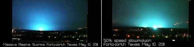
May 10, 2011
http://www.star-telegram.com/2011/05/10/3066121/fireballs-reported-in-east-fort.html
Per the Zetas, though transformer explosion did occur, earthquake lights were also occurring. Fort Worth is along the Balcones Escarpment, where the rock strata changes, and this created tension in the rock, allowing the compressed rock to be a conduit for electricity, thus the earthquake lights, and thus the discharge between the upper atmosphere and the ground. More of this to follow!
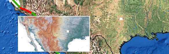
ZetaTalk Explanation 5/21/2011: Where the blue plasma lights seen during the recent Fort Worth, TX lightning storm are ascribed to exploding transformers, there were also earthquake lights among the mix. A massive number of lightning strikes, in the hundreds, were recorded during the hour. What caused such a lightning storm, which occurred without rain? Where lightning was certainly present, this was an effect, not a cause. The N American continent is under extreme stress due to the bowing, whereby Mexico is pulled west while the rest of the continent remains in place. We have described the center of the bow at San Diego, and following this to the east one arrives in the vicinity of Fort Worth, TX. Signs of stress have been noted for the past couple years along this stress line, even east of the Mississippi. What was it about Fort Worth at this particular time that elicited such rock compression that electrical charges jumped into the atmosphere, creating a lightning storm? Forth Worth is at the edge of the Balcones Escarpment, where the rock strata changes from older rock to softer more recent rock. The escarpment resists breaking, forcing the softer rock to the east of the escarpment to stretch over the escarpment, thus allowing electrical discharge from the highly compressed rock. Will such lightning storms be on the increase as the N American continent is bowed in the extreme, prior to the New Madrid adjustment? You can count on it!
Sep 1, 2011
bill
FortWorthExplosions
Sep 1, 2011
bill
Massive Power Outage Hits So. Calif., Arizona, Coachella Valley
Rolling backouts occur like this, where a LACK of power from one source means that others go into overload and shut down, and thus the blackout rolls. New ZT re that (may be some typos not yet reviewed)
A few hours ago a massive power outage struck the San Diego area, stretching into Mexico and Arizona, and affecting over 2 million people - as reported on this ning as well as mainstream news sources. This reminds many of us of what happened in the northeast US back in 2003; was this event triggered or assisted by benign aliens, and if so, what's behind it? Or, like the outages of 2003, was it due to the charged tail of PX now wafting close enough to us to cause outages on what will be a regular basis, as was predicted back then?
[and from another]
http://www.nbclosangeles.com/news/local/129498468.html:
It could be as widespread from Mexico to Phoenix. The outage was triggered after a 500-kilovolt (kV) high-voltage line from Arizona to California tripped out of service. At the San Onofre Nuclear Power Plant, two units went off line around 3:38 pm. The shutdown was part of standard procedure during a power outage. San Diego Gas & Electric advised its customers via Twitter at 5:37 pm: "If you have a personal family emergency plan, please activate it now."
[and from another]
http://english.aljazeera.net/news/americas/2011/09/201199535537907....
A power outage triggered by human error has left at least two million people without electricity in the US states of California and Arizona, as well as in Mexico's northwestern state of Baja California. An ill-fated procedure by an Arizona power utility employee in a small town unleashed a chain of events which brought down power across a large swath of southwestern states. A high-power line supplying electricity to Southern California failed first. Minutes later, that led to a blockage at California's San Onofre nuclear energy plant, a second major source of power to the north of San Diego, which shut down. The US-Mexico border was cloaked in darkness and police on both sides sent reinforcements into border cities.
SOZT
Rolling blackouts are a well understood phenomena, where a single problem on the grid can cause overloads everywhere, with cautionary shutdowns. The interdependency of electric grids is also not new, or limited to the San Diego area. In an effort to service the needs of the public, especially during times when heavy use of air conditioning might be required, utilities have formed virtual spiderwebs of connections to allow for ALTERNATIVE sources. This structure also allows for the entire spiderweb to go down, simultaneously, where a problem develops anywhere on the web. What is notable here is NOT that there was an outage, at a time when the Summer heat was not exceptional, as equipment failure or human error is always present as a possibility. What is notable here is the warning issued by the establishment in San Diego - “If you have a personal family emergency plan, please activate it now.”
Since blackouts will increasingly be a problem as the tail of Planet X will on occasion whip the Earth during the magnetic contortions in their magnetic dance, what will this mean to those regions that have become accustomed to the electric grid or a stable electric flow? Equipment failure at the least, rolling blackouts primarily, and when grids are peppered with f
Sep 10, 2011
bill
Magnitude 6.7 - VANCOUVER ISLAND, CANADA REGION
Sep 10, 2011
bill
http://www.zetatalk10.com/ning/09ap2011.htm
ZetaTalk Chat Q&A for April 9, 2011
We have stated that the Ottawa River will split open during the pole shift, separating the part of Ottawa on either side of the river in the process. This split is, of course, along the existing fault line that runs under the river, where the rock is already pulling apart. This will not occur until the pole shift, will not rip during the New Madrid adjustment expected during the 7 of 10 scenarios.
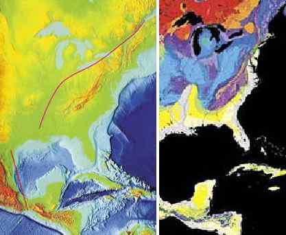
We have described the trauma that cities along the Seaway will experience, during the new Madrid adjustment and beyond, as devastating as regards earthquake shaking but not as regards inundation. Cities to the south of the Seaway such as Cleveland, Toledo, and Buffalo will be shattered during the 7 of 10 New Madrid adjustment, but the pinch in the Seaway where the Seaway opens into Lake Ontario will not split during the 7 of 10. And even though the Seaway will split open at the pinch during the pole shift, Montreal just
Sep 13, 2011
bill
http://zetatalk7.com/newsletr/issue247.htm
Lack of Warning
Sep 14, 2011
bill
http://poleshift.ning.com/forum/topics/zetatalk-chat-for-july-16-20...
I noticed and can easily see in the distance from the populated areas of The City of San Diego California, several not active volcanoes in the distance of the greater San Diego County area, that have no recorded history per my research of being active. Per the web site provide below, that also provides additional web site links too on this issue, it is noted from these web links in their discussion concerning volcanoes they note over 500 volcanoes/vents exist in California, of which 76 had been active in the last 10,000 years, not giving specifics except map noted with below web link. Per my readings, I understand any volcano that has erupted in last 10,000 years has potential to erupt during the pole shift period. Except for the two volcanoes I note in next paragraph the other several OLD volcanoes in area I have no information about. San Diego greater area does have hot springs. Currently per the below web site per Volcanoes info USGS California, see map, “Amboy Crater” in San Bernardino County being almost due east of Los Angeles, and “Salton Buttes”, actually within the Salton Sea, in Imperial County, is closer too and almost due east of The City of San Diego California. These two locations per my research are believed to have the current potential to be active again now. Additionally as I said, there are natural hot springs a lot closer within San Diego County area at Borrego Hot Springs, and I understand at a nearby Indian reservation has hot springs too. Can the Zetas comment, if the Zetas anticipate any of these several dormant volcanoes near and observable from within The City of San Diego becoming active again, along with the activity of the New Madrid fault line activity, long before or during the pole shift?


http://vulcan.wr.usgs.gov/Volcanoes/WesternUSA/Maps/map_west_coast_...
This site also provide several other related web sites concerning California volcanoes that I got my information from, please see.
SOZT
Many of the volcanoes in California are listed by the USGS to have been active approximately 10,000 years ago. Upon which side of our warning - to anticipate ALL volcanoes active within the last 10,000 years to erupt
http://www.zetatalk.com/poleshft/p120.htm
- does this fall?
In southern California the Amboy and Salton volcanoes appear relatively inactive, with 10,000 and 14,000 years respectively since last activity per the USGS. But note their close proximity to many fault lines
http://www.zetatalk.com/ning/25sp009.jpg
and the San Andreas itself. Though the San Andreas is considered a slip-slide fault, devastating only on the fault line itself, the New Madrid adjustment will do more than move the land up or down along the San Andreas. It will create pressure in the region jumping WEST during the diagonal adjustment, and this includes all lands to the south of Ma
Sep 14, 2011
bill
http://poleshift.ning.com/profiles/blogs/7-of-10-sequence
Hi John
Here is some ZetaTalk that may help
http://www.zetatalk.com/ning/23oc2010.htm
Due to the rise in sea level to 675 feet within two years after the pole shift, the N American continent will appear to be two separate land masses in the future. The 7 of 10 will not effect this change, but will tear most bridges on the Mississippi River when the New Madrid adjusts. This will of course affect travel and distribution of goods, but in that the Mississippi employs barges, a workaround will be arranged quickly enough. But after the pole shift the eastern half of the continent will certainly be more isolated. Travel across the widened seaway by boat, across the flooded Mississippi Valley by barge, and by foot through the swampy land of what is now northern Illinois will certainly be possible. After the New Madrid adjusts, those living in the US should be considering their proximity to loved ones, in this light, the travel restrictions being considered a wake-up call re what is coming if nothing else.
In describing the 7 of 10 scenarios, we do not detail every minor quake or every point where a minor tsunami might be generated. The 7 of 10 scenarios did not even include the major quakes in Japan, which are predicted to be in the range of magnitude 9's. Nor did they include the tsunami that large quakes in Japan always involve, which we have recently stated could be considered to be as high as 150 feet for the South Island quakes. After the New Madrid adjusts the West Coast adjusts, as we have stated. We have not detailed this, as compared to the New Madrid this is minor. All the fault lines closely watched on the West Coast will adjust, the volcanoes nervously watched will erupt, and certainly the waters off the coast will be choppy if not generating some minor tsunami during the plate adjustments. The West Coast of the US is alert and guarded in this regard, as is Japan. They anticipate this type of activity, and will be alert to signs that a quake or eruption or tsunami is pending. Thus, we focus on the larger changes, and in warning those areas that will not receive such services from their governments.
http://www.zetatalk.com/ning/11de2010.htm
We have been allowed to state that the European tsunami will happen almost instantly after the New Madrid adjusts. Other than indicate that a slip-side adjustment along the San Andreas will occur after this New Madrid, and occur after the Hoover Dam breaks we have not given any timing clues. Great quakes, such as magnitude 9, should not be expected, but eruptions in theWest Coast volcanoes should be anticipated. A slip-slide fault line usually does not move all at once, but in a domino fashion, a bit here, a bit there.
Sep 24, 2011
bill
http://poleshift.ning.com/profiles/blogs/tennessee-us-neighborhood-...
Sep 22, 2011
KNOXVILLE, Tenn. (WVLT) -- Adrienne Hooker doesn't feel safe at home. Her Blount County neighborhood has a problem - it shakes.
For 2 days, the house rocks every few hours. It can sound like an explosion.
She describes it like this: "Tiny earthquakes, makes the whole house shake it makes everyone wake up if they're sleeping."
They've called the U.S. Geological , but no earthquakes have been reported.
They thought it might be construction at a nearby house, but the Blount County Sheriff's Office checked. Another dead end.
The "what" isn't all that important, they just want it to stop.
http://www.volunteertv.com/home/headlines/Neighborhood_mysteriously...
Sep 24, 2011
bill
http://poleshift.ning.com/profiles/blogs/california-us-mysterious-f...
Sep 22, 2011
Wednesday afternoon the floor at the Santa Cruz County jail started bulging and tiles started to pop off, said Deputy April Skalland.
The front lobby of the jail was evacuated and the prisoners were placed on lockdown as the mystery was investigated. According to Deputy Skalland, neither a gas leak nor a water leak caused the floor tiles to start moving.
At this time it is still unknown what caused the floor to start moving. According to the United States Geological Survey no earthquakes were recorded during this time.
http://www.kionrightnow.com/story/15518534/floor-tile-moving-around...
Sep 24, 2011
bill
http://poleshift.ning.com/profiles/blogs/another-large-fish-kill-on...
Thousands of dead fish are washing ashore along the Arkansas River near the newly opened Two Rivers Bridge in west Little Rock. The Arkansas Game and Fish Commission say it does not know what's causing all the white bass to turn up dead.
When you think natural beauty along the Arkansas River, thousands of dead fish along the banks is not it.
Five to eight inch white bass are washing ashore in what the Game and Fish Commission calls a larger than normal fish kill. Crews spent the afternoon Tuesday in the water near the confluence of the Arkansas and Little Maumelle rivers collecting fish samples to find out why they're dying
Michael Murphy of Alexander fishes in the area for recreation. He says he noticed the kill Monday when he paddled upstream towards Maumelle.
"I don’t know if it was a lightning strike or something but it is a little disturbing to see all these dead fish," Murphy says.
The fish kill isn't just isolated by the Two Rivers Bridge. Eyewitness reports have seen dead fish all the way along the Arkansas River back to the Big Dam Bridge.
http://www.fox16.com/news/local/story/Large-fish-kill-near-Two-Rive...
Sep 24, 2011
Starr DiGiacomo
Wind, waves close parts of lakeshore path
September 30, 2011 (CHICAGO) (WLS) -- High winds and strong waves created a dangerous situation along the Lake Michigan shoreline from the city to northwest Indiana Friday.
Sections of the path along the lake have been closed.
Joggers and bicyclists had to dodge high waves. Some people were knocked down and nearly dragged into the lake. The path is now closed between Oak Street and Fullerton because of the dangerous conditions.
http://abclocal.go.com/wls/story?section=news/local&id=8373745
Sep 30, 2011
Starr DiGiacomo
Hope you don't mind Bill but I'm adding this here.
Northern Ohio, USA Nuclear Power Plant Containment Building Crack
Oak Harbor, Ohio Nuke Plant w/ Crack in containment building. Note the location of the plant being on a seismic zone slated for future big earth changes. Obviously to us zetatalk readers, we are aware that there is increasing seismic activity at Lake Erie. This is more evidence of earths crustal movement perilously close to most unaware residents of this continent...
see link for news video:
http://www.stumbleupon.com/su/26y7tf/universalmysteries.co/crack-di...
according to wikipedia:
"Davis-Besse Nuclear Power Station is a nuclear power plant with a single pressurized water reactor, also referred to as a light water reactor. As of 2011, it is operated by the FirstEnergy Nuclear Operating Company subsidiary of FirstEnergy Corp. The power station is located on the southwest shore of Lake Erie about 10 miles (16 km) north of Oak Harbor, Ohio and is on the north side of Highway 2 just east of Highway 19 on a 954-acre (386 ha) site in the Carroll Township. The plant only utilizes 221 acres (89 ha), with 733 acres (297 ha) devoted to the Ottawa National Wildlife Refuge. The entrance to the Magee Marsh Wildlife Area[1] is less than a mile east of the power station. The official name ac
Oct 14, 2011
bill
'It can't be possible. That tree has been there thousands of years
and then you realise the tree is falling and you had to run' Gerrit Panzner
Video available here: http://www.youtube.com/watch?v=AaQSAd8eTMU&feature=player_embedded
One of two downed trees lies across the popular Trail of 100 Giants at Sequoia National Forest, California, temporarily closing the trail
These incredible pictures show how a pair of 1,500-year-old giant sequoias - whose branches are the size of normal trees - dramatically fell to the ground.
A German tourist watched the two 250ft trees fall to the ground at the Trail of 100 Giants in California and captured the amazing moments and the crushing sound on video.
The trees lay the length of a football pitch and their diameter of their torn roots and base was 20ft.
'It can't be possible,' Gerrit Panzner, who watched the tree fall, told Catholic Online. 'That tree has been there thousands of years and then you realise the tree is falling and you had to run.'
He heard loud ‘crinkling’ noises before they eventually fell - but nobody was injured. The trees are believed to have fallen over because they could simply not support their weight anymore.
They fell on the Trail of 100 Giants in the Sierra Nevada, which is a route accessible to wheelchairs that allows visitors to view more than 100 huge sequoia trees.
Now Forest Service officials are deciding what to do with two of the world’s largest trees, as many conservationists have suggested they should be left alone.
This would mean the trail would have to be rerouted around them, which could cause problems for wheelchair users who would not be able to use steep alternative paths, reported NBC News.
Fallen trees can also be a habitat for wildlife and release nutrients back into the soil, reported the Los Angeles Times. The trees became a national monument 11 years ago.
Forest officials have even suggested building a bridge over the trees or cutting them up for firewood, reported NBC News.
They are set to make a decision on what to do by next summer, but until then are inviting the public to help them decide.
‘It's very, very rare for a giant Sequoia tree to die standing up unless it's in a very, very severe fire,’ a district ranger told Catholic Online. (Emphasis added.) http://www.dailymail.co.uk/news/article-2057782/Pair-giant-sequoias...
Nov 7, 2011
bill
http://earthquake.usgs.gov/earthquakes/recenteqsus/Quakes/usb0006kl...
Magnitude 5.6 - OKLAHOMA
2011 November 06 03:53:10 UTC
Versión en Español
Earthquake Details
63 km (39 miles) SSE of Stillwater, Oklahoma
68 km (42 miles) ESE of Guthrie, Oklahoma
71 km (44 miles) ENE of OKLAHOMA CITY, Oklahoma
M-type=regional moment magnitude (Mw), Version=9
Location: USGS NEIC (WDCS-D)
Nov 7, 2011
bill
http://nz.news.yahoo.com/a/-/world/11421382/5-6-earthquake-shakes-c...
WASHINGTON (AFP) - A rare 5.6 earthquake, considered to be the strongest on record in the area, shook the central US state of Oklahoma late Saturday reportedly causing damage but no injuries.
After initially putting the magnitude of the temblor at 5.2, the US Geological Survey revised the strength of the seismic event, the second of the day, saying it had reached magnitude 5.6.
The epicenter of the tremor, which occurred at 10:53 pm local time (0353 GMT Sunday), was located just six kilometers (four miles) east of the town of Sparks at a depth of five kilometers.
KJRH television said the Lincoln County Emergency Management agency was reporting significant damage, but its extent was not immediately clear.
The Tulsa World newspaper quoted Lincoln County emergency manager Joey Wakefield as saying that portions of federal highway 62 had buckled and the chimney on a two-story house collapsed near the town of Prague.
Other buildings were also damaged.
"It was a pretty ornery little earthquake," Wakefield is quoted as saying.
The first 4.7-magnitude jolt was reported north of the town of Prague early Saturday.
The readings were based on the open-ended Moment Magnitude scale, now used by US seismologists, which measures the area of the fault that ruptured and the total energy released.
The Oklahoman newspaper said the quake was felt as far away as north Texas. It quoted Michelann Ooten, a spokeswoman for the Oklahoma Department of Emergency Management, as saying that no injuries were reported to emergency management officials.
But a lot of people were scared.
"The picture by the TV fell off the wall and we jumped up because we thought somebody had hit the house," Oklahoma City resident Noeh Morales told The Oklahoman. "It was like a roaring noise. I've never heard one that bad over here."
Oklahoma City is 72 kilometers (45 miles) southwest from the epicenter of the quake.
A strong jolt was also felt in Kansas City, more that 350 miles (570 kilometers) away.
"The whole house shook," Kansas City resident Barb Balliett McCall Belt told KCTV5, a local television broadcaster. "It felt like someone was standing behind my recliner shaking it back and forth. You could see items shaking that were sitting on the entertainment center."
According to USGS, the strongest earthquake previously recorded in Oklahoma was in 1952. It registered 5.5 on the Moment Magnitude scale.
Nov 7, 2011
bill
http://www.upi.com/Business_News/Energy-Resources/2011/11/07/PGE-pi...
PG&E pipeline burst triggers landslide
SAN FRANCISCO, Nov. 7 (UPI) -- A rupture on the same pipeline that caused last year's San Bruno, Calif., explosion triggered a mudslide along a major interstate highway, authorities said.
Officials at Pacific Gas and Electric Co. said they weren't sure what caused the failure of a gas pipeline near Woodside, Calif., during the weekend, the San Francisco Chronicle reports.
The pipeline ruptured Sunday afternoon, triggering a landslide that closed part of a freeway for four hours. PG&E officials said they suspect the pipeline ruptured at a dent, which they said was likely caused by another person or company, the Chronicle adds.
The rupture was the second failure reported during four days of testing.
In late October, a natural gas pipeline failed along a weld seam during pressure testing by PG&E, leaving a large crater in a field. No one was reported injured. The pipeline was transiting water at the time.
A Sept. 9, 2010, explosion ejected a 28-foot section of a PG&E pipeline out of the ground, causing a fireball in a San Bruno neighborhood that left eight people dead and 38 homes destroyed.
The National Transportation Safety Board said defective pipeline welds contributed to the explosion. PG&E was faulted for inadequate record-keeping after the company argued the San Bruno line didn't have weld seams.
Nov 8, 2011
bill
http://www.freerepublic.com/focus/f-news/2803534/posts
Cracks from 5.6 quake found in the earth near Sparks
SPARKS, Okla. – Near a remote, dirt road intersection not far from this Lincoln County community, there are at least five visible cracks in the road, evidence of the 5.6 magnitude earthquake that was centered here late Saturday evening, according to the U.S. Geological Survey.
Having experienced an earthquake both at Red Dirt Report headquarters in Oklahoma City and another one while visiting Oklahoma State University in Stillwater – all in less than 24 hours, your Red Dirt Reporter, along with RDR contributor Ted H. Smith and photographer Marie Mentesana did our research as to the location of the quake’s epicenter and – thanks to researcher “Dutchsinse” – found it near the intersection of N. 3513 Road and E. 1020 Road, just to the northwest of Prague Lake.
Driving to the location from Sparks Road, we did not witness much in the way of damage – save for a few leaning power poles and some cracked walls on buildings – until we got to the epicenter and found a man from Tulsa, who gave his name as “Jason.” Jason had emerged from a pasture along 1020 Road. It was near a creek, which had a bridge across it, which appeared undamaged, despite the magnitude of the earthquake. The pasture was also marked as having a gas pipeline on it, belonging to New Dominion.
Asking if he had seen anything of interest in the area, Jason informed us we had driven over it. Sure enough, large cracks, where the earth had shifted and split, were criss-crossing 1020 Road. We had found the epicenter. It was a bit surreal.
Nov 8, 2011
bill
http://poleshift.ning.com/profiles/blogs/pic-of-ca-highway-slipping...
http://photoblog.msnbc.msn.com/_news/2011/11/21/8933907-coastal-cal...
A landslide after Sunday's heavy rainstorm collapsed a section of a coastal bluff road in San Pedro, seen Monday Nov. 21, 2011. There were no injuries or property damaged. A Los Angeles official says the stretch of road that collapsed is likely irreparable and a new route for the scenic roadway will have to be considered.
Nov 23, 2011
bill
http://poleshift.ning.com/profiles/blogs/earth-quakes-clouds-at-ca
There are eaerth quakes clouds at CA in USA!
Nov 23, 2011
bill
http://poleshift.ning.com/profiles/blogs/georgetown-sinkhole
The scope of this becomes apparent as you get close to the end of the video.
http://youtu.be/3cjeW7GKaTY
Nov 23, 2011
bill
Comment by Starr DiGiacomo on Friday
http://www.latimes.com/news/local/la-me-historic-river-bridge-20111...
Los Angeles City Council to vote on fate of 6th Street Bridge
L.A. leaders could decide Friday to demolish the iconic 6th Street Bridge because its concrete is rupturing. Concerns about the aesthetics of new bridge, and the cost, complicate the decision.
The crumbling 6th Street Bridge, which spans the Los Angeles River, was built in 1932. (Luis Sinco / Los Angeles Times / November 17, 2011)
November 18, 2011
The doomed 1932 viaduct is the last built, the longest and — to many — the most iconic of the dozen historic bridges that vault the river east of downtown. It is a much-beloved and much-filmed symbol of a proud city that embraced elegance and the automobile.
On Friday, the Los Angeles City Council could decide to demolish it and replace it with a modern bridge, ending an anguished debate over its fate. But preservationists are still urging the council to build a bridge that replicates one of the most recognizable features: the double-arched main span.
"It pained us to recommend that there was no other alternative but to replace this bridge," Gary Lee Moore, the city engineer told a council committee earlier this week. He said a contemporary bridge could become a new symbol of the city and catalyze efforts to revitalize the river. "We're very hopeful that will occur because these bridges are gifts to all of us."
The council is scheduled to vote on an environmental impact report that recommends the city build a cable-supported span that "could invoke a uniquely modern statement over the river." But some council members, worried that the federal government cannot be counted on for its share of funding, have questioned whether the city should move ahead on the six-year, $401-million project. And others, citing the bridge's deterioration, wonder whether the city should shut it down now.
The bridge has sparked vigorous debate since 2002, when it was diagnosed with alkali silica reaction, which produces a gel that expands and ruptures the concrete. Preservationists adamantly pressed city engineers to repair it, but after consulting experts worldwide, both parties reluctantly concluded nothing
Nov 23, 2011
bill
http://billingsgazette.com/news/state-and-regional/montana/article_...
Damaged historic bridge west of Miles City slated for demolition
The bridge across the Yellowstone River at Fort Keogh, west of Miles City, is falling down and is slated for demolition this fall.
Nov 23, 2011
bill
http://poleshift.ning.com/profiles/blogs/california-1-500-year-old-...
This may be a first, folks!
The Establishment Lie provided is beyond lame: "The trees are believed to have fallen over because they could simply not support their weight anymore."
The tallest trees in the world do not normally collapse for no apparent reason.
'It can't be possible. That tree has been there thousands of years
and then you realise the tree is falling and you had to run' Gerrit Panzner
Video available here: http://www.youtube.com/watch?v=AaQSAd8eTMU&feature=player_embedded
These incredible pictures show how a pair of 1,500-year-old giant sequoias - whose branches are the size of normal trees - dramatically fell to the ground.
A German tourist watched the two 250ft trees fall to the ground at the Trail of 100 Giants in California and captured the amazing moments and the crushing sound on video.
The trees lay the length of a football pitch and their diameter of their torn roots and base was 20ft.
'It can't be possible,' Gerrit Panzner, who watched the tree fall, told Catholic Online. 'That tree has been there thousands of years and then you realise the tree is falling and you had to run.'
He heard loud ‘crinkling’ noises before they eventually fell - but nobody was injured. The trees are believed to have fallen over because they could simply not support their weight anymore.
They fell on the Trail of 100 Giants in the Sierra Nevada, which is a route accessible to wheelchairs that allows visitors to view more than 100 huge sequoia trees.
Now Forest Service officials are deciding what to do with two of the world’s largest trees, as many conservationists have suggested they should be left alone.
This would mean the trail would have to be rerouted around them, which could cause problems for wheelchair users who would not be able to use steep alternative paths, reported NBC
Nov 23, 2011
bill
http://poleshift.ning.com/profiles/blogs/gas-line-explodes-near-bat...
Gas line explodes near Batesville, Mississippi
More evidence of ground movement,New Madrid getting pressure
BATESVILLE, MS -
(WMC-TV) - Panola County authorities are investigating what caused a natural gas pipeline explosion and fire near Batesville that forced the evacuation of 20 to 30 families.
There were no injuries or fatalities related to Monday's incident. Authorities allowed the fire from the ruptured Tennessee Gas Pipeline line to burn out overnight. The pipeline is located off Mississippi Highway 6 west of the Tallahatchie River and west of Batesville.
Emergency Management Director Daniel Cole said fire departments from across the county were mobilized but were released Monday night as the fire died.
"It is my understanding the line itself did not rupture," Cole said. "It was a leak."
Cole said families were moved to a community center about two miles away from the fire.
"Twenty minutes into that evacuation the gas found an ignition source and did ignite, and at that point in the time we deployed three fire departments to standby to protect structures that might have been in danger," he said.
Tennessee Gas personnel shut off the supply of gas feeding through the pipeline, allowing the excess gas to burn off.
Tuesday, local officials re-opened State Highway 6, and Macedonia Road, which had to be closed.
Check back for updates.
>>Text WMCNEWS to 56376 to receive breaking news text messages from Action News 5.
Copyright 2011 WMC-TV. All rights reserved. The AP contributed to this story
http://www.wmctv.com/story/16097309/gas-line-explodes-near-batesvil...
http://youtu.be/3Une-AkJPto
Nov 23, 2011
bill
http://usnews.msnbc.msn.com/_news/2011/11/29/9102193-first-quakes-t...
First quakes, then sinkhole: Oklahomans wonder about a connection
A large sinkhole has opened up near Sayre, Okla., and people in the region are wondering if it's related to a string of small earthquakes shaking the region.
The hole opened up a couple of days after one of the earthquakes about two weeks ago, the property caretaker told NBC station KFOR.
"Kind of spooky. You don't want to mess with it today," Jack Damron told KFOR.
See video and read the original story at KFOR.com
"Glad my house wasn't over it," neighbor Tony Bills told the station.
KFOR reported that geologists are dubious of a connection between the quakes and the sinkhole. Scientists at the Oklahoma Geological Survey said the sinkhole could have been caused by drought conditions, the dissolving of salt or rock formations, or draining of an old coal mine.
The area, about 40 miles northeast of Oklahoma City, was struck on Nov. 5 by a magnitude 5.6 quake, the strongest ever recorded in the state. There had been a 4.7 quake earlier in the day. The big quake caused minor damage to buildings and roads in the area.
And the shaking has continued since then. There have been a string of small quakes over the past week; the strongest was a 3.7 on Thanksgiving. There was a 2.7 on Tuesday morning.
Dec 6, 2011
bill
http://arkansasmatters.com/fulltext/?nxd_id=487087
A bridge in Van Buren County collapses cutting off one of the few ways across the entire county.
It happened Wednesday on Dodd Mountain Road near the community of Shirley where a one lane bridge collapsed shortly after a dump truck crossed.
We spoke with the county judge who says they are working to choose an engineering company to get an estimate of how long it will take to fix and how much it will cost.
Dec 6, 2011
bill
http://articles.kspr.com/2011-12-07/partial-building-collapse_30488426
Greenfield, Mo — On Wednesday, a partial building collapse and gas leak closed several buildings in downtown Greenfield. Crews are searching for the cause of the collapse that shut down “That Place" an old fashioned soda shop. To prevent injuries crews quickly shut off gas to the area. The owners of the well known business aren't sure how long the damage will keep them out of business. “We drove by the front and we couldn't see any damage at all,” family friend Brian smith said. “Once we got back here we could see it. We could smell gas that was probably about 8:30 this morning.”
Dec 8, 2011
bill
http://www.wfmz.com/news/news-regional-lehighvalley/Families-feelin...
HANOVER TWP., Pa. -
It's double trouble for the three families in Lehigh County who were forced out of their homes by a sinkhole.
Thursday morning, a second sinkhole opened up in their backyard.
On Monday morning, a water main broke off Irma Drive in Hanover Twp., then the giant hole appeared in their front yard.
Dec 8, 2011
bill
http://poleshift.ning.com/profiles/blogs/fema-camps
Suddenly, and without explanation or apology, the US is openly preparing for disaster. This did not occur after the Katrina disaster, so is clearly not a reaction to recent events. If a preparation for a New Madrid disaster, which is vaguely predicted by officials for sometime in the next century or beyond, then why the sudden sense of urgency? The public is not noticing these efforts, as they are kept out of the mainstream press. But for those tracking such revealing plans and actions, the meaning is clear. The US government, FEMA, expects the New Madrid disaster to occurs soon, and is saying nothing to its citizenry about it!
Source: ZetaTalk Chat Q&A for December 10, 2011
Dec 10, 2011
bill
http://poleshift.ning.com/profiles/blogs/senate-bill-1867
What comes across from the passage of Senate Bill 1867 is fear, palpable fear. What are they afraid of? Losing the US to home grown terrorists? And under what circumstance would this occur? Phrases like "indefinite detention" of American citizens cast suspicion on the claim that this is a bill intended to protect the US from another 911 type attack. The US has a working court system, and Gitmo under US military rule seems without serious challenge. Under what circumstance would the US be so overwhelmed by home grown terrorists that the US court system and federal agencies would not be able to deal with the issue?
That the vote on this Senate Bill was 97-3 in favor of passage is another astonishing fact. This palpable fear crosses political boundaries! Given that the wording in the bill runs amuck of the Constitution - the right to bear arms, the right to a speedy trial, and the casual deployment of the US military of US soil - it would not withstand court challenges as it stands. What has happened to cause the US Senate to be so gripped by fear that it, as a body, runs amuck of the Constitution? Clearly it is not an economic depression or the national debt, both of which have been long running and caused no more than argument in the Senate about jobs bills and lifting the debt ceiling.
This is a panic induced by a sudden and widespread awareness of our predictions on the pending pole shift, the reality of the presence of Planet X in the inner solar system, the accuracy of our predictions in the past, and how our 7 of 10 predictions are rapidly proving correct. The New Madrid scenario has the Senate, almost to a one, in a panic. They don't consider this hypothetical, they now consider this a pending reality. Europe, their ally
Dec 11, 2011
bill
http://theextinctionprotocol.wordpress.com/2011/12/08/massive-18-ac...
December 8, 2011 – OREGON – A landslide has forced Oregon Department of Forestry officials to close a camping area along Ben Smith Creek in the Tillamook State Forest. The slide has created the potential for flooded trails and camping sites. The 18-acre slide dumped trees, earth and rocks into the stream and caused it to change course, creating the potential for a large debris flow down Ben Smith Creek into the Wilson River. The creek runs into the Wilson just above where Oregon Highway 6 crosses the river at Lee’s Camp about 25 miles east of Tillamook. Department geotechnical specialists have determined that the slide does not pose a risk to those driving on Highway 6 or to homes along the Wilson River. Some trails on Ben Smith Creek have been closed by the Department of Forestry because of the potential for trail washouts and debris flows. Signs have been posted at trailheads to warn about the safety concerns. The upside is that wood that washes into the creek will create habitat for fish, officials said. “These actions are part of a natural process always at work in northwest Oregon forests,” said Mike Buren, a geo-technical specialist with the department. “These changes are going on in the forest undetected by most people, especially in fall and winter.” –
Dec 11, 2011
bill
Ohio suspends well operations after series of small quakes
(Reuters) - Ohio has suspended operations at five deep-well hazardous fluid disposal sites after a series of 11 earthquakes in Youngstown last year including one on Saturday with a magnitude of 4.0, officials said on Sunday.
The Ohio Department of Natural Resources said it was halting operations at five Mahoning County wells owned by Northstar Disposal Services LLC as a precaution, citing concerns of a possible link between well activity and the quakes.
"We are being overly cautious in order to ensure public safety in asking the company to halt disposal injections at one site on Friday and then asking for a halt to any injections in a five-mile radius Saturday," Ohio Department of Natural Resources deputy director Andy Ware told Reuters.
"Our geologist would say there is a strong chance there is a fault line very close to the site of the well," Ware said, adding the department was concerned that pressure from the fluid disposal could be affecting a previously unknown fault line.
Earthquakes induced by human activity have been documented in a few locations in the United States, Japan and Canada, according to the U.S. Geological Survey web site. The largest and best known resulted from fluid injection at the Rocky Mountain Arsenal near Denver, Colorado, where in 1967 a 5.5 magnitude earthquake followed a series of smaller quakes.
Ware said Northstar won the right to drill in the area in March 2010 and began drilling in mid-summer. The injection disposal started in December 2010 and the first earthquake occurred in 2011. A representative for Northstar could not be reached for comment on Sunday.
Ohio Governor John Kasich felt the move was important to "quickly ensure the safety of the public," spokesman Robert Nichols said.
"We fully expect to be criticized for overreacting on this, but we are okay with that," Nichols said.
Earthquakes are not common in Youngstown, and seismic records going back to 1980 show no reports of earthquakes prior to the series of quakes last year. A 2.1 magnitude quake, the first of 11 in 2011, was reported on March 17. More were reported in August, September, October, November and December.
Ware said that after a 2.7 magnitude quake was reported on December 24, Northstar Disposal Services voluntarily lowered the pressure at one well, known as Northstar No. 1.
At 3:05 p.m. on New Year's Eve, a 4.0 earthquake was reported, "causing the Ohio Department of Resources to recommend all wells in the area stop operations," Ware said.
After the initial spate of earthquakes in the area, four more monitors were set up in the proximity of the first well to get more data on the source of the seismic activity.
There are 177 disposal wells currently in operation in Ohio. The Mahoning County well is 9,000 feet deep and is used to dispose hazardous fluids, injecting fluid that cannot be disposed of in landfills into sandstone well below groundwater level.
An internal briefing was scheduled for later on Sunday, and Ware could not say when or if the wells would resume operations. Authorities said there may be a change in how the wells operate.
"That is one of the things that would be discussed, possibly plugging the well to a certain level." Ware said. "We will continue to monitor and have our geologists monitor the data."
Jan 2, 2012
bill
Hope landslide closes Othello Road, knocks down power lines
A landslide Tuesday morning knocked out power and communications lines along Othello Road in Hope.
The slide — which can't be seen from and isn't affecting traffic on the nearby Coquihalla Highway — spans the entire roadway and has made the area "unsafe," said RCMP Const. Tracy Wolbeck in a release.
Telus and B.C. Hydro lines were toppled by the slide and crews are on scene Tuesday.
"Residents of Hope are being asked to use alternate routes to avoid the area of the slide and allow the crews the space they need to get the debris off the roadway," said Wolbeck.
"There are no injuries to report. However, because of the lines that are down and on the ground the area is very unsafe," she warned.
Crews hope to get the road open by the end of the day, she said
Jan 18, 2012
bill
Floods, landslides force scores of evacuations in Corvallis
CORVALLIS, Ore. -- Governor John Kitzhaber declared a state of emergency Thursday for Benton County, where dozens of people were evacuated due to high water or the threat of landslides.
Just after 4 a.m., a landslide knocked a home off its foundation in the hills north of Corvallis. Consequently, 22 homes near Northwest Sulphur Springs Road and Northwest Rosewood Drive were evacuated.
"The cause for evacuation is unstable ground and earth movement due to heavy water saturation," said Benton County officials in a news release.
Conditions were so serious that Benton County Sheriff's Office (BCSO) deputies would not let anyone up the hill. Paul Schlegelmann was not allowed to return home after dropping his children off at school.
"He wouldn't even let me go back to the house to get clothes. I need medicine for my son, but I couldn't even get that," Schlegelmann said.
Schlegelmann spent most of the day Thursday at Crescent Valley High School, where the Red Cross set up a shelter for those who had been evacuated.
"We don't have any idea how many days we're not going to be allowed in our home. There's a lot of uncertainty at this point," Schlegelmann said.
Just north of downtown Corvallis, at Cambridge Circle and Conifer Boulevard, the Corvallis Police Department reports that 52 people voluntarily evacuated their homes or apartments.
The water was so deep that several people were out kayaking and canoeing Thursday afternoon.
"It's kind of nice. We passed two kayakers. It's not just a summer sport, apparently," shouted Amy Skaugstad from a canoe.
The water damaged cars parked along Cambridge Circle.
"You can see in the windows, they are full of water. It's seeped in through the doors. There are pop bottles in this one just floating around," Robert Skaugstad said.
While it is a neighborhood prone to flooding, a Benton County deputy said it has been at least 15 years since the water has been this high.
As of 6 p.m. Thursday, flooding or landslide danger had closed 16 Benton County roads. More than two dozen additional roads are reported to have high water across them
Jan 21, 2012
bill
Homes evacuated after mudslide in Bellevue
BELLEVUE, Wash. — A mudslide in Bellevue has prompted the evacuation of four homes and closed a portion of West Lake Sammamish Parkway Southeast.
Bellevue Fire Lt. Troy Donlin says no one was injured, but mud reached three homes while a fourth was evacuated out of precaution. He says the mud has covered half of the road, heavily used by commuters, and is spread over about 40 feet in length.
Meanwhile, Bellevue city officials are responding to a break in a 6-foot water main on West Lake Sammamish Drive. The water has been shut off. A portion of that road has also been closed until further notice.
It was unclear whether the main break caused the mudslide or the mudslide caused the main break
Jan 23, 2012
bill
Threat of collapse forces bridge closure on the South Farm at Missi...
STARKVILLE, Miss. (WTVA) _ A bridge on Harris Road in Oktibbeha County has been closed.
County Administrator Don Posey tells WTVA.com the bench supporting the bridge is shifted and engineers fear it could have failed.
The bridge was closed following a meeting of the board of supervisors on Tuesday.
The area affected is between Turkey Creek Road and Chapel Hill Road.
The bridge is located on the South Farm at Mississippi State, but was used by university workers and the public on a daily basis.
The county does plan to repair the bridge, but no timetable for the work has been determined.
Jan 26, 2012
bill
Rhome, Texas School bus stuck in bridge collapse
http://www.myfoxdfw.com/dpp/news/school-bus-stuck-in-bridge-collaps...
A Decatur ISD bus was involved in a bridge collapse. | Photo by Shari Guess
School Bus Stuck in Bridge Collapse
A Decatur ISD bus was involved
Published : Thursday, 26 Jan 2012, 7:02 PM CST
FOX 4 News
RHOME, Texas - A bridge collapsed under the weight of a school bus Thursday afternoon, leaving the bus stuck with its rear in the air.
The Decatur Independent School District bus was on Heritage Creek Drive in Rhome when the accident happened.
The driver was able to lead four children on board from Carson Elementary to safety. No one was hurt.
Wise County reconstructed the bridge last summer, but the area received almost 6 inches of rain this week.
Jan 28, 2012
bill
http://poleshift.ning.com/profiles/blogs/barge-strikes-eggners-ferr...
Barge Strikes Eggners Ferry Bridge; Causes Partial Collapse
MARSHALL, Ky. – Parts of the Eggners Ferry Bridge between Trigg & Marshall County, Kentucky have collapsed after being hit by a tow boat-barge.
The bridge carries U.S. 68 and Kentucky Route 80 across Kentucky Lake.
Keith Todd from the Kentucky Transportation Cabinet said the Motor Vessel Delta Mariner struck the main span of the bridge around 8:10 p.m.
Emergency crews from the KYTC, Kentucky State Police, Coast Guard, Trigg County, and Marshall County have been called to the scene.
Officials with Marshal County said the bridge collapsed into water. No vehicles fell into the water and no injuries were reported.
Todd said there were 20 crew members aboard the vessel. None injuries were reported.
The tow boat was still afloat and holding position downstream from the bridge.
Dispatchers with the Trigg County Sheriff's Office said the road has been closed in both directions. It was unknown if vehicles were on the bridge at the time of the incident.
Todd said the bridge opened to traffic in March 1932. The bridge was close for 6 months in 1943 to be raised to accommodate higher water levels when Kentucky Lake was impounded.
The bridge was also struck by a barge in November 2011, according to the Marshall County Daily. They reported the Motor Vessel Miss Katie was headed downstream when it mistakingly went inder one of the approach spans, striking a support structure.
NewsChannel 5 has a crew headed to the scene. Stay with NewsChannel5.com for more details as they become available and watch NewsChannel 5 at 10 p.m. for a live update.
http://www.newschannel5.com/story/16612822/barge-strikes-eggners-fe...
Jan 28, 2012
bill
Several hurt in collapse at Cincinnati casino site
CINCINNATI – Two will remain hospitalized overnight after a partial collapse at a casino construction site Friday injured about 20 workers.
Jan 28, 2012
bill
Mudslide Shuts Down Westbound I-40 - Again
A portion is of Interstate 40 near the Tennessee-North Carolina state lines is shut down because of a mudslide. A Tennessee transportation spokeswoman says it isn't yet clear how long the lanes will remain closed. Mud and rocks tumbled onto the highway early Tuesday in Cocke County.
Tennessee Department of Transportation spokeswoman B.J. Doughty said another house-sized boulder was in a precarious position above the highway and TDOT geotechnical personnel were checking how stable the situation was.
Doughty said the department was preparing to let an emergency contract to remove the debris and was working with North Carolina authorities on a detour. Westbound traffic was initially being routed onto Interstates 26 and 81 - a long detour through the Tri-Cities.
A rockslide in October 2009 shut down all lanes of I-40 in both directions for several months.
Jan 31, 2012