"We warned at the start of ZetaTalk, in 1995, thatunpredictable weather extremes, switching about from drought to deluge,would occur and increase on a lineal basis up until the pole shift. Where this occurred steadily, it has only recently become undeniable. ZetaTalk, and only ZetaTalk, warned of these weather changes, at that early date. Our early warnings spoke to the issue of global heating from the core outward, hardly Global Warming, a surface or atmospheric issue, but caused by consternation in the core. Affected by the approach of Planet X, which was by then starting to zoom rapidly toward the inner solar system for its periodic passage, the core was churning, melting the permafrost and glaciers and riling up volcanoes. When the passage did not occur as expected in 2003 because Planet X had stalled in the inner solar system, we explained the increasing weather irregularities in the context of the global wobble that had ensued - weather wobbles where the Earth is suddenly forced under air masses, churning them. This evolved by 2005 into a looping jet stream, loops breaking away and turning like a tornado to affect the air masses underneath. Meanwhile, on Planet Earth, droughts had become more intractable and deluges positively frightening, temperature swings bringing snow in summer in the tropics and searing heat in Artic regions, with the violence of storms increasing in number and ferocity."
The wobble seems to have changed, as the temperature in Europe suddenly plunged after being like an early Spring, Alaska has its coldest temps ever while the US and much of Canada is having an extremely mild winter. India went from fatal cold spell to balmy again. Has the Earth changed position vs a vs Planet X to cause this?[and from another]Bitter cold records broken in Alaska - all time coldest record nearly broken, but Murphy's Law intervenes[Jan 30]http://wattsupwiththat.com/2012/01/30/bitter-cold-records-broken-in-alaskaJim River, AK closed in on the all time record coldest temperature of -80°F set in 1971, which is not only the Alaska all-time record, but the record for the entire United States. Unfortunately, it seems the battery died in the weather station just at the critical moment. While the continental USA has a mild winter and has set a number of high temperature records in the last week and pundits ponder whether they will be blaming the dreaded "global warming" for those temperatures, Alaska and Canada have been suffering through some of the coldest temperatures on record during the last week.
There has been no change in the wobble pattern, the wobble has merely become more severe. Nancy noted a Figure 8 format when the Earth wobble first became noticeable, in early 2005, after Planet X moved into the inner solar system at the end of 2003. The Figure 8 shifted along to the east a bit on the globe between 2005 and 2009, (the last time Nancy took its measure) as Planet X came closer to the Earth, encountering the magnetic N Pole with a violent push earlier in the day. But the pattern of the Figure 8 remained essentially the same. So what changed recently that the weather patterns became noticeably different in late January, 2012?
The N Pole is pushed away when it comes over the horizon, when the noon Sun is centered over the Pacific. This regularly puts Alaska under colder air, with less sunlight, and thus the historically low temps there this January, 2012 as the wobble has gotten stronger. But by the time the Sun is positioned over India, the N Pole has swung during the Figure 8 so the globe tilts, and this tilt is visible in the weather maps from Asia. The tilt has forced the globe under the hot air closer to the Equator, warming the land along a discernable tilt demarcation line.
The next loop of the Figure 8 swings the globe so that the N Pole moves in the other direction, putting the globe again at a tilt but this time in the other direction. This tilt is discernable in weather maps of Europe, again along a diagonal line. Depending upon air pressure and temperature differences, the weather on either side of this diagonal line may be suddenly warm or suddenly cold. The tilt and diagonal line lingers to affect much of the US and Canada, but the Figure 8 changes at this point to be an up and down motion, pulling the geographic N Pole south so the US is experiencing a warmer than expected winter under a stronger Sun. Then the cycle repeats, with the magnetic N Pole of Earth pushed violently away again as the Sun is positioned over the Pacific.
Would the Zetas be able to let us know what is causing the early break-up of the Arctic Ice, the ice seems to have taken on a swirling pattern at the same time, would this be wobble related?[and from another]http://www.vancouversun.com/news/national/Canada+Arctic+cracks+spec... The ice in Canada’s western Arctic ripped open in a massive “fracturing event” this spring that spread like a wave across 1,000 kilometres of the Beaufort Sea. Huge leads of water – some more than 500 kilometres long and as much as 70 kilometres across – opened up from Alaska to Canada’s Arctic islands as the massive ice sheet cracked as it was pushed around by strong winds and currents. It took just seven days for the fractures to progress across the entire area from west to east.[and from another]http://earthobservatory.nasa.gov/IOTD/view.php?id=80752&src=iot... A high-pressure weather system was parked over the region, producing warmer temperatures and winds that flowed in a southwesterly direction. That fueled the Beaufort Gyre, a wind-driven ocean current that flows clockwise. The gyre was the key force pulling pieces of ice west past Point Barrow, the northern nub of Alaska that protrudes into the Beaufort Sea.
The Figure 8 formed by the N Pole during the daily Earth wobble has shifted somewhat to the East, due to Planet X positioned more to the right of the Earth during its approach. This was anticipated, and well described in ZetaTalk, the Earth crowding to the left in the cup to escape the approach of Planet X, so the angle between these two planets would change slightly. This shift of the Figure 8 to the East is due to the push against the Earth’s magnetic N Pole occurring sooner each day than prior. Thus instead of occurring when the Sun is high over the Pacific, over New Zealand, it is now occurring when the Sun is high over Alaska. All the wobble points have shifted eastward accordingly.
This has brought a lingering Winter to the western US, and a changed sloshing pattern to the Arctic waters. Instead of Pacific waters being pushed through the Bering Straits into the Arctic when the polar push occurs, the wobble is swinging the Arctic to the right, and then later to the left, creating a circular motion in the waters trapped in the Arctic. Since the Earth rotates counterclockwise, the motion also takes this path. This is yet another piece of evidence that the establishment is hard pressed to explain. They are attempting to ascribe this to high pressure and wind, all of which are not new to the Arctic, but this circular early breakup of ice in the Arctic is new.
Extreme 'once-in-a-decade' storm brings destructive winds and rain to Western Australia
An extreme weather event described as a "once-in-a-decade" brought destructive winds and rain to a wide stretch of Western Australia on May 24 and 25, 2020.
Wind speed of up to 132 km/h (82 mph) was recorded at Cape Leeuwin, the state's strongest May gust in 15 years. In Perth, the wind gusted at more than 90 km/h (56 mph) overnight.
The highest rainfall totals in a 24-hour period to Monday were 60 mm (2.4 inches) at Learmonth Airport and 54 mm (2.1 inches) in Margaret River. Several areas in the Pilbara region received up to 50 mm (2 inches), while up to 20 mm (0.8 inches) soaked agricultural lands.
More than 60 000 homes lost electricity, most of which in the main city of Perth. In an update at 09:00 UTC (17:00 LT) on Monday, Western Powerreportedthat around 4 400 properties remain off supply in the metropolitan area.
In the northern part of the network extending to Geraldton and the Mid West, the number of disrupted homes has been reduced to 1 000, from a peak of 13 000 on Sunday, May 24.
"Our teams have responded to 1 500 incidents over the past 24 hours, with 650 in the metropolitan area alone and nearly 500 hazards identified and assessed," it stated.
Geraldton was hit particularly bad, with debris scattered on streets, windscreens smashed, and several buildings demolished.
Bureau of Meteorology (BOM) manager Neil Bennettsaidthe weather system stretched some 1 200 km (746 miles), also causing some flooding and beach erosion.
"It was really right up and down the coast, including the Perth area, but particularly that southwest area of Western Australia really caught the brunt of this one."
The Canal Rocks walk bridge was reportedly badly damaged by heavy swells and high tides. The area has since been closed to the public.
Pilbara Ports Authority said that while port operations had not been impacted, elevated swell led to some minor changes in the shipping schedule at the Port of Dampier.
Jon Broomhall, Assistant Acting Commissioner of the Department of Fire and Emergency Services, dubbed the storm system a "once-in-a-decade" type.
The situation was caused by the remnants of Ex-Tropical Cyclone "Mangga" that hit a cold front. "This is a rare event for WA particularly due to the extent of the area affected and the possibility of multiple areas of dangerous weather," said BOM.
The strong winds through #Perth last night whipped up large waves and higher than normal tides causing significant beach erosion along the west coast. A Severe Weather Warning is still current for much of the southwest. http://ow.ly/xLip50zP6Tr
While strong wind gusts may still be felt in the Perth metro area, they are no longer expected to be severe or above 90 km/h (56 mph), the weather bureau noted.
A severe weather warning for damaging winds and abnormally high tides is in force for South Coastal, South East Coastal, and parts of South West and Great Southern districts. Marine wind warnings are also in place for some areas, while a severe fire danger warning is forecast for Eucla.
The sky of Beijing turns into complete darkness during the afternoon Fri May 22, 2020
22nd May 2020 -(Beijing) Beijing turned into complete darkness at around 3.45pm yesterday. A BBC Camera Journalist, Edward Lawrence based in China who previously produced and shot documentaries captured the bizarre phenomenon. He said that 10 minutes before the darkness, Beijing was still bright with lights.
Another netizen also shared the video of Beijing shrouded in complete darkness on Youtube. A bolt of lightning was seen striking an object before the end of the video. A severe thunderstorm was hitting the city moments later.
"It’s 3.45 in Beijing and ALL OF A SUDDEN IT’S GONE DARK. 10 mins ago, it was light. Now it’s as dark as night." "10-15 mins later is became light again after some heavy rain. Very weird."
“I have never seen such a cyclone in my life. It seemed like the end of the world. All I could do was to pray." Death toll approaches 100 as “Super Cyclonic Storm Amphan hits India and Bangladesh
People make way through gusty winds as super cyclone Amphan makes landfall, near Dhamara Port in Bhadrak district. (PTI) Hindu Times
The most powerful cyclone to strike eastern India and Bangladesh in over a decade has killed 84 people with many missing after a powerful cyclone tore through coastal areas and neighbouring Bangladesh, a state chief minister said on Thursday. The cyclone struck the state of West Bengal on Wednesday evening, devastating villages, tearing down power lines, and leaving large tracts of land underwater. State Chief Minister Mamata Banerjee said the death toll stood at 84 with most caused by electrocution and falling trees. Bangladesh, where the cyclone moved on to, has so far reported 10 deaths.
Mass evacuations organised by authorities before Cyclone Amphan made landfall undoubtedly saved countless lives, but the full extent of the casualties and damage to property would only be known once communications were restored, officials said.
“I have never seen such a cyclone in my life. It seemed like the end of the world. All I could do was to pray... Almighty Allah saved us,” Azgar Ali, 49, a resident of Satkhira district on the Bangladesh coast told Reuters. At one point 14 million people were without power in the city of Kolkata. Many thousands of people have been evacuated causing a massive problem for people safe-distancing due to the Covid-19 Pandemic.
Tropical cyclone Amphan (Bay of Bengal) was one of the most intense Category 5 storms on record in the North Indian Ocean. A “Super Cyclonic Storm” – the equivalent of a Category 5 hurricane on the Saffir Simpson scale. The deadliest tropical cyclone on record, the Great Bhola Cyclone in November 1970, killed at least 300,000 people in modern-day Bangladesh and led to the establishment in 1972, of a body in charge of the regional coordination mechanism for tropical cyclones, the WMO/ESCAP Panel on Tropical Cyclones Extensive and coordinated disaster risk reduction campaigns have, in recent years, limited casualties.
Extreme hurricanic winds and flying debris in Russia
Comment by Gerard Zwaan on May 10, 2020 at 11:52am
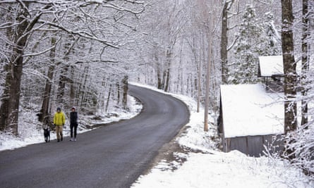
Polar vortex brings May snow and freeze warnings to New York and New England
Peter and Joanna Brown walk their dog in West Paris, Maine, on Saturday.Photograph: Andree Kehn/AP
AssociatedPressinBoston
Published onSat 9 May 2020 19.55 BST
Mother’s Day weekend got off to an unseasonably snowy start in the US north-east on Saturday, thanks to the polar vortex bringing cold air down from the north.
Some higher elevation areas in northern New York state and New England reported snowfall accumulations of up to 10in, while traces of snow were seen along the coast from Maine to Boston and as far south as Manhattan.
John Cannon, a meteorologist with the National Weather Service (NWS) in Gray, Maine, said parts of northern New England saw as much as 10in of snow and coastal areas of Maine and New Hampshire got a dusting. There were even reports of flurries in Boston.
“We’ve had several inches in many areas in the north-east. This is a rare May snow event,” he said.
The hardest-hit areas were hill town communities like Sugar Hill, New Hampshire, which got 10.5in, and Carrabasset Valley in Maine, which got 9in, he said.
Conditions at the Mount Washington Observatory, atop the highest peak in the north-east, were downright arctic on Saturday afternoon, with the wind chill at -22F (-30C) and winds gusting at 87mph.
In many areas, the snowfall was one for the record books, even if it didn’t stick around. Massachusetts had not seen measurable snow in May since 2002, while in Manhattan’s Central Park, the flakes tied a record set in 1977 for latest snow of the season.
The wintry weather came two days after Vermont began to lift restrictions on tennis, golf and other outdoor activities that had been imposed to curb the coronavirus outbreak. Phil Scott, the state’s governor, tweeted sympathy to Vermonters frustrated by the weather following weeks of being inside.
“I know snow on 9 May isn’t a welcome sight for many Vermonters, just as we’re cautiously allowing outdoor recreation to get going again,” he wrote. “But this is just a snapshot in time. Just like better weather is ahead, better days will come, as well. We will get through this, together.”
Usually the polar vortex is a batch of cold air that stays trapped in the Arctic all winter, but a couple times during the season it wanders south and brings bone-chilling cold and snow to Canada and parts of the US.
A low pressure system off the coast of southern New England helped pull cold air down from the north, said lan Dunham, a meteorologist with the NWS in Norton, Massachusetts.
Cannon said the snow would give way to strong winds upward of 40mph and 50mph in much of the US north-east for the remainder of Saturday, along with unusually cold conditions. There were freeze watches and warnings out for much of the region.
Temperatures were expected to dip below 30F (-1C) from midnight through Sunday morning in parts of New Jersey and New York and a freeze warning was issued from Saturday night until Sunday morning in parts of Pennsylvania.
A once-in-a-decade dump of 80cm+ of snow in early May at Hotham!
Let it snow!
02/05/2020
It's continued snowing lightly all day and we now have over 80cm+ from this remarkable Autumn snowstorm.
Some of the windrifts are over a metre deep! The table-o-metre has nearly disappeared and checkout the breathtaking images in our gallery.
Let's take it all in from our lounge rooms as we remind you that 'stay at home' restrictions remain in place in Victoria until 11 May 2020.
01/05/2020
Mid-winter conditions on the first day of May today at Hotham! An unbelievable dump of 50cm+ in the last 24 hours has seen the snow pillows on the table-o-metre growing by the hour.
With blizzard conditions today, the flakes continue to fall heavily and we could be in for another 15-20cm from this incredible Autumn snowstorm.
30/04/2020
Mother nature has forgotten we’re still in April, delivering a once-in-a-decade Autumn snowstorm with a bang at Hotham. With wet weather all through Victoria, frigid alpine temperatures have blanketed Hotham in 15cm of snow over the last 12 hours. And this is only the entrée, with another 40cm or more still on the way!
It’s continued snowing steadily today with the forecast calling for snow to intensify tonight and all through tomorrow. Blizzard-like conditions at Hotham on Friday will see a maximum temperature of -3C and winds up to 55 kilometres per hour.
With snow showers not easing until Saturday morning, stay home with a Hot(ham) chocolate, rug up and tune in to oursnow camsto watch the snow build up!
FOR DEAR LIFE: Frightened neighbors captured the moment roofers were caught in a powerful storm Sunday in Nashville, Tennessee, holding on for their lives as heavy winds tossed debris toward them; the workers reportedly were not injured.
Rwanda – Heavy Rain Leaves 8 Dead, Homes Destroyed
The Ministry of Emergency Situations (MINEMA) inRwandareports that heavy rain fell across the country from 01 May causing severe damages. As of 03 May 8 people had died, 5 were injured, more than 100 houses had collapsed and roads were closed.
Meteo Rwanda said the Mushubati weather station in Rutsiro District recorded 81mm of rainfall on 02 May.
According to Meteo Rwanda, more heavy rain is expected in Kigali city, Northern Province and Rubavu, Nyabihu, Rutsiro, Ngororero, Muhanga and Ruhango districts over the next 7 days, increasing the risk of further floods and landslides. MINEMA urged people to take necessary precautions.
Rwanda Red Cross warned of the further difficulties posed by flooding and landslides during the COVID-19 pandemic. Via Social Media, Rwanda Red Cross said:
“Imagine heavy rains resulting in floods and landslides during a pandemic: Disasters that are occurring in Rwanda lead to loss of human life, destruction of crops and homes, loss of livestock. A deterioration of health conditions of communities already affected by the lock-down.”
Flood damage in Rwanda after heavy rainfall from 01 May 2020. Photo: MINEMA
Floods in Rwanda after heavy rainfall from 01 May 2020. Photo: MINEMA
Rainfall reported on 2nd May 2020 from 8:00 am to 3rd May at 8:00 am. Mushubati Weather Station in @RutsiroDistrict recorded the highest rainfall amount of 81 mm.
Imagine heavy rains resulting in floods and landslides during a pandemic: Disasters that are occurring in Rwanda lead to loss of human life, destruction of crops and homes, loss of livestock. A deterioration of health conditions of communities already affected by the lock-down.
More parts of downtown Fort McMurray ordered to evacuate; food bank floods
Flood waters from the Clearwater River cover the Ptarmigan Trailer Park in Waterways on Monday, April 27, 2020.
A mandatory evacuation has been ordered from Hardin Street to Waterways. A voluntary evacuation notice has been given between Hardin Street and the highway 63 bridges.
People affected by this order are asked to report to the Casman Centre at 110 Eymundson to register. The Casman Centre is set up as a secondary registration centre to help alleviate the volume at the Oil Sands Discovery Centre.
Highway 63 remains open. Currently the evacuation does not include the hospital.
Earlier Monday, parts of downtown were ordered to evacuate as the Athbasca, Clearwater and Snye rivers continue flooding into Fort McMurray.
The Wood Buffalo Food Bank has closed after its building flooded Monday morning. Damage is still being assessed.
Heritage Village is also asking for help, as its protective berm is starting to breach. Anyone with dump trucks, sand, dirt or any other helpful equipment can call 780-788-5035.
Other sections of downtown have already been ordered to evacuate due to the flood. They are:
Alberta Drive
Biggs Avenue
Saunderson Avenue
Nixon Street
Crescent Heights
Haineault Street to Hospital Street
Birch Road
Bennett Crescent
Rae Crescent
Centennial Drive
Demers Drive
Armit Crescent
Fitzsimmons Avenue
Father Mercredi Street
Platinum Hotel
Mandatory evacuations have already been ordered for:
Waterways
Taiga Nova Industrial Park
Draper
Longboat Landing
A second state of local emergency has been declared after parts of Fort McMurray saw flooding from the overflowing Athabasca, Snye and Clearwater Rivers. People are being asked not to travel into downtown unless absolutely necessary.
The spring breakup of the Athabasca and Clearwater Rivers began at approximately 5:11 a.m. Sunday, elevating the risk of flooding for Fort McMurray’s lower townsite.
Scott, Yurdiga request military support
Mayor Don Scott has requested help from the Canadian Armed Forces as Fort McMurray issues evacuation orders. Since the request was made, most of Fort McMurray is now under a boil water advisory.
Scott said he put in the request on Sunday afternoon. Military assistance could come in the form of digging sandbags, helping with evacuations or clearing the jammed river ice.
Many people have suggested using the military to use explosives to clear the river ice, said Scott.
He is interested to see if this idea could work, since he has been told by First Nation leaders that dynamite has been used in the past to clear ice blockages. However, Scott has been told by the province this idea could be challenging, considering the thickness of the ice. The ice jam is also 24 kilometres long and stretches just north of Fort McKay.
“I would want them to use whatever is effective and safe,” said Scott. “If we needed more assistance, the federal government says they would be there for us.”
Flood waters from the Clearwater River cover the Ptarmigan Trailer Park in Waterways on Monday, April 27, 2020. Vincent McDermott/Fort McMurray Today/Postmedia Network
David Yurdiga, MP for Fort McMurray-Cold Lake, said he forwarded Scott’s request during a meeting with Adam Vaughn, parliamentary secretary to the Minister of Families, Children and Social Development.
Afterwards, Yurdiga was told by National Defence Minister Harjit Sajjan that military support would be approved following a formal request from the province.
Alberta’s cabinet is scheduled to meet at 9 a.m. today. Environment Minister Jason Nixon is expected to update the government on the situation and the request for military support.
“The number one priority is getting people to a safe location and making sure they have somewhere to go, and I’m glad we have the hotel space for that,” said Yurdiga. “Everything’s on the table for remedying crisis.”
Boil water advisories issued north of Athabasca River
A boil water advisory for all Fort McMurray neighbourhoods north of the Athabasca River bridges has been issued until further notice. This includes:
Dickinsfield
Eagle Ridge
Parsons Creek
Stone Creek
Thickwood
Timberlea
Wood Buffalo
The advisory came shortly after 1 a.m. Monday, when AHS and the municipality began receiving reports of discoloured tap water in neighbourhoods north of the bridges.
Currently, areas south of the bridge have not been affected.
Tap water should not be used for drinking, cooking, making baby formula, making ice, washing fruits or vegetables, brushing teeth and feeding pets before being boiled. The water is safe for bathing.
More information about using water under a boil advisory can be found on the AHS website.
RMWB included flooding in pandemic plans
In a Sunday afternoon interview, Scott said the municipality is “well prepared” to handle evacuations, flood mitigation efforts and public health orders related to the COVID-19 pandemic.
The registration centre had already been set up for a week when evacuations were ordered, he added, and pandemic response plans created in January considered the possibility of flooding.
“You can’t control Mother Nature, but you can control your response and we have a very effective team on the ground,” said Scott. “We want people to stay calm and follow all the advice and the orders that are in place. It’s absolutely critical that people follow the advice of the officials who are managing this.”
A truck crosses the Saline Creek Bridge in Fort McMurray as flood waters from the Clearwater River rise on Monday, April 27, 2020.
Chunks of river ice beneath bridges crossing the Athabasca River in Fort McMurray, Alberta on Sunday, April 26, 2020.
Ice floes in the Athabasca River seen next to the River Park Glen apartments in Fort McMurray on Sunday, April 26, 2020.
Chunks of ice on the Athabasca River, moments after river breakup began, on Sunday, April 26, 2020.
A park near the Fort McMurray neighbourhood of Waterways floods on Sunday, April 26, 2020.
A solar panel at a Fort McMurray park along the Clearwater River sticks out after the river flooded on Sunday, April 26, 2020.
A sign from the municipality warning people about the breakup of the Clearwater and Athabasca Rivers on Sunday, April 26, 2020.


You need to be a member of Earth Changes and the Pole Shift to add comments!
Join Earth Changes and the Pole Shift