Earth Changes and the Pole Shift
Wild Weather, the Wobble Effect
|
Weather: |
Tides and Whirlpools:
|
"We warned at the start of ZetaTalk, in 1995, that unpredictable weather extremes, switching about from drought to deluge, would occur and increase on a lineal basis up until the pole shift. Where this occurred steadily, it has only recently become undeniable. ZetaTalk, and only ZetaTalk, warned of these weather changes, at that early date. Our early warnings spoke to the issue of global heating from the core outward, hardly Global Warming, a surface or atmospheric issue, but caused by consternation in the core. Affected by the approach of Planet X, which was by then starting to zoom rapidly toward the inner solar system for its periodic passage, the core was churning, melting the permafrost and glaciers and riling up volcanoes. When the passage did not occur as expected in 2003 because Planet X had stalled in the inner solar system, we explained the increasing weather irregularities in the context of the global wobble that had ensued - weather wobbles where the Earth is suddenly forced under air masses, churning them. This evolved by 2005 into a looping jet stream, loops breaking away and turning like a tornado to affect the air masses underneath. Meanwhile, on Planet Earth, droughts had become more intractable and deluges positively frightening, temperature swings bringing snow in summer in the tropics and searing heat in Artic regions, with the violence of storms increasing in number and ferocity."
From the ZetaTalk Chat Q&A for February 4, 2012:
The wobble seems to have changed, as the temperature in Europe suddenly plunged after being like an early Spring, Alaska has its coldest temps ever while the US and much of Canada is having an extremely mild winter. India went from fatal cold spell to balmy again. Has the Earth changed position vs a vs Planet X to cause this? [and from another] Bitter cold records broken in Alaska - all time coldest record nearly broken, but Murphy's Law intervenes [Jan 30] http://wattsupwiththat.com/2012/01/30/bitter-cold-records-broken-in-alaska Jim River, AK closed in on the all time record coldest temperature of -80°F set in 1971, which is not only the Alaska all-time record, but the record for the entire United States. Unfortunately, it seems the battery died in the weather station just at the critical moment. While the continental USA has a mild winter and has set a number of high temperature records in the last week and pundits ponder whether they will be blaming the dreaded "global warming" for those temperatures, Alaska and Canada have been suffering through some of the coldest temperatures on record during the last week.

There has been no change in the wobble pattern, the wobble has merely become more severe. Nancy noted a Figure 8 format when the Earth wobble first became noticeable, in early 2005, after Planet X moved into the inner solar system at the end of 2003. The Figure 8 shifted along to the east a bit on the globe between 2005 and 2009, (the last time Nancy took its measure) as Planet X came closer to the Earth, encountering the magnetic N Pole with a violent push earlier in the day. But the pattern of the Figure 8 remained essentially the same. So what changed recently that the weather patterns became noticeably different in late January, 2012?
The N Pole is pushed away when it comes over the horizon, when the noon Sun is centered over the Pacific. This regularly puts Alaska under colder air, with less sunlight, and thus the historically low temps there this January, 2012 as the wobble has gotten stronger. But by the time the Sun is positioned over India, the N Pole has swung during the Figure 8 so the globe tilts, and this tilt is visible in the weather maps from Asia. The tilt has forced the globe under the hot air closer to the Equator, warming the land along a discernable tilt demarcation line.
The next loop of the Figure 8 swings the globe so that the N Pole moves in the other direction, putting the globe again at a tilt but this time in the other direction. This tilt is discernable in weather maps of Europe, again along a diagonal line. Depending upon air pressure and temperature differences, the weather on either side of this diagonal line may be suddenly warm or suddenly cold. The tilt and diagonal line lingers to affect much of the US and Canada, but the Figure 8 changes at this point to be an up and down motion, pulling the geographic N Pole south so the US is experiencing a warmer than expected winter under a stronger Sun. Then the cycle repeats, with the magnetic N Pole of Earth pushed violently away again as the Sun is positioned over the Pacific.
From the ZetaTalk Chat Q&A for April 6, 2013:
Would the Zetas be able to let us know what is causing the early break-up of the Arctic Ice, the ice seems to have taken on a swirling pattern at the same time, would this be wobble related? [and from another] http://www.vancouversun.com/news/national/Canada+Arctic+cracks+spectacular+event/8185609/story.html The ice in Canada’s western Arctic ripped open in a massive “fracturing event” this spring that spread like a wave across 1,000 kilometres of the Beaufort Sea. Huge leads of water – some more than 500 kilometres long and as much as 70 kilometres across – opened up from Alaska to Canada’s Arctic islands as the massive ice sheet cracked as it was pushed around by strong winds and currents. It took just seven days for the fractures to progress across the entire area from west to east. [and from another] http://earthobservatory.nasa.gov/IOTD/view.php?id=80752&src=iotdrss A high-pressure weather system was parked over the region, producing warmer temperatures and winds that flowed in a southwesterly direction. That fueled the Beaufort Gyre, a wind-driven ocean current that flows clockwise. The gyre was the key force pulling pieces of ice west past Point Barrow, the northern nub of Alaska that protrudes into the Beaufort Sea.

The Figure 8 formed by the N Pole during the daily Earth wobble has shifted somewhat to the East, due to Planet X positioned more to the right of the Earth during its approach. This was anticipated, and well described in ZetaTalk, the Earth crowding to the left in the cup to escape the approach of Planet X, so the angle between these two planets would change slightly. This shift of the Figure 8 to the East is due to the push against the Earth’s magnetic N Pole occurring sooner each day than prior. Thus instead of occurring when the Sun is high over the Pacific, over New Zealand, it is now occurring when the Sun is high over Alaska. All the wobble points have shifted eastward accordingly.
This has brought a lingering Winter to the western US, and a changed sloshing pattern to the Arctic waters. Instead of Pacific waters being pushed through the Bering Straits into the Arctic when the polar push occurs, the wobble is swinging the Arctic to the right, and then later to the left, creating a circular motion in the waters trapped in the Arctic. Since the Earth rotates counterclockwise, the motion also takes this path. This is yet another piece of evidence that the establishment is hard pressed to explain. They are attempting to ascribe this to high pressure and wind, all of which are not new to the Arctic, but this circular early breakup of ice in the Arctic is new.
Gerard Zwaan
STORMS CAUSE FLOODING IN MANY PARTS OF NETHERLANDS
By Janene Pieters on May 30, 2018 - 07:54
Thunderstorms that drew across the Netherlands on Tuesday afternoon and evening caused flooding in many parts of the country, especially in the Rotterdam region. The storms prompted meteorological institute KNMI to issue a code orange weather warning - dangerous weather - for the entire country except the Wadden islands.
The showers were very scattered throughout the country and fell so locally that some places in Utrecht and Zeeland didn't even notice the bad weather, while other places faced flooded streets, NU.nl reports. The A20 was completely closed at Schiedam due to flooding and an accident. Photos on social media show a large pool of rainwater on the highway. Around 10:00 p.m. only two lanes were still closed.
Neighboring municipalities like Ridderkerk and Hellevoetsluis also dealt with flooded streets. The local safety office received 13 reports of flooding in a matter of minutes, according to the newspaper. Most cases involved flooded homes. In Barendrecht a part of a warehouse collapsed under the downpour. No one was injured.
A resident of Terwolde in Gelderland was injured when strong winds blew a tree over onto his house. The fire brigade in Deventer received 40 reports of storm damage in a short period of time. Most of the reports involved fallen trees and damaged cars.
According to the KNMI, some places saw 50 millimeters of rain per hour on Tuesday. Weeronline reports that Milingen aan de Rijn in Gelderland saw the most rain with 72 millimeters - well above the 61 millimeters that falls per month on average. The strongest gust of wind registered at 93.3 kilometers per hour in Ruurlo.
Tuesday was also the first official tropical day of the year. It was 30.7 degrees Celsius in De Bilt at 2:40 p.m. It was also the warmest May 29th since temperature measurements started in the Netherlands in 1901. The previous heat record dates from 1944, when temperatures climbed to 30 degrees exactly in De Bilt.
Source: https://nltimes.nl/2018/05/30/storms-cause-flooding-many-parts-neth...
May 30, 2018
SongStar101
Temperatures above 48 degrees Celsius (118 deg F) causing dizziness dehydration birds falling out of the sky roads and cars melting in India
http://www.thebigwobble.org/2018/05/temperatures-above-48-degrees-c...
After strong winds, lightning and thunderstorms swept through northern and eastern India, killing at least 54 people earlier this week the incredible heat is not going away anytime soon.
At a time when many of Indian's fall prey to dizziness and dehydration merely after spending a couple of hours in the scorching sun, birds falling out of the sky due to dehydration and heatstroke and roads and cars melting.
Andhra Pradesh's State Disaster Management Authority has forecast extreme heatwave conditions in parts of the state with temperatures expected to touch 48 degrees Celsius, (118 deg F), the hottest in 40 years, in the next 24 hours, PTI reported on Wednesday.
The State Disaster Management Authority said many parts of Krishna district are expected to record 46 degrees Celsius on May 31, while the temperature may range from 43 to 44 degrees Celsius in East and West Godavari, Guntur, SPS Nellore and Chittoor districts.
The disaster management authority predicted that Srikakulam and Vizianagaram may record 38 to 39 degrees Celsius, while Visakhapatnam, Kadapa, Anantapuramu and Kurnool districts may record 40 to 41 degrees Celsius.
The southwest monsoon that has hit the Kerala coast is expected to advance into Andhra Pradesh around June 3, SDMA said.
On Wednesday, the southwest monsoon advanced to a few parts of the central Arabian Sea, and the remaining areas in Kerala, where it arrived three days early on Tuesday.
It also advanced to most parts of coastal Karnataka and interior regions in the states southern part, the meteorological department said.
Heavy rains lashed Mangaluru on Tuesday, inundating several low-lying areas.
The India Meteorological Department on Wednesday said the country will receive between 96% and 104% of the average rainfall.
Mexico burning! Life-threatening temperatures hitting 50 C (122 F) just 3.9 Celsius short of the hottest temperature ever recorded on our planet
http://www.thebigwobble.org/2018/06/mexico-burning-life-threatning....
A heat wave in Mexico that has increased temperatures to 50 C (122 F) in many areas has led authorities to declare a state of emergency, the country's National Weather Service (SMN) said Thursday.
According to the SMN, temperatures could rise to 50 C in the northern state of Sinaloa, the western state of Michoacan and the central state of Hidalgo, while temperatures in the rest of the country will exceed 30 C (113 F).
The SMN recommended residents to stay alert to announcements made by the National System of Civil Protection and by state and municipal authorities, as well as to take preventative measures such as staying hydrated and avoid excessive exposure to the sun.
Civil Protection declared a state of emergency in numerous municipalities throughout the country, allowing the use of federal funds to help states and local authorities assist residents during the heat wave.
The world's hottest ever temperature belongs to Death Valley at 134.1 degrees (56.7 Celsius), set July 10, 1913, but Weather Underground does not believe it is a credible measurement:
“The record has been scrutinized perhaps more than any other in the United States,”
“we don’t have much more to add to the debate aside from our belief it is most likely not a valid reading when one looks at all the evidence.”
If you discard the Death Valley record from 1913, the 129.2-degree F (53.9 Celsius) reading from Mitribah June 2016 would tie the world’s highest known temperature, also observed in Death Valley on June 30, 2013, and in Tirat Tsvi, Israel, on June 22, 1942.
But Masters says the Israeli measurement is controversial.
-----------------------------
Hot enough? Heat wave triggers emergency declarations in 22 states
The temperature reached 47 C at locations in Hidalgo and Sinaloa yesterday
https://mexiconewsdaily.com/news/not-even-a-cold-beer-is-enough-to-...
Temperatures have been soaring this week in Mexico, reaching as high as 47 C in two locations, and the heat wave continued across much of the country today.
The mercury hit 47 in Metztitlán, Hidalgo, and Huites, Sinaloa, yesterday, according to the National Meteorological Service (SMN), while it was 45 degrees or above in locations in Chihuahua, Michoacán, Guerrero and Jalisco.
Some relief may soon be on the way to some areas in the states of Chiapas, Oaxaca, Veracruz, Tabasco, Campeche, Yucatán and Quintana Roo, where the SMN has forecast electrical storms.
Yesterday’s heat wave led federal Civil Protection authorities to declare extraordinary emergency situations in 329 municipalities in 13 different states. The measure was later extended to include 573 municipalities in 22 states.
In Mexico City, where temperatures reached 31 yesterday, residents attempted to combat the heat in a variety of ways.
Shorts and miniskirts were the favored attire for many women, while businessmen and office workers rolled up their sleeves and removed their ties to seek relief.
Some capitalinos choose to visit one of the city’s hundreds of cantinas to quench their thirst and cool down — with mixed results.
“Not even a beer is enough to quell the heat,” 65-year-old pensioner Luis González told the newspaper El Universal as he fanned himself and mopped sweat from his brow with a handkerchief after he had downed a dark ale.
“The beer made me even thirstier, my mouth feels dry and my saliva’s heavy. That’s why I decided to order water, I hope that this will get rid of it [the heat],” he added, holding up his glass.
Other patrons are trying their luck with mojitos, a barman at another cantina said, explaining that along with beer it is the most popular beverage when the mercury starts to climb.
Yesterday’s hot spots.
Saúl López told El Universal that the number of customers has risen in recent days, seemingly indicating that many still believe drinking alcoholic beverages is a tried and tested remedy for the heat.
For children — and the young at heart — the fountains at the Monument to the Revolution or in the Alameda Central Park have been popular all week, with kids quick to remove their shoes and douse themselves — often fully-clothed — in the spurts of water.
For others, dealing with the heat hasn’t been quite so much fun.
In the city’s crowded subway system — where conditions can be uncomfortable even in times of more moderate weather —temperatures reached as high as 38 yesterday.
Commuters tried to cope as best they could by moving as close as possible to one of the ceiling fans in the carriages or buying a frozen paleta (popsicle). One man compared entering a train to going into a steam room.
His daughter Esperanza said “there’s nowhere to hide, it’s really hot and even though they put the fans on, it’s impossible to feel them . . .”
Jun 1, 2018
KM
http://www.cbc.ca/news/world/like-dominoes-utah-homes-burn-as-wildf...
'Like dominoes': Utah homes burn as wildfires menace U.S. West
Colorado also struggling to beat back forest fires
A fast-moving brush fire destroyed eight homes in the Utah tourist town of Moab, while more than 3,000 people in Colorado and Wyoming fled multiple wildfires scorching the drought-stricken U.S. West on Wednesday.
The blaze in Moab, known for its dramatic red rocks, started in a wooded area Tuesday night and quickly spread to homes over less than a square kilometre, Police Chief Jim Winder said. Crews were extinguishing embers Wednesday.
Moab residents Tim Clark and his girlfriend Tina Saunders grabbed their dogs, family photos and a laptop, evacuating with their home in flames.
"Those houses just started going like dominoes," Clark told the Salt Lake Tribune . "Bam! Bam! Bam! Bam!"
Police said the early investigation has ruled out natural causes for the blaze that ignited near a creek that is frequently used as a walkway in a largely blue-collar neighbourhood. It was not near the tourist-heavy areas in the town known for its proximity to Arches and Canyonlands national parks.
Moab resident Shane Tangren told the newspaper that he arrived home from work Tuesday evening to find flames nearby. He was trying to protect the house he's lived in since he was 16 by wetting it down, but the wind shifted and sent the flames barrelling right toward him. He fled.
"I sat there and watched it burn to the ground," Tangren, 55, told the newspaper. "Everything — photographs, birth certificates, memories — it's all gone. My first car — that was a 1970 (Pontiac) GTO. Up in flames. I bought it when I was 15."
Fierce wind gusts and brutally bone-dry conditions are expected on Thursday across a five-state region. Red flag warnings have been issued for parts of Nevada, Arizona, Utah, Colorado and Wyoming, where winds gusts could reach 65 kilometres an hour and humidity drop to 5 per cent throughout the day, the National Weather Service said.
Weather conditions along with possible dry lightning from thunderstorms could contribute to "extreme fire behaviour" on Thursday in southwest United States where more than two dozen wildfires are currently burning, the service warned.
Firefighters were hoping for some relief from a promising shift in weather patterns forecast for Friday, some of it associated with Hurricane Bud, which on Wednesday was off the Pacific coast of Mexico.
In Colorado's mountains, residents have evacuated more than 1,300 houses — condos, apartments and pricey homes — as flames threatened an area known for its ski resorts. Firefighters, with help from aircraft, got a quick jump on a fire near Silverthorne after it was reported Tuesday.
Summit Fire Chief Jeff Berino said Wednesday night that lightning did not play a role in the fire and that "some type of human element is probably likely" as a cause.
Across the state, Colorado's largest fire has burned about 111 square kilometres over nearly two weeks. Residents could go back to about 180 homes no longer threatened at the northern edge of the fire Wednesday, but others remained out of more than 1,900 houses.
The blaze about 43 kilometres north of Durango is in the Four Corners region where Colorado, New Mexico, Arizona and Utah meet and which is in the middle of a large swath of exceptional drought. Much of the U.S. West is experiencing some level of drought.
Colorado Gov. John Hickenlooper said the rapid response from emergency crews has helped prevent a repeat of devastating wildfires in 2012 and 2013.Years ago, he said fire departments were hesitant to commit resources to fighting every fire, and launching a co-ordinated response to a major blaze could take up to two days.
Hickenlooper said better co-ordination has cut down on delays, and the state reimburses local departments for initial response costs, in an attempt to control a blaze before it can spread.
"We learned a lot from the disasters, the fires we had in 2012 and 2013," Hickenlooper told reporters.
Meanwhile, a wildfire in Wyoming's Medicine Bow National Forest doubled in size over 24 hours, burning about 21 square kilometres. Nearly 400 seasonal and permanent homes have been evacuated because of the fire near the Colorado border.
The fire has destroyed some structures, but investigators have not said how many or what type.
The situation was better in central Washington, where authorities lifted evacuation orders or warnings for about 50 residents as crews work to contain a wildfire burning grass and brush.
Officials said one small outbuilding was lost but no injuries have been reported.
Jun 14, 2018
jorge namour
JET STREAM ran through southern Europe and North Africa passed over Lebanon
JUNE 14 2018
TRADUCED https://www.facebook.com/Khneisser.weather/videos/1395705923862973/...
The international media have been beset by the torrent that hit Baalbek
LEBANON yesterday, and some Russian websites, which broadcast by video and audio, reported what happened in the region, that this is the most violent trend seen by meteorologists in the Middle East,
The spread of this news in all Arab countries and on all social networking sites have already stated previously that the Bekaa is threatened by heavy rains and floods
JET STREAM ran through southern Europe and North Africa passed over Lebanon
JET STREAM GOING SOUTH SOURCE METEOWEB
FLOODS PHOTO
https://www.facebook.com/Khneisser.weather/photos/a.596174583816115...
Jun 19, 2018
Derrick Johnson
The tropical cyclone that created LAKES across the world's biggest sand desert: Incredible satellite images reveal the aftermath of killer Cyclone Mekunu
Spanning the southern third of the Arabian Peninsula, the Rub’ al-Khali is the world’s largest contiguous sand desert, and one of the driest places on Earth.
However, in May this year, Tropical Cyclone Mekunu passed over the region, dramatically changing the landscape.
It created a vast series of in the lowlands between dunes - revealed for the first time in these incredible images.
Salalah, a large port city in Oman about 300 kilometers (190 miles) south of this image, reportedly received 278 millimeters (11 inches) of rain over 24 hours between May 25–26 - more than twice the average amount the city sees in a year.
Authorities say Cyclone Mekunu killed at least 30 people when it barreled across Oman and Yemen.
The storm's Category 3 hurricane-equivalent landfall was one of the strongest on record in Oman.
The storm dumped more than two years' worth of rain on Oman in just 24 hours, flooding streets and trapping vehicles.
The International Federation of the Red Cross and Red Crescent Societies said in a statement that the majority of the fatalities happened on the Yemeni island of Socotra, where 20 were killed.
The cyclone packed maximum sustained winds of 170-180 kilometers (105-111 miles) per hour with gusts of up to 200 kph (124 mph).
The amazing images were captured by Operational Land Imager (OLI) on Landsat 8 acquired these false-color images of the eastern part of the desert in Saudi Arabia, near the border of Oman.
False-color (bands 7-5-3) makes it easier to distinguish different rock and soil types and to detect the presence of moisture. 'Mekunu dissipated as it tracked northwest over land, but still delivered huge amounts of of water to the desert,' NASA said.
Notice where water collected in the lowlands between sand dunes.'
For comparison, the second image was acquired on May 13 and represents the typically dry appearance of the interdune sand flats.
Source: http://www.dailymail.co.uk/sciencetech/article-5861745/Tropical-cyc...
Jun 20, 2018
KM
http://www.dailymail.co.uk/news/article-5857627/Death-attributed-fl...
One dead in Upper Midwest flash floods which have left huge sinkholes along roads as some areas are hit with more than 15 inches of rain
Widespread flooding in the Upper Midwest was blamed for at least one death in Wisconsin, while disaster declarations were issued Monday in northern Michigan after flash-flooding washed out roads, damaged businesses and caused dozens of sinkholes.
The body of a 75-year-old man was recovered about 60 feet (18 meters) from his pickup truck in a ditch along a flooded road Sunday in White River, the Ashland County Sheriff's Office said Monday. Sheriff's officials said the investigation was ongoing but that the death was flood related.
Heavy rains also flooded roads in northern areas of Minnesota, causing some sections to collapse. In parts of Michigan's Upper Peninsula, where up to 7 inches (18 centimeters) of rain was reported, swollen waterways washed away roads, leaving behind large chunks of concrete and asphalt, making some streets impassible.
The body of a 75-year-old man was recovered about 60 feet (18 meters) from his pickup truck in a ditch along a flooded road Sunday in White River, Wisconsin
'The majority of us can't even get home. Roads are collapsed. Bridges are collapsed. Roads are covered in water. Whatever roads aren't collapsed it depends on how heavy of a vehicle you drive whether or not you are able to drive on those roads,' Tom Cowell, who lives in Chassell, a community on a peninsula in Lake Superior, told local television station WLUC.
'This is a pretty wild experience that we are having here,' he said.
In nearby Houghton, a swollen creek washed away much of a parking lot and a Taco Bell sign. The land up to the restaurant's building caved into an adjacent ravine. Water rushed down a hilly street through businesses, including a comic book store and sporting goods shop where employees were trying to salvage goods.
Jun 20, 2018
SongStar101
The U.S. just had its warmest May in history, blowing past 1934 Dust Bowl record
https://www.washingtonpost.com/news/capital-weather-gang/wp/2018/06...
Almost every tract of land in the contiguous United States was warmer than normal in May, helping to break a Dust Bowl-era record.
The month’s average temperature 0f 65.4 degrees swept by the previous high mark of 64.7 degrees set in 1934. Temperatures were more than 5 degrees above normal, according to the National Oceanic and Atmospheric Administration, which published a May U.S. climate assessment Wednesday.
The 1934 record was impressive, enduring for decades even as the climate has warmed because of increasing greenhouse gases in the atmosphere. One of the main reasons May 1934 was so hot was because it was so dry, posting the least precipitation for the month on record. When the land surface is dry, it heats up faster.
A combination of drought and farming practices had left fields bare of vegetation in 1934, resulting in “an estimated 35 million acres of formerly cultivated land had been rendered useless for farming,” according to History.com.
The parched conditions were so severe that on May 11 “a massive dust storm two miles high traveled 2,000 miles to the East Coast, blotting out monuments such as the Statue of Liberty and the U.S. Capitol,” History.com wrote.
In May 2018, temperatures soared to record levels even without as much help from dry soils. Precipitation was a hair above normal averaged over the nation. Maryland, hit by major floods in Frederick and Ellicott City, had its wettest May on record. So did Florida. Asheville, N.C., posted 14.68 inches of rain, its wettest month in history.
Jun 21, 2018
jorge namour
Istanbul - TURKEY
JUNE 2018
TRADUCED
This is how the people of Istanbul are waiting for the storm and HAIL
https://www.facebook.com/Khneisser.weather/posts/1412375402196025
Jun 26, 2018
Juan F Martinez
Florida - Looks like a scene from, War of the Worlds.
AMAZING PHOTO! Check out this incredible shot by Nick Alan out of Connerton in Land O' Lakes during the lightning storm yesterday. Wow
Jun 27, 2018
Gerard Zwaan
Heatwaves reported from Canada, U.S. UK, Europe and Russia as the Northern Hemisphere hits high summer
As summer hits the Northern Hemisphere heatwaves are being reported from Canada, the U.S. the UK, Europe and Asia as the northern half of the planet bakes.
Of course, it is summer but for the whole Northern Hemisphere to witnessing heat-wave weather this is unusual.
In parts of south-west France, temperatures are expected to hit 40 deg C (104 deg F) today.
In Canada residents in the Toronto area had to endure a humidex temp which pushed into the mid-40s deg C (113 deg F) this weekend as the heat is expected to last the rest of this week.
Meanwhile, a dangerous, oppressive heat wave has scorched central, and the eastern US this weekend.
Temperatures have reached at least 30 Celsius in England, Scotland, Wales and Northern Ireland during the last week with the hot weather expected to hold well into next week.
Here in western and northern Europe, we are also basking in glorious sunshine with very hot temperatures and no let up in the coming week.
High temperatures along with high humidity have been hindering the players during the World Cup in Russia.
Source: www.thebigwobble.org/2018/07/heatwaves-reported-from-canada-to.html
Jul 2, 2018
Juan F Martinez
29 degrees and snow in Montana, July 3, 2018
Blending seasons.
Source: Showdown Montana Ski Resort
https://www.facebook.com/showdownmontana/photos/pcb.211249728882582...
Jul 4, 2018
Juan F Martinez
Jul 7, 2018
KM
'It was pretty much mayhem': Storm leaves campers trapped
Source
Sunday, July 8, 2018, 6:51 PM - It was a close call for a number of families camping at Saskatchewan's Emma Lake Friday night, who awoke to a storm tearing through the Murray Point campground.
Terri Bjarnason was in her camper with her husband and two young children.
She said she was trying to go to sleep when it started to rain and the wind began to howl.
"We heard a big crack and we looked out our window, and there was a tree at our site that had snapped off and was laying across the road," she said.
A truck that was hit by a tree during the storm on Saturday morning at Emma Lake. (Facebook/Lakeland & District Fire Department)
Bjarnason's husband ran out to put their awning away when the storm revved up.
"All of a sudden the camper was being rocked and I thought that we were rolling. I was thrown forward and there were cabinets on top of me," she said. "I didn't know what had happened. I thought that we were upside down."
Bjarnason said her leg was stuck under furniture but she was able to get free and crawl out of a hole in the side of the camper that had been made by another fallen tree.
BELOW: Another week, another severe storm risk for this Prairie province
She said she called 911 at 12:30 a.m., while both of her children, ages five and three, were still sleeping in their bunk beds.
The couple carried their children to another nearby trailer while they waited for the rain, thunder and lightning to die down.
While their camper is destroyed, Bjarnason has only scratches and bruises. The rest of her family was unscathed.
One other camper was destroyed nearby, but no one was hurt at that lot either. Another four people who were sleeping in a tent woke up to find out a tree came down right next to them, Bjarnason said.
40 first responders in action
Those in the area were trapped by trees lying across the road until park officials came around with chainsaws and cleared the way.
Chris McShannock, fire chief with Lakeland and District Fire Department, said 22 firefighters responded. With emergency responders from Parkland ambulance, conservation officers and park staff, he said about 40 people took part in the rescue effort.
About 15 to 18 people were trapped, although some got out before emergency crews arrived, he said. At the time, campers were panicked.
"It kind of seemed like chaos. Everybody didn't really know what to do," McShannock said. "There were so many trees down you couldn't take 10 steps without jumping over or crawling under a tree. It was pretty much mayhem."
McShannock said the day's hot weather sparked a thunderstorm and a significant wind which took down the trees.
A few people sustained minor injuries and were checked over by paramedics. No one was taken to hospital.
McShannock said park staff continued to clear the trees from the area Saturday.
"It's kind of like a box of toothpicks when you drop it on the floor," he said. "It's a mess. It's all over the place."
According to McShannock, the last significant storm at the Murray Point Campground took place seven years ago.
Emma Lake is about 40 kilometres northwest of Prince Albert
Jul 9, 2018
Gerard Zwaan
Unprecedented Japanese floods death toll near 100 with more than 50 missing and almost 6 million ordered to evacuate as horror unfolds
The death toll from torrential rains in western Japan reached 88 late Sunday, with over 50 others still missing after massive flooding and landslides destroyed homes and displaced tens of thousands. Rescue operations by Self-Defense Forces personnel and others were continuing in disaster-hit areas early Monday, as Japan's weather agency warned the public of the continuing danger of landslides and flooding.
At one point, evacuation orders or advisories were issued for up to 5.9 million people in 19 prefectures, while over 30,000 people were staying at evacuation centres as of Sunday afternoon, according to the Fire and Disaster Management Agency.
The number of casualties is expected to rise as damage in affected areas unfolds.
Many people are believed to be stranded in their homes due to a lack of access roads because of flooding.
In Okayama Prefecture, one of the hardest-hit areas, more than 1,000 people were temporarily trapped on the roofs of buildings submerged by floods following the bursting of three dykes on the nearby Oda River.
Most of them were rescued by boats or helicopters.
In the Mabi district, about 1,200 hectares, or one-third of the district, was submerged.
About 4,600 homes were inundated in the area.
The Ministry of Land, Infrastructure, Transport and Tourism mobilized pumper trucks to drain the inundated area but it is likely to take about two weeks to complete the drainage.
Since the downpour began Thursday, 38 people have died in Hiroshima, 21 in Ehime and 13 in Okayama.
The other casualties were from Yamaguchi, Kyoto, Gifu, Shiga, Hyogo, Kochi, Fukuoka and Kagoshima prefectures.
About 267,000 homes suffered water outages in 11 prefectures as of Sunday.
Roads were also damaged and flooded everywhere and many railway sections remain disrupted. According to the transport ministry, 17 railroad operators were suspending services on 56 routes in western Japan or elsewhere.
Businesses continued to be affected, with automaker Mazda Motor Corp and Daihatsu Motor Co, a minivehicle making unit of Toyota Motor Corp, suspending operations in factories in Kyoto, Hiroshima and Yamaguchi.
The companies decided on the suspension to ensure the safety of employees amid traffic disruptions as well as due to uncertainty over the procurement of auto parts.
Source: www.thebigwobble.org/2018/07/unprecedented-japanese-floods-death.html
Jul 9, 2018
Gerard Zwaan
As 2018 is set to be the hottest year ever Europe is beginning to parch from the lack of water after 50 days without rainfall
As June is expected to be named the hottest June ever on this planet and July going the same way and 2018 set to be the hottest year ever Europe is beginning to parch from the lack of water
After what seems like weeks without rainfall this is what grass looks like in North Holland after the incredible heatwave which has gripped the UK and Western and Northern Europe recently.
Reservoirs are running dry after a 50-day dry spell while global temperatures rocket.
Millions of homes in the UK are facing hose-pipe bans as a water shortage looms.
The extreme weather conditions have been taking their toll on roads, with melting tarmac leading to a number of incidents around the UK.
According to the Daily Mail, a 24-year-old man’s leg got stuck in a sinkhole when tarmac melted beneath him while he was on his way to buy breakfast on Thursday in Newcastle.
He was trapped from the thigh downwards for 20 minutes before firemen using a hammer and chisel freed him.
A global map of temperatures from July 7, 2018, showing the above average heat which is affecting the northern hemisphere
Source: www.thebigwobble.org/2018/07/as-2018-is-set-to-be-hottest-year-ever...
Jul 9, 2018
Juan F Martinez
Grand Marais, Michigan - 4.00 Inch Hail Near Newberry, Michigan On 06/30/2018
http://www.stormersite.com/showreport/437397
This grapefruit sized hail was reported at 12:40:00 PM CDT on 06/30/2018 about 23 miles from the center of Newberry, Michigan. Newberry has a population of 1519. The exact location that this hail report originated from was 46.68, -85.64. The area around Newberry has had 4 hail storm reports within 10 miles in the last 3 years.
Jul 13, 2018
Juan F Martinez
This fell from the sky in Italy Monday July 16th 2018
Jul 17, 2018
Gerard Zwaan
WATER SUPPLY IN RIJN RIVER BELOW MINIMUM LEVEL
By Janene Pieters on July 19, 2018 - 08:59
The supply of water to the Rijn river that enters at Spijk Nederland dropped below the minimum limit for the month of July, the national coordination committee for water distribution LCW announced. The LCW therefore issued a code yellow, which means that a water shortage may be imminent. The low water level may lead to measures, though what measures exactly is not yet clear, the LCW said, NU.nl reports.
According to the LCW, both the Rijn and the Maas are important for the water supply in the Netherlands. The minimum quantity of water that must flow into the Rijn in July is 1,200 cubic meters per second. On July 15th this dropped below that limit, and it currently stands at 1,140 cubic meters per second. Almost no rain is expected in the basin of the river, elsewhere in Europe, for the next week. The LCW therefore expects that the water supply will drop well below 1,100 cubic meters per second.
The water supply to the Maas is expected to drop to between 30 and 60 cubic meters per second. This is still above the lower limit of 25 cubic meters per second, and the LCW does not expect it will drop below that limit over the next 15 days. The water levels in the IJsselmeer area are "on level", except for those of the Veluwerand lakes.
The consequences of the drought are most noticeable on the high sandy soils in the Netherlands - Noord-Brabant, Limburg, Drenthe, Twente, the Achterhoek and the Veluwe. These areas are not supplied by water from rivers and are completely dependent on rainfall. The ban on irrigation using surface water will remain in place in these areas for the time being.
The LCW expects that, especially in agriculture, the demand for water will increase to higher than the supply in the coming period. "At the moment supply and demand are in balance, but that will change", Harold van Waveren, chairman of the LCW, said, according to the newspaper. The weather services expect no significant rainfall in the weeks ahead. It is expected that the national average of the precipitation deficit will rise to 266 millimeters. "Such a precipitation deficit is comparable with the situation in the record [drought] year of 1976", according to the LCW.
No water is currently being discharged to the sea through the Asluitdijk and Haringvliet locks, to retain as much fresh water as possible. Water boards are also continually monitoring peat dikes, to make sure they don't break through like what happened in 2003. Due to the drought, the peat became lighter and caused a dike to be washed away. They dikes are sprayed with water where necessary, making the peat heavier, which should prevent the dike breaking.
The drought and heat also mean that the water quality in the Netherlands is decreasing. Over the past weeks, there were increasing reports of blue-green algae, botulism, fish mortality and unwanted bacteria in fresh water. The expectation is that the water temperature will rise further in the coming week, thereby decreasing the quality further. But in relative terms, the situation is not too bad. "Despite the high water temperature, the water quality is still of good quality compared to other years", the LCW said. Rijkswaterstaat and the water boards call on swimmers to only go swimming in official swimming locations.
On Wednesday the municipality of Sittard-Geleen warned residents that the drought is increasing the rat problem. The wells along the street are drying up. "Rats do not like that. They need water every day and come out of the sewer in search of water and food", the municipality wrote on Facebook. Pouring a bucket of water into the wells will help keep the rats in the sewers, and also reduce the sewage smell, the municipality said.
Source: https://nltimes.nl/2018/07/19/water-supply-rijn-river-minimum-level
Jul 20, 2018
KM
http://www.dailymail.co.uk/news/article-5972703/Tornado-hits-factor...
'Houses are being torn to shreds': Dramatic video shows powerful tornadoes ravaging through Iowa - entirely flattening one town which has been left in a state of emergency
Amateur video posted on social media of powerful tornadoes ripping through Iowa looked like scenes right out of the movie Twister.
The dramatic images showed the roofs of homes torn to shreds as tornadoes waded through rural parts of the Hawkeye State on Thursday.
A flurry of tornadoes swept through central Iowa, flattening buildings and damaging the courthouse in Marshalltown and hitting an agricultural machinery plant in Pella as people were working.
Authorities said a hospital was evacuated and there were some injuries from the storms.
Hardest hit appeared to be Marshalltown, a city of 27,000 people about 50 miles northeast of Des Moines, where brick walls collapsed in the streets, roofs were blown off buildings and the cupola of the historic courthouse tumbled 175 feet to the ground. The city declared a state of emergency Thursday evening.
A number of people were injured while a hospital was evacuated. UnityPoint Health hospital in Marshalltown was damaged
UnityPoint Health hospital in Marshalltown was damaged, spokeswoman Amy Varcoe said.
Varcoe said all 40 of its patients were being transferred to the health system's hospitals in Waterloo and Grundy Center.
The Marshalltown hospital's emergency room remained open to treat patients injured in the storm, Varcoe said. Ten people injured in the storm had been treated by 7pm Thursday, she said.
She did not know how serious those patients' injuries were.
Another tornado hit agricultural machinery maker Vermeer Manufacturing, where some people were still working, in the town of Pella, about 40 miles southeast of Des Moines.
It scattered huge sheets of metal through a parking lot and left one building with a huge hole in it.
Pella Police Lt. Shane Cox told television station KCCI-TV that some people from the plant were taken to a hospital, but he didn't know the extent of injuries or the number of people.
Damage to production plants at Vermeer Corp., a farm and construction equipment manufacturer in Pella, Iowa, is seen in an aerial view on Thursday
A local resident runs past a tornado-damaged building on Main Street in Marshalltown, Iowa
Jul 20, 2018
Gerard Zwaan
Various article about the weather and drought in Europe
https://www.theguardian.com/environment/2018/jul/20/crop-failure-an...
https://nltimes.nl/2018/07/19/water-supply-rijn-river-minimum-level
https://www.theguardian.com/uk-news/2018/jul/20/uk-water-firm-asks-...
http://www.euronews.com/2018/07/19/the-record-breaking-heatwave-tha...
Hailstorm, 80 cm did fall near Nice, France
https://youtu.be/7ubPTU4UR90
Forest fires in Sweden
https://youtu.be/qP9ubw6JQVE
Jul 20, 2018
Yvonne Lawson
'It's dire': farmers battle their worst drought in 100 years – New South Wales, Australia
In the central-west region of New South Wales, farmers continue to battle a crippling drought that many locals are calling the worst since 1902. In Warrumbungle shire, where sharp peaks fall away to once fertile farmland, the small town of Coonabarabran is running out of water. The town dam has fallen to 23% of its capacity and residents are living with level-six water restrictions. There are real fears the town will run dry.
Last year the Doolans recorded their fourth-lowest average rainfall and it has been followed by even drier conditions. They have sold whatever stock they can and spend their entire days at the moment feeding the cattle that remains because the pastures have dried up.
Farmers in this part of NSW are importing almost all food for their livestock from as far away as South Australia as prices rise with demand. The continued cost of buying feed is causing many to question their future on the land. The NSW government recently approved an emergency drought relief package of $600m, at least $250m of which will cover low-interest loans to assist eligible farm businesses to recover. The package has been welcomed but, in the words of a local farmer, “it barely touches the sides”. With the prospect of a dry El Niño weather pattern hitting the state in spring, the longer-term outlook is dire.
Read more: https://www.theguardian.com/environment/2018/jul/19/you-count-your-...
Jul 22, 2018
jorge namour
Greece asks for international help as one person killed in fires
Mon Jul 23, 2018
https://www.presstv.com/Detail/2018/07/23/569061/Greece--internatio...
Greece appealed for help from other countries on Monday, July 23, to tackle fires raging uncontrolled near Athens that killed at least one person.
"Due to the large expanse, the intensity, and the dangers the fires pose, the country has submitted a request through the European civil protection mechanism for international ground and air assistance," fire brigade spokesperson Stavroula Malliri said.
Greek emergency services said one person had been killed and 25 persons were injured.
In the port town of Rafina, on Athens' east coast, some 30 kilometres from the capital, a heavily populated area full of summer homes, fire-fighters battled flames amidst houses. A local mayor said he saw at least 100 homes and 200 cars engulfed in flames.
Greek authorities urged residents in the coastal region of Kineta, some 54 kilometres west from Athens, to abandon their homes as a wildfire burned ferociously.
The army was drafted in on Monday afternoon to help fight the blazes. Some flights, mainly landings, were disrupted on Monday afternoon by low visibility and diverted elsewhere, air traffic controllers said.
Jul 24, 2018
jorge namour
'It will impact the world': Gov. Brown on wheat loss from Substation Fire
OREGON
uly 19, 2018
https://www.kgw.com/article/money/it-will-impact-the-world-gov-brow...
"This [fire] will have devastating impacts on Oregon. This is definitely our wheat basket. It's going to impact Oregon, it's going to impact the world," said Oregon Gov. Kate Brown.
PORTLAND, Ore. — The Substation Fire, which has burned more than 50,000 acres southeast of The Dalles, will have a substantial impact on Oregon’s agricultural economy, according to Oregon Gov. Kate Brown.
In addition to causing one death and forcing several communities to evacuate, the fire is threatening wheat crops and livestock in Sherman and Wasco counties.
"This [fire] will have devastating impacts on Oregon. This is definitely our wheat basket," Brown said on Thursday. "It’s going to impact Oregon, it’s going to impact the world.
“We have an awful lot of wheat out there that had not been harvested, that is in danger of being destroyed,” he said.
-----------------------------------------------------------------------------------
Heat wave record in the United Kingdom: London at risk of catastrophic fires
25 July 2018
http://www.meteoweb.eu/2018/07/caldo-regno-unito-incendi-londra/112...
he inhabitants of London were asked not to throw cigarette butts and any kind of live flame on dry grass after a series of grass fires in the city
The record heat wave , in fact, has left completely dry gardens, fields and parks and any fire could flare up could be " catastrophic ", this is the adjective used by local authorities.
The city's firefighters fought two different fires on the hottest day of the year, on July 23 just past. A total of 125 firefighters were called to Woolwich Common on the evening of 23, while another 25 men were summoned for a huge fire in a 4-hectare woodland in Croydon.
Referring to the Woolwich Common fire, station manager Clinton Walsh said: " London is completely dry at the moment and a stray cigarette or even a glass bottle is enough to trigger a fire like this
Jul 26, 2018
SongStar101
Trump declares emergency declaration for California fires
http://www.ktvu.com/news/trump-declares-emergency-declaration-for-c...
REDDING, Calif. (BCN) - President Donald Trump signed an emergency declaration making federal emergency aid available to supplement state, local and tribal efforts in battling California wildfires, the Department of Homeland Security said today.
The state is battling raging fires in several counties. The declaration authorizes the Federal Emergency Management Agency to coordinate disaster relief efforts.
California governor Jerry Brown sent a letter to the president on Friday, requesting an emergency declaration that would help Shasta County communities suffering the impacts of the Carr Fire.
"I am requesting direct federal assistance, including Department of Defense assets to immediately mitigate the impacts of this fire," Brown wrote.
The governor also requested "shelter supplies and water for 30,000 evacuated residents in Shasta County; U.S. Department of Agriculture's assistance in evacuating large animals; mass care; evacuation assistance for individuals with access and functional needs; and ambulatory assistance."
Cal Fire and crews from around the state are battling fires on several different fronts, including major wildfire blazes in Shasta, Mendocino and Mariposa counties.
More details:
AP News updates: https://www.apnews.com/6f5fefa581554c8eb5b2a5e77c9eb849
Fires all over the state:
http://www.fire.ca.gov/general/firemaps
Jul 29, 2018
jorge namour
Record-breaking temperatures could hit Spain, Portugal and create drought conditions, forecasters warn
August 2, 2018
https://edition.cnn.com/2018/08/02/europe/europe-heatwave-drought-w...
London (CNN)Forecasters have warned of potentially record-breaking temperatures in Spain and Portugal this week as much of Europe swelters in a heat wave that has left some farmers suffering drought conditions.
The UK Met Office said parts of the Iberian peninsula could beat the all-time continental European record of 48 degrees Celsius (118.4 degrees Fahrenheit) this week, with inland areas likely to be hotter than the coast.
The Portuguese capital, Lisbon, could see a high of 41 Celsius on Saturday, according to CNN forecasters. Its average temperature is 28 Celsius for this time of year
A heat wave warning was in place across much of southern and eastern France on Thursday.
Vulnerable people such as children and the elderly could be at risk of heat stroke, which occurs when a person's core body temperature rises above 40 Celsius and can lead to permanent brain, heart and kidney damage and, in more severe instances, death.
The United Kingdom is also experiencing a prolonged spell of hot, dry weather
The National Farmers' Union hosted an emergency summit Wednesday with representatives of the UK government, at which it called for its members to be given help to cope with the conditions. Farmers are struggling with irrigation, heat stress on livestock, the loss of crops and a shortage of forage for animals, the union said.
Meanwhile, German Agriculture Minister Julia Klöckner wrote to the European Commission on Wednesday urging it to take steps to help farmers affected by drought. Food for livestock could become scarce in the coming weeks, she warned.
The past four months in Germany have been very hot and dry, particularly in the north and east of the country.
The partly dried-out bed of the River Danube is pictured in Mariaposching, southern Germany, on Wednesday.
Aug 2, 2018
jorge namour
France floods: One missing and 1,600 evacuated
August 10, 2018
https://edition.cnn.com/2018/08/10/europe/france-flash-floods-intl/...
Rescuers walk past damaged bicycles in a flooded camping area on August 9 in Saint-Julien-de-Peyrolas in southern France
Paris (CNN)A German man in his 70s is missing and 1,600 people have been evacuated because of flash floods in France, according to authorities.
The man is thought to have fallen into the fast-flowing River Aube at the village of Rouvres-sur-Aube in eastern France on Thursday afternoon, Françoise Souliman, prefect of the Haute-Marne district, told the German Press Agency on Friday. Divers and a helicopter have been deployed to search for the missing man, Souliman said.
In southeastern France, 1,600 people were evacuated because of a "violent" storm, according to a government statement Thursday.
Rescuers walk past a damaged tent in Saint-Julien-de-Peyrolas.
Supported by four helicopters, more than 400 firefighters and paramilitary officers were mobilized for the rescue operation.
French Interior Minister Gérard Colomb advised citizens to exercise "utmost caution" in a tweet Thursday.
Heavy rainfall has swept across central Europe in the past few days following weeks of extreme heat and drought. Storms in Germany caused hundreds of people to be evacuated and dozens of flights were canceled.
Aug 10, 2018
Khan
Summer snowfall in Saudi Arabia.
Aug 21, 2018
Source
Aug 23, 2018
Khan
Rare snow falls in Uruguay; Graupel covers parts of Argentina.
Aug 21, 2018
Rare snowfall was seen across parts of Uruguay on Sunday while graupel resulted in an icy coating across parts of eastern Argentina.
Below are several different videos and photos from twitter showing the incredible snowfall in Uruguay.
Source
Aug 23, 2018
SongStar101
Hawaii braces for Hurricane Lane, as officials say there are not 'enough shelters for everyone'
http://www.foxnews.com/us/2018/08/22/hawaii-braces-for-hurricane-la...
As Hurricane Lane barrels towards Hawaii as a Category 4 storm packing sustained winds of 155 mph, officials in the Aloha state are warning residents they don't have enough shelter space to meet the "estimated demands" of the population.
The National Weather Service's Central Pacific Hurricane Center said in its 11 a.m. ET advisory that Lane, which is likely to cause catastrophic damage with winds 155 mph or above, is located about 460 miles south-southeast of Honolulu and moving west-northwest at 9 mph. The storm strengthened to a Category 5 storm with 160 mph winds before slightly weakening, but hurricane warnings are in effect for Hawaii's Big Island and the island of Maui.
"Some weakening is forecast during the next 48 hours, but Lane is forecast to remain a dangerous hurricane as it draws closer to the Hawaiian Islands," the CPHC said.
On Tuesday, emergency management officials across the state urged residents to prepare to evacuate if needed or shelter in place if its safe. Hawaii State Emergency Management Administrator Tom Travis said during a news conference that the priorities for state officials are to manage shelters because "we do not have enough shelters for everyone."
"The sheltering policy should be – if you’re not in a flood zone, most citizens should remain in their homes," Travis said. "If in a flood zone, actively seek shelter elsewhere with someone not in a flood zone or public shelter."
Live satellite image of Hurricane Lane
Earlier this year, a state report on hazards facing Hawaii warned there are only 277,376 available shelter spaces for the islands' estimated 1.4 million people.
HURRICANE LANE STRENGTHENS TO CATEGORY 5, HEADS TOWARD HAWAII
"Hurricane evacuation shelters are a last resort option for residents and visitors who do not have a safer place to stay," the report noted. "There are insufficient hurricane evacuation shelters to meet the estimated demand of the population and these shelters have no supplies."
State officials said residents instead should harden their homes, and stock up on two weeks-worth of food and water to weather the storm and its after-effects.
"It's obvious there aren't enough shelters," Brig. Gen. Moses Kaoiwi, director of joint staff of the Hawaii National Guard told Hawaii News Now after the report was issued. "If you have a home you can shelter in, it's probably better to stay at home."
Public schools on the Big Island and in Maui County are closed Wednesday until further notice, and Hawaii Gov. David Ige is allowing non-essential state employees on the Big Island and Maui to go on administrative leave from Wednesday to Friday as Hurricane Lane approaches. Employees on Hawaii and Maui islands who work in disaster response as well as in hospitals and prisons are required to report to their jobs, the governor said.
Brianna Sugimura unloads supplies for riding out the storm while her children, Radon-Kai and Kanaloa watch in the parking lot of a Walmart store Tuesday, Aug. 21, 2018, in Lihue, on the island of Kauai in Hawaii. (Dennis Fujimoto/The Garden Island via AP)
A statement from the U.S. Navy also revealed Wednesday that Hawaii-based ships and submarines have started to "sortie," or are being moved from their locations, ahead of the storm in order to avoid potential damage.
"Based on the current track of the storm, we made the decision to begin to sortie the Pearl Harbor-based ships," Rear Adm. Brian Fort, commander, Naval Surface Group Middle Pacific, said. "This allows the ships enough time to transit safely out of the path of the storm."
The ships will stay at sea until Lane's potential dangers pass and "will be positioned to help respond after the storm, if needed," the statement said. Because of "maintenance availabilities," certain ships will not depart but they'll take "extra precautions to avoid potential damage."
President Trump said on Twitter in the path of Lane needs to prepare for the storm.
"Everyone in the path of #HurricaneLane please prepare yourselves, heed the advice of State and local officials, and follow @NWSHonolulu for updates," he wrote. "Be safe!"
Ige said the state will start to see impacts beginning late Wednesday into Thursday, and that Federal Emergency Management Agency has been "very proactive" with placing food, water and emergency equipment throughout the state.
"We do anticipate that we would activate the National Guard depending on what the impact would be," he told reporters.
HURRICANE LANE NEARS HAWAII AS STATE BRACES FOR HEAVY RAIN, POWERFUL WINDS
The center of Lane is forecast to pass just west of the Big Island on Thursday, likely weakening to a category 2 or 3 storm by then, according to Fox News Senior Meteorologist Janice Dean. Hurricane-force winds extend 40 miles from Lane’s eye, while tropical storm-force winds extend 140 miles from the center of the storm.
The forecast for rain through Saturday across Hawaii from Hurricane Lane. (Fox News)
"Not only are hurricane-force winds possible on the Big Island, but torrential rain, flooding, and mudslides are likely given the steep terrain," Dean said.
The forecast track is still uncertain, and if the storm slows down "catastrophic flooding" will be a danger, as the towering mountains on the islands of Maui and the Big Island could lead to deadly flash flooding and landslides. Besides heavy rain, tropical-storm force winds of up to 73 mph are possible for all of the islands, in addition to coastal flooding and possible storm-surge flooding if the center of Lane moves close to land.
The high elevation on Hawaii may cause additional flooding problems. (Fox News)
Lane is the strongest storm to come this close to Hawaii in recorded history, and only six category 5 storms have been located in this part of the Pacific Ocean.
The Aloha State, while located in a vast ocean, has not had many brushes with large tropical systems. According to the National Oceanic and Atmospheric Administration's database, there is no record of a hurricane track within 65 nautical miles of either Maui or Honolulu since statehood.
For Hawaii, the "big one" came in in 1992 when Hurricane Iniki struck the island of Kauai as a Category-4 storm, causing $3.2 billion in damage and killing six people, according to Dean.
Iniki is still the costliest and deadliest storm to hit the islands in recorded history, and only two other hurricanes -- an unnamed storm in 1871 and Dot in 1959 -- have hit a Hawaiian island in that time period.
Aug 23, 2018
SongStar101
Mendocino Complex Fire is now 400,000 acres—more than half the size of Rhode Island
https://www.sfgate.com/california-wildfires/article/Mendocino-Compl...
Twin fires burning on both sides of Clear Lake in Mendocino, Lake and Colusa counties have devoured more than 400,000 acres, scorching an area more than half the size of Rhode Island.
The Ranch Fire near Ukiah has chewed up 351,557 acres, making it the largest wildfire in modern California history, and the River Fire north of Hopland has burned through 48,920 acres. Many are referring to the pair of infernos as the Mendocino Complex Fire.
The out-of-control wildfires both started on July 27 by unknown causes and rapidly caught up to the state's previous record holder--the Thomas Fire--that consumed an area the size of New York City in December 2017.
Five of the 10 largest wildfires in California history have occurred in the the past five years, and many experts believe the more extreme nature of today's wildfires is a result of environmental conditions.
At the current pace, the two fire seasons since California's five-year drought ended will be the worst on record.
In recent weeks, residents have been forced to flee their homes as firefighters battled flames up and down the state and temperatures in inland valleys and mountain regions repeatedly soared into the triple digits.
The deadly Ferguson Fire that has been burning for more than a month and caused closures at Yosemite National Park is now fully contained.
Firefighters over the weekend gained full control of the wildfire that began July 13 and has burned nearly 156 square miles (404 square kilometers).
But officials say firefighters continue to work in the area and that some islands of unburned vegetation will continue to ignite but they are not a threat to containment lines.
Two Firefighters were killed while battling the blaze, which overtook parts of Yosemite, the Stanislaus and Sierra National Forests.
As the Mendocino Complex Fire continues to spread, officials ordered new mandatory evacuations for some areas in Glenn County. The blaze has already displaced people in neighboring Lake, Mendocino and Colusa counties. Nearly 3,500 firefighters are battling the blaze that's burning in steep, difficult-to-access terrain covered in deep timber and dry brush.
While the state saw heavy precipitation two years ago, with reservoirs filling up and California Governor Jerry Brown declaring an end to the drought, the landscape is parched and groundwater depleted from multiple years marked by low rainfall and a paltry snowpack.
"Folks believe the rains came and took care of the problem," says Scott McLean, a Cal Fire deputy chief. "They exacerbated the problem by promoting growth. Our grass growth has been very significant in recent years and that has added fuel to these fires. It just takes a spark. We need several years of significant winters to get us back to the place we were before."
Adding yet another dimension to the problem, the forests suffered through years of drought leading up to 2017, and the state estimates that since Dec. 2016 some 129 million trees have died due to drought and insect infestation. That's a staggering 2 million trees a month.
"The fact is millions of trees die every year, and there are millions of little seedlings that don't make it," says Keith Gilles, a professor of forest economics at UC Berkeley. "But when you have this many big trees dead, it's pretty different. The fuel load is very high."
For more information on blazes burning around California, check out SFGATE's wildfire page.
----------------------------------------------------------------------------------------------
Separate from the article above, here is an image based on 400,000 acres:
Aug 25, 2018
SongStar101
Extreme weather shifts unexpectedly. First very Cold, then very sizzling Warm again!
SNOW falls on UK as Brits SHIVER in freezing -2C start to Bank Holiday
BRITS woke up to a bone-chilling start to the Bank Holiday this morning – with even snow falling on some parts.
https://www.dailystar.co.uk/news/latest-news/725585/Weather-forecas...
Published 25th August 2018
Fresh flurries of the white stuff were recorded in the Scottish mountains in the early hours of this morning as temperatures plummeted.
The snowfall was the first of the summer – coming just days after Brits sizzled in the high 20s and weeks after a relentless 35C heatwave.
Temperatures nosedived to single figures across the UK overnight as freezing Arctic air sweapt in from Iceland.
The bitterly cold air saw rain fall as snow in some parts of northern Scotland at around 5am, including the Cairngorms National Park near Inverness where -2C was felt.
Weather maps by NetWeather also showed the white stuff falling over mountains to the west of Inverness in central Scotland.
Elsewhere, the teeth-chattering cold air saw temperatures drop across England and Wales to around 6C, according to the Met Office.
London “felt like” 5C, say NetWeather, while Brighton shivered in 3C, Cardiff 4C and Edinburgh 2C.
Although temperatures are set to rise into the mid-to-late teens this afternoon, the cold air will strike again tonight.
Single figure temperatures will return to deliver another chiller in another “dramatic dip” and it won’t be until next week when the Arctic air disappears.
Meteorologist Becky Mitchell told Express.co.uk: “We are going to see quite a dramatic dip in temperatures.”
--------------------------------------------------------------
Just two days later weather was SAVED unexpectedly??
--------------------------------------------------------------
Weather forecast UK: Met Office says Bank Holiday SAVED by 22C sizzler
A MISERABLE Bank Holiday weekend that has left Brits soaked and cold will be swept away by a 22C sizzler today.
https://www.dailystar.co.uk/news/latest-news/725859/Weather-forecas...
Published 27th August 2018
Drenched Brits suffered a torrid “soaking Sunday” yesterday, as a massive band of rain was dumped all over the UK.
Gale force winds of up to 50mph also battered the country – after weeks of relentless 35C heat came a shuddering end.
Friday night saw the UK blasted by Arctic air from Iceland as temperatures plummeted to freezing as a low pressure system moved in.
The teeth-chattering conditions even saw bands of rain turn to snow in parts of Scotland in a massive contrast in weather.
But after two days of misery, there is finally light at the end of the tunnel on the last day of the three-day Bank Holiday weekend.
The huge band of rain has now made way for a warm spell that will see temperatures leap to 23C across southern parts of the UK.
The sun will finally make a reappearance for many parts this morning, with the warmest part of the day set to be this afternoon.
Although the BBC forecasts 20C for London, NetWeather say it will “feel like” 23C when brisk winds ease later on.
And Met Office forecaster Greg Dewhurst said: “The (low pressure) system is all cleared by Sunday night, with sunny spells and improved temperatures for the Bank Holiday.
“22C (is) possible in the South-East.”
The Met Office forecast reads: “Monday will be drier and brighter than Sunday, although some showers are still likely, mainly affecting north Wales, northwest England and western Scotland.
“Where the sun does come out, it will feel warmer, particularly when the breeze dies down later.”
Also warning of another wet day up north, where temperatures will manage to reach the mid-teens, BBC Weather’s forecast reads: “A fairly cloudy day for most with a scattering of showers around, especially in the north and west.
“Showers will gradually ease in the afternoon with perhaps some sunny breaks in places.”
The warm weather today will set the trend for the rest of the week too, with forecast maps hinting a return of the 30C roastings the UK has enjoyed all summer.
Aug 28, 2018
SongStar101
Unusual Weather the last few days: very cold snow and sizzling hot within the same day accross two parts of Canada, Snow in European Alps...in August.
Canada, eh? Snow in the west as easterners brace for heat wave
https://www.ctvnews.ca/canada/canada-eh-snow-in-the-west-as-eastern...
In some parts of Canada, the end of summer vacation is bringing some of the hottest temperatures of the year.
In other areas, it’s bringing weather more typically experienced in December than during the last week of August.
Some B.C. communities saw temperatures dip near or below the freezing mark Monday morning. A temperature of -1.5 C was recorded at Burns Lake at 5 a.m. One hour later, the temperature in Prince George dipped to 0 C.
The cold snap marked Prince George’s second unusual weather phenomenon in eight days, following the ash-filled skies that had shrouded the city from the sun as smoke from some of the province’s hundreds of active wildfires drifted over the region.
Temperatures in the low single digits were also reported Monday in some areas around the B.C.-Alberta border. Traffic cameras captured snow falling on Alberta’s Highway 1 near the community of Canmore.
It was a very different story in Eastern Canada, where heat warnings were in place for most of southern Ontario and parts of southern Quebec.
Environment Canada warned that cities including Toronto, Montreal and Hamilton would see daily highs at or above 30 C through Wednesday, with humidex values around 40.
Tuesday was expected to be especially hot and humid in the Montreal area. Cooler temperatures were expected later in the week, with a slight warmup in the forecast for the Labour Day weekend.
Authorities warned that parents should ensure to keep their children hydrated and away from prolonged exposure to heat to help prevent medical emergencies.
Also considered particularly at risk for heat-related illnesses are seniors, pregnant women and people with chronic illnesses, although Environment Canada was warning all people in areas under heat warnings to drink water and try to avoid outdoor activities during the hottest periods of the heat wave.
==========================================================
Austria and Germany covered in 40cm of SNOW as temperatures drop 15 degrees after August heatwave
https://www.mirror.co.uk/news/world-news/austria-germany-covered-40...
Stunning pictures baffle the world as Austrian mountains covered in up to 40cm of snow
We’re in August and people across the EU should be enjoying summer’s sweltering temperatures.
But baffling images show Germany and Austria covered in SNOW as temperatures dropped up to 15 degrees from one day to another.
The pictures shows different mountainous areas in the two bordering countries turning into a very early winter wonderland.
Of the two, Austria was most hit with up a downfall over the weekend that left it with up to 40cm of snow.
The city of Salzburg, according to WetterOnline , saw the heaviest downfall. But areas at less than 1000 metres of altitude were also covered in snow.
The ski town of Bad Gastein, for example, which is south of Salzburg and at 900 metres of altitude, awoke to a dreamy white landscape as it was covered in up to five centimetres of snow.
Residents of Obertauern, Rauris, Sankt Jakob in Defereggental and Hintertux on Sunday morning were welcomed with snowflakes amid zero-degree temperatures.
And according to the Central Institute for Meteorology and Geodynamics (CIMG) announced, higher mountain roads from Tyrol to Styria were inaccessible because of the sudden and equally bizarre weather. It also snowed down on the 1,200 metre-high Alps valley of Pustertal.
The Alpine Sölkpass road (L704) had to be closed between Stein an der Enns (Liezen district) and Baierdorf in the Murau district in the early hours of Sunday morning.
==================================================================
August Summer Snowfall in the Alps
https://www.inthesnow.com/august-summer-snowfall-in-the-alps/
There has been heavy snowfall on higher slopes in the Alps this weekend, with Austrian glaciers appearing to get the biggest accumulations so far.
The forecast snowfall has resulted from a cold front moving across central Europe, bringing snow above 1500 metres in places.
About half a dozen glacier ski areas are currently open in Austria, Italy and Switzerland with today the last day of the summer ski season at Les 2 Alpes, the only area currently open in France.
Up to 35cm of snow was forecast to fall by Monday morning at Hintertux, which reports 30cm of fresh snow so far this morning. So it looks like a summer powder day there when the weather clears.
The unusual weather is not all good news in the Alps though, the leading resort of Saalbach Hinterglemm had an emergency evacuation a few days ago as flash floods hit.
This was the resort of Obertauern in Salzburgerland, which opens in November with one of the longest seasons for a non-glacier resort in Austria:
Aug 28, 2018
SongStar101
Kerala India: Devastation Leaves More Than 200,000 People Unable To Return Home, Warns Christian Aid
https://reliefweb.int/report/india/kerala-devastation-leaves-more-2...
Kerala's floods and landslides have left ruin so terrible that around 200,000 people will be unable return home for at least six months, Christian Aid estimates.
A further 75,000 people in the south Indian State will never be able to return to properties that have disappeared in the floodwaters or mud or are irreparably damaged, the charity fears.
Even among houses that were not destroyed, many are now filled with stinking mud, vegetation and rubbish, roofs and walls have collapsed, furniture and household goods ruined and wells contaminated.
"The floodwaters have receded but left such severe damage that we estimate around 200,000 people will be unable to go home, for at least six months to come," said Madara Hettiarachchi, Head of Humanitarian Programmes at Christian Aid.
"They will have to live in temporary shelters or other temporary accommodation until their homes are safe enough for return.
"The hardest hit of all may be people who earned their living as farm labourers. With crops ruined and livestock lost, they will be unable to work for the next two or three months."
Christian Aid staff working in Kerala have heard many people's stories of losing everything they had, including important legal documents, livestock, household goods and sometimes their houses too.
Kurrmati, a woman from Nattra colony, Thirunaly panchayat, Wayanad district, has lost her home to a landslide. She told us she valued the emergency aid kit that Christian Aid and its partners are distributing but also the chance to tell her story and share her grief. Christian Aid and its local partners IGSSS and CASA are working in two of the hardest hit of Kerala's 14 districts, Wayanad and Idukki, targeting areas where many people are considered to be Dalits and 'Tribals' - among the most deprived and excluded in society.
By Sunday 26th August, we had reached 10,000 people with emergency kits that include water purification tablets, tarpaulins, mosquito nets, soap, rope and blankets. Thanks to the work of our local partner PHIA, a further 2,000 people have safe drinking water. We will reach a further 7,500 people in the week commencing Monday 27th August.
Globally, floods force more people to flee their homes than any other type of 'natural' disaster, according to experts at the Internal Displacement Monitoring Centre in Geneva.
Well over one million people are thought to have been displaced by the Kerala floods, while more than 400 have died.
Even today, official figures suggest that some 725,000 people are still sheltering in emergency camps set up by the government.
Ms Hettiarachchi added: "People in Kerala are due to get financial help from the government, depending on what they have lost, but it's not yet clear how this will work and it's likely to be a long process.
"Aid agencies should try to involve farm labourers in the clean-up - for instance clearing debris, repairing roads and repairing water sources - and pay them. This will help, until their normal work becomes possible again."
Aug 28, 2018
SongStar101
Typhoon Jebi: thousands stranded at island airport in Japan
https://www.theguardian.com/world/2018/sep/05/typhoon-jebi-thousand...
At least nine people have died after worst storm in quarter of a century battered country’s western reaches
An estimated 3,000 people were trapped at the terminal of Kansai international airport, which stands on a manmade island in Osaka Bay, as the typhoon barrelled across large parts of western Japan.
Their flights cancelled and with seawater flooding the runway outside, all the passengers could do was sit and wait until they could leave safely. That moment came on Wednesday morning, when high-speed boats began transferring passengers to nearby Kobe airport.
“This storm is super-strong. I hope I can get home,” a female tourist from Hong Kong told the public broadcaster NHK as the storm swirled overhead on Tuesday evening.
Another woman who was among the first to be taken off the airport island said she and other passengers spent a sweltering night in the terminal after its airconditioning failed. “I never expected a typhoon to do this much damage,” she said.
There was no indication when the airport, which operates more than 400 flights a day, would reopen, but an unnamed industry source told the Yomiuri newspaper it could remain closed for up to a week.
At the other end of a road bridge connecting the airport to the mainland, the Houn Maru, a 2,591-tonne tanker, lurched as waves repeatedly slammed it into the side of the structure. The tanker was damaged, but its 11 crew were unhurt, according to the coast guard.
Unleashing torrential rain and winds of more than 200km/h (125mph), Typhoon Jebi left a trail of destruction as it passed over the western cities of Kobe, Osaka and Kyoto before heading into the Sea of Japan late on Tuesday.
Television networks showed dramatic live images of waves crashing over sea defences, roof panels being dislodged and blown away by the wind, and high-sided vehicles being lifted on to two wheels and toppling over.
In central Osaka, the wind sent a 100-metre-tall ferris wheel into a furious spin, even though its power had been cut off. “I’ve never seen anything like it,” an onlooker told the public broadcaster NHK.
At the height of the storm, evacuation advisories were issued for more than a million people, according to the fire and disaster management agency, while 16,000 people spent the night in shelters across 20 prefectures, Jiji Press reported.
About 10cm of rain fell on one part of Kyoto, Japan’s ancient capital, in an hour. Several people were injured at Kyoto Station when part of a glass ceiling collapsed.
The typhoon brought widespread disruption to air and rail travel. Almost 800 domestic and international flights were cancelled, along with scores of ferry and train services, the public broadcaster NHK said. Bullet train services between Tokyo and Hiroshima were suspended – but resumed on Wednesday morning – while schools and factories were closed for the day.
More than 1.6m households remained without power in Osaka, Kyoto and four nearby prefectures late on Tuesday, according to Kansai Electric Power.
On Wednesday morning, details emerged of some of the casualties, including a 71-year-old man whose body was found beneath a collapsed warehouse. Another man in his 70s apparently died after falling from the roof of his house, NHK said, adding that more than more than160 people had suffered mostly minor injuries.
Typhoon Jebi batters Japan – in pictures
https://www.theguardian.com/world/gallery/2018/sep/05/typhoon-jebi-...
The most powerful storm in a quarter of a century has left a trail of devastation in Japan. At least 10 people have been killed and hundreds more injured by Typhoon Jebi after it hit the area around Osaka, Japan’s second city
Sep 5, 2018
KM
https://www.thesun.co.uk/news/7229712/snow-south-africa-blizzards-d...
Giraffes and elephants wander about in the snow after freak blizzards hit Africa
Animals more suited to the brilliant sunshine usually associated with the continent have been snapped trudging through snow in amazing pictures
ANIMALS more used to the searing heat have been swanning around in the snow after freak blizzards hit the Savannah.
Giraffes, antelopes and elephants were all among the beasts braving the freeze after the white stuff hit South Africa over the weekend.
Pictures of the snow covered creatures have swept across social media as viewers marvel at the bizarre scenes.
Kitty Viljoen captured elephants enjoying the snow in the Sneeuberg on the Western Cape of South Africa, where snow hit late last week.
Sneeuberg translates to Snow Mountain and dustings are not unusual across parts of South Africa in the winter, but this cold snap comes particularly late in the season.
She also photographed giraffes in snow in the Karoo semi-desert region.
Antelope on the Glen Harry Game reserve in Graaff-Reinet, Eastern Cape, were also snapped surrounded by white covered vegetation.
Snowfall across parts of South Africa late last week forced the department of transport to close roads across the Eastern Cape due to icy conditions.
On the Western Cape temperatures dropped below zero across parts of Cederberg, the Hex River Mountains and the Matroosberg Reserve.
In July, mid-winter for the Southern Hemisphere, parts of the country were blanketed after several days of heavy snowfall.
More snow is forecast in the Northern, Western and Eastern Cape, as well as in the state of Kwazulu-Natal, with some areas receiving more than 25cm over the weekend according to Snow Report South Africa.
Sep 11, 2018
Juan F Martinez
First light over the Category 5 super typhoon #Mangkhut in western Pacific right now. Sustained winds of 161 mph ( = 260 km/h), gusting up to 196 mph ( = 315 km/h), pressure below 915 mbar.
Image by Himawari-8 satellite
Sep 12, 2018
KM
http://www.thebigwobble.org/2018/09/a-storm-surge-four-storeys-high...
A storm surge four storeys high wind gusts 330 kmh (an incredible 205mh) Super Typhoon Mangkhut slams into the northern Philippines
It's easily the biggest storm of the year...
Super Typhoon Mangkhut slammed into the northern Philippines on Saturday (Sept 15) with violent winds and torrential rains, as authorities warned millions in its path of potentially heavy destruction.
The massive storm, which forecasters have called the strongest typhoon this year, blew down trees, tore off roofs and knocked out power when it made landfall on the island of Luzon in the pre-dawn darkness.
As it barrelled west toward China across the disaster-prone archipelago, the storm's gusts strengthened up to 330 kilometres per hour but its sustained winds had weakened to 185kmh.
"As much as possible, stay indoors," Chris Perez, a forecaster for the state weather service, warned the roughly four million people in the path of the storm after it landed at 1.40am.
An average of 20 typhoons and storms lash the Philippines each year, killing hundreds of people. Thousands of people fled their homes in high-risk areas ahead of the storm's arrival because of major flooding and landslide risks.
Authorities hiked the storm alert on Friday to its second-highest level in northern Luzon provinces and mobilised rescue teams.
The elevated warning level carried risks of "very heavy" damage to communities hit by the typhoon and a storm surge that was forecast to hit six meters in some areas, the weather service said. Residents had started lashing down their roofs and gathering supplies days before the arrival of the storm.
"Among all the typhoons this year, this one ( Mangkhut) is the strongest," Japan Meteorological Agency forecaster Hiroshi Ishihara told AFP on Friday.
"This is a violent typhoon.
It has the strongest sustained wind (among the typhoons of this year)."
After blasting the Philippines, Mangkhut is predicted to hurtle towards China's heavily populated southern coast this weekend.
"They (authorities) said this typhoon is twice as strong as the last typhoon, that's why we are terrified," Myrna Parallag, 53, told AFP after fleeing her home in the northern Philippines.
"We learned our lesson last time. The water reached our roof," she said, referring to when her family rode out a typhoon at home in 2016.
The country's deadliest on record is Super Typhoon Haiyan, which left more than 7,350 people dead or missing across the central Philippines in November 2013.
Poor communities reliant on fishing are some of the most vulnerable to fierce typhoon winds and the storm surges that pound the coast.
"The rains will be strong and the winds are no joke... We may have a storm surge that could reach four storeys high," Michael Conag, a spokesman for local civil defence authorities, told AFP.
The storm is not forecast to directly hit Hong Kong, but forecasters say the city will be lashed by Mangkhut's wind and rain.
The Hong Kong Observatory warned that the massive typhoon will pose a "severe threat" to China's southern coast before moving on to northern Vietnam.
Sep 15, 2018
SongStar101
Days of flooding ahead in the Carolinas as Florence leaves at least 13 dead
https://www.cnn.com/2018/09/16/us/florence-sunday-wtc/index.html
Key developments
Sep 16, 2018
jorge namour
Major flash floods in Culiacán, Mexico today, September 20!
*World Weather* Devastating flash floods in Mexico today!
https://www.facebook.com/severeworldweather/videos/267091503935006/...[0]=68.ARC3XXn5u6Xd9shqylkZzRkcllscihJHk4ubeAeRyLxl0vCkNU9C_vaING0zuASXdJxNVuXIftY2hKe0ihl-JXgqF8Sw9ObqA1jqI5_nVCe9YMRBwdQCM6kA6zDiE7djodfl9zrQ6rT0shciOEC6JsrW0dglHoCRfZ9SvnAKUhTqGdmbYl35mA&__tn__=FC-R
MAP: https://es.wikipedia.org/wiki/Culiac%C3%A1n
Sep 21, 2018
KM
https://www.aol.com/article/weather/2018/09/22/hundreds-of-thousand...
Hundreds of thousands without power in Ottawa after tornado hits
OTTAWA, Sept 22 (Reuters) - Hundreds of thousands of people were stranded without power in and around the Canadian capital Ottawa on Saturday after a tornado touched down twice, destroying some houses and ripping the roofs off others.
At the same time high winds also battered the region and Ottawa mayor Jim Watson said it could be days before electricity was fully restored. At least six people were injured.
"It's in the top two or three traumatic events that have affected our city," Watson told reporters. "It looks like something from a movie scene or a war scene."
SEE ALSO: This Utah lightning storm looks like a dystopian nightmare
The tornado hit on Friday evening, demolishing homes in the town of Dunrobin to the north west of the city before crossing over to the town of Gatineau, which lies directly to the north of Ottawa in the province of Quebec.
High winds damaged part of Ottawa's major electrical substations and officials said around 200,000 people on both sides of the river were without power. Ottawa and Gatineau together have a population of around 1.3 million people.
See photos of the damage Quebec in:
Quebec premier Philippe Couillard broke off campaigning ahead of an Oct 1 provincial election to travel to Gatineau.
Sep 22, 2018
SongStar101
Dozens injured, thousands without power as Typhoon Trami lashes Japan
https://www.accuweather.com/en/weather-news/powerful-typhoon-trami-...
More lives and property will be threatened as Typhoon Trami tracks from the Ryukyu Islands to mainland Japan with destructive winds, flooding rain and an inundating storm surge through Monday.
"Trami will continue to blast the Ryukyu Islands through Sunday morning, with mainland Japan bracing for the blow Sunday into Monday," AccuWeather Senior Meteorologist Kristina Pydynowski said.
The strength of the powerful typhoon is expected to be equal to a Category 3 or strong Category 2 hurricane in the Atlantic or eastern Pacific oceans as it tracks dangerously close or onto the southern coast of Kyushu and Shikoku on Sunday.
Trami slammed Okinawa on Saturday, producing wind gusts over 160 km/h (100 mph). Winds gusted to 191 km/h (119 mph) at Naha and 202 km/h (126 mph) at Itokazu.
Strong winds are being blamed for injuring 38 people as of Saturday night, according to NHK. Broken glass caused some of the injuries; others were knocked down by the wind.
About 200,000 homes have lost power, while hundreds of flights have been canceled across the Ryukyu Islands and western Japan.
Naha Airport on Okinawa was shut down on Saturday. The Kansai International Airport in Osaka is closing its two runways from midday Sunday to early Monday, NHK stated.
The Ryukyu Islands from Okinawa northward and areas from southern Kyushu to Shikoku and south-central Honshu are expected to endure the most severe impacts.
Residents in these communities could be left without power or water for days or weeks in the wake of Trami. Travel via air, rail and roads can be shut down for a time.
Well-built homes can endure major roof or siding damage. Additional property damage can occur as many trees may be downed. Roads littered with tree damage can delay power outage recovery.
A northeast movement will take the center of Trami dangerously close to and eventually onto the southwestern coast of mainland Japan on Sunday.
The southern coast and mountains of Kyushu, Shikoku and Honshu's Kansai region can be blasted by destructive wind gusts in excess of 160 km/h (100 mph).
"Anyone outside during the height of the storm can endure bodily harm or be fatally struck by flying debris," Pydynowski said.
All of Kyushu, Shikoku and western Honshu will face torrential rain that can trigger widespread flooding and mudslides. This includes some of the same communities that endured the historic flooding over the summer.
"Combined with the rain that preceded Trami into Saturday, there can be an AccuWeather Local StormMax™ of 400 mm (16 inches) across western Japan," Pydynowski said.
"Storm surge flooding along the entire southern coast of Japan will further threaten lives and property Sunday into Sunday night," she added.
Trami will then race across central and eastern Honshu later Sunday into Sunday night.
The heaviest rain may fall north and west of Tokyo, but wind gusts of 95-145 km/h (60-90 mph) can still whip the city on Sunday night. Haneda Airport may be forced to shut down for a time.
While drier weather will quickly return for Monday, the morning commute and daily routines can still be disrupted due to any damage, littered roads or rail lines or power outages left in the wake of Trami.
Hokkaido will be the final stop of Trami in Japan overnight Sunday into Monday, with flooding rain and damaging winds remaining concerns.
With a projected landfall, Trami would be the eighth named storm to strike Japan this year, according to AccuWeather Senior Meteorologist Jason Nicholls. "There are signs that strengthening Tropical Storm Kong-rey may follow later in the new week."
"Out of the seven storms before Trami, six were typhoons," Nicholls added. "The record for land-falling typhoons in Japan is 10 from 2004."
Since Japan has been battered by numerous tropical systems, along with the historic flooding and deadly heat wave, recovery efforts in the wake of Trami can further put a strain on Japan's disaster recovery budget.
Due to the large size and sheer power of Trami, gusty winds and occasional downpours will still affect northern Taiwan, including Taipei, daily through Saturday as a northeast flow streams moisture into the region.
Dangerously rough seas will also be stirred around the island, especially along its northern and eastern coast.
Sep 29, 2018
SongStar101
'Medicane' wreaks havoc in Greece as torrential rainfall, angry seas and winds batter region
https://www.accuweather.com/en/weather-news/medicane-to-bring-heavy...
A rare phenomenon is expected to bring a period of heavy rain and strong winds to southern Greece and western Turkey in the final days of September.
While dry weather dominates most of Europe, a "medicane" is anticipated to form over the eastern Mediterranean Sea late this week.
A medicane is a rare, tropical-like cyclone that forms in the Mediterranean Sea whose formation is similar to that of a subtropical system in the Atlantic Ocean. Medicanes are typically small cyclones with a short lifespan.
Such winds can down trees and damage weak structures. Power outages can occur, while travelers may face disruptions.
If the storm tracks more to the north than currently expected, the zone of the heaviest rain and strongest winds will also follow suit.
-------------------------------------------------------------------
Rosa to slam into northern Baja California, Mexico, to start October
https://www.accuweather.com/en/weather-news/rosa-to-slam-into-north...
Rosa is expected to batter far northwestern Mexico with gusty winds and flooding rainfall on the first day of October.
Among the communities in the path of Rosa is Mexicali, the region's capital, which normally receives about 7 mm (0.3 of an inch) of rainfall during the entire month of October. The city could be inundated with as much as three times this amount in just one day as Rosa impacts the area early next week.
Rosa, currently a Category 2 hurricane churning out in the eastern Pacific, is expected to turn northeastward and make landfall along Baja California's Pacific Coast late Monday or Monday night.
Rosa may be a tropical storm at landfall as the cooler waters offshore of Mexico cause it to lose wind intensity.
As the storm approaches the area this weekend, coastal conditions will remain hazardous for small craft and swimmers. Anyone vacationing in a coastal community should pay attention to local officials and avoid going in the water.
Rosa will further lose wind intensity as it moves inland and interacts with the region's steep terrain.
Regardless, flooding rainfall will continue to be a threat as the system moves through northern Baja California and into the American Southwest.
Mountainous areas will be subject to flash flooding and mudslides, where over 100 mm (4 inches) of rainfall could fall Monday and Monday night.
Sep 30, 2018
KM
https://globalnews.ca/news/4511829/highway-1-stranded-snowfall/
Drivers stranded for over 10 hours on Highway 1 near Canmore after massive snowfall
WATCH: Parts of southern Alberta were slammed with snow on Tuesday, resulting in dangerous driving conditions. West of Calgary, Highway 1 was shut down, leaving hundreds of drivers stranded. Jayme Doll reports.
What started out as a lighthearted and “pretty darn Canadian” story took a decidedly difficult turn on Tuesday.
In the midst of a traffic jam on Highway 1 in the afternoon, Jens Lindemann busted out his trumpet and played “O Canada” on the side of the road.
“But there are now thousands of people out here who’ve been stuck, not moving an inch, for eight and a half hours and there has not been one RCMP or emergency vehicle that’s driven by or even walked by to check on folks,” he added. “It’s now getting a little bit problematic. We’re looking after each other out here; I guess that’s the way it’s going to be tonight.”
Mackenzie Murphy was on her way from Banff to Airdrie when she took the video of Lindemann playing the trumpet.
Close to 9:30 p.m., Murphy said — through her mom Tara — that people aren’t moving and many are out of gas, adding that she is turning around to Canmore for the night.
READ MORE: ‘Pretty darn Canadian’: Trumpet player serenades snow-stranded driv...
On her way home from the Kootenays to Calgary, Leah Jones said the only road warning she saw was an electronic sign that said Highway 93 was closed — nothing about Highway 1.
She was stranded right outside of Canmore as of 10:15 p.m.
“Both eastbound lanes are jammed with all of us parked here, so there’s nowhere to turn around,” Jones said.
She said westbound lanes appear to be clear, adding that some people became stuck in the meridian trying to turn around and start moving again.
Drivers were stranded for up to 11 hours on Highway 1 near Canmore after a massive snowfall on Tuesday.
With cell service going in and out, it’s hard to stay informed with updates, Jones said. She added that when she called the RCMP on Tuesday night, they said they couldn’t offer assistance. Jones wanted to know the RCMP’s protocol for road closure delays lasting more than 10 hours.
“If it were -20 C right now, people would be dead,” she said.
Throughout the delay, Jones has been turning her vehicle — equipped with winter tires — on and off to keep warm and preserve gas.
“It’s pitch dark now. If we could’ve turned around and been safe — now you’ve got hundreds, if not, a thousand or plus cars… driving in the middle of the night here,” she said.
“The snow’s just coming, coming, coming.”
Pictures surfacing on social media showed jackknifed semis on snowy roads. An update from 511 just before 10 p.m. said traffic is moving but very slowly.
“The ripple effect of braking and some vehicles getting stuck momentarily is being felt along the backlog,” one of many tweets read.
Valeria Lima was stranded near Lac Des Arcs on Highway 1 heading east in a car without winter tires. As of 9 p.m., Lima has been stranded for eight hours.
“I was frustrated, of course, because we’ve lost a day here,” she said.
She is scheduled to catch a plane back to Quebec on Wednesday.
“I’m coming from Montreal — I have a lot of snow also, but I’ve never seen something like this,” she said.
WATCH BELOW: Southern Alberta was slammed with snow on Tuesday. Shortly after 11 p.m., Phil Darlington provided an update on the weather in that part of the province as well as in the Edmonton area.
Lima said she couldn’t obtain information through an automated 511 phone call, but a fellow stranded person showed her Twitter updates.
“We have no information here,” Lima said.
“The washroom is also an issue.”
As snacks and water deplete, Lima said everyone is in the same boat.
“It’s kind of a community here already,” she said.
Canmore RCMP said the Trans-Canada Highway west of Calgary was closed Tuesday in both directions near Dead Man’s Flats.
Police said the westbound lanes opened at around 6:20 a.m. but the eastbound lanes remain closed.
Vehicles were in the ditches and highway crews and tow trucks were trying to clear them out.
Police escorted stranded motorists to the warming centre at the Canmore high school early Wednesday morning.
One driver told Global News the stranded cars were being directed to gas stations and restaurants in Canmore early Wednesday morning as the start of the school day approached.
Oct 3, 2018
KM
http://floodlist.com/asia/sri-lanka-floods-october-2018
Sri Lanka – Floods and Storms Leave 9 Dead and 5,000 Displaced
At least 9 people have died and around 5,000 displaced in Sri Lanka after a period of heavy rain and storms which have caused flooding, landslides and wind damage.
According to Sri Lanka’s Disaster Management Centre (DMC), 4 people have died in floods in the district of Kalutara, 2 in Galle and 2 in Rathnapura. One person died after strong winds downed trees in Kegalle district.
DMC said that a total of 5,834 people from 1,318 families are currently displaced and staying in 21 temporary relocation centers in the districts of Colombo (5,654 people), Kalutara (58) and Nuwara Eliya (122).
Around 1,700 homes and buildings have been severely damaged, with around 35 totally destroyed.
Sri Lanka’s Department of Meteorology said that 334.1 mm of rain fell in 24 hours to 07 October, 2018 in Podiwela, Galle district.
The department said more severe weather is possible due to a deep depression located in the Bay of Bengal, adding that “very heavy falls above 150 mm can be expected at some places in Western, North-western, Central and Sabaragamuwa provinces and in Galle, Matara districts.”
The country suffered major flooding in May this year when at least 12 people died and thousands were displaced. Over 140 people died in massive flooding and landslides in May 2017.
Oct 10, 2018
KM
https://www.dailymail.co.uk/news/article-6266499/Hurricane-Michael-...
Horrific before and after photos capture utter devastation inflicted by Hurricane Michael after it obliterated Florida's Panhandle with 155mph winds and 14ft storm surges
Horrific before and after photos have captured the utter devastation inflicted by Hurricane Michael after it crashed into several small towns on the Florida Panhandle with near-record force.
The deadly hurricane's assault left nothing more than empty foundations and heaps of rubble when it smashed into Florida's northwest coast near the small town of Mexico Beach on Wednesday with screeching 155 mile per hour winds and 14-foot storm surges.
While search-and-rescue teams were having difficulty reaching some areas on Thursday, the extent of the damage is slowly becoming clear with the before and after images showing the severe destruction.
One of the hardest-hit spots was Mexico Beach where entire blocks of homes near the beach were washed away, leaving nothing but concrete slabs in the sand.
Hurricane Michael left nothing more than empty foundations and heaps of rubble when it smashed into Florida's northwest coast near the small town of Mexico Beach on Wednesday
One of the hardest-hit spots was Mexico Beach where entire blocks of homes near the beach were washed away, leaving nothing but concrete slabs in the sand
Trees were stripped to stalks, roofs were shredded, trucks toppled and boats pushed into buildings. Downed power lines lay nearly everywhere, while pine trees were stripped and snapped off about 20 feet high
Rows and rows of other homes were reduced to piles of debris or crumpled and slumped at odd angles.
Trees were stripped to stalks, roofs were shredded, trucks toppled and boats pushed into buildings. Downed power lines lay nearly everywhere, while pine trees were stripped and snapped off about 20 feet high.
Hundreds of cars had broken windows and twisted street signs lay on the ground.
In Panama City, 20 miles northwest of Mexico Beach, buildings were crushed and boats were scattered around. Michael left a trail of utility wires on roads, flattened tall pine trees and knocked a steeple from a church.
At Jinks Middle School in Panama City, the storm peeled back part of the gym roof and tore off one wall, leaving the wooden floor covered in water. A year ago the school welcomed students and families displaced by Hurricane Maria in Puerto Rico.
Nearly 850,000 homes and businesses were without power in Florida, Alabama, the Carolinas and Georgia on Thursday.
Search-and-rescue teams fanned out across the Florida Panhandle to reach trapped people in Michael's wake on Thursday as daylight yielded the devastating scenes.
The hurricane, one of the most powerful hurricanes ever to strike the U.S. mainland, left at least six people dead in Florida, Georgia and North Carolina.
Sarah Radney, an 11-year-old girl, was killed in Seminole County, Georgia, when a tree fell on her home. Another man was killed by a falling tree in Gadsden County, Florida. Three others were also found dead in Gadsden County and another man was killed when a tree landed on his car in Statesville, North Carolina.
Oct 12, 2018
KM
https://www.bloomberg.com/news/articles/2018-10-12/portugal-spain-f...
Portugal Is Facing the Region’s Strongest Atlantic Storm Since 1842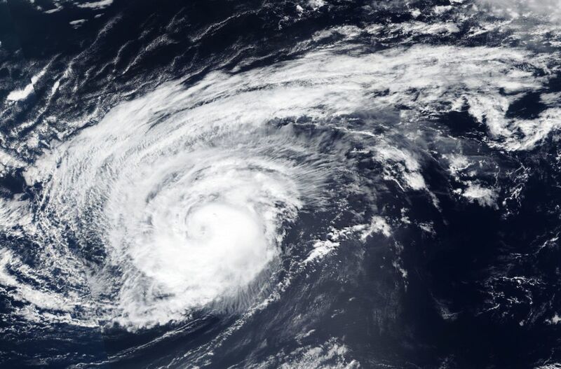
NASA-NOAA’s Suomi NPP satellite provided a visible image of the very large Hurricane Leslie on Oct. 10 as it continued to linger in the Eastern Atlantic.
Photographer: NASA Worldview, Earth Observing System Data and Information System (EOSDIS)/ NOAAAfter three weeks meandering around the Atlantic Ocean, Leslie is expected to finally crash ashore near Lisbon on Sunday, marking the third time a storm that powerful has made it to the Iberian Peninsula in the past 176 years.
Storm warnings cover Portugal, according to the Portuguese Institute for Sea and Atmosphere. There is a 70-to-80 percent chance tropical storm winds will reach Lisbon by about midday on Saturday, the U.S. National Hurricane Center said. The storm will make landfall early Sunday, local time.
“Leslie is expected to bring near hurricane-strength winds on Saturday to portions of Portugal as a powerful post-tropical cyclone,” Dan Brown, a senior hurricane specialist at the Hurricane Center, wrote in an analysis. “Tropical-storm strength winds are also likely to affect portions of western Spain.
In addition, Leslie will bring as much as 4 inches (10 centimeters) of rain.
“Whether it will be technically a tropical cyclone or not, it is going to be a big storm for them,” said Jeff Masters, co-founder of Weather Underground, an IBM company. “It’s kind of unprecedented for them.”
In 1842, Spain was hit by a large storm that scientists concluded was a hurricane in a 2008 study. On Oct. 11, 2005, Vince made landfall near Huelva, Spain, about 383 miles southwest of Madrid, as a tropical depression with sustained winds of 35 miles per hour.
Leslie was rated a Category 1 hurricane on the five-step Saffir-Simpson scale with top winds of 85 miles per hour at 5 p.m. New York time Friday, the hurricane center said. It was about 895 miles south-southwest of Lisbon. A tropical storm warning has been issued for Madeira Island, an autonomous region of Portugal in the Atlantic off the African coast. Cold ocean water and wind shear will disrupt Leslie’s structure, robbing it of its tropical characteristics.
Storm heading for Iberian Peninsula this weekend
While its winds aren’t as strong as Hurricane Michael, which devastated the Florida Panhandle this week, Leslie is about 20 percent larger in size. Tropical-storm strength winds reach out 230 miles from its center, about the distance between New York and Boston, and hurricane-force winds extend 70 miles.
Leslie became a named storm on Sept. 23 and since then has wandered around the central Atlantic waxing and waning in strength. It became a hurricane again on Wednesday.
Oct 13, 2018
KM
https://watchers.news/2018/10/14/cyclone-titli-andra-pradesh-odisha...
Cyclone "Titli" aftermath: trail of destruction, dozens dead and missing, farming sector worst affected
Severe Cyclonic Storm "Titli" slammed into the Indian state of Andhra Pradesh and moved into Odisha late October 10 into October 11, 2018. The storm brought winds of 150 km/h (90 mph) and flooding rainfall, wreaking havoc across Andra Pradesh, Odisha and West Bengal. Dozens of people are feared dead. Infrastructural and agricultural damage is very high.
Early on October 8, a low-pressure area organized into a depression in the east-central Bay of Bengal, with the Indian Meteorological Department assigning the system the identifier BOB 08. Later on the same day, the system strengthened into a Deep Depression and reached Very Severe Cyclonic Storm over the next few days.
Titli made landfall near Palasa, Andhra Pradesh - Odisha border region between 23:00 UTC, October 10 and 00:00 UTC, October 11 (04:30 and 05:30 IST October 11), with winds of 150 km/h (90 mph).
The storm caused significant damage to roads and housing infrastructure in the states of Andra Pradesh, Odisha and West Bengal, but has proved to be most disastrous to the farming sector.
Special Relief Commissioner (SRC) B P Sethi said as many as 127 262 people were sheltered in 963 relief centers Friday, while the NDRF and the Orissa Disaster Rapid Action Force (ODRAF) were deployed to speed up rescue and relief operations.
In Andhra Pradesh, heavy rainfall and wind damaged 290 km (180 miles) of roads and created 65 traffic disruptions, of which 55 were promptly cleared. Power supply in over 4 000 villages has been affected as several electric poles were uprooted. 8 962 houses were also damaged.
At least 85 612 hectares (211 511 acres) of crop area was affected in Ganjam district. Similarly, 50 000 livestock got affected and 1 543 livestock casualty occurred. The agricultural damage in Srikakulam, AP is estimated to be at 139 844 hectares (345 562 acres) – mostly paddy, followed by cotton, maize and sugarcane.
The agricultural damage in Vizianagaram was estimated at over 2 700 hectares (6 671 acres).
Oct 14, 2018
SongStar101
NOAA: Super Typhoon Yutu strongest storm to ever hit US soil
https://www.msn.com/en-us/weather/topstories/noaa-super-typhoon-yut...
"Tinian has been devastated by Typhoon Yutu," Mayor Joey P. San Nicolas said Thursday. "The homes, main roads have been destroyed. Our critical infrastructure has been compromised. We currently have no power and water. Our ports at this time are inaccessible and several points within the island are inaccessible."
The power plant has been damaged, and the power "distribution system is completely destroyed,” San Nicolas said.
San Nicolas, a former attorney general for the Commonwealth of the Northern Mariana Islands, said he sent out a request for commodities to be brought to Tinian, like drinking water and ready-to-eat meals.
With no running water, Tinian stores have not reopened.
He said roads are being cleared of debris, and Tinian’s airport runway is now usable.
President Donald Trump issued an emergency disaster declaration on Wednesday for Saipan and Tinian, along with the rest of the Northern Marianas, in anticipation of the typhoon.
On Saipan, Rosalyn Ajoste remembers hearing loud ripping noises and screeching around 1:30 a.m., before her roof and windows blew off, causing water to flood her concrete-and-wood house in the village of Susupe.
"It was terrifying and dangerous," she said.
Ajoste, a 39-year-old teacher and librarian at Saipan Southern High School, said she was too scared to move from her hiding place until 3 a.m.
"I just sat there, praying and shaking," she said. "I lost several thousand dollars worth of stuff," and priceless items such as family photos.
In a statement, Gov. Ralph DLG. Torres said the strong wind and rain tested the islands' spirits.
"Already, we know friends and family who have experienced the worst of these conditions," he said. "My heart goes out to all who call the CNMI home. But what we suffer through together, we will overcome together."
Three years ago, Typhoon Soudelor slammed Saipan and Tinian. Yutu, a Category 5 super typhoon, exceeded the magnitude of Soudelor.
"It's one of the most powerful typhoons I've seen in my life," former Gov. Juan N. Babauta said Thursday morning. "There's widespread destruction of property, from homes to cars. There's also destruction of utilities. Power poles were knocked down, blocking main and secondary roads."
The former governor said power and water in his village of Garapan and other areas was lost around 5:30 p.m. Wednesday, and they remained without power Thursday morning.
Given the extent of the damage, power won't be restored any time soon, he said.
"People are still in a state of shock," Babauta said. "People are in desperate need of immediate housing, food and other assistance. We heard reports of two babies stuck in a house needing to be rescued, but responders couldn't immediately get to them, and people with health conditions needing oxygen but nobody to give that to them right away. We hope they got the help they needed."
Rep. Ed Propst, a member of the CNMI House of Representatives, said his family home's storm boards flew away, their windows broke, and their table and chairs flew.
He said his house flooded and the bedroom door ripped off its hinges. They all relocated into one bedroom, he said.
"Never experienced any typhoon of this magnitude in my 45 years living here," Propst said.
Oct 25, 2018
Starr DiGiacomo
https://www.aol.com/article/weather/2018/10/23/remote-hawaiian-isla...
Remote Hawaiian island wiped off the map
October 23 2018
A powerful hurricane in the eastern Pacific washed away an 11-acre island in the French Frigate Shoals, part of a national monument in the remote northwestern Hawaiian Islands.
Approximately a half mile long and 400 feet wide, East Island was the second-largest islet in French Frigate Shoals ― an atoll some 550 miles northwest of Honolulu ― and a key habitat for the critically endangered Hawaiian monk seal, the threatened Hawaiian green sea turtle and several species of seabirds.
The island’s dramatic vanishing act was first reported by Honolulu Civil Beat and confirmed by HuffPost. Satellite images distributed by the U.S. Fish and Wildlife Service show the spit of white sand almost entirely erased, scattered out onto the reef to the north. The U.S. Fish and Wildlife Service did not immediately respond to a request for comment
East Island was destroyed by storm surge from Hurricane Walaka, which roared through the northwestern Hawaiian Islands as a powerful Category 3 storm this month. Seven researchers, including three studying green sea turtles on East Island, were forced to evacuate from French Frigate Shoals before the storm.
Charles Littnan, the director of the National Oceanic and Atmospheric Administration’s protected species division, told HuffPost it will likely take years to understand what the island’s loss means for these imperiled species.
The biggest concern, he said, is the persistent loss of habitat, which has been identified as a significant threat to monk seals and green sea turtles. Nearby Trig Island was also lost beneath the surface this year, not because of a storm but from high wave activity.
“These small, sandy islets are going to really struggle to persist” in a warming world with rising seas, Littnan said. “This event is confronting us with what the future could look like.”
French Frigate Shoals is the nesting ground for 96 percent of the green sea turtle population, and approximately half lay their eggs at East Island. Historically, it has been the “single most important” nesting site for the turtles, he said.
All nesting females had left by the time Walaka hit, so the storm likely had little if any impact on the adult population. But NOAA scientists estimate that 19 percent of this year’s nests on East Island had not yet hatched and were swept away by the storm. And 20 percent of the turtle nests on nearby Tern Island, the largest island in the French Frigate Shoals, were lost.
The island was also a critical habitat for the federally protected Hawaii monk seal, one of the most endangered marine mammals on the planet. Roughly 80 percent of the population of just over 1,400 seals live in the northwestern Hawaiian Islands, a remote archipelago that is surrounded by the Papahanaumokuakea Marine National Monument.
In a typical year, 30 percent of monk seal pups are born at East Island. In 2018, 12 pups were born there, and NOAA said it believes that all but maybe one had been weaned before the storm hit.
Littnan said that monk seals are known to move into the water to ride out storms but that scientists won’t know if there was significant mortality until they are able to return to the area to survey the population next year.
Athline Clark, NOAA’s superintendent of Papahanaumokuakea, described the satellite images as “startling” and said that while the long-term implications are not clear, the island’s loss will have significant effects on future nesting and pupping cycles.
Before disappearing, East and Trig islands accounted for 60 percent of the monk seal pups born at French Frigate Shoals, according to NOAA.
Chip Fletcher, an associate dean at the University of Hawaii’s School of Ocean and Earth Science and Technology, told HuffPost that after an initial “holy sh*t” moment, he realized the island’s disappearance makes sense.
“This is not surprising when you consider the bad luck of a hurricane going into that vicinity and sea level rise already sort of deemed the stressor in the background for these ecosystems,” he said. “The probability of occurrences like this goes up with climate change.”
This month the Intergovernmental Panel on Climate Change, the leading United Nations consortium of researchers studying human-caused climate change, issued a dire warning about the threats the world now faces. Failing to overhaul the global economy and rein in carbon emissions would come with devastating, perhaps irreversible effects, the IPCC found.
The scientific community — including experts at NOAA — has long warned that anthropogenic climate change influences extreme weather events. The 2015 National Climate Assessment concluded that “hurricane intensity and rainfall are projected to increase as the climate continues to warm.”
Phil Klotzbach, a hurricane expert at Colorado State University, said the central Pacific is one area where a lot of models forecast that climate change will trigger more frequent and stronger hurricanes. He said Walaka rapidly intensified at an “impressive rate,” from a tropical storm with 40 mph winds to a major hurricane with winds of 120 mph in just 30 hours.
After reaching Category 5 strength, it weakened as it made its way north toward the national monument.
“The complete loss of the island is very impressive,” Klotzbach said after viewing the photos.
From satellite imagery and observations during a flyover of East Island and Tern Island, Littnan said, NOAA scientists expect that all the islets in French Frigate Shoals were completely washed over by the storm surge. It’s unclear if any others experienced significant damage.
There’s no telling if East Island will return. An islet named Whale-Skate Island, also once an important habitat for Hawaiian monk seals, vanished from French Frigate Shoals in the 1990s and has not reappeared.
Clark, Fletcher and Littnan said scientists are already exploring what, if anything, can be done to intervene to protect these vulnerable habitats and increase the resilience of the affected species. Those efforts could include pumping sand back above the ocean’s surface to restore islets.
“We’re going to have to look at really creative ways to help support these species to persist into the future,” Littnan said.
Oct 27, 2018
KM
https://www.dailymail.co.uk/news/article-6329643/Venice-marathon-go...
Venice placed on ‘code red’ as flooding reaches historic levels as large swathes of Italy are battered by howling winds and intense flooding, leaving at least five people dead
Flooding reached historic levels in Venice today leading to rain-soaked tourists being asked to leave the historic St Mark's Square, as large swathes of Italy experienced heavy winds and flooding, leaving at least five people dead.
Tourists were barred from the sodden area by the authorities after the 'acqua alta' (high water) peaked at more than 5ft (61 inches) by the afternoon- something that has only happened five times in recorded history.
Veneto regional governor Luca Zaia says flooding this week could reach the levels of the 1966 flood that struck Venice and devastated Florence's historic centre.
He added: 'All of Veneto is in code red alarm for this wave of bad weather.'
A couple walk in the flooded St Mark Square during a period of seasonal high water in Venice. Veneto regional governor Luca Zaia says flooding this week could reach the levels of the 1966 flood that struck Venice and devastated Florence's historic centre
A woman walks in a flooded street of Venice where authorities estimate 70 per cent of the lagoon city has been flooded by waters rising
Nearly all of northern Italy was on alert due to the storms, with wind gusts up to 100 kilometres per hour and rainfall in some places equivalent to the amount that falls over several months.
With high winds toppled trees that killed passers-by in four incidents in Naples, Lazio and Liguria.
In Venice elevated wooden platforms usually placed on main passageways in the Renaissance city were not high enough to ensure safe passage in the low-lying square.
People walk in the flooded St Mark Square during a period of seasonal high water in Venice, Italy. Strong winds and rain have battered the country
Families carried children on their shoulders through the surrounding streets, as schools as hospitals were closed throughout the city and people were advised not to leave their homes.
While some tourists donned thigh-high wellies, others had opted to take off their shoes and wade through the water, carrying their luggage on their head.
Authorities estimated 70 per cent of the lagoon city had been flooded by rising waters today.
The Interior Ministry urged officials in storm-struck regions, about half of the country, to consider closing schools and offices for a second day Tuesday.
Oct 30, 2018