Earth Changes and the Pole Shift
Wild Weather, the Wobble Effect
|
Weather: |
Tides and Whirlpools:
|
"We warned at the start of ZetaTalk, in 1995, that unpredictable weather extremes, switching about from drought to deluge, would occur and increase on a lineal basis up until the pole shift. Where this occurred steadily, it has only recently become undeniable. ZetaTalk, and only ZetaTalk, warned of these weather changes, at that early date. Our early warnings spoke to the issue of global heating from the core outward, hardly Global Warming, a surface or atmospheric issue, but caused by consternation in the core. Affected by the approach of Planet X, which was by then starting to zoom rapidly toward the inner solar system for its periodic passage, the core was churning, melting the permafrost and glaciers and riling up volcanoes. When the passage did not occur as expected in 2003 because Planet X had stalled in the inner solar system, we explained the increasing weather irregularities in the context of the global wobble that had ensued - weather wobbles where the Earth is suddenly forced under air masses, churning them. This evolved by 2005 into a looping jet stream, loops breaking away and turning like a tornado to affect the air masses underneath. Meanwhile, on Planet Earth, droughts had become more intractable and deluges positively frightening, temperature swings bringing snow in summer in the tropics and searing heat in Artic regions, with the violence of storms increasing in number and ferocity."
From the ZetaTalk Chat Q&A for February 4, 2012:
The wobble seems to have changed, as the temperature in Europe suddenly plunged after being like an early Spring, Alaska has its coldest temps ever while the US and much of Canada is having an extremely mild winter. India went from fatal cold spell to balmy again. Has the Earth changed position vs a vs Planet X to cause this? [and from another] Bitter cold records broken in Alaska - all time coldest record nearly broken, but Murphy's Law intervenes [Jan 30] http://wattsupwiththat.com/2012/01/30/bitter-cold-records-broken-in-alaska Jim River, AK closed in on the all time record coldest temperature of -80°F set in 1971, which is not only the Alaska all-time record, but the record for the entire United States. Unfortunately, it seems the battery died in the weather station just at the critical moment. While the continental USA has a mild winter and has set a number of high temperature records in the last week and pundits ponder whether they will be blaming the dreaded "global warming" for those temperatures, Alaska and Canada have been suffering through some of the coldest temperatures on record during the last week.

There has been no change in the wobble pattern, the wobble has merely become more severe. Nancy noted a Figure 8 format when the Earth wobble first became noticeable, in early 2005, after Planet X moved into the inner solar system at the end of 2003. The Figure 8 shifted along to the east a bit on the globe between 2005 and 2009, (the last time Nancy took its measure) as Planet X came closer to the Earth, encountering the magnetic N Pole with a violent push earlier in the day. But the pattern of the Figure 8 remained essentially the same. So what changed recently that the weather patterns became noticeably different in late January, 2012?
The N Pole is pushed away when it comes over the horizon, when the noon Sun is centered over the Pacific. This regularly puts Alaska under colder air, with less sunlight, and thus the historically low temps there this January, 2012 as the wobble has gotten stronger. But by the time the Sun is positioned over India, the N Pole has swung during the Figure 8 so the globe tilts, and this tilt is visible in the weather maps from Asia. The tilt has forced the globe under the hot air closer to the Equator, warming the land along a discernable tilt demarcation line.
The next loop of the Figure 8 swings the globe so that the N Pole moves in the other direction, putting the globe again at a tilt but this time in the other direction. This tilt is discernable in weather maps of Europe, again along a diagonal line. Depending upon air pressure and temperature differences, the weather on either side of this diagonal line may be suddenly warm or suddenly cold. The tilt and diagonal line lingers to affect much of the US and Canada, but the Figure 8 changes at this point to be an up and down motion, pulling the geographic N Pole south so the US is experiencing a warmer than expected winter under a stronger Sun. Then the cycle repeats, with the magnetic N Pole of Earth pushed violently away again as the Sun is positioned over the Pacific.
From the ZetaTalk Chat Q&A for April 6, 2013:
Would the Zetas be able to let us know what is causing the early break-up of the Arctic Ice, the ice seems to have taken on a swirling pattern at the same time, would this be wobble related? [and from another] http://www.vancouversun.com/news/national/Canada+Arctic+cracks+spectacular+event/8185609/story.html The ice in Canada’s western Arctic ripped open in a massive “fracturing event” this spring that spread like a wave across 1,000 kilometres of the Beaufort Sea. Huge leads of water – some more than 500 kilometres long and as much as 70 kilometres across – opened up from Alaska to Canada’s Arctic islands as the massive ice sheet cracked as it was pushed around by strong winds and currents. It took just seven days for the fractures to progress across the entire area from west to east. [and from another] http://earthobservatory.nasa.gov/IOTD/view.php?id=80752&src=iotdrss A high-pressure weather system was parked over the region, producing warmer temperatures and winds that flowed in a southwesterly direction. That fueled the Beaufort Gyre, a wind-driven ocean current that flows clockwise. The gyre was the key force pulling pieces of ice west past Point Barrow, the northern nub of Alaska that protrudes into the Beaufort Sea.

The Figure 8 formed by the N Pole during the daily Earth wobble has shifted somewhat to the East, due to Planet X positioned more to the right of the Earth during its approach. This was anticipated, and well described in ZetaTalk, the Earth crowding to the left in the cup to escape the approach of Planet X, so the angle between these two planets would change slightly. This shift of the Figure 8 to the East is due to the push against the Earth’s magnetic N Pole occurring sooner each day than prior. Thus instead of occurring when the Sun is high over the Pacific, over New Zealand, it is now occurring when the Sun is high over Alaska. All the wobble points have shifted eastward accordingly.
This has brought a lingering Winter to the western US, and a changed sloshing pattern to the Arctic waters. Instead of Pacific waters being pushed through the Bering Straits into the Arctic when the polar push occurs, the wobble is swinging the Arctic to the right, and then later to the left, creating a circular motion in the waters trapped in the Arctic. Since the Earth rotates counterclockwise, the motion also takes this path. This is yet another piece of evidence that the establishment is hard pressed to explain. They are attempting to ascribe this to high pressure and wind, all of which are not new to the Arctic, but this circular early breakup of ice in the Arctic is new.
SongStar101
Mid Latitudes in a grip of massive heatwave worldwide: http://www.wunderground.com/climate/extremes.asp
Jul 20, 2013
Gerard Zwaan
Severe weather affects Dutch people in Spain
Source: http://youtu.be/v4rMMFA7cDQ
Source: http://youtu.be/OV3hAJo4A4E
Jul 20, 2013
Howard
North of Calgary Alberta Painted White By Ferocious Hailstorm (July 6)

Areas north of Calgary were pounded by a brutal hailstorm that left a large swath of land a half-mile wide and 75 miles long painted white. Within 15 minutes, the ground was mired in a full foot of hailstones.
Source
http://www.theatlanticcities.com/neighborhoods/2013/07/huge-land-sc...
Jul 21, 2013
Mark
In a flash, heatwave gives way to deluge: Spectacular storms across Britain destroy homes as hottest weather for seven years finally comes to a halt
http://www.dailymail.co.uk/news/article-2374858/UK-weather-Heatwave...
Britain's sunny spell ended with a bang after the country was hit by violent tropical thunder- storms that herald a month of unsettled weather.
For almost three weeks the UK has basked in glorious sunshine during the longest heatwave for seven years. But Met Office forecasters say the storms have ushered in changeable conditions for the coming weeks.
Skies across the country were illuminated with dramatic scenes of lightning in the early hours yesterday as a fortnight’s worth of rain fell in some places.
----------------------------------------------------------------------------------------------------------------------------------------------------
(It should be noted that, before the weather switched suddenly, the weathermen in the UK were predicting that the heatwave would last all through August)
Jul 24, 2013
lonne rey
Brazil - Snow reaches more than 80 cities in the South and closes highways and schools
The mass of polar air that passed through Argentina before coming to Brazil at the end of last week dropped snow in at least 87 cities of Paraná, Santa Catarina and Rio Grande do Sul.
The cold wave, which reaches South, Southeast, Midwest, and up to two northern states of the country (Rondônia and Acre), is the longest in 13 years, according to the National Institute of Meteorology (Inmet).
“Should greatly disrupt agriculture”
“There were 17 days in all. Now, there are already seven days with temperatures below zero, and certainly this will continue until Friday, which should greatly disrupt agriculture, especially citrus plantations and lettuce, and bring problems health,” says meteorologist Lucia Gularte of Inmet.
Among the places hit by the snow are two capitals: Curitiba and Florianópolis. In Curitiba, the record snow made on Tuesday by Simepar Meteorological Institute is the first since 1975.
In Santa Catarina, Epagri / Ciram snow recorded in the region of the Morro Cambirela in Palhoça, in Florianópolis. It is the first occurrence of the kind in 29 years, also seen in other cities in the metropolitan region, as Alfredo Wagner, Angelina and Burnt Ranch, and several parts of the state.
Altogether, at least 57 cities in Santa Catarina had snow.
Largest snowfall in decades
According to weatherman Marcelo Schneider of Inmet, the snowfall in Santa Catarina and Paraná is one of the largest in decades. In some cities, such as Curitiba, the last occurrence was 38 years ago.
“The accumulation of snow in southern Paraná is also rare. So what draws attention is the duration of cold days, the permanence of the polar air and snow, not the absolute minimum temperature,” explains Schneider.
Source
http://translate.google.com/translate?hl=en&sl=auto&tl=en&a...
Jul 24, 2013
Howard
Storm System Moves Backwards Across U.S., Pummels Kansas With Baseball Sized Hail (July 25)
 A low pressure system that started in the Eastern United States has retrograded under a ridge of high pressure to the north over the last couple of days. This system is moving from east to west, which is extremely unusual for this hemisphere. Such storms usually move east to west for a short period of time, but this one will make it to Southern California by the time it weakens.
And with it came a hailstorm that pounded south-central Kansas with baseball sized hail.
The Hutchinson News reports dealerships in the city were scrambling to get insurance appraisals after the fast-moving storm hit the area Tuesday night.
Large hailstones pounded hundreds of vehicles parked in dealers' lots.
The general manager of Midwest Superstore says all 400 cars on the lot were damaged, and signs announcing discounts of up to $6,000 went up immediately. But Nick Hill also says that some vehicles will be taken away for salvage if they're deemed a total loss.
At Hutchinson's Midway Motors, two pickups worth a combined $100,000 were destroyed when a 100-foot flagpole was toppled by winds gusting over 80 mph.
Sources
http://www.theweatherspace.com/2013/07/14/unusual-storm-system-movi...
http://www.kake.com/news/headlines/Kansas-Vehicle-Dealers-Coping-Wi...
http://www.wdam.com/story/22916915/kansas-walloped-by-baseball-size...
Jul 25, 2013
Howard
Strange Orange Sky Over Michigan (July 22)
"All of a sudden it got very yellow outside, it felt strange and mysterious. Then it slowly looked very orange, it was the craziest thing I have ever witnessed over my head. I almost expected to see a tornado or something!
These clouds looked like "Bubble Cups" but in meteorology terms they are called Mammatus clouds. They are extremely rare in this part of the country and many people have never seen anything like it before."
Taken around 8 p.m. CDT on July 22 coinciding with a cold front that moved through the area. The high for that day around Iron Mountain, Mich., was 85. The day was also marked with high humidity. When the cold front moved through, it pushed down from atop the warm air and created the pockets in the clouds.
Sources
http://www.accuweather.com/en/weather-news/orange-sky-clouds-apocal...
http://www.news.com.au/technology/sci-tech/strange-orange-mammatus-...
Jul 26, 2013
Derrick Johnson
North Pole Melting Leaves Small Lake At The Top Of The World (VIDEO)
The North Pole probably looks a bit different than you would expect right now. Because, at this very moment, it's actually a lake.
Photos from North Pole Environmental Observatory
Produced by Jake Bialer
The time-lapse video below comes from a webcam set up by the North Pole Environmental Observatory that has monitored the state of Arctic sea ice since the spring of 2000. Surprisingly, the pole has been melting since at least 2002, according to photos on the project's website.
July is usually the warmest month in the area, but temperatures were 1 to 3 degrees Celsius above average this year. The shallow lake you see at the pole is made of meltwater sitting on top of a layer of ice, according to the observatory.
Arctic sea ice has become a noticeable victim of climate change. The area of ice cover expands and contracts every year with the change in seasons, but last summer's minimum extent was the lowest on record and this year's maximum winter coverage was the sixth-lowest since satellite observations began in the 1970s.
http://www.huffingtonpost.com/2013/07/25/north-pole-melting-leaves_...
Jul 26, 2013
lonne rey
Fire brigade in Bertrix (Luxembourg) removes hailstones with bulldozers
The storm this morning has already caused several floods in Hainaut. In Luxembourg Bertrix they had to clear hailstones with bulldozers . According to several French websites between 20 and 30 cm hail was reported, as can be seen inter alia in the video below this article.
In Bertrix the fire department called out to remove fallen trees from the road and damaged roofs, once during the storm also hail from the sky had fallen. "In some places we had to use bulldozers to remove hailstones, especially near Ochamps on the road.We have never seen this We then called on the support of the Civil Protection," the fire brigade of Bertrix.
In Rouvroy scouts had to be evacuated with the help of the fire brigade of Virton.
The wind also tore off the roof of a school in Montignies-sur-Sambre (Hainaut).
source +video
http://translate.google.com/translate?hl=en&sl=auto&tl=en&a...
Jul 27, 2013
Shaun Kazuck
Many cities in northern Wisconsin set records for lowest high temperature today. Some of these records are close to 100 years old. Here is the report from wunderground.com
An unseasonably cold airmass invaded the Great Lakes region
this weekend. This airmass... combined with cloud cover and
scattered showers held high temperatures in the 50s and low
60s.
Record
city low Max old record year(s)
-----------------------------------------------------------------------
Antigo 55 68 2011,1915
Appleton 60 68 1928
Green Bay 62 67 1928,1925,1915
Manitowoc 61 63 1992
Marshfield 57 69 1915
Merrill 57 63 1915
Oshkosh 62 70 1928
Rhinelander 55 66 1991
Stevens Point 56 67 1972
Sturgeon Bay 61 65 1915
Wausau 61 63 1945,1915
Wisconsin Rapids 59 67 1915
Normal/average temperatures this time of year for Rhinelander, WI are a high of 79 and a low of 55.
Jul 28, 2013
Shaun Kazuck
http://www.nbcphiladelphia.com/news/local/Heavy-Rain-Causes-Floodin...
Heavy Rains Cause Flooding, Record Rainfall for Philadelphia
By Danielle Johnson
| Monday, Jul 29, 2013 | Updated 12:48 AM EDT
Heavy rain caused major flooding and traffic nightmares across the area Sunday and set an all-time record for one-day rainfall in Philadelphia.
A record all-time daily rainfall of 7.99 inches fell at the Philadelphia International Airport, according to the National Weather Service. More than 7 inches fell during a 4-hour period. This breaks the all-time record for a single day rainfall set during Tropical Storm Floyd of 6.63 inches which was on September 16, 1999. Records go back to 1872.
The airport experienced a temporary power outage due to the weather. A spokesperson says Terminal A East lost power around 5 p.m. Power was restored around 9:45 p.m. Passengers experienced minor delays, according to spokesperson Vicki Lupica.
A Flash Flood Warning was extended for Camden, Philadelphia, Delaware, Gloucester, New Castle and Salem counties until 10:45 p.m.
The heaviest rain moved through Gloucester City, Camden County shortly after 3 p.m. Within a span of three hours about 7 inches of rain flooded the area.
At least eight cars were submerged in high water in the eastbound lane of I-76 at Kings Highway. Two people were left stranded in a car in the middle of the street. Authorities say both people were rescued. No injuries were reported.
Lightning strikes were also a problem for the area. Fire crews put out a minor fire at a home located on the 100 block of North Brown Street after it was struck by lightning. No one was injured.
A driver was trapped on top of his roof under the Route 42 overpass. Two other cars were trapped in the water.
There was also major flooding along Route 130 in Pennsauken. Shore traffic combined with flooding rains made for major backups along the Atlantic City Expressway. There were reports of delays for up to two hours.
The on and off ramp from I-95 to Broad Street in Philadelphia was shut down around 4:30 p.m. due to major flooding. It was reopened just before 9 p.m.
This story is developing. Stay with NBC10.com for more updates.
Jul 29, 2013
Howard
Tornado Rips Through Milan Italy (July 29)
A tornado has ripped through a suburb of Milan, injuring 12 people and damaging buildings and vehicles.
Video shot by witnesses on their mobile phones captured the twister tearing through an industrial region in Grezzago, leaving a trail of devastation as it destroyed cars, overturned trucks and uprooted telegraph poles.
"We were inside there and a lorry crashed into the wall and came through it. Then all the windows broke and we couldn't understand what was happening," said Stefano Grimoldi who was caught up the carnage.
"Look there is no more roof, no more doors, there's nothing left," he added.
"It lasted, I'm not sure, the time it took, ten minutes or a quarter of an hour," they added.
Firemen, civil protection and other rescue services rushed to the scene. Although no deaths have been reported there are reports of a dozen injuries.
Source
http://news.sky.com/story/1121989/milan-tornado-12-hurt-after-twist...
Jul 30, 2013
Rich Racosky
In the US, we went from record hot to record cold - as per the Zetas, a true extreme of temperature swings we will and are experiencing. Plus many record rainfalls.
http://www.climatedepot.com/2013/07/30/1122-record-cold-temps-in-th...
Jul 31, 2013
Carlos
Pipestone, Minnesota July cold breaks 102-year-old record
Sweatshirts aren't the usual attire for baling hay, but a cold snap made the job more pleasant last week as this group made a second cutting for Gary Gorter.
Weekend temperatures in Pipestone plummeted to lows not seen for 102 years as a cold air mass from northern Canada slipped down into the region.
Temperatures of 39 degree and 38 degrees were recorded in Pipestone on Saturday morning, July 27 and Sunday morning, July 28 respectively, according to Mike Gillispie, National Weather Service meteorologist out of Sioux Falls, S.D.
The lows broke the record of 42 degrees set in 1911.
"There are a few others in the upper 40s, but only two incidences down that cold," Gillispie said - - the 1911 record and then a 44-degree low recorded in 2005.
The cold air mass combined with light winds, clear skies and low humidity to allow the temperatures to plunge over the evening hours. The pattern isn't abnormal, Gillispie said, but it doesn't typically occur during the dog days of summer when high-pressure ridges generally extend all the way through the northern plains.
"When we're setting records that have been around for 100 years, it doesn't happen often," Gillispie said.
The NWS's latest 30-day weather model for August predicts the unseasonable cold won't last, with Pipestone straddling regions with forecasts of normal to above normal temperatures.
Aug 2, 2013
Stra
Kabul - Heavy rain and flash floods in eastern Afghanistan claimed at least 60 lives, many are still missing, summarizes the Slovenian Press Agency. Floods hit the area around Kabul and in the provinces Vardak and Host.
Floods are surprised to Afghanistan, as well as in this country is currently very hot. Estimated by meteorologists as the warmest summer in Afghanistan over the past 50 years.
So far, 42 deaths counted only in the Kabul area, but increased total water we now take this one after 61 lives, including many women and children, were reported by the Afghan government in Kabul. They fear, however, that the number of victims has increased because many people still missing.
Sources: bit.ly/1coG7u7
http://www.newsobserver.com/2013/08/04/3081849/flash-floods-kill-35...
http://www.stripes.com/news/middle-east/dozens-feared-dead-in-afgha...
http://zeenews.india.com/news/south-asia/flash-floods-kill-35-in-af...
Aug 4, 2013
Stra
New heat record in Austria - 39.9 degrees in Carinthia
Dellach in Carinthia's Drau was achieved with 39.9 degrees, the highest temperature ever measured in Austria on Saturday afternoon from the Central Institute for Meteorology and Geodynamics (ZAMG). The hitherto applicable, also scored in Dellach record high of 39.7 degrees in 1983 was exceeded by 0.2 degrees.
New state record in Lower Austria
In Lower Austria, a new state-record was 39.7 ° C on Saturday. The old heat record for Lower Austria was 39.3 ° C in Waidhofen / Ybbs, measured on 5 Juli 1950.
August new records
In Tyrol (38.9 ° C in Lienz), Vienna (38.5 ° C in Vienna / Danube field) and Styria (38.8 ° C in Frohnleiten) it was in August, never as hot as Saturday. The old record was in August at 37.4 ° C in Tirol Innsbruck / University (13th August 2003 and August 2, 2013), in Vienna at 38.2 ° C in Vienna / Danube field (13 August 2003) and Styria at 38.5 ° C in Leibnitz (13 August 2003).
The Top 5 from Saturday
Lesachtal / K 39.9 ° C
Millstatt / K 39.1 ° C
Ferlach / K 39.0 ° C
Feistritz / K 38.9 ° C
Lienz / T 38.9 ° C
Already 39.2 degrees last week
At the culmination of the first heat wave the mercury column last Sunday were indeed increased in heights rarely reached, it was ultimately quite enough in Waidhofen (NE) and in Bad Goisern (Upper Austria), not with each 39.2 degrees.
Source: bit.ly/13O9sFf
Aug 4, 2013
Kojima
* Heatwave kills four in Japan: by Staff Writers; Tokyo (AFP) Aug 11, 2013
http://www.terradaily.com/reports/Heatwave_kills_four_in_Japan_999....
A heatwave stifled Japan Sunday as the temperature topped 40 degrees Celsius (104 Fahrenheit ) in two cities, leaving at least four people dead over the weekend, officials and reports said.
The Japan Meteorological Agency said the temperature reached 40.6 C in Kofu, 100 kilometres (60 miles) west of Tokyo, in mid-afternoon.
The weather agency had warned early Sunday that the temperature would soar past 35 C in 39 of the country's 47 prefectures. It warned people to drink plenty of water and use air-conditioners.
On Saturday the mercury topped 40 C for the first time in Japan since August 2007, when it had reached an all-time high of 40.9 C in two separate cities.
An 84-year-old woman and a 66-year-old man in western Japan died from heat stroke on Saturday after they were found collapsed in fields, Kyodo news agency said.
Two more deaths from heat stroke were confirmed by officials on Sunday.
An 80-year-old woman died in hospital after she was found collapsed at her wooden home Sunday morning in Arita, a city south of Osaka, a medical evacuation official said. The living room where she was found was not air-conditioned.
In Saitama north of Tokyo, a 60-year-old man died in hospital after he was found unconscious on a street Saturday afternoon.
The heatwave, also gripping parts of China, has been caused by a Pacific high pressure system covering most of the Japanese islands, the weather agency said.
In early July a heatwave in the country claimed at least a dozen lives, according to media reports.
* Record high temperatures in Austria: by Staff Writers; Vienna, Austria (AFP) Aug 08, 2013
http://www.spacedaily.com/reports/Record_high_temperatures_in_Austr...
Temperatures in Austria rose above 40 degrees Celsius (104 Fahrenheit) on Thursday for the first time since records began in the mid 19th century, the meteorological office ZAMG said.
At Neusiedl am See the temperature reached 40.6 degrees Celsius, although the ZAMG said this had to be double checked, while in Bad Deutsch Altenburg, also in eastern Austria, the mercury hit a confirmed 40.5 degrees.
Prior to records set in the current heatwave, Austria's previous high temperature of 39.7 degrees was set some 30 years ago.
The capital Vienna was sweltering in temperatures of up to 39.5 degrees, the highest since 1957.
No extra deaths from the heatwave were reported although hospitals saw a rise in patients with dehydration and blood circulation problems.
Aug 12, 2013
SongStar101
First Europe, now all of Asia in record heat wave! http://www.washingtonpost.com/blogs/capital-weather-gang/wp/2013/08...
Japan, South Korea soar to hottest recorded levels
August 12 at 4:21
South Koreans swim at Caribbean Bay swimming pool in South Korea’s largest amusement park Everland in Yongin, about 50 km (31 miles) south of Seoul August 11, 2013. South Korea has been suffering from the sweltering heat wave for weeks with temperatures in most parts of the country soaring above 35 degrees Celsius (95 degrees Fahrenheit), reported a local news agency (REUTERS/Lee Jae-Won)
Late last week Austria and Slovenia established new records for extreme heat in ce.... Moving east, we can now add South Korea and Japan to the list of countries with new high temperature records, courtesy the summer of 2013.
The Wall Street Journal reports Shimanto city, in southern Japan, climbed to 106 degrees (41 C) Monday, the country’s highest temperature ever measured.
In Tokyo, the nighttime temperature dropped to just 87 F (30.4 C) Sunday tweets The Weather Channel’s Nick Wiltgen, its highest overnight low temperature in 136 years of record-keeping.
The hot weather is being blamed for 9 deaths in Japan over the weekend writes IOL News.
In South Korea, the record-breaking heat peaked Saturday.
“[T]he government issued a warning of power shortages and the highest temperature ever recorded by the Korea Meteorological Association was hit: 39.2 degrees [102.6 F], reached Saturday in Gimhae in the country’s southeast,” reports the Wall Street Journal.
This latest sweltering stretch in South Korea follows Seoul’s hottest June in 106 years of records.
A bulging heat dome – or ridge of high pressure – centered over the East China Sea is main driver of the heat, forecast to continue for the next several days.
Heat dome centered over Korea and southern Japan this weekend via a GFS model simulation of high altitude pressures (WeatherBell.com)
Excessive heat has also plagued parts of China this summer. Shanghai broke its high temperature record on three separate occasions (July 26, August 6, and ultimately August 7 – 105.4ºF (40.8ºC)).
Temperatures compared to normal in northern Siberia over the last week of July. Dark reds indicate differences from average of over 20 degrees (NASA).
The searing heat has extended to the northern reaches of Asia as well. Unusually hot weather – some 20 degrees above normal – bubbled up into northern Siberia in late July, likely contributing to a rash of wildfires.
So while temperatures have been pretty ordinary in North America this summer, the heat has been punishing from central Europe across the Orient.
Aug 13, 2013
lonne rey
Rare summer snowfall in Xinjiang
China's Xinjiang Uygur Autonomous Region witnessed a rare display of summer snowfall on Tuesday as a powerful cold air front moved into the area.
China's Xinjiang Uygur Autonomous Region witnessed a rare display of summer snowfall on Tuesday as a powerful cold air front moved into the area.
Xinjiang has been suffering scorching heat since July, with temperatures reaching over 40 degrees Celsius. A powerful cold air front has recently moved into the region, causing much and heavy rainfall.
However, one netizen under the username "Chief of the Daolang Tribe" uploaded a group of photos taken near the Tieliemaiti Pass to his microblog account on August 13, saying that some rare summer snowfall occurred near the Duku section of National Highway 217.
The snowfall's photos went viral within hours as residents in most parts of southern China are still enduring a heat wave.
Source
Aug 16, 2013
Derrick Johnson
Sunburned in Siberia: Heat Wave Leads to Wildfires
An intense heat wave in Siberia has contributed to an unusual flare up of wildfires across the fragile and carbon-rich landscape. Smoke from the fires is lofting high into the atmosphere, and is drifting toward the Arctic, where soot can hasten the melting of snow and sea ice.
The Siberian city of Norilsk, the most northerly city in the world with a population greater than 100,000, recorded temperatures above 83F over eight consecutive days starting on July 18, according to blogger Chris Burt of Weather Underground. During that timespan, Burt reported, the mercury hit 90F, breaking the record for the hottest temperature recorded for the city. For comparison the average July high temperature in Norilsk is a comparatively chilly 61F.
Norilsk isn’t an isolated example, but rather sits amid a sea of abnormally hot temperatures and smoky conditions in north-central Siberia. According to NASA’s Earth Observatory, from July 20 through July 27, temperatures were about 30F above average across a large swath of this vast, sparsely populated region.
The warm weather has contributed to a spike in wildfires. As of July 29, wildfires continued to burn at least 22,200 acres in Siberia, according to news reports. Heavy smoke from them grounded commercial flights in Omsk, a city in southwestern Siberia, Russia Today reported.
The Siberian fires come on the heels of Russia’s worst wildfire season on record in 2012. Fires burned roughly 74 million acres that year, well above the 50 million acres burned on average for the period from 2000 to 2008. While it’s still early to tell if 2013 will challenge 2012 for a record-setting year, one thing to note about this season is the unusual location of the fires. Typically, large wildfires burn on the southern fringe of the taiga, a dense forest ecosystem also known as the boreal forest, but this year’s fires are burning in a more central portion of the taiga.
Northern Russia has warmed more rapidly than many other places on the globe in recent decades, and according to NASA, researchers expect the number of taiga wildfires there to double by the end of the century.
A recent study of taiga wildfires in Alaska found that these forests are burning at the highest rate in at least the past 10,000 years, and climate change projections show even more wildfire activity may be to come as the northern climate continues to warm and precipitation patterns change.
Concurrent with the heat in Russia, Alaska has had a hot summer too, with wildfires already charring more than 1 million acres across the state. In Anchorage, temperatures topped 70F for 15 consecutive days in the latter half of the month. That beat the previous string of days above 70F, which was 13 days set in 2004.
Temperature records have fallen from the coast to the interior. Fairbanks is nearing its all-time record for the greatest number of 80-degree days, having had 29, which is well above their average of 11 such days in a typical summer.
Trees, plants, and soils across the northern latitudes lock up 30 percent of the world’s carbon, far more than forests closer to the equator. The forests are also currently a carbon “sink,” which mean they take up more carbon than they release. While they still act as net carbon sinks at present, it’s possible that wildfires could help flip that role in the future by making these ecosystems a source of carbon dioxide and methane emissions that accelerate global warming.
Fires in the region also deposit soot on ice sheets and glaciers, reducing the amount of incoming solar radiation that the ice can reflect back to space. The dirty ice can then melt faster because it absorbs more heat. Research has suggested that process is already happening in Greenland. Speeding up the melt can contribute to increased sea level rise as well as shifts in weather patterns further south.
Greenland itself saw the highest temperature ever recorded on the island on Tuesday, according to the Washington Post’s Capital Weather Gang blog. The temperature reached 78.6F in Mantiisoq located in the west coast of Greenland. The previous record of 78F was set in 1990 at Kangerlussuaq, also located on the west coast.
The culprit behind much of the extreme heat in each case has been large, strong, and persistent areas of high pressure, which have set up shop over these high latitude locations, keeping cooler weather and precipitation at bay.
Aug 18, 2013
Heather
Pink snow falls in heat of summer in Karaganda 15 August 2013, 11:03
CA-NEWS (KZ) -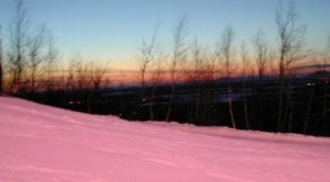 A pink snow has fallen in Karaganda in the heat of summer, reported local television channel.
Snowfall started in Karaganda on August 13 after 10.00 pm covering the roofs of buildings, eyewitnesses say.
Meteorologists have not registered snow, however. They forecast rain for that day and were skeptical about snow reports. Though the probability of snowfalls in August is not excluded by them. They call it wonders of nature.
- See more at: http://en.ca-news.org/news:526790/#sthash.43TL3jbK.dpuf
Aug 19, 2013
Howard
70% of Manila Under Water (Aug 20)
"The Eurasian Plate is being stretched, sinkholes and twisting rails a plague from the UK past the Black Sea region and onto the Far East. Thus stretched, river bottom lands in many places will interfere with drainage, causing flooding." ZetaTalk: June 29, 2013
70 percent of the Philippine capital is submerged underwater, driving tens of thousands from their homes and bringing life in many areas to a standstill. Authorities evacuated thousands of residents along Manila's overflowing river and braced for more chaos in outlying provinces.
At least eight people have died, including four who drowned north of Manila. The dead included a 5-year-old boy whose house was hit by a concrete wall that collapsed, and a 3-year-old boy who fell into a swollen river in Mariveles town in Bataan province. Four people are missing.
Throughout the sprawling, low-lying capital region of 12 million people, offices, banks and schools were closed and most roads were impassable. People stumbled through waist- or neck-deep waters, holding on to ropes strung from flooded houses.
More than 200 evacuation centers were opened in Manila and surrounding provinces, filled with tens of thousands of people, Social Welfare Secretary Corazon Soliman said. Overall, more than 600,000 people have been affected by the floods.
"I had to wade through a waist-deep flood," said Esteban Gabin, a 45-year-old driver, who was plotting the best route to check on his family in Pampanga province, northwest of Manila. "But I may have to swim to reach my home because we live near the Pampanga River, and the flood there could reach up to neck deep."
In Marikina, where the river breached its banks, authorities started evacuating some 12,000 people to schools and gymnasiums that were turned into emergency shelters.
In Pampanga's rice-producing town of Minalin, more than 200 villagers fled after water from a swollen river spilled over a dike and began flooding communities amid pounding rain. Villagers scrambled to lay sandbags on the dike and in front of their houses, said Office of Civil Defense officer Nigel Lontoc.
"The villagers are afraid that the dike may collapse any time," Lontoc said by phone.
About 200 members of the Aeta tribe living near the foot of Mount Pinatubo left their homes for fear of being swept away by a raging river near Botolan township in Zambales province, said Elsa Novo, a leader of an Aeta federation in the province. She said other family members stayed behind to watch their property.
Evacuations were also under way around the La Mesa dam, north of Manila, which began overflowing. The waters from the dam flow into the Tullahan River, which passes through some of the densely populated areas of the capital.
The flooding followed two nights of heavy monsoon rains enhanced by Tropical Storm Trami. The storm hovered over the North Philippine Sea and drenched the main northern island of Luzon with up to 30 millimeters (just over an inch) of rain per hour. It was forecast to move away from the Philippines toward Taiwan on Wednesday.
In many coastal towns along swollen Lake Laguna, near Manila, and in food-growing riverside provinces, residents were trapped on rooftops, waded through the streets or drifted on makeshift rafts. Many chose to stay close to their homes for fear they would be looted if they left.
"We're surprised by the rainfall. Some areas experienced record levels," said Science Secretary Mario Montejo.
According to an assessment from the Department of Science and Technology, rainfall reached 600 mm (23 ½ inches) in and around Manila Bay on Sunday alone — more than a month's worth of rain in a day. That's compared to the disastrous 2009 Typhoon Ketsana, the strongest to hit Manila in modern history, when 455 mm of rain fell in 24 hours.
Many domestic and international flights at Ninoy Aquino International Airport were canceled. Key roads leading to the airport were flooded and passengers and crew were delayed.
Sources
http://abcnews.go.com/International/wireStory/floods-paralyze-phili...
http://www.cnn.com/2013/08/20/world/asia/philippines-floods/index.h...
Aug 20, 2013
Tracie Crespo
http://local.msn.com/rare-snow-atacama-desert-chile
Mudslides and snow hit Chile's Atacama Desert
The Atacama Desert gets a sprinkling of snow and rain for the first time in 30 years, prompting mudslides and traffic chaos in what is usually one of the driest places on Earth.
http://news.yahoo.com/video/mudslides-snow-hit-chiles-atacama-11022...
SANTIAGO, Chile (AP) — A rare snowfall in Chile's Atacama desert has delighted visitors to one of the world's driest areas.
Residents of San Pedro de Atacama say the weekend snow was the heaviest in three decades for the desert city, which is 750 miles (1,200 kilometers) north of the capital, Santiago.
But local officials say they are concerned the snow and rain that fell over the weekend could cause some rivers to flood as has happened in the past.
The national tourism office says the road to San Pedro de Atacama was temporarily blocked due to the unusual weather. Officials have not ordered any evacuation although they expect more rain in the area.
Aug 27, 2013
Howard
Another Massive Dust Storm Swallows Phoenix Arizona (Aug 26)
Phoenix is left blanketed in grit after the Arizona city was enveloped by a massive sand storm towering a mile high on Monday, August 26.
Source
http://www.telegraph.co.uk/news/worldnews/northamerica/usa/10268402...
Aug 28, 2013
Sevan Makaracı
Unusually cold weather and snow in South American countries affect localsand tourists, even Atacama Desert saw snow!
In the latter, the authorities blamed the weather for the death of more than 5,000 cattle too.
Weather forecasters say a cold front from Antarctica entered the region almost a week ago.
On Friday, the Peruvian deputy education minister, Martin Vegas, said schools were closed in 43 provinces in 10 regions.
“They will remain closed next week as more snowfalls have been forecast,” he said.
Thousands of llamas and alpacas have died in the cold weather.
Peruvian President Ollanta Humala visited some of the worst affected areas earlier this week.
He said blankets and alpaca covers were needed, as well as medicines and clothes.
In Bolivia, roads closed by the snow have disrupted supplies to mines in the province of Inquisivi, in La Paz.
Work in five mines in the region, which employ thousands of workers, had to be suspended since last weekend because of the snow.
Correspondents say they were running out of supplies.
One of the driest places on earth, the Atacama desert in northern Chile, also saw snow earlier this week.
Forecasters said the snowfall was the heaviest in the area, about 1,000km (600 miles) north of the capital Santiago, in three decades.
Source1, Source2
Sep 2, 2013
Derrick Johnson
Salt Lake City breaks record for most days over 95 degrees
By Bob Mims
| The Salt Lake Tribune
First Published Aug 30 2013 07:15 am • Last Updated Sep 03 2013 09:49 am
Salt Lake City has broken the all-time record for the most days in year that have hit 95 degrees or higher.
The National Weather Service made the announcement Friday at about 1:30 p.m., saying Salt Lake City hit the mark for the 52nd time this year, the most since 1874, when record-keeping started.
On Thursday, when Utah’s capital city soared to 97, a 1961 record of 51 days of 95 degrees or better was tied. Friday’s late-afternoon high of 97, recorded at 3:45 p.m., left the old heat record a veritable molten historical slag.
Friday’s low temperature of 71 also tied a record of its own, matching the 2012 record as the hottest minimum temperature for that day.
http://www.sltrib.com/sltrib/news/56803465-78/record-degrees-utah-f...
Sep 8, 2013
Derrick Johnson
South Pole experiences more record heat in August to end warmest winter ever
September 6, 2013
Last month was the warmest August on record for the South Pole, ending a winter that will go down as the mildest ever since record-keeping began in 1957.
The record average temperature of minus 63.9 degrees Fahrenheit (minus 53.3 degrees Celsius) broke the previous record of minus 64.5F (53.6C) set in August 1996. The departure from normal was 11.6 degrees Fahrenheit (or 6.4 degrees Celsius). The record average max temperature of minus 56.2F (minus 49.0C) broke the previous record of minus 57.3F (minus 49.6C), also set in August 1996.
The relatively warm month included one record warm day. On Aug. 11, the maximum temperature was minus 36.9F (38.3C), which broke the previous maximum temperature record of minus 40F (minus 40C) set in 1968.
It was also a windy month, with seven days that either broke or tied the previous peak wind speed record for those days.
In terms of the winter climatological period — the months of June, July and August — it was the warmest three-month stretch at the South Pole since records began 56 years ago, according to Phillip Marzette, senior meteorologist at the South Pole Station.
The average temperature for the the winter months in 2013 was minus 66.8F (minus 54.9C). The next warmest temperature during that same period was in 1964, with an average of minus 69F (minus 56.1C).
The wild weather began as early as March, with extreme swings between record maximum and minimum temperatures. In June, the weather really got crazy, when the all-time maximum temperature record for the month of June was set not once but twice.
On June 2, the winter-time temperature hit minus 22.2F (minus 30.1C), shattering the previous record for that day of minus 35.7F (minus 37.6C) set in 1987. The new June record barely lasted two weeks. On June 19, the temperature climbed to minus 19.8F (minus 28.8C). The record-setting day was bookended by two single day maximum temperature records as well.
June was tied for the third warmest, with an average of minus 62.9F (minus 52.7C), last recorded in June 1996. That was 10.4 degres Fahrenheit (5.8 degrees Celsius) above normal.
The weird weather has meant fewer clear days to enjoy the brilliant sky-filled nights and the ghostly auroras that paint the winter at South Pole.
“The weather has been really bad this year,” said Dana Hrubes, a scientist currently working on the South Pole Telescope who has wintered seven times at the South Pole Station since 2000. “I’ve never seen anything like it.”
http://scienceblog.com/66290/south-pole-experiences-more-record-hea...
Sep 8, 2013
Howard
Colorado Towns Left Stranded After Deadly Floods (Sept 12)
“This is not your ordinary disaster,” said Joe Pelle, the sheriff of Boulder County, where two of the deaths were reported.
As heavy rain continued falling late Thursday, homes, bridges and small dams built along the mountains that bisect the state collapsed, succumbing to rushing floodwaters and record levels of rainfall. Mudslides swept down hillsides left treeless by recent wildfires. Firefighters made dozens of rescues as cars were overtaken by rain-swollen creeks and roads suddenly gave way.
Boulder County was hit hardest, with up to 6 inches of rain falling over 12 hours. But flooding was reported all along the Front Range, from Colorado Springs to north of Fort Collins.
Capt. John Burt of the Colorado State Patrol said a storm cell moved over the mountains during the night, headed east over the Plains, then circled back around. The National Weather Service warned of an "extremely dangerous and life-threatening situation" throughout the region as the flooding forced people from their homes and caused mud and rockslides in some areas.
"Move to higher ground now. Act quickly to protect your life," the Weather Service warned throughout the morning.
Boulder Office of Emergency Management spokeswoman Gabrielle Boerkircher said many roads were blocked and volunteers were trying to help stranded people until emergency crews could arrive.
Boerkircher told The Associated Press one person was killed when a structure collapsed in the tiny town of Jamestown. Boulder County Sheriff Joe Pelle said another person was also found dead in northern Boulder.
"We're trying to get to Jamestown," Boerkircher said of a mountain community northwest of Boulder. "A lot of towns need assistance, and we cannot get through."
Two other structures in the area were also damaged and may have collapsed.
To the south, Colorado Springs spokeswoman Kim Melchor said police conducting flood patrols found a body in Fountain Creek on the west side of the city early Thursday.
National Weather Service meteorologist Bob Kleyla said a 20-foot wall of water was reported in Left Hand Canyon north of Boulder, and a firefighter radioed he was trapped in a tree. He said rescuers were trying to get through, but were blocked by debris.
In Broomfield, U.S. Highway 287 collapsed when a culvert washed out, dumping three vehicles into the rushing water. Three people were rescued and had minor injuries.
Near Lyons, about 2 feet of water was standing on U.S. Highway 36 as a normally shallow creek known for trout fishing flooded its banks.
At least one earthen dam gave way southeast of Estes Park, the gateway to Rocky Mountain National Park, and water levels could rise downstream as authorities release more water to keep more dams from giving way.
A National Guard helicopter requested to help pull people from their homes hasn't been able to take off because of fog and low cloud cover throughout the area.
Flash flood warnings were issued for multiple counties in the region, including Jamestown and the Fourmile wildfire burn area.
Flash flood emergencies were also issued downstream from the Front Range mountain areas, including Fort Lupton, Dacono, Plateville and other farming areas as debris piled up near bridges.
An evacuation center for the mountain residents has been sent up in nearby Nederland, officials said.
Meanwhile, about 400 students in a dorm at the University of Colorado in Boulder were evacuated and classes were canceled Thursday and Friday because of the flooding.
Mudslides and rockslides were reported in several areas, with parts of U.S. 6, Boulder Canyon, Colorado 14 and U.S. 287 all reporting problems and temporary blockages during the evening Lefthand Canyon was reported blocked by one of the many slides.
Boulder police dispatchers were receiving calls of flooded homes and streets and submerged cars.
One volunteer fire crew was stranded on a mountainside after a wave of rainwater abruptly washed out a road, the authorities said.
Much of the worst of the flooding Thursday appeared to be in Boulder, where the university canceled classes Thursday and Friday and some 500 students and staff members were ordered evacuated. Dozens of buildings have been damaged, the university said, including the school’s theater and the Norlin Library.
A message posted on the university’s Web site Thursday announced: “Wall of water coming down Boulder Canyon. STAY AWAY FROM BOULDER CREEK.”
But the warning did not dissuade some people from flocking there. They stood on bridges marveling at the torrent of fast-moving brown water as it swept away anything in its path.
“I’ve never seen anything like this,” said Ryan Corbett, 24, a student who was among the onlookers. “I’ve lived here for seven years. This is unreal.”
A few miles north, a 50-yard wide portion of Route 36 was submerged as a stream bed overflowed and coursed by at 1,000 cubic feet per second, said Anne Reid, a firefighter with the Lefthand Fire Protection District.
“This is usually just a little stream that you wouldn’t even think to fish in,” Ms. Reid said.
The flooded highway has cut off residential areas for the foreseeable future, sweeping up whole willow and cottonwood trees as if they were twigs. John and Billie Brumder, who live across from the Crestview Estates neighborhood, said they were awakened at about 1:30 a.m. Thursday by the frightening sound of large rocks being dragged along the creek bed.
“When I heard that, I knew it was a big deal,” he said. “I knew we had to get out of there.”
Their car, which was already partly submerged, stalled, Mr. Brumder said, but they were able to escape in their pickup truck.
The authorities said Thursday afternoon that they expected the death toll in the state, currently at three, to rise.
One person drowned and a second person was killed when a structure collapsed in the town of Jamestown, northwest of Boulder. The third victim was found in Colorado Springs by police officers conducting flood patrols.
Rain had been falling in the Boulder area since Monday, but picked up significantly on Wednesday evening, causing mudslides in Colorado’s Front Range, where since 2010 wildfires have denuded some areas of trees and brush that would have normally helped soak up the moisture.
Dozens of streams and creeks overflowed, and downstream, portions of Colorado Springs and Denver flooded, as well as large parts of Boulder. The National Weather Service reported that more than 6 inches of rain had fallen in a 12-hour period. Forecasters predicted that the rain would continue into Friday.
According to provisional data from the United States Geological Survey, parts of Boulder Creek reached flood levels that have a 1 in 100 chance of occurring in any given year — what some refer to as a 100-year flood.
Sylvia Tawse, who owns a vegetable and flower farm in Longmont, said her husband got a call at 3 a.m. from the local fire chief, warning that a 20-foot wall of water was barreling down nearby Left Hand Creek. Ms. Tawse’s property, nestled among a patchwork of family farms about 10 miles north of Boulder, was spared. But her neighbors were not so lucky.
“We’re on slightly higher ground, so we’re not in danger,” she said. “But their farm fields are completely underwater.”
Ms. Tawse said that by early Thursday, Left Hand Creek, typically barely a trickle, had swollen into a raging rush of muddy water.
“We had a bad flood here in 1995,” she said. “But this is worse than that.”
Source
http://www.nytimes.com/2013/09/13/us/colorado-towns-are-left-strand...
Sep 13, 2013
Derrick Johnson
Record rainfall soaks New Mexico, prompts rescues
By SUSAN MONTOYA BRYAN Associated Press
Posted: 09/12/2013 07:20:41 AM MDT
ALBUQUERQUE, N.M.—The New Mexico National Guard and other rescue crews evacuated dozens of campers and residents who were stranded by floodwaters along the Pecos River as New Mexico was drenched Thursday by another round of record rainfall.
While the moisture is helping the state out of an unprecedented drought, the runoff was threatening an RV park near Brantley Lake and had pooled up around the community of Lakewood. Crews were using boats and helicopters to bring about 70 people to dry land, where they were checked by medical personnel and bussed to a shelter in Carlsbad.
Red Cross officials said 80 evacuees were staying at a shelter in Carlsbad on Thursday night with five people at another shelter in Vado.
National Guard officials said they were concerned floodwaters could breach a channel above the lake and spread out into an old lake bed, flooding the area and posing "life-threatening events."
Empty reservoirs along the Pecos River were filling up with muddy water Thursday afternoon, as northern New Mexico braced for its share of the moisture. Officials said areas with recent wildfire burn scars and mountain slopes—and places downstream from those areas—would be particularly vulnerable to mudslides and flooding.
"The rainfall totals from when this event began are going to be record-breaking, they already have been," said Kerry Jones, a National Weather Service meteorologist in Albuquerque.
Jones said it's likely some areas could see 6 to 10 inches of rain by the weekend. In one spot in the Guadalupe Mountains of southern New Mexico, more than 11 inches fell in a 24-hour period, which forecasters described as "unbelievable."
The rain-soaked plains of eastern New Mexico were shedding runoff into arroyos that were draining into the Pecos River. At Avalon Dam just north of Carlsbad, federal water managers reported flows of 6,000 cubic feet per second. There's typically no to little flow through the area at this time of year.
Authorities issued a plea for people to stay away from the river and the dam.
Another concern was the floodwaters flowing down the river and combining with runoff coursing through a large canyon near the southern edge of Carlsbad. By Thursday evening, the river's flow had reached about 13,000 cubic feet per second.
"We're watching everything very closely," said Mary Perea Carlson, a spokeswoman for the Bureau of Reclamation.
Although water levels in all reservoirs along the Pecos have significantly increased in the last 24 hours, Perea Carlson said plenty of storage space remains and all structures remain sound.
The city of Carlsbad closed a bridge along U.S. 285 as a precaution.
Volunteers with the American Red Cross were manning shelters in Chaves and Dona Ana counties to help motorists and residents affected by flood waters.
Officials at Carlsbad Caverns National Park closed the park Thursday and asked all employees and visitors to leave due to the potential for flooding along the park's main road. They planned to reopen the park Friday morning.
Near Alamogordo, two rain-caused rock slides on both sides of a tunnel on U.S. 82 closed the highway briefly Wednesday.
http://www.ruidosonews.com/ci_24077465/more-rain-expected-new-mexic...
Sep 15, 2013
Derrick Johnson
Anchorage ties record for most consecutive rainy days
Read more here: http://www.adn.com/2013/09/13/3073271/anchorage-ties-record-for-mos...
Anchorage Daily News / adn.com
Rain overnight in Anchorage pushed the number of consecutive rainy days in the city to 18 -- tying a record set in September 1919, the National Weather Service reports.
As of 10 a.m. Friday, the weather service office on Sand Lake Road had measured .19 inches of rain since midnight, the agency reported.
That makes 18 straight days, starting Aug. 27, of measurable rainfall in the city. The earlier record was set in 1919, from Sept. 7 to Sept. 24. Records in the city go back to 1915.
The forecast for Saturday doesn't look great for setting a record but it's not out of the question. The weather service is calling for a chance of rain Friday night, then partly cloudy on Saturday.
http://www.adn.com/2013/09/13/3073271/anchorage-ties-record-for-mos...
Sep 15, 2013
Derrick Johnson
The last day of summer tries for one final heat record
By Jim Dalrymple II
| The Salt Lake Tribune
First Published Sep 21 2013 08:40 am • Updated 2 hours ago
On its last day, Summer packed one final, furious burst of heat for Utahns along the Wasatch Front.
Temperatures peaked at 90 degrees Saturday afternoon in Salt Lake City, tying the previous heat record for Sept. 21, set in 1944, according to the National Weather Service. Saturday’s high also marked the 78th time temperatures hit 90 degrees in Salt Lake City. That puts 2013 in second place for the most days at or above 90 degrees, tied with 2007 and just behind 1961, which had 82 simmering days.
The heat comes on the last day of the hottest summer on record, which saw buckling roadways and stressed crops as a result of the weather.
Much of the state also saw intense, dry wind Saturday. The NWS reported that winds along the Wasatch Front were expected to blow at 35 mph Saturday afternoon. Gusts could reach 45 mph. A wind advisory covered much of the eastern part of Utah Saturday, including Salt Lake City. Forecasters expected the entire middle of the state to see windy conditions as well, while thunderstorms were expected along the Colorado border.
In southern Utah, forecasters expected temperatures near 90 degrees Saturday. The St. George region also is under a wind advisory Saturday, with breezes reaching 35 mph in the afternoon.
But as if a switch were being flipped for the first day of fall, forecasters expect much cooler temperatures Sunday. Along the Wasatch Front, highs will only reach the mid 60s. Wind will continue and the NWS reports a 30 percent chance of rain.
http://www.sltrib.com/sltrib/news/56901504-78/degrees-saturday-lake...
Sep 22, 2013
Howard
Last Day of Summer Brings Snow in California Sierra (Sept 21)
Tyler Harbison can't remember the last time it's ever snowed this early in the Sierra.
"It definitely took everyone by surprise," said Harbison.
"I'm in a tank top. We brought flip flops. We're totally weren't expecting snow at all," said Andrea Avila of Santa Cruz.
She and her family are heading to Tahoe to see Avila's brother in the Ironman Competition Sunday. Snow was the very last thing on their minds.
Bob Carollo of Los Gatos is sporting his flip flops and and shorts tonight. He and his friends were backpacking down Royal Gorge and decided to leave early because of all the rain Saturday.
"About 2/3 the way backup to the ridge, it started snowing," said Carollo. "I'm embarrassed to say it; we were cursing the weather man as we were walking out, saying 'what?! Nobody said anything about snow!!'"
Source
http://www.news10.net/news/article/258182/2/Snow-in-the-Sierra-on-t...
Sep 23, 2013
Derrick Johnson
Antarctic sea ice hit 35-year record high Saturday
By Jason Samenow, Published: September 23 at 3:23 pmE-mail the writer
Antarctic sea ice extent on September 22 compared to 1981-2010 median depicted by orange curve (NSIDC)
Antarctic sea ice has grown to a record large extent for a second straight year, baffling scientists seeking to understand why this ice is expanding rather than shrinking in a warming world.
On Saturday, the ice extent reached 19.51 million square kilometers, according to data posted on the National Snow and Ice Data Center Web site. That number bested record high levels set earlier this month and in 2012 (of 19.48 million square kilometers). Records date back to October 1978.
(NSIDC)
"The increasing ice is especially perplexing since the water beneath the ice has warmed, not cooled.
“The overwhelming evidence is that the Southern Ocean is warming,” said Jinlun Zhang, a University of Washington scientist, studying Antarctic ice. “Why would sea ice be increasing? Although the rate of increase is small, it is a puzzle to scientists.”
In a new study in the Journal of Climate, Zhang finds both strengthening and converging winds around the South Pole can explain 80 percent of the increase in ice volume which has been observed.
“The polar vortex that swirls around the South Pole is not just stronger than it was when satellite records began in the 1970s, it has more convergence, meaning it shoves the sea ice together to cause ridging,” the study’s press release explains. “Stronger winds also drive ice faster, which leads to still more deformation and ridging. This creates thicker, longer-lasting ice, while exposing surrounding water and thin ice to the blistering cold winds that cause more ice growth.”
But no one seems to have a conclusive answer as to why winds are behaving this way.
“I haven’t seen a clear explanation yet of why the winds have gotten stronger,” Zhang told Michael Lemonick of Climate Central."
http://www.washingtonpost.com/blogs/capital-weather-gang/wp/2013/09...
Sep 24, 2013
Howard
“Extraordinary” Pacific Storms Shatter Records, Seattle Tornado (Sept 30)
 A series of storms battered the PNW bringing record rainfall, damaging winds and a rare September tornado near Seattle.
The NWS called today’s storm extraordinary for late September and much more like a November storm.
The center of the storm moved ashore the center of Vancouver Island (in British Columbia, Canada) early this morning with a minimum pressure of 970 mb, deeper than any hurricane to form in the tropical Atlantic this hurricane season. On West Vancouver Island, a wind gust was clocked at 76 mph (122 km/h) Sunday night.
What the NWS called the “poisonous tail” of the storm whipped coastal Oregon and Washington, spawning a small tornado outside Seattle in Frederickson – about 40 miles to the south.
The twister hit near a Boeing plant “causing some damage to a building’s roof, tipping over rail cars, and causing debris-blown damage to cars in a nearby parking lot”, reports KOMONews, a local TV affiliate.
Both Seattle and Olympia had their wettest September days on record, the NWS said. Seattle received more rain in that single day, 1.71 inches, than it averages in an entire September (1.50 inches). It has now received more than 5.8 inches of rain this month (nearly 4 times the average).
The onslaught of rain has continued further down the coast into Oregon.
“Through this morning, Astoria, Oregon had broken century-plus records for all-time wettest September (by over 1″), wettest September day (by almost 1″), and wettest 2-day and 3-day totals for September,” writes Capital Climate.
Portland and Eugene have also had their wettest September on records.
Source
http://www.washingtonpost.com/blogs/capital-weather-gang/wp/2013/09...
Oct 1, 2013
SongStar101
Simultaneous Hazardous Weather Warnings for nearly every State in US!
More states likely to show warnings further into this strange weather pattern....
http://www.intellicast.com/Storm/Severe/OutlookToday.aspx
Tornado Watch/Warning - Conditions are favorable for the development of severe thunderstorms and tornadoes in and close to the watch area. These watches are issued for large areas by the Storm Prediction Center in Norman, Oklahoma, and are usually valid for five to eight hours.
Severe Thunderstorm Watch/Warning - Conditions are favorable for the development of severe thunderstorms in and close to the watch area. A severe thunderstorm contains large damaging hail of 3/4 inch (20 mm) diameter or larger, and/or damaging winds greater than 58 mph (95 km/h or 50 knots) or greater. Isolated tornadoes are also possible but not expected to be the dominant severe weather event. These watches are issued for large areas by the Storm Prediction Center in Norman, Oklahoma, and are usually valid for five to eight hours.
(Flash) Flood Watch/Warning - Conditions are favorable for (flash) flooding in and close to the watch area. These watches are issued by the Weather Forecast Office and are usually issued six to twenty-four hours in advance of expected flood potential. In Canada, a Heavy Rainfall Warning has a similar meaning.
Flood Watch/Warning - General or areal flooding of streets, low-lying areas, urban storm drains, creeks and small streams is occurring, imminent, or highly likely. Flood warnings are issued for flooding that occurs more than 6 hours after the excessive rainfall. These warnings are issued on a county by county basis by the local Weather Forecast Office and are generally in effect for 6 to 12 hours.
Winter Storm Watch/Warning - Hazardous winter weather conditions that pose a threat to life and/or property are occurring, imminent, or highly likely. The generic term, winter storm warning, is used for a combination of two or more of the following winter weather events; heavy snow, freezing rain, sleet and strong winds.
High Wind Watch/Warning - Sustained winds of 40 mph (65 km/h) or greater for a duration of one hour or longer or frequent gusts to 58 mph (93 km/h) or greater.
Extreme Fire Watch/Warning in California shows on this map also: http://www.weather.gov/
http://www.srh.noaa.gov/sjt/
Oct 6, 2013
Howard
Early Snow Kills 60,000 Cattle in South Dakota (Oct 7)
A record-breaking storm that dumped 4 feet of snow in parts of western South Dakota left ranchers dealing with heavy losses, in some cases up to half their herds, as they assess how many of their cattle died during the unseasonably early blizzard.
"It's the worst early season snowstorm I've seen in my lifetime,"
Gary Cammack, 60, who ranches on the prairie near Union Center about 40 miles northeast of the Black Hills, said cattle were soaked by 12 hours of rain early in the storm, so many were unable to survive an additional 48 hours of snow and winds up to 60 mph.
"It's bad. It's really bad. I'm the eternal optimist and this is really bad," Cammack said. "The livestock loss is just catastrophic. ... It's pretty unbelievable."
Disaster aid will be slow to come for South Dakota ranchers who lost as many as 60,000 head of cattle during an historic blizzard over the weekend, industry officials said on Tuesday.
Cattle died of hypothermia or suffocated under snowdrifts after a disastrous storm brought rain, then record snowfall and strong winds to the portion of the state west of the Missouri River, said Silvia Christen, executive director of the South Dakota Stockgrowers Association.
Early estimates suggest western South Dakota lost at least 5 percent of its cattle, said Silvia Christen, executive director of the South Dakota Stockgrowers Association. Some individual ranchers reported losses of 20 percent to 50 percent of their livestock, Christen said. The storm killed calves that were due to be sold soon as well as cows that would produce next year's calves in an area where livestock production is a big part of the economy, she said.
"This is, from an economic standpoint, something we're going to feel for a couple of years," Christen said.
Some ranchers still aren't sure how many animals they lost, because they haven't been able to track down all of their cattle. Snowdrifts covered fences, allowing cattle to leave their pastures and drift for miles.
"Some cattle might be flat buried in a snow bank someplace," said Shane Kolb of Meadow, who lost only one cow.
State officials are tallying livestock losses, but the extent won't be known for several days until ranchers locate their cattle, Jamie Crew of the state Agriculture Department said.
Ranchers and officials said the losses were aggravated by the fact that a government disaster program to help ranchers recover from livestock losses has expired. Ranchers won't be able to get federal help until Congress passes a new farm bill, said Perry Plumart, a spokesman for Sen. Tim Johnson, D-S.D.
Meanwhile, more than 22,000 homes and businesses in western South Dakota remained without power Monday afternoon, according to utility companies. National Guard troops were helping utility crews pull equipment through the heavy, wet snow to install new electricity poles.
At least 1,600 poles were toppled in the northwest part of the state alone, and workers expect to find more, Grand River Electric Coop spokeswoman Tally Seim said.
"We've got guys flying over our territory, counting as they go. We're finding more as we are able to access the roads. The roads have been pretty blocked on these rural country roads," Seim said.
"One of our biggest challenges is getting access to areas that are still snowed in," added Vance Crocker, vice president of operations for Black Hills Power, whose crews were being hampered by rugged terrain in the Black Hills region.
In Rapid City, where a record-breaking 23 inches of snow fell, travel was slowly getting back to normal.
The city's airport and all major roadways in the region had reopened by Monday. The city's streets also were being cleared, but residents were being asked to stay home so crews could clear downed power lines and tree branches, and snow from roadsides. Schools and many public offices were closed.
Cleanup also continued after nine tornadoes hit northeast Nebraska and northwest Iowa on Friday, injuring at least 15 people and destroying several homes and businesses. Authorities also are blaming the weather for a car accident that killed three people along a slick, snow-covered road in Nebraska.
In South Dakota, the 19 inches of snow that fell in Rapid City on Friday broke the city's 94-year-old one-day snowfall record for October by about 9 inches, according to the National Weather Service. The city also set a record for snowfall in October, with a total of 23.1 inches during the storm. The previous record was 15.1 inches in October 1919.
Sources
http://www.omaha.com/article/20131006/AP09/310069928
http://www.theglobeandmail.com/report-on-business/blizzard-kills-60...
Oct 8, 2013
SongStar101
VERY UNUSUAL: Strongest storm ever recorded and three in a row?
Satellite images: Three powerful storms—Phailin, Nari, and Wipha—menace Asia at the same time
http://qz.com/134870/radar-images-three-powerful-storms-phailin-nar...
While Cyclone Phailin—at one point, the strongest storm ever recorded in the Indian Ocean—makes landfall in India, two other tropical storms are also menacing Asia. The images above show the cyclone and two typhoons now. The first is from Weather Underground; the second, from Quartz meteorologist Eric Holthaus.
Typhoon Nari tore through the Philippines with wind gusts up to 116 mph, killing at least 13 people and leaving 2.1 million people without electricity. The storm largely spared Manila, the capital city, which is prone to flooding. Now forming again in the South China Sea, Nari is expected to hit Vietnam on October 14 at a similar strength—Category 3—as when it passed over the Philippines.
Typhoon Wipha is a lesser storm at the moment, but it’s strengthening quickly and forecasted to turn north toward Japan. Wipha, which officially became a typhoon yesterday, could pass by Tokyo on October 15 or 16.
It’s unusual, though not unheard of, for three named storms to stalk the Eastern Hemisphere at the same time. Wipha is the 26th Pacific tropical storm of the year; an average year has 26. Here’s another view of the three storms:
Oct 15, 2013
jorge namour
October 17, 2013
Papeete under hail, an exceptional phenomenon in Tahiti
Papeete, October 17, 2013 (AFP) - The hail fell on Wednesday Papeete, Tahiti, where this phenomenon is exceptional, said Meteo-France.
The hailstones the size of marbles, fell for about ten minutes, near the port of Papeete.
"We thought they were pebbles falling on our trailer," reflects on the local channel TNTV a young woman, . "It was still hurt when it fell on us, for me this is the first time, so it's pretty awesome," she adds.
This phenomenon of hail is found only once or twice per decade in this archipelago of French Polynesia in the tropical climate.
"For us, the temperature of zero degrees, it is 4,000 meters above sea level, so she had to cross the whole area of positive temperature to reach us said forecasting division Météo-France to Tahiti.
http://translate.google.com/translate?sl=fr&tl=en&js=n&...
MAP
Oct 18, 2013
Howard
Large, Rare Tornado Strikes Greek Island (Oct 17)
An eerie sight greeted residents of Rhodes, Greece, early Thursday morning when an F2 tornado formed just off the coast of the island of Rhodes. A large rotating column of air is seen in this video along with multiple smaller funnel clouds.
Source
http://www.accuweather.com/en/weather-news/videos-large-rare-tornad...
Oct 19, 2013
SongStar101
Atlantic hurricane season quietest in 45 years, experts say
(Reuters) - The 2013 Atlantic hurricane season looks set to go down as a big washout, marking the first time in 45 years that the strongest storm to form was just a minor Category 1 hurricane.
There could still be a late surprise in the June 1-November 30 season, since the cyclone that mushroomed into Superstorm Sandy was just revving up at this time last year.
But so far, at least, it has been one of the weakest seasons since modern record-keeping began about half a century ago, U.S. weather experts say. Apart from Tropical Storm Andrea, which soaked Florida after moving ashore in the Panhandle in June, none of this year's cyclones has made a U.S. landfall.
That meant relief for tens of millions of people in U.S. hurricane danger zones. But 2013 has been a bust for long-range forecasters who had predicted a stronger-than-usual burst of activity in the tropical Atlantic.
It has been "a very strange sort of year" in the unpredictable world of cyclones, said Jeff Masters, a hurricane expert and director of meteorology at Weather Underground (www.wunderground.com).
"We've been in this multi-decadal pattern of activity but it just didn't happen this year," Masters said, referring to the prolonged period of increased hurricane activity that began in 1995.
That period is still playing out, fed primarily by warm ocean temperatures in the tropical Atlantic that fuel hurricanes. But instead of increased activity, 2013 almost seems like a year when an enormous tranquilizer dart was fired into the heart of the main breeding ground for hurricanes.
A confluence of factors, including abundant sinking air and dry air, and possibly dust flowing out of North Africa's Sahara desert, kept a lid on hurricane formation in 2013, according to many cyclone experts.
That wreaked havoc with most leading seasonal forecasts like the one issued by Colorado State University on August 2. The errant forecast said 2013 would see above-average activity, with eight hurricanes and three that would develop into major hurricanes of Category 3 or higher on the five-step Saffir-Simpson intensity scale.
An average season has six hurricanes and three major hurricanes. But an August 8 outlook from the National Oceanic and Atmospheric Administration called for six to nine hurricanes, three to five of which would become major hurricanes.
There were two short-lived Category 1 hurricanes this year, making it the first Atlantic season since 1968 when no storm made it beyond the first level of intensity, according to the National Hurricane Center.
It has also been a year marked by the fewest number of hurricanes since 1982 and the first since 1994 without the formation of a major hurricane.
In terms of so-called "Accumulated Cyclone Energy" (ACE), a common measure of the total destructive power of a season's storms, 2013 ranks among the 10 weakest since the dawn of the satellite era in the mid-1960s, said Dennis Feltgen, a spokesman for the Miami-based National Hurricane Center.
"The ACE so far in 2013 is 33 percent of normal," he said.
Long-range hurricane forecasts are eagerly awaited in U.S. financial and energy markets, which quiver every time a storm bears down on the U.S. oil and gas-producing region of the Gulf of Mexico.
Phil Klotzbach, a Colorado State University climatologist, readily admits that the forecasts are based on statistical models that will "occasionally fail," since the atmosphere is chaotic and subject to fluctuations that cannot be predicted more than a week or two in advance.
But Klotzbach and other experts say the models, and seasonal forecasts, still provide useful insight into something as unpredictable as extreme weather even if they do not always pan out.
"Obviously, individuals should not plan differently for a specific season based upon a seasonal forecast," Klotzbach told Reuters by email. "They are purely there to satisfy the public's curiosity based on our best knowledge of how large-scale climate features impact tropical cyclone seasons."
Despite the season ending with a whimper, Masters said long-range forecasts are still worth betting on.
"They have a point, as long as you understand their limitations," Masters told Reuters.
"You expect that they will have bust years, like this year. That's part of the game," he said. "But if you consistently bet the way they're going, then eventually over the long run they'll pay off."
Oct 25, 2013
jorge namour
Posted: Saturday, November 02, 2013 -
A hailstorm frosted Irazú Volcano on Friday- Costa Rica
A glacial freeze on Irazú? An official said the national park has never seen anything like it before.
Rhapsody in white on Irazú Volcano National Park. Photo
Meteorologists were expecting heavy rains Friday, but instead the country received a rare hailstorm that left Irazú National Park covered in white.
Alejandra Varela, a park official for the National System of Conservation Areas (SINAC), photographed the aftermath of the unusual phenomenon, and Irazú Volcano SINAC shared the photo on its Facebook.
UPDATE: A forecaster at the National Meteoroligical Institute confirmed to La Nación that no snow fell in Costa Rica on Friday, and all the frost was left by the hailstorm.
http://www.ticotimes.net/More-news/News-Briefs/A-hailstorm-frosted-...
Nov 6, 2013
Derrick Johnson
Video captures roll cloud in Texas
This is not your typical cloudy sky. Truck driver Bonnie Mask, who lives near Amarillo, Texas, looked out the window around sunrise last week and spotted an odd sight: A long, tube-shaped formation called a roll cloud.
Mask had the day off and decided to record the strange weather event for her husband, Todd. The video is captured from her deck in Timbercreek Canyon.
“Apparently, it’s pretty rare,” Mask told Yahoo News. She noted that she had never seen anything like it. “There was some cool air that blew over as the cloud blew over the house,” she said, adding that it was “kind of strange.”
Viewers of the video agreed. Doggone posted on Yahoo, “That is the freakiest thing I have seen so far — weather-wise, that is.” Kari J added, “That is a little eerie and slightly ominous.”
According to LiveScience.com, the bizarre cloud is formed when cold air forces warm, moist air higher into the sky. Then strong winds "roll" the cloud into the tube shape parallel to the earth's surface.
After what Mask estimates to be about 20 or 30 minutes, the long cloud formation, which seems to stretch endlessly across the horizon, rolled on by.
http://news.yahoo.com/video-captures-roll-cloud-in-texas-222843606....
Nov 12, 2013
sourabh kale
Iraqi streets flooded by torrential rain
Heavy rainfall during the past four days flooded the streets in many Iraqi cities, including the capital Baghdad, forcing the Iraqi government to declare an emergency public holiday on Monday.
The wave of heavy rainfall turned many of Baghdad’s streets into rivers, paralyzing the traffic as many vehicles were trapped in dozens of huge puddles, particular in the downtown area.
Late on Sunday, the bad weather forced the Iraqi government to declare Monday as “a holiday for the state institutions except for Baghdad Mayoralty and the Ministries of Health and Municipalities.”
In Baghada’s old districts in the center, such as Qasir al- Abiyadh, as well as Baladiyat and Sadr City in the east, the floods entered many houses and cut some areas off from the rest of the city.
“The heavy rain and the lack of services due to the weak performance of Baghdad Mayoralty led to this catastrophe,” said Ahmed Ibrahim, whose car was caught in a flooded underpass in eastern Baghdad. “Poor drainage was behind this bad situation.”
In Sadr City, Ali Hussein’s home was flooded and his neighborhood was surrounded by floods. “Since yesterday, the water flooded into my house and damaged my furniture, we can’t go out to buy food and I can’t go to my work because all the roads are flooded,” said Hussein, a 44-year- old father of four daughters.
“We are using bricks and wood panels to step on when we move between the rooms,” he said. The Iraqi state meteorology body said that the rainfall is expected to continue on Monday and the weather will gradually turn clear in a few days.
Baghdad Mayoralty said in a statement that “the rainfall was the heaviest in nearly two decades and was at much higher rates than normal… It (sewage system) requires some time to drain the water from some areas of the capital Baghdad, especially those located in Rusafa (east of Tigris River).”
Since the US-led invasion in 2003, Iraq has long faced the lack of public services, which pushed many Iraqis to protest what they said corruption and incompetence of the government.
http://english.eastday.com/e/131111/u1a7768704.html
Nov 12, 2013
sourabh kale
Sydney goes from fires to floods
Torrential rain leads to severe flooding in parts of eastern Australia
Violent storms lashed parts of Queensland and New South Wales on Saturday, flooding some roads and causing damage to some homes. A spokesman for the New South Wales Emergency Service said that they received around 1,000 calls for help during the overnight period.
Just a few weeks ago, this area was battling against some of the worst bushfires in their history. The early fires have raised concerns that it is going to be a long and hard bushfire season, so the heavy downpours were by no means unwelcome.
The worst of the weather occurred along the northern coast of New South Wales and also around the northern suburbs of Sydney. Between 30 to 40mm of rain was recorded across the area during a 12 hour period submerging many roads.
Passengers at Sydney airport were also badly affected with dozens of flights cancelled overnight as the thunderstorms rumbled on. Elsewhere, rising waters in the Nepean River, west of the city, forced the rescue of five people.
The downpours were accompanied by some strong and gusty winds and the disturbed weather is expected to persist along the east coast for much of the coming week. The heaviest rain is expected between Sydney and Brisbane where some parts could see a further 100 to 150mm of rain over the next two or three days.
Nov 17, 2013
sourabh kale
Floods in Calabria, Italy
As mentioned in our update report on the floods in Sardinia, other area of Italy have also been experiencing sever weather. One of the worst hit areas has been Calabria, in particularly around Catanzaro, Crotone and Vibo Valentia.
The area saw between 100mm and 200mm of rain fall in just 24 hours up until yesterday. The result was flash flooding in several areas, as well as rivers overflowing. Roads were blocked with flood water and debris, and homes and streets inundated. Germaneto and Catanzaro were amongst the worst hit areas in the region.
Rainfall Amounts
Pagliarelle – 206mm Albi – 201mm Cotronei – 194mm
Although the storm and heavy rainfall that struck Calabria bears similarities to the disaster that recently hit Sardinia in the last few days, killing at least 17 people, no casualties have been reported in Calabria so far.
http://floodlist.com/europe/floods-calabria-italy
Nov 25, 2013
Kojima
Slow Atlantic hurricane season coming to a close [NOAA; 25 November, 2013]
No major hurricanes formed in the Atlantic basin - first time since 1994
The 2013 Atlantic hurricane season, which officially ends on Saturday, Nov. 30, had the fewest number of hurricanes since 1982, thanks in large part to persistent, unfavorable atmospheric conditions over the Gulf of Mexico, Caribbean Sea, and tropical Atlantic Ocean. This year is expected to rank as the sixth-least-active Atlantic hurricane season since 1950, in terms of the collective strength and duration of named storms and hurricanes.
“A combination of conditions acted to offset several climate patterns that historically have produced active hurricane seasons,” said Gerry Bell, Ph.D., lead seasonal hurricane forecaster at NOAA’s Climate Prediction Center, a division of the National Weather Service. “As a result, we did not see the large numbers of hurricanes that typically accompany these climate patterns.”
Thirteen named storms formed in the Atlantic basin this year. Two, Ingrid and Humberto, became hurricanes, but neither became major hurricanes. Although the number of named storms was above the average of 12, the numbers of hurricanes and major hurricanes were well below their averages of six and three, respectively. Major hurricanes are categories 3 and above.
Tropical storm Andrea, the first of the season, was the only named storm to make landfall in the United States this year. Andrea brought tornadoes, heavy rain, and minor flooding to portions of Florida, eastern Georgia and eastern South Carolina, causing one fatality.
The 2013 hurricane season was only the third below-normal season in the last 19 years, since 1995, when the current high-activity era for Atlantic hurricanes began.
“This unexpectedly low activity is linked to an unpredictable atmospheric pattern that prevented the growth of storms by producing exceptionally dry, sinking air and strong vertical wind shear in much of the main hurricane formation region, which spans the tropical Atlantic Ocean and Caribbean Sea,” said Bell. “Also detrimental to some tropical cyclones this year were several strong outbreaks of dry and stable air that originated over Africa.”
Unlike the U.S., which was largely spared this year, Mexico was battered by eight storms, including three from the Atlantic basin and five from the eastern North Pacific. Of these eight landfalling systems, five struck as tropical storms and three as hurricanes.
NOAA and the U.S. Air Force Reserve flew 45 hurricane hunter aircraft reconnaissance missions over the Atlantic basin this season, totaling 435 hours--the fewest number of flight hours since at least 1966.
NOAA will issue its 2014 Atlantic Hurricane Outlook in late May, prior to the start of the season on June 1.
NOAA's National Weather Service is the primary source of weather data, forecasts and warnings for the United States and its territories. NOAA’s National Weather Service operates the most advanced weather and flood warning and forecast system in the world, helping to protect lives and property and enhance the national economy. Working with partners, NOAA’s National Weather Service is building a Weather-Ready Nation to support community resilience in the face of increasing vulnerability to extreme weather. Visit us online at weather.gov and on Facebook.
NOAA’s mission is to understand and predict changes in the Earth's environment, from the depths of the ocean to the surface of the sun, and to conserve and manage our coastal and marine resources. Join us on Facebook, Twitter, Instagram and our other social media channels.
Nov 26, 2013
sourabh kale
Storm causes havoc in Europe and deaths in UK
Updated: 22:36, Friday, 06 December 2013
The worst tidal floods in 60 years to hit the east coast of England caused several homes to fall into the sea at Hemsby in Norfolk overnight.
Two people were killed in Britain as the Met office measured winds of up to 225km/h when the storm hit Scotland and parts of England.
A lorry driver was killed and four people injured when his vehicle overturned and collided with other vehicles in West Lothian.
A second man died near Nottingham when he was hit by a falling tree.
Three properties collapsed completely into the sea and four more were seriously undermined as a result of the severe storms.
British Police taped off the dangerous areas, where some of the homes were expected to be completely washed out to sea.
Residents managed to rescue some furniture while their properties were claimed by the waves as the land collapsed.
Thousands of people in Norfolk were forced to spend the night in emergency shelters.
North Sea oil and gas producers including ConocoPhillips, Maersk Oil, and Statoil cut production and evacuated staff from some platforms.
All train services in Scotland were cancelled for a time yesterday due to debris on tracks but services were slowly restored during the day.
Northern Europe hit by severe winds
Hurricane-force Storm Xaver swept across northern Germany leaving choppy seas and a trail of damaged property.
Xaver blasted into northern Europe late today where it really was an extreme winter gale at the North Sea coast.
The highest wind speeds were recorded at the North sea coast at around 150kph.
About 4,000 people in the northern state of Mecklenburg-Western Pomerania had no power today.
Schools were closed and about 70 flights at Hamburg airport were cancelled.
Officials said floodwaters in the northern German port city of Hamburg rose to 6.09 meters above normal levels.
A high-speed rail line running 300km between Germany's two largest cities Hamburg and Berlin was blocked by debris on the tracks.
Stranded passengers were transferred to buses, Deutsche Bahn officials said.
The Oresund bridge linking southern Sweden with Denmark was shut in the afternoon. Some railway lines in southern Sweden were closed with high winds expected in the south and heavy snow further north.
In Denmark, railroad company DSB said it would stop operating most trains. Airline Alsie Express cancelled all domestic flights and the 6.8km Great Belt Bridge,which includes a 1.6km suspension bridge section was closed. Copenhagen Airport, the Nordic region's busiest airport was closed to all traffic yesterday evening until this morning due to the storm.
Trains in the northern Netherlands were halted, Dutch Railways said.
At Amsterdam's Schiphol Airport, 50 flights were cancelled with a spokesman warning of further possible cancellations
http://floodlist.com/europe/united-kingdom/uk-storm-floods-update
http://www.rte.ie/news/2013/1206/491180-storm-causes-havoc-in-europ...
Dec 7, 2013
jorge namour
Israel, the worst snowstorm since 1953 [PHOTOS
Friday, December 13, 2013
Bad weather in Israel also likely to persist over the weekend, with snow on Friday is expected to reach even higher areas to the south, to the Negev Desert: the first flakes fell on Mount Hermon, and they are also expected in some areas to the north and Galilee, as well as in altitude in the most central area of the country. The Jerusalem Municipality has issued the alert in virtue of which the schools have been closed in the metropolitan area. The courses at the Hebrew University have been suspended.
Many roads have been closed across the country on Thursday, including those linking Jerusalem to Hebron and to the Dead Sea. According to the forecast, temperatures are expected to remain lower than the norm for the rest of the week, decreasing steadily every day. The strong winds are creating inconvenience to Ben Gurion International Airport and Sde Dov Airport in Tel Aviv, where streets and sidewalks have turned into small rivers due to heavy rains.
As a result, it had to reschedule the date and time of the meeting of U.S. Secretary of State John Kerry with President Shimon Peres and Prime Minister Netanyahu Brenjamin to be held in the capital.
http://translate.google.com.ar/translate?sl=it&tl=en&js=n&a...
Frost falls on the Middle East and whitens the Syrian desert, Palmyra flakes on the archaeological site
hursday, December 12, 2013
The cold wave that Poland, Belarus and Ukraine has slingshots to the Aegean Sea, Turkey and the Asia Minor coast is giving really suggestive scenarios, from the depths of winter, right in the heart of the desert areas of Syria. Yesterday evening a beautiful snowfall, mixed with rain, has managed to whitewash the beautiful archaeological site of Palmyra, in the heart of the Syrian desert, as well as other places of the central Syrian desert. The measurements between the city of Palmyra and Homo were completely whitewashed by a layer of fresh snow fell during the night. Palmyra snow is really rare, but not rare, because the location is situated above 400 meters in height, in the middle of the Syrian desert
http://translate.google.com.ar/translate?sl=it&tl=en&js=n&a...
Bad weather, Canary devastated landslides and floods in Tenerife, El Hierro and La Palma, 5 dead- CANARY ISLANDS
Thursday, December 12, 2013
The bad weather has hit hard the Canary Islands in recent hours, for the second time in just a few days in this terrible beginning of December to the Atlantic islands of Tenerife, El Hierro and La Palma were literally devastated by torrential rains that new have caused 5 deaths and considerable damage. Eloquent images accompanying the article, coming from these locations between yesterday and today. Serious inconvenience to the population of the island, where schools and offices are closed for 3 days.
Last night hath also been a bad plane crash in runway of Los Rodeos airport in Tenerife, where a flight from Gran Canaria in landing has slipped on the wet track and ended up off the track, getting stuck in the mud. Fortunately there were no serious injuries, just bruises for some passengers.
http://translate.google.com.ar/translate?hl=es&sl=it&tl=en&...

Dec 13, 2013
jorge namour
Snowfall in Egypt: the snow whitens Cairo, has not happened since 1639!! [PHOTOS]
Friday, December 13, 2013,
Cairo, Egypt's capital, a metropolis of over 10 million people, where the snow is an event quite unique. The last time she had fallen in 1639, in the middle of the "Little Ice Age", well 374 years ago
This morning the cold in recent days has affected all of Europe south / east bringing the first snow in Istanbul, then in Jerusalem and the Syrian desert, came even more to the south, invading Egypt, where there have been severe thunderstorms snowy . In Cairo, the temperature dropped to +3 ° C and the snow has whitened the city in an extraordinary way, as we can see in the photos accompanying the article:
http://translate.google.com.ar/translate?sl=it&tl=en&js=n&a...
Dec 13, 2013
Howard
3 Feet of Snow in Jerusalem (Dec 13)
In the West Bank, the branches of olive trees groaned under the weight of snow.
Sources
Dec 14, 2013