"The causes of landslides are not a mystery to mankind. Layers of rock and soil such that rain running along a clay or rock layer can create a slippery surface for the weight of the layers above it is a common cause. A rock jumble from previous mountain building, broken or fractured rock easily dislodged. We have stated that the earthquakes man experiences between the periodic passages of Planet X can be considered aftershocks from the last passage, and this is true of landslides also. Mountain building rumples the landscape, so the land is not flat but has steep ravines and hill sides. Older mountain ranges are recognized for their rounded or smoothed appearance, because of frequent landslides distributing the rubble.

"As we approach another passage, another Pole Shift, the pace of landslides has picked up. Why would this be? Plates under pressure will put pressure on regions that contain rumpled hillsides and deep ravines, as these give more readily than strictly flat land, thus act as a weak link. In addition, due to the wobble, the weather has gotten more extreme, with drought and deluge increasing in extremes. Dry ground, suddenly flooded with rainwater needing to seek its level as runoff, will create internal water slides between the rock and soil layers that constitute the rumpled hillsides. Is there an early warning system that mankind could use? The trembles that soil about to slide emits could be detected, yes. These are not earthquakes, and have their own frequency. "

ZetaTalk Chat Q&A: March 22, 2014

Views: 122069

Comment

You need to be a member of Earth Changes and the Pole Shift to add comments!

Join Earth Changes and the Pole Shift

Comment by jorge namour on March 13, 2015 at 1:09am

Several injured in north Lebanon mud flood

Mar. 12, 2015

http://www.dailystar.com.lb/News/Lebanon-News/2015/Mar-12/290498-se...

TRIPOLI, Lebanon: A large farm pond collapsed Thursday due to heavy rains, causing a torrent of muddy water to sweep through a north Lebanon town, injuring two people and blocking the main Hasroun-Bsharri road.

The overnight rain combined by warm wind blowing across the mountains around Hasroun caused the snow to melt down the plains, leading to the collapse of the pond and leaving several homes flooded with muddy water.

A number of vehicles along the Hasroun-Bsharri road were also washed away by the floods.

The town’s municipality, Civil Defense units, the Lebanese Red Cross and a number of bulldozers reopened the road after it had been blocked for four hours.

Charbel Touma, who was in his shop when floods carried uprooted trees and debris into his workshop, suffered a broken shoulder.

And an elderly woman identified as Loulou Bou Nassif was rescued by Civil Defense workers after her bedroom was flooded. CONTINUE...

PHOTOS FROM A LINK.

MAP. https://www.google.com.ar/search?q=HASROUN+LEBANON+MAP&biw=1020...

Comment by Starr DiGiacomo on March 12, 2015 at 11:33pm

http://www.charlestondailymail.com/article/20150312/DM05/150319672
Thursday, March 12, 2015

Residents urged to evacuate after Yeager Airport hillside collapses

Kanawha County emergency officials are urging residents who live in the vicinity of Yeager Airport along Barlow and Keystone drives to evacuate as the hillside in that area is beginning to collapse.

What began over the weekend as a hillside slip of the airport’s engineered fill, which surrounds its runway overrun area, has turned into a landslide, said Kanawha Deputy Emergency Manager and Fire Coordinator C.W. Sigman.

Airport officials announced Wednesday they had evacuated six people from two houses in the area after a portion of the hillside underneath the main runway’s emergency overrun area slipped about 6 feet over the weekend. The Keystone Apostolic Church has also been advised to move its services.

Airport engineers and emergency services personnel have been monitoring the situation around-the-clock. Earlier Thursday, officials closed a portion of Keystone Drive as the hill continued to slip.

Sigman said he arrived at the scene shortly before 12:30 p.m. Thursday. Within 45 minutes, he and other officials watch the hillside begin to rapidly crumble.

“We’ve had three or four major slips since we’ve been here bringing down trees and a lot of soil,” he said.

Sigman said officials have been keeping a safe distance from the area. While they don’t think the landslide has affected the Keystone Apostolic Church, they believe it’s already caused significant damage to at least one home in the area.

While only two homes had been evacuated as of Wednesday, Metro 911 is now asking all residents who live near the airport on Barlow and Keystone drives to evacuate the area.

The crumbling hillside was part of and engineered fill the airport had constructed as part of its runway expansion project, which was completed about eight years ago. About 1.5 million cubic feet of dirt was used to build up the hillside by about 270 feet.

Airport officials now say about a third of that fill has slipped downhill.

Kanawha County Sheriff’s Department Deputy T.M. Hill said the landslide has toppled several power poles, causing outages across the area. Deputy K.L. Washburn said there was natural gas bubbling up from ruptured pipe under nearby creek. Officials have notified the gas company, which initiated shutoff procedures.

Mountaineer Gas spokesman Larry Meador confirmed there was a leak in a small gas line but the problem has been contained.

“There’s no danger at this time with our gas line,” Meador said.

He said to contain the leak, the company shut off the gas supply to about 30 customers along Keystone Drive. He said crews would work to restore service to those homes later today by piping in gas from a different direction.

The Kanawha County Board of Education said three bus routes would be affected by the landslide and road closure


Comment by Khan on March 10, 2015 at 9:47am

Main road "Budva-Cetinje" slipped down to 5 meters.

Mar. 9th, 2015

Main road "Budva-Cetinje" slipped down to 5 meters, the landslide brought destruction.
While it is impossible to start rebuilding the road, the land is still fixed. The depth of the cracks - 3 m.


https://translate.google.com/translate?sl=ru&tl=en&js=y&...=

Comment by Mark on March 5, 2015 at 6:27pm

Isle of Wight landslip: Remaining homes evacuated

http://www.bbc.co.uk/news/uk-england-hampshire-26238665

FEB 18th: 

Residents remaining on a crumbling road on the Isle of Wight are to evacuate their properties as the land there is becoming increasingly unstable.

Occupants of nine homes in Undercliff Drive, between Niton and St Lawrence, were advised to leave on Friday after a landslip caused the road to collapse.

A handful initially refused to leave but those remaining are expected to leave in the next 24 hours.

One evacuated bungalow has already suffered serious structural damage.

Some residents had told the council they were reluctant to leave because their insurers said moving out would invalidate their insurance.

Council deputy leader Steve Stubbings said: "We can't tell them they've got to leave but we have advised them to leave because we are concerned about continuing movement in the area.

Comment by Howard on March 4, 2015 at 4:19pm

2 Massive River-Blocking Landslides in the High Mountains of South Asia (Mar 3)

A landslide in the Reshun Valley of district Chitral has blocked the flow of the Chitral river.

According to details, the river blockade has caused the creation of a lake that is almost 1.5 kilometers long and the water level is continuously increasing.

The water surge has reportedly started inundating the land in the region, creating panic and fear among the local community members.

Humla

Thousands of people living in the downstream villages of Karnali River Basin were put on high alert on Tuesday morning after the water volume in one of the two tributaries of the country’s longest river dropped significantly, raising fears of possible damming upstream.

Locals along with authorities in Humla district rang alarm bells after Limi Khola, which flows into the Karnali, recorded a dramatic 80 percent drop in water levels since Tuesday morning. Limi and Muchu rivers feed the Karnali.

“We have suspected damming of the river in the high altitude region along the Nepal-China border after the water level dropped significantly in the rivers flowing in Humla. However, we are yet to ascertain whether the river is blocked due to an avalanche or has frozen,” said Keshab Adhikari, deputy inspector general of police in the mid-western region, who is updating the situation in Humla.

Zanskar

A valley-blocking landslide occurred in Zanskar in northern India on December 31, 2014 is also unresolved.

Sources

http://pamirtimes.net/2015/03/04/landslide-blocks-river-flow-create...

http://www.myrepublica.com/portal/index.php?action=news_details&...

http://blogs.agu.org/landslideblog/2015/03/04/chitral-and-humla-1/

http://blogs.agu.org/landslideblog/2015/01/19/zanskar-valley-1/

Comment by Howard on March 3, 2015 at 4:07am

Massive Landslide in Hautes-Pyrénées France (Feb 27)

Residents of a hamlet in the Hautes-Pyrénées looked out of their windows on Friday afternoon to find they had been cut off from the rest of the world.

A 150-metre stretch of road, the only access route serving the community in Gazost, collapsed under a massive landslide. A barn was swept almost 1km away by the rock and mud - and one house was almost taken with it.

No one was injured, but two residents in need of long-term medical attention were airlifted out by helicopter.

The hamlet has an official population of 140, but most of the properties are second homes. Only 20 people were at home at the time.

Gazost is a tiny village located high in the Hautes-Pyrenees region of France.

Sources

http://connexionfrance.com/hamlet-hautes-pyrenees-cut-off-landslide...

http://france3-regions.francetvinfo.fr/midi-pyrenees/2015/02/28/hau...

http://translate.google.com/translate?hl=en&sl=auto&tl=en&a...

Comment by Starr DiGiacomo on March 1, 2015 at 8:25pm

http://www.dailymail.co.uk/news/article-2974200/Thousands-skiers-tr...

Thousands of skiers trapped in the Alps after giant 50-tonne rock blocks main mountain road

  • British holidaymakers were trapped after 50-tonne boulder blocked road
  • Falling rocks cut off ski resorts Val Thorens, Les Menuires and St Martin 
  • Thousands of skiers stranded in a 50-mile tailback in the French Alps
  • Road was ruled too dangerous for large vehicles to use Friday morning

Thousands of British holidaymakers were trapped in the French Alps after a giant 50-tonne boulder blocked a main mountain road.

Falling rocks cut off popular resorts Val Thorens, Les Menuires and St Martin and ski enthusiasts were left stranded in a 50-mile tailback.

Holiday coaches were stopped from entering and leaving the resorts in the Tarentaise Valley after authorities ruled the N117 road was too dangerous for large vehicles to use on Friday morning. 

Scroll down for video 

Tourists took to social media to vent their frustration at being stranded after the rockslide.

Mike Parkes ‏tweeted: 'Delay getting out of Alps due to 100 tonne boulder that has decided to fall into the road! #annoying This never happens to #judithchalmers.' 

Claire Zillman ‏said: '1st for everything: 'a boulder cracked the road so there's no traveling in or out of this village. Skiing in Alps was spectacular until now.'

Comment by Starr DiGiacomo on February 28, 2015 at 1:11am

http://globalnews.ca/news/1855338/watch-tourists-rescued-via-steel-...

February 27, 2015 3:30 pm

WATCH: Tourists rescued via steel cable following landslide in Peru

ABOVE: Tourists trapped by a landslide in Peru are rescued via a steel cable 

Dozens of tourists were transported on a steel cable across a river to the Machu Picchu Inca ruins in Peru after a landslide disrupted travel in the area.

The landslide occurred early on Wednesday and caused the Aobamba River to overflow and damage a pedestrian bridge used to access the tourist attraction.

On Thursday, authorities helped visitors cross the river into other side while the bridge was being repaired.

As a safety precaution, government authorities asked tourism agencies and locals travelling with groups from the Santa Teresa district to Machu Picchu to avoid visiting the site.

Heavy rains triggered the landslide that damaged the bridge.

and another:

http://en.people.cn/n/2015/0227/c90882-8854859.html

Mudslides trap 500 on Xinjiang highway

(Xinhua)    20:27, February 27, 2015


Photo taken on Feb. 27, 2015 shows police officers guiding vehicles stranded due to mudslide at a section of the Sino-Pakistan Highway in northwest China's Xinjiang Uygur Autonomous Region. The mudslide caused over 500 people and at least 100 vehicles stranded. (Xinhua/Han Guangning)

URUMQI, Feb. 27 (Xinhua) -- More than 500 people and 100 vehicles have been trapped after mudslides triggered by melting snow hit a section of the Karakoram Highway in northwest China's Xinjiang on Friday.

The blocked road is located in Akto County of the Kizilsu Kirghiz Autonomous Prefecture, which has been plagued by heavy snow since Thursday.

But with rising temperatures, the melting snow caused mudslides, which cut off the section linking Kashgar to Taxkorgan Tajik Autonomous County of the Karakoram Highway, said Dong Bo, head of a border check point in the prefecture.

Local government authorities have sent rescuers to clear the road and evacuate trapped people.

The Karakoram Highway, which runs more than 1,000 km, links China's Xinjiang with Pakistan's Gilgit-Baltistan region. The road is frequently hit by geological disasters owing to its high elevation.

Comment by Starr DiGiacomo on February 25, 2015 at 6:52pm

http://www.news.com.au/world/asia/afghanistan-hit-by-deadly-avalanc...

Afghanistan hit by deadly avalanches

Deadly storm ... more than 100 people have been killed in avalanches in Afghanistan. Pict

AVALANCHES caused by a heavy winter snow have killed at least 124 people in north-eastern Afghanistan.

The avalanches buried homes across four northeast provinces, killing those beneath, said Mohammad Aslam Syas, the deputy director of the Afghanistan Natural Disaster Management Authority.

The province worst hit appeared to be Panjshir province, about 100km northeast of the capital, Kabul, where the avalanches destroyed or damaged around 100 homes.

Rescue teams had been dispatched to the affected areas and casualties were expected to rise, Syas said.

Snowed in ... vehicles get stuck in snow between Bamian and Daykundi provinces in Central

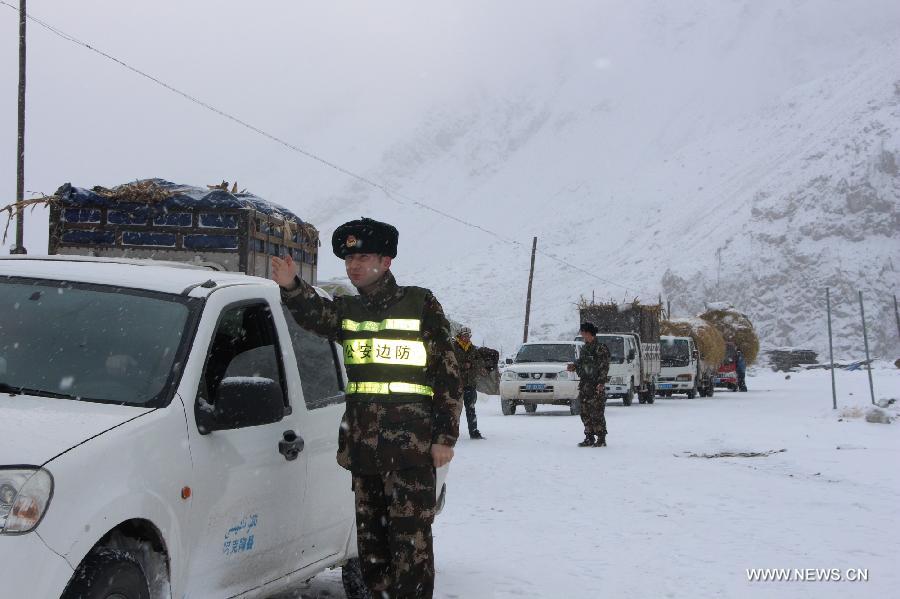
Snowed in ... vehicles get stuck in snow between Bamian and Daykundi provinces in Central Afghanistan. Picture: Courtesy Bilal Harwary Source: Supplied

The heavy snowstorms, which began early Tuesday, hampered rescue efforts.

Snowfall from the storm was nearly one-metre deep in places and fallen trees blocked roads in the Panjshir Valley.

Avalanches in the valley’s Dara district affected up to 600 families, according to people trying to reach the area to assist in rescue efforts.

Snowstorm ... an Afghan vegetable vendor pushes his cart during a snowstorm in Kabul, Afghanistan. Picture: AP Photo/Massoud Hossaini Source: AP

“People there have told me that two of my relatives have been killed and eight others are still under the snow,” said an Afghan who goes by the single name Sharafudin.

“My son and I are trying to get through to see if we can help find their bodies. But it will take us at least three or four hours to get there because of the snow and the road is very narrow, so we have to walk, the car can’t get through.”

Large parts of Afghanistan have been covered in snow as a major storm interrupted an otherwise mild and dry winter.

Blizzard ... Afghan women and a child walk during a snowstorm in Kabul, Afghanistan. Picture: AP Photo/Massoud Hossaini Source: AP

Afghanistan has suffered through some three decades of war since the Soviet invasion in 1979. But natural disasters such as landslides, floods and avalanches have taken a toll on a country with little infrastructure or development outside of its major cities.

In May, a massive landslide killed anywhere from 250 to 2700 people, authorities said at the time. Another landslide in 2012 killed 71 people.

Comment by Howard on February 21, 2015 at 3:47pm

Landslide Closes Golf Course in Southern British Columbia (Feb 20)

The Fauquier golf course, near Nakusp in the B.C. West Kootenay is crumbling, and sliding towards a neighbouring lake and officials aren't sure why.

Water is pooling, and there are large craters that have appeared on the course.

"It's not the first time that has happened, but in my memory, it's the worst that I've seen. There's no questions about it, it's quite a mess," Fauquier fire chief and golf club member John Banta told Daybreak South's Chris Walker.

Banta said two out of nine holes are affected — both between the lake and the now-crumbled bluff where the clubhouse sits.

Banta isn't sure what caused the damage.

Fauquier is across the lake from a mudslide that has closed Highway 6 , one kilometer west of the Needles Ferry.

Sources

http://www.cbc.ca/news/canada/british-columbia/fauquier-golf-course...

https://www.facebook.com/DaybreakSouth/posts/803190113086800

SEARCH PS Ning or Zetatalk

 
Search:

This free script provided by
JavaScript Kit

Donate

Donate to support Pole Shift ning costs. Thank you!

© 2024   Created by 0nin2migqvl32.   Powered by

Badges  |  Report an Issue  |  Terms of Service