"We warned at the start of ZetaTalk, in 1995, thatunpredictable weather extremes, switching about from drought to deluge,would occur and increase on a lineal basis up until the pole shift. Where this occurred steadily, it has only recently become undeniable. ZetaTalk, and only ZetaTalk, warned of these weather changes, at that early date. Our early warnings spoke to the issue of global heating from the core outward, hardly Global Warming, a surface or atmospheric issue, but caused by consternation in the core. Affected by the approach of Planet X, which was by then starting to zoom rapidly toward the inner solar system for its periodic passage, the core was churning, melting the permafrost and glaciers and riling up volcanoes. When the passage did not occur as expected in 2003 because Planet X had stalled in the inner solar system, we explained the increasing weather irregularities in the context of the global wobble that had ensued - weather wobbles where the Earth is suddenly forced under air masses, churning them. This evolved by 2005 into a looping jet stream, loops breaking away and turning like a tornado to affect the air masses underneath. Meanwhile, on Planet Earth, droughts had become more intractable and deluges positively frightening, temperature swings bringing snow in summer in the tropics and searing heat in Artic regions, with the violence of storms increasing in number and ferocity."
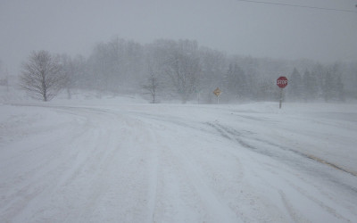
The wobble seems to have changed, as the temperature in Europe suddenly plunged after being like an early Spring, Alaska has its coldest temps ever while the US and much of Canada is having an extremely mild winter. India went from fatal cold spell to balmy again. Has the Earth changed position vs a vs Planet X to cause this?[and from another]Bitter cold records broken in Alaska - all time coldest record nearly broken, but Murphy's Law intervenes[Jan 30]http://wattsupwiththat.com/2012/01/30/bitter-cold-records-broken-in-alaskaJim River, AK closed in on the all time record coldest temperature of -80°F set in 1971, which is not only the Alaska all-time record, but the record for the entire United States. Unfortunately, it seems the battery died in the weather station just at the critical moment. While the continental USA has a mild winter and has set a number of high temperature records in the last week and pundits ponder whether they will be blaming the dreaded "global warming" for those temperatures, Alaska and Canada have been suffering through some of the coldest temperatures on record during the last week.
There has been no change in the wobble pattern, the wobble has merely become more severe. Nancy noted a Figure 8 format when the Earth wobble first became noticeable, in early 2005, after Planet X moved into the inner solar system at the end of 2003. The Figure 8 shifted along to the east a bit on the globe between 2005 and 2009, (the last time Nancy took its measure) as Planet X came closer to the Earth, encountering the magnetic N Pole with a violent push earlier in the day. But the pattern of the Figure 8 remained essentially the same. So what changed recently that the weather patterns became noticeably different in late January, 2012?
The N Pole is pushed away when it comes over the horizon, when the noon Sun is centered over the Pacific. This regularly puts Alaska under colder air, with less sunlight, and thus the historically low temps there this January, 2012 as the wobble has gotten stronger. But by the time the Sun is positioned over India, the N Pole has swung during the Figure 8 so the globe tilts, and this tilt is visible in the weather maps from Asia. The tilt has forced the globe under the hot air closer to the Equator, warming the land along a discernable tilt demarcation line.
The next loop of the Figure 8 swings the globe so that the N Pole moves in the other direction, putting the globe again at a tilt but this time in the other direction. This tilt is discernable in weather maps of Europe, again along a diagonal line. Depending upon air pressure and temperature differences, the weather on either side of this diagonal line may be suddenly warm or suddenly cold. The tilt and diagonal line lingers to affect much of the US and Canada, but the Figure 8 changes at this point to be an up and down motion, pulling the geographic N Pole south so the US is experiencing a warmer than expected winter under a stronger Sun. Then the cycle repeats, with the magnetic N Pole of Earth pushed violently away again as the Sun is positioned over the Pacific.
Would the Zetas be able to let us know what is causing the early break-up of the Arctic Ice, the ice seems to have taken on a swirling pattern at the same time, would this be wobble related?[and from another]http://www.vancouversun.com/news/national/Canada+Arctic+cracks+spec... The ice in Canada’s western Arctic ripped open in a massive “fracturing event” this spring that spread like a wave across 1,000 kilometres of the Beaufort Sea. Huge leads of water – some more than 500 kilometres long and as much as 70 kilometres across – opened up from Alaska to Canada’s Arctic islands as the massive ice sheet cracked as it was pushed around by strong winds and currents. It took just seven days for the fractures to progress across the entire area from west to east.[and from another]http://earthobservatory.nasa.gov/IOTD/view.php?id=80752&src=iot... A high-pressure weather system was parked over the region, producing warmer temperatures and winds that flowed in a southwesterly direction. That fueled the Beaufort Gyre, a wind-driven ocean current that flows clockwise. The gyre was the key force pulling pieces of ice west past Point Barrow, the northern nub of Alaska that protrudes into the Beaufort Sea.
The Figure 8 formed by the N Pole during the daily Earth wobble has shifted somewhat to the East, due to Planet X positioned more to the right of the Earth during its approach. This was anticipated, and well described in ZetaTalk, the Earth crowding to the left in the cup to escape the approach of Planet X, so the angle between these two planets would change slightly. This shift of the Figure 8 to the East is due to the push against the Earth’s magnetic N Pole occurring sooner each day than prior. Thus instead of occurring when the Sun is high over the Pacific, over New Zealand, it is now occurring when the Sun is high over Alaska. All the wobble points have shifted eastward accordingly.
This has brought a lingering Winter to the western US, and a changed sloshing pattern to the Arctic waters. Instead of Pacific waters being pushed through the Bering Straits into the Arctic when the polar push occurs, the wobble is swinging the Arctic to the right, and then later to the left, creating a circular motion in the waters trapped in the Arctic. Since the Earth rotates counterclockwise, the motion also takes this path. This is yet another piece of evidence that the establishment is hard pressed to explain. They are attempting to ascribe this to high pressure and wind, all of which are not new to the Arctic, but this circular early breakup of ice in the Arctic is new.
El Nino blamed for Durban's worst drought in living memory: Emergency steps to deliver water to it's 3 million residents
Authorities in Durban have started emergency steps to deliver water to the city's three million people as a record drought grips the country. The city is setting up machines that will prepare four- liter (one gallon) bags of water for distribution among the neediest residents, its executive committee said Tuesday. Durban is installing 80 water tanks and increasing the number of tankers driving around the city to serve households. Local utility Umgeni Water said Tuesday the drought "is worsening and minimal rainfall is expected over the next four to six months." Water levels in the three main dams supplying Durban and KwaZulu-Natal province capital Pietermaritzburg are at 35%, 38% and 47%, said Shami Harichunder, a spokesman. An El Nino weather system has caused the lowest rainfall across South Africa for more than a century. KwaZulu-Natal sugarcane farmers have lost as much as 70% of their crops in a drought they are describing as the worst in living memory, the province's agricultural union said in an e-mailed statement. Water restrictions may soon be imposed in Pietermaritzburg for the first time in 33 years. Curbs were introduced in Durban last year.
Comment by jorge namour on January 29, 2016 at 12:37am
Windstorm #Gertrude / #Thor is set to hit the SW coast of Norway
Windstorm #Gertrude / #Thor is set to hit the SW coast of Norway tomorrow with strong storm to hurricane force winds, gusting up to 150-180 km/h. Peak winds in the late afternoon and evening
Cleanup Underway After Tornado Rips Through Broward
COCONUT CREEK (CBSMiami) — Another dreary, rainy day and crews in Coconut Creek are cleaning up the mess a tornado left behind after sweeping through Broward County Wednesday.
“It was pretty intense,” said Cindy Paz, who was affected by the damaging winds. “All the trees were blowing really, really hard. It leaves you pretty shaken for a little while.”
Neighborhoods in Coconut Creek are littered with debris. The wicked weather splintered trees, wrecked cars and damaged buildings.
“We are used to hurricanes. You have time to plan for a hurricane and this yard’s been through a few hurricanes and never had this kind of damage from a hurricane,” said Paz.
Frightening cellphone video even captured the tornado whirling across the Florida turnpike, picking up a truck like a toy and dropping it a few lanes over.
“I just braced myself. I thought I was gonna get tipped over but luckily my truck was heavy enough and I didn’t get tipped over,” said German Serena, the driver.
The tornado’s power managed to overturn several trucks. Violent gusts toppled a small bus and sent one car flying from the southbound side of the turnpike to the northbound lanes.
Minutes earlier, the tornado touched down on Broward College’s north campus.
“All of a sudden alarms going off, messages going to phones that there was a tornado warning,” said student Tiffany Permenter. “We saw trees being ripped apart and thrown. And so we opened classroom doors because students were still outside and we motioned them to get inside.”
Winds up to 100 mph tossed cars through the parking lot, even stacking some on top of others.
A day later in the Wynmoor retirement community, homes are being boarded up and workers have started repairs on ripped up roofs.
“Appeared as though (one roof) was actually peeled back from the damage and we did notice a lot of doors to the residences were blown in,” said Sgt. Kathryn Marklane.
One homeowner was bringing in her outdoor furniture when she heard a loud noise inside her home.
“Something had crashed through my window and glass was over my entire bedroom,” said Judy Katanya. “It’s a mess.”
The National Weather Service surveyed the damage and says severe weather season in south Florida is just getting started.
“This is the type of stuff we can expect over the next few months and is typical of an El Niño year,” said Pablo Santos of the National Weather Service.
Due to the risk of more severe weather, all outdoor activities at Broward County Public Schools have been cancelled.
Australia – 2 Months of Rain in 1 Hour Causes Flash Floods in Geelong, Victoria
A storm in Geelong, Victoria, Australia on 27 January 2016 dumped more than double the January monthly average rain on parts of the city in just 1 hour.
Avalon, a suburb of the city, recorded 72 mm of rain between 16:00 to 17:00 local time on 27 January. Geelong Racecourse recorded over 40 mm of rain between 15:00 and 17:00.
The rain caused severe flash flooding throughout the city and suburbs. Emergency services responded to over 500 requests and had to carry out 15 flood rescues.
The City of Greater Geelong said that “Yesterday’s storm was considered a 1 in 100 year event with double the January monthly average rain falling in just 1 hour”.
Stefan Delatovic, Manager of Emergency Management Communications for Victoria State Emergency Service (VICSES) said:
“This dramatic storm has been characterised as a “once in a century event”, but it’s important to say that this is a measure of magnitude, as in ‘a storm this severe has a one-in-100 chance of occurring in any given year’. It doesn’t mean another storm like this isn’t expected for another 50 years. More rain is forecast for today, another storm like this could pop up anywhere in Victoria with little warning”.
Flash floods in Geelong, Victoria, Australia, January 2016. Photo: VICSES
7 People Trapped in Cars
Victoria State Emergency Service personnel were praised for their efforts during the storm by Geelong’s mayor.
Victoria State Emergency Service (VICSES) responded to over 520 requests. Amongst these calls for help were 15 people rescued from floodwater, including seven people who were trapped in cars.
Stefan Delatovic, said that “volunteers from around Victoria flooded in to help their Geelong peers to clear these incidents overnight. We’re indebted to their service”.
Stay Away from Floodwater
Throughout the storm and in the aftermath, VICSES stressed the importance of staying away from flood water, especially for those in vehicles. Via social media they said:
“If you can’t seen the road, you can’t guarantee that it is safe. Never drive through floodwater”.
The photos below were taken in North Geelong on 28 January, after the floodwater had receded. Photo credit: VICSES
In a statement earlier today, Mr Delatovic said:
“If you only do one thing, make it an easy one: commit to never entering floodwater. Floodwater moves quickly, picking up dirt and debris as it goes. Television news coverage of Geelong’s storms shows vehicles being swept away. Imagine if you were in them and how scary that would be. Our volunteers will try to save you if you’re trapped in a vehicle being tossed around by floods at obvious risks to themselves, but don’t put their lives in danger by entering it willingly.
TV coverage of last night’s storm included footage of people driving through floodwater, with many neglecting to warn of the severe risk.. Of chief concern to emergency managers is footage of a man surfing on floodwater which often cropped up as a light-hearted end to bulletins, characterised as a bit of fun. Obviously the man in question was having fun, and it’s not the media’s job to do anything more than accurately depict what is occurring, but flood stories including images of “locals enjoying the water” are common, and they normalise this activity.
Floodwater can include fast-moving sheets of corrugated iron, or a concealed storm drain creating an inescapable current. If you cut yourself, you’re prone to infection because the water is filthy. Current images of the receding floodwater in Geelong demonstrate how damaged roads can become. If you can’t see the road, you can’t guarantee that it’s safe.
The media shouldn’t stop broadcasting images of people playing in floodwater, or driving through it, but we all need a reminder of how dangerous it is.
Floods, storms and fires are unpredictable and they will inflict tragedy upon us. Let’s not give them any help”.
California's Record Hailstones Look Like Spiky Grenades (1/26/16)
...The ones that fell Saturday during a severe thunderstorm in Tehama County, California, about 150 miles north of San Francisco, are a bit different. ...
...The starfish-stones, which almost seem composed of grafted icicles, tied the record for largest hail in California set in 1960 in San Diego County. Their diameter was a whopping three inches from spike tip to spike tip, as shown in a photo by Jeff Boyce recently shared by the National Weather Service.
Boyce tweets the stones dropped during violent weather that also featured a funnel cloud, and that their unusual shapes were “exactly how I found them! Had soft landing on grass & didn’t break up like most.” Interestingly enough, other hail through the region had similar spiky growths, though on a smaller scale.
Rare cold snap hits east Asia, blamed for more than 65 deaths
Snow sits on the Chinese god statues at the Pinglin temple in the high mountain area of New Taipei City, Taiwan, Monday, Jan. 25, 2016. (AP / Wally Santana)
Ralph Jennings and Louise Watt, The Associated Press Published Monday, January 25, 2016 6:21AM EST Last Updated Monday, January 25, 2016 7:36AM EST
TAIPEI, Taiwan -- Unusually cold weather in eastern Asia has been blamed for more than 65 deaths, disrupted transportation and brought the first snow to a subtropical city in southern China in almost 50 years. Here is a look at the worst cold weather to hit the region in years:
TAIWAN
Temperatures in Taiwan's capital of Taipei plunged to a 16-year low of 4 degrees Celsius (39 Fahrenheit), killing 57 mostly elderly people, according to government officials. The semi-official Focus Taiwan news website reported that 85 people had died because of the cold.
Most homes in subtropical Taiwan lack central heating, and the cold caused heart trouble and breathing problems for many of the victims, a city official said. Normally, temperatures in Taipei hover around 16 degrees C (60 degrees F) in January, according to Taiwan's Central Weather Bureau.
The cold snap was blamed in the deaths of 40 people in the capital, Taipei, and 17 in neighbouring New Taipei City. The cold front also left 9 centimetres (3.5 inches) of snow on Taipei's highest peak.
JAPAN
Heavy snow in western and central Japan left five people dead over the weekend and possibly a sixth on Monday.
Kyodo News service said the victims included a woman who fell from a roof while removing snow, a man in a weather-related traffic accident, another man found under a snowplow and a couple that fell into an irrigation channel, apparently while removing snow.
An 88-year-old woman in western Japan's Tottori prefecture died after a landslide hit her house before dawn on Monday, Kyodo and other media reported.
The heavy snow stranded motorists, delayed bullet train service and caused flight cancellations.
MAINLAND CHINA
Most parts of mainland China experienced their coldest weather in decades over the weekend. The southern city of Guangzhou, which has a humid subtropical climate, saw snow for the first time since 1967 on Sunday.
The cold led to at least four deaths -- strawberry farmers who died of carbon monoxide poisoning when they turned up the heat in a greenhouse, the Xinhua News Agency reported.
The cold spell coincided with the beginning of the 40-day travel rush for the Lunar New Year, which is on Feb. 8 this year, disrupting cars, flights and trains. More than 11,000 passengers were stranded at Kunming airport in southern Yunnan province.
Temperatures fell 8 to 16 degrees Celsius from Thursday to Sunday in parts of north China, and temperatures in central and eastern China were 6 to 8 degrees lower than average, Xinhua said.
The National Meteorological Bureau forecast that temperatures in southern China would drop another 3-8 degrees on Monday.
SOUTH KOREA
Temperatures in the capital, Seoul, fell to minus 18 degrees Celsius on Sunday, the lowest since 2001. On Saturday, Jeju Island received 12 centimetres (4.7 inches) of snow, the heaviest since 1984, and its airport was closed from Saturday until Monday.
The shutdown stranded about 86,000 people, mostly tourists, on the island and forced the cancellations of about 1,100 flights, according to Transport Ministry and airport officials.
Comment by SongStar101 on January 24, 2016 at 10:49am
East coast brought to standstill as blizzard delivers near-record US snowfall
Severe weather affecting 80 million people to continue through Sunday
19 deaths reported amid flooding, snow and hurricane-strength winds
A blizzard with hurricane-force winds has brought much of the US East coast to a standstill, dumping as much as 3ft (90cm) of snow, stranding tens of thousands of travellers and shutting down Washington and New York City.
An estimated 80 million people across 20 states are facing a second day of being effectively trapped inside due to heavy snow and dangerous conditions, which are expected to last until Sunday.
After days of weather warnings, most people in the storm’s path heeded requests to stay home and off the roads, which were largely deserted. Yet at least 19 deaths were blamed on the weather, resulting from car crashes, shovelling snow and hypothermia. And there is more snow to come, forecasters warned.
“This is going to be one of those generational events, where your parents talk about how bad it was,” Ryan Maue, a meteorologist for WeatherBell Analytics, said from Tallahassee, Florida, which also got some flakes.
The weather system was mammoth, dropping snow from the Gulf Coast to the northeastern New England states. By afternoon, areas near Washington had surpassed 30in of snow. The heaviest unofficial report was in a rural area of West Virginia, not far from Harper’s Ferry, with 40in.
“It seems the weather forecasters got it right this time,” New York governor Andrew Cuomo said at a morning press conference. “There is a blizzard.”
Like officials all around the east coast, he warned people to stay off the roads: “I don’t care how superb a driver, how big a four-wheel drive vehicle you have, the roads are barely passable.”
“The roads are technically open,” Cuomo said. “But if you really do not need to leave your house, I can’t stress enough you should not leave your house.”
Cuomo said he was particularly concerned about flooding conditions – “what I consider the worst of Mother Nature’s wrath” – in New York City and along Long Island. Swells rivaled those of hurricane Sandy in some areas, though officials insisted the storm did not rival the 2012 disaster.
Airlines cancelled nearly 7,000 weekend flights and started to cut Monday service.
As the storm picked up, forecasters increased their snow predictions for New York and points north and warned areas nearly as far north as Boston to expect heavy snow.
“This is kind of a Top 10 snowstorm,” said weather service winter storm expert Paul Kocin, who co-wrote a two-volume textbook on blizzards.
It was the third biggest snowstorm in New York City’s history, where more than 25in of snow had fallen as of 7pm on Saturday, close to the record, 26.9in, set in February 2006.
Three people died while shoveling snow. The normally bustling streets around Rockefeller Center, Penn Station and other landmarks were mostly empty and Broadway shows were cancelled. Those who did venture out walked down the middle of snow-covered streets to avoid even deeper drifts on the sidewalks.
Officials imposed a travel ban in the city, ordering all non-emergency vehicles off the roads. Commuter rails and above-ground segments of the nation’s biggest subway system shut down, too, along with buses.
Comment by SongStar101 on January 22, 2016 at 11:52am
More than 75MILLION people brace themselves for the wrath of Jonas - the monster East Coast snowstorm - as FIVE THOUSAND flights are canceled and panic buyers clear the shelves
More than 2,500 flights around the country have been canceled on Friday and at least 2,300 on Saturday
Virginia, North Carolina, Maryland, and D.C. have all declared a state of emergency to prepare for the storm
Two feet of snow to hit Northeast - with 60mph winds expected to shut off power on coast from VA to NY
DC Mayor Muriel Bowser made unusual move of apologizing for underestimating early onset of snow and ice after gridlock traffic paralyzed the city last night
The city's subway - the second busiest in the nation - is set to be shut down over the weekend as a result
The mid-Atlantic states are bracing for a historic winter storm and travel chaos that could bring large parts of the Eastern seaboard to a standstill.
Emergencies have been declared in Maryland, Virginia, North Carolina and Washington, D.C., as the East Coast and 75 million people prepare for one of the most brutal snowstorms in a century - Storm Jonas - and it is set to last until Sunday.
More than 5,000 flights have already been canceled around the country from Friday until Saturday night and more than 2,100 flights have been delayed as of Friday morning as airports get ready for the severe weather.
It came after Washington, D.C., had already ground to a halt under just an inch of snowfall, with highways around the capital gridlocked. There is set to be more travel chaos over the weekend with the subway in the capital - the second busiest in the nation - set to close until Sunday.
Schools and government offices have been closed pre-emptively, food and supplies disappeared from grocery and hardware stores. College basketball games and concerts would have to wait.
The National Weather Service warned this is just the tip of the iceberg as the agency issued a blizzard alert for the region. The storm is set to dump two feet of snow between Mississippi and Boston, hitting Virginia, Maryland, and D.C. the worst.
Winds of around 60mph are expected to shut off power in hundreds of thousands of homes on the coastal region from Virginia Beach to Long Island.
Tornadoes have even been predicted in parts of Mississippi.
All schools in Washington, D.C., will be closed on Friday with road restrictions in place as of 9.30am.
Washington's metro system will close at 11:00 pm Friday and will not reopen until Monday morning. Trains will be stored in the tunnels to protect them from the elements. It is the first time in its 40-year history it will be closing.
Bus service will end even earlier, with the last buses leaving depots at 5:00 pm Friday, and service to resume Monday.
'The actions we are taking today are all in the interest of our customers' and employees' safety, and will help us return to service once the storm passes and the snow is cleared,' said the metro system's general manager Paul Wiedefeld.
Schools in Baltimore will also be closed before a snowflake is seen falling.
The National Weather Service said in a statement Wednesday that 12 to 16 inches of snow could come down between Friday night and Sunday morning around the Interstate 95 corridor.
As much as a foot of snow is possible for Philadelphia's northern suburbs.
With 20 inches set to blanket the capital, this storm - dubbed Storm Jonas by the Weather Channel - could rival the biggest snowstorms in the history of the United States.
Chicago's biggest ever snowstorm brought 23 inches of snow to the city, while St Louis' and Columbus's each saw 20.4 inches settle.
Mitchell Gaines of the National Weather Service in Mount Holly, New Jersey, said people should be prepared for strong winds, heavy, wet snow and power outages.
The National Weather Service's Weather Prediction Center warns of heavy, 'perhaps crippling' snow across the northern mid-Atlantic region, including Baltimore, Washington and Philadelphia, probably beginning Friday.
In the District of Columbia, Mayor Muriel Bowser requested Humvees from the National Guard to reach isolated people and places if necessary.
'If this is a blizzard and we have sustained winds and people lose power, that would be my biggest concern,' Bowser said at a news conference. 'We can move the snow. We will move the snow.'
Bowser took the unusual step of apologizing for her administration's response to the minor storm. She said crews should have been out earlier with more resources.
Arlington County officials said the region 'underestimated' the storm and it was a 'scary and frustrating night' for residents.
Comment by SongStar101 on January 22, 2016 at 11:46am
So cold your EYEBROWS could freeze: Chinese residents embrace coldest winter in 30 years as temperatures drop to as low as -47.8C
China is facing a cold snap this week with the northern part seeing figures as low as -47.8 in Inner Mongolia
Pictures show residents wrapping up warm, walking on frozen oceans and throwing freezing water into the air
State-run media are saying that this is the coldest weather the country has faced in the past three decades
Sub-tropical Hong Kong is also feeling the chill with forecasters predicting the city will see frost and ice
China is bracing itself for a week-long cold wave that has seen temperatures drop well below freezing and in some cases as low as -47.8 degrees Celsius.
Schools in several cities in north China have been suspended and emergency services are preparing themselves for the worst, the People's Daily Online reports.
Images have emerged online depicting the country's current freeze including pictures of people's eyebrows collecting frost in the bitter cold as several cities issued a blue alert for extreme weather.
The National Meteorological Center has predicted that temperatures will drop by 10 degrees Celsius across much of the country over the next four days.
China's state-run Xinhua News Agency say that temperatures are expected to drop below freezing in 90 per cent of the country this week.
Today in Genhe, Inner Mongolia, the temperature dropped to -47.8 degrees Celsius.
There are concerns that the extreme weather will affect fruit and vegetable crops and local agricultural authorities have warned farmers to add organic fertilizers to their crops to reduce damage control.
One farmer Zhu Dazhi spoke to the People's Daily warning: 'The temperature will stay below zero for several days. Only ten percent of the vegetables will survive'.
Electricity companies say they have made preparations for the extreme weather.
In Hangzhou, there have been scenes of locals rushing to the supermarket to stock up on necessary items including vegetables and bread.
While other people have been getting out into the snow, testing out the arctic-like temperatures by throwing boiling water into the air which freezes turning the water into a cloud of crystals.
Zhejiang province is currently on a yellow alert, the second highest alert for cold weather.
While Hong Kong which is usually sub-tropical, will see temperatures plunge to around seven degrees Celsius. In the New Territories forecasters have predicted ice and frost for the area. There have only been four instances of this since records began in Hong Kong.
In 2008, China was affected by a series of winter storms in which some 129 people died.
During this time, it even snowed in the Tacklamakan desert where it snowed for 11 consecutive days and killed livestock.
Mongolia experiencing very low temperatures, heavy snowfall
Bishkek (AKIpress) -
Mongolia is experiencing very low temperatures and heavy snowfall since early-November 2015, locally named dzud (or jute, mass deaths of livestock in winter). According to the National Emergency Management Authority, snow has covered 90 percent of the total territory with conditions getting more severe,ReliefWeb reports.
Based on the latest assessment report released from the Mongolian government in early-January 2016, 50 districts in 16 provinces are currently categorized as experiencing dzud, while 120 districts in 20 provinces are on the edge of entering dzud condition.
Some local level governments have already declared dzud in their respective districts as part of the early warning and preparedness measures.
The Information and Research Institute of Meteorology, Hydrology and Environment has indicated that based on the weather forecast, continuous snowfall, snowstorms and temperatures are expected to persist on average of below -25 degrees Celsius (-13°F) during daytime and -38 degrees (-36°F) during night in the coming weeks. These will further affect more than 965,000 people, especially vulnerable herders living in the affected districts.


 Flash floods in Geelong, Victoria, Australia, January 2016. Photo: VICSES


You need to be a member of Earth Changes and the Pole Shift to add comments!
Join Earth Changes and the Pole Shift