Wild Weather, the Wobble Effect
|
Weather: |
Tides and Whirlpools:
|
"We warned at the start of ZetaTalk, in 1995, that unpredictable weather extremes, switching about from drought to deluge, would occur and increase on a lineal basis up until the pole shift. Where this occurred steadily, it has only recently become undeniable. ZetaTalk, and only ZetaTalk, warned of these weather changes, at that early date. Our early warnings spoke to the issue of global heating from the core outward, hardly Global Warming, a surface or atmospheric issue, but caused by consternation in the core. Affected by the approach of Planet X, which was by then starting to zoom rapidly toward the inner solar system for its periodic passage, the core was churning, melting the permafrost and glaciers and riling up volcanoes. When the passage did not occur as expected in 2003 because Planet X had stalled in the inner solar system, we explained the increasing weather irregularities in the context of the global wobble that had ensued - weather wobbles where the Earth is suddenly forced under air masses, churning them. This evolved by 2005 into a looping jet stream, loops breaking away and turning like a tornado to affect the air masses underneath. Meanwhile, on Planet Earth, droughts had become more intractable and deluges positively frightening, temperature swings bringing snow in summer in the tropics and searing heat in Artic regions, with the violence of storms increasing in number and ferocity."
From the ZetaTalk Chat Q&A for February 4, 2012:
The wobble seems to have changed, as the temperature in Europe suddenly plunged after being like an early Spring, Alaska has its coldest temps ever while the US and much of Canada is having an extremely mild winter. India went from fatal cold spell to balmy again. Has the Earth changed position vs a vs Planet X to cause this? [and from another] Bitter cold records broken in Alaska - all time coldest record nearly broken, but Murphy's Law intervenes [Jan 30] http://wattsupwiththat.com/2012/01/30/bitter-cold-records-broken-in-alaska Jim River, AK closed in on the all time record coldest temperature of -80°F set in 1971, which is not only the Alaska all-time record, but the record for the entire United States. Unfortunately, it seems the battery died in the weather station just at the critical moment. While the continental USA has a mild winter and has set a number of high temperature records in the last week and pundits ponder whether they will be blaming the dreaded "global warming" for those temperatures, Alaska and Canada have been suffering through some of the coldest temperatures on record during the last week.

There has been no change in the wobble pattern, the wobble has merely become more severe. Nancy noted a Figure 8 format when the Earth wobble first became noticeable, in early 2005, after Planet X moved into the inner solar system at the end of 2003. The Figure 8 shifted along to the east a bit on the globe between 2005 and 2009, (the last time Nancy took its measure) as Planet X came closer to the Earth, encountering the magnetic N Pole with a violent push earlier in the day. But the pattern of the Figure 8 remained essentially the same. So what changed recently that the weather patterns became noticeably different in late January, 2012?
The N Pole is pushed away when it comes over the horizon, when the noon Sun is centered over the Pacific. This regularly puts Alaska under colder air, with less sunlight, and thus the historically low temps there this January, 2012 as the wobble has gotten stronger. But by the time the Sun is positioned over India, the N Pole has swung during the Figure 8 so the globe tilts, and this tilt is visible in the weather maps from Asia. The tilt has forced the globe under the hot air closer to the Equator, warming the land along a discernable tilt demarcation line.
The next loop of the Figure 8 swings the globe so that the N Pole moves in the other direction, putting the globe again at a tilt but this time in the other direction. This tilt is discernable in weather maps of Europe, again along a diagonal line. Depending upon air pressure and temperature differences, the weather on either side of this diagonal line may be suddenly warm or suddenly cold. The tilt and diagonal line lingers to affect much of the US and Canada, but the Figure 8 changes at this point to be an up and down motion, pulling the geographic N Pole south so the US is experiencing a warmer than expected winter under a stronger Sun. Then the cycle repeats, with the magnetic N Pole of Earth pushed violently away again as the Sun is positioned over the Pacific.
From the ZetaTalk Chat Q&A for April 6, 2013:
Would the Zetas be able to let us know what is causing the early break-up of the Arctic Ice, the ice seems to have taken on a swirling pattern at the same time, would this be wobble related? [and from another] http://www.vancouversun.com/news/national/Canada+Arctic+cracks+spec... The ice in Canada’s western Arctic ripped open in a massive “fracturing event” this spring that spread like a wave across 1,000 kilometres of the Beaufort Sea. Huge leads of water – some more than 500 kilometres long and as much as 70 kilometres across – opened up from Alaska to Canada’s Arctic islands as the massive ice sheet cracked as it was pushed around by strong winds and currents. It took just seven days for the fractures to progress across the entire area from west to east. [and from another] http://earthobservatory.nasa.gov/IOTD/view.php?id=80752&src=iot... A high-pressure weather system was parked over the region, producing warmer temperatures and winds that flowed in a southwesterly direction. That fueled the Beaufort Gyre, a wind-driven ocean current that flows clockwise. The gyre was the key force pulling pieces of ice west past Point Barrow, the northern nub of Alaska that protrudes into the Beaufort Sea.

The Figure 8 formed by the N Pole during the daily Earth wobble has shifted somewhat to the East, due to Planet X positioned more to the right of the Earth during its approach. This was anticipated, and well described in ZetaTalk, the Earth crowding to the left in the cup to escape the approach of Planet X, so the angle between these two planets would change slightly. This shift of the Figure 8 to the East is due to the push against the Earth’s magnetic N Pole occurring sooner each day than prior. Thus instead of occurring when the Sun is high over the Pacific, over New Zealand, it is now occurring when the Sun is high over Alaska. All the wobble points have shifted eastward accordingly.
This has brought a lingering Winter to the western US, and a changed sloshing pattern to the Arctic waters. Instead of Pacific waters being pushed through the Bering Straits into the Arctic when the polar push occurs, the wobble is swinging the Arctic to the right, and then later to the left, creating a circular motion in the waters trapped in the Arctic. Since the Earth rotates counterclockwise, the motion also takes this path. This is yet another piece of evidence that the establishment is hard pressed to explain. They are attempting to ascribe this to high pressure and wind, all of which are not new to the Arctic, but this circular early breakup of ice in the Arctic is new.
Views: 626917
Comment
-
Comment by lonne rey on June 24, 2015 at 11:24am
-
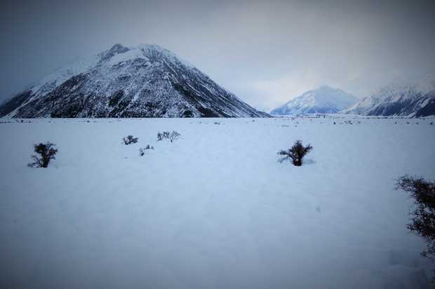
South Island wakes to record freeze (new zealand)
http://www.radionz.co.nz/news/regional/276919/south-island-wakes-to...
In a rare event, almost the entire South Island has woken up to temperatures below zero degrees today.
MetService meteorologist Stephen Glassy said the coldest place in the South Island overnight was Pukaki aerodrome near Twizel which reached a bone chilling - 19.8°C.
The all time record low is - 25.6°C recorded in Ranfurly in 1903.
Power still out for many
Some people in the Canterbury region have been without power since heavy snow brought down lines last week.
Line workers have been working to restore power, using helicopters to get to isolated places.
-
-
Pakistan Heat Wave Kills Hundreds: Victims 'Dying On the Streets'
http://www.nbcnews.com/news/world/pakistan-heat-wave-kills-hundreds...
ISLAMABAD, Pakistan — A heat wave raging through southern Pakistan has claimed more than 700 lives, officials said, with witnesses describing victims "dropping dead" on the streets.
Temperatures have exceeded 110 degrees in recent days, and thousands of people have been left to face the heat without electricity amid widespread power outages.

-
Comment by jorge namour on June 23, 2015 at 1:32am
-
Rare double rainbow frames Sydney skyline
June 18, 2015
http://edition.cnn.com/2015/06/18/asia/sydney-double-rainbow-stunne...
double rainbow at sunset in Sydney.
Sydney's sunset was twice as spectacular Wednesday when its beaches, harbor and city skyline were framed by a rare double rainbow.
Social media was awash with breathtaking pictures, with the sight literally stopping traffic on the city's streets.
-
Comment by KM on June 21, 2015 at 3:05pm
-
http://pulse.ng/local/in-lagos-floods-overwhelm-major-streets-photo...
Floods overwhelm major streets [PHOTOS]
Motorists are finding it hard to navigate their way due to the water level and pedestrians are unable to pass unaided.
 Flooding in Lagos Twitter
 Flooding in Lagos Twitter

 Flooding in Lagos Twitter
Motorists are finding it hard to navigate their way due to the water level and pedestrians are unable to pass unaided.
The affected areas include Lekki, Ajah, Oshodi, Iju, Opebi, Agege and Ikorodu among others.
Floods are a constant problem in Lagos leading the state government to provide a free phone line, 08099183777, for residents to report flooding incidents in their respective areas.
-
-
http://www.stuff.co.nz/national/69567269/hundreds-flee-rising-flood...
Hundreds flee rising floodwaters in North Island

 CHARLOTTE CURD/Stuff.co.nz
People in Waitotara return to the Taranaki town to assess the damage from the weekend's flooding.
A hundred people have been evacuated from Waitotara - likely the south Taranaki village's entire population - after flooding engulfed the remote town.
Waitotara is located about 30 kilometres north of Whanganui. It has sixty houses and sits on the Waitotara River, which flooded in the heavy rain over the weekend.
Residents were not able to return to their homes on Sunday, as flood waters were still high, Civil Defence said. Some residents were asked to evacuate, while others self-evacuated. Many went to the nearby town of Waverley.
A state of emergency remains in place for Taranaki, Whanganui and Rangitikei.
More than 200 people were evacuated from areas near the Whanganui River, which reached record levels of 9.1 metres at Town Bridge at 3am on Sunday. Many more people had self-evacuated.
About 100 flood affected homes on the city's Anzac Parade could be inaccessible until Tuesday because of the high waters, the Ministry of Civil Defence said.

The Whangaehu River in flood.
Assessments of properties along the Whanganui River had been delayed because water levels were not expected to start receding until early afternoon, despite improvements in the weather, CD director Sarah Stuart-Black said.
Slips had also come down on the aveneue and needed to be assessed before the road could reopen.
-
-
18 dead, 4 missing as dangerous storms sweep through China
http://www.foxnews.com/world/2015/06/20/18-dead-4-missing-as-danger...

Heavy storms that swept through several southern Chinese provinces this past week have killed 18 people and left four more missing, according to the Ministry of Civil Affairs.
The storms have dumped more than nearly 8 inches of rainfall in 48 hours on some towns, toppled thousands of homes, and dislocated tens of thousands of residents, the ministry said Friday.
The deaths were caused by house collapses, landslides, drowning or lightning.
-
-
June on track to be coldest summer for 40 years
http://www.heraldscotland.com/news/home-news/june-on-track-to-be-co...
JUNE is on track to be the coldest summer month for more than 40 years as the persistent rainfall and low temperatures blight hopes of a turn to warmer weather.
Scotland's average temperature up until June 15 was 9.3C, two degrees below normal and the coldest June, July or August since June 1972, Met Office records show.

Forecasters are predicting another 10 days of downpours from next week. But first, another cold front will bring cloud and scattered heavy showers tomorrow, followed by a wet Sunday with hail. Highs of 18C tomorrow will drop to 15C on Sunday.
-
-
Thunderstorms in France: more than 500,000 lightning in 15 days!
News - Updated Friday, 19 June 2015 by The Weather Channel - LA CHAINE METEO
After a remarkably stable spring, the beginning of June was particularly hot in France, but also very stormy, with several peaks of activity during the first 15 days.
http://actualite.lachainemeteo.com/actualite-meteo/2015-06-19-06h25...
https://translate.google.com.ar/translate?sl=fr&tl=en&js=y&...
If the first three days of June 2015 have not been particularly stormy, it is quite another result. Indeed, according Blitzortung network, the number of readings lightning was above 20000 for 10 consecutive days, from June 5 to 14, with two peaks of activity on June 6 and June 11 (over 80000 flashes these days there). Of all the first 15 days of the month, more than 500,000 lightning were recorded.
However, in the image of the distribution of total rainfall, thunderstorm activity was very heterogeneous across the country. It is above the edge of the reliefs and the south, mainly the southeast as storms erupted and where the electrical activity was intense. In the north, however, the electric activity was much lower (0 days in Paris), and mainly concerns the Normandy and Picardy.
-
-
Coldest June in 92 years (Norway)
You have every reason to complain about the weather. Trøndelag has not experienced such a cold first half of June since 1923.
Since the daily measurements (average temperature through the day) began in Trondheim in 1870, it has been measured an even colder first half of June only once, 92 years ago.
There has not been a single day of summer meteorological in Trondheim in the first half of June.
-
-
Downburst in Normandy: impressive photos - FRANCE
News - Published Friday, June 12, 2015 by The Weather Channel - LA CHAINE METEO
Our users have sent us photos of wet downbursts taken during a storm in the Orne this Thursday, June 11, 2015. Explanation and video of the phenomenon in action.
http://actualite.lachainemeteo.com/actualite-meteo/2015-06-12-17h13...
https://translate.google.com.ar/translate?sl=fr&tl=en&js=y&...
L ORNE was crossed by severe thunderstorms on Thursday, causing large amounts of rainfall. The photographs of our users show perfectly the phenomenon as a whole: a powerful very localized rain curtain, so very violent, under the storm cloud. This is a wet downburst, or "wet downburst" in English. A weather phenomenon sudden and short-lived (a few minutes) capable of crushing everything in its path.
Totally different from tornadoes with which they are sometimes confused, downbursts are destructive wind corridors able to bring down a plane landing or taking off.
© 2024 Created by 0nin2migqvl32.
Powered by
![]()
You need to be a member of Earth Changes and the Pole Shift to add comments!
Join Earth Changes and the Pole Shift