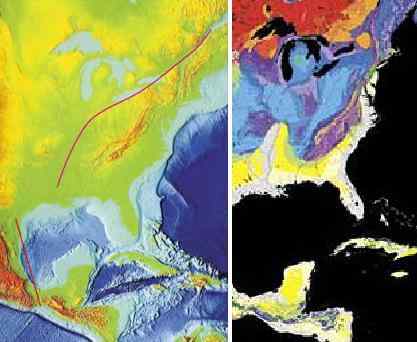
New Madrid
There has been much made of an earthquake in the recent past long the New Madrid fault line, as this was unexpected, being in a quiescent area, and thus raised all manner of questions regarding the possibility of massive earthquakes in areas presumed to be safe. Simply put, there are no earthquake free areas, and during the coming pole shift, all parts of the globe will be subject to them, without exception. Thus, individuals living in areas which have never experienced an earthquake should not presume safety but should take the same steps in preparing for the pole shift that those living atop highly active fault lines take - stay out of old or masonry buildings, and anticipate earthquakes as severe as any that mankind has ever experienced and noted.
ZetaTalk ™
Our description on the pole shift itself describes not a single jolt when the crust stops moving but a series of jolts. Most severe earthquakes are like this, in fact, if one examines their pattern. There are small quakes ahead of time, swarms, and jiggling that unsettles people as they sense something is pending. Then when the rock fingers that are preventing the fault line from sliding or subducting suddenly break, a large jolt. This often, within minutes, results in more jolts as the pressure that was at one point now moves to be pressure at the next point where rock fingers are holding the slippage. Aftershocks result, as yet more rock fingers break, until a point arrives where there is so much resistance to slippage that the quake and its after effects is considered complete.
For the New Madrid, which will include the European tsunami in its effects, there will be one large jolt with a subsequent and almost immediate tearing of the Atlantic. We have stated that the European tsunami will be the largest, but smaller ones will follow in time. Likewise for the New Madrid adjustment, which involve a tearing of the entire N American continent from the seaway down to Mexico. This adjustment will not occur until minor rock fingers have been steadily broken in a number of places. The areas to be affected have already been experiencing quake swarms, buckling roadways, sinkholes, breaking dams, and unsettling jigging which is unexplained by the authorities. When the primary blockage gives, there will be a huge jolt, with little warning. Aftershocks will continue until the time of the pole shift itself.
ZetaTalk ™ 2010
It is known by man that the New Madrid Fault line runs beyond the immediate area of New Madrid. When we stated that "Chicago will rupture and adjust" and "Ohio will be pulled in places" this should not be news to man. The New Madrid runs up along the Seaway, to the mouth of the Seaway, and thus will rupture any land it passes through. Plot its course and consider that more than the fault line itself will be disrupted. Rock detached from its former connections is free to react to the dominant theme in the area. If rock was held down, formerly, it can bounce up. If rock was held back, it is free to spring forward. And adjustment in rock strata means that loose soil will sink or heave. This most certainly can affect a broader area than just the fault line. We have stated that Ohio will be affected most in this regard. These matters are related to the rock strata, which bonds or breaks, as we have stated. There is a natural break in the rock strata holding Ohio, along the Ohio River and into its headwaters, as can be seen. Why should Chicago be affected? There is a natural break in the rock strata between the New Madrid and Chicago also, a weakness, which will rupture with the New Madrid. When the Seaway pulls apart there will be a dropin support formerly present during rock attachments. Chicago has long been predicted, by ourselves and others, to be devastated. Much of the infrastructure will rupture, causing buildings to crumble and freeways to be worthless and irreparable. One need only follow the geology of the region, to predict what will happen.
ZetaTalk ™ 2010
During the 7 of 10 New Madrid adjustment the Seaway will be affected, as we mentioned earlier. It will not tear open to the degree we predicted for the pole shift itself, but weak points along the Seaway will adjust. During the 7 of 10 Duluth will find crevasses nearby, similar to the crevasse that has occurred recently in the Michigan Penninsula, but with greater depth and scope. Inland locks along the Seaway will break. Detroit and Toronto will be unaffected during the 7 of 10 except of course for earthquake damage. As the New Madrid fault line runs up along the Seaway just under the Great lakes in Ohio, cities such as Cleveland and Toledo will find their infrastructure greatly shattered in places as the rock beneath them will jut and drop, vertical adjustments. Buffalo, being virtually on the fault line, will likewise be shattered in this way, such that freeways become useless, but the seaway at Niagara Falls will remain.
ZetaTalk ™ 2010
As both sides of the New Madrid Fault Line are pulled in opposite directions, the entire fault line operates as a slip-slide fault line. In that the land just to the west of the Mississippi River moves the greatest distance, to ease the pressure on the bow currently formed by the N American continent, this creates a void, a stretch zone void, causing the land there to drop, as we have explained. This is the region currently experiencing precursor earthquakes, the region considered the New Madrid region. But the movement is not yet happening, the void not yet being created. Instead, occasional slight slip-slide adjustments are being made, deep within the rock strata, causing minor quake swarms or sympathetic jolts in neighboring areas. The rock fingers are slipping, but not losing their grip.
When the plate tearing starts in earnest, these slip-slide jolts will be huge, and rise up to the magnitude 8-9 range, as we have stated. These quakes will ride up to the bend in the fault line just south of Lake Michigan. Earthquake damage is primarily done when the rock close to the surface is affected, as is known by man. The quality of the rock along the fault line thus affects the shaking and resulting damage to the surface. A glance at a map of the geology of the fault line shows that the rock along the Mississippi at Arkansas and Missouri is younger, laid down by sediment, and tends to fracture broadly, thus relaying earthquake jolts over a vast area. Broad fractures also cause post quake adjustments, so the quake includes rock shuffling, all of which translates to a larger magnitude for the area. Thus, the worst of the New Madrid adjustment will be felt in this area.
The rock strata that hold Illinois and Indiana is older, and more solid. Fracturing of the rock tends to be a single jolt, not the multiple ricocheting jolts that magnify any adjustment in the rock strata experienced by the rock strata in Arkansas and Missouri. The magnitude will still be considered high, perhaps an 8, but the shaking will not last as long, and the damage therefore not as great. Were the bend in the fault line just south of Lake Michigan not at a point where the southeastern part of the US is dropping away from the Seaway, the damage along the Seaway would be much greater. The Equator is expanding in the center of the Atlantic, and has already, by this time, ripped open between S America and Africa. The southeast thus drops toward this void, relieving pressure and friction along the slip-slide in the fault line as it runs under the Seaway.
By the time the New Madrid adjustment reaches the bend, land to the west of the Mississippi has already dropped, pulled away, but this actually puts more pressure on the fault line as it runs under Michigan. This holds, momentarily, while the southeast starts to drop toward the Atlantic Rift, and then pulls apart sharply. Here, beneath Michigan, the jolts will also not last for long, and will also be considered up to magnitude 8. The fault line thence along the Seaway will unzip, along rock strata borders already established. Where stretch zones such as this normally have adjustments that are basically silent, they do much damage. The unzipping creates crevasses and landslides and sinkholes, and when this occurs under cities is devastating. The quakes will be considered much less than magnitude 8 but the damage will be greater, with consequent lost of life and infrastructure. A building that has collapsed because of a large jolt is no different than one that has collapsed because the ground beneath it sank.
As is known, there is a fault line running up along the East Coast of the US that attaches to the New Madrid fault line in the Gulf. Both fault lines touch there, in the Gulf, and when the New Madrid adjusts there is a sympathetic adjustment up along this fault line. During the last New Madrid adjustment, church bells rang in Boston and cracks appeared in buildings in Savannah, GA and Charleston, SC. These changes are caused by earthquakes equivalent to a magnitude 4-5 or less, not serious.
ZetaTalk ™ March 19, 2011

Note New Madrid Sequence commentary.
Note USGS Signals commentary.
Source: New Madrid
Views: 91103
Comment
-
Comment by Kojima on October 26, 2022 at 3:09am
-
Corps begins constructing underwater sill to halt saltwater intrusion in Mississippi River
USACE NEW ORLEANS
Published Oct. 12, 2022
NEW ORLEANS – The U.S. Army Corps of Engineers, New Orleans District began construction of an underwater sill Oct. 11, 2022, across the bed of the Mississippi River channel to prevent further upriver progression of salt water from the Gulf of Mexico.
The Mississippi River’s volume of water has fallen to a level that allows salt water to intrude upstream. Saltwater from the Gulf of Mexico moves upriver in a wedge shape that may stretch up approximately 20 miles from the bottom to the surface of the river.
To stop the salt water from moving upriver and reduce the risk to freshwater intakes, the New Orleans District began construction of an underwater barrier sill Oct. 11 at river mile 64, which is near Myrtle Grove, Louisiana, to arrest the progression of saltwater intrusion.
The sill is being created using sediment dredged from a designated area just upstream for this purpose. Throughout the construction phase, the Corps will test salinity levels in the river to determine where the saltwater wedge is and how high the sill may need to be built.
Currently, the greatest risk associated with the saltwater intrusion is the appearance of unsafe salinity levels at the intakes of municipal drinking water intakes in Plaquemines Parish. Additionally, the U.S. Coast Guard has issued navigation restrictions around the sill construction site from river mile 63.5 to 64.
The New Orleans District and U.S. Coast Guard are closely coordinating with the navigation industry to ensure vessel traffic in the river is not significantly impacted. Draft restrictions may be issued as construction of the sill progresses.
###
Contact
Matt Roe
504-862-1606
Release no. 22-024
^^^^^^^^^^^^^^^^^^^^^^^^^^^^^^^^^^^^^^^^^^^^^^^^^^^^^
ZetaTalk
https://www.zetatalk5.com/ning/31oc2022.htm
We stated that the New Madrid Adjustment began on October 12, 2019 when the Hard Rock Hotel in New Orleans collapsed. The Isthmus of Tehuantepec was then watched closely as this is the start of the New Madrid Fault Line. The Isthmus is constantly peppered with deep quakes, as the Mainland Portion to the West of the fault line pulls down and toward the Pacific while the SE Portion to the East of the fault line stays glued to the Africa and Caribbean Plates.
The separation of the Mainland and SE Portion reached New Orleans by April, 2022, but made scant progress up the Mississippi River since then. Now the floor of the Mississippi River is rising at New Orleans due to the tugging apart of the N America portions. This is due to the Mainland Portion dropping as it is pulled down toward Mexico and westward into the Pacific. The Mainland Portion is being stretched during this process, losing elevation thus, and during this process is raising the floor of the Mississippi River at New Orleans.
-
-
Data from VolcanoDiscovery.com
Past earthquakes in California
https://www.volcanodiscovery.com/earthquakes/california/archive/2022-oct-24.html
2022/10/24 00:51 - 23:47 (n=101; Updated Oct 25. 2022 04:03 GMT)
-
-
Data from VolcanoDiscovery.com
https://www.volcanodiscovery.com/earthquakes/mexico.html
2022/10/24 02:01 - 23:58
(n=42; Updated Oct 25, 2022 05:00 GMT)
https://www.volcanodiscovery.com/earthquakes/mexico/archive/2022-10-24-2022-10-24.html
-
-
Earthquakes of 1811-1812 | New Madrid, MO - Official Website
http://www.new-madrid.mo.us/102/Earthquakes-of-1811-1812
Home > Visiting > Tourism > Earthquakes of 1811-1812 > Strange Happenings during the Earthquakes
STRANGE HAPPENINGS DURING THE EARTHQUAKES
http://www.new-madrid.mo.us/132/Strange-Happenings-during-the-Earthquake
STRANGE HAPPENINGS
The New Madrid earthquakes were the biggest earthquakes in American history. They occurred in the central Mississippi Valley, but were felt as far away as New York City, Boston, Montreal, and Washington D.C. President James Madison and his wife Dolly felt them in the White House. Church bells rang in Boston. From December 16, 1811 through March of 1812 there were over 2,000 earthquakes in the central Midwest, and between 6,000-10,000 earthquakes in the Bootheel of Missouri where New Madrid is located near the junction of the Ohio and Mississippi Rivers.
In the known history of the world, no other earthquakes have lasted so long or produced so much evidence of damage as the New Madrid earthquakes. Three of the earthquakes are on the list of America's top earthquakes: the first one on December 16, 1811, a magnitude of 8.1 on the Richter scale; the second on January 23, 1812, at 7.8; and the third on February 7, 1812, at as much as 8.8 magnitude.
THE MISSISSIPPI RAN BACKWARDS
After the February 7 earthquake, boatmen reported that the Mississippi actually ran backwards for several hours. The force of the land upheaval 15 miles south of New Madrid created Reelfoot Lake, drowned the inhabitants of an Indian village; turned the river against itself to flow backwards; devastated thousands of acres of virgin forest; and created two temporary waterfalls in the Mississippi. Boatmen on flatboats actually survived this experience and lived to tell the tale.
GETTING OVER CRACKS
As the general area experienced more than 2,000 earthquakes in five months, people discovered that most of crevices opening up during an earthquake ran from north to south, and when the earth began moving, they would chop down trees in an east- west direction and hold on using the tree as a bridge. There were "missing people" who were most likely swallowed up by the earth. Some earthquake fissures were as long as five miles.
EARTHQUAKE PHENOMENA
Sand Boils
The world's largest sand boil was created by the New Madrid earthquake. It is 1.4 miles long and 136 acres in extent, located in the Bootheel of Missouri, about eight miles west of Hayti, Missouri. Locals call it "The Beach." Other, much smaller, sand boils are found throughout the area.Seismic Tar Balls
Small pellets up to golf ball sized tar balls are found in sand boils and fissures. They are petroleum that has been solidified, or "petroliferous nodules."Earthquake Lights
Lights flashed from the ground, caused by quartz crystals being squeezed. The phenomena is called "seismoluminescence."Warm Water
Water thrown up by an earthquake was lukewarm. It is speculated that the shaking caused the water to heat up and/or quartz light heated the water.Earthquake Smog
The skies turned dark during the earthquakes, so dark that lighted lamps didn't help. The air smelled bad, and it was hard to breathe. It is speculated that it was smog containing dust particles caused by the eruption of warm water into cold air.Loud Thunder
Sounds of distant thunder and loud explosions accompanied the earthquakes.Animal Warnings
People reported strange behavior by animals before the earthquakes. They were nervous and excited. Domestic animals became wild, and wild animals became tame. Snakes came out of the ground from hibernation. Flocks of ducks and geese landed near people.
-
-
Mississippi River has dropped to record-low levels ... - CNN
Before and after: See how the Mississippi River and its tributaries have dropped to record lows
By Angela Fritz and Brandon Miller, CNN
Published 5:02 AM EDT, Sat October 22, 2022
https://edition.cnn.com/2022/10/22/weather/mississippi-river-low-level-drought-climate/index.html
(CNN) — Photos and satellite imagery from the central United States show how the region’s worst drought in at least a decade has pushed the Mississippi River and its tributaries to drop to record lows this month.
Across the river basin, dozens of gauges have fallen below their low-water threshold. The Mississippi River was at historically low levels from Illinois to Louisiana this week, and many of these gauges will continue to see decreasing water levels as the forecast remains stubbornly dry.
Drone video of the Mississippi River near Memphis shows how far the mighty river has contracted away from its banks.
The river dropped to minus-10.75 feet there earlier this week, according to data from the National Weather Service, which was the lowest level ever recorded in Memphis.
Drought expanded again this week across the Midwest and South, according to the US Drought Monitor. Half of the contiguous US is covered by moderate or worse drought conditions – the third-highest value of the year so far and the highest since March.
More than 134 million people are affected by drought conditions, the monitor reports, which is the highest percent population since 2016.
The Midwest has seen the worst deterioration, with the amount of area covered in drought increasing by an area of about 60,000 square miles, which is equivalent to the size of Georgia.
Before-and-after satellite imagery from the National Weather Service shows how rivers have receded from their banks between July 14 and October 17.
The Mississippi River at the Kentucky Bend and New Madrid, Missouri:
The Ohio River at Mound City Landing, Illinois:
In Nebraska, aerial photos show the Platte River, which flows across the state and empties into the Mississippi, has almost completely dried up in some locations. The river has vanished near Kearney, Nebraska, and dry sand is all that’s left where water usually flows.
Several inches of rain are possible over the next week in the central US, according to the National Weather Service, which could provide some relief, particularly for the Mississippi River’s tributaries.
But the longterm outlook is drier than average. The seasonal drought outlook from the National Oceanic and Atmospheric Administration calls for the region’s drought to persist through January.
The river’s low levels have allowed people to walk on foot to Tower Rock, CNN has previously reported – an island in the middle of the Mississippi River south of St. Louis that is typically only accessible by boat.
https://edition.cnn.com/2022/10/15/weather/mississippi-river-low-water-tower-rock-climate/index.html
The low levels are also allowing salt water from the Gulf of Mexico to creep up the Mississippi, and the Army Corps is now building a 1,500-foot-wide underwater levee to keep salt out of drinking water in Louisiana.
Additionally – just as the record-low water levels in Lake Mead have revealed several sets of human remains – a woman walking the banks of the Mississippi River over the weekend discovered bones that turned out to be human, officials said. The remains include a lower jawbone, rib bones and some unidentified bone pieces, Coahoma County, Mississippi, Chief Medical Examiner Scotty Meredith told CNN.
The Tennessee Valley Authority announced this week it would release more water from two dams to help supplement water levels on the Mississippi River. At Cairo, Illinois, the Mississippi “is approaching its lowest river level since 1901,” the agency noted on its Facebook page.
“To help stabilize commercial navigation conditions on the lower Ohio and Mississippi Rivers, we are scheduling special water releases from Kentucky Dam on the Tennessee River and Barkley Dam on the Cumberland River to help low river level impacts,” the agency wrote.
Travis Brickey, a spokesperson for TVA, tells CNN that water from the dams is typically released on a fluctuating basis, as they operate on a “generate-stop-generate-stop” cycle.
But for the foreseeable future, the dams are releasing a consistent flow of water to help counteract the impact the ongoing drought is having on water levels.
The low water levels on the Mississippi come at a crucial time of the year for the transport of crops from the nation’s heartland, CNN has previously reported.
The Army Corps of Engineers has been dredging portions of the river to keep traffic flowing, albeit at a much slower pace. Hundreds of barges and vessels have been queuing up this month, waiting for the all-clear to pass through the treacherously low river.
CNN’s Kevin France, David Williams, Andi Babineau, Rachel Ramirez and Chris Isidore contributed to this report.
-
-
Data from VolcanoDiscovery.com
Past earthquakes in California
https://www.volcanodiscovery.com/earthquakes/california/archive/2022-oct-23.html
2022/10/23 00:25 - 23:53 (n=67; Updated Oct 24. 2022 02:38 GMT)
-
-
Data from VolcanoDiscovery.com
https://www.volcanodiscovery.com/earthquakes/mexico.html
2022/10/23 05:36 - 23:10
(n=35; Updated Oct 24, 2022 03:52 GMT)
https://www.volcanodiscovery.com/earthquakes/mexico/archive/2022-10-23-2022-10-23.html
-
-
* Earthquakes US & Caribbean [2022/10/16 - 2022/10/22]
Search Earthquake Catalog, USGS
https://earthquake.usgs.gov/earthquakes/search/
Geographic Region: [North 54N, South 10N; West 132W, East 56W]
Magnitude: 1.5+
Date & Time (UTC): [Start 2022-10-16 00:00:00; End 2022-10-22 23:59:59]
-
-
Data from VolcanoDiscovery.com
Past earthquakes in California
https://www.volcanodiscovery.com/earthquakes/california/archive/2022-oct-22.html
2022/10/22 01:29 - 23:32 (n=81; Updated Oct 23. 2022 04:35 GMT)
-
-
Data from VolcanoDiscovery.com
https://www.volcanodiscovery.com/earthquakes/mexico.html
2022/10/22 00:47 - 23:40
(n=37; Updated Oct 23, 2022 04:29 GMT)
https://www.volcanodiscovery.com/earthquakes/mexico/archive/2022-10-22-2022-10-22.html
© 2024 Created by 0nin2migqvl32.
Powered by
![]()
You need to be a member of Earth Changes and the Pole Shift to add comments!
Join Earth Changes and the Pole Shift